Hail Map on September 16, 2026
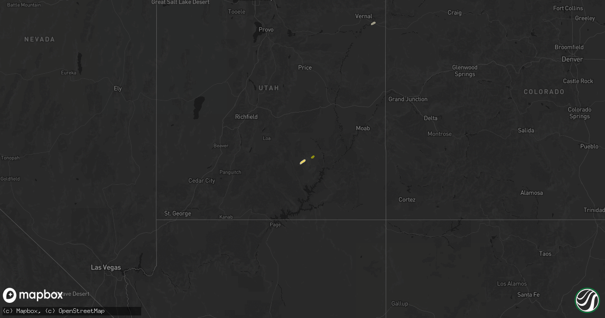
Get this storm
September 16 map
$229
one time, instant access
Download today. No call, no setup
Keep the $229
Bought the map and want the full workflow? Apply the entire $229 to a subscription within 7 days. None of it is wasted.
Every map, not just this one
This buys you this map. Subscription and you get every map we run, in the markets you choose from a few cities to whole states to nationwide. Plus real-time alerts the moment a storm fires.
Contact data
Name, contact info, occupancy, even credit band for addresses in the footprint. You go from where it hit to who to call.
Become the source they trust
Unlimited branding weather history reports on demand. You already have the documented answer ready for the property owner, and you are the one who showed up with it.
Property data and RoofTrace estimates
Pull up any address you have got, its value and the exact code rules for that jurisdiction, straight from One Click Code. Then RoofTrace estimates the squares, pitch, and roof value, priced the way you price.
States Impacted by Hail Map on September 16, 2026
Storm reports
Missouri
| Date | Description |
|---|---|
| 09/16/20265:20 PM CDT | Report from a trained spotter of a roof removed on a condo garage near osage beach. |
| 09/16/20265:04 PM CDT | Power line down. |
| 09/16/20265:04 PM CDT | Quarter to half dollar size hail. Limbs down approx 2ft in diameter. |
Utah
| Date | Description |
|---|---|
| 09/16/20265:04 PM CDT | Trained spotter reported quarter sized hail reported in sunnyside... Ut. |
| 09/16/20265:02 PM CDT | Quarter sized hail via social media report from media partners. Time estimated via radar. |
| 09/16/20263:35 PM CDT | Social media report of multiple hailstones... Estimated to the size of a quarter. |
| 09/16/20263:35 PM CDT | More than a dozen vehicles damaged by hail in huntington. Time estimated based on other reports. |
Ohio
| Date | Description |
|---|---|
| 09/16/20266:41 PM CDT | Multiple reports of trees and wires down southeast of mansfield... Oh. |
| 09/16/20266:20 PM CDT | Part of a grain silo/ metal storage container was blown down. |
| 09/16/20266:05 PM CDT | Roof damage to barn. Time estimated from radar data. |
| 09/16/20266:05 PM CDT | A older large barn lost around 500f its sheet metal roofing. |
| 09/16/20264:21 PM CDT | Large tree downed near intersection of w. Greene street and n. Wayne street. Time estimated by radar. |
| 09/16/20264:15 PM CDT | A large hardwood tree was downed near the intersection of broadway street and high street in piqua. |
| 09/16/20264:15 PM CDT | A large hardwood tree was downed near the intersection of west snodgrass road and north county road 25a. |
| 09/16/20263:54 PM CDT | A hardwood tree was snapped along its base and downed onto the awning of a nearby home... Causing minor damage. |
| 09/16/20263:54 PM CDT | Large tree limb downed along 100 block of east wood street. Time estimated by radar. |
| 09/16/20263:46 PM CDT | Between five and 10 trees were downed in the neighborhood just north of swamp creek near versailles. |
Oklahoma
| Date | Description |
|---|---|
| 09/16/20264:30 PM CDT | Power pole snapped and large tree limb broken near 91st and aspen. |
Arizona
| Date | Description |
|---|---|
| 09/16/20261:10 PM CDT | Downed power lines in the area of higley road to 56th street and adobe road to main street in mesa. Timing estimated from radar. |
Idaho
| Date | Description |
|---|---|
| 09/16/20261:29 AM CDT | Asos station ktwf twin falls. |
Indiana
| Date | Description |
|---|---|
| 09/16/202612:40 AM CDT | Power lines snapped at the intersection of spencer avenue and north washington street in marion. Time estimated via radar. |
| 09/16/202612:38 AM CDT | Large tree limbs snapped onto a home by westlea park in marion. Photo of the damage provided by homeowner. Time estimated via radar. |
Cities Impacted by Hail Map on September 16, 2026
- Hanksville, UT
- Vernal, UT
- Maricopa, AZ
- Leupp, AZ
- Belle, MO
- Vichy, MO
- Leslie, MO
- Huntington, UT
- Elmo, UT
- Phoenix, AZ
- Gerald, MO
- Flat Rock, IL
- Cleveland, UT
- San Tan Valley, AZ
- Richmond, IN
- Piqua, OH
- Webster, IN
- Brazil, IN
- Centerpoint, IN
- Camdenton, MO
- New Paris, OH
- Montreal, MO
- Green River, UT
- East Carbon, UT
- Linn Creek, MO
- Sunnyside, UT
- Osage Beach, MO
- Kaiser, MO
- Sunrise Beach, MO
- Carrizozo, NM
- Corona, NM
- Eaton, OH
- Lake Ozark, MO
- Mansfield, OH
- Lucas, OH
- Macks Creek, MO
- Perrysville, OH
- Bellville, OH
- Butler, OH
- Loudonville, OH
- Danville, OH
- Parker, AZ
- Granville, OH
- Johnstown, OH
- Tularosa, NM
- Marion, IN
- Riverside, IA
- Kalona, IA
- Lone Tree, IA