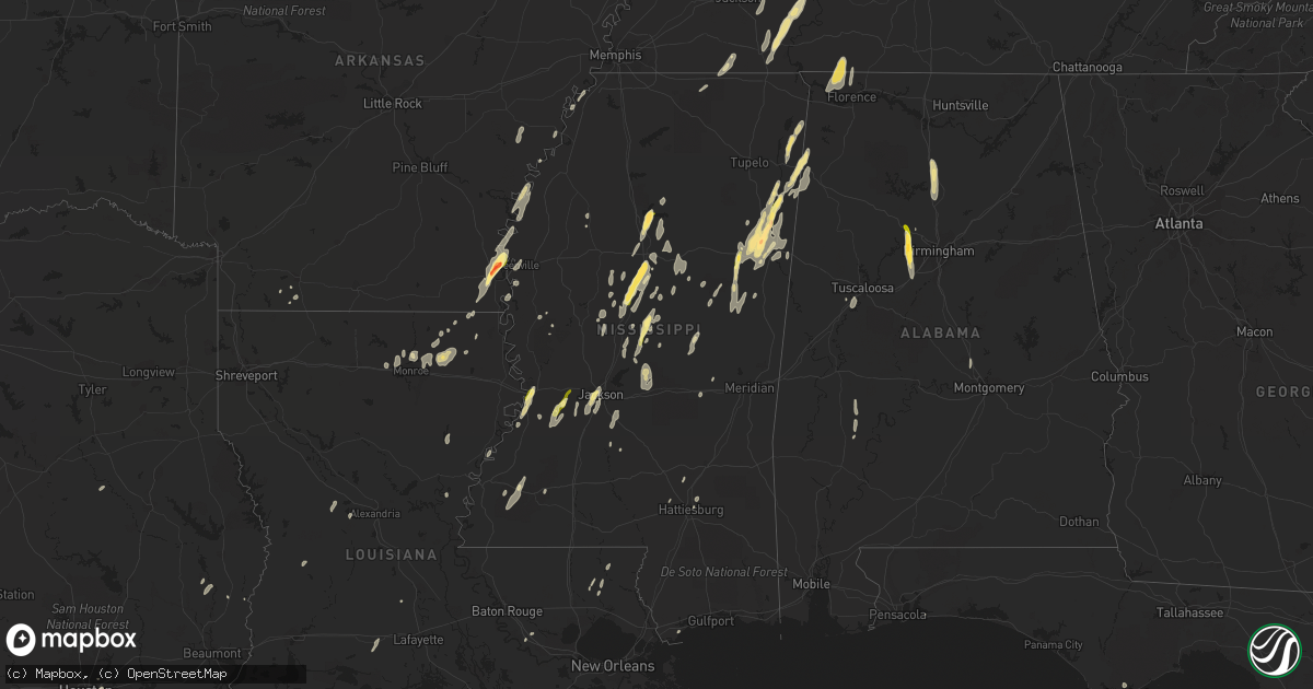
Hail Map in Mississippi on October 13, 2014
Get this storm
October 13 map
$229
one time, instant access
Download today. No call, no setup
Keep the $229
Bought the map and want the full workflow? Apply the entire $229 to a subscription within 7 days. None of it is wasted.
Every map, not just this one
This buys you this map. Subscription and you get every map we run, in the markets you choose from a few cities to whole states to nationwide. Plus real-time alerts the moment a storm fires.
Contact data
Name, contact info, occupancy, even credit band for addresses in the footprint. You go from where it hit to who to call.
Become the source they trust
Unlimited branding weather history reports on demand. You already have the documented answer ready for the property owner, and you are the one who showed up with it.
Property data and RoofTrace estimates
Pull up any address you have got, its value and the exact code rules for that jurisdiction, straight from One Click Code. Then RoofTrace estimates the squares, pitch, and roof value, priced the way you price.
Storm reports in Mississippi
Mississippi
| Date | Description |
|---|---|
| 10/13/20146:44 PM CDT | Tree down through a house |
| 10/13/20145:56 PM CDT | Tree down across s bound lane of hwy 49. |
| 10/13/20145:30 PM CDT | Some trees fell on powerlines on yellowjacket road on the campus of starkville high school. |
| 10/13/20145:28 PM CDT | Tree down on pine rd |
| 10/13/20145:15 PM CDT | Tree down |
| 10/13/20145:15 PM CDT | Tree down on airport rd |
| 10/13/20145:10 PM CDT | Trees down along hwy 10 and 47. |
| 10/13/20145:09 PM CDT | Multiple trees down east of mccomb. |
| 10/13/20145:05 PM CDT | Tree down blocking 1 lane of hwy 15 |
| 10/13/20145:04 PM CDT | Reported by msu meteorology |
| 10/13/20145:02 PM CDT | Numerous trees snapped north side of starkville...likely due to microburst. Some trees on cars and powerlines. Msu meteorologist on scene estimates 75 to 80 mph winds o |
| 10/13/20144:50 PM CDT | A few trees down on robinwood rd |
| 10/13/20144:45 PM CDT | Approx 25 trees down with 3 on homes. Three hanging street lights were blown away. Damage was on the north side along hwy 45. |
| 10/13/20144:44 PM CDT | On kincaid rd |
| 10/13/20144:42 PM CDT | Several trees snapped along hwy 45 north of columbus |
| 10/13/20144:42 PM CDT | A local report indicates 1.25 inch wind near 2 SE TREMONT |
| 10/13/20144:42 PM CDT | Tree down at a residence in columbus. Report relayed from social media. |
| 10/13/20144:40 PM CDT | Several trees down |
| 10/13/20144:30 PM CDT | Power line down along hwy 12 |
| 10/13/20144:25 PM CDT | Numerous trees and powerlines down in southern end of monroe county. |
| 10/13/20144:23 PM CDT | Several trees down and minor roof damage on hwy 25. |
| 10/13/20144:15 PM CDT | A couple trees down |
| 10/13/20144:15 PM CDT | Trees and power lines down |
| 10/13/20144:15 PM CDT | Trees and power lines down |
| 10/13/20144:15 PM CDT | At least 10 utility poles were snapped in noxubee county |
| 10/13/20144:11 PM CDT | A local report indicates 1.25 inch wind near HATLEY |
| 10/13/20144:06 PM CDT | Trees and power lines down |
| 10/13/20144:02 PM CDT | Tree down |
| 10/13/20144:00 PM CDT | A few trees down |
| 10/13/20143:58 PM CDT | Tree down |
| 10/13/20143:58 PM CDT | A few trees down |
| 10/13/20143:57 PM CDT | A few trees down |
| 10/13/20143:56 PM CDT | A local report indicates 1.00 inch wind near 3 W FORKVILLE |
| 10/13/20143:54 PM CDT | Trees down and power outages |
| 10/13/20143:33 PM CDT | A local report indicates 2.00 inch wind near 4 ESE WEST POINT |
| 10/13/20143:32 PM CDT | Nickel to quarter size on greenway dr. |
| 10/13/20143:25 PM CDT | A few trees down |
| 10/13/20143:22 PM CDT | A few trees down on dentville rd |
| 10/13/20143:15 PM CDT | 3 to 4 trees were blown down |
| 10/13/20143:12 PM CDT | A few trees down on martinsville rd |
| 10/13/20143:10 PM CDT | Tree down in town |
| 10/13/20143:10 PM CDT | Tree down |
| 10/13/20143:07 PM CDT | A local report indicates 1.50 inch wind near 4 E GRENADA |
| 10/13/20143:05 PM CDT | A few trees down along hwy 35 |
| 10/13/20143:05 PM CDT | A local report indicates 1.00 inch wind near 2 N VAIDEN |
| 10/13/20143:00 PM CDT | A local report indicates 1.00 inch wind near 4 E MCNAIR |
| 10/13/20143:00 PM CDT | A few trees down and many large limbs and tree debris. |
| 10/13/20143:00 PM CDT | Occurred at rest stop along i-55...relayed by nws employee... |
| 10/13/20142:52 PM CDT | A local report indicates 1.00 inch wind near 8 W RAYMOND |
| 10/13/20142:40 PM CDT | At intersection of bill strong and port gibson roads |
| 10/13/20142:27 PM CDT | Trees down across old port gibson rd |
| 10/13/20142:10 PM CDT | Trees down across barland rd |
| 10/13/20142:09 PM CDT | I-20 and halls ferry road |
| 10/13/20141:37 PM CDT | Tree down on sullivan dr. In waynesboro. |
| 10/13/20141:26 PM CDT | Tree down hwy 63 at perry dr. |
| 10/13/20141:00 PM CDT | Major roof damage to a warehouse storage facility along mississippi river |
| 10/13/201412:42 PM CDT | Power line down |
| 10/12/20147:30 PM CDT | A couple of trees were down. |
| 10/12/20147:18 PM CDT | Report of a tree down blocking a roadway on north frontage road in meridian. |
| 10/12/20147:00 PM CDT | A few trees down across roads in hattiesburg and petal. |
| 10/12/20147:00 PM CDT | Power lines downed in the sandersville rd area |
All States Impacted by Hail Map on October 13, 2014
Cities Impacted by Hail Map on October 13, 2014
- Bastrop, LA
- Mer Rouge, LA
- Starkville, MS
- Tremont, MS
- Smithville, MS
- Columbus, MS
- Canton, MS
- Roxie, MS
- Calhoun, LA
- Downsville, LA
- Rosedale, MS
- Watson, AR
- Rohwer, AR
- Duncan, MS
- Snow Lake, AR
- Gunnison, MS
- Middleton, TN
- Gore Springs, MS
- Grenada, MS
- Duck Hill, MS
- West Point, MS
- McCarley, MS
- Amory, MS
- Vaiden, MS
- West, MS
- Sumrall, MS
- Navarre, FL
- Jackson, MS
- Raymond, MS
- Terry, MS
- Byram, MS
- Lexington, MS
- Sidon, MS
- Cruger, MS
- Coila, MS
- Eudora, AR
- Gonzales, LA
- Oak Grove, LA
- Pioneer, LA
- Durant, MS
- Winona, MS
- Greenville, MS
- Portland, AR
- Lake Village, AR
- Iron City, TN
- Florence, AL
- Cypress Inn, TN
- Waterloo, AL
- Hamilton, MS
- Aberdeen, MS
- Fulton, MS
- Dennis, MS
- Belmont, MS
- Golden, MS
- Holladay, TN
- Decaturville, TN
- Lobelville, TN
- Stantonville, TN
- Reagan, TN
- McEwen, TN
- Parsons, TN
- Vanleer, TN
- Selmer, TN
- Palmyra, TN
- Morris Chapel, TN
- Woodlawn, TN
- Clarksville, TN
- Scotts Hill, TN
- Sugar Tree, TN
- Erin, TN
- Enville, TN
- Hurricane Mills, TN
- Waverly, TN
- Sardis, TN
- Cumberland Furnace, TN
- Milledgeville, TN
- Cumberland City, TN
- Adamsville, TN
- Saltillo, TN
- Cunningham, TN
- Eastpoint, FL
- Prairie, MS
- Camden, MS
- Sallis, MS
- Adger, AL
- Quinton, AL
- McCalla, AL
- Cordova, AL
- Mulga, AL
- Bessemer, AL
- Jonesville, LA
- Monterey, LA
- Bay Saint Louis, MS
- Waveland, MS
- Lorman, MS
- West Monroe, LA
- Farmerville, LA
- Weir, MS
- McCool, MS
- Carrollton, MS
- Call, TX
- Louisville, MS
- Coffeeville, MS
- Cullman, AL
- Hanceville, AL
- Vicksburg, MS
- Crosby, MS
- Hamilton, AL
- Vina, AL
- Greenwood Springs, MS
- Philadelphia, MS
- Vinemont, AL
- Collinston, LA
- Edwards, MS
- Utica, MS
- Emerson, AR
- Petal, MS
- Pine Hill, AL
- Arlington, AL
- Thomasville, AL
- Hayden, AL
- Florence, MS
- Marvell, AR
- Holly Grove, AR
- Yazoo City, MS
- Finger, TN
- Bethel Springs, TN
- Tunica, MS
- Marianna, AR
- Decatur, MS
- Jones, LA
- Fosters, AL
- Kosciusko, MS
- Ethel, MS
- Grapeland, TX
- Rayville, LA
- Oak Ridge, LA
- Benton, MS
- Hollandale, MS
- Carthage, MS
- Hermanville, MS
- Pinola, MS
- Vaughan, MS
- Monroe, LA
- Goodman, MS
- Loranger, LA
- Folsom, LA
- Guys, TN
- Ramer, TN
- Steens, MS
- Mississippi State, MS
- Caledonia, MS
- Red Bay, AL
- Crawford, MS
- Macon, MS
- Morton, MS
- Detroit, AL
- Sulligent, AL
- Wisner, LA
- Luray, TN
- Beech Bluff, TN
- Henderson, TN
- Rolling Fork, MS
- Deridder, LA
- Franklinton, LA
- Bonita, LA
- Dora, AL
- Minter City, MS
- Lutts, TN
- Pelahatchie, MS
- Lena, MS
- Thomaston, AL
- Anguilla, MS
- Amite, LA
- Estherwood, LA
- Crowley, LA
- Morse, LA
- Boyce, LA
- Kilmichael, MS
- Magnolia, AR
- Sterlington, LA
- Stewart, MS
- Ellisville, MS
- Seminary, MS
- Ashland, MS
- Robinsonville, MS
- Pickens, MS
- Ralph, AL
- Flatwoods, LA
- Mora, LA
- French Camp, MS
- Eupora, MS
- Woodville, TX
- Hillister, TX
- Helena, AR
- Deatsville, AL
- Prattville, AL
- Walnut Grove, MS
- Houston, TX
- Taylor, AR
- Ackerman, MS
- Dermott, AR
- Benoit, MS
- Parkdale, AR
- Kirbyville, TX
- Opelousas, LA
- Braxton, MS
- Charleston, MS
- Fred, TX
- Spurger, TX
- Walnut, MS
- Galena Park, TX
- Meadville, MS
- Newton, MS
- Clarksdale, MS
- Port Gibson, MS
- Tallulah, LA


