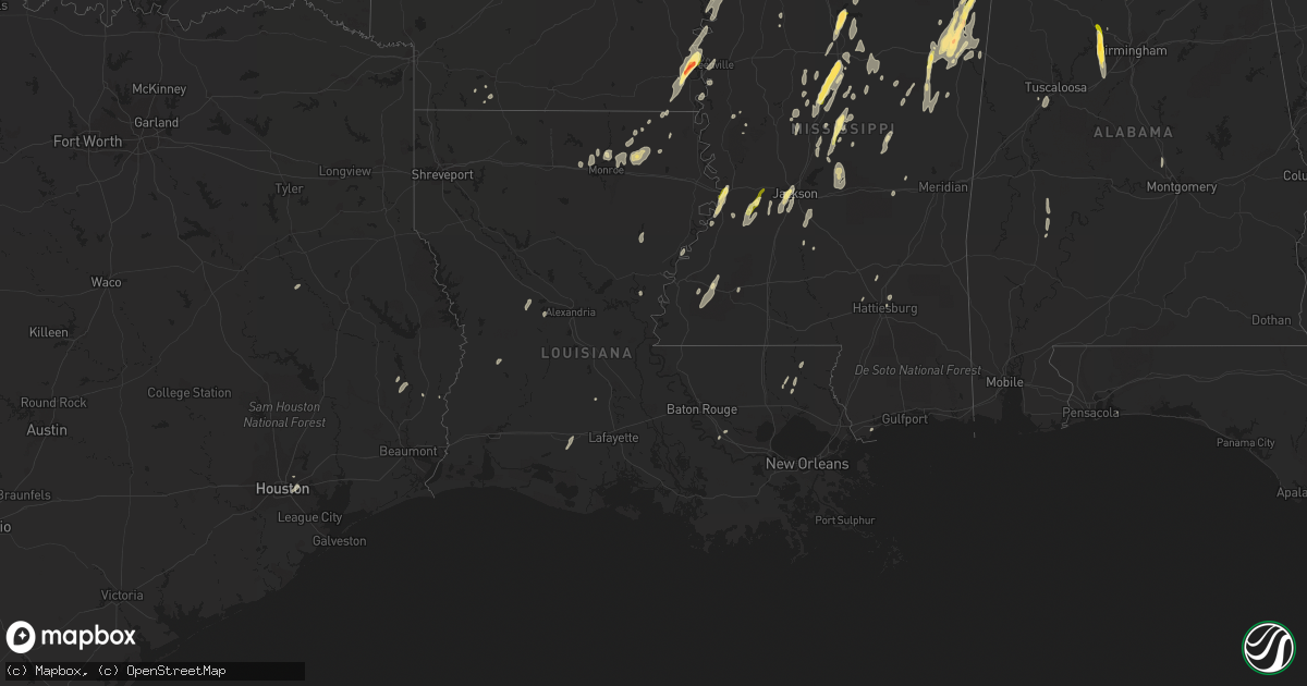
Hail Map in Louisiana on October 13, 2014
Get this storm
October 13 map
$229
one time, instant access
Download today. No call, no setup
Keep the $229
Bought the map and want the full workflow? Apply the entire $229 to a subscription within 7 days. None of it is wasted.
Every map, not just this one
This buys you this map. Subscription and you get every map we run, in the markets you choose from a few cities to whole states to nationwide. Plus real-time alerts the moment a storm fires.
Contact data
Name, contact info, occupancy, even credit band for addresses in the footprint. You go from where it hit to who to call.
Become the source they trust
Unlimited branding weather history reports on demand. You already have the documented answer ready for the property owner, and you are the one who showed up with it.
Property data and RoofTrace estimates
Pull up any address you have got, its value and the exact code rules for that jurisdiction, straight from One Click Code. Then RoofTrace estimates the squares, pitch, and roof value, priced the way you price.
Storm reports in Louisiana
Louisiana
| Date | Description |
|---|---|
| 10/13/20146:40 PM CDT | Tree down across highway 190 at jackson ave. Power out in mandeville. |
| 10/13/20146:05 PM CDT | Trees uprooted on tartan drive in bissonet subdivision. Time estimated by radar. |
| 10/13/20145:53 PM CDT | More trees reported down near albert and hwy 190 and some structural damage to a home in quail creek. |
| 10/13/20145:50 PM CDT | Tree and power lines down near soult and highway 1088 in mandeville. |
| 10/13/20145:45 PM CDT | Tree down across highway 190 at jackson ave. Power out in mandeville. |
| 10/13/20145:35 PM CDT | Scattered reports of downed trees across the parish. |
| 10/13/20145:01 PM CDT | 4 to 5 trees and patio cover down. |
| 10/13/20144:44 PM CDT | A few trees down around the st amant and acy communities. |
| 10/13/20144:30 PM CDT | Tree down across road. Location at 13605 brown rd. Central... La 70714. |
| 10/13/20144:18 PM CDT | 4 to 5 trees and patio cover down. |
| 10/13/20144:10 PM CDT | A tree was downed by strong thunderstorm winds near the intersection of woodside drive and country club drive. |
| 10/13/20143:24 PM CDT | Trees down on hwy 190 |
| 10/13/20142:58 PM CDT | A tree is down across us 90 west of crowley |
| 10/13/20142:46 PM CDT | Strong thunderstorm winds downed a tree on louisiana state highway 1 which knocked out power to residents. |
| 10/13/20142:35 PM CDT | Power line down |
| 10/13/20142:08 PM CDT | 911 center relayed report of a tree down |
| 10/13/20142:05 PM CDT | A local report indicates 1.00 inch wind near 2 NE ST. JOSEPH |
| 10/13/20142:00 PM CDT | 911 relayed report of trees down on hwy 363 |
| 10/13/20141:53 PM CDT | Tree reported down |
| 10/13/20141:20 PM CDT | A few trees and power lines down. |
| 10/13/20141:15 PM CDT | 911 relayed report of a tree down |
| 10/13/20141:05 PM CDT | Several trees and some power lines down. |
| 10/13/201412:55 PM CDT | 911 relayed report of trees down |
| 10/13/201412:55 PM CDT | 911 relayed report of snapped power lines in pitkin |
| 10/13/201412:42 PM CDT | A few trees down around hwy 134 |
| 10/13/201412:40 PM CDT | A couple trees down |
| 10/13/201412:35 PM CDT | Vernon parish sheriff reports trees down on hwy 10... Baily rd...providence...lewis and henry bass. |
| 10/13/201412:35 PM CDT | Beauregard sheriff reports trees down about 1 mile south of deridder on franklin rd. Additional trees leaning against powerlines at hwy 27 and mall. |
| 10/13/201412:33 PM CDT | Power line down |
| 10/13/201412:30 PM CDT | A power line... Several limbs and a few trees were snapped along hwy 2. |
| 10/13/201412:30 PM CDT | A tree snapped and many large limbs down on the w side town. |
| 10/13/201412:18 PM CDT | Power line down |
| 10/13/201412:15 PM CDT | Power pole snapped along hwy 2. |
| 10/13/201412:13 PM CDT | Several large trees uprooted along trails end rd near fluker rd. Damage was from straight line winds est at 70 mph. |
| 10/13/201412:10 PM CDT | Several trees snapped along i-20 |
| 10/13/201412:10 PM CDT | Damage to st. Francis clinic and centurylink building |
| 10/13/201412:04 PM CDT | Trees and power lines down across the parish. |
| 10/13/201412:00 PM CDT | A few trees blown down...one damaged a peir. |
| 10/13/201411:58 AM CDT | Trees down near bawcomville |
| 10/13/201411:55 AM CDT | Numerous trees down in several locations south of bastrop. |
| 10/13/201411:35 AM CDT | Damage on thomas road exit... Exit closed due to damage... Signs down... Sign on vehicle... Bldg roof damage |
| 10/13/201411:32 AM CDT | Damage at univ of la at monroe... Large trees in half... Power poles in half... Streetlight turned sideways... Streets impassible at ulm |
| 10/13/201411:29 AM CDT | Trees down... Tops of trees off... Power out... Damage to concrete plant |
| 10/13/201411:20 AM CDT | Tree down near montgomery |
| 10/13/201411:20 AM CDT | Trees down near bawcomville |
| 10/13/201411:16 AM CDT | An ef2 tornado touched down 3.5 miles west of the city limits of west monroe near the 4000 block of new natchitoches road. Numerous trees were uprooted or snapped. The |
| 10/13/201411:13 AM CDT | Several large trees uprooted along trails end rd near fluker rd. |
| 10/13/201411:11 AM CDT | An ef2 tornado touched down 3.5 miles west of the city limits of west monroe near the 4000 block of new natchitoches road. Numerous trees were uprooted or snapped. The |
| 10/13/201411:11 AM CDT | An ef2 tornado touched down 3.5 miles west of the city limits of west monroe near the 4000 block of new natchitoches road. Numerous trees were uprooted or snapped. The |
| 10/13/201411:11 AM CDT | An ef-1 tornado touched down along caples road near the intersection of western murray circle...snapping numerous trees as it continued northeast across eastern murray |
| 10/13/201410:48 AM CDT | Trees down all over northern part of parish... 167 north... 37 at 1236... 1233 at hwy 156 |
| 10/13/201410:45 AM CDT | Tree on home on maple street in ruston |
| 10/13/201410:43 AM CDT | Power lines down and on fire |
| 10/13/201410:30 AM CDT | Trees down in northern part of parish |
| 10/13/201410:14 AM CDT | Tree down in castor |
| 10/13/201410:09 AM CDT | Power out 3 north of bienville |
| 10/13/20149:32 AM CDT | Trees down county wide... La 512 and 481... Fire tower road... And 177 nearby mansfield area |
| 10/13/20149:22 AM CDT | Trees down county wide... La 512 and 481... Fire tower road... And 177 nearby mansfield area |
| 10/13/20149:00 AM CDT | An ef1 tornado touched down 4.5 miles south of mansfield just east of highway 171. The tornado moved east along a 0.9-mile track and lifted at the intersection of la 51 |
All States Impacted by Hail Map on October 13, 2014
Cities Impacted by Hail Map on October 13, 2014
- Bastrop, LA
- Mer Rouge, LA
- Starkville, MS
- Tremont, MS
- Smithville, MS
- Columbus, MS
- Canton, MS
- Roxie, MS
- Calhoun, LA
- Downsville, LA
- Rosedale, MS
- Watson, AR
- Rohwer, AR
- Duncan, MS
- Snow Lake, AR
- Gunnison, MS
- Middleton, TN
- Gore Springs, MS
- Grenada, MS
- Duck Hill, MS
- West Point, MS
- McCarley, MS
- Amory, MS
- Vaiden, MS
- West, MS
- Sumrall, MS
- Navarre, FL
- Jackson, MS
- Raymond, MS
- Terry, MS
- Byram, MS
- Lexington, MS
- Sidon, MS
- Cruger, MS
- Coila, MS
- Eudora, AR
- Gonzales, LA
- Oak Grove, LA
- Pioneer, LA
- Durant, MS
- Winona, MS
- Greenville, MS
- Portland, AR
- Lake Village, AR
- Iron City, TN
- Florence, AL
- Cypress Inn, TN
- Waterloo, AL
- Hamilton, MS
- Aberdeen, MS
- Fulton, MS
- Dennis, MS
- Belmont, MS
- Golden, MS
- Holladay, TN
- Decaturville, TN
- Lobelville, TN
- Stantonville, TN
- Reagan, TN
- McEwen, TN
- Parsons, TN
- Vanleer, TN
- Selmer, TN
- Palmyra, TN
- Morris Chapel, TN
- Woodlawn, TN
- Clarksville, TN
- Scotts Hill, TN
- Sugar Tree, TN
- Erin, TN
- Enville, TN
- Hurricane Mills, TN
- Waverly, TN
- Sardis, TN
- Cumberland Furnace, TN
- Milledgeville, TN
- Cumberland City, TN
- Adamsville, TN
- Saltillo, TN
- Cunningham, TN
- Eastpoint, FL
- Prairie, MS
- Camden, MS
- Sallis, MS
- Adger, AL
- Quinton, AL
- McCalla, AL
- Cordova, AL
- Mulga, AL
- Bessemer, AL
- Jonesville, LA
- Monterey, LA
- Bay Saint Louis, MS
- Waveland, MS
- Lorman, MS
- West Monroe, LA
- Farmerville, LA
- Weir, MS
- McCool, MS
- Carrollton, MS
- Call, TX
- Louisville, MS
- Coffeeville, MS
- Cullman, AL
- Hanceville, AL
- Vicksburg, MS
- Crosby, MS
- Hamilton, AL
- Vina, AL
- Greenwood Springs, MS
- Philadelphia, MS
- Vinemont, AL
- Collinston, LA
- Edwards, MS
- Utica, MS
- Emerson, AR
- Petal, MS
- Pine Hill, AL
- Arlington, AL
- Thomasville, AL
- Hayden, AL
- Florence, MS
- Marvell, AR
- Holly Grove, AR
- Yazoo City, MS
- Finger, TN
- Bethel Springs, TN
- Tunica, MS
- Marianna, AR
- Decatur, MS
- Jones, LA
- Fosters, AL
- Kosciusko, MS
- Ethel, MS
- Grapeland, TX
- Rayville, LA
- Oak Ridge, LA
- Benton, MS
- Hollandale, MS
- Carthage, MS
- Hermanville, MS
- Pinola, MS
- Vaughan, MS
- Monroe, LA
- Goodman, MS
- Loranger, LA
- Folsom, LA
- Guys, TN
- Ramer, TN
- Steens, MS
- Mississippi State, MS
- Caledonia, MS
- Red Bay, AL
- Crawford, MS
- Macon, MS
- Morton, MS
- Detroit, AL
- Sulligent, AL
- Wisner, LA
- Luray, TN
- Beech Bluff, TN
- Henderson, TN
- Rolling Fork, MS
- Deridder, LA
- Franklinton, LA
- Bonita, LA
- Dora, AL
- Minter City, MS
- Lutts, TN
- Pelahatchie, MS
- Lena, MS
- Thomaston, AL
- Anguilla, MS
- Amite, LA
- Estherwood, LA
- Crowley, LA
- Morse, LA
- Boyce, LA
- Kilmichael, MS
- Magnolia, AR
- Sterlington, LA
- Stewart, MS
- Ellisville, MS
- Seminary, MS
- Ashland, MS
- Robinsonville, MS
- Pickens, MS
- Ralph, AL
- Flatwoods, LA
- Mora, LA
- French Camp, MS
- Eupora, MS
- Woodville, TX
- Hillister, TX
- Helena, AR
- Deatsville, AL
- Prattville, AL
- Walnut Grove, MS
- Houston, TX
- Taylor, AR
- Ackerman, MS
- Dermott, AR
- Benoit, MS
- Parkdale, AR
- Kirbyville, TX
- Opelousas, LA
- Braxton, MS
- Charleston, MS
- Fred, TX
- Spurger, TX
- Walnut, MS
- Galena Park, TX
- Meadville, MS
- Newton, MS
- Clarksdale, MS
- Port Gibson, MS
- Tallulah, LA


