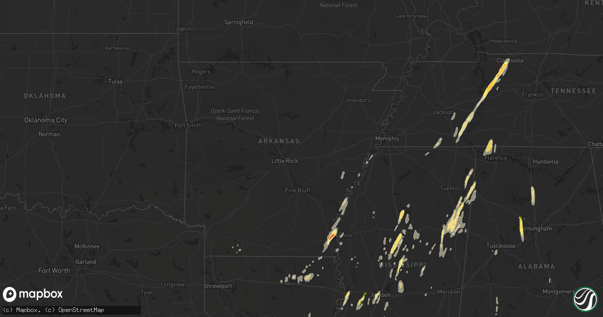
Hail Map in Arkansas on October 13, 2014
Get this storm
October 13 map
$229
one time, instant access
Download today. No call, no setup
Keep the $229
Bought the map and want the full workflow? Apply the entire $229 to a subscription within 7 days. None of it is wasted.
Every map, not just this one
This buys you this map. Subscription and you get every map we run, in the markets you choose from a few cities to whole states to nationwide. Plus real-time alerts the moment a storm fires.
Contact data
Name, contact info, occupancy, even credit band for addresses in the footprint. You go from where it hit to who to call.
Become the source they trust
Unlimited branding weather history reports on demand. You already have the documented answer ready for the property owner, and you are the one who showed up with it.
Property data and RoofTrace estimates
Pull up any address you have got, its value and the exact code rules for that jurisdiction, straight from One Click Code. Then RoofTrace estimates the squares, pitch, and roof value, priced the way you price.
Storm reports in Arkansas
Arkansas
| Date | Description |
|---|---|
| 10/13/20141:20 PM CDT | Mayor reports that two city buildings were destroyed. |
| 10/13/20141:14 PM CDT | 2 trees down and shingles ripped off a roof and another bldg damaged. |
| 10/13/20141:00 PM CDT | Several trees down in mcdougal. |
| 10/13/201412:59 PM CDT | Four houses badly damaged north of highway 62. Also trees down on houses. |
| 10/13/201412:35 PM CDT | An eighteen wheeler was blown over along ar highway 8 near eudora |
| 10/13/201412:17 PM CDT | Based on pictures relayed via social media... |
| 10/13/201412:17 PM CDT | Trees and power lines downed in the city |
| 10/13/201412:17 PM CDT | The roof of a two-story apartment building along us highway 82 was damaged |
| 10/13/201412:16 PM CDT | 6 poles were downed along us highway 82 near lake village |
| 10/13/201412:10 PM CDT | A roof was blown off a classroom building and landed on a nearby roof. |
| 10/13/20149:27 AM CDT | Nws storm survey revealed an ef1 tornado with peak winds of 85-90 mph and max width of 150 yds. Large trees were blown down...part of a metal roof was ripped off a shed |
| 10/13/20148:05 AM CDT | Part of a fence was blown down. |
| 10/13/20147:45 AM CDT | Limbs were blown down. |
| 10/13/20147:40 AM CDT | Nws storm survey revealed an ef1 tornado with peak winds of 95-105 mph and max width of 250 yds. Hundreds of trees were snapped off or blown down. Several trees landed |
| 10/13/20147:26 AM CDT | Large limbs were blown down. |
| 10/13/20147:20 AM CDT | Trees and powerlines down near the intersection of highway 128 and highway 7. |
| 10/13/20147:20 AM CDT | A local report indicates 62 MPH wind near PETIT JEAN MTN |
| 10/13/20147:10 AM CDT | Tree down near intersection of highway 67 and highway 51. |
All States Impacted by Hail Map on October 13, 2014
Cities Impacted by Hail Map on October 13, 2014
- Bastrop, LA
- Mer Rouge, LA
- Starkville, MS
- Tremont, MS
- Smithville, MS
- Columbus, MS
- Canton, MS
- Roxie, MS
- Calhoun, LA
- Downsville, LA
- Rosedale, MS
- Watson, AR
- Rohwer, AR
- Duncan, MS
- Snow Lake, AR
- Gunnison, MS
- Middleton, TN
- Gore Springs, MS
- Grenada, MS
- Duck Hill, MS
- West Point, MS
- McCarley, MS
- Amory, MS
- Vaiden, MS
- West, MS
- Sumrall, MS
- Navarre, FL
- Jackson, MS
- Raymond, MS
- Terry, MS
- Byram, MS
- Lexington, MS
- Sidon, MS
- Cruger, MS
- Coila, MS
- Eudora, AR
- Gonzales, LA
- Oak Grove, LA
- Pioneer, LA
- Durant, MS
- Winona, MS
- Greenville, MS
- Portland, AR
- Lake Village, AR
- Iron City, TN
- Florence, AL
- Cypress Inn, TN
- Waterloo, AL
- Hamilton, MS
- Aberdeen, MS
- Fulton, MS
- Dennis, MS
- Belmont, MS
- Golden, MS
- Holladay, TN
- Decaturville, TN
- Lobelville, TN
- Stantonville, TN
- Reagan, TN
- McEwen, TN
- Parsons, TN
- Vanleer, TN
- Selmer, TN
- Palmyra, TN
- Morris Chapel, TN
- Woodlawn, TN
- Clarksville, TN
- Scotts Hill, TN
- Sugar Tree, TN
- Erin, TN
- Enville, TN
- Hurricane Mills, TN
- Waverly, TN
- Sardis, TN
- Cumberland Furnace, TN
- Milledgeville, TN
- Cumberland City, TN
- Adamsville, TN
- Saltillo, TN
- Cunningham, TN
- Eastpoint, FL
- Prairie, MS
- Camden, MS
- Sallis, MS
- Adger, AL
- Quinton, AL
- McCalla, AL
- Cordova, AL
- Mulga, AL
- Bessemer, AL
- Jonesville, LA
- Monterey, LA
- Bay Saint Louis, MS
- Waveland, MS
- Lorman, MS
- West Monroe, LA
- Farmerville, LA
- Weir, MS
- McCool, MS
- Carrollton, MS
- Call, TX
- Louisville, MS
- Coffeeville, MS
- Cullman, AL
- Hanceville, AL
- Vicksburg, MS
- Crosby, MS
- Hamilton, AL
- Vina, AL
- Greenwood Springs, MS
- Philadelphia, MS
- Vinemont, AL
- Collinston, LA
- Edwards, MS
- Utica, MS
- Emerson, AR
- Petal, MS
- Pine Hill, AL
- Arlington, AL
- Thomasville, AL
- Hayden, AL
- Florence, MS
- Marvell, AR
- Holly Grove, AR
- Yazoo City, MS
- Finger, TN
- Bethel Springs, TN
- Tunica, MS
- Marianna, AR
- Decatur, MS
- Jones, LA
- Fosters, AL
- Kosciusko, MS
- Ethel, MS
- Grapeland, TX
- Rayville, LA
- Oak Ridge, LA
- Benton, MS
- Hollandale, MS
- Carthage, MS
- Hermanville, MS
- Pinola, MS
- Vaughan, MS
- Monroe, LA
- Goodman, MS
- Loranger, LA
- Folsom, LA
- Guys, TN
- Ramer, TN
- Steens, MS
- Mississippi State, MS
- Caledonia, MS
- Red Bay, AL
- Crawford, MS
- Macon, MS
- Morton, MS
- Detroit, AL
- Sulligent, AL
- Wisner, LA
- Luray, TN
- Beech Bluff, TN
- Henderson, TN
- Rolling Fork, MS
- Deridder, LA
- Franklinton, LA
- Bonita, LA
- Dora, AL
- Minter City, MS
- Lutts, TN
- Pelahatchie, MS
- Lena, MS
- Thomaston, AL
- Anguilla, MS
- Amite, LA
- Estherwood, LA
- Crowley, LA
- Morse, LA
- Boyce, LA
- Kilmichael, MS
- Magnolia, AR
- Sterlington, LA
- Stewart, MS
- Ellisville, MS
- Seminary, MS
- Ashland, MS
- Robinsonville, MS
- Pickens, MS
- Ralph, AL
- Flatwoods, LA
- Mora, LA
- French Camp, MS
- Eupora, MS
- Woodville, TX
- Hillister, TX
- Helena, AR
- Deatsville, AL
- Prattville, AL
- Walnut Grove, MS
- Houston, TX
- Taylor, AR
- Ackerman, MS
- Dermott, AR
- Benoit, MS
- Parkdale, AR
- Kirbyville, TX
- Opelousas, LA
- Braxton, MS
- Charleston, MS
- Fred, TX
- Spurger, TX
- Walnut, MS
- Galena Park, TX
- Meadville, MS
- Newton, MS
- Clarksdale, MS
- Port Gibson, MS
- Tallulah, LA


