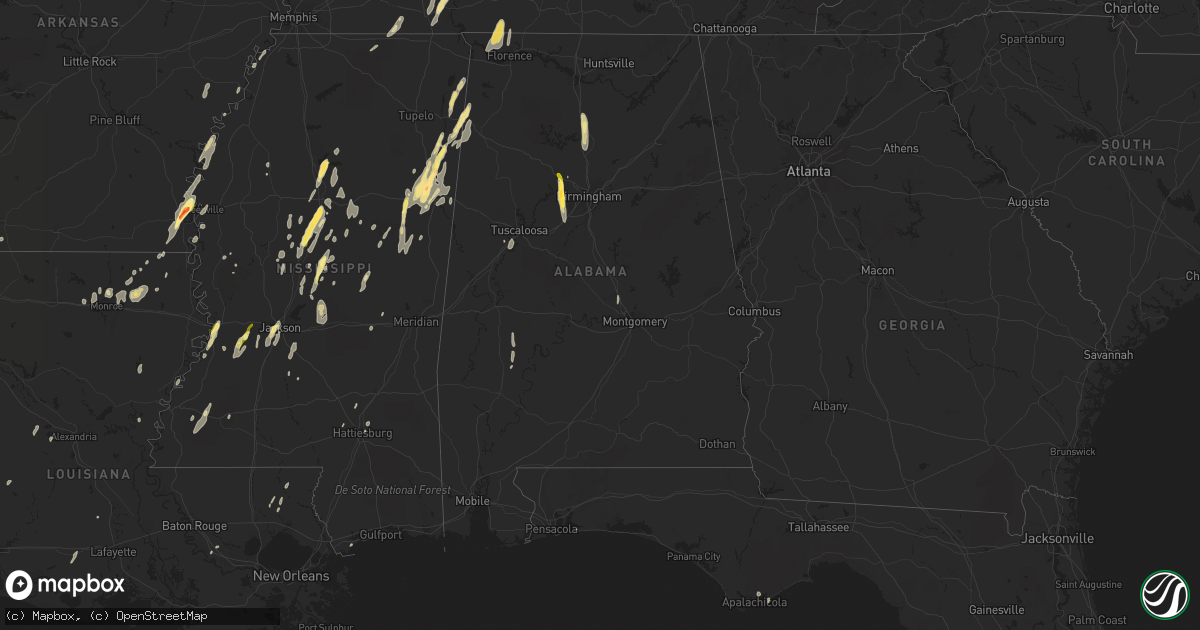
Hail Map in Alabama on October 13, 2014
Get this storm
October 13 map
$229
one time, instant access
Download today. No call, no setup
Keep the $229
Bought the map and want the full workflow? Apply the entire $229 to a subscription within 7 days. None of it is wasted.
Every map, not just this one
This buys you this map. Subscription and you get every map we run, in the markets you choose from a few cities to whole states to nationwide. Plus real-time alerts the moment a storm fires.
Contact data
Name, contact info, occupancy, even credit band for addresses in the footprint. You go from where it hit to who to call.
Become the source they trust
Unlimited branding weather history reports on demand. You already have the documented answer ready for the property owner, and you are the one who showed up with it.
Property data and RoofTrace estimates
Pull up any address you have got, its value and the exact code rules for that jurisdiction, straight from One Click Code. Then RoofTrace estimates the squares, pitch, and roof value, priced the way you price.
Storm reports in Alabama
Alabama
| Date | Description |
|---|---|
| 10/13/20146:48 PM CDT | A brief weak tornado touched down in extreme ne lamar county and crossed henson springs rd. Approximately 20-30 trees were either snapped or uprooted along the short pa |
| 10/13/20146:25 PM CDT | Trees down near county lake road and aberdeen road west of vernon. |
| 10/13/20145:37 PM CDT | Tree down and powerline down at kengington place |
| 10/13/20145:13 PM CDT | Minor damage to an outbuilding on sunnyview drive. |
| 10/13/20145:12 PM CDT | One tree was reported blown down. |
| 10/13/20145:09 PM CDT | Large trees were reported uprooted and large tree limbs snapped. Wind gusts were estimated at more than 70 mph. |
| 10/13/20145:08 PM CDT | A 60 mph gust was measured at this location. |
| 10/13/20145:07 PM CDT | A tree fell on a house along rube robinson road causing roof damage. |
| 10/13/20145:00 PM CDT | A large tree limb was reported down and a mobile home underpinning was ripped off at this location. Winds estimated at 65 mph. |
| 10/13/20145:00 PM CDT | Several trees reported down. |
| 10/13/20144:59 PM CDT | Tree down on a carport and house near the corner of lindsay ln and nick davis rd east of athens. Relayed via twitter. |
| 10/13/20144:58 PM CDT | Several power poles were reported snapped near their base in front of the harley davidson store on highway 20. Power poles were reported snapped futher to the east for |
| 10/13/20144:57 PM CDT | Estimated 55-60 mph winds. Shutters ripped off nearby house. |
| 10/13/20144:57 PM CDT | Estimated 55-60 mph winds. Shutters ripped off nearby house. |
| 10/13/20144:55 PM CDT | Trees were reported down on chaney thompson road and moutain gap road. |
| 10/13/20144:48 PM CDT | Power outages reported at bibb garret road and highway 20. |
| 10/13/20144:48 PM CDT | Mutiple trees and powerlines down in the trinity area. |
| 10/13/20144:48 PM CDT | Trees down along county highway 11 south of shottsville. |
| 10/13/20144:48 PM CDT | Trees down on county road 242 near al 157 |
| 10/13/20144:47 PM CDT | Roof damage was reported to businessess in the vinemont area. |
| 10/13/20144:43 PM CDT | A weak tornado touched down in western marion county north of interstate 22/us highway 78 mainly uprooting trees along its path and causing minor structure damage. Tota |
| 10/13/20144:42 PM CDT | Trees and powerlines were reported completely blocking the road. |
| 10/13/20144:42 PM CDT | Mutiple trees and powerlines were reported down. |
| 10/13/20144:40 PM CDT | Tree down on power lines along us 31 near the decatur city limits |
| 10/13/20144:38 PM CDT | Mulitple trees and powerlines were reported down. |
| 10/13/20144:37 PM CDT | Multiple trees and powerlines were reported down. |
| 10/13/20144:35 PM CDT | Numerous trees down from morgan city to arab in western marshall county. |
| 10/13/20144:30 PM CDT | Multiple trees were reported near highway 91 around hanceville. |
| 10/13/20144:30 PM CDT | Trees and powerlines down in haleyville. |
| 10/13/20144:27 PM CDT | Several trees were reported down and a porch was heavily damaged at this location. |
| 10/13/20144:23 PM CDT | A few trees down around double springs. Social media |
| 10/13/20144:22 PM CDT | A 70 mph wind gust was reported. |
| 10/13/20144:20 PM CDT | Tree reported down on home. |
| 10/13/20144:20 PM CDT | Tree down on house on hwy 47 south of arley. |
| 10/13/20144:15 PM CDT | Multiple trees and powerlines down in lynn |
| 10/13/20144:06 PM CDT | A report of winds gusts between 50 and 60 mph was reported. |
| 10/13/20144:00 PM CDT | Tree on power line in hayden. |
| 10/13/20143:59 PM CDT | Multiple trees down across the county more details to follow. |
| 10/13/20143:56 PM CDT | Tree down on occupied vehicle. |
| 10/13/20143:51 PM CDT | Multiple trees down. Time estimated from radar. |
| 10/13/20143:48 PM CDT | *** 1 fatal *** elderly woman killed from tree falling on mobile home on creel street near dora. Time estimated from radar. |
| 10/13/20143:40 PM CDT | Tree down on unoccupied vehicle near little river trail and birmingport road. |
| 10/13/20143:40 PM CDT | Tree down in pinson. |
| 10/13/20143:35 PM CDT | Trees and power lines down at 12000 block of northside road. Time estimated via radar. |
| 10/13/20143:35 PM CDT | Powerpoles snapped at 22nd st and 2nd ave n. |
| 10/13/20143:35 PM CDT | Tree down in thorsby. |
| 10/13/20143:35 PM CDT | Tree down near bass lane and meadows lane in moody. |
| 10/13/20143:25 PM CDT | Large tree limbs/branches down across dickey springs road. Time estimated from radar. |
| 10/13/20143:20 PM CDT | Tree down on tom mongtomery road. |
| 10/13/20143:20 PM CDT | A power pole was snapped off on highway 78 in pratt city. |
| 10/13/20143:20 PM CDT | Updated...trees were blown down on bama rock garden road and a barn roof was damaged on will walker road...near coaling and vance. |
| 10/13/20143:14 PM CDT | Trees blown down in woodstock including along highway 11 and along pike road |
| 10/13/20143:14 PM CDT | Tree down in russet woods neighborhood in hoover. Time estimated from radar. Reported via social media. |
| 10/13/20143:12 PM CDT | A few trees were blown down near mccalla. |
| 10/13/20143:05 PM CDT | Four trees approximately 8 inches in diameter broken off at four feet above the ground. |
| 10/13/20143:05 PM CDT | Updated...a greenhouse was destroyed and several trees were blown down near west blocton including along maple st and pecan st. |
| 10/13/20142:50 PM CDT | Multiple trees were blown down near centreville including at highway 82 and highway 219...and along orchard lane. |
| 10/13/20142:28 PM CDT | Trees and powerlines down in the clanton area along county road 28 and 471. |
| 10/13/20142:18 PM CDT | Roof blown off a laundromat just east of demopolis on us 80. Also several trees down across the county as the storm moved through. |
| 10/13/20141:40 PM CDT | Thomasville police reported tree down across hwy 5...5 n of thomasville. |
| 10/13/20146:15 AM CDT | Tree down in enterprise |
| 10/13/201412:41 AM CDT | Old chicken house collapsed along cr 2263. Small outbuilding also destroyed. Winds estimated at 50-55 mph. Time estimated from radar. |
| 10/12/201410:15 PM CDT | Tree down blocking county road 39 at sunday drive in chelsea. |
| 10/12/20149:41 PM CDT | Trees across cr10 south of newbern. |
| 10/12/20149:15 PM CDT | A tree was blown down on to a house along 44th ave ne |
| 10/12/20149:14 PM CDT | Several trees in the road on county road 16 in cedarville. |
| 10/12/20149:09 PM CDT | Several trees across johnson road in sawyerville. |
| 10/12/20148:17 PM CDT | Power lines down on road near sipsey valley road and cornelius church road. Time estimated from radar. |
| 10/12/20147:47 PM CDT | Trees down and possible structure damage near intersection of county road 49 and highway 18. Time estimated from radar. |
| 10/12/20147:38 PM CDT | The public reported damage to a shed and trees knocked down in killen. |
| 10/12/20147:30 PM CDT | Numerous trees down within the tuscumbia area. |
| 10/12/20147:30 PM CDT | Trees down on powerlines on billy bowling blvd. |
| 10/12/20147:29 PM CDT | Tree down on vehicle on east 4th steet. |
| 10/12/20147:29 PM CDT | *** 1 inj *** ef-1 tornado with peak wind of 105 mph... Path length of 3.5 miles... And maximum path width of 200 yards. |
| 10/12/20147:28 PM CDT | Trees down on moss ave. Size of trees unknown. |
| 10/12/20147:28 PM CDT | Powerline down on vehicle at 2nd st. |
| 10/12/20147:25 PM CDT | Tree down on a house at east 4th street and high street. |
All States Impacted by Hail Map on October 13, 2014
Cities Impacted by Hail Map on October 13, 2014
- Bastrop, LA
- Mer Rouge, LA
- Starkville, MS
- Tremont, MS
- Smithville, MS
- Columbus, MS
- Canton, MS
- Roxie, MS
- Calhoun, LA
- Downsville, LA
- Rosedale, MS
- Watson, AR
- Rohwer, AR
- Duncan, MS
- Snow Lake, AR
- Gunnison, MS
- Middleton, TN
- Gore Springs, MS
- Grenada, MS
- Duck Hill, MS
- West Point, MS
- McCarley, MS
- Amory, MS
- Vaiden, MS
- West, MS
- Sumrall, MS
- Navarre, FL
- Jackson, MS
- Raymond, MS
- Terry, MS
- Byram, MS
- Lexington, MS
- Sidon, MS
- Cruger, MS
- Coila, MS
- Eudora, AR
- Gonzales, LA
- Oak Grove, LA
- Pioneer, LA
- Durant, MS
- Winona, MS
- Greenville, MS
- Portland, AR
- Lake Village, AR
- Iron City, TN
- Florence, AL
- Cypress Inn, TN
- Waterloo, AL
- Hamilton, MS
- Aberdeen, MS
- Fulton, MS
- Dennis, MS
- Belmont, MS
- Golden, MS
- Holladay, TN
- Decaturville, TN
- Lobelville, TN
- Stantonville, TN
- Reagan, TN
- McEwen, TN
- Parsons, TN
- Vanleer, TN
- Selmer, TN
- Palmyra, TN
- Morris Chapel, TN
- Woodlawn, TN
- Clarksville, TN
- Scotts Hill, TN
- Sugar Tree, TN
- Erin, TN
- Enville, TN
- Hurricane Mills, TN
- Waverly, TN
- Sardis, TN
- Cumberland Furnace, TN
- Milledgeville, TN
- Cumberland City, TN
- Adamsville, TN
- Saltillo, TN
- Cunningham, TN
- Eastpoint, FL
- Prairie, MS
- Camden, MS
- Sallis, MS
- Adger, AL
- Quinton, AL
- McCalla, AL
- Cordova, AL
- Mulga, AL
- Bessemer, AL
- Jonesville, LA
- Monterey, LA
- Bay Saint Louis, MS
- Waveland, MS
- Lorman, MS
- West Monroe, LA
- Farmerville, LA
- Weir, MS
- McCool, MS
- Carrollton, MS
- Call, TX
- Louisville, MS
- Coffeeville, MS
- Cullman, AL
- Hanceville, AL
- Vicksburg, MS
- Crosby, MS
- Hamilton, AL
- Vina, AL
- Greenwood Springs, MS
- Philadelphia, MS
- Vinemont, AL
- Collinston, LA
- Edwards, MS
- Utica, MS
- Emerson, AR
- Petal, MS
- Pine Hill, AL
- Arlington, AL
- Thomasville, AL
- Hayden, AL
- Florence, MS
- Marvell, AR
- Holly Grove, AR
- Yazoo City, MS
- Finger, TN
- Bethel Springs, TN
- Tunica, MS
- Marianna, AR
- Decatur, MS
- Jones, LA
- Fosters, AL
- Kosciusko, MS
- Ethel, MS
- Grapeland, TX
- Rayville, LA
- Oak Ridge, LA
- Benton, MS
- Hollandale, MS
- Carthage, MS
- Hermanville, MS
- Pinola, MS
- Vaughan, MS
- Monroe, LA
- Goodman, MS
- Loranger, LA
- Folsom, LA
- Guys, TN
- Ramer, TN
- Steens, MS
- Mississippi State, MS
- Caledonia, MS
- Red Bay, AL
- Crawford, MS
- Macon, MS
- Morton, MS
- Detroit, AL
- Sulligent, AL
- Wisner, LA
- Luray, TN
- Beech Bluff, TN
- Henderson, TN
- Rolling Fork, MS
- Deridder, LA
- Franklinton, LA
- Bonita, LA
- Dora, AL
- Minter City, MS
- Lutts, TN
- Pelahatchie, MS
- Lena, MS
- Thomaston, AL
- Anguilla, MS
- Amite, LA
- Estherwood, LA
- Crowley, LA
- Morse, LA
- Boyce, LA
- Kilmichael, MS
- Magnolia, AR
- Sterlington, LA
- Stewart, MS
- Ellisville, MS
- Seminary, MS
- Ashland, MS
- Robinsonville, MS
- Pickens, MS
- Ralph, AL
- Flatwoods, LA
- Mora, LA
- French Camp, MS
- Eupora, MS
- Woodville, TX
- Hillister, TX
- Helena, AR
- Deatsville, AL
- Prattville, AL
- Walnut Grove, MS
- Houston, TX
- Taylor, AR
- Ackerman, MS
- Dermott, AR
- Benoit, MS
- Parkdale, AR
- Kirbyville, TX
- Opelousas, LA
- Braxton, MS
- Charleston, MS
- Fred, TX
- Spurger, TX
- Walnut, MS
- Galena Park, TX
- Meadville, MS
- Newton, MS
- Clarksdale, MS
- Port Gibson, MS
- Tallulah, LA


