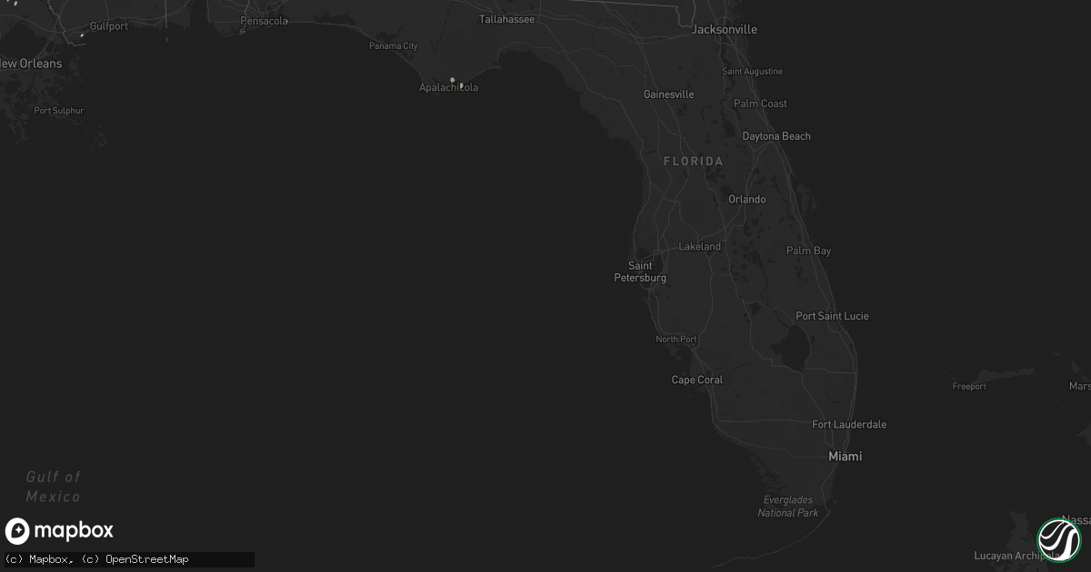
Hail Map in Florida on October 13, 2014
Get this storm
October 13 map
$229
one time, instant access
Download today. No call, no setup
Keep the $229
Bought the map and want the full workflow? Apply the entire $229 to a subscription within 7 days. None of it is wasted.
Every map, not just this one
This buys you this map. Subscription and you get every map we run, in the markets you choose from a few cities to whole states to nationwide. Plus real-time alerts the moment a storm fires.
Contact data
Name, contact info, occupancy, even credit band for addresses in the footprint. You go from where it hit to who to call.
Become the source they trust
Unlimited branding weather history reports on demand. You already have the documented answer ready for the property owner, and you are the one who showed up with it.
Property data and RoofTrace estimates
Pull up any address you have got, its value and the exact code rules for that jurisdiction, straight from One Click Code. Then RoofTrace estimates the squares, pitch, and roof value, priced the way you price.
Storm reports in Florida
Florida
| Date | Description |
|---|---|
| 10/13/20144:21 PM CDT | Tornadic debris signature seen on dual pol radar from both evx and tlh at this location. Tornado rated ef0 based on pictures of tree damage. No structural damage report |
| 10/13/20146:55 AM CDT | Tree down on js jones rd. |
| 10/13/20146:55 AM CDT | Tree down at olie and ambus roads. |
| 10/13/20146:47 AM CDT | Tree down at pine ridge and rolling pines roads. |
| 10/13/20145:43 AM CDT | Couple of trees down around santa rosa beach |
| 10/13/20143:45 AM CDT | Power lines were blown down along highway 71. Time is estimated. |
| 10/13/20143:00 AM CDT | Damage mainly to trees. However one house had a garage door blown in and some of the roof structure removed. Rated ef0 with winds of 75 to 80 mph. |
| 10/13/20142:25 AM CDT | Several reports of power lines down from around the panama city beach area and panama city. Wind was also driving rainwater into some condo units through the balcony do |
| 10/13/20142:05 AM CDT | Delayed report. A sign and tree limbs blown down. |
| 10/13/20142:00 AM CDT | Lightning also struck a tree near the home. Wind recorded by anemometer. |
| 10/13/20141:07 AM CDT | 55 knots measured at crestview asos |
| 10/12/20149:01 PM CDT | Tornadic debris signature seen on the tlh dual pol data at this location. Emergency manager forwarded a report of trees down as well. A shed was also damaged. Rated ef0 |
| 10/12/20148:59 PM CDT | Trees down and a roof blown off a shed in the vicinity of sumatra. Exact location unknown. Relayed by wmbb-tv meteorologist. |
| 10/12/20147:50 PM CDT | Another tornadic debris signature seen on tlh dual pol data at this location. Likely a separate tornado. Rated ef0 with tree damage. |
| 10/12/20147:29 PM CDT | Tornadic debris signature seen on dual pol radar from tlh at this location. This tornado touched down in the forest with no structural damage reported. Rated ef0. |
| 10/12/20147:16 PM CDT | Damage to 3 residences and 2 barns. Power lines and fences down. |
All States Impacted by Hail Map on October 13, 2014
Cities Impacted by Hail Map on October 13, 2014
- Bastrop, LA
- Mer Rouge, LA
- Starkville, MS
- Tremont, MS
- Smithville, MS
- Columbus, MS
- Canton, MS
- Roxie, MS
- Calhoun, LA
- Downsville, LA
- Rosedale, MS
- Watson, AR
- Rohwer, AR
- Duncan, MS
- Snow Lake, AR
- Gunnison, MS
- Middleton, TN
- Gore Springs, MS
- Grenada, MS
- Duck Hill, MS
- West Point, MS
- McCarley, MS
- Amory, MS
- Vaiden, MS
- West, MS
- Sumrall, MS
- Navarre, FL
- Jackson, MS
- Raymond, MS
- Terry, MS
- Byram, MS
- Lexington, MS
- Sidon, MS
- Cruger, MS
- Coila, MS
- Eudora, AR
- Gonzales, LA
- Oak Grove, LA
- Pioneer, LA
- Durant, MS
- Winona, MS
- Greenville, MS
- Portland, AR
- Lake Village, AR
- Iron City, TN
- Florence, AL
- Cypress Inn, TN
- Waterloo, AL
- Hamilton, MS
- Aberdeen, MS
- Fulton, MS
- Dennis, MS
- Belmont, MS
- Golden, MS
- Holladay, TN
- Decaturville, TN
- Lobelville, TN
- Stantonville, TN
- Reagan, TN
- McEwen, TN
- Parsons, TN
- Vanleer, TN
- Selmer, TN
- Palmyra, TN
- Morris Chapel, TN
- Woodlawn, TN
- Clarksville, TN
- Scotts Hill, TN
- Sugar Tree, TN
- Erin, TN
- Enville, TN
- Hurricane Mills, TN
- Waverly, TN
- Sardis, TN
- Cumberland Furnace, TN
- Milledgeville, TN
- Cumberland City, TN
- Adamsville, TN
- Saltillo, TN
- Cunningham, TN
- Eastpoint, FL
- Prairie, MS
- Camden, MS
- Sallis, MS
- Adger, AL
- Quinton, AL
- McCalla, AL
- Cordova, AL
- Mulga, AL
- Bessemer, AL
- Jonesville, LA
- Monterey, LA
- Bay Saint Louis, MS
- Waveland, MS
- Lorman, MS
- West Monroe, LA
- Farmerville, LA
- Weir, MS
- McCool, MS
- Carrollton, MS
- Call, TX
- Louisville, MS
- Coffeeville, MS
- Cullman, AL
- Hanceville, AL
- Vicksburg, MS
- Crosby, MS
- Hamilton, AL
- Vina, AL
- Greenwood Springs, MS
- Philadelphia, MS
- Vinemont, AL
- Collinston, LA
- Edwards, MS
- Utica, MS
- Emerson, AR
- Petal, MS
- Pine Hill, AL
- Arlington, AL
- Thomasville, AL
- Hayden, AL
- Florence, MS
- Marvell, AR
- Holly Grove, AR
- Yazoo City, MS
- Finger, TN
- Bethel Springs, TN
- Tunica, MS
- Marianna, AR
- Decatur, MS
- Jones, LA
- Fosters, AL
- Kosciusko, MS
- Ethel, MS
- Grapeland, TX
- Rayville, LA
- Oak Ridge, LA
- Benton, MS
- Hollandale, MS
- Carthage, MS
- Hermanville, MS
- Pinola, MS
- Vaughan, MS
- Monroe, LA
- Goodman, MS
- Loranger, LA
- Folsom, LA
- Guys, TN
- Ramer, TN
- Steens, MS
- Mississippi State, MS
- Caledonia, MS
- Red Bay, AL
- Crawford, MS
- Macon, MS
- Morton, MS
- Detroit, AL
- Sulligent, AL
- Wisner, LA
- Luray, TN
- Beech Bluff, TN
- Henderson, TN
- Rolling Fork, MS
- Deridder, LA
- Franklinton, LA
- Bonita, LA
- Dora, AL
- Minter City, MS
- Lutts, TN
- Pelahatchie, MS
- Lena, MS
- Thomaston, AL
- Anguilla, MS
- Amite, LA
- Estherwood, LA
- Crowley, LA
- Morse, LA
- Boyce, LA
- Kilmichael, MS
- Magnolia, AR
- Sterlington, LA
- Stewart, MS
- Ellisville, MS
- Seminary, MS
- Ashland, MS
- Robinsonville, MS
- Pickens, MS
- Ralph, AL
- Flatwoods, LA
- Mora, LA
- French Camp, MS
- Eupora, MS
- Woodville, TX
- Hillister, TX
- Helena, AR
- Deatsville, AL
- Prattville, AL
- Walnut Grove, MS
- Houston, TX
- Taylor, AR
- Ackerman, MS
- Dermott, AR
- Benoit, MS
- Parkdale, AR
- Kirbyville, TX
- Opelousas, LA
- Braxton, MS
- Charleston, MS
- Fred, TX
- Spurger, TX
- Walnut, MS
- Galena Park, TX
- Meadville, MS
- Newton, MS
- Clarksdale, MS
- Port Gibson, MS
- Tallulah, LA


