Hail Map in Nebraska on October 12, 2023
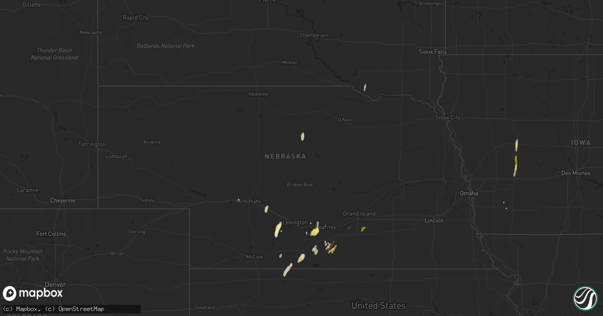
Get this storm
October 12 map
$229
one time, instant access
Download today. No call, no setup
Keep the $229
Bought the map and want the full workflow? Apply the entire $229 to a subscription within 7 days. None of it is wasted.
Every map, not just this one
This buys you this map. Subscription and you get every map we run, in the markets you choose from a few cities to whole states to nationwide. Plus real-time alerts the moment a storm fires.
Contact data
Name, contact info, occupancy, even credit band for addresses in the footprint. You go from where it hit to who to call.
Become the source they trust
Unlimited branding weather history reports on demand. You already have the documented answer ready for the property owner, and you are the one who showed up with it.
Property data and RoofTrace estimates
Pull up any address you have got, its value and the exact code rules for that jurisdiction, straight from One Click Code. Then RoofTrace estimates the squares, pitch, and roof value, priced the way you price.
Storm reports in Nebraska
Nebraska
| Date | Description |
|---|---|
| 10/12/20235:04 PM CDT | Very brief rope tornado reported by a few storm chasers and also fire department personnel...1 mile west of hwy 281. |
| 10/12/20234:45 PM CDT | Radar debris signature started at this time and lasted 5-10 minutes as it tracked into hall county. Based on radar data. No known damage at this time. |
| 10/12/20234:38 PM CDT | Unofficial weather station. |
| 10/12/20234:06 PM CDT | Report from mping: quarter |
| 10/12/20233:52 PM CDT | Report from mping: quarter |
| 10/12/20233:49 PM CDT | Report from mping: quarter |
| 10/12/20233:46 PM CDT | Just touched down. Storm chaser report via nwschat. |
| 10/12/20233:32 PM CDT | Report from spotter relayed by em. |
| 10/12/20232:20 PM CDT | Storm chaser video and report confirms brief touchdown near i-80 just east of the overton exit. Not fully condensed but debris visible. Time estimated from radar. |
| 10/12/20232:05 PM CDT | Storm chaser social media report and photo confirms a tornado in this area that touched down at 205pm and lasted about 4 minutes. Small bowl that turned into a cone and |
| 10/12/20232:05 PM CDT | Windows blown out of a building. |
All States Impacted by Hail Map on October 12, 2023
Cities Impacted by Hail Map on October 12, 2023
- Eustis, NE
- Farnam, NE
- Bassett, NE
- Dante, SD
- Wagner, SD
- Elm Creek, NE
- Funk, NE
- Kearney, NE
- Hildreth, NE
- Minden, NE
- Upland, NE
- Franklin, NE
- Wood River, NE
- Trumbull, NE
- Loomis, NE
- Holdrege, NE
- Norton, KS
- Hendley, NE
- Cambridge, NE
- Holbrook, NE
- Wilcox, NE
- Axtell, NE
- Alma, NE
- Hastings, NE
- Doniphan, NE
- Giltner, NE
- Brady, NE
- Beaver City, NE
- Oxford, NE
- Orleans, NE
- Stamford, NE
- Hershey, NE
- Almena, KS
- Odessa, NE
- Amherst, NE
- Salina, KS
- Little River, KS
- Bennington, KS
- Exira, IA
- Hamlin, IA
- Audubon, IA
- Stanton, IA
- Carroll, IA
- Elliott, IA
- Brayton, IA
- Templeton, IA


