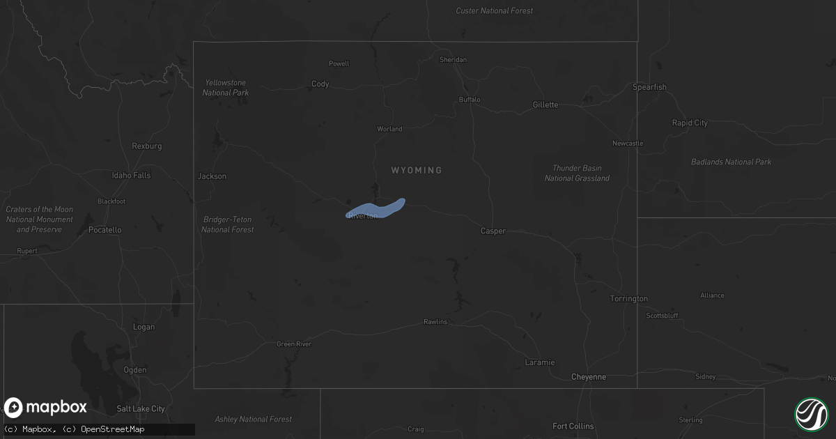
Hail Map in Wyoming on September 10, 2021
Get this storm
September 10 map
$229
one time, instant access
Download today. No call, no setup
Keep the $229
Bought the map and want the full workflow? Apply the entire $229 to a subscription within 7 days. None of it is wasted.
Every map, not just this one
This buys you this map. Subscription and you get every map we run, in the markets you choose from a few cities to whole states to nationwide. Plus real-time alerts the moment a storm fires.
Contact data
Name, contact info, occupancy, even credit band for addresses in the footprint. You go from where it hit to who to call.
Become the source they trust
Unlimited branding weather history reports on demand. You already have the documented answer ready for the property owner, and you are the one who showed up with it.
Property data and RoofTrace estimates
Pull up any address you have got, its value and the exact code rules for that jurisdiction, straight from One Click Code. Then RoofTrace estimates the squares, pitch, and roof value, priced the way you price.
Storm reports in Wyoming
Wyoming
| Date | Description |
|---|---|
| 09/10/20216:30 PM CDT | Asos station kriw riverton airport. |
| 09/10/20216:25 PM CDT | Asos station kriw riverton airport. |
| 09/10/20216:19 PM CDT | Asos station klnd lander airport. |
| 09/10/20211:01 AM CDT | At 559 PM MDT, an outflow boundary with severe winds was located along a line extending from 9 miles northeast of Boysen State Park to 15 miles southwest of Moneta, moving east at 40 mph. HAZARD...60 mph wind gusts. SOURCE...Radar indicated. IMPACT...Expect damage to roofs, siding, and trees. Locations impacted include... Moneta, Cottonwood Pass and Hiland. |
| 09/10/202112:28 AM CDT | At 527 PM MDT, an outflow boundary with severe winds was located near Riverton, moving northeast at 45 mph. HAZARD...70 mph wind gusts. SOURCE...Radar indicated. IMPACT...Expect considerable tree damage. Damage is likely to mobile homes, roofs, and outbuildings. This severe thunderstorm will be near... Boysen State Park and Hidden Valley around 545 PM MDT.Other locations in the path of this severe thunderstorm includeShoshoni. |


