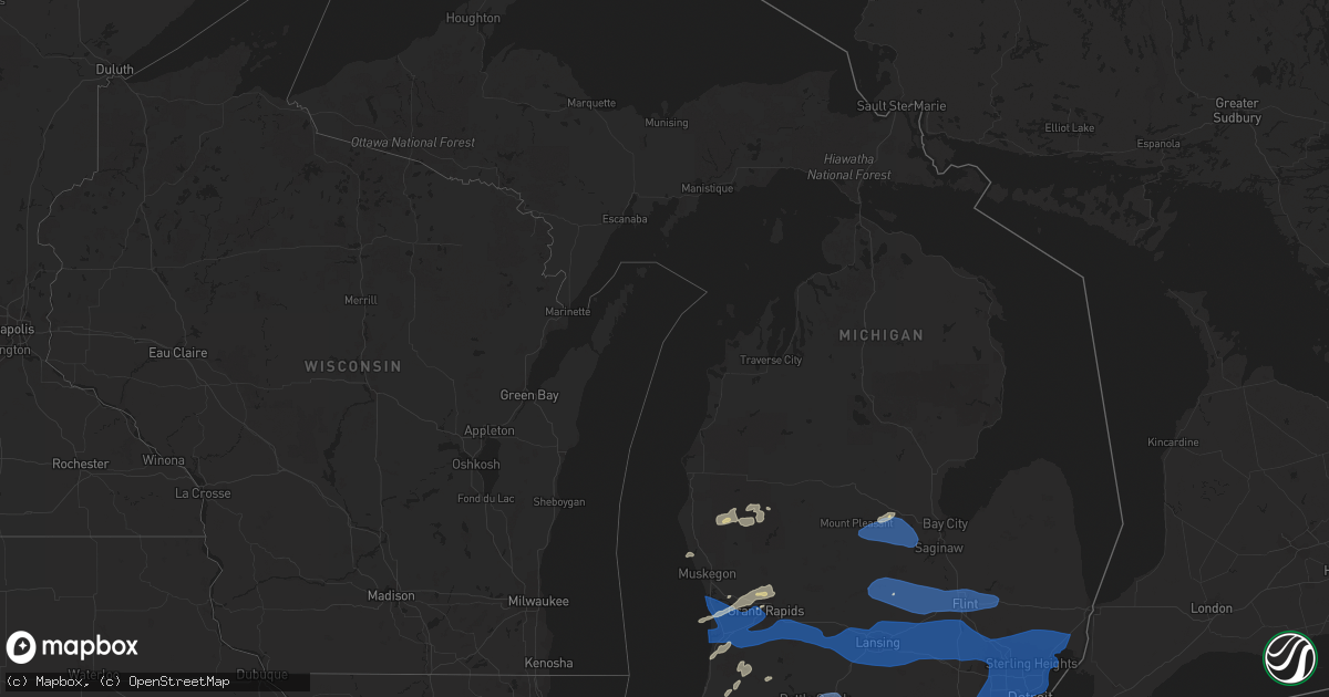
Hail Map in Michigan on August 29, 2022
Get this storm
August 29 map
$229
one time, instant access
Download today. No call, no setup
Keep the $229
Bought the map and want the full workflow? Apply the entire $229 to a subscription within 7 days. None of it is wasted.
Every map, not just this one
This buys you this map. Subscription and you get every map we run, in the markets you choose from a few cities to whole states to nationwide. Plus real-time alerts the moment a storm fires.
Contact data
Name, contact info, occupancy, even credit band for addresses in the footprint. You go from where it hit to who to call.
Become the source they trust
Unlimited branding weather history reports on demand. You already have the documented answer ready for the property owner, and you are the one who showed up with it.
Property data and RoofTrace estimates
Pull up any address you have got, its value and the exact code rules for that jurisdiction, straight from One Click Code. Then RoofTrace estimates the squares, pitch, and roof value, priced the way you price.
Storm reports in Michigan
Michigan
| Date | Description |
|---|---|
| 08/29/20225:55 PM CDT | Dispatch reports numerous trees and power lines down in algonac. |
| 08/29/20225:35 PM CDT | Measured at kmtc selfridge angb. |
| 08/29/20225:30 PM CDT | Social media photo shows snapped tree branch at carrington golf club. |
| 08/29/20225:30 PM CDT | Numerous trees downed across richmond. Largest was a foot in diameter. |
| 08/29/20225:23 PM CDT | Large trees blocking a portion of north ave. Roof damage also noted. |
| 08/29/20225:23 PM CDT | Multiple large diameter trees along heydenreich rd south of 21 mile plus wires downed by fallen trees. |
| 08/29/20225:20 PM CDT | Photo relayed via social media of large tree branch downed across road. |
| 08/29/20225:15 PM CDT | Measured at kdet detroit city airport. |
| 08/29/20225:15 PM CDT | 1 foot diameter branch downed on pickup truck cab. |
| 08/29/20225:12 PM CDT | Measured at kttf monroe custer airport. |
| 08/29/20225:08 PM CDT | Several large branches estimated 8 inches in diameter downed. |
| 08/29/20225:06 PM CDT | 6 to 12 inch diameter branches downed. |
| 08/29/20225:05 PM CDT | Measured at kdtw detroit metro airport. |
| 08/29/20225:02 PM CDT | Large tree downed - time estimated via radar. |
| 08/29/20224:54 PM CDT | Measured at kyip willow run airport. |
| 08/29/20224:52 PM CDT | Numerous large tree branches greater than 12 inches down across city of marlette. |
| 08/29/20224:47 PM CDT | Measured gust and 130 ft pine tree snapped. |
| 08/29/20224:47 PM CDT | Updated report. Peak measured gust 74 mph and 130 ft pine tree snapped. |
| 08/29/20224:45 PM CDT | Large branch downed and wires downed near walled lake dr and pontiac trail. |
| 08/29/20224:45 PM CDT | Several large trees down across wardlow rd. |
| 08/29/20224:44 PM CDT | Measured at nws white lake. |
| 08/29/20224:35 PM CDT | Tusola county central dispatch reported numerous trees and power lines down in and around millington. |
| 08/29/20224:29 PM CDT | Tree downed and large limbs downed. |
| 08/29/20224:24 PM CDT | Lenawee county central dispatch reported numerous trees and power lines down throughout cambridge township. There was also a report of roof damage to a home. |
| 08/29/20224:23 PM CDT | Social media photos of several large trees downed around pinckney. |
| 08/29/20224:21 PM CDT | Large limbs downed. |
| 08/29/20224:10 PM CDT | Spotter report of 60 mph wind gust near moscow michigan in hillsdale county. |
| 08/29/20224:00 PM CDT | Trees and power lines down throughout ingham county. |
| 08/29/20224:00 PM CDT | 6-8 inch trees down across the road at fields rd & e dansville rd. Time estimated from radar. |
| 08/29/20224:00 PM CDT | Several reports of trees and wires down within the county. |
| 08/29/20223:53 PM CDT | Measured at kmbs tri-cities airport. |
| 08/29/20223:44 PM CDT | Report of 14-inch tree down on gale rd south of ferris rd. Time estimated from radar. |
| 08/29/20223:42 PM CDT | Report of a 26-inch tree down. Time estimated. |
| 08/29/20223:40 PM CDT | Report of a 30-inch tree down. Time estimated. |
| 08/29/20223:35 PM CDT | A local report indicates 1.00 inch wind near SANFORD |
| 08/29/20223:35 PM CDT | Large tree down. |
| 08/29/20223:31 PM CDT | Multiple large trees and power lines down across midland county. Dispatch received numerous reports at the intersection of 9 mile rd and stewart rd. |
| 08/29/20223:25 PM CDT | Power pole snapped in shepherd. 14 trees down across isabella county. 3 reports of power lines down across the county. |
| 08/29/20223:15 PM CDT | Photos of downed limbs on power lines... Via social media. Power outage at location. Time estimated. |
| 08/29/20223:15 PM CDT | Tree down and blocking road at 20th st and upton ave. Time estimated from radar. |
| 08/29/20223:15 PM CDT | Asos station kbtl battle creek executive airport. |
| 08/29/20223:15 PM CDT | Trees and power lines down throughout calhoun county. |
| 08/29/20223:15 PM CDT | Report of large limb down along charlotte hwy near butler rd... Via social media. Time estimated. |
| 08/29/20223:02 PM CDT | Some trees and branches down in north portage. |
| 08/29/20223:00 PM CDT | Trees down in and around the city. |
| 08/29/20222:59 PM CDT | Large trees down. Time estimated from radar. |
| 08/29/20222:52 PM CDT | Numerous trees down; road commission responding. Time estimated from radar. |
| 08/29/20222:50 PM CDT | Photos provided by kent county emergency mgmt showing snapped power poles... Downed trees |
| 08/29/20222:47 PM CDT | Report of metal roof ripped off building. |
| 08/29/20222:45 PM CDT | Report of trees and power lines down throughout otsego. Some trees/limbs have fallen onto homes. Time estimated from radar. |
| 08/29/20222:45 PM CDT | Tree blocking road. |
| 08/29/20222:43 PM CDT | Asos station kgrr gerald r ford intl. |
| 08/29/20222:42 PM CDT | Trees and wires down across the road. |
| 08/29/20222:40 PM CDT | Trees and power lines down in the road at northland drive and 5 mile road. |
| 08/29/20222:40 PM CDT | Trees in the road. |
| 08/29/20222:40 PM CDT | Tree in road. |
| 08/29/20222:35 PM CDT | Lots of branches down in the city of dowagiac with power lines down in the street. |
| 08/29/20222:35 PM CDT | Report from mping: 1-inch tree limbs broken; shingles blown off. |
| 08/29/20222:32 PM CDT | Trees in the road. |
| 08/29/20222:28 PM CDT | Report from mping: trees uprooted or snapped; roof blown off. |
| 08/29/20222:28 PM CDT | Tree down on coit ave between jupiter and husburger. Water partially over road. Traffic signal out at coit and jupiter. Time estimated. |
| 08/29/20222:27 PM CDT | Photo of trees snapped in a rockford neighborhood... Via social media. Time estimated. |
| 08/29/20222:25 PM CDT | Tree on road on east 4th street. Multiple trees down across newaygo county. |
| 08/29/20222:20 PM CDT | Numerous branches down across hope college campus. |
| 08/29/20222:15 PM CDT | Public report of trees down near waverly and chicago drive. |
| 08/29/20222:15 PM CDT | Asos station kbiv w mich regional arpt. |
| 08/29/20222:06 PM CDT | Buoy station hlnm4 holland harbor. |
| 08/29/20222:00 PM CDT | Tree on road. |
| 08/29/20221:57 AM CDT | At 657 PM EDT, severe thunderstorms were located along a line extending from 7 miles east of Lakeport to near Marysville to near Harsens Island, moving east at 45 mph. HAZARD...60 mph wind gusts. SOURCE...Radar indicated. IMPACT...Expect damage to roofs, siding, and trees. Severe thunderstorms will be near... Marysville around 700 PM EDT. Port Huron around 710 PM EDT. Marine City around 715 PM EDT.Other locations impacted by these severe thunderstorms includeAnchorville, Fort Gratiot, Adair, Columbus, Rattle Run, Pearl Beach,Smiths Creek, Fair Haven and Wadhams. |
| 08/29/202212:52 AM CDT | At 551 PM EDT, severe thunderstorms were located along a line extending from near Kingston to near Lapeer to Livonia, moving east at 60 mph. HAZARD...60 mph wind gusts. SOURCE...Radar indicated. IMPACT...Expect damage to roofs, siding, and trees. Severe thunderstorms will be near... Marlette around 555 PM EDT. Capac around 610 PM EDT. Yale and Emmett around 615 PM EDT. Port Huron and Lakeport around 630 PM EDT.Other locations impacted by these severe thunderstorms includeAnchorville, North Street, Lynn Township, Amador, Brockway, FortGratiot, Avoca, Fargo, Berville and Roseburg.Additional scattered thunderstorms have developed ahead of this main line and will be capable of producing wind gusts to 60 mph. |
| 08/29/202212:47 AM CDT | At 546 PM EDT, severe thunderstorms were located along a line extending from 8 miles west of Port Austin to near Gagetown to near Clifford, moving east at 45 mph. HAZARD...60 mph wind gusts. SOURCE...Radar indicated. IMPACT...Expect damage to roofs, siding, and trees. Severe thunderstorms will be near... Port Austin around 600 PM EDT. Ubly around 610 PM EDT. Sandusky around 625 PM EDT. Harbor Beach, Deckerville, Forestville and Carsonville around 635 PM EDT. Applegate around 640 PM EDT. Port Sanilac around 650 PM EDT.Other locations impacted by these severe thunderstorms includeParisville, Huron City, White Rock, Ivanhoe, Rapson, Grindstone City,Juhl, Elmer, New Greenleaf and Port Crescent State Park. |
| 08/29/202212:31 AM CDT | At 530 PM EDT, severe thunderstorms were located along a line extending from Grand Blanc to near Brighton to near Manchester, moving east at 60 mph. HAZARD...60 mph wind gusts and penny size hail. SOURCE...Radar indicated. IMPACT...Expect damage to roofs, siding, and trees. Severe thunderstorms will be near... South Lyon around 535 PM EDT. Milford and Ortonville around 540 PM EDT. Novi around 545 PM EDT. West Bloomfield around 550 PM EDT. Pontiac and Belleville around 555 PM EDT. Southfield, Royal Oak and Birmingham around 600 PM EDT. Warren, Troy and Rochester around 605 PM EDT. Flat Rock, Sterling Heights and Clinton around 610 PM EDT.Other locations impacted by these severe thunderstorms includeFranklin, Keego Harbor, Melvindale, Gibraltar, Waterford, ShelbyTownship, Holly State Recreation Area, Commerce, Ray Center andUtica.Scattered thunderstorms ahead of this line will also be capable of 60 mph wind gusts and penny size hail. |
| 08/29/202212:23 AM CDT | At 523 PM EDT, severe thunderstorms were located along a line extending from near Birch Run to Flint to Linden, moving east at 45 mph. HAZARD...70 mph wind gusts. SOURCE...Radar indicated. IMPACT...Expect considerable tree damage. Damage is likely to mobile homes, roofs, and outbuildings. Severe thunderstorms will be near... Burton around 530 PM EDT. Davison and Otisville around 535 PM EDT. Grand Blanc and Otter Lake around 540 PM EDT. Columbiaville and Goodrich around 545 PM EDT. Lapeer and Hadley around 550 PM EDT. North Branch, Metamora, Clifford and Lum around 600 PM EDT. Imlay City around 605 PM EDT. Brown City and Dryden around 610 PM EDT.Other locations impacted by these severe thunderstorms include Atlas,Goodland Township, Burnside, Attica, Elba, Thetford Township, KingsMill, Silverwood, Genesee and Thornville. |
| 08/29/202212:19 AM CDT | At 519 PM EDT, severe thunderstorms were located along a line extending from near Fayette to near Stryker, moving east at 50 mph. HAZARD...60 mph wind gusts. SOURCE...Radar indicated. IMPACT...Expect damage to roofs, siding, and trees. Locations impacted include... Napoleon, Wauseon, Archbold, Swanton, Delta, Fayette, Liberty Center, Metamora, Lyons, Texas, Oakshade, Pettisville, Brailey, Zone, Seward, Ridgeville Corners, Gerald, Denson, Winameg and Assumption.This includes Interstate 80 in Ohio between mile markers 23 and 48. |
| 08/29/202212:15 AM CDT | At 515 PM EDT, severe thunderstorms were located along a line extending from 9 miles south of Au Gres to near Quanicassee to near Montrose, moving east at 50 mph. HAZARD...60 mph wind gusts. SOURCE...Radar indicated. IMPACT...Expect damage to roofs, siding, and trees. Severe thunderstorms will be near... Akron and Fairgrove around 520 PM EDT. Unionville around 525 PM EDT. Frankenmuth and Caro around 530 PM EDT. Vassar, Cass City, Millington, Caseville, Pigeon and Gagetown around 540 PM EDT. Mayville around 550 PM EDT. Kingston around 600 PM EDT.Other locations impacted by these severe thunderstorms includeCarrollton, Arthur, Colling, Wisner, Ellington, Buena Vista Township,Gera, Gilford, Indiantown and Deford. |
| 08/28/202211:58 PM CDT | At 457 PM EDT, severe thunderstorms were located along a line extending from near Morrice to near Leslie to near Jonesville, moving east at 55 mph. HAZARD...60 mph wind gusts and penny size hail. SOURCE...Radar indicated. IMPACT...Expect damage to roofs, siding, and trees. Severe thunderstorms will be near... Gregory around 520 PM EDT. Chelsea and Pinckney around 525 PM EDT. Dexter around 530 PM EDT. Ann Arbor and Hamburg around 535 PM EDT. Whitmore Lake around 540 PM EDT. South Lyon and Dixboro around 545 PM EDT. Salem around 550 PM EDT. Milan around 555 PM EDT.Other locations impacted by these severe thunderstorms includePittsfield Township, Whittaker, Plainfield, Hudson Mills Metropark,Island Lake State Recreation Area, Bridgewater, Delhi Mills, PleasantLake, Barton Hills and Conway Township.Additional isolated storms are located ahead of this main line which may also produce wind gusts to 60 mph and penny size hail |
| 08/28/202211:32 PM CDT | At 431 PM EDT, severe thunderstorms were located along a line extending from near Breckenridge to near St. Johns to Grand Ledge, moving east at 55 mph. HAZARD...60 mph wind gusts. SOURCE...Radar indicated. IMPACT...Expect damage to roofs, siding, and trees. Severe thunderstorms will be near... Merrill around 440 PM EDT. Owosso, Freeland, Oakley and Henderson around 450 PM EDT. Laingsburg and Corunna around 455 PM EDT. New Lothrop around 500 PM EDT. Saginaw, Perry, Zilwaukee, Montrose, Morrice, Lennon and Bridgeport around 505 PM EDT. Flushing and Swartz Creek around 510 PM EDT. Clio, Mount Morris, Bancroft and Beecher around 515 PM EDT. Flint, Byron and Gaines around 520 PM EDT.Other locations impacted by these severe thunderstorms include Brant,Nelson, Carrollton, Garfield, Arthur, Rankin, Fenmore, Burt, BuenaVista Township and Gera. |
| 08/28/202211:15 PM CDT | At 413 PM EDT, severe thunderstorms were located along a line extending from near Nashville to 9 miles north of Colon, moving east at 50 mph. These storms have a history of producing damaging winds and power outages. HAZARD...60 mph wind gusts and penny size hail. SOURCE...Trained weather spotters. Airport observations have also indicated wind gusts of 55 to 60 mph with these storms. IMPACT...Expect damage to roofs, siding, and trees. Locations impacted include... Jackson... Charlotte... Albion... Mason... Marshall... Eaton Rapids... Leslie... Homer... Bellevue... Stockbridge... Brooklyn... Grass Lake... Burlington... Vandercook Lake... Leoni... Spring Arbor... Napoleon... Sandstone... Aurelius... Onondaga... |
| 08/28/202211:05 PM CDT | At 405 PM EDT, severe thunderstorms were located along a line extending from Houghton Lake to near Clare to 8 miles northeast of Edmore, moving east at 45 mph. HAZARD...60 mph wind gusts and penny size hail. SOURCE...Radar indicated. IMPACT...Expect damage to roofs, siding, and trees. Locations impacted include... Alger, Gladwin, Standish, Au Gres, Sterling, Maple Ridge, Beaverton, Omer, Twining, Turner, Hockaday, Rhodes, Skeels, Winegars and Wooden Shoe Village. |
| 08/28/202211:02 PM CDT | At 401 PM EDT, severe thunderstorms were located along a line extending from Harrison to near Rosebush to near Edmore, moving east at 45 mph. HAZARD...60 mph wind gusts. SOURCE...Radar indicated. IMPACT...Expect damage to roofs, siding, and trees. Severe thunderstorms will be near... Coleman around 420 PM EDT. Pleasant Valley around 425 PM EDT. Sanford and Edenville around 435 PM EDT. Bentley around 445 PM EDT. Auburn around 455 PM EDT. Kawkawlin and Linwood around 500 PM EDT. Bay City and Essexville around 505 PM EDT. Munger around 515 PM EDT.Other locations impacted by these severe thunderstorms include MountForest, Laporte, Averill, Gordonville, Bombay, Porter Township,Crump, Poseyville, Willard and Hope. |
| 08/28/202210:47 PM CDT | At 345 PM EDT, a line of severe thunderstorms was located along a line from Grand Rapids to near Stanton, moving east at 45 mph. These storms have a history of producing wind damage and power outages. Seek shelter inside a sturdy building. HAZARD...60 mph wind gusts and quarter size hail. SOURCE...Trained weather spotters. IMPACT...Hail damage to vehicles is expected. Expect wind damage to roofs, siding, and trees. Locations impacted include... Lansing... Ionia... Alma... Charlotte... Greenville... Mason... St. Johns... Hastings... Portland... Ithaca... Stanton... East Lansing... Grand Ledge... St. Louis... Belding... Williamston... Potterville... Lake Odessa... Nashville... Breckenridge... |
| 08/28/202210:40 PM CDT | At 340 PM EDT, a severe thunderstorm was located near Otsego, or 9 miles southeast of Allegan, moving east at 45 mph. HAZARD...60 mph wind gusts and quarter size hail. SOURCE...Radar indicated. IMPACT...Hail damage to vehicles is expected. Expect wind damage to roofs, siding, and trees. Locations impacted include... Kalamazoo... Portage... Battle Creek... Allegan... Paw Paw... Otsego... Plainwell... Vicksburg... Galesburg... Mattawan... Lawton... Schoolcraft... Climax... Richland... Martin... Burlington... Brownlee Park... Comstock Northwest... Gull Lake... Kalamazoo-Battle Cre... |
| 08/28/202210:37 PM CDT | At 336 PM EDT, severe thunderstorms were located along a line extending from Cassopolis to Lakeville, moving east at 45 mph. HAZARD...60 mph wind gusts. SOURCE...Radar indicated. IMPACT...Expect damage to roofs, siding, and trees. Locations impacted include... South Bend, Elkhart, Mishawaka, Goshen, Three Rivers, Nappanee, Georgetown, Gulivoire Park, Granger, Dunlap, Simonton Lake, Middlebury, Osceola, Constantine, Cassopolis, Wakarusa, Bristol, White Pigeon, Edwardsburg and Marcellus.This includes Interstate 80 in Indiana between mile markers 77 and109. |
| 08/28/202210:33 PM CDT | At 332 PM EDT, a severe thunderstorm was located 9 miles north of Mecosta, or 10 miles east of Big Rapids, moving east at 45 mph. HAZARD...60 mph wind gusts and penny size hail. SOURCE...Radar indicated. IMPACT...Expect damage to roofs, siding, and trees. Locations impacted include... Mount Pleasant... Clare... Shepherd... Marion... Farwell... Mecosta... Rosebush... Canadian Lakes... Lake Isabella... Harrison... Remus... Millbrook... Lake... Barryton... Brinton... Sylvester... Lake George... Avondale... Delwin... Winn... |
| 08/28/202210:17 PM CDT | At 316 PM EDT, a severe thunderstorm was located over Hudsonville, or 12 miles northeast of Holland, moving east at 45 mph. HAZARD...70 mph wind gusts and quarter size hail. SOURCE...Observed wind gusts. At 3:08 pm, the West Michigan Regional Airport in Holland had a gust to 66 mph. IMPACT...Hail damage to vehicles is expected. Expect considerable tree damage. Wind damage is also likely to mobile homes, roofs, and outbuildings. Locations impacted include... Grand Rapids... Hastings... Wyoming... Kentwood... Walker... Grandville... East Grand Rapids... Rockford... Sparta... Wayland... Lowell... Middleville... Caledonia... Freeport... Gerald R. Ford Inter... Ada... Dorr... Grattan... Cedar Springs... Irving... |
| 08/28/202210:01 PM CDT | At 301 PM EDT, a severe thunderstorm was located near White Cloud, moving east at 50 mph. HAZARD...60 mph wind gusts and quarter size hail. SOURCE...Radar indicated. IMPACT...Hail damage to vehicles is expected. Expect wind damage to roofs, siding, and trees. Locations impacted include... Big Rapids... Newaygo... White Cloud... Fremont... Hesperia... Grant... Morley... Croton... Bridgeton... Paris... Stanwood... Brohman... Woodland Park... Rodney... Reeman... Hawkins... Woodville... Roben-Hood Airport... Bitely... Chippewa Lake... |
| 08/28/20229:56 PM CDT | At 256 PM EDT, a severe thunderstorm was located near Holland SP, or 8 miles west of Holland, moving east at 55 mph. HAZARD...70 mph wind gusts and quarter size hail. SOURCE...Radar indicated. IMPACT...Hail damage to vehicles is expected. Expect considerable tree damage. Wind damage is also likely to mobile homes, roofs, and outbuildings. Locations impacted include... Holland... Grand Haven... Hudsonville... Zeeland... Coopersville... Ferrysburg... Spring Lake... Saugatuck... Beechwood... Jenison... Holland SP... Allendale... Conklin... Hamilton... Wright... Douglas... Port Sheldon... Crockery Lake... Lamont... Grand Haven Memorial... |
| 08/28/20229:32 PM CDT | At 232 PM EDT, a severe thunderstorm was located 16 miles west of Roosevelt Park, or 17 miles west of Muskegon, moving east at 45 mph. HAZARD...60 mph wind gusts and quarter size hail. SOURCE...Radar indicated. IMPACT...Hail damage to vehicles is expected. Expect wind damage to roofs, siding, and trees. Locations impacted include... Muskegon... Muskegon Heights... Roosevelt Park... North Muskegon... Whitehall... Montague... Lakewood Club... Ravenna... Fruitport... Norton Shores... Dalton... Holton... Sullivan... Casnovia... Brunswick... Muskegon SP... Big Blue Lake... Wolf Lake... Duck Lake SP... Twin Lake... |
| 08/28/20228:47 PM CDT | At 147 PM EDT, a severe thunderstorm was located 7 miles northeast of Hesperia, or 11 miles northwest of White Cloud, moving northeast at 35 mph. HAZARD...60 mph wind gusts and quarter size hail. SOURCE...Radar indicated. IMPACT...Hail damage to vehicles is expected. Expect wind damage to roofs, siding, and trees. Locations impacted include... Big Rapids... Evart... Reed City... Hesperia... Chase... Paris... Hersey... Brohman... Woodland Park... Hawkins... Woodville... Ashton... Roben-Hood Airport... Bitely... Nartron Field... |
All States Impacted by Hail Map on August 29, 2022
Cities Impacted by Hail Map on August 29, 2022
- Watervliet, MI
- Allegan, MI
- Bloomingdale, MI
- Salem, WI
- Burlington, WI
- Indianola, IA
- Big Rapids, MI
- Dalton City, IL
- Montague, MI
- Whitehall, MI
- Chelsea, MI
- Oakland, IL
- Ridge Farm, IL
- Metcalf, IL
- Indianola, IL
- Brocton, IL
- Catlin, IL
- Georgetown, IL
- Hume, IL
- Chrisman, IL
- Newman, IL
- Fennville, MI
- Hamilton, MI
- Saugatuck, MI
- Holland, MI
- Douglas, MI
- Dana, IN
- Clinton, IN
- Hillsdale, IN
- Paris, IL
- Bennett, IA
- Ainsworth, IA
- Pontiac, IL
- Odell, IL
- Streator, IL
- Ancona, IL
- Wenona, IL
- Cornell, IL
- Long Point, IL
- Saunemin, IL
- Fisher, IL
- Mahomet, IL
- Franklin, IL
- New Berlin, IL
- Jacksonville, IL
- Alexander, IL
- Mansfield, IL
- Newark, MO
- Knox City, MO
- Decatur, IL
- Hammond, IL
- La Place, IL
- Cerro Gordo, IL
- Argenta, IL
- Elliott, IL
- Gibson City, IL
- Frankfort, KS
- Lincoln, IL
- Allerton, IL
- Broadlands, IL
- Fairfield, IL
- Clinton, MO
- Montrose, MO
- Grand Rapids, MI
- Grand Ridge, IL
- Gary, IN
- Lake Station, IN
- Seneca, IL
- Sharon, WI
- Clinton, WI
- Sibley, IL
- Beallsville, OH
- Curwensville, PA
- Clearfield, PA
- West Terre Haute, IN
- Newcomerstown, OH
- West Lafayette, OH
- Pembroke Township, IL
- Lansing, IL
- Chicago Heights, IL
- Glenwood, IL
- Munster, IN
- Highland, IN
- Monon, IN
- Delphi, IN
- Yeoman, IN
- Idaville, IN
- Monticello, IN
- Brookston, IN
- Leonard, MO
- Gibbs, MO
- Novelty, MO
- Hurdland, MO
- La Plata, MO
- Kentland, IN
- Earl Park, IN
- Fowler, IN
- Goodland, IN
- Remington, IN
- Wathena, KS
- Saint Joseph, MO
- Grand Junction, MI
- Washington, IA
- Clinton, IA
- Long Grove, IA
- McCausland, IA
- Calamus, IA
- Thomson, IL
- Bryant, IA
- Grand Mound, IA
- Charlotte, IA
- Savanna, IL
- Camanche, IA
- Preston, IA
- Eldridge, IA
- Welton, IA
- Princeton, IA
- Sabula, IA
- Miles, IA
- Delmar, IA
- De Witt, IA
- Goose Lake, IA
- Driftwood, PA
- Chatsworth, IL
- Melvin, IL
- Strawn, IL
- Beason, IL
- Everest, KS
- Lancaster, KS
- Horton, KS
- Effingham, KS
- Lone Jack, MO
- Loraine, IL
- West Point, IL
- Pleasant Hill, MO
- Kingsville, MO
- Gardner, KS
- Edgerton, KS
- Spring Hill, KS
- Gardner, IL
- Dwight, IL
- Manhattan, IL
- Elwood, IL
- Joliet, IL
- Mokena, IL
- Channahon, IL
- New Lenox, IL
- Sanford, MI
- Shepherd, MI
- Coleman, MI
- Midland, MI
- Shelbyville, MO
- Emden, MO
- Lake Village, IN
- Marne, MI
- Coopersville, MI
- Belmont, MI
- Zeeland, MI
- Rockford, MI
- Allendale, MI
- Comstock Park, MI
- Conklin, MI
- Sparta, MI
- West Olive, MI
- Waterford, WI
- Cooksville, IL
- Richland, IA
- Brighton, IA
- Warsaw, IL
- Basco, IL
- Carthage, IL
- North Judson, IN
- Demotte, IN
- Fair Oaks, IN
- Wheatfield, IN
- Rensselaer, IN
- San Pierre, IN
- Elsie, MI
- Brohman, MI
- Bitely, MI
- White Cloud, MI
- Paris, MI
- Reddick, IL
- Muscatine, IA
- Winterset, IA
- Plymouth, IN
- Bourbon, IN
- Argos, IN
- Carbon, IN
- Brazil, IN
- Hartford, MI
- Nunica, MI
- New Salem, IL
- Colchester, IL
- Wheatland, IA
- New Liberty, IA
- Morocco, IN
- Danville, IL
- Terre Haute, IN
- Lovington, IL
- Chenoa, IL
- Junction City, KS
- Murrayville, IL
- Paloma, IL
- Holden, MO
- Lakeville, OH
- Glenmont, OH
- Bethany, MO
- East Palestine, OH
- Montgomery, IN
- Cannelburg, IN
- Ashland, IL
- Herington, KS
- Offerle, KS
- Lewis, KS
- Kinsley, KS
- Valparaiso, IN
- Hobart, IN
- Tolono, IL
- Philo, IL
- Sidney, IL
- Savoy, IL
- Potomac, IL
- Saint Joseph, IL
- Rossville, IL
- Rantoul, IL
- Loda, IL
- Thomasboro, IL
- Buckley, IL
- Roberts, IL
- Paxton, IL
- Homer, IL
- Armstrong, IL
- Collison, IL
- Muncie, IL
- Urbana, IL
- Gifford, IL
- Ogden, IL
- Fairmount, IL
- Cissna Park, IL
- Champaign, IL
- Oakwood, IL
- Ludlow, IL
- Penfield, IL
- Fithian, IL
- Royal, IL
- Rankin, IL
- La Monte, MO
- Hughesville, MO
- Sedalia, MO
- Knob Noster, MO
- Pleasant Plains, IL
- Springfield, IL
- Hopedale, IL
- Minier, IL
- Barry, IL
- Genoa City, WI
- Lake Geneva, WI
- Peculiar, MO
- Columbus Junction, IA
- Crawfordsville, IA
- Columbus City, IA
- Wayland, IA
- Francesville, IN
- Winamac, IN
- Medaryville, IN
- Chillicothe, OH
- Waverly, OH
- Freeman, MO
- Stoutland, MO
- Richland, MO
- Ewing, IL
- McLeansboro, IL
- Macedonia, IL
- Dahlgren, IL
- Belle Rive, IL
- Plainwell, MI
- Otsego, MI
- Chariton, IA
- Lovilia, IA
- Russell, IA
- Melrose, IA
- Bonfield, IL
- La Porte, IN
- Minooka, IL
- Hamilton, IL
- Maroa, IL
- Virginia, IL
- Beardstown, IL
- Arenzville, IL
- Coshocton, OH
- Hamilton, MO
- Kidder, MO
- Cameron, MO
- Waverly, IL
- Chandlerville, IL
- Bath, IL
- Tallula, IL
- Loami, IL
- Marshfield, MO
- Strafford, MO
- Packwood, IA
- Fairfield, IA
- Tipton, IN
- Beloit, KS
- Mount Carroll, IL
- Lanark, IL
- Shannon, IL
- Hoisington, KS
- Olmitz, KS
- Norwalk, IA
- Saint Charles, IA
- Prole, IA
- Patterson, IA
- Martensdale, IA
- Bevington, IA
- Dexter, MO
- Bloomfield, MO
- Dixon, IA
- Cosby, MO
- Easton, MO
- Ensign, KS
- Niangua, MO
- Columbus, OH
- Culver, IN
- Knox, IN
- Pittsfield, IL
- Sullivan, IL
- Beecher, IL
- Walkerville, MI
- Hesperia, MI
- Westville, IN
- Crete, IL
- Saint John, IN
- Dyer, IN
- Piper City, IL
- Gilman, IL
- Ashkum, IL
- Danforth, IL
- Kempton, IL
- Blakesburg, IA
- Ottumwa, IA
- Drakesville, IA
- Albia, IA
- Bloomfield, IA
- Moravia, IA
- Agency, IA
- Unionville, IA
- Barnard, KS
- Seymour, MO
- Bethesda, OH
- Iuka, IL
- Dix, IL
- Walnut Hill, IL
- Kell, IL
- Dodge City, KS
- Circleville, OH
- Ramona, KS
- Hope, KS
- Joelton, TN
- Goodlettsville, TN
- Whites Creek, TN
- Jeffersonville, IN
- Yukon, OK
- Wayne City, IL
- Burkesville, KY
- Norman, OK
- Huntingburg, IN
- Verden, OK
- Chickasha, OK
- Spearville, KS
- Richmond, KY
- Louisville, KY
- Fairdale, KY
- Fort Sumner, NM
- Pond Creek, OK
- Kremlin, OK
- Big Clifty, KY
- Pawnee, OK
- Amarillo, TX
- Geary, OK
- Calumet, OK
- Broseley, MO
- Melbourne, AR
- Sage, AR
- Ozark, AR
- Cleveland, OK
- Stillwater, OK
- Coyle, OK
- Perkins, OK
- Cache, OK
- Indiahoma, OK
- Skiatook, OK
- Fort Cobb, OK
- Barnsdall, OK
- Milnesand, NM
- Morton, TX
- Tatum, NM
- Tulia, TX
- Mustang, OK
- Gotebo, OK
- Mountain View, OK
- Elida, NM
- Abernathy, TX
- Happy, TX
- Weir, KS
- Anson, TX
- Reeds Spring, MO
- Whiteface, TX
- Pecos, TX
- Childress, TX
- Matador, TX
- Otis, KS
- Bison, KS
- Alexander, KS
- Bazine, KS
- Chaffee, MO
- Lockney, TX
- Floydada, TX
- Loving, NM
- Idalou, TX
- Petersburg, TX
- Apache, OK
- Quincy, IL
- Ellsworth, KS
- Kanopolis, KS
- Meade, KS
- Plains, KS
- Turpin, OK
- Forgan, OK
- Kismet, KS
- Anton, TX
- Levelland, TX
- Great Bend, KS
- Ewing, MO
- Maljamar, NM
- Lovington, NM
- Muleshoe, TX
- Sudan, TX
- Earth, TX
- Oran, MO
- Advance, MO
- Whitewater, MO
- Cape Girardeau, MO
- Booker, TX
- Nixa, MO
- Clever, MO
- Vinson, OK
- Seminole, OK
- Prague, OK
- Nazareth, TX
- Hart, TX
- Dimmitt, TX
- Ropesville, TX
- Meadow, TX
- Lorenzo, TX
- Tokio, TX
- Plains, TX
- Denver City, TX
- Crowell, TX
- Vernon, TX
- La Crosse, KS
- Bland, MO
- Balko, OK
- La Grange, MO
- Monticello, MO
- Lewistown, MO
- Canton, MO
- Payson, IL
- Taylor, MO
- Maywood, MO
- Palmyra, MO
- Durham, MO
- Philadelphia, MO
- Flomot, TX
- Wright, KS
- Odell, TX
- Capitan, NM
- Nekoma, KS
- Ness City, KS
- Albert, KS
- Winchester, KY
- Irvine, KY
- Amoret, MO
- Warrensburg, MO
- Billings, MO
- Republic, MO
- Enid, OK
- Hominy, OK
- Silverton, TX
- Blanchard, OK
- Amber, OK
- Owasso, OK
- Collinsville, OK
- Claremore, OK
- Jerico Springs, MO
- Lamar, MO
- Sheldon, MO
- Stockton, MO
- Ada, OK
- Canyon, TX
- Claude, TX
- Longview, IL
- Sutter, IL
- Lawton, OK
- Glencoe, OK
- Rosedale, IN
- Anadarko, OK
- Gracemont, OK
- Lebanon, MO
- Spearman, TX
- Kress, TX
- Plainview, TX
- Hamlin, TX
- Tecumseh, OK
- Shawnee, OK
- Linden, TN
- Wilson, KS
- Mulhall, OK
- Rogers, NM
- Eskridge, KS
- Paxico, KS
- Alma, KS
- Dumas, TX
- Sunray, TX
- Brownfield, TX
- Perryton, TX
- Oreana, IL
- Crosbyton, TX
- Frederick, OK
- Garden City, MO
- Dale, IN
- Lincoln City, IN
- Gentryville, IN
- Santa Claus, IN
- Holland, IN
- Ferdinand, IN
- Hoopeston, IL
- Blue Mound, IL
- Moweaqua, IL
- Macon, IL
- Stonington, IL
- Stratford, TX
- Wellsville, KS
- Rule, TX
- Owensville, IN
- Poseyville, IN
- Griffin, IN
- Mount Carmel, IL
- New Harmony, IN
- Dorrance, KS
- Bunker Hill, KS
- Ford, KS
- Hanston, KS
- Harrisonville, MO
- Johnsonville, IL
- Bluford, IL
- Sims, IL
- Mount Vernon, IL
- Opdyke, IL
- Keenes, IL
- Elgin, OK
- Jal, NM
- Paducah, TX
- Old Glory, TX
- Hobbs, NM
- Bethel, MO
- La Belle, MO
- El Dorado Springs, MO
- Milo, MO
- Scammon, KS
- Charleston, MO
- Mountain Grove, MO
- Berea, KY
- Waco, KY
- Vinita, OK
- Lindsay, OK
- Purcell, OK
- Centerville, TN
- Earlsboro, OK
- Lexington, OK
- Noble, OK
- Washington, OK
- Van Horn, TX
- Latham, IL
- Chestnut, IL
- Kenney, IL
- Cross Plains, IN
- Dubois, IN
- Butler, MO
- Walnut, KS
- Ribera, NM
- Eldorado, OK
- Elmer, OK
- Norwich, OH
- Graymont, IL
- Jetmore, KS
- Temple, OK
- Marble Hill, MO
- Claflin, KS
- Greensburg, KS
- Watonga, OK
- Emporia, KS
- Saint Anthony, IN
- Madison, IN
- Nowata, OK
- Hartville, MO
- Foster, MO
- Amsterdam, MO
- Omaha, AR
- Hollister, MO
- Stendal, IN
- Lamar, IN
- Sierra Blanca, TX
- Dalhart, TX
- Ellington, MO
- Hitchcock, OK
- Sweetwater, TX
- Panhandle, TX
- Springdale, AR
- Fayetteville, AR
- Tinnie, NM
- Fort Hancock, TX
- Paint Rock, TX
- Russellville, AL
- Tuscumbia, AL
- Orlando, OK
- Crescent, OK
- Guthrie, OK
- Farwell, TX
- Cedarbluff, MS
- Littlefield, TX
- Lubbock, TX
- Spur, TX
- Tell, TX
- Gallatin, MO
- Terlton, OK
- Rush Center, KS
- Golden Gate, IL
- Ellery, IL
- Albion, IL
- Gruver, TX
- Wanette, OK
- Salt Flat, TX
- Mentone, TX
- Post, TX
- Amherst, TX
- Weed, NM
- Gerald, MO
- Rosebud, MO
- Ottawa, KS
- Chilhowee, MO
- French Lick, IN
- West Baden Springs, IN
- Jasper, IN
- Adamsville, OH
- Centerview, MO
- Atwood, IL
- Pawnee Rock, KS
- Keota, OK
- Laredo, MO
- Chula, MO
- Alex, OK
- Oronogo, MO
- Liberal, MO
- Rozel, KS
- Omega, OK
- Hamersville, OH
- Bethel, OH
- Hurricane Mills, TN
- Waverly, TN
- Oklahoma City, OK
- Alton, MO
- Elkins, AR
- Paden, OK
- Mcloud, OK
- Newalla, OK
- Faxon, OK
- Whiteman Air Force Base, MO
- Ralls, TX
- Crane, MO
- Bartlesville, OK
- Pawhuska, OK
- Clay City, KY
- Olton, TX
- Maple, TX
- New Haven, MO
- Leslie, MO
- Gail, TX
- Roscoe, TX
- De Mossville, KY
- Falmouth, KY
- Perry, OK
- Mount Erie, IL
- West Salem, IL
- Eminence, MO
- Aurora, MO
- Prescott, KS
- Pleasanton, KS
- Mound City, KS
- Jeffersonville, KY
- Fowler, KS
- Louisa, KY
- Fort Sill, OK
- Shell Knob, MO
- Kimberling City, MO
- Aberdeen, MS
- Breckenridge, MO
- Dry Ridge, KY
- Willisburg, KY
- Blue Rapids, KS
- Golconda, IL
- Lerna, IL
- Belle, MO
- Owensville, MO
- Williamstown, KY
- Morning View, KY
- Butler, KY
- Crittenden, KY
- Hampton, KY
- Smithland, KY
- Grovespring, MO
- Grand Rivers, KY
- Goreville, IL
- Maple Hill, KS
- Foster, WV
- Danville, WV
- Julian, WV
- Chapmanville, WV
- Harts, WV
- Big Creek, WV
- New Florence, MO
- Hermann, MO
- River, KY
- Meally, KY
- Tomahawk, KY
- Boons Camp, KY
- Paintsville, KY
- Bellmont, IL
- Browns, IL
- Grayville, IL
- Tuttle, OK
- Tulsa, OK
- Jennings, OK
- Olmsted, IL
- Kevil, KY
- Villa Ridge, IL
- Grand Chain, IL
- Rush Springs, OK
- Powell, MO
- Florence, AL
- Sugar Tree, TN
- Prue, OK
- Quitaque, TX
- Shallowater, TX
- Loveland, OK
- Oologah, OK
- Cyril, OK
- Plantersville, MS
- Fulton, MS
- Tupelo, MS
- Onarga, IL
- Blackstone, IL
- Kinsman, IL
- Forest, IN
- Michigantown, IN
- Frankfort, IN
- Burlington, IN
- Russiaville, IN
- Cutler, IN
- Bringhurst, IN
- Flora, IN
- Kokomo, IN
- Cape Fair, MO
- Galena, MO
- Shoals, IN
- Goodwell, OK
- Wheeling, MO
- Alden, MN
- Hartland, MN
- Albert Lea, MN
- Grand Meadow, MN
- Ridgeview, WV
- Russell, KS
- Tahoka, TX
- Smyer, TX
- Wolfforth, TX
- Turkey, TX
- Clarendon, TX
- Lakeview, TX
- Wilmette, IL
- Chicago, IL
- Streamwood, IL
- Hanover Park, IL
- Lincolnwood, IL
- Kenilworth, IL
- Roselle, IL
- Bensenville, IL
- Kingston, IL
- Sycamore, IL
- Schaumburg, IL
- Arlington Heights, IL
- Winnetka, IL
- Wayne, IL
- Mount Prospect, IL
- Wasco, IL
- Palatine, IL
- Evanston, IL
- Park Ridge, IL
- Golf, IL
- Wood Dale, IL
- Wheeling, IL
- South Elgin, IL
- Maple Park, IL
- Saint Charles, IL
- Skokie, IL
- Rolling Meadows, IL
- Hoffman Estates, IL
- Malta, IL
- Hampshire, IL
- Addison, IL
- Franklin Park, IL
- West Chicago, IL
- Elgin, IL
- Niles, IL
- Burlington, IL
- Itasca, IL
- Dekalb, IL
- Schiller Park, IL
- Carol Stream, IL
- Glendale Heights, IL
- Elk Grove Village, IL
- Cortland, IL
- Kirkland, IL
- Harwood Heights, IL
- Glenview, IL
- Bloomingdale, IL
- Glencoe, IL
- Medinah, IL
- Highland Park, IL
- Esmond, IL
- Clare, IL
- Barrington, IL
- Bartlett, IL
- Northbrook, IL
- Elburn, IL
- Prospect Heights, IL
- Des Plaines, IL
- Genoa, IL
- Morton Grove, IL
- Churubusco, IN
- Convoy, OH
- Rudolph, OH
- Continental, OH
- Waterville, OH
- Hazel Crest, IL
- Arcola, IN
- Craigville, IN
- South Whitley, IN
- Ligonier, IN
- Montpelier, OH
- Manteno, IL
- North Webster, IN
- Crown Point, IN
- New Haven, IN
- Larwill, IN
- Thayer, IN
- Lakeville, IN
- Angola, IN
- Hamilton, IN
- Leo, IN
- Bowling Green, OH
- Wauseon, OH
- Steger, IL
- Huntington, IN
- Griffith, IN
- Syracuse, IN
- Hicksville, OH
- Wakarusa, IN
- La Crosse, IN
- Zanesville, IN
- Middle Point, OH
- Grelton, OH
- New Bavaria, OH
- Defiance, OH
- Milford, IN
- Ney, OH
- Monclova, OH
- Holgate, OH
- Warsaw, IN
- Decatur, IN
- Oakwood, OH
- Saint Joe, IN
- Delphos, OH
- Ossian, IN
- Deshler, OH
- Country Club Hills, IL
- Van Wert, OH
- Rome City, IN
- Haviland, OH
- Fremont, IN
- Boone Grove, IN
- Leesburg, IN
- Flossmoor, IL
- Richton Park, IL
- Urbana, IN
- Kingsford Heights, IN
- Andrews, IN
- Ohio City, OH
- Laotto, IN
- Auburn, IN
- Etna Green, IN
- Mark Center, OH
- Edgerton, OH
- Nappanee, IN
- Grant Park, IL
- Fort Jennings, OH
- Cromwell, IN
- Pleasant Lake, IN
- Stryker, OH
- Hudson, IN
- Venedocia, OH
- Monroeville, IN
- Napoleon, OH
- Merrillville, IN
- Waterloo, IN
- Tinley Park, IL
- Custar, OH
- Bradley, IL
- Hamler, OH
- Huntertown, IN
- Bluffton, IN
- Grovertown, IN
- Monee, IL
- Union Mills, IN
- Park Forest, IL
- Lagrange, IN
- Columbia City, IN
- Albion, IN
- Frankfort, IL
- Neapolis, OH
- North Liberty, IN
- Scott, OH
- Monroe, IN
- Evansport, OH
- Cedar Lake, IN
- Kendallville, IN
- Matteson, IL
- Kankakee, IL
- Goshen, IN
- Willshire, OH
- Sherwood, OH
- Wolcottville, IN
- Bryan, OH
- Peotone, IL
- Wilmington, IL
- South Milford, IN
- North Manchester, IN
- Hamlet, IN
- Edon, OH
- Uniondale, IN
- Wawaka, IN
- Spencerville, IN
- University Park, IL
- Pierceton, IN
- Thornton, IL
- Kimmell, IN
- Latty, OH
- Olympia Fields, IL
- Roanoke, IN
- Fort Wayne, IN
- Schneider, IN
- Antwerp, OH
- Melrose, OH
- Tontogany, OH
- McClure, OH
- Ridgeville Corners, OH
- Shelby, IN
- Bremen, IN
- Harlan, IN
- Delta, OH
- Bourbonnais, IL
- Paulding, OH
- Grover Hill, OH
- Corunna, IN
- Milton Center, OH
- Wren, OH
- Avilla, IN
- Garrett, IN
- Liberty Center, OH
- Grand Rapids, OH
- Archbold, OH
- New Paris, IN
- Hoagland, IN
- Schererville, IN
- Hebron, IN
- Swanton, OH
- Markle, IN
- Lowell, IN
- Whitehouse, OH
- Cecil, OH
- Hanna, IN
- Cloverdale, OH
- Ashley, IN
- Malinta, OH
- Grabill, IN
- Wanatah, IN
- Woodburn, IN
- Homewood, IL
- Weston, OH
- Momence, IL
- Payne, OH
- Kouts, IN
- Yoder, IN
- Butler, IN
- Walkerton, IN
- Chebanse, IL
- Clifton, IL
- Buckingham, IL
- Herscher, IL
- Cabery, IL
- Washington, MO
- Clawson, MI
- Ecorse, MI
- Haslett, MI
- Owosso, MI
- Utica, MI
- Linden, MI
- Romulus, MI
- Melvindale, MI
- Hamtramck, MI
- Clinton Township, MI
- Ray, MI
- Fraser, MI
- Leonard, MI
- Ypsilanti, MI
- Perry, MI
- Vermontville, MI
- Rockwood, MI
- Commerce Township, MI
- Eastpointe, MI
- Howell, MI
- Mason, MI
- Saint Clair Shores, MI
- River Rouge, MI
- Charlotte, MI
- Potterville, MI
- Northville, MI
- Madison Heights, MI
- Lake Orion, MI
- Grosse Pointe, MI
- Milford, MI
- Macatawa, MI
- Dansville, MI
- Casco, MI
- Portland, MI
- Fenton, MI
- Livonia, MI
- Eaton Rapids, MI
- Center Line, MI
- Gaines, MI
- Fair Haven, MI
- Riverview, MI
- Romeo, MI
- Oak Park, MI
- Clarkston, MI
- Trenton, MI
- Berkley, MI
- Lowell, MI
- Waterford, MI
- Wayland, MI
- Walled Lake, MI
- Dearborn, MI
- Sunfield, MI
- Huntington Woods, MI
- Canton, MI
- Spring Lake, MI
- Dimondale, MI
- Southfield, MI
- Taylor, MI
- Byron, MI
- Belleville, MI
- Roseville, MI
- Swartz Creek, MI
- Highland Park, MI
- Redford, MI
- Freeport, MI
- East Lansing, MI
- Williamston, MI
- Franklin, MI
- Lansing, MI
- Morrice, MI
- Flat Rock, MI
- Grosse Ile, MI
- Warren, MI
- New Haven, MI
- Hastings, MI
- Wayne, MI
- Inkster, MI
- Richmond, MI
- Grandville, MI
- Macomb, MI
- Lincoln Park, MI
- Novi, MI
- Royal Oak, MI
- Laingsburg, MI
- Mulliken, MI
- Wyandotte, MI
- Oakland, MI
- Hazel Park, MI
- Brighton, MI
- Pleasant Ridge, MI
- Harrison Township, MI
- Bath, MI
- Highland, MI
- Webberville, MI
- Alto, MI
- Ferndale, MI
- Keego Harbor, MI
- Eagle, MI
- Armada, MI
- New Boston, MI
- Mount Clemens, MI
- Bancroft, MI
- Fowlerville, MI
- Harper Woods, MI
- Pontiac, MI
- Allen Park, MI
- Holly, MI
- West Bloomfield, MI
- Dorr, MI
- Southgate, MI
- Plymouth, MI
- Farmington, MI
- Bloomfield Hills, MI
- Clarksville, MI
- Holt, MI
- Middleville, MI
- Hartland, MI
- Grand Blanc, MI
- Caledonia, MI
- Birmingham, MI
- Washington, MI
- Byron Center, MI
- Garden City, MI
- Woodland, MI
- Durand, MI
- Sterling Heights, MI
- Wyoming, MI
- Davisburg, MI
- Okemos, MI
- Grand Haven, MI
- Hudsonville, MI
- Grand Ledge, MI
- New Baltimore, MI
- Lake Odessa, MI
- Ada, MI
- Detroit, MI
- White Lake, MI
- Westland, MI
- Troy, MI
- Dearborn Heights, MI
- Rochester, MI
- Jenison, MI
- Dewitt, MI
- Auburn Hills, MI
- Bellevue, MI
- Marshall, MI
- Albion, MI
- Battle Creek, MI
- Parma, MI
- Ceresco, MI
- Freeland, MI
- Breckenridge, MI
- Saint Louis, MI
- Merrill, MI
- Mount Pleasant, MI
- Wheeler, MI
- Hemlock, MI
- Mount Morris, MI
- Oakley, MI
- Lapeer, MI
- Davison, MI
- Flint, MI
- New Lothrop, MI
- Saint Johns, MI
- Corunna, MI
- Bannister, MI
- Ovid, MI
- Flushing, MI
- Lennon, MI
- Ashley, MI
- Chesaning, MI
- Burton, MI
- Perrinton, MI
- Henderson, MI
- Monroe, MI
- Genesee, MI


