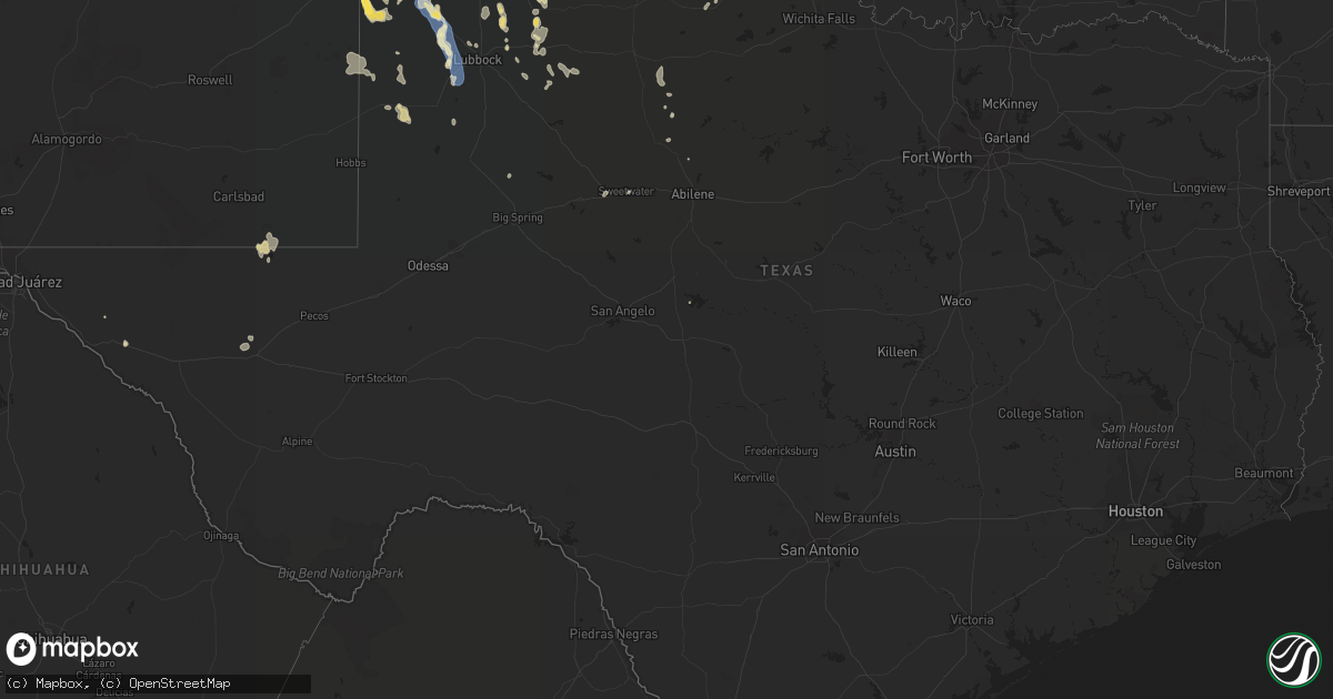
Hail Map in Texas on August 29, 2022
Get this storm
August 29 map
$229
one time, instant access
Download today. No call, no setup
Keep the $229
Bought the map and want the full workflow? Apply the entire $229 to a subscription within 7 days. None of it is wasted.
Every map, not just this one
This buys you this map. Subscription and you get every map we run, in the markets you choose from a few cities to whole states to nationwide. Plus real-time alerts the moment a storm fires.
Contact data
Name, contact info, occupancy, even credit band for addresses in the footprint. You go from where it hit to who to call.
Become the source they trust
Unlimited branding weather history reports on demand. You already have the documented answer ready for the property owner, and you are the one who showed up with it.
Property data and RoofTrace estimates
Pull up any address you have got, its value and the exact code rules for that jurisdiction, straight from One Click Code. Then RoofTrace estimates the squares, pitch, and roof value, priced the way you price.
Storm reports in Texas
Texas
| Date | Description |
|---|---|
| 08/29/20226:49 PM CDT | West texas mesonet |
| 08/29/20226:48 PM CDT | West texas mesonet |
| 08/29/20226:33 PM CDT | Reported by west texas mesonet meteorologist |
| 08/29/20226:19 PM CDT | West texas mesonet |
| 08/29/20226:18 PM CDT | West texas mesonet |
| 08/29/20226:10 PM CDT | West texas mesonet |
| 08/29/20226:04 PM CDT | West texas mesonet |
| 08/29/20225:52 PM CDT | West texas mesonet |
| 08/29/20225:50 PM CDT | West texas mesonet |
| 08/29/20225:47 PM CDT | West texas mesonet |
| 08/29/20225:46 PM CDT | West texas mesonet |
| 08/29/20225:45 PM CDT | West texas mesonet |
| 08/29/20225:04 PM CDT | West texas mesonet |
| 08/29/20224:44 PM CDT | West texas mesonet |
| 08/29/20224:34 PM CDT | Mesonet station 91 dell city |
| 08/29/20224:30 PM CDT | *** 1 fatal *** nolan county sheriff confirmed 6 accidents on i-20 near roscoe... Tx around 430pm... With 1 fatality caused by a tanker truck rolling over. No tornadoes |
| 08/29/20224:30 PM CDT | *** 1 fatal *** multiple crashes occurred on interstate 20 including several jack-knifed 18-wheelers. Highway patrol also reported multiple downed power lines nearby. |
| 08/29/20224:05 PM CDT | Billboard boards blown off just west of sunday canyon road and texas highway 217. From social media. Time estimated by radar. |
| 08/29/20223:58 PM CDT | Half of a tree was down with a diameter of approximately 12 to 18 inches at the lake tanglewood golf course. Time estimated based on radar. |
| 08/29/20223:56 PM CDT | Three to four four inch diameter tree branches down in tangle aire subdivision. Time estimated from radar. |
| 08/29/20223:35 PM CDT | Corrects previous hail report from 7 sw amarillo. Report from mping: quarter |
| 08/29/20223:35 PM CDT | Report from mping: quarter |
| 08/29/20223:34 PM CDT | Quarter size hail reported at arden and coulter. Report from social media. Time estimated by radar. |
| 08/29/20223:25 PM CDT | Social media report with picture including reference quarter. |
| 08/29/20225:39 AM CDT | At 1039 AM CDT, a severe thunderstorm was located over Anahuac, or 9 miles east of Beach City, moving north at 25 mph. HAZARD...60 mph wind gusts. SOURCE...Radar indicated. IMPACT...Expect damage to roofs, siding, and trees. Locations impacted include... Anahuac, Ames, Devers, Hankamer and Wallisville. |
| 08/29/20225:30 AM CDT | At 1030 PM CDT, a severe thunderstorm was located 4 miles southwest of Waka, or 6 miles northeast of Spearman, moving southwest at 20 mph. HAZARD...60 mph wind gusts and quarter size hail. SOURCE...Radar indicated. IMPACT...Minor damage to roofs, siding, and trees is possible. Hail damage to vehicles is expected. Locations impacted include... Spearman, Waka and Morse. |
| 08/29/20223:58 AM CDT | At 857 PM CDT, severe thunderstorms were located along a line extending from 7 miles northwest of Greenwood to near West Odessa, moving east at 40 mph. HAZARD...60 mph wind gusts and penny size hail. SOURCE...National Weather Service employee estimated 60 mph winds and zero visibility. IMPACT...Expect damage to roofs, siding, and trees. Locations impacted include... Midland, Odessa, Greenwood, Garden City, Midland International Air and Space Port, West Odessa, Cotton Flat, Midkiff, Warfield, Midland Airpark, Skywest Airport, Notrees, Odessa Schlemeyer Field, Penwell, Spraberry and Pleasant Farms.This includes Interstate 20 between mile markers 93 and 148. |
| 08/29/20222:47 AM CDT | At 744 PM CDT, severe thunderstorms were located along a line extending from near Lake Alan Henry to 8 miles north of Lamesa Municipal Airport, moving southeast at 35 mph. HAZARD...60 mph wind gusts and penny size hail. SOURCE...Grasslands in Garza County measured a wind gust of 64 mph at 740 PM CDT. IMPACT...Expect damage to roofs, siding, and trees. Locations impacted include... Snyder, Lamesa, Ackerly, Gail, Fluvanna, Lamesa Municipal Airport, J B Thomas Reservoir, Los Ybanez, Sparenberg, Randalls Corner, Arvana, Winston Field, Knapp, Hancock, Tenmile, Vealmoor and Key. |
| 08/29/20222:20 AM CDT | At 720 PM CDT, severe thunderstorms were located along a line extending from near O'Donnell to 7 miles west of Welch to near Denver City, moving south at 35 mph. HAZARD...60 mph wind gusts and penny size hail. SOURCE...Radar indicated. IMPACT...Expect damage to roofs, siding, and trees. Locations impacted include... Lamesa, Seminole, Seagraves, Seagraves Airport, Gaines County Airport, Welch, Loop, Florey, Punkin Center, Patricia, McKenzie Lake, Tenmile, Gaines County Park and Klondike. |
| 08/29/20221:59 AM CDT | At 659 PM CDT, severe thunderstorms were located along a line extending from 5 miles southeast of Mcadoo to 3 miles west of Southland, moving south at 15 mph. HAZARD...60 mph wind gusts. SOURCE...Radar indicated. IMPACT...Expect damage to roofs, siding, and trees. Locations impacted include... Slaton, Post, Crosbyton, Spur, Dickens, Lake Alan Henry, White River Lake, Ralls, Kalgary, Grassland, Justiceburg, Caprock, Southland and Mcadoo. |
| 08/29/20221:34 AM CDT | At 634 PM CDT/534 PM MDT/, a severe thunderstorm was located near Red Bluff Reservoir, or 30 miles southeast of Carlsbad, moving west at 10 mph. HAZARD...60 mph wind gusts and quarter size hail. SOURCE...Radar indicated. IMPACT...Hail damage to vehicles is expected. Expect wind damage to roofs, siding, and trees. Locations impacted include... Red Bluff Reservoir and Red Bluff. |
| 08/29/20221:18 AM CDT | At 617 PM CDT, a severe thunderstorm was located 4 miles southwest of Reese Center, or 12 miles west of Lubbock, moving southeast at 15 mph. At 610 PM, a gust to 68 mph was measured at Reese Center. HAZARD...70 mph wind gusts. SOURCE...West Texas Mesonet. IMPACT...Expect considerable tree damage. Damage is likely to mobile homes, roofs, and outbuildings. Locations impacted include... Lubbock, Wolfforth, Reese Center, Smyer and Ropesville. |
| 08/29/202212:55 AM CDT | At 555 PM CDT, a severe thunderstorm was located 5 miles north of Dumas, moving south at 20 mph. HAZARD...60 mph wind gusts and quarter size hail. SOURCE...Radar indicated. IMPACT...Minor damage to roofs, siding, and trees is possible. Hail damage to vehicles is expected. Locations impacted include... Dumas, Cactus, Fritch, Sunray, Four Way, Masterson and Lake Meredith. |
| 08/29/202212:13 AM CDT | At 512 PM CDT, a severe thunderstorm was located near Amherst, or 4 miles northwest of Littlefield, moving southeast at 15 mph. A wind gust to 64 mph was measured near Amhert at 504 PM with this storm. HAZARD...70 mph wind gusts and penny size hail. SOURCE...West Texas Mesonet. IMPACT...Expect considerable tree damage. Damage is likely to mobile homes, roofs, and outbuildings. Locations impacted include... Littlefield, Anton, Amherst, Spade and Whitharral. |
| 08/29/202212:06 AM CDT | At 506 PM CDT, severe thunderstorms were located along a line extending from 3 miles west of Gruver to 4 miles northeast of Cactus to 9 miles southwest of Conlen, moving south at 40 mph. HAZARD...60 mph wind gusts and quarter size hail. SOURCE...Radar indicated. IMPACT...Minor damage to roofs, siding, and trees is possible. Hail damage to vehicles is expected. Locations impacted include... Dumas, Dalhart, Stratford, Hartley, Cactus, Sunray, Stinnett, Gruver, Morse, Conlen and Pringle. |
| 08/29/202212:01 AM CDT | At 501 PM CDT, a severe thunderstorm was located 4 miles south of Elmer, moving northeast at 10 mph. HAZARD...60 mph wind gusts and quarter size hail. SOURCE...Radar indicated. IMPACT...Hail damage to vehicles is expected. Expect wind damage to roofs, siding, and trees. Locations impacted include... Elmer, Odell and Hess. |
| 08/28/202211:57 PM CDT | At 457 PM MDT, a severe thunderstorm was located near Bledsoe, or 20 miles southwest of Morton, moving east at 10 mph. HAZARD...60 mph wind gusts and half dollar size hail. SOURCE...Radar indicated. IMPACT...Hail damage to vehicles is expected. Expect wind damage to roofs, siding, and trees. This severe thunderstorm will remain over mainly rural areas of southeastern Roosevelt County. |
| 08/28/202211:40 PM CDT | At 439 PM MDT, a severe thunderstorm was located 5 miles northeast of Tornillo, moving southeast at 10 mph. HAZARD...65 mph wind gusts and quarter size hail. SOURCE...Radar indicated. IMPACT...Hail damage to vehicles is expected. Expect wind damage to roofs, siding, and trees. Locations impacted include... Tornillo and Indian Cliffs Ranch. This includes Interstate 10 in Texas between mile markers 51 and 62. |
| 08/28/202211:12 PM CDT | At 412 PM CDT, severe thunderstorms were located along a line extending from 4 miles east of Washburn to 6 miles south of Palo Duro Canyon, moving southeast at 10 mph. HAZARD...60 mph wind gusts and penny size hail. SOURCE...Radar indicated. IMPACT...Minor damage to roofs, siding, and trees is possible. Locations impacted include... Claude, Washburn, Wayside and Goodnight. |
| 08/28/202211:02 PM CDT | At 401 PM CDT, a severe thunderstorm was located 6 miles east of Muleshoe, moving southeast at 10 mph. HAZARD...70 mph wind gusts and penny size hail. SOURCE...Radar indicated. IMPACT...Expect considerable tree damage. Damage is likely to mobile homes, roofs, and outbuildings. Locations impacted include... Muleshoe and Sudan. |
| 08/28/202210:56 PM CDT | At 356 PM CDT, a severe thunderstorm was located over Lake Tanglewood, or 8 miles northeast of Canyon, moving south at 10 mph. HAZARD...60 mph wind gusts and quarter size hail. SOURCE...Radar indicated. IMPACT...Minor damage to roofs, siding, and trees is possible. Hail damage to vehicles is expected. Locations impacted include... Canyon, Lake Tanglewood, Mescalero Park, Buffalo Lake, Wayside, Umbarger, Palo Duro Canyon and Timbercreek Canyon. |
| 08/28/202210:53 PM CDT | Kfst asos measured a wind gust of 60 mph at 10:53pm cdt. |
| 08/28/202210:29 PM CDT | At 329 PM MDT, a severe thunderstorm was located 15 miles north of Finlay, moving southeast at 15 mph. HAZARD...60 mph wind gusts and quarter size hail. SOURCE...Radar indicated. IMPACT...Hail damage to vehicles is expected. Expect wind damage to roofs, siding, and trees. This severe thunderstorm will remain over mainly rural areas of central Hudspeth County. |
| 08/28/202210:21 PM CDT | At 321 PM CDT, severe thunderstorms were located along a line extending from 6 miles northwest of Washburn to 5 miles west of Mescalero Park, moving east at 10 mph. HAZARD...60 mph wind gusts and quarter size hail. SOURCE...Radar indicated. IMPACT...Minor damage to roofs, siding, and trees is possible. Hail damage to vehicles is expected. Locations impacted include... Amarillo, Canyon, Panhandle, Lake Tanglewood, Mescalero Park, Bushland, Washburn, Timbercreek Canyon and Pantex. |
| 08/28/202210:07 PM CDT | At 307 PM MDT, a severe thunderstorm was located near Sierra Blanca, moving southeast at 25 mph. HAZARD...60 mph wind gusts and quarter size hail. SOURCE...Radar indicated. IMPACT...Hail damage to vehicles is expected. Expect wind damage to roofs, siding, and trees. Locations impacted include... Sierra Blanca.This includes Interstate 10 in Texas between mile markers 105 and113. |
| 08/28/20229:47 PM CDT | At 246 PM MDT, a severe thunderstorm was located 11 miles west of Cornudas, moving southeast at 10 mph. HAZARD...60 mph wind gusts and quarter size hail. SOURCE...Radar indicated. IMPACT...Hail damage to vehicles is expected. Expect wind damage to roofs, siding, and trees. This severe thunderstorm will remain over mainly rural areas of north central Hudspeth County. |
| 08/28/20229:09 PM CDT | Mesonet station 77 1sse lomax lomax/howard county. |
| 08/28/20229:00 PM CDT | Off-duty nws employee estimated 60 mph wind gusts and near zero visibility due to blowing dust. |
| 08/28/20227:46 PM CDT | West texas mesonet |
| 08/28/20227:38 PM CDT | Mesonet station 25 seminole 2n. |
| 08/28/20227:35 PM CDT | West texas mesonet |
| 08/28/20227:33 PM CDT | West texas mesonet. Earlier gusts to 62 mph at 727 pm and 60 mph at 728 pm. |
| 08/28/20227:27 PM CDT | West texas mesonet. Later gust to 60 mph at 728 pm. |
| 08/28/20227:23 PM CDT | 1 sw seagraves mesonet measured wind gust of 58 mph. |
All States Impacted by Hail Map on August 29, 2022
Cities Impacted by Hail Map on August 29, 2022
- Watervliet, MI
- Allegan, MI
- Bloomingdale, MI
- Salem, WI
- Burlington, WI
- Indianola, IA
- Big Rapids, MI
- Dalton City, IL
- Montague, MI
- Whitehall, MI
- Chelsea, MI
- Oakland, IL
- Ridge Farm, IL
- Metcalf, IL
- Indianola, IL
- Brocton, IL
- Catlin, IL
- Georgetown, IL
- Hume, IL
- Chrisman, IL
- Newman, IL
- Fennville, MI
- Hamilton, MI
- Saugatuck, MI
- Holland, MI
- Douglas, MI
- Dana, IN
- Clinton, IN
- Hillsdale, IN
- Paris, IL
- Bennett, IA
- Ainsworth, IA
- Pontiac, IL
- Odell, IL
- Streator, IL
- Ancona, IL
- Wenona, IL
- Cornell, IL
- Long Point, IL
- Saunemin, IL
- Fisher, IL
- Mahomet, IL
- Franklin, IL
- New Berlin, IL
- Jacksonville, IL
- Alexander, IL
- Mansfield, IL
- Newark, MO
- Knox City, MO
- Decatur, IL
- Hammond, IL
- La Place, IL
- Cerro Gordo, IL
- Argenta, IL
- Elliott, IL
- Gibson City, IL
- Frankfort, KS
- Lincoln, IL
- Allerton, IL
- Broadlands, IL
- Fairfield, IL
- Clinton, MO
- Montrose, MO
- Grand Rapids, MI
- Grand Ridge, IL
- Gary, IN
- Lake Station, IN
- Seneca, IL
- Sharon, WI
- Clinton, WI
- Sibley, IL
- Beallsville, OH
- Curwensville, PA
- Clearfield, PA
- West Terre Haute, IN
- Newcomerstown, OH
- West Lafayette, OH
- Pembroke Township, IL
- Lansing, IL
- Chicago Heights, IL
- Glenwood, IL
- Munster, IN
- Highland, IN
- Monon, IN
- Delphi, IN
- Yeoman, IN
- Idaville, IN
- Monticello, IN
- Brookston, IN
- Leonard, MO
- Gibbs, MO
- Novelty, MO
- Hurdland, MO
- La Plata, MO
- Kentland, IN
- Earl Park, IN
- Fowler, IN
- Goodland, IN
- Remington, IN
- Wathena, KS
- Saint Joseph, MO
- Grand Junction, MI
- Washington, IA
- Clinton, IA
- Long Grove, IA
- McCausland, IA
- Calamus, IA
- Thomson, IL
- Bryant, IA
- Grand Mound, IA
- Charlotte, IA
- Savanna, IL
- Camanche, IA
- Preston, IA
- Eldridge, IA
- Welton, IA
- Princeton, IA
- Sabula, IA
- Miles, IA
- Delmar, IA
- De Witt, IA
- Goose Lake, IA
- Driftwood, PA
- Chatsworth, IL
- Melvin, IL
- Strawn, IL
- Beason, IL
- Everest, KS
- Lancaster, KS
- Horton, KS
- Effingham, KS
- Lone Jack, MO
- Loraine, IL
- West Point, IL
- Pleasant Hill, MO
- Kingsville, MO
- Gardner, KS
- Edgerton, KS
- Spring Hill, KS
- Gardner, IL
- Dwight, IL
- Manhattan, IL
- Elwood, IL
- Joliet, IL
- Mokena, IL
- Channahon, IL
- New Lenox, IL
- Sanford, MI
- Shepherd, MI
- Coleman, MI
- Midland, MI
- Shelbyville, MO
- Emden, MO
- Lake Village, IN
- Marne, MI
- Coopersville, MI
- Belmont, MI
- Zeeland, MI
- Rockford, MI
- Allendale, MI
- Comstock Park, MI
- Conklin, MI
- Sparta, MI
- West Olive, MI
- Waterford, WI
- Cooksville, IL
- Richland, IA
- Brighton, IA
- Warsaw, IL
- Basco, IL
- Carthage, IL
- North Judson, IN
- Demotte, IN
- Fair Oaks, IN
- Wheatfield, IN
- Rensselaer, IN
- San Pierre, IN
- Elsie, MI
- Brohman, MI
- Bitely, MI
- White Cloud, MI
- Paris, MI
- Reddick, IL
- Muscatine, IA
- Winterset, IA
- Plymouth, IN
- Bourbon, IN
- Argos, IN
- Carbon, IN
- Brazil, IN
- Hartford, MI
- Nunica, MI
- New Salem, IL
- Colchester, IL
- Wheatland, IA
- New Liberty, IA
- Morocco, IN
- Danville, IL
- Terre Haute, IN
- Lovington, IL
- Chenoa, IL
- Junction City, KS
- Murrayville, IL
- Paloma, IL
- Holden, MO
- Lakeville, OH
- Glenmont, OH
- Bethany, MO
- East Palestine, OH
- Montgomery, IN
- Cannelburg, IN
- Ashland, IL
- Herington, KS
- Offerle, KS
- Lewis, KS
- Kinsley, KS
- Valparaiso, IN
- Hobart, IN
- Tolono, IL
- Philo, IL
- Sidney, IL
- Savoy, IL
- Potomac, IL
- Saint Joseph, IL
- Rossville, IL
- Rantoul, IL
- Loda, IL
- Thomasboro, IL
- Buckley, IL
- Roberts, IL
- Paxton, IL
- Homer, IL
- Armstrong, IL
- Collison, IL
- Muncie, IL
- Urbana, IL
- Gifford, IL
- Ogden, IL
- Fairmount, IL
- Cissna Park, IL
- Champaign, IL
- Oakwood, IL
- Ludlow, IL
- Penfield, IL
- Fithian, IL
- Royal, IL
- Rankin, IL
- La Monte, MO
- Hughesville, MO
- Sedalia, MO
- Knob Noster, MO
- Pleasant Plains, IL
- Springfield, IL
- Hopedale, IL
- Minier, IL
- Barry, IL
- Genoa City, WI
- Lake Geneva, WI
- Peculiar, MO
- Columbus Junction, IA
- Crawfordsville, IA
- Columbus City, IA
- Wayland, IA
- Francesville, IN
- Winamac, IN
- Medaryville, IN
- Chillicothe, OH
- Waverly, OH
- Freeman, MO
- Stoutland, MO
- Richland, MO
- Ewing, IL
- McLeansboro, IL
- Macedonia, IL
- Dahlgren, IL
- Belle Rive, IL
- Plainwell, MI
- Otsego, MI
- Chariton, IA
- Lovilia, IA
- Russell, IA
- Melrose, IA
- Bonfield, IL
- La Porte, IN
- Minooka, IL
- Hamilton, IL
- Maroa, IL
- Virginia, IL
- Beardstown, IL
- Arenzville, IL
- Coshocton, OH
- Hamilton, MO
- Kidder, MO
- Cameron, MO
- Waverly, IL
- Chandlerville, IL
- Bath, IL
- Tallula, IL
- Loami, IL
- Marshfield, MO
- Strafford, MO
- Packwood, IA
- Fairfield, IA
- Tipton, IN
- Beloit, KS
- Mount Carroll, IL
- Lanark, IL
- Shannon, IL
- Hoisington, KS
- Olmitz, KS
- Norwalk, IA
- Saint Charles, IA
- Prole, IA
- Patterson, IA
- Martensdale, IA
- Bevington, IA
- Dexter, MO
- Bloomfield, MO
- Dixon, IA
- Cosby, MO
- Easton, MO
- Ensign, KS
- Niangua, MO
- Columbus, OH
- Culver, IN
- Knox, IN
- Pittsfield, IL
- Sullivan, IL
- Beecher, IL
- Walkerville, MI
- Hesperia, MI
- Westville, IN
- Crete, IL
- Saint John, IN
- Dyer, IN
- Piper City, IL
- Gilman, IL
- Ashkum, IL
- Danforth, IL
- Kempton, IL
- Blakesburg, IA
- Ottumwa, IA
- Drakesville, IA
- Albia, IA
- Bloomfield, IA
- Moravia, IA
- Agency, IA
- Unionville, IA
- Barnard, KS
- Seymour, MO
- Bethesda, OH
- Iuka, IL
- Dix, IL
- Walnut Hill, IL
- Kell, IL
- Dodge City, KS
- Circleville, OH
- Ramona, KS
- Hope, KS
- Joelton, TN
- Goodlettsville, TN
- Whites Creek, TN
- Jeffersonville, IN
- Yukon, OK
- Wayne City, IL
- Burkesville, KY
- Norman, OK
- Huntingburg, IN
- Verden, OK
- Chickasha, OK
- Spearville, KS
- Richmond, KY
- Louisville, KY
- Fairdale, KY
- Fort Sumner, NM
- Pond Creek, OK
- Kremlin, OK
- Big Clifty, KY
- Pawnee, OK
- Amarillo, TX
- Geary, OK
- Calumet, OK
- Broseley, MO
- Melbourne, AR
- Sage, AR
- Ozark, AR
- Cleveland, OK
- Stillwater, OK
- Coyle, OK
- Perkins, OK
- Cache, OK
- Indiahoma, OK
- Skiatook, OK
- Fort Cobb, OK
- Barnsdall, OK
- Milnesand, NM
- Morton, TX
- Tatum, NM
- Tulia, TX
- Mustang, OK
- Gotebo, OK
- Mountain View, OK
- Elida, NM
- Abernathy, TX
- Happy, TX
- Weir, KS
- Anson, TX
- Reeds Spring, MO
- Whiteface, TX
- Pecos, TX
- Childress, TX
- Matador, TX
- Otis, KS
- Bison, KS
- Alexander, KS
- Bazine, KS
- Chaffee, MO
- Lockney, TX
- Floydada, TX
- Loving, NM
- Idalou, TX
- Petersburg, TX
- Apache, OK
- Quincy, IL
- Ellsworth, KS
- Kanopolis, KS
- Meade, KS
- Plains, KS
- Turpin, OK
- Forgan, OK
- Kismet, KS
- Anton, TX
- Levelland, TX
- Great Bend, KS
- Ewing, MO
- Maljamar, NM
- Lovington, NM
- Muleshoe, TX
- Sudan, TX
- Earth, TX
- Oran, MO
- Advance, MO
- Whitewater, MO
- Cape Girardeau, MO
- Booker, TX
- Nixa, MO
- Clever, MO
- Vinson, OK
- Seminole, OK
- Prague, OK
- Nazareth, TX
- Hart, TX
- Dimmitt, TX
- Ropesville, TX
- Meadow, TX
- Lorenzo, TX
- Tokio, TX
- Plains, TX
- Denver City, TX
- Crowell, TX
- Vernon, TX
- La Crosse, KS
- Bland, MO
- Balko, OK
- La Grange, MO
- Monticello, MO
- Lewistown, MO
- Canton, MO
- Payson, IL
- Taylor, MO
- Maywood, MO
- Palmyra, MO
- Durham, MO
- Philadelphia, MO
- Flomot, TX
- Wright, KS
- Odell, TX
- Capitan, NM
- Nekoma, KS
- Ness City, KS
- Albert, KS
- Winchester, KY
- Irvine, KY
- Amoret, MO
- Warrensburg, MO
- Billings, MO
- Republic, MO
- Enid, OK
- Hominy, OK
- Silverton, TX
- Blanchard, OK
- Amber, OK
- Owasso, OK
- Collinsville, OK
- Claremore, OK
- Jerico Springs, MO
- Lamar, MO
- Sheldon, MO
- Stockton, MO
- Ada, OK
- Canyon, TX
- Claude, TX
- Longview, IL
- Sutter, IL
- Lawton, OK
- Glencoe, OK
- Rosedale, IN
- Anadarko, OK
- Gracemont, OK
- Lebanon, MO
- Spearman, TX
- Kress, TX
- Plainview, TX
- Hamlin, TX
- Tecumseh, OK
- Shawnee, OK
- Linden, TN
- Wilson, KS
- Mulhall, OK
- Rogers, NM
- Eskridge, KS
- Paxico, KS
- Alma, KS
- Dumas, TX
- Sunray, TX
- Brownfield, TX
- Perryton, TX
- Oreana, IL
- Crosbyton, TX
- Frederick, OK
- Garden City, MO
- Dale, IN
- Lincoln City, IN
- Gentryville, IN
- Santa Claus, IN
- Holland, IN
- Ferdinand, IN
- Hoopeston, IL
- Blue Mound, IL
- Moweaqua, IL
- Macon, IL
- Stonington, IL
- Stratford, TX
- Wellsville, KS
- Rule, TX
- Owensville, IN
- Poseyville, IN
- Griffin, IN
- Mount Carmel, IL
- New Harmony, IN
- Dorrance, KS
- Bunker Hill, KS
- Ford, KS
- Hanston, KS
- Harrisonville, MO
- Johnsonville, IL
- Bluford, IL
- Sims, IL
- Mount Vernon, IL
- Opdyke, IL
- Keenes, IL
- Elgin, OK
- Jal, NM
- Paducah, TX
- Old Glory, TX
- Hobbs, NM
- Bethel, MO
- La Belle, MO
- El Dorado Springs, MO
- Milo, MO
- Scammon, KS
- Charleston, MO
- Mountain Grove, MO
- Berea, KY
- Waco, KY
- Vinita, OK
- Lindsay, OK
- Purcell, OK
- Centerville, TN
- Earlsboro, OK
- Lexington, OK
- Noble, OK
- Washington, OK
- Van Horn, TX
- Latham, IL
- Chestnut, IL
- Kenney, IL
- Cross Plains, IN
- Dubois, IN
- Butler, MO
- Walnut, KS
- Ribera, NM
- Eldorado, OK
- Elmer, OK
- Norwich, OH
- Graymont, IL
- Jetmore, KS
- Temple, OK
- Marble Hill, MO
- Claflin, KS
- Greensburg, KS
- Watonga, OK
- Emporia, KS
- Saint Anthony, IN
- Madison, IN
- Nowata, OK
- Hartville, MO
- Foster, MO
- Amsterdam, MO
- Omaha, AR
- Hollister, MO
- Stendal, IN
- Lamar, IN
- Sierra Blanca, TX
- Dalhart, TX
- Ellington, MO
- Hitchcock, OK
- Sweetwater, TX
- Panhandle, TX
- Springdale, AR
- Fayetteville, AR
- Tinnie, NM
- Fort Hancock, TX
- Paint Rock, TX
- Russellville, AL
- Tuscumbia, AL
- Orlando, OK
- Crescent, OK
- Guthrie, OK
- Farwell, TX
- Cedarbluff, MS
- Littlefield, TX
- Lubbock, TX
- Spur, TX
- Tell, TX
- Gallatin, MO
- Terlton, OK
- Rush Center, KS
- Golden Gate, IL
- Ellery, IL
- Albion, IL
- Gruver, TX
- Wanette, OK
- Salt Flat, TX
- Mentone, TX
- Post, TX
- Amherst, TX
- Weed, NM
- Gerald, MO
- Rosebud, MO
- Ottawa, KS
- Chilhowee, MO
- French Lick, IN
- West Baden Springs, IN
- Jasper, IN
- Adamsville, OH
- Centerview, MO
- Atwood, IL
- Pawnee Rock, KS
- Keota, OK
- Laredo, MO
- Chula, MO
- Alex, OK
- Oronogo, MO
- Liberal, MO
- Rozel, KS
- Omega, OK
- Hamersville, OH
- Bethel, OH
- Hurricane Mills, TN
- Waverly, TN
- Oklahoma City, OK
- Alton, MO
- Elkins, AR
- Paden, OK
- Mcloud, OK
- Newalla, OK
- Faxon, OK
- Whiteman Air Force Base, MO
- Ralls, TX
- Crane, MO
- Bartlesville, OK
- Pawhuska, OK
- Clay City, KY
- Olton, TX
- Maple, TX
- New Haven, MO
- Leslie, MO
- Gail, TX
- Roscoe, TX
- De Mossville, KY
- Falmouth, KY
- Perry, OK
- Mount Erie, IL
- West Salem, IL
- Eminence, MO
- Aurora, MO
- Prescott, KS
- Pleasanton, KS
- Mound City, KS
- Jeffersonville, KY
- Fowler, KS
- Louisa, KY
- Fort Sill, OK
- Shell Knob, MO
- Kimberling City, MO
- Aberdeen, MS
- Breckenridge, MO
- Dry Ridge, KY
- Willisburg, KY
- Blue Rapids, KS
- Golconda, IL
- Lerna, IL
- Belle, MO
- Owensville, MO
- Williamstown, KY
- Morning View, KY
- Butler, KY
- Crittenden, KY
- Hampton, KY
- Smithland, KY
- Grovespring, MO
- Grand Rivers, KY
- Goreville, IL
- Maple Hill, KS
- Foster, WV
- Danville, WV
- Julian, WV
- Chapmanville, WV
- Harts, WV
- Big Creek, WV
- New Florence, MO
- Hermann, MO
- River, KY
- Meally, KY
- Tomahawk, KY
- Boons Camp, KY
- Paintsville, KY
- Bellmont, IL
- Browns, IL
- Grayville, IL
- Tuttle, OK
- Tulsa, OK
- Jennings, OK
- Olmsted, IL
- Kevil, KY
- Villa Ridge, IL
- Grand Chain, IL
- Rush Springs, OK
- Powell, MO
- Florence, AL
- Sugar Tree, TN
- Prue, OK
- Quitaque, TX
- Shallowater, TX
- Loveland, OK
- Oologah, OK
- Cyril, OK
- Plantersville, MS
- Fulton, MS
- Tupelo, MS
- Onarga, IL
- Blackstone, IL
- Kinsman, IL
- Forest, IN
- Michigantown, IN
- Frankfort, IN
- Burlington, IN
- Russiaville, IN
- Cutler, IN
- Bringhurst, IN
- Flora, IN
- Kokomo, IN
- Cape Fair, MO
- Galena, MO
- Shoals, IN
- Goodwell, OK
- Wheeling, MO
- Alden, MN
- Hartland, MN
- Albert Lea, MN
- Grand Meadow, MN
- Ridgeview, WV
- Russell, KS
- Tahoka, TX
- Smyer, TX
- Wolfforth, TX
- Turkey, TX
- Clarendon, TX
- Lakeview, TX
- Wilmette, IL
- Chicago, IL
- Streamwood, IL
- Hanover Park, IL
- Lincolnwood, IL
- Kenilworth, IL
- Roselle, IL
- Bensenville, IL
- Kingston, IL
- Sycamore, IL
- Schaumburg, IL
- Arlington Heights, IL
- Winnetka, IL
- Wayne, IL
- Mount Prospect, IL
- Wasco, IL
- Palatine, IL
- Evanston, IL
- Park Ridge, IL
- Golf, IL
- Wood Dale, IL
- Wheeling, IL
- South Elgin, IL
- Maple Park, IL
- Saint Charles, IL
- Skokie, IL
- Rolling Meadows, IL
- Hoffman Estates, IL
- Malta, IL
- Hampshire, IL
- Addison, IL
- Franklin Park, IL
- West Chicago, IL
- Elgin, IL
- Niles, IL
- Burlington, IL
- Itasca, IL
- Dekalb, IL
- Schiller Park, IL
- Carol Stream, IL
- Glendale Heights, IL
- Elk Grove Village, IL
- Cortland, IL
- Kirkland, IL
- Harwood Heights, IL
- Glenview, IL
- Bloomingdale, IL
- Glencoe, IL
- Medinah, IL
- Highland Park, IL
- Esmond, IL
- Clare, IL
- Barrington, IL
- Bartlett, IL
- Northbrook, IL
- Elburn, IL
- Prospect Heights, IL
- Des Plaines, IL
- Genoa, IL
- Morton Grove, IL
- Churubusco, IN
- Convoy, OH
- Rudolph, OH
- Continental, OH
- Waterville, OH
- Hazel Crest, IL
- Arcola, IN
- Craigville, IN
- South Whitley, IN
- Ligonier, IN
- Montpelier, OH
- Manteno, IL
- North Webster, IN
- Crown Point, IN
- New Haven, IN
- Larwill, IN
- Thayer, IN
- Lakeville, IN
- Angola, IN
- Hamilton, IN
- Leo, IN
- Bowling Green, OH
- Wauseon, OH
- Steger, IL
- Huntington, IN
- Griffith, IN
- Syracuse, IN
- Hicksville, OH
- Wakarusa, IN
- La Crosse, IN
- Zanesville, IN
- Middle Point, OH
- Grelton, OH
- New Bavaria, OH
- Defiance, OH
- Milford, IN
- Ney, OH
- Monclova, OH
- Holgate, OH
- Warsaw, IN
- Decatur, IN
- Oakwood, OH
- Saint Joe, IN
- Delphos, OH
- Ossian, IN
- Deshler, OH
- Country Club Hills, IL
- Van Wert, OH
- Rome City, IN
- Haviland, OH
- Fremont, IN
- Boone Grove, IN
- Leesburg, IN
- Flossmoor, IL
- Richton Park, IL
- Urbana, IN
- Kingsford Heights, IN
- Andrews, IN
- Ohio City, OH
- Laotto, IN
- Auburn, IN
- Etna Green, IN
- Mark Center, OH
- Edgerton, OH
- Nappanee, IN
- Grant Park, IL
- Fort Jennings, OH
- Cromwell, IN
- Pleasant Lake, IN
- Stryker, OH
- Hudson, IN
- Venedocia, OH
- Monroeville, IN
- Napoleon, OH
- Merrillville, IN
- Waterloo, IN
- Tinley Park, IL
- Custar, OH
- Bradley, IL
- Hamler, OH
- Huntertown, IN
- Bluffton, IN
- Grovertown, IN
- Monee, IL
- Union Mills, IN
- Park Forest, IL
- Lagrange, IN
- Columbia City, IN
- Albion, IN
- Frankfort, IL
- Neapolis, OH
- North Liberty, IN
- Scott, OH
- Monroe, IN
- Evansport, OH
- Cedar Lake, IN
- Kendallville, IN
- Matteson, IL
- Kankakee, IL
- Goshen, IN
- Willshire, OH
- Sherwood, OH
- Wolcottville, IN
- Bryan, OH
- Peotone, IL
- Wilmington, IL
- South Milford, IN
- North Manchester, IN
- Hamlet, IN
- Edon, OH
- Uniondale, IN
- Wawaka, IN
- Spencerville, IN
- University Park, IL
- Pierceton, IN
- Thornton, IL
- Kimmell, IN
- Latty, OH
- Olympia Fields, IL
- Roanoke, IN
- Fort Wayne, IN
- Schneider, IN
- Antwerp, OH
- Melrose, OH
- Tontogany, OH
- McClure, OH
- Ridgeville Corners, OH
- Shelby, IN
- Bremen, IN
- Harlan, IN
- Delta, OH
- Bourbonnais, IL
- Paulding, OH
- Grover Hill, OH
- Corunna, IN
- Milton Center, OH
- Wren, OH
- Avilla, IN
- Garrett, IN
- Liberty Center, OH
- Grand Rapids, OH
- Archbold, OH
- New Paris, IN
- Hoagland, IN
- Schererville, IN
- Hebron, IN
- Swanton, OH
- Markle, IN
- Lowell, IN
- Whitehouse, OH
- Cecil, OH
- Hanna, IN
- Cloverdale, OH
- Ashley, IN
- Malinta, OH
- Grabill, IN
- Wanatah, IN
- Woodburn, IN
- Homewood, IL
- Weston, OH
- Momence, IL
- Payne, OH
- Kouts, IN
- Yoder, IN
- Butler, IN
- Walkerton, IN
- Chebanse, IL
- Clifton, IL
- Buckingham, IL
- Herscher, IL
- Cabery, IL
- Washington, MO
- Clawson, MI
- Ecorse, MI
- Haslett, MI
- Owosso, MI
- Utica, MI
- Linden, MI
- Romulus, MI
- Melvindale, MI
- Hamtramck, MI
- Clinton Township, MI
- Ray, MI
- Fraser, MI
- Leonard, MI
- Ypsilanti, MI
- Perry, MI
- Vermontville, MI
- Rockwood, MI
- Commerce Township, MI
- Eastpointe, MI
- Howell, MI
- Mason, MI
- Saint Clair Shores, MI
- River Rouge, MI
- Charlotte, MI
- Potterville, MI
- Northville, MI
- Madison Heights, MI
- Lake Orion, MI
- Grosse Pointe, MI
- Milford, MI
- Macatawa, MI
- Dansville, MI
- Casco, MI
- Portland, MI
- Fenton, MI
- Livonia, MI
- Eaton Rapids, MI
- Center Line, MI
- Gaines, MI
- Fair Haven, MI
- Riverview, MI
- Romeo, MI
- Oak Park, MI
- Clarkston, MI
- Trenton, MI
- Berkley, MI
- Lowell, MI
- Waterford, MI
- Wayland, MI
- Walled Lake, MI
- Dearborn, MI
- Sunfield, MI
- Huntington Woods, MI
- Canton, MI
- Spring Lake, MI
- Dimondale, MI
- Southfield, MI
- Taylor, MI
- Byron, MI
- Belleville, MI
- Roseville, MI
- Swartz Creek, MI
- Highland Park, MI
- Redford, MI
- Freeport, MI
- East Lansing, MI
- Williamston, MI
- Franklin, MI
- Lansing, MI
- Morrice, MI
- Flat Rock, MI
- Grosse Ile, MI
- Warren, MI
- New Haven, MI
- Hastings, MI
- Wayne, MI
- Inkster, MI
- Richmond, MI
- Grandville, MI
- Macomb, MI
- Lincoln Park, MI
- Novi, MI
- Royal Oak, MI
- Laingsburg, MI
- Mulliken, MI
- Wyandotte, MI
- Oakland, MI
- Hazel Park, MI
- Brighton, MI
- Pleasant Ridge, MI
- Harrison Township, MI
- Bath, MI
- Highland, MI
- Webberville, MI
- Alto, MI
- Ferndale, MI
- Keego Harbor, MI
- Eagle, MI
- Armada, MI
- New Boston, MI
- Mount Clemens, MI
- Bancroft, MI
- Fowlerville, MI
- Harper Woods, MI
- Pontiac, MI
- Allen Park, MI
- Holly, MI
- West Bloomfield, MI
- Dorr, MI
- Southgate, MI
- Plymouth, MI
- Farmington, MI
- Bloomfield Hills, MI
- Clarksville, MI
- Holt, MI
- Middleville, MI
- Hartland, MI
- Grand Blanc, MI
- Caledonia, MI
- Birmingham, MI
- Washington, MI
- Byron Center, MI
- Garden City, MI
- Woodland, MI
- Durand, MI
- Sterling Heights, MI
- Wyoming, MI
- Davisburg, MI
- Okemos, MI
- Grand Haven, MI
- Hudsonville, MI
- Grand Ledge, MI
- New Baltimore, MI
- Lake Odessa, MI
- Ada, MI
- Detroit, MI
- White Lake, MI
- Westland, MI
- Troy, MI
- Dearborn Heights, MI
- Rochester, MI
- Jenison, MI
- Dewitt, MI
- Auburn Hills, MI
- Bellevue, MI
- Marshall, MI
- Albion, MI
- Battle Creek, MI
- Parma, MI
- Ceresco, MI
- Freeland, MI
- Breckenridge, MI
- Saint Louis, MI
- Merrill, MI
- Mount Pleasant, MI
- Wheeler, MI
- Hemlock, MI
- Mount Morris, MI
- Oakley, MI
- Lapeer, MI
- Davison, MI
- Flint, MI
- New Lothrop, MI
- Saint Johns, MI
- Corunna, MI
- Bannister, MI
- Ovid, MI
- Flushing, MI
- Lennon, MI
- Ashley, MI
- Chesaning, MI
- Burton, MI
- Perrinton, MI
- Henderson, MI
- Monroe, MI
- Genesee, MI


