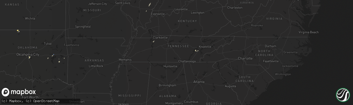
Hail Map in Tennessee on August 28, 2022
The weather event in Tennessee on August 28, 2022 includes Hail, Wind, and Tornado maps. 14 states and 286 cities were impacted and suffered possible damage. The total estimated number of properties impacted is 0.
Want more than just the map?
Turn this storm into a full workflow.
- Owner + property data so you know who to knock
- OnDemand branded weather history reports to win the "did we even have hail?" argument
- RoofTrace estimate so reps stop guessing numbers at the door
Bought this map? Upgrade within 7 days and we'll credit the $230. (10-15 min setup call)
Hail
Wind
Tornado
0
Estimated number of impacted properties by a 1.00" hail or larger0
Estimated number of impacted properties by a 1.75" hail or larger0
Estimated number of impacted properties by a 2.50" hail or largerStorm reports in Tennessee
Tennessee
| Date | Description |
|---|---|
| 08/28/20225:19 PM CDT | A few trees down. |
| 08/28/20223:24 PM CDT | Several trees down. |
| 08/28/20221:00 AM CDT | At 559 PM EDT, a severe thunderstorm was located 7 miles east of Knoxville, moving northwest at 5 mph. HAZARD...60 mph wind gusts. SOURCE...Radar indicated. IMPACT...Expect damage to roofs, siding, and trees. Locations impacted include... Knoxville, House Mountain State Park, Maloneyville, Lake Forest, Mascot and Kimberlin Heights.This includes the following highways... Interstate 40 in Tennessee between mile markers 387 and 401. Interstate 75 in Tennessee between mile markers 108 and 110. |
| 08/27/202211:02 PM CDT | At 401 PM EDT, a severe thunderstorm was located 8 miles west of Sweetwater, moving north at 10 mph. HAZARD...60 mph wind gusts. SOURCE...Radar indicated. IMPACT...Expect damage to roofs, siding, and trees. Locations impacted include... Kingston, Rockwood, Fairview, Midtown, Harriman, Eagle Furnace and Ten Mile.This includes Interstate 40 in Tennessee between mile markers 348 and352. |
| 08/27/202210:43 PM CDT | At 343 PM EDT, a severe thunderstorm was located near Sweetwater, and is nearly stationary. HAZARD...60 mph wind gusts. SOURCE...Radar indicated. IMPACT...Expect damage to roofs, siding, and trees. Locations impacted include... Sweetwater, Loudon, Philadelphia and Paint Rock. This includes Interstate 75 in Tennessee between mile markers 61 and74. |
All States Impacted by Hail Map on August 28, 2022
Cities Impacted by Hail Map on August 28, 2022
- Andover, MN
- Minneapolis, MN
- Howard Lake, MN
- Bigfork, MN
- Ypsilanti, ND
- Marion, ND
- Downs, KS
- Osborne, KS
- Kimball, MN
- Eden Valley, MN
- Paynesville, MN
- Richmond, MN
- Watkins, MN
- South Haven, MN
- Cold Spring, MN
- Hinckley, MN
- Tahoka, TX
- White Deer, TX
- Panhandle, TX
- Fingal, ND
- Kathryn, ND
- Dexter, IA
- Stuart, IA
- Casey, IA
- Exira, IA
- Menlo, IA
- Adair, IA
- Anita, IA
- La Pointe, WI
- Tennessee Ridge, TN
- Stewart, TN
- Loudon, TN
- Philadelphia, TN
- Ludlow, IL
- Paxton, IL
- Thomasboro, IL
- Rantoul, IL
- Urbana, IL
- Loda, IL
- Gifford, IL
- Rankin, IL
- Saint Joseph, IL
- Pulaski, WI
- Norman, OK
- Brownfield, TX
- Meadow, TX
- Clarendon, TX
- Sterling, IL
- Bensenville, IL
- Pine City, MN
- Brook Park, MN
- Medford, WI
- Webster, WI
- Columbia, MO
- Merrill, WI
- Weyerhaeuser, WI
- Bruce, WI
- Exeland, WI
- Argyle, MO
- Meta, MO
- Suamico, WI
- Midkiff, TX
- Cook, MN
- Mountain, WI
- Mcintosh, MN
- Fosston, MN
- Buffalo, ND
- Andrews, TX
- Clara City, MN
- Monahans, TX
- Nome, ND
- Litchville, ND
- Van Buren, AR
- Fort Smith, AR
- Ladysmith, WI
- Jonesville, SC
- Sharon, SC
- Two Harbors, MN
- Grand Rapids, MN
- Bovey, MN
- Cohasset, MN
- Cerro Gordo, IL
- Milmine, IL
- Hammond, IL
- Gilman, WI
- Sheldon, WI
- Springerton, IL
- McLeansboro, IL
- Valley City, ND
- Quitaque, TX
- Hancock, IA
- Oakland, IA
- Minden, IA
- Argenta, IL
- Harlan, IA
- Lebanon, MO
- Elkhorn, NE
- Brazil, IN
- Cory, IN
- Centerpoint, IN
- Big Rock, IL
- Leland, IL
- Sandwich, IL
- Somonauk, IL
- Hinckley, IL
- Elburn, IL
- Annandale, MN
- Winger, MN
- Waterman, IL
- Shabbona, IL
- Dekalb, IL
- Stigler, OK
- Alborn, MN
- McClelland, IA
- Marshall, IL
- Dennison, IL
- Ten Mile, TN
- Makinen, MN
- Withee, WI
- Yale, IL
- Willow Hill, IL
- Littlefork, MN
- Big Falls, MN
- Panama, IA
- Westphalia, IA
- Portsmouth, IA
- Earling, IA
- Oakland, IL
- Crivitz, WI
- Pound, WI
- White Lake, WI
- Chamois, MO
- Bland, MO
- Linn, MO
- Wyoming, MN
- Polo, IL
- Chadwick, IL
- Lyndon, IL
- Morrison, IL
- Milledgeville, IL
- Sweetwater, TN
- Westboro, WI
- Ogema, WI
- Mora, MN
- Grasston, MN
- Goldsmith, TX
- Park Ridge, IL
- Niles, IL
- Morton Grove, IL
- Chicago, IL
- Martinsville, IL
- Hanna, OK
- Federal Dam, MN
- Catawba, WI
- Sandstone, MN
- Raymond, MN
- Mikana, WI
- Rice Lake, WI
- Anderson, SC
- Oklahoma City, OK
- Cotton, MN
- Gleason, WI
- Lublin, WI
- Athens, WI
- Rib Lake, WI
- Deerbrook, WI
- Tomahawk, WI
- Antigo, WI
- Irma, WI
- Thorp, WI
- Maple Park, IL
- Cortland, IL
- Earlville, IL
- Lee, IL
- Paw Paw, IL
- Hawkins, WI
- Glen Flora, WI
- Conrath, WI
- Kennan, WI
- Tony, WI
- Holcombe, WI
- Amorita, OK
- Burlington, OK
- Bison, KS
- Harmon, IL
- Cameron, WI
- Longville, MN
- Post, TX
- Fort Ransom, ND
- Remer, MN
- Walker, MN
- Kelliher, MN
- Blackduck, MN
- Redby, MN
- Watertown, MN
- Mayer, MN
- Wilson, TX
- Grantsburg, WI
- Wright, MN
- Floodwood, MN
- Waverly, MN
- Buffalo, MN
- Bokoshe, OK
- Spiro, OK
- Birchwood, WI
- Waterloo, NE
- Amarillo, TX
- Omaha, NE
- Wink, TX
- Warba, MN
- Deer River, MN
- Akeley, MN
- Hackensack, MN
- Nevis, MN
- Newton, IL
- Danbury, WI
- Wabeno, WI
- Fort Calhoun, NE
- Lisbon, ND
- Enderlin, ND
- Ponemah, MN
- Lakeview, TX
- Hines, MN
- Shell Lake, WI
- Sarona, WI
- Barronett, WI
- Glencoe, MN
- Brownton, MN
- New Germany, MN
- Malden, IL
- Olney, IL
- Woodbine, IA
- Plymouth, IN
- Walkerton, IN
- Bena, MN
- Kennard, NE
- Washington, NE
- Blair, NE
- Arlington, NE
- Bennington, NE
- Valley, NE
- Poland, IN
- Coal City, IN
- Patricksburg, IN
- Bowling Green, IN
- Arlington, IL
- La Moille, IL
- Coyanosa, TX
- Griswold, IA
- Kermit, TX
- Malta, IL
- Clare, IL
- Sycamore, IL
- Rochelle, IL
- Steward, IL
- Golden Gate, IL
- Parkersburg, IL
- West Salem, IL
- Mount Erie, IL
- Comstock, WI
- Cumberland, WI
- Long Lake, MN
- Wayzata, MN
- Ashmore, IL
- Charleston, IL
- Brocton, IL
- Gully, MN
- Gail, TX
- Red Oak, OK
- Green Bay, WI
- Henriette, MN
- Clearwater, MN
- Maple Lake, MN
- Monticello, MN
- Hopkins, MN
- Gonvick, MN
- Chetek, WI
- Little Suamico, WI
- Eufaula, OK
- Checotah, OK
- Clearbrook, MN
- Prinsburg, MN
- Maynard, MN
- Blomkest, MN
- Lake Lillian, MN
- Northome, MN


