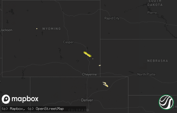
Hail Map in Wyoming on August 25, 2019
The weather event in Wyoming on August 25, 2019 includes Wind and Hail maps. 9 states and 248 cities were impacted and suffered possible damage. The total estimated number of properties impacted is 3,308.

Wind
Hail
3,308
Estimated number of impacted properties by a 1.00" hail or larger0
Estimated number of impacted properties by a 1.75" hail or larger0
Estimated number of impacted properties by a 2.50" hail or largerStorm reports in Wyoming
Wyoming
| Date | Description |
|---|---|
| 08/25/20191:54 AM CDT | At 653 PM MDT, severe thunderstorms were located along a line extending from 6 miles north of Rozet to 15 miles south of Camplex Event Facility, moving southeast at 40 mph. HAZARD...Golf ball size hail and 70 mph wind gusts. SOURCE...Radar indicated. IMPACT...People and animals outdoors will be injured. Expect hail damage to roofs, siding, windows, and vehicles. Expect considerable tree damage. Wind damage is also likely to mobile homes, roofs, and outbuildings. Locations impacted include... Upton, Moorcroft, Osage, Rozet, Inyan Kara Mountain and southwestern Keyhole Reservoir.This includes Interstate 90 in Wyoming between Mile Markers 134 and169. |
| 08/25/20191:39 AM CDT | At 639 PM MDT, a severe thunderstorm was located 5 miles northwest of Oshoto, or 34 miles northeast of Gillette, moving southeast at 40 mph. HAZARD...60 mph wind gusts and half dollar size hail. SOURCE...Radar indicated. IMPACT...Hail damage to vehicles is expected. Expect wind damage to roofs, siding, and trees. Locations impacted include... Oshoto, Carlile, Devils Tower National Monument, Warren Peak, Cook Lake and Devils Tower Junction.This includes Interstate 90 in Wyoming between Mile Markers 175 and177. |
| 08/25/20191:07 AM CDT | At 606 PM MDT, severe thunderstorms were located along a line extending from 5 miles south of Spotted Horse to 10 miles northeast of Powder River Rest Area, moving east at 40 mph. HAZARD...60 mph wind gusts and nickel size hail. SOURCE...Radar indicated. IMPACT...Expect damage to roofs, siding, and trees. Locations impacted include... Gillette, Echeta, Rozet, Camplex Event Facility and Gillette Airport.This includes Interstate 90 in Wyoming between Mile Markers 108 and143. |
| 08/25/201912:47 AM CDT | At 546 PM MDT, a severe thunderstorm was located 14 miles northeast of Recluse, or 36 miles south of Broadus, moving east at 45 mph. HAZARD...60 mph wind gusts and quarter size hail. SOURCE...Radar indicated. IMPACT...Hail damage to vehicles is expected. Expect wind damage to roofs, siding, and trees. Locations impacted include... Rockypoint. |
| 08/24/20199:05 PM CDT | A local report indicates 60 MPH wind near 11 NE MORRISEY |
| 08/24/20199:05 PM CDT | A local report indicates 1.00 inch wind near 11 NE MORRISEY |
| 08/24/20198:20 PM CDT | A local report indicates 1.25 inch wind near 19 SW UPTON |
| 08/24/20198:10 PM CDT | Hail and strong winds took off some tree branches. |
| 08/24/20197:57 PM CDT | Window shattered due to the strong winds and hail. |
| 08/24/20197:57 PM CDT | Window shattered due to the strong winds and hail. |
| 08/24/20197:52 PM CDT | A local report indicates 1.00 inch wind near 3 ESE DWTN GILLETTE |
| 08/24/20197:50 PM CDT | A local report indicates 1.00 inch wind near 3 ESE OSHOTO |
| 08/24/20197:49 PM CDT | Trees uprooted |
| 08/24/20197:44 PM CDT | 2 inch diameter tree branches broken off |
| 08/24/20197:40 PM CDT | Siding and tree damage... Along with many downed power lines around. |
| 08/24/20197:40 PM CDT | Siding and tree damage... Along with many downed power lines around. |
| 08/24/20197:36 PM CDT | Report from mping: quarter |
| 08/24/20197:35 PM CDT | A local report indicates 71 MPH wind near 5 NNW DWTN GILLETTE |
| 08/24/20197:15 PM CDT | A local report indicates 60 MPH wind near 23 WNW DWTN GILLETTE |
| 08/24/20197:10 PM CDT | A local report indicates 72 MPH wind near 1 NE ECHETA |
All States Impacted by Hail Map on August 25, 2019
Cities Impacted by Hail Map on August 25, 2019
- Driscoll, ND
- Steele, ND
- Binford, ND
- Mchenry, ND
- Pekin, ND
- Wood River, NE
- Upton, WY
- Newcastle, WY
- Mcclusky, ND
- Denhoff, ND
- Hurdsfield, ND
- Iroquois, SD
- Merriman, NE
- Bingham, NE
- Rushville, NE
- Gordon, NE
- Loup City, NE
- Arcadia, NE
- Fessenden, ND
- New Salem, ND
- Center, ND
- Mercer, ND
- Goodrich, ND
- Hazard, NE
- Pleasanton, NE
- Cathay, ND
- Menoken, ND
- Mandan, ND
- Bismarck, ND
- Baldwin, ND
- Esmond, ND
- Dawson, ND
- Tappen, ND
- Braddock, ND
- Moffit, ND
- Garrison, ND
- Pine Ridge, SD
- Oelrichs, SD
- Hot Springs, SD
- Chadron, NE
- Edgemont, SD
- Hay Springs, NE
- Comstock, NE
- Sargent, NE
- Broken Bow, NE
- Lehr, ND
- Wishek, ND
- Whitman, NE
- Drake, ND
- Okaton, SD
- White River, SD
- Wilton, ND
- Edgeley, ND
- Turon, KS
- Gillette, WY
- Presho, SD
- Vivian, SD
- Draper, SD
- Longdale, OK
- Saint Libory, NE
- Hastings, NE
- Grand Island, NE
- Giltner, NE
- Harvard, NE
- Henderson, NE
- Aurora, NE
- Doniphan, NE
- Trumbull, NE
- Alda, NE
- Saronville, NE
- Sutton, NE
- Brewster, NE
- Robinson, ND
- Jud, ND
- Cherokee, OK
- Fairview, OK
- Okeene, OK
- Hampton, NE
- Mobridge, SD
- Eagle Butte, SD
- Trail City, SD
- Wakpala, SD
- Shelton, NE
- Gibbon, NE
- Allen, SD
- Porcupine, SD
- Pettibone, ND
- Rugby, ND
- New Rockford, ND
- Purdum, NE
- Grace City, ND
- Ansley, NE
- Ord, NE
- Mason City, NE
- Anamoose, ND
- Moorcroft, WY
- Weston, WY
- Devils Tower, WY
- Litchfield, NE
- Cairo, NE
- Ravenna, NE
- Rockville, NE
- Anselmo, NE
- Fort Pierre, SD
- Murdo, SD
- Ellsworth, NE
- Ashby, NE
- Saint Anthony, ND
- Cody, NE
- Custer, SD
- Saint Paul, NE
- York, NE
- Gettysburg, SD
- Martin, ND
- Turtle Lake, ND
- Regan, ND
- Tuttle, ND
- Washburn, ND
- Butte, ND
- Wing, ND
- Alexandria, NE
- Fairbury, NE
- Gilead, NE
- Rozet, WY
- Martin, SD
- Batesland, SD
- Smithwick, SD
- Elm Creek, NE
- Holdrege, NE
- Funk, NE
- Cleveland, ND
- Jamestown, ND
- Stanton, ND
- Hazen, ND
- Dunning, NE
- Medina, ND
- Gackle, ND
- Hayes, SD
- Watonga, OK
- Southard, OK
- Hitchcock, OK
- Canton, OK
- Ashton, NE
- Amherst, NE
- Farwell, NE
- Boelus, NE
- Loomis, NE
- Axtell, NE
- Bertrand, NE
- Smithfield, NE
- Timber Lake, SD
- Bridgewater, SD
- Dannebrog, NE
- Clewiston, FL
- Kearney, NE
- Kulm, ND
- Merna, NE
- Endicott, NE
- Hanover, KS
- Washington, KS
- Steele City, NE
- Odell, NE
- Daykin, NE
- Belvidere, NE
- Diller, NE
- Morrowville, KS
- Hollenberg, KS
- Hebron, NE
- Mahaska, KS
- Halsey, NE
- Minot, ND
- Archer, NE
- Palmer, NE
- Edinburg, TX
- Chaseley, ND
- Harvey, ND
- Bowdon, ND
- Raymondville, TX
- Streeter, ND
- Stanley, ND
- Cunningham, KS
- Sullivan City, TX
- Tuthill, SD
- Mission, TX
- La Joya, TX
- Dickey, ND
- Hazelton, ND
- Palermo, ND
- Miller, NE
- Chamberlain, SD
- Elba, NE
- Clay Center, NE
- Westerville, NE
- Taylor, NE
- Riverdale, NE
- Burwell, NE
- North Loup, NE
- Phillips, NE
- Marquette, NE
- Emery, SD
- Shickley, NE
- Davenport, NE
- Underwood, ND
- Coleharbor, ND
- Montpelier, ND
- Maddock, ND
- Sherwood, ND
- Alexandria, SD
- Elwood, NE
- Penitas, TX
- St John, KS
- Hulett, WY
- Central City, NE
- Zenda, KS
- Nashville, KS
- Spivey, KS
- Stafford, KS
- Flasher, ND
- Mcallen, TX
- Attica, KS
- Medicine Lodge, KS
- Lebanon, SD
- Arnold, NE
- Chapman, NE
- Valentine, NE
- Oglala, SD
- Oral, SD
- Mullen, NE
- Wounded Knee, SD
- Hill City, SD
- Rapid City, SD
- Box Elder, SD
- Caputa, SD
- Sterling, ND
- Pleasant Hill, MO
- La Feria, TX
- Armstrong, TX
- San Perlita, TX
- Harlingen, TX
- Edcouch, TX
- Santa Rosa, TX
- Weslaco, TX
- La Villa, TX
- Mercedes, TX
- Elsa, TX
- Lyford, TX
- Pharr, TX
- Sundance, WY


