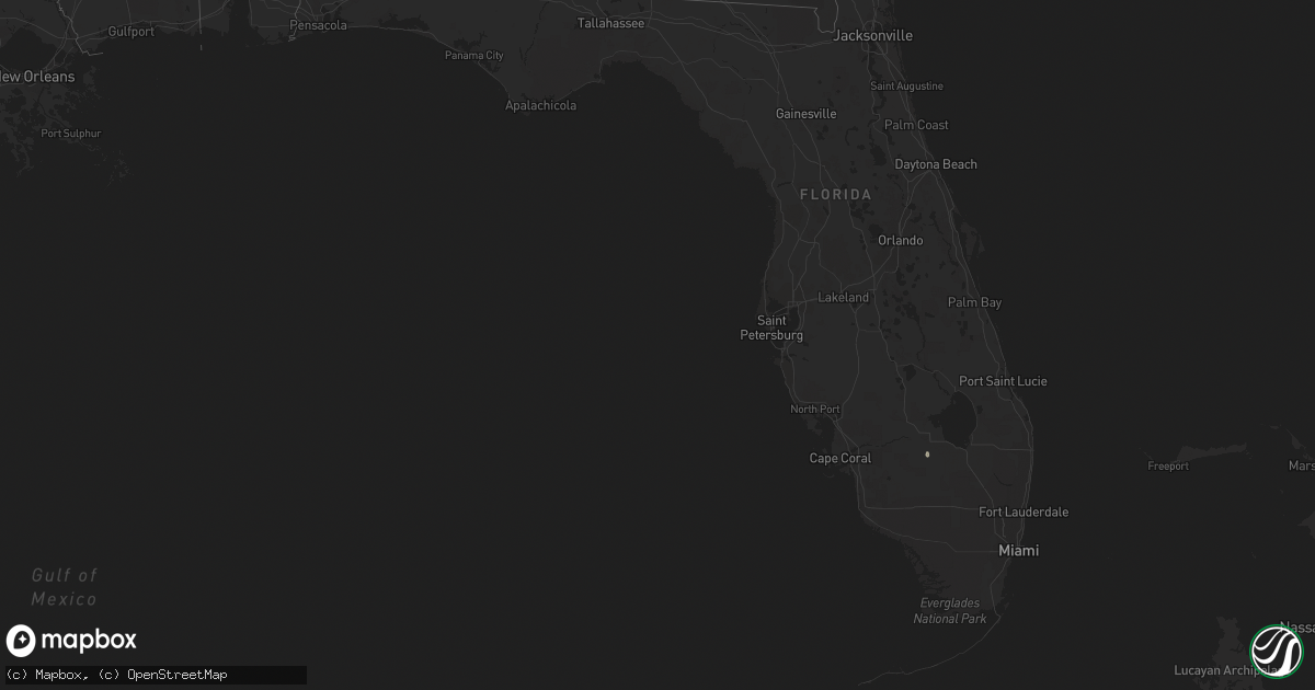
Hail Map in Florida on August 25, 2019
Get this storm
August 25 map
$229
one time, instant access
Download today. No call, no setup
Keep the $229
Bought the map and want the full workflow? Apply the entire $229 to a subscription within 7 days. None of it is wasted.
Every map, not just this one
This buys you this map. Subscription and you get every map we run, in the markets you choose from a few cities to whole states to nationwide. Plus real-time alerts the moment a storm fires.
Contact data
Name, contact info, occupancy, even credit band for addresses in the footprint. You go from where it hit to who to call.
Become the source they trust
Unlimited branding weather history reports on demand. You already have the documented answer ready for the property owner, and you are the one who showed up with it.
Property data and RoofTrace estimates
Pull up any address you have got, its value and the exact code rules for that jurisdiction, straight from One Click Code. Then RoofTrace estimates the squares, pitch, and roof value, priced the way you price.
Storm reports in Florida
Florida
| Date | Description |
|---|---|
| 08/25/20193:50 PM CDT | Combination of strong winds and lightning resulted in the scattered power outages across washington county on the west florida electric coop outage map. |
| 08/24/201910:18 PM CDT | At 318 PM CDT, severe thunderstorms were located along a line extending from 9 miles southwest of Bonifay to 17 miles west of Blountstown, moving northeast at 15 mph. HAZARD...60 mph wind gusts. SOURCE...Radar indicated. IMPACT...Expect damage to roofs, siding, and trees. Locations impacted include... Vernon, Chipley, Bonifay, Marianna, Bradford, Cottondale, Altha, Alford, Caryville, Wausau, Westville, Moose Pond, Whitehead Crossroads, Camps Head, Porter Lake, Bahoma, Chipley Municipal Airport, Orange Hill, Kynesville and Chason. |
All States Impacted by Hail Map on August 25, 2019
Cities Impacted by Hail Map on August 25, 2019
- Driscoll, ND
- Steele, ND
- Binford, ND
- Mchenry, ND
- Pekin, ND
- Wood River, NE
- Upton, WY
- Newcastle, WY
- Mcclusky, ND
- Denhoff, ND
- Hurdsfield, ND
- Iroquois, SD
- Merriman, NE
- Bingham, NE
- Rushville, NE
- Gordon, NE
- Loup City, NE
- Arcadia, NE
- Fessenden, ND
- New Salem, ND
- Center, ND
- Mercer, ND
- Goodrich, ND
- Hazard, NE
- Pleasanton, NE
- Cathay, ND
- Menoken, ND
- Mandan, ND
- Bismarck, ND
- Baldwin, ND
- Esmond, ND
- Dawson, ND
- Tappen, ND
- Braddock, ND
- Moffit, ND
- Garrison, ND
- Pine Ridge, SD
- Oelrichs, SD
- Hot Springs, SD
- Chadron, NE
- Edgemont, SD
- Hay Springs, NE
- Comstock, NE
- Sargent, NE
- Broken Bow, NE
- Lehr, ND
- Wishek, ND
- Whitman, NE
- Drake, ND
- Okaton, SD
- White River, SD
- Wilton, ND
- Edgeley, ND
- Turon, KS
- Gillette, WY
- Presho, SD
- Vivian, SD
- Draper, SD
- Longdale, OK
- Saint Libory, NE
- Hastings, NE
- Grand Island, NE
- Giltner, NE
- Harvard, NE
- Henderson, NE
- Aurora, NE
- Doniphan, NE
- Trumbull, NE
- Alda, NE
- Saronville, NE
- Sutton, NE
- Brewster, NE
- Robinson, ND
- Jud, ND
- Cherokee, OK
- Fairview, OK
- Okeene, OK
- Hampton, NE
- Mobridge, SD
- Eagle Butte, SD
- Trail City, SD
- Wakpala, SD
- Shelton, NE
- Gibbon, NE
- Allen, SD
- Porcupine, SD
- Pettibone, ND
- Rugby, ND
- New Rockford, ND
- Purdum, NE
- Grace City, ND
- Ansley, NE
- Ord, NE
- Mason City, NE
- Anamoose, ND
- Moorcroft, WY
- Weston, WY
- Devils Tower, WY
- Litchfield, NE
- Cairo, NE
- Ravenna, NE
- Rockville, NE
- Anselmo, NE
- Fort Pierre, SD
- Murdo, SD
- Ellsworth, NE
- Ashby, NE
- Saint Anthony, ND
- Cody, NE
- Custer, SD
- Saint Paul, NE
- York, NE
- Gettysburg, SD
- Martin, ND
- Turtle Lake, ND
- Regan, ND
- Tuttle, ND
- Washburn, ND
- Butte, ND
- Wing, ND
- Alexandria, NE
- Fairbury, NE
- Gilead, NE
- Rozet, WY
- Martin, SD
- Batesland, SD
- Smithwick, SD
- Elm Creek, NE
- Holdrege, NE
- Funk, NE
- Cleveland, ND
- Jamestown, ND
- Stanton, ND
- Hazen, ND
- Dunning, NE
- Medina, ND
- Gackle, ND
- Hayes, SD
- Watonga, OK
- Southard, OK
- Hitchcock, OK
- Canton, OK
- Ashton, NE
- Amherst, NE
- Farwell, NE
- Boelus, NE
- Loomis, NE
- Axtell, NE
- Bertrand, NE
- Smithfield, NE
- Timber Lake, SD
- Bridgewater, SD
- Dannebrog, NE
- Clewiston, FL
- Kearney, NE
- Kulm, ND
- Merna, NE
- Endicott, NE
- Hanover, KS
- Washington, KS
- Steele City, NE
- Odell, NE
- Daykin, NE
- Belvidere, NE
- Diller, NE
- Morrowville, KS
- Hollenberg, KS
- Hebron, NE
- Mahaska, KS
- Halsey, NE
- Minot, ND
- Archer, NE
- Palmer, NE
- Edinburg, TX
- Chaseley, ND
- Harvey, ND
- Bowdon, ND
- Raymondville, TX
- Streeter, ND
- Stanley, ND
- Cunningham, KS
- Sullivan City, TX
- Tuthill, SD
- Mission, TX
- La Joya, TX
- Dickey, ND
- Hazelton, ND
- Palermo, ND
- Miller, NE
- Chamberlain, SD
- Elba, NE
- Clay Center, NE
- Westerville, NE
- Taylor, NE
- Riverdale, NE
- Burwell, NE
- North Loup, NE
- Phillips, NE
- Marquette, NE
- Emery, SD
- Shickley, NE
- Davenport, NE
- Underwood, ND
- Coleharbor, ND
- Montpelier, ND
- Maddock, ND
- Sherwood, ND
- Alexandria, SD
- Elwood, NE
- Penitas, TX
- St John, KS
- Hulett, WY
- Central City, NE
- Zenda, KS
- Nashville, KS
- Spivey, KS
- Stafford, KS
- Flasher, ND
- Mcallen, TX
- Attica, KS
- Medicine Lodge, KS
- Lebanon, SD
- Arnold, NE
- Chapman, NE
- Valentine, NE
- Oglala, SD
- Oral, SD
- Mullen, NE
- Wounded Knee, SD
- Hill City, SD
- Rapid City, SD
- Box Elder, SD
- Caputa, SD
- Sterling, ND
- Pleasant Hill, MO
- La Feria, TX
- Armstrong, TX
- San Perlita, TX
- Harlingen, TX
- Edcouch, TX
- Santa Rosa, TX
- Weslaco, TX
- La Villa, TX
- Mercedes, TX
- Elsa, TX
- Lyford, TX
- Pharr, TX
- Sundance, WY


