Hail Map in Montana on August 15, 2011
Get this storm
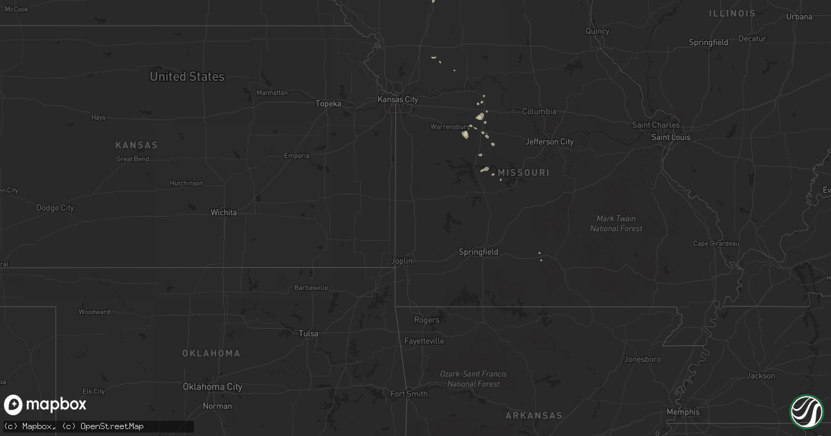
August 15 map
$229
one time, instant access
Download today. No call, no setup
Keep the $229
Bought the map and want the full workflow? Apply the entire $229 to a subscription within 7 days. None of it is wasted.
Every map, not just this one
This buys you this map. Subscription and you get every map we run, in the markets you choose from a few cities to whole states to nationwide. Plus real-time alerts the moment a storm fires.
Contact data
Name, contact info, occupancy, even credit band for addresses in the footprint. You go from where it hit to who to call.
Become the source they trust
Unlimited branding weather history reports on demand. You already have the documented answer ready for the property owner, and you are the one who showed up with it.
Property data and RoofTrace estimates
Pull up any address you have got, its value and the exact code rules for that jurisdiction, straight from One Click Code. Then RoofTrace estimates the squares, pitch, and roof value, priced the way you price.
Storm reports in Montana
Montana
| Date | Description |
|---|---|
| 08/14/201111:15 PM CDT | A local report indicates 60 MPH wind near 25 N WOLF POINT |
| 08/14/201110:55 PM CDT | A local report indicates 65 MPH wind near 11 N WOLF POINT |
| 08/14/20119:27 PM CDT | Quarter to golf ball sized hail. Winds estimated 40 to 50 mph. |
| 08/14/20118:01 PM CDT | A local report indicates 65 MPH wind near 4 SE MOORHEAD |
All States Impacted by Hail Map on August 15, 2011
Cities Impacted by Hail Map on August 15, 2011
- Menoken, ND
- Bismarck, ND
- Ellendale, ND
- Fullerton, ND
- Gladstone, ND
- Dickinson, ND
- Richardton, ND
- Manning, ND
- Dunn Center, ND
- Killdeer, ND
- Taylor, ND
- Hebron, ND
- Carson, ND
- Mott, ND
- Scranton, ND
- New England, ND
- Amidon, ND
- Bowman, ND
- Regent, ND
- Hettinger, ND
- Reeder, ND
- Woodbine, IA
- Hazelton, ND
- Braddock, ND
- Hammond, MT
- Lemmon, SD
- Alzada, MT
- Boyes, MT
- Wayan, ID
- Suitland, MD
- District Heights, MD
- Buffalo, SD
- La Monte, MO
- Knob Noster, MO
- Green Ridge, MO
- Carbon, IA
- Corning, IA
- Glen Ullin, ND
- Kenmare, ND
- Wing, ND
- Mcclusky, ND
- Nodaway, IA
- Kamas, UT
- New Leipzig, ND
- Oakes, ND
- Soda Springs, ID
- Halliday, ND
- Ludlow, SD
- Elgin, ND
- Mandan, ND
- Flasher, ND
- New Salem, ND
- Hague, ND
- Edwards, MO
- Lincoln, MO
- Duchesne, UT
- Myton, UT
- Camp Crook, SD
- Milford, DE
- Almont, ND
- Randlett, UT
- Marana, AZ
- Sterling, ND
- Rhame, ND
- Climax Springs, MO
- Atlantic, IA
- Lewis, IA
- Edgeley, ND
- Massena, IA
- Garrison, ND
- Harlan, IA
- Steele, ND
- Egnar, CO
- Kenansville, FL
- Marshall, MO
- Lamoure, ND
- Teasdale, UT
- Hanksville, UT
- Capitol, MT
- Ridgeway, MO
- Cogswell, ND
- Sedalia, MO
- Hughesville, MO
- Earling, IA
- Defiance, IA
- Dow City, IA
- Denison, IA
- Charter Oak, IA
- Topping, VA
- Turtle Lake, ND
- Mercer, ND
- Moffit, ND
- Logan, IA
- Dunlap, IA
- Panama, IA
- Raleigh, ND
- Gackle, ND
- Baldwin, ND
- McIntosh, SD
- Herreid, SD
- Andrews Air Force Base, MD
- Upper Marlboro, MD
- Belgrade, MT
- Two Dot, MT
- Cumberland, IA
- Eureka, SD
- Zeeland, ND
- Ashley, ND
- Forman, ND
- East Carbon, UT
- McLaughlin, SD
- Denhoff, ND
- Downey, ID
- Kulm, ND
- Debary, FL
- Saint Anthony, ND
- Driscoll, ND
- Frostproof, FL
- Berlin, ND
- Strasburg, ND
- Gravity, IA
- Rutland, ND
- Afton, WY
- Lisbon, ND
- Portsmouth, IA
- Havana, ND
- Cole Camp, MO
- Broadus, MT
- Thayne, WY
- Cowgill, MO
- Cayuga, ND
- Bowbells, ND
- Polo, MO
- Kingston, MO
- Lewistown, MT
- Blythedale, MO
- Immokalee, FL
- Williston, ND
- Grover, WY
- New Effington, SD
- Jordan, MT
- Morgan, UT
- Croydon, UT
- Talmage, UT
- Lamoni, IA
- Kellerton, IA
- Mound City, SD
- Isabel, SD
- Meadow, SD
- Bison, SD
- Medina, ND
- Tappen, ND
- Marion, ND
- Litchville, ND
- Verona, ND
- Griswold, IA
- Labelle, FL
- Streeter, ND
- Beulah, ND
- Norborne, MO
- Hurdsfield, ND
- Lefor, ND
- Fort Ransom, ND
- Cleveland, ND
- Pollock, SD
- Helper, UT
- Clinton, MD
- Stephen, MN
- Milnor, ND
- Harrison, MT
- Montpelier, ID
- Eagleville, MO
- Wake, VA
- Rock Springs, WY
- Vineland, NJ
- Oakland, IA
- Walnut, IA
- Manhattan, MT
- Bozeman, MT
- Elk Horn, IA
- Mountain Grove, MO
- Bethany, MO
- Bedford, WY
- Alamo, ND
- Dove Creek, CO
- Dawson, ND
- Roach, MO
- Jensen Beach, FL
- Jud, ND
- Melbourne Beach, FL
- Indialantic, FL
- Satellite Beach, FL
- Melbourne, FL
- New Market, IA
- Hosmer, SD
- Windsor, MO
- Nelson, MO
- Grace, ID
- Houstonia, MO
- Lodgepole, SD
- Java, SD
- Bowdle, SD
- Pinedale, WY
- Bondurant, WY
- Deltona, FL
- Lewes, DE
- Stover, MO
- Mora, MO
- Coleharbor, ND
- White Sulphur Springs, MT
- Ekalaka, MT
- Goodrich, ND


