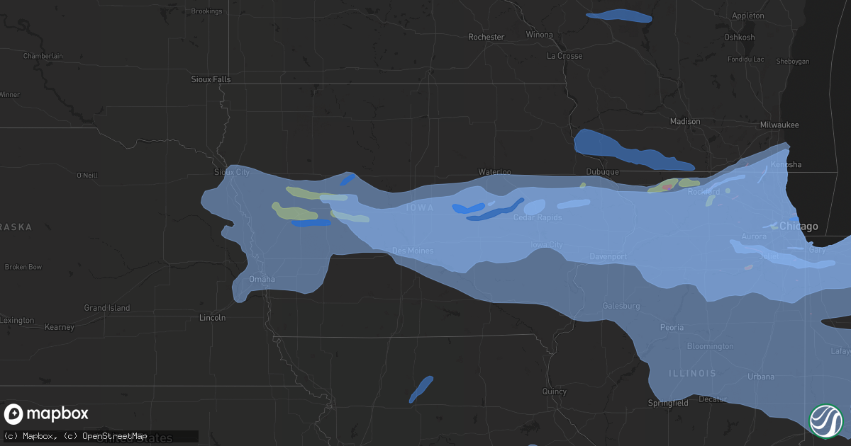
Hail Map in Iowa on August 10, 2020
Get this storm
August 10 map
$229
one time, instant access
Download today. No call, no setup
Keep the $229
Bought the map and want the full workflow? Apply the entire $229 to a subscription within 7 days. None of it is wasted.
Every map, not just this one
This buys you this map. Subscription and you get every map we run, in the markets you choose from a few cities to whole states to nationwide. Plus real-time alerts the moment a storm fires.
Contact data
Name, contact info, occupancy, even credit band for addresses in the footprint. You go from where it hit to who to call.
Become the source they trust
Unlimited branding weather history reports on demand. You already have the documented answer ready for the property owner, and you are the one who showed up with it.
Property data and RoofTrace estimates
Pull up any address you have got, its value and the exact code rules for that jurisdiction, straight from One Click Code. Then RoofTrace estimates the squares, pitch, and roof value, priced the way you price.
Storm reports in Iowa
Iowa
| Date | Description |
|---|---|
| 08/10/20202:32 PM CDT | Extensive damage to buildings at this interchange. |
| 08/10/20202:02 PM CDT | 60 to 70 mph winds estimated. Time is also estimated. |
| 08/10/20202:00 PM CDT | Delayed report. 400 foot radio broadcast tower collapsed. |
| 08/10/20202:00 PM CDT | Trees and wires down. |
| 08/10/20202:00 PM CDT | A local report indicates 74 MPH wind near CLINTON AIRPORT |
| 08/10/20202:00 PM CDT | Numerous reports of trees... Limbs andpowerlines down in the county. Clinton awos shows gusts over 60 mph for about 45 minutes. Time of the event was estimated based on |
| 08/10/20201:58 PM CDT | 8 inch branch snapped and numerous additional tree damage. Also damage to wood fence. |
| 08/10/20201:52 PM CDT | A local report indicates 68 MPH wind near 1 NNW BETTENDORF |
| 08/10/20201:50 PM CDT | Corrects previous tstm wnd gst report from 3 nnw moline to ad addiitional information. Dot rwis on i-74 bridge there are numerous reports of of powerlines and trees dow |
| 08/10/20201:47 PM CDT | Delayed report. From iowa dot rwis. Peak wind gust on i-74 bridge. |
| 08/10/20201:47 PM CDT | 4-5 semi trailers blown over on hwy 61 blocking traffic... Time estimated from radar. |
| 08/10/20201:47 PM CDT | Significant roof damage at radio station kmcn... With roofing and insulation material blown into adjacent field. |
| 08/10/20201:46 PM CDT | Two large interstate signs steel supports were snapped. |
| 08/10/20201:45 PM CDT | Via social media. Large tree and limbs down in front yard about 12 to 18 inches in diameter.time of the event is estimated using radar. |
| 08/10/20201:45 PM CDT | Corrects previous tstm wnd gst report from davenport airport. Numerous tree limbs down around the airport including a 3 foot wide sycamore tree that was partially rotte |
| 08/10/20201:45 PM CDT | A local report indicates 69 MPH wind near CLINTON AIRPORT |
| 08/10/20201:35 PM CDT | Shingle damage to house at this location. Time estimated by radar. |
| 08/10/20201:30 PM CDT | Trees down across road... Time estimated from radar. |
| 08/10/20201:30 PM CDT | Estimated location and time from radar. Large trees down. |
| 08/10/20201:30 PM CDT | Lost an old hickory tree and another 18 inch diameter tree was broken off halfway up. Strong winds lasted until 2 pm. Time of the event was estimated using radar. |
| 08/10/20201:30 PM CDT | Heavy structural damage to a grain silo. It looks like the top part of it collapsed through the center of the silo. |
| 08/10/20201:30 PM CDT | Several snapped trees and large tree branches on the ground. |
| 08/10/20201:30 PM CDT | Via social media...trees down and soffitt peeled back on an outbuilding north of wildcat den state park. Time was estimated using radar. |
| 08/10/20201:30 PM CDT | Trees and wires down. |
| 08/10/20201:28 PM CDT | Large tree uprooted and laying across someones yard. Large limbs throughout the street. |
| 08/10/20201:28 PM CDT | Multiple trees down with very strong winds. |
| 08/10/20201:27 PM CDT | Numerous tree branches down all over town... Time estimated from radar. |
| 08/10/20201:26 PM CDT | Nws office... Rsois. |
| 08/10/20201:25 PM CDT | A local report indicates 1.00 inch wind near 1 ENE CASCADE |
| 08/10/20201:25 PM CDT | 60 knot gust reported at davenport municipal airport asos. |
| 08/10/20201:25 PM CDT | Delayed report. From iowa dot rwis on i-74 bridge. Initial gust when outflow arrived. |
| 08/10/20201:24 PM CDT | 6 inch tree limbs down across power lines. |
| 08/10/20201:23 PM CDT | Flagpole bent over. |
| 08/10/20201:22 PM CDT | A local report indicates 60 MPH wind near BURLINGTON REGIONAL AIR |
| 08/10/20201:20 PM CDT | Tree blown down. |
| 08/10/20201:20 PM CDT | Neighbors wooden fence was blown down... Which was relatively new. There is some damage to his siding of the house. Several 4-6 inch limbs are down... Along with a larg |
| 08/10/20201:20 PM CDT | Trees snapped in half... Around 12 inch diameter |
| 08/10/20201:15 PM CDT | Trees reported down in town. |
| 08/10/20201:15 PM CDT | A lot of tree damage throughout the town. Large tree limbs and trees down. |
| 08/10/20201:15 PM CDT | A local report indicates 58 MPH wind near MUSCATINE AIRPORT |
| 08/10/20201:12 PM CDT | Tree limbs everywhere. |
| 08/10/20201:10 PM CDT | Estimated location. Large tree down. |
| 08/10/20201:07 PM CDT | No power and lots of 6-12 inch diameter trees snapped. Estimating 90mph winds. |
| 08/10/20201:06 PM CDT | Shingles completely blown off roof. |
| 08/10/20201:05 PM CDT | Several tree branches blown to the ground... Up to 3 inches in diameter. No power. Personal weather station recorded 69 knots before the power went out. |
| 08/10/20201:05 PM CDT | Several large tree branches down along with several power flashes. |
| 08/10/20201:05 PM CDT | Estimated location. Downed trees and an amateur radio operator tower went down. |
| 08/10/20201:05 PM CDT | Estimating wind gusts to 75mph. |
| 08/10/20201:05 PM CDT | Large tree branches blown off trees with an estimate at 60+mph winds. |
| 08/10/20201:01 PM CDT | Damage to mobile homes in the area of intersection of highways 13 and 151. Estimates of wind around 90 mph. |
| 08/10/20201:00 PM CDT | The emergency manager relayed numerous reports of widespread trees... Powerlines and limbs down throughout the county. The time of the event was estimated using radar. |
| 08/10/20201:00 PM CDT | Ia-dot. |
| 08/10/20201:00 PM CDT | Corrects date of previous tstm wnd gst report from wilton. |
| 08/10/20201:00 PM CDT | Time estimated. Estimated winds to be between 80-90 mph. Telephone poles snapped with power poles down... Tree lines between 2 and 4 inches in diameter are down... And |
| 08/10/20201:00 PM CDT | 70 ft tall tree toppled. |
| 08/10/20201:00 PM CDT | Estimated location. Large tree down. |
| 08/10/20201:00 PM CDT | Large tree limbs and fences are down. |
| 08/10/202012:58 PM CDT | Small to medium tree limbs down within town. |
| 08/10/202012:58 PM CDT | Estimated gusts over 100 mph with multiple campers blown over... Along with the shelter roof at the park blown off. |
| 08/10/202012:57 PM CDT | 2 ft diameter trees uprooted. Shingles torn off house and power out. |
| 08/10/202012:56 PM CDT | Large branches down... Playground equipment blown out of yards. |
| 08/10/202012:55 PM CDT | Several trees down in her neighborhood... Two of which were in her yard. |
| 08/10/202012:55 PM CDT | A local report indicates 112 MPH wind near 1 S MIDWAY |
| 08/10/202012:55 PM CDT | A local report indicates 58 MPH wind near MOUNT PLEASANT AIRPORT |
| 08/10/202012:52 PM CDT | Gust measured with davis weather station. |
| 08/10/202012:51 PM CDT | Delayed report with time estimated from radar. Newer tree split from high winds. |
| 08/10/202012:51 PM CDT | A local report indicates 70 MPH wind near WEST BRANCH |
| 08/10/202012:50 PM CDT | 60-70 mph winds estimated. |
| 08/10/202012:49 PM CDT | A local report indicates 100 MPH wind near HIAWATHA |
| 08/10/202012:45 PM CDT | Minor damage to new construction sites. |
| 08/10/202012:44 PM CDT | Reported a measured gust of 70 mph. |
| 08/10/202012:43 PM CDT | Widespread tree damage in cedar rapids... With very high winds. Numerous power outages. |
| 08/10/202012:43 PM CDT | Corrects time to previous tstm wnd gst report from iowa city municipal arpt. Recovered peak wind gust from asos. |
| 08/10/202012:42 PM CDT | Multiple trees and branches down. |
| 08/10/202012:40 PM CDT | Time estimated from radar. |
| 08/10/202012:40 PM CDT | A lot of tree damage with large oak trees snapped half way up. An outbuilding was tossed into a field and a large amount of corn damage was observed in the area. |
| 08/10/202012:40 PM CDT | Numerous large 1 ft diameter or larger trees snapped. |
| 08/10/202012:40 PM CDT | Several large 12 inch tree limbs down... Time estimated from radar. |
| 08/10/202012:40 PM CDT | Measured wind gust from hand-held anemometer. Time estimated. |
| 08/10/202012:40 PM CDT | Multiple transformers have blown... With large tree limbs down in town. |
| 08/10/202012:39 PM CDT | *** 1 fatal *** tree fell on biker. Time is estimated based on radar. |
| 08/10/202012:39 PM CDT | Corrects previous tstm wnd gst report from iowa city airport. |
| 08/10/202012:38 PM CDT | 4 inch limb from a tree snapped and over roadway. |
| 08/10/202012:38 PM CDT | Estimated wind gusts up to 80 mph. |
| 08/10/202012:37 PM CDT | 3 trees tops knocked out. Multiple limbs down in the area. |
| 08/10/202012:35 PM CDT | Large mature trees down at linn/benton rd. |
| 08/10/202012:35 PM CDT | A local report indicates 60 MPH wind near OTTUMWA |
| 08/10/202012:35 PM CDT | A local report indicates 60 MPH wind near FAIRFIELD MUNICIPALITY |
| 08/10/202012:35 PM CDT | Winds in excess of 80 mph with large limbs down. |
| 08/10/202012:35 PM CDT | Parts of a church roof ripped off... Along with several shingles missing. |
| 08/10/202012:35 PM CDT | Trees snapped in half... Around 12 inch diameter |
| 08/10/202012:35 PM CDT | Large tree snapped. 80 ft long tree that was about a foot in diameter. |
| 08/10/202012:34 PM CDT | Measured with handheld anemometer. |
| 08/10/202012:32 PM CDT | Lots of tree damage with a large birch tree fallen. |
| 08/10/202012:31 PM CDT | Straight line winds estimated around 140 mph removed the roof of an apartment complex... And destroyed most exterior walls and some interior walls. Video and pictures r |
| 08/10/202012:31 PM CDT | A brief tornado moved through cropland just north of the eastern iowa airport. The path was found in high resolution satellite imagery. The tornado was on the leading e |
| 08/10/202012:31 PM CDT | Fire department reported winds around 90 mph. |
| 08/10/202012:30 PM CDT | Heavy damage reported at the housby heavy equipment building. |
| 08/10/202012:30 PM CDT | Benton co em reported wind gust at shellsburg fire department wind meter. |
| 08/10/202012:30 PM CDT | Estimated location. Several trees snapped clean at the middle in wooded area. |
| 08/10/202012:30 PM CDT | Coop grain bins blown in and severely damaged. Widespread crop damage across tama county. Delayed report and time estimated by radar. |
| 08/10/202012:30 PM CDT | A local report indicates 68 MPH wind near CEDAR RAPIDS MUNICIPALI |
| 08/10/202012:30 PM CDT | Location approximated from social media report. Roof of a house nearly torn all off. Major structural damage. Large tree limbs down in the front lawn. |
| 08/10/202012:30 PM CDT | Estimated time. Major tree damage and shingles everywhere. |
| 08/10/202012:30 PM CDT | Large grain bins destroyed and blown around yard. One is up against the house... While the other is in a bunch of trees. Some siding damage to their house also. |
| 08/10/202012:30 PM CDT | Midwest athletic center building completely destroyed. Two walls blown out. Looks like winds came in from the west facing wall and blew out the south facing wall. Heavy |
| 08/10/202012:28 PM CDT | A local report indicates 70 MPH wind near 6 NNE VAN HORNE |
| 08/10/202012:28 PM CDT | Widespread damage across southern benton county... From keystone... To van horne and the atkins area. Numerous houses... Outbuildings... Grain bins and trees damaged or |
| 08/10/202012:28 PM CDT | Delayed report. Roof removed from small strip mall. Some exterior walls collapsed. |
| 08/10/202012:28 PM CDT | Public report relayed by emergency manager. Measured on home weather station with a clear western exposure. |
| 08/10/202012:25 PM CDT | Heavy structural damage to residents house. Several shingles ripped off the roof. 2x4s through the walls of the house. Parts of the roof actually torn off. Trees snappe |
| 08/10/202012:25 PM CDT | Delayed report. Antenna mounted on a tower at 340 feet above ground was snapped off. Antenna was rated to withstand 125 mph winds. |
| 08/10/202012:25 PM CDT | Winds in excess of 90 mph with major damage reported in town. |
| 08/10/202012:20 PM CDT | A bunch of damage done to trees... Roofing missing on several buildings... And a building was destroyed. |
| 08/10/202012:19 PM CDT | Along with pea sized hail. |
| 08/10/202012:15 PM CDT | Multiple spotter reports of 70+ mph winds from belle plaine to luzerne. |
| 08/10/202012:15 PM CDT | Trees down all over town on the roads. Estimated wind speeds 70 mph. Time estimated. |
| 08/10/202012:10 PM CDT | Semi blown over on i-80 just west of the grinnell interchange. |
| 08/10/202012:01 PM CDT | Tornado associated with qlcs derecho first observed via high resolution satellite imagery. Path was also overflown by uas confirming convegent path of debris. No damage |
| 08/10/202012:01 PM CDT | 60x90 foot machine shed completely demolished. Neighbors |
| 08/10/202012:00 PM CDT | Significant tree and structural damage. Exact time unknown. |
| 08/10/202012:00 PM CDT | A local report indicates 90 MPH wind near 3 S CHELSEA |
| 08/10/202011:58 AM CDT | Significant damage in state center. Numerous cars blown off us30 and flipped. |
| 08/10/202011:58 AM CDT | A local report indicates 75 MPH wind near 2 SW CONRAD |
| 08/10/202011:57 AM CDT | Reported at leighton... Ia. Pws. |
| 08/10/202011:55 AM CDT | 70 mph plus wind gust in toledo. Tree struck office. |
| 08/10/202011:52 AM CDT | Personal weather station kiamarsh15. |
| 08/10/202011:52 AM CDT | Numerous trees and powerlines downed. Via socail media. |
| 08/10/202011:51 AM CDT | Several large sections of roofs blown off buildings along old highway 30 on south part of marshalltown. |
| 08/10/202011:51 AM CDT | Estimated winds of 90 to 100 mph. |
| 08/10/202011:50 AM CDT | Asos station kmiw marshalltown airport. Peak gust thus far. |
| 08/10/202011:47 AM CDT | Damage to barns and roofs. |
| 08/10/202011:43 AM CDT | Mesonet station rmti4 marshalltown |
| 08/10/202011:43 AM CDT | Numerous large trees down. Winds estimated at 70 mph. |
| 08/10/202011:43 AM CDT | Recovered peak wind gust from asos. |
| 08/10/202011:40 AM CDT | Mesonet station nswi4 neil smith nwr raws. |
| 08/10/202011:39 AM CDT | Multiple large tree limbs down... Largest is eight inches in diameter. Exact time unknown. |
| 08/10/202011:39 AM CDT | Tornado initially found from high resolution satellite imagery and confirmed via uas overflight. Damage was done to crop and trees. Some minor damage to housing structu |
| 08/10/202011:38 AM CDT | Mesonet station fw1669 hubbard. |
| 08/10/202011:36 AM CDT | Brief tornado captured from post event uas survey. Stayed in cropland with no impacts to damage indicators... Hence the efu rating. Delayed report. |
| 08/10/202011:35 AM CDT | Awos station koxv knoxville airport. |
| 08/10/202011:34 AM CDT | Large tree branches down. Street signs blown down in town. Part of house roof blown off. Exact time unknown. |
| 08/10/202011:30 AM CDT | Brief qlcs tornado on leading edge of convection. Path found via high resolution satellite imagery. The tornado impacted no damage indicators... Hence the efu rating. D |
| 08/10/202011:30 AM CDT | Peak wind gust of 77 mph via davis weather station. Tree branches of 2-3 inch diameter broken and on the ground. 4 inch tree broke off at the ground. |
| 08/10/202011:29 AM CDT | Damage reported throughout town. Tree damage with roads blocked. Delayed report at 12:30 pm. Radar estimated 11:29 am. |
| 08/10/202011:26 AM CDT | Mailboxes blown down... Along with trees and branches of undetermined size. |
| 08/10/202011:26 AM CDT | Asos station klwd lamoni airport. |
| 08/10/202011:24 AM CDT | Iowa state campus. 65 to 75 mph winds estimated. Extensive tree damage throughout ames. No power. |
| 08/10/202011:24 AM CDT | Large tree blocking both lanes of state highway f48 in town of colfax. |
| 08/10/202011:20 AM CDT | Trees down with high winds. Power on/off. |
| 08/10/202011:20 AM CDT | Winds of 70 to 80 mph. |
| 08/10/202011:19 AM CDT | Large tree down. |
| 08/10/202011:16 AM CDT | 128th and douglas urbandale... Iowa fence blown down with high winds. |
| 08/10/202011:16 AM CDT | Lots of tree damage in carlisle. Social media. |
| 08/10/202011:15 AM CDT | Awos station kikv ankeny airport. |
| 08/10/202011:15 AM CDT | Tree and bin damage. Time estimated. |
| 08/10/202011:14 AM CDT | Large tree branches down. |
| 08/10/202011:13 AM CDT | Part of the des moines buccaneers roof blown off. Relayed by who-tv. |
| 08/10/202011:12 AM CDT | Trees down. Damage to roofs. Relayed by woi-tv. |
| 08/10/202011:11 AM CDT | Estimated over 70 mph winds in ames. |
| 08/10/202011:10 AM CDT | Nw johnston tree uprooted. Time estimated. |
| 08/10/202011:10 AM CDT | Branches down. |
| 08/10/202011:10 AM CDT | Mesonet station up752 0.6 w elkhart |
| 08/10/202011:10 AM CDT | 6 in larger tree limbs down. Power outages. Time estimated by radar. Wind gusts of 50 mph lasted 30 minutes. Report 11:40 am. |
| 08/10/202011:10 AM CDT | Mesonet station rami4 2 e ames. |
| 08/10/202011:07 AM CDT | A local report indicates 70 MPH wind near GILBERT |
| 08/10/202011:06 AM CDT | Lots of small branches down. |
| 08/10/202011:06 AM CDT | Mesonet station cw2001 madrid. |
| 08/10/202011:05 AM CDT | Twelve inch to eight inch diameter trees down. |
| 08/10/202011:05 AM CDT | Roof damage to buccaneer arena. 72nd and hickman rd. Report via social media. Time estimated. |
| 08/10/202011:04 AM CDT | Asos station kdsm des moines international airport. |
| 08/10/202011:03 AM CDT | A local report indicates 58 MPH wind near INDIANOLA |
| 08/10/202011:03 AM CDT | Several large trees down throughout the town of cumming. Time estimated by radar. |
| 08/10/202011:02 AM CDT | Numerous trees down along with power outages. |
| 08/10/202011:01 AM CDT | Mesonet station raki4 ankeny - i35 and ne 36th. |
| 08/10/202011:00 AM CDT | Reported at 112th ne and 104th... Des moines from personal weather station. Time estimated. |
| 08/10/202011:00 AM CDT | 100 to 120 cars had their windows blown out at a factory. Time estimated. |
| 08/10/202011:00 AM CDT | Several large tree limbs down and a couple tree trunks snapped. Roads blocked. |
| 08/10/202011:00 AM CDT | Numerous trees and powerlines down. Time estimated. |
| 08/10/202010:59 AM CDT | Reported at 75th and diamond... Urbandale iowa tree damage. |
| 08/10/202010:57 AM CDT | Power out... Trees down. |
| 08/10/202010:56 AM CDT | Power out near cumming... Iowa. |
| 08/10/202010:55 AM CDT | A local report indicates 75 MPH wind near 5 WSW CUMMING |
| 08/10/202010:55 AM CDT | Trees down... Roof off building. Lots of tree damage. |
| 08/10/202010:54 AM CDT | Time estimated from radar. |
| 08/10/202010:54 AM CDT | Damage to home foundation and several large tree limbs down as well as very large tree trunk. |
| 08/10/202010:54 AM CDT | Several large tree limbs down... Power out. |
| 08/10/202010:52 AM CDT | Semi blown over at us30/highway 17 interchange. Time estimated by radar. |
| 08/10/202010:48 AM CDT | Wind reported in city of adel. Limbs down... Objects blown around. |
| 08/10/202010:47 AM CDT | Mills civic and i35; 70 mph winds. Sign and tree damage. Winds of 55 to 70 lasted nearly 20 minutes during the surge. |
| 08/10/202010:40 AM CDT | Lots of small trees down and several anchored swing sets toppled over. |
| 08/10/202010:38 AM CDT | Tree damage reported. Winds greater than 60 mph estimated. |
| 08/10/202010:37 AM CDT | Power off/on. Winds higher than 60 mph. |
| 08/10/202010:34 AM CDT | Trees down. Wind still blowing. |
| 08/10/202010:34 AM CDT | 8 inch tree limbs down. Power lines down. Trees down all over town. |
| 08/10/202010:33 AM CDT | 60 to 70 mph wind gusts. |
| 08/10/202010:32 AM CDT | Large tree limb down hit house. Without power now. Estimate 60 mph winds or higher. |
| 08/10/202010:30 AM CDT | Roof damage to a home. Time estimated. |
| 08/10/202010:30 AM CDT | Debris on roads as well. |
| 08/10/202010:26 AM CDT | Branches down... Power out. |
| 08/10/202010:25 AM CDT | Two foot diameter tree limb down in perry. |
| 08/10/202010:21 AM CDT | Along with pea sized hail and heavy rainfall. |
| 08/10/202010:20 AM CDT | Personal weather station. Time estimated from radar. |
| 08/10/202010:15 AM CDT | Large trees down blocking roads. Wind still blowing. |
| 08/10/202010:14 AM CDT | A local report indicates 65 MPH wind near 5 SSE GUTHRIE CENTER |
| 08/10/202010:10 AM CDT | A local report indicates 60 MPH wind near 4 SSE ATLANTIC |
| 08/10/202010:04 AM CDT | Semi blown over at mile marker 28 near minden. |
| 08/10/202010:02 AM CDT | A local report indicates 74 MPH wind near 3 WSW GLIDDEN |
| 08/10/202010:00 AM CDT | Outbuilding had roof blown off. Time estimated. |
| 08/10/20209:58 AM CDT | Wind-driven hail caused significant damage northeast of breda. Winds estimated to be 60 mph or greater. Delayed report. Time estimated by radar. |
| 08/10/20209:45 AM CDT | Tree damage reported around town. |
| 08/10/20209:36 AM CDT | Large tree limb roughly 6 inches in diameter and 20 feet long down. Several smaller tree limbs down as well. |
| 08/10/20209:35 AM CDT | Awos station khnr harlan airport. |
| 08/10/20209:33 AM CDT | A local report indicates 60 MPH wind near 3 E HARLAN |
| 08/10/20209:30 AM CDT | Semi jackknifed due to strong winds. |
| 08/10/20209:30 AM CDT | Law reports tree damage in town - tree fell on neighbors car. Tree damage throughout the county. Time estimated. |
| 08/10/20209:29 AM CDT | 4 or 5 large branches down. Lots of smaller branches and leaves down. |
| 08/10/20209:20 AM CDT | Coop observer called in with winds estimated of at least 60 mph. He noted several large trees were down in the area. |
| 08/10/20209:20 AM CDT | Tree limbs were strewn across the highway. |
| 08/10/20209:11 AM CDT | Measured on a personal weather station. |
| 08/10/20209:10 AM CDT | Coop observer estimated wind speeds of 70 mph. Noted that there were several downed tree limbs in his area. |
| 08/10/20209:00 AM CDT | Large tree snapped off. Appears to be at least 3 feet in diameter. Report via social media. Time estimated based on radar data. |
| 08/10/20208:40 AM CDT | Mesonet station rsci4 sioux city |
| 08/10/20208:24 AM CDT | Delayed report. Asos station ksux sioux gateway airport. |
| 08/10/20208:20 AM CDT | Asos station ksux sioux gateway airport. |
| 08/10/20208:16 AM CDT | Branches and part of a tree laying in the road. Trees swayed back and forth for at least 10 to 15 minutes. Time estimated from radar. |
| 08/10/20207:47 AM CDT | At 1246 PM CDT, severe thunderstorms were located along a line extending from near Mount Auburn to near Amana, moving east at 50 mph. HAZARD...70 mph wind gusts. SOURCE...Trained weather spotters. IMPACT...Expect considerable tree damage. Damage is likely to mobile homes, roofs, and outbuildings. Locations impacted include... Cedar Rapids, Vinton, Hiawatha, Center Point, Fairfax, Atkins, Walford, Urbana, Palo, Shellsburg, Newhall, Blairstown, Van Horne, Keystone, Norway, Garrison, Luzerne, Toddville, Vinton Memorial Airport and Hannen Lake Park.This includes Interstate 380 between mile markers 29 and 41. |
| 08/10/20207:38 AM CDT | At 1238 PM CDT, a severe thunderstorm was located near Monticello, or 12 miles north of Anamosa, moving east at 50 mph. HAZARD...60 mph wind gusts and quarter size hail. SOURCE...Radar indicated. IMPACT...Hail damage to vehicles is expected. Expect wind damage to roofs, siding, and trees. Locations impacted include... Dubuque, Monticello, Cascade, Epworth, Peosta, Hopkinton, Worthington, Bernard, Zwingle, Swiss Valley Park, Otter Creek, Jones County Fairgrounds, South Gary Owen, Dubuque Regional Airport, Fillmore, Garry Owen, Pictured Rocks Wildlife Area, Fillmore Recreation Area, Buck Creek and Camp Courageous. |
| 08/10/20207:37 AM CDT | At 1236 PM CDT, severe thunderstorms were located along a line extending from 9 miles southwest of Boscobel to near Lancaster to Rickardsville, moving east at 35 mph. HAZARD...70 mph wind gusts and quarter size hail. SOURCE...Radar indicated. IMPACT...Hail damage to vehicles is expected. Expect considerable tree damage. Wind damage is also likely to mobile homes, roofs, and outbuildings. Severe thunderstorms will be near... Lancaster around 1240 PM CDT. Fennimore and Dickeyville around 100 PM CDT. Platteville around 105 PM CDT. Cuba City and Hazel Green around 115 PM CDT.Other locations impacted by these severe thunderstorms includeArthur, Highway 61 And County T, Montfort, Beetown, County Roads KAnd T, Nelson Dewey State Park and Lancaster Municipal Airport. |
| 08/10/20207:34 AM CDT | At 1233 PM CDT, severe thunderstorms were located along a line extending from near Center Point to Ely to near Wellman, moving east at 70 mph. These are very dangerous storms! HAZARD...80 mph wind gusts. SOURCE...Trained weather spotters. This line of storms has a history of producing 70 to 90 mph winds and significant tree damage. IMPACT...Flying debris will be dangerous to those caught without shelter. Mobile homes will be heavily damaged. Expect considerable damage to roofs, windows, and vehicles. Extensive tree damage and power outages are likely. Locations impacted include... Cedar Rapids, Davenport, Iowa City, Moline, Rock Island, Bettendorf, Clinton, Muscatine, East Moline, Maquoketa, Anamosa, Tipton, West Branch, Durant, Mechanicsville, Stanwood, Marion, Coralville, North Liberty and Silvis.This includes the following highways... Interstate 74 in Iowa between mile markers 1 and 5. Interstate 80 in Iowa between mile markers 235 and 306. Interstate 380 between mile markers 1 and 30. Interstate 80 in Illinois between mile markers 1 and 4. Interstate 74 in Illinois between mile markers 1 and 7. Interstate 88 between mile markers 1 and 13. Interstate 280 between mile markers 1 and 18. |
| 08/10/20207:28 AM CDT | At 1227 PM CDT, severe thunderstorms were located along a line extending from 7 miles south of Reinbeck to near Brooklyn to 6 miles northeast of Eddyville, moving east at 70 mph. HAZARD...60 mph wind gusts still possible as these storms depart. SOURCE...Trained Spotters. IMPACT...Expect damage to roofs, siding, and trees. Locations impacted include... Tama, Traer, Brooklyn, Dysart, Victor, Holiday Lake, Deep River, Chelsea, Clutier, Elberon, Barnes City, Rose Hill, Hartwick, Guernsey, Vining, Tf Clark State Park and Toledo Municipal Airport.This includes Interstate 80 between mile markers 195 and 204. |
| 08/10/20207:17 AM CDT | At 1216 PM CDT, a severe thunderstorm was located near Hudson, or 11 miles southwest of Waterloo, moving east at 55 mph. HAZARD...70 mph wind gusts. SOURCE...Radar indicated. IMPACT...Expect considerable tree damage. Damage is likely to mobile homes, roofs, and outbuildings. Locations impacted include... Independence, Manchester, Jesup, Urbana, Central City, Fairbank, Edgewood, Winthrop, Hazleton, Walker, Coggon, Quasqueton, Lamont, Ryan, Brandon, Rowley, Aurora, Prairieburg, Dundee and Mount Auburn.This includes Interstate 380 between mile markers 41 and 55. |
| 08/10/20207:13 AM CDT | At 1212 PM CDT, a severe thunderstorm was located near Reinbeck, or 13 miles east of Grundy Center, moving east at 50 mph. HAZARD...70 mph wind gusts. SOURCE...Radar indicated. IMPACT...Expect considerable tree damage. Damage is likely to mobile homes, roofs, and outbuildings. Locations impacted include... Waterloo, Cedar Falls, Evansdale, Jesup, La Porte City, Hudson, Reinbeck, Dike, Elk Run Heights, Crossroads Mall, Waterloo Municipal Airport, Uni-Dome And McLeod Center, Washburn, Dunkerton, Raymond, Gilbertville, Morrison, Tf Clark State Park and George Wyth State Park.This includes Interstate 380 between mile markers 56 and 73. |
| 08/10/20206:52 AM CDT | At 1152 AM CDT, severe thunderstorms were located along a line extending from 8 miles east of Conrad to near Brooklyn to near Oskaloosa, moving east at 60 mph. These are very dangerous storms. HAZARD...90 mph wind gusts and quarter size hail. SOURCE...Trained Spotters. IMPACT...You are in a life-threatening situation. Flying debris may be deadly to those caught without shelter. Mobile homes will be heavily damaged or destroyed. Homes and businesses will have substantial roof and window damage. Expect extensive tree damage and power outages. Locations impacted include... Marshalltown, Oskaloosa, Pella, Grinnell, Toledo, Montezuma, Tama, Traer, Brooklyn, Dysart, New Sharon, Conrad, Meskwaki Casino, Rock Creek Lake, Gladbrook, Le Grand, Victor, Sully, Garwin and Gilman.This includes Interstate 80 between mile markers 175 and 204. |
| 08/10/20206:48 AM CDT | At 1148 AM CDT, severe thunderstorms were located along a line extending from 7 miles east of Conrad to near Montezuma to near Pella, moving east at 70 mph. These are very dangerous storms! HAZARD...80 mph wind gusts. SOURCE...Radar indicated. IMPACT...Flying debris will be dangerous to those caught without shelter. Mobile homes will be heavily damaged. Expect considerable damage to roofs, windows, and vehicles. Extensive tree damage and power outages are likely. Locations impacted include... Cedar Rapids, Iowa City, Vinton, Marengo, West Branch, Sigourney, Marion, Coralville, North Liberty, Hiawatha, Mount Vernon, Robins, Williamsburg, Belle Plaine, Center Point, Kalona, Lisbon, Fairfax, Solon and Tiffin.This includes the following highways... Interstate 80 in Iowa between mile markers 205 and 253. Interstate 380 between mile markers 1 and 40. |
| 08/10/20206:47 AM CDT | At 1147 AM CDT, a severe thunderstorm was located near Eldora, moving east at 55 mph. HAZARD...60 mph wind gusts and quarter size hail. SOURCE...Radar indicated. IMPACT...Hail damage to vehicles is expected. Expect wind damage to roofs, siding, and trees. Locations impacted include... Eldora, Grundy Center, Hudson, Reinbeck, Dike, Conrad, Wellsburg, Union, Steamboat Rock, Holland, New Providence, Beaman, Lincoln, Whitten, Morrison, Owasa, Pine Lake State Park, Tf Clark State Park and Eldora Municipal Airport. |
| 08/10/20206:29 AM CDT | At 1128 AM CDT, a severe thunderstorm gust front was located along a line extending from 7 miles northwest of Mercer to near Cainsville to near Ridgeway to near Bethany, moving east at 55 mph. HAZARD...60 mph wind gusts. SOURCE...Automated Surface Observation. IMPACT...Expect damage to roofs, siding, and trees. Locations impacted include... Trenton, Bethany, Milan, Unionville, Princeton, Ridgeway, Gilman City, Mercer, Cainsville, Spickard, Galt, Lineville, Laredo, Blythedale, Newtown, Humphreys, Pollock, Mount Moriah, Lucerne and Tindall.This includes Interstate 35 in Missouri between mile markers 87 and103. |
| 08/10/20206:28 AM CDT | At 1128 AM CDT, severe thunderstorms were located along a line extending from 6 miles southwest of Monroe to 6 miles south of Melcher-Dallas to 11 miles northwest of Corydon, moving east at 50 mph. HAZARD...60 mph wind gusts. SOURCE...Radar indicated. IMPACT...Expect damage to roofs, siding, and trees. Locations impacted include... Oskaloosa, Knoxville, Centerville, Chariton, Albia, Corydon, Pleasantville, Melcher-Dallas, Eddyville, Lake Sundown, Rathbun Lake, Knoxville Raceway, Ottumwa Industrial Airport, Lake Red Rock, Hartford, Fremont, Seymour, Moravia, Russell and Lovilia. |
| 08/10/20206:19 AM CDT | At 1118 AM CDT, severe thunderstorms were located along a line extending from 12 miles southwest of Eldora to near Newton to Pleasantville, moving east at 70 mph. These are very dangerous storms. HAZARD...80 mph wind gusts and quarter size hail. SOURCE...Radar indicated. IMPACT...Flying debris will be dangerous to those caught without shelter. Mobile homes will be heavily damaged. Expect considerable damage to roofs, windows, and vehicles. Extensive tree damage and power outages are likely. Locations impacted include... Marshalltown, Newton, Altoona, Oskaloosa, Pella, Grinnell, Pleasant Hill, Nevada, Toledo, Montezuma, Carlisle, Bondurant, Story City, Tama, Mitchellville, Colfax, Monroe, Traer, Prairie City and State Center.This includes Interstate 80 between mile markers 142 and 204. |
| 08/10/20206:10 AM CDT | At 1110 AM CDT, a severe thunderstorm was located near Jewell Junction, or 16 miles southeast of Webster City, moving east at 55 mph. HAZARD...60 mph wind gusts. SOURCE...Radar indicated. IMPACT...Expect damage to roofs, siding, and trees. Locations impacted include... Webster City, Iowa Falls, Eldora, Ackley, Jewell Junction, Hubbard, Alden, Radcliffe, Ellsworth, Stanhope, Union, Williams, Steamboat Rock, New Providence, Blairsburg, Kamrar, Randall, Whitten, Buckeye and Garden City.This includes Interstate 35 between mile markers 127 and 148. |
| 08/10/20205:58 AM CDT | At 1058 AM CDT, a severe thunderstorm was located over Polk City, or near Johnston, moving east at 70 mph. HAZARD...70 mph wind gusts. SOURCE...Radar indicated. IMPACT...Expect considerable tree damage. Damage is likely to mobile homes, roofs, and outbuildings. Locations impacted include... West Des Moines, Urbandale, Johnston, Clive, Waukee, Boone, Grimes, Perry, Adel, Madrid, Ogden, Dallas Center, Granger, De Soto, Woodward, Van Meter, Jordan Creek Town Center, Boone Speedway, Valley West Mall and Big Creek Lake.This includes the following highways... Interstate 35 between mile markers 67 and 72. Interstate 80 between mile markers 110 and 129. Interstate 235 between mile markers 1 and 2. |
| 08/10/20205:51 AM CDT | At 1050 AM CDT, severe thunderstorms were located along a line extending from Norwalk to near Sun Valley Lake, moving east at 50 mph. HAZARD...60 mph wind gusts. SOURCE...Radar indicated. IMPACT...Expect damage to roofs, siding, and trees. Locations impacted include... West Des Moines, Indianola, Norwalk, Knoxville, Osceola, Chariton, Pleasantville, Melcher-Dallas, Lakeside Casino, Knoxville Raceway, Avenue Of The Saints Event Center, Lake Red Rock, Milo, Hartford, Murray, St. Charles, Russell, New Virginia, Truro and Martensdale.This includes Interstate 35 between mile markers 25 and 66. |
| 08/10/20205:39 AM CDT | At 1039 AM CDT, severe thunderstorms were located along a line extending from 10 miles northwest of Boone to near Granger to near Van Meter, moving east at 70 mph. HAZARD...70 mph wind gusts and quarter size hail. SOURCE...Radar indicated. IMPACT...Hail damage to vehicles is expected. Expect considerable tree damage. Wind damage is also likely to mobile homes, roofs, and outbuildings. Locations impacted include... Des Moines, Ames, West Des Moines, Ankeny, Urbandale, Johnston, Clive, Newton, Altoona, Pella, Norwalk, Pleasant Hill, Grimes, Nevada, Windsor Heights, Carlisle, Bondurant, Story City, Polk City and Huxley.This includes the following highways... Interstate 35 between mile markers 67 and 72, and between milemarkers 87 and 126. Interstate 80 between mile markers 122 and 174. Interstate 235 between mile markers 1 and 14. |
| 08/10/20205:35 AM CDT | At 1034 AM CDT, a severe thunderstorm was located near Gowrie, or 17 miles south of Fort Dodge, moving east at 55 mph. HAZARD...60 mph wind gusts and nickel size hail. SOURCE...Radar indicated. IMPACT...Expect damage to roofs, siding, and trees. Locations impacted include... Webster City, Jewell Junction, Gowrie, Dayton, Stratford, Coalville, Otho, Ellsworth, Stanhope, Lehigh, Duncombe, Callender, Farnhamville, Williams, Harcourt, Blairsburg, Kamrar, Randall, Moorland and Somers.This includes Interstate 35 between mile markers 127 and 150. |
| 08/10/20205:32 AM CDT | At 1030 AM CDT, a severe thunderstorm was located near Jerico, or 9 miles southwest of Cresco, moving east at 25 mph. HAZARD...60 mph wind gusts and quarter size hail. SOURCE...Radar indicated. IMPACT...Hail damage to vehicles is expected. Expect wind damage to roofs, siding, and trees. This severe thunderstorm will be near... Protivin around 1045 AM CDT. Ridgeway around 1100 AM CDT. Spillville around 1105 AM CDT. Calmar around 1110 AM CDT. Decorah around 1115 AM CDT.Other locations impacted by this severe thunderstorm include VernonSprings County Park, Festina, Vernon Springs, Lake Meyer County Park,County Roads V 58 And A 46, Bluffton and New Hampton Airport. |
| 08/10/20205:17 AM CDT | At 1017 AM CDT, severe thunderstorms were located along a line extending from Stuart to 9 miles northeast of Lake Icaria, moving east at 65 mph. HAZARD...60 mph wind gusts. SOURCE...Radar indicated. IMPACT...Expect damage to roofs, siding, and trees. Locations impacted include... Winterset, Greenfield, Stuart, Earlham, Avenue Of The Saints Event Center, St. Charles, Truro, Orient, Lorimor, Patterson, East Peru, Macksburg, Bevington, Greenfield Municipal Airport, Nodaway Park, Badger Creek State Park and Winterset-Madison County Airport.This includes Interstate 80 between mile markers 89 and 98. |
| 08/10/20205:11 AM CDT | At 1011 AM CDT, severe thunderstorms were located along a line extending from 11 miles east of Lake City to near Jefferson to 8 miles west of Stuart, moving east at 55 mph. HAZARD...70 mph wind gusts and quarter size hail. SOURCE...Radar indicated. IMPACT...Hail damage to vehicles is expected. Expect considerable tree damage. Wind damage is also likely to mobile homes, roofs, and outbuildings. Locations impacted include... West Des Moines, Urbandale, Johnston, Clive, Waukee, Boone, Grimes, Perry, Jefferson, Adel, Guthrie Center, Polk City, Madrid, Ogden, Stuart, Dallas Center, Earlham, Granger, Panora and De Soto.This includes the following highways... Interstate 35 between mile markers 67 and 72. Interstate 80 between mile markers 100 and 129. Interstate 235 near mile marker 1. |
| 08/10/20204:46 AM CDT | At 946 AM CDT, a severe thunderstorm was located over Black Hawk Lake, or 9 miles south of Sac City, moving east at 35 mph. HAZARD...60 mph wind gusts and nickel size hail. SOURCE...Radar indicated. IMPACT...Expect damage to roofs, siding, and trees. Locations impacted include... Sac City, Rockwell City, Lake City, Manson, Lake View, North Twin Lake, Black Hawk Lake, South Twin Lake, Wall Lake, Pomeroy, Early, Farnhamville, Lohrville, Twin Lakes, Auburn, Lytton, Somers, Nemaha, Knierim and Rinard. |
| 08/10/20204:39 AM CDT | At 938 AM CDT, a severe thunderstorm was located near Atlantic, moving east at 55 mph. HAZARD...60 mph wind gusts. SOURCE...Radar indicated. IMPACT...Expect damage to roofs, siding, and trees. Locations impacted include... Atlantic, Greenfield, Griswold, Anita, Adair, Fontanelle, Lewis, Casey, Massena, Cumberland, Bridgewater, Brayton, Marne, Wiota, Lake Anita State Park, Greenfield Municipal Airport, Nodaway Park, Griswold Park, Cold Springs State Park and Atlantic Municipal Airport.This includes Interstate 80 between mile markers 50 and 88. |
| 08/10/20204:29 AM CDT | At 929 AM CDT, a severe thunderstorm was located 7 miles northwest of Manning, or 9 miles east of Denison, moving east at 55 mph. HAZARD...70 mph wind gusts and quarter size hail. SOURCE...Radar indicated. IMPACT...Hail damage to vehicles is expected. Expect considerable tree damage. Wind damage is also likely to mobile homes, roofs, and outbuildings. Locations impacted include... Carroll, Jefferson, Audubon, Guthrie Center, Manning, Coon Rapids, Glidden, Panora, Lake Panorama, Exira, Elk Horn, Scranton, Arcadia, Breda, Bayard, Casey, Churdan, Templeton, Menlo and Kimballton. |
| 08/10/20204:26 AM CDT | At 926 AM CDT, a severe thunderstorm was located over Arthur, or near Ida Grove, moving east at 40 mph. HAZARD...60 mph wind gusts and quarter size hail. SOURCE...Radar indicated. IMPACT...Hail damage to vehicles is expected. Expect wind damage to roofs, siding, and trees. This severe thunderstorm will be near... Arthur around 930 AM CDT.Other locations impacted by this severe thunderstorm includeSchaller. |
| 08/10/20204:09 AM CDT | At 908 AM CDT, severe thunderstorms were located along a line extending from near Dunlap to 5 miles north of Underwood to Bellevue, moving east at 60 mph. HAZARD...65 mph wind gusts. SOURCE...Trained weather spotters and automated weather systems have measured winds of 55 to 75 mph with this storm. The strongest winds within this warning will be over Shelby county. IMPACT...Expect damage to roofs, siding, and trees. Severe thunderstorms will be near... Minden and Earling around 915 AM CDT. Shelby and Defiance around 920 AM CDT. Oakland, Avoca and Irwin around 925 AM CDT.Other locations impacted by these severe thunderstorms include OldTown Park, Prairie Rose State Park, Farm Creek Public Wildlife Area,McClelland, Hancock, Botna Bend Park, Tennant, Manteno RecreationArea, Nishna Bend Recreation Area and Panama.This includes Interstate 80 in Iowa between mile markers 31 and 48. |
| 08/10/20203:53 AM CDT | At 853 AM CDT, a severe thunderstorm was located near Ute, or 23 miles west of Denison, moving east at 55 mph. HAZARD...60 mph wind gusts and quarter size hail. SOURCE...Radar indicated. IMPACT...Hail damage to vehicles is expected. Expect wind damage to roofs, siding, and trees. Locations impacted include... Denison, Sac City, Manning, Lake View, Dunlap, Odebolt, Black Hawk Lake, Schleswig, Wall Lake, Manilla, Schaller, Early, Dow City, Charter Oak, Arcadia, Vail, Westside, Kiron, Deloit and Ricketts. |
| 08/10/20203:53 AM CDT | At 852 AM CDT, a gust front associated with severe thunderstorms to the north was located along a line extending from 5 miles west of Missouri Valley to near Elkhorn to 6 miles southeast of Wahoo, moving southeast at 50 mph. HAZARD...60 mph wind gusts. SOURCE...Radar indicated. IMPACT...Expect damage to roofs, siding, and trees. Locations impacted include... Omaha, Council Bluffs, Bellevue, Papillion, La Vista, Ralston, Wahoo, Gretna, Ashland, Valley, Springfield, Yutan, Louisville, Underwood, Fort Calhoun, Waterloo, Minden, Mead, Greenwood and Cedar Creek.This includes the following highways... Interstate 29 between mile markers 42 and 74. Interstate 80 in Iowa between mile markers 1 and 29. Interstate 80 in Nebraska between mile markers 418 and 454. |
| 08/10/20203:49 AM CDT | At 849 AM CDT, a severe thunderstorm was located near Anthon, or 20 miles west of Ida Grove, moving east at 45 mph. HAZARD...60 mph wind gusts and penny size hail. SOURCE...Radar indicated. IMPACT...Expect damage to roofs, siding, and trees. This severe thunderstorm will be near... Danbury around 900 AM CDT. Battle Creek around 910 AM CDT. Ida Grove around 915 AM CDT. Arthur around 925 AM CDT.Other locations impacted by this severe thunderstorm include Oto. |
| 08/10/202012:51 AM CDT | At 551 AM CDT, a severe thunderstorm was located near Rock Rapids, moving east at 45 mph. HAZARD...60 mph wind gusts and quarter size hail. SOURCE...Radar indicated. IMPACT...Hail damage to vehicles is expected. Expect wind damage to roofs, siding, and trees. This severe thunderstorm will be near... Ellsworth around 600 AM CDT. Little Rock around 610 AM CDT. Sibley and Ashton around 620 AM CDT. Ocheyedan and Melvin around 630 AM CDT.Other locations impacted by this severe thunderstorm include Bigelow. |
| 08/09/202011:27 PM CDT | At 427 AM CDT, severe thunderstorms were located along a line extending from near Salem to near Canistota to near Dolton, moving east at 45 mph. HAZARD...60 mph wind gusts. SOURCE...Radar indicated. IMPACT...Expect damage to roofs, siding, and trees. Severe thunderstorms will be near... Montrose around 435 AM CDT. Humboldt around 440 AM CDT. Wall Lake around 450 AM CDT. Hartford and Colton around 455 AM CDT. Crooks around 500 AM CDT. Sioux Falls and Baltic around 505 AM CDT. Dell Rapids around 510 AM CDT. Brandon, Garretson and Palisades State Park around 515 AM CDT. |
| 08/09/20209:38 PM CDT | At 238 PM CDT, severe thunderstorms were located along a line extending from 7 miles north of Brashear to near Plevna, moving northeast at 30 mph. HAZARD...60 mph wind gusts and quarter size hail. SOURCE...Radar indicated. IMPACT...Hail damage to vehicles is expected. Expect wind damage to roofs, siding, and trees. Locations impacted include... Memphis, Rutledge, Greensburg, Crawford, Bible Grove, Sand Hill, Memphis Memorial Airport, Scotland County Fairgrounds, Spillman Mound and Hitt. |
| 08/09/20209:15 PM CDT | At 214 PM CDT, severe thunderstorms were located along a line extending from near Shannon to near Sheffield, moving east at 65 mph. These are very dangerous storms! HAZARD...80 mph wind gusts. SOURCE...Trained weather spotters. This line of storms has a history of producing up to 70 to 90 mph mph wind gusts and significant tree damage. IMPACT...Flying debris will be dangerous to those caught without shelter. Mobile homes will be heavily damaged. Expect considerable damage to roofs, windows, and vehicles. Extensive tree damage and power outages are likely. Locations impacted include... Clinton, Sterling, Rock Falls, Morrison, Mount Carroll, Camanche, Fulton, Savanna, Prophetstown, Port Byron, Erie, Lanark, Garden Plain, Milledgeville, Preston, Rapids City, Fairhaven, Albany, Tampico and Shannon.This includes Interstate 88 between mile markers 7 and 44. |
| 08/09/20208:58 PM CDT | At 157 PM CDT, severe thunderstorms were located along a line extending from near Spickard to 6 miles west of Milan to 9 miles south of Green City to 14 miles north of Bucklin to near Callao, moving northeast at 40 mph. HAZARD...60 mph wind gusts and penny size hail. SOURCE...Radar indicated. IMPACT...Expect damage to roofs, siding, and trees. Locations impacted include... Kirksville, Trenton, Macon, Milan, Unionville, La Plata, Lancaster, Princeton, Bevier, Green City, Queen City, Bucklin, Novinger, Greentop, Atlanta, Downing, Mercer, Callao, Greencastle and Brashear. |
| 08/09/20208:23 PM CDT | At 123 PM CDT, severe thunderstorms were located along a line extending from Hamlet to Niota, moving east at 60 mph. HAZARD...60 mph wind gusts. SOURCE...Trained weather spotters. IMPACT...Expect damage to roofs, siding, and trees. Locations impacted include... Burlington, Kewanee, Fort Madison, Monmouth, Aledo, Cambridge, Oquawka, West Burlington, Galva, Burgess, Roseville, Viola, Dallas City, Stronghurst, Woodhull, Millersburg, Matherville, Kirkwood, Alpha and Sherrard.This includes Interstate 74 in Illinois between mile markers 22 and33. |
| 08/09/20208:20 PM CDT | At 119 PM CDT, a severe thunderstorm was located over Bernard, or 13 miles southwest of Dubuque, moving east at 50 mph. Additional thunderstorms were located along the Highway 20 corridor near Galena and Freeport, moving east. HAZARD...60 mph wind gusts and quarter size hail. SOURCE...Radar indicated. IMPACT...Hail damage to vehicles is expected. Expect wind damage to roofs, siding, and trees. Locations impacted include... Dubuque, Freeport, Galena, Asbury, Lena, Bellevue, Cascade, Stockton, Epworth, East Dubuque, Farley, Warren, Peosta, Hanover, Pearl City, Elizabeth, Cedarville, Davis, Woodbine and Dakota. |
| 08/09/20208:15 PM CDT | At 114 PM CDT, severe thunderstorms were located along a line extending from near Center Junction to Calamus to near Montpelier, moving east at 70 mph. These are very dangerous storms! HAZARD...90 mph wind gusts. SOURCE...Trained weather spotters. This line of storms has a history of producing winds up to 80 to 100 mph and significant tree damage. IMPACT...You are in a life-threatening situation. Flying debris may be deadly to those caught without shelter. Mobile homes will be heavily damaged or destroyed. Homes and businesses will have substantial roof and window damage. Expect extensive tree damage and power outages. Locations impacted include... Davenport, Moline, Rock Island, Bettendorf, Clinton, East Moline, Sterling, Rock Falls, Maquoketa, Morrison, Durant, Mount Carroll, Silvis, Geneseo, Eldridge, DeWitt, Milan, Colona, Camanche and Le Claire.This includes the following highways... Interstate 74 in Iowa between mile markers 1 and 5. Interstate 80 in Iowa between mile markers 276 and 306. Interstate 80 in Illinois between mile markers 1 and 48. Interstate 74 in Illinois between mile markers 1 and 21. Interstate 88 between mile markers 1 and 44. Interstate 280 between mile markers 1 and 18. |
All States Impacted by Hail Map on August 10, 2020
Cities Impacted by Hail Map on August 10, 2020
- Marienthal, KS
- Holcomb, KS
- Deerfield, KS
- Buffalo, OK
- Rosston, OK
- Englewood, KS
- Ashland, KS
- Cherryvale, KS
- Altamont, KS
- Parsons, KS
- Hazelton, KS
- Burlington, OK
- Waldron, KS
- Kiowa, KS
- Garden City, KS
- Scott City, KS
- Healy, KS
- Wright, KS
- Dodge City, KS
- Jetmore, KS
- Spearville, KS
- Hanston, KS
- La Crosse, KS
- Bison, KS
- McCracken, KS
- Brownell, KS
- Victoria, KS
- Hays, KS
- Ford, KS
- Minneola, KS
- Plains, KS
- Dorrance, KS
- Bunker Hill, KS
- Russell, KS
- Hudson, KS
- Raymond, KS
- Holyrood, KS
- Lorraine, KS
- Ellsworth, KS
- Conway Springs, KS
- Argonia, KS
- Waseca, MN
- New Richland, MN
- Pemberton, MN
- Mapleton, MN
- Janesville, MN
- Ellendale, MN
- Minnesota Lake, MN
- Waldorf, MN
- Centerview, MO
- Bates City, MO
- Otterville, MO
- Holden, MO
- Sedalia, MO
- Kingsville, MO
- Franklin, MO
- Higginsville, MO
- Warrensburg, MO
- Knob Noster, MO
- Boonville, MO
- Chilhowee, MO
- Concordia, MO
- Houstonia, MO
- Mayview, MO
- Pilot Grove, MO
- Nelson, MO
- Tipton, MO
- Smithton, MO
- Whiteman Air Force Base, MO
- Syracuse, MO
- Clarksburg, MO
- Blackburn, MO
- Odessa, MO
- Hughesville, MO
- Bunceton, MO
- Sweet Springs, MO
- Leeton, MO
- Blackwater, MO
- Marshall, MO
- La Monte, MO
- Mora, MO
- Cole Camp, MO
- Florence, MO
- Rush Hill, MO
- Thompson, MO
- Montgomery City, MO
- Wellsville, MO
- Mexico, MO
- Centralia, MO
- Laddonia, MO
- Vandalia, MO
- Middletown, MO
- Farber, MO
- Galt, MO
- Humphreys, MO
- Chillicothe, MO
- Chula, MO
- Trenton, MO
- Browning, MO
- Laredo, MO
- Jefferson City, MO
- Holts Summit, MO
- Bonnots Mill, MO
- Chamois, MO
- Tebbetts, MO
- Lake Saint Louis, MO
- Moscow Mills, MO
- Red Bud, IL
- Festus, MO
- Eolia, MO
- Prairie Du Rocher, IL
- Lenzburg, IL
- Eureka, MO
- Wildwood, MO
- Baldwin, IL
- Ashley, IL
- Herculaneum, MO
- Saint Libory, IL
- New Baden, IL
- Imperial, MO
- Hillsboro, MO
- Smithton, IL
- Troy, MO
- Ballwin, MO
- Arnold, MO
- Wentzville, MO
- Columbia, IL
- Mascoutah, IL
- East Carondelet, IL
- Old Monroe, MO
- Marissa, IL
- Fults, IL
- O'Fallon, MO
- Waterloo, IL
- Tamaroa, IL
- Belleville, IL
- Chesterfield, MO
- Millstadt, IL
- Winfield, MO
- Richview, IL
- Sparta, IL
- Oakdale, IL
- Okawville, IL
- Elsberry, MO
- High Ridge, MO
- Saint Peters, MO
- Nashville, IL
- Barnhart, MO
- House Springs, MO
- Defiance, MO
- Hecker, IL
- Coulterville, IL
- Addieville, IL
- Pevely, MO
- Hawk Point, MO
- Freeburg, IL
- Valley Park, MO
- Pinckneyville, IL
- Fenton, MO
- New Athens, IL
- Silex, MO
- Crystal City, MO
- Dupo, IL
- Valmeyer, IL
- Saint Charles, MO
- Tilden, IL
- Bowling Green, MO
- Du Bois, IL
- Evansville, IL
- Saint Louis, MO
- El Dorado Springs, MO
- Bolivar, MO
- Flemington, MO
- Polk, MO
- Freeport, IL
- Dakota, IL
- Lena, IL
- Kent, IL
- Stockton, IL
- Rock City, IL
- McConnell, IL
- Pearl City, IL
- Cedarville, IL
- Rockford, IL
- Winnebago, IL
- Rockton, IL
- Ridott, IL
- Davis, IL
- Pecatonica, IL
- Durand, IL
- Davis Junction, IL
- Belvidere, IL
- Cherry Valley, IL
- Monroe Center, IL
- Garden Prairie, IL
- Marengo, IL
- Morris, IL
- Lombard, IL
- Glen Ellyn, IL
- Villa Park, IL
- Oak Brook, IL
- Elmhurst, IL
- Stratford, TX
- Dalhart, TX
- Vega, TX
- Spearman, TX
- Gruver, TX
- Perryton, TX
- Hereford, TX
- Canyon, TX
- Dimmitt, TX
- Happy, TX
- Tulia, TX
- Adrian, TX
- Wildorado, TX
- Sudan, TX
- Borger, TX
- Skellytown, TX
- Panhandle, TX
- Pampa, TX
- Miami, TX
- Lohrville, IA
- Carroll, IA
- Odebolt, IA
- Glidden, IA
- Lanesboro, IA
- Auburn, IA
- Kiron, IA
- Battle Creek, IA
- Lake City, IA
- Breda, IA
- Wall Lake, IA
- Arthur, IA
- Ida Grove, IA
- Churdan, IA
- Vail, IA
- Charter Oak, IA
- Arion, IA
- Manilla, IA
- Manning, IA
- Ute, IA
- Dunlap, IA
- Westside, IA
- Dow City, IA
- Mapleton, IA
- Denison, IA
- Coon Rapids, IA
- Scranton, IA
- Jefferson, IA
- Cascade, IA
- Bernard, IA
- Parnell, IA
- Alexandria, IN
- Griffith, IN
- Zearing, IA
- Le Claire, IA
- New Buffalo, MI
- Reddick, IL
- Stillman Valley, IL
- Huxley, IA
- Maple Park, IL
- Wren, OH
- Kimmell, IN
- Princeville, IL
- Crescent City, IL
- Tampico, IL
- Soldier, IA
- Elmwood Park, IL
- Bristol, IL
- Loda, IL
- Slater, IA
- New Goshen, IN
- Forest City, IL
- Spencerville, IN
- Osceola, IN
- Tolono, IL
- Harlan, IA
- Carman, IL
- Macy, NE
- Yates City, IL
- Alvin, IL
- Newtown, IN
- Hills, IA
- Lawndale, IL
- Groveland, IL
- Grovertown, IN
- Lost Nation, IA
- Kewanna, IN
- Evergreen Park, IL
- Bloomingdale, IN
- Berkeley, IL
- Davenport, IA
- Lake View, IA
- Garwin, IA
- Caledonia, WI
- Irwin, IA
- University Park, IL
- Wayne, IL
- Springville, IA
- Morocco, IN
- Delavan, IL
- Homestead, IA
- Sheridan, IL
- Mooseheart, IL
- Franklin Grove, IL
- Creve Coeur, IL
- Mark Center, OH
- Batavia, IL
- Edgerton, OH
- Galien, MI
- Woodhull, IL
- Urbandale, IA
- Windfall, IN
- Round Lake, IL
- Emington, IL
- Saunemin, IL
- Pine Village, IN
- Magnolia, IA
- Russiaville, IN
- Worth, IL
- Aspinwall, IA
- Reinbeck, IA
- Grundy Center, IA
- Marne, IA
- Alamo, IN
- Cedar, IA
- Bartlett, IL
- Wapella, IL
- Chebanse, IL
- Hebron, IL
- Olds, IA
- Danville, IA
- Papineau, IL
- Stevensville, MI
- Ely, IA
- Independence, IA
- Stuart, IA
- Kenosha, WI
- Park Ridge, IL
- Spring Valley, IL
- Little York, IL
- Whitestown, IN
- Kalamazoo, MI
- Caledonia, IL
- Pleasant Prairie, WI
- Brookston, IN
- Grinnell, IA
- Williamsville, IL
- London Mills, IL
- Yeoman, IN
- Stone Park, IL
- Boswell, IN
- Walkerton, IN
- Lemont, IL
- Hudson, IA
- Cuba, IL
- Grand Ridge, IL
- Westpoint, IN
- Seneca, IL
- Thornton, IL
- Payne, OH
- Maywood, IL
- Fair Oaks, IN
- Great Lakes, IL
- Roberts, IL
- Veedersburg, IN
- Oswego, IL
- Crystal Lake, IL
- Staunton, IN
- Decatur, MI
- Grover Hill, OH
- Laura, IL
- Westchester, IL
- Jones, MI
- Clinton, WI
- Willshire, OH
- Marshalltown, IA
- Gladbrook, IA
- New Bremen, OH
- Kinsman, IL
- Emerson, IA
- Eldon, IA
- Palatine, IL
- Hanna City, IL
- New Windsor, IL
- Coloma, MI
- Gridley, IL
- Keswick, IA
- Manteno, IL
- Walnut, IL
- Marshall, IN
- Cambridge, IA
- Conroy, IA
- Spragueville, IA
- Kelley, IA
- Grand Junction, MI
- Muncie, IN
- Waterloo, NE
- Paxton, IL
- Mansfield, IL
- Lafayette, IN
- Manchester, IA
- Greencastle, IN
- Moscow, IA
- Crawfordsville, IA
- Morton Grove, IL
- Somonauk, IL
- Sherwood, OH
- Kalida, OH
- Clarence, IA
- Stanwood, IA
- North Sioux City, SD
- Monroe, IN
- Sheffield, IL
- Fowler, IN
- Constantine, MI
- Wilmette, IL
- Royal, IL
- Ferguson, IA
- Roachdale, IN
- Easton, IL
- Saint Joe, IN
- Taylor Ridge, IL
- Clemons, IA
- Riverside, IA
- River Grove, IL
- Coggon, IA
- Arlington Heights, IL
- Boone, IA
- Kirkville, IA
- Botkins, OH
- Emden, IL
- Shipshewana, IN
- Oakwood, IL
- Wanatah, IN
- Oneida, IL
- Yorkville, IL
- Solon, IA
- Cicero, IL
- Lexington, IL
- La Motte, IA
- Momence, IL
- Paragon, IN
- Craig, NE
- Monroe, IA
- Baroda, MI
- Mount Carroll, IL
- Altona, IL
- Buffalo Grove, IL
- Cary, IL
- Yutan, NE
- Bellevue, IA
- Gilson, IL
- Delta, IA
- Lima, OH
- Bourbon, IN
- Defiance, OH
- Verona, IL
- Panora, IA
- Minonk, IL
- Johnston, IA
- Eureka, IL
- Keota, IA
- Griswold, IA
- Rio, IL
- Cedar Rapids, IA
- Genoa, IL
- Capron, IL
- Lockridge, IA
- Arthur, IL
- Thomasboro, IL
- Osco, IL
- Serena, IL
- Hornick, IA
- Keithsburg, IL
- Colfax, IA
- Wilton, IA
- Fairfield, IA
- Harper, IA
- Council Bluffs, IA
- Lidderdale, IA
- Springfield, NE
- Fox Lake, IL
- Rippey, IA
- Dixon, IA
- New Haven, IN
- La Salle, IL
- Bouton, IA
- Chicago Heights, IL
- Arcola, IL
- Kokomo, IN
- Shelby, IN
- East Moline, IL
- Oxford, IA
- Wapello, IA
- Hometown, IL
- Waynetown, IN
- Bainbridge, IN
- Markle, IN
- Avilla, IN
- Genoa City, WI
- Pesotum, IL
- Elliott, IL
- Le Roy, IL
- Hayesville, IA
- Milford, IL
- Plano, IL
- Olin, IA
- Toulon, IL
- Homewood, IL
- Willowbrook, IL
- Mitchellville, IA
- Climax, MI
- Algonquin, IL
- Smithland, IA
- Buffalo, IL
- Durant, IA
- Danvers, IL
- Wakarusa, IN
- Bloomingdale, IL
- West Brooklyn, IL
- Tipton, IN
- Lovilia, IA
- Coatesville, IN
- Oakford, IL
- Andover, IL
- Maroa, IL
- Ludlow, IL
- McClelland, IA
- Toddville, IA
- Mount Auburn, IA
- Hooper, NE
- Piper City, IL
- Chesterton, IN
- Addison, IL
- La Place, IL
- Georgetown, IL
- Yale, IA
- Perrysville, IN
- New Bedford, IL
- Lane, IL
- Minooka, IL
- Preston, IA
- Arrowsmith, IL
- Columbus Junction, IA
- Pekin, IL
- Lawton, MI
- Barrington, IL
- Ladoga, IN
- Wataga, IL
- South Wilmington, IL
- New Ross, IN
- Mount Pleasant, IA
- North Aurora, IL
- Bremen, IN
- Dalzell, IL
- Larwill, IN
- East Galesburg, IL
- Blakesburg, IA
- New Troy, MI
- Van Wert, OH
- Newton, IA
- Goshen, IN
- Wellington, IL
- Hickory Hills, IL
- Canton, IL
- Mount Pulaski, IL
- Monmouth, IL
- Saint Joseph, MI
- Pleasant Valley, IA
- Bettendorf, IA
- Lacona, IA
- Whitten, IA
- Park Forest, IL
- Winthrop Harbor, IL
- Hoopeston, IL
- North English, IA
- Lovington, IL
- Springfield, IL
- Randall, IA
- Russellville, IN
- Spencerville, OH
- Monterey, IN
- Lowden, IA
- Rensselaer, IN
- Kellogg, IA
- Metcalf, IL
- White Heath, IL
- Newhall, IA
- Loves Park, IL
- Lincolnwood, IL
- Des Plaines, IL
- Milmine, IL
- Fairview, IL
- Hillside, IL
- Allegan, MI
- Rossville, IL
- Oak Lawn, IL
- Hindsboro, IL
- Carlock, IL
- Melrose Park, IL
- Saint Anne, IL
- Elliott, IA
- Mahomet, IL
- North Liberty, IA
- Erie, IL
- Ira, IA
- Avoca, IA
- Kilbourne, IL
- Underwood, IA
- Waynesville, IL
- Bensenville, IL
- Marion, IA
- Dana, IN
- Cutler, IN
- Brazil, IN
- Washington, IA
- Brook, IN
- Linden, IA
- Beverly Shores, IN
- West Chester, IA
- Summit Argo, IL
- Indianola, IA
- Clinton, IN
- Pella, IA
- Bancroft, NE
- Guernsey, IA
- Ackworth, IA
- Westfield, IN
- Wilmot, WI
- Winfield, IA
- Emerson, NE
- Blue Island, IL
- Robbins, IL
- Gifford, IL
- Dubuque, IA
- Camargo, IL
- Naperville, IL
- Kingsford Heights, IN
- Hubbard, NE
- Franklin Park, IL
- Cloverdale, IN
- Sodus, MI
- Waveland, IN
- Elkhart, IN
- Bloomington, IL
- Sac City, IA
- Churubusco, IN
- Wilmington, IL
- Rochelle, IL
- Magnolia, IL
- Milo, IA
- Winfield, IL
- Glasford, IL
- Dundee, IL
- Martinsburg, IA
- Tallula, IL
- Little Sioux, IA
- Donahue, IA
- Farnhamville, IA
- Hartsburg, IL
- Dixon, IL
- Lowpoint, IL
- Big Rock, IL
- Dekalb, IL
- Venedocia, OH
- Tekamah, NE
- Zionsville, IN
- Story City, IA
- Craigville, IN
- Letts, IA
- Winnebago, NE
- Central City, IA
- Cabery, IL
- Oquawka, IL
- West Chicago, IL
- West Des Moines, IA
- Cushing, IA
- Bennett, IA
- Wheatfield, IN
- Battle Creek, MI
- Putnamville, IN
- Palos Heights, IL
- Brandon, IA
- Chicago, IL
- Bagley, IA
- Louisville, NE
- Deep River, IA
- Bondville, IL
- Clarks Hill, IN
- Exira, IA
- Glenview, IL
- Joy, IL
- Scott, OH
- Danbury, IA
- Posen, IL
- Norwalk, IA
- Bismarck, IL
- Treynor, IA
- Bringhurst, IN
- Berrien Center, MI
- De Witt, IA
- Danville, IN
- Polk City, IA
- Sully, IA
- Lone Tree, IA
- Newman, IL
- Dover, IL
- Raymond, IA
- Olympia Fields, IL
- Evansdale, IA
- Brooklyn, IN
- Gilman, IL
- Gibson City, IL
- Fishers, IN
- Mossville, IL
- Persia, IA
- Clutier, IA
- Chillicothe, IA
- Rolling Prairie, IN
- Dallas Center, IA
- Oakwood, OH
- Lincolnshire, IL
- Waterford, WI
- Urbana, IA
- Chenoa, IL
- Sibley, IL
- Center Junction, IA
- Traer, IA
- Dedham, IA
- Garrett, IN
- Hickory Corners, MI
- Bridgman, MI
- Bonfield, IL
- Fremont, IA
- Trafalgar, IN
- Colfax, IN
- Eldridge, IA
- McCallsburg, IA
- La Rose, IL
- Knox, IN
- Elk Horn, IA
- Grayslake, IL
- Sadorus, IL
- Rhodes, IA
- Lynnville, IA
- Paw Paw, MI
- Minburn, IA
- Lakeville, IN
- Hamilton, IA
- Brimfield, IL
- Oakland, IL
- Oglesby, IL
- Kingston, IL
- Dana, IL
- Burlington, IA
- Searsboro, IA
- Mineral, IL
- Wheatland, IA
- Seaton, IL
- Clifton, IL
- Gosport, IN
- Huntley, IL
- Havana, IL
- Ligonier, IN
- Conrad, IA
- Young America, IN
- Henderson, IA
- Congerville, IL
- Onslow, IA
- Hedrick, IA
- Midlothian, IL
- Wood Dale, IL
- Crestwood, IL
- Spring Grove, IL
- Glenwood, IL
- Steger, IL
- Wenona, IL
- Trevor, WI
- Lawrence, MI
- Braceville, IL
- Philo, IL
- Hanover, IL
- Mount Morris, IL
- Riverside, IL
- Columbia City, IN
- Illinois City, IL
- Hennepin, IL
- Lapel, IN
- Universal, IN
- Dewey, IL
- Greentown, IN
- Hooppole, IL
- Winamac, IN
- Broadview, IL
- Adel, IA
- Saint Charles, IL
- Daleville, IN
- Worthington, IA
- Lebanon, IN
- Hinckley, IL
- Tuscola, IL
- Hazel Crest, IL
- Watseka, IL
- Carson, IA
- Smithshire, IL
- Oakland, IA
- Cisco, IL
- Climbing Hill, IA
- Princeton, IA
- Cassopolis, MI
- Middletown, IL
- Princeton, IL
- Sioux City, IA
- Michigan City, IN
- Red Oak, IA
- Catlin, IL
- Watkins, IA
- Brighton, IA
- Tracy, IA
- Williamsport, IN
- Schneider, IN
- Saint John, IN
- Speer, IL
- Bristol, IN
- Sloan, IA
- Rockford, OH
- Bondurant, IA
- Hamlet, IN
- Cissna Park, IL
- Prole, IA
- Silver Lake, WI
- Cantrall, IL
- Decatur, NE
- Gobles, MI
- Adair, IA
- Rose Hill, IA
- Middletown, IA
- Middlebury, IN
- Logan, IA
- Atlantic, IA
- Fithian, IL
- Northbrook, IL
- Hopkinton, IA
- Roselle, IL
- Pleasantville, IA
- Pilot Mound, IA
- Forest Park, IL
- Hobart, IN
- Welton, IA
- Reelsville, IN
- Pender, NE
- Armstrong, IL
- Hancock, IA
- Glencoe, IL
- Claypool, IN
- Plainfield, IN
- Tama, IA
- Richton Park, IL
- Fisher, IL
- Crown Point, IN
- Dewitt, IL
- Elmwood, IL
- De Land, IL
- Francesville, IN
- Reasnor, IA
- Highland, IN
- Crawfordsville, IN
- Normal, IL
- Macy, IN
- Panama, IA
- Buck Creek, IN
- Glenwood, IA
- Oakland, NE
- Somers, IA
- Defiance, IA
- Elizabeth, IL
- Vandalia, MI
- Buda, IL
- Farmington, IL
- Muscatine, IA
- Joliet, IL
- Wyanet, IL
- Long Grove, IA
- Portsmouth, IA
- Albion, IA
- Villa Grove, IL
- Callender, IA
- Epworth, IA
- Anderson, IN
- Orland Park, IL
- Warrensburg, IL
- Benson, IL
- Campus, IL
- Montezuma, IA
- Anchor, IL
- South Bend, IN
- Mulberry, IN
- Lewis, IA
- Sawyer, MI
- Esmond, IL
- Bowling Green, IN
- Riverton, IL
- Millington, IL
- Harcourt, IA
- Wakefield, NE
- Millersburg, IN
- Streator, IL
- Carbon Cliff, IL
- Hinton, IA
- Pittsboro, IN
- Silver Lake, IN
- Garden City, IA
- Cedar Falls, IA
- Wauconda, IL
- Luzerne, IA
- Atkinson, IL
- Kewanee, IL
- Laketon, IN
- Port Byron, IL
- Terre Haute, IN
- Island Lake, IL
- Dakota City, NE
- Shellsburg, IA
- South Bend, NE
- Ellisville, IL
- Templeton, IN
- Schleswig, IA
- Nappanee, IN
- Oregon, IL
- Huntertown, IN
- Cumming, IA
- Riley, IN
- Thurston, NE
- Donovan, IL
- Waukegan, IL
- Advance, IN
- Runnells, IA
- Radcliffe, IA
- Fox River Grove, IL
- Andrew, IA
- Jesup, IA
- Galveston, IN
- Waukee, IA
- Mason City, IL
- Seatonville, IL
- Sparland, IL
- Kempton, IN
- Danville, IL
- Teeds Grove, IA
- Westmont, IL
- Scotts, MI
- Bryan, OH
- Tiffin, IA
- Mokena, IL
- Eldora, IA
- Riverdale, IL
- Wayland, IA
- Portage, IN
- Bryant, IL
- Elburn, IL
- Baileyville, IL
- Richland, IA
- Berwyn, IL
- Correctionville, IA
- Ralston, IA
- Grant Park, IL
- Moline, IL
- Continental, OH
- East Peoria, IL
- Peoria, IL
- Booneville, IA
- Thorntown, IN
- Liberty Mills, IN
- Westville, IN
- Bayard, IA
- Walthill, NE
- Penfield, IL
- Ogden, IL
- Andalusia, IL
- Rantoul, IL
- Rochester, IN
- South Elgin, IL
- Hopedale, IL
- Kendallville, IN
- Avon, IL
- Victoria, IL
- Mount Ayr, IN
- Haverhill, IA
- Frankton, IN
- Papillion, NE
- Peoria Heights, IL
- Silvis, IL
- Wheaton, IL
- Gaston, IN
- Herman, NE
- Troy Grove, IL
- Varna, IL
- Eau Claire, MI
- Heyworth, IL
- Union Grove, WI
- Edelstein, IL
- Battle Ground, IN
- Coal Valley, IL
- Kingsley, IA
- Wadsworth, IL
- Pleasant Hill, IA
- Grimes, IA
- Noblesville, IN
- Saint Anthony, IA
- Woodridge, IL
- Butler, IN
- Cropsey, IL
- Atlanta, IL
- Bourbonnais, IL
- Columbus, IN
- New Holland, IL
- Brookfield, IL
- Gretna, NE
- Elkhart, IA
- Oskaloosa, IA
- West Point, NE
- Cory, IN
- Lake In The Hills, IL
- Savoy, IL
- Union, IL
- New Knoxville, OH
- Cornell, IL
- La Fayette, IL
- Rutland, IL
- Delavan, WI
- Shorewood, IL
- Elkhorn, WI
- Earlham, IA
- Romney, IN
- Albia, IA
- Athens, IL
- Richland, MI
- West Lafayette, IN
- Lake Station, IN
- Union, MI
- Ryan, IA
- Holcomb, IL
- Ambia, IN
- Homer Glen, IL
- Leonore, IL
- Decatur, IL
- Washburn, IL
- Ohio City, OH
- Rowley, IA
- Schererville, IN
- Leaf River, IL
- Lake Villa, IL
- Norris, IL
- Swayzee, IN
- Bridgeton, IN
- Hillsdale, IN
- Flora, IN
- Morning Sun, IA
- Baldwin, IA
- Peru, IL
- Saybrook, IL
- Maquon, IL
- Rossville, IN
- Muncie, IL
- Delmar, IA
- Melrose, OH
- Highwood, IL
- Martinton, IL
- Cedar Point, IL
- West Liberty, IA
- Boxholm, IA
- Anamosa, IA
- Ricketts, IA
- Union Mills, IN
- Summitville, IN
- Flossmoor, IL
- Webster, IA
- Compton, IL
- Etna Green, IN
- Buffalo, IA
- Rockville, IN
- Fairmount, IL
- Lisle, IL
- Ames, IA
- Golf, IL
- Blairstown, IA
- Jamaica, IA
- Rockwell City, IA
- Avon, IN
- Yoder, IN
- Blencoe, IA
- Carbon, IN
- Montezuma, IN
- Buckingham, IL
- Rankin, IL
- Leo, IN
- Niantic, IL
- Woodward, IA
- Bellevue, NE
- Leighton, IA
- Ringwood, IL
- Albion, IN
- Kouts, IN
- Chillicothe, IL
- Morrison, IL
- Libertyville, IA
- Amboy, IL
- Abingdon, IL
- Carlisle, IA
- La Grange, IL
- Dawson, IA
- Buckley, IL
- Kenilworth, IL
- Polo, IL
- Columbus City, IA
- Anthon, IA
- Otsego, MI
- Hoffman Estates, IL
- New Lenox, IL
- Oak Park, IL
- Country Club Hills, IL
- Cecil, OH
- Sperry, IA
- Manlius, IL
- Jamestown, IN
- Dyersville, IA
- Edwards, IL
- Gilbert, IA
- Lanark, IL
- South Beloit, IL
- University Park, IA
- Burket, IN
- Prospect Heights, IL
- Ney, OH
- Forsyth, IL
- Audubon, IA
- Buckland, OH
- Oxford Junction, IA
- North Chicago, IL
- Trivoli, IL
- Fulton, MI
- Rosalie, NE
- Darien, IL
- Hume, IL
- Conesville, IA
- Cortland, IL
- Berwick, IL
- Akron, IN
- Haviland, OH
- Mundelein, IL
- Poplar Grove, IL
- Collins, IA
- Lake Bluff, IL
- Dike, IA
- Hanna, IN
- Harvard, IL
- Whiting, IA
- Wheeling, IL
- Langworthy, IA
- Sherrard, IL
- Hamilton, IN
- Weldon, IL
- Chestnut, IL
- Valley, NE
- Alleman, IA
- East Chicago, IN
- Buchanan, MI
- Colfax, IL
- Knightsville, IN
- Millbrook, IL
- Clive, IA
- Otterbein, IN
- Carmel, IN
- Goodfield, IL
- Brayton, IA
- Neponset, IL
- South Holland, IL
- Grabill, IN
- Topeka, IN
- Elwood, IN
- Monon, IN
- Dowagiac, MI
- Waterloo, IA
- Ladd, IL
- Ossian, IN
- Hammond, IN
- Moorhead, IA
- Wellman, IA
- Dolton, IL
- Media, IL
- Missouri Valley, IA
- North Liberty, IN
- Kempton, IL
- Melbourne, IA
- Charlotte, IA
- White Pigeon, MI
- Ophiem, IL
- South English, IA
- Atlanta, IN
- Offutt Afb, NE
- Waterman, IL
- Swan, IA
- Onarga, IL
- Chelsea, IA
- Deer Grove, IL
- Linden, IN
- Maxwell, IA
- Lake Zurich, IL
- Monee, IL
- Henry, IL
- Itasca, IL
- Mentone, IN
- Hillsboro, IN
- Corunna, IN
- New Paris, IN
- Columbia, IA
- Casey, IA
- Shirley, IL
- Hampshire, IL
- Wonder Lake, IL
- Ashley, IN
- Stanhope, IA
- Union Hill, IL
- Paris, IL
- La Porte, IN
- Greenview, IL
- State Line, IN
- Beech Grove, IN
- Bennington, NE
- Saint Augustine, IL
- Kirkman, IA
- Pierceton, IN
- Roanoke, IL
- Zanesville, IN
- Henderson, IL
- Brocton, IL
- Milan, IL
- Guthrie Center, IA
- Wawaka, IN
- Fulton, IL
- New Richmond, IN
- Galva, IL
- Ollie, IA
- Paton, IA
- Crest Hill, IL
- Harwood Heights, IL
- Minster, OH
- Bargersville, IN
- Clare, IL
- North Manchester, IN
- La Crosse, IN
- Quasqueton, IA
- Decatur, IN
- Montour, IA
- Kirkland, IL
- Aledo, IL
- Union, IA
- Plainfield, IL
- Schaumburg, IL
- Winona Lake, IN
- Downers Grove, IL
- Marseilles, IL
- Ellsworth, IL
- Lyons, IL
- Minier, IL
- McCausland, IA
- Bridgeview, IL
- Carpentersville, IL
- Morrison, IA
- Roanoke, IN
- Packwood, IA
- Killduff, IA
- Cameron, IL
- Matherville, IL
- Calamus, IA
- Luther, IA
- Morley, IA
- Huntington, IN
- Rosedale, IN
- Convoy, OH
- Bloomingdale, MI
- Springfield, WI
- Illiopolis, IL
- Pleasant Plains, IL
- Batavia, IA
- Greenwood, IN
- Arcola, IN
- Whiting, IN
- Putnam, IL
- Fort Jennings, OH
- Gardner, IL
- Atwood, IL
- Dunlap, IL
- Hubbard, IA
- Niles, IL
- Zion, IL
- Saint Marys, OH
- Rolling Meadows, IL
- Coralville, IA
- Dana, IA
- Brownsburg, IN
- Henning, IL
- Peotone, IL
- Odell, IL
- Franklin, IN
- Wedron, IL
- West Newton, IN
- Ladora, IA
- Zwingle, IA
- Crescent, IA
- Spencer, IN
- Elwood, IL
- North Henderson, IL
- Vining, IA
- Metamora, IL
- Prairie City, IA
- Oakville, IA
- Castana, IA
- Mattawan, MI
- Broadlands, IL
- Mount Union, IA
- Harlan, IN
- Fort Wayne, IN
- Paw Paw, IL
- Martinsville, IN
- Lincoln, IA
- Sabula, IA
- Bradford, IL
- Lockport, IL
- Ellsworth, IA
- Roland, IA
- Bunker Hill, IN
- Toledo, IA
- Dawson, IL
- Monmouth, IA
- Malden, IL
- Royal Center, IN
- Granger, IN
- Fort Calhoun, NE
- Plainwell, MI
- Covert, MI
- Victor, IA
- Cooksville, IL
- Lostant, IL
- Homer, NE
- Indianapolis, IN
- Stronghurst, IL
- Munster, IN
- Moorland, IA
- Harbert, MI
- Oxford, IN
- Justice, IL
- Alburnett, IA
- Iowa City, IA
- Boone Grove, IN
- Swisher, IA
- Laurel, IA
- Sterling, IL
- Gladstone, IL
- Amana, IA
- Fontana, WI
- Three Oaks, MI
- Melvin, IL
- Chicago Ridge, IL
- State Center, IA
- Cherry, IL
- Latham, IL
- Towanda, IL
- Champaign, IL
- Beaverville, IL
- Laotto, IN
- Libertyville, IL
- Burnettsville, IN
- Auburn, IN
- Hillsdale, IL
- Stratford, IA
- South Whitley, IN
- Bellflower, IL
- New Market, IN
- Sturtevant, WI
- Belle Plaine, IA
- Shabbona, IL
- Shannon, IL
- Fenton, IL
- Glendale Heights, IL
- Walker, IA
- Markham, IL
- Deloit, IA
- Gilberts, IL
- Lytton, IA
- Wyoming, IL
- Delhi, IA
- Urbana, IL
- Byron, IL
- New Boston, IL
- Yarmouth, IA
- Elgin, IL
- Lacon, IL
- Lake Village, IN
- Granville, IL
- Warsaw, IN
- Buffalo, IN
- Essex, IL
- Tremont, IL
- Graymont, IL
- Middle Amana, IA
- Rodney, IA
- Ankeny, IA
- San Jose, IL
- Halbur, IA
- Lake Geneva, WI
- Colona, IL
- Eldena, IL
- Lake Forest, IL
- Braidwood, IL
- Hammond, IL
- Kenney, IL
- Ingleside, IL
- Walnut, IA
- Alexis, IL
- East Leroy, MI
- Collison, IL
- Walworth, WI
- Highland Park, IL
- Earlville, IA
- Syracuse, IN
- Frankfort, IN
- Gary, IN
- Arcadia, IN
- Calumet City, IL
- Idaville, IN
- Sergeant Bluff, IA
- Liscomb, IA
- Berwick, IA
- Alsip, IL
- Logansport, IN
- Van Orin, IL
- Woodbine, IA
- Walford, IA
- Brooklyn, IA
- Martelle, IA
- Tipton, IA
- Arlington, IL
- Sheridan, IN
- Leesburg, IN
- Monticello, IA
- Kirklin, IN
- South Haven, MI
- Lee, IL
- Kalona, IA
- Danforth, IL
- Petersburg, IL
- Altoona, IA
- Bryant, IA
- Manito, IL
- Clinton, IL
- Hoagland, IN
- Hicksville, OH
- Elkhart, IL
- Mapleton, IL
- Ora, IN
- Sidney, IL
- Vicksburg, MI
- Romeoville, IL
- Roseville, IL
- Lawton, IA
- Walton, IN
- Fruitland, IA
- Remington, IN
- Hines, IL
- Vernon Hills, IL
- Argos, IN
- Sandwich, IL
- Bolingbrook, IL
- Woodstock, IL
- Murdock, IL
- Mackinaw, IL
- Mingo, IA
- Ridge Farm, IL
- Deerfield, IL
- Delphos, OH
- Buckingham, IA
- Mount Vernon, IA
- Holstein, IA
- Westphalia, IA
- Orion, IL
- Kansasville, WI
- Coal City, IL
- Athens, MI
- Milledgeville, IL
- Farmer City, IL
- Viola, IL
- Galesburg, IL
- Jolley, IA
- Ottawa, OH
- Kankakee, IL
- Redmon, IL
- Attica, IN
- Stockton, IA
- Montgomery, IL
- Cedar Lake, IN
- Wyoming, IA
- Deer Creek, IL
- Dayton, IN
- Richmond, IL
- Triumph, IL
- Gray, IA
- Nichols, IA
- Monrovia, IN
- Farley, IA
- Bristol, WI
- Shelby, IA
- Hinsdale, IL
- Paulding, OH
- Waterloo, IN
- Milford, IN
- Warrenville, IL
- Antioch, IL
- Agency, IA
- Valparaiso, IN
- Burlington, IL
- Mendon, OH
- Berrien Springs, MI
- Frankfort, IL
- Gibson, IA
- Vermilion, IL
- Lisbon, IA
- Schoolcraft, MI
- Lincoln, IL
- Cloverdale, OH
- Elkhorn, NE
- Hebron, IN
- South Pekin, IL
- Beaver, IA
- Matteson, IL
- Bellwood, IL
- Delphi, IN
- Woosung, IL
- Aurora, IL
- Portage, MI
- Blue Grass, IA
- Racine, WI
- Covington, IN
- Boys Town, NE
- Stockland, IL
- Van Meter, IA
- Burlington, WI
- Goodland, IN
- Dahinda, IL
- Granger, IA
- Kentland, IN
- Silver City, IA
- Atkins, IA
- Depue, IL
- Hamlin, IA
- New Liberty, IA
- Williams Bay, WI
- Malcom, IA
- Blackstone, IL
- Thayer, IN
- Redfield, IA
- Sugar Grove, IL
- Macedonia, IA
- Tiskilwa, IL
- Tippecanoe, IN
- Camden, IN
- Saint David, IL
- Geneseo, IL
- Melcher Dallas, IA
- Wiota, IA
- Dysart, IA
- Bradley, IL
- Thomson, IL
- West Branch, IA
- Williamsfield, IL
- Sheldon, IL
- Bussey, IA
- Kingston Mines, IL
- Lyndon, IL
- Poland, IN
- West Terre Haute, IN
- Lizton, IN
- Downs, IL
- Potomac, IL
- Bement, IL
- Lynn Center, IL
- Cicero, IN
- Nineveh, IN
- Beacon, IA
- North Judson, IN
- Allerton, IL
- Pendleton, IN
- Nevada, IA
- Miles, IA
- Chadwick, IL
- Uniondale, IN
- Oto, IA
- Harmon, IL
- Hartford, MI
- West Lebanon, IN
- Delton, MI
- Saint Joseph, IL
- Masonville, IA
- Beason, IL
- Cullom, IL
- Norway, IA
- Demotte, IN
- Perry, IA
- Carter Lake, IA
- Franksville, WI
- Jonesboro, IN
- Tonica, IL
- Cromwell, IN
- Cordova, IL
- Ransom, IL
- Uehling, NE
- Gilbertville, IA
- Kansas, IL
- Center Point, IA
- Gowrie, IA
- Mendon, MI
- Benton Harbor, MI
- South Sioux City, NE
- Alpha, IL
- Watervliet, MI
- Salix, IA
- German Valley, IL
- Marengo, IA
- Foosland, IL
- Barnes City, IA
- Hartford, IA
- Monticello, IN
- Fairbury, IL
- Medinah, IL
- Mill Creek, IN
- Crete, IL
- Otley, IA
- Taylorsville, IN
- Knoxville, IA
- Annawan, IL
- Anna, OH
- Millersburg, IA
- Westville, IL
- Biggsville, IL
- Standard, IL
- Ashton, IL
- Lansing, IL
- Aroma Park, IL
- Grand Junction, IA
- Sublette, IL
- Twin Lakes, WI
- Chrisman, IL
- Beecher, IL
- Rock Falls, IL
- Morton, IL
- Mooresville, IN
- La Vista, NE
- Malta, IL
- Hanover Park, IL
- Bangor, MI
- Earl Park, IN
- Darlington, IN
- Maquoketa, IA
- Mchenry, IL
- Monroeville, IN
- Carol Stream, IL
- New Sharon, IA
- Kirkwood, IL
- Bluffton, IN
- Camanche, IA
- Lucerne, IN
- Chatsworth, IL
- Longview, IL
- Monticello, IL
- Eddyville, IA
- Green Valley, IL
- Quincy, IN
- Utica, IL
- Thawville, IL
- Grand Mound, IA
- Grandview, IA
- Rapids City, IL
- Pontiac, IL
- Oak Forest, IL
- Ogden, IA
- Liverpool, IL
- Honey Creek, IA
- Schiller Park, IL
- Skokie, IL
- Seymour, IL
- El Paso, IL
- Vinton, IA
- Van Horne, IA
- Roscoe, IL
- Early, IA
- Evanston, IL
- Edwardsburg, MI
- Garrison, IA
- Savanna, IL
- Columbus Grove, OH
- Galesburg, MI
- Tilton, IL
- Lakeside, MI
- Notre Dame, IN
- Ottoville, OH
- Marcellus, MI
- Palos Hills, IL
- Winthrop, IA
- Le Grand, IA
- Pembroke Township, IL
- Niles, MI
- Minden, IA
- Morgantown, IN
- Yorktown, IN
- Willow Springs, IL
- New Carlisle, IN
- Mount Prospect, IL
- Salem, WI
- McLean, IL
- Medaryville, IN
- What Cheer, IA
- Michigantown, IN
- Steward, IL
- Cayuga, IN
- Winnetka, IL
- Sherman, IL
- Rock Island, IL
- Topeka, IL
- River Forest, IL
- Colo, IA
- Prairieburg, IA
- Stilesville, IN
- Sidney, OH
- Culver, IN
- Mendota, IL
- Keystone, IA
- Montpelier, IA
- Homer, IL
- Long Point, IL
- Chana, IL
- Middletown, IN
- La Porte City, IA
- Beaman, IA
- Hartwick, IA
- McNabb, IL
- Clayton, IN
- Manhattan, IL
- Mediapolis, IA
- Baxter, IA
- Forreston, IL
- Sheldahl, IA
- Western Springs, IL
- Mecca, IN
- Kimballton, IA
- Earlville, IL
- Ottawa, IL
- Ashkum, IL
- Ainsworth, IA
- Ohio, IL
- Lewistown, IL
- Des Moines, IA
- North Salem, IN
- Harmony, IN
- Menlo, IA
- Fortville, IN
- Wapakoneta, OH
- Lyons, NE
- Dyer, IN
- Sidell, IL
- Fairfax, IA
- Indianola, IL
- Madrid, IA
- Channahon, IL
- Palo, IA
- Wolcott, IN
- Onawa, IA
- Burlington, IN
- Union Pier, MI
- Atwood, IN
- Pierson, IA
- Mazon, IL
- Mineola, IA
- Flanagan, IL
- Ceresco, MI
- Ivesdale, IL
- Cerro Gordo, IL
- La Moille, IL
- Palos Park, IL
- Camby, IN
- Lowell, IN
- Knoxville, IL
- Lindenwood, IL
- Forrest, IL
- New London, IA
- Anita, IA
- Wingate, IN
- Latty, OH
- Fairmount, IN
- Fillmore, IN
- Augusta, MI
- Blair, NE
- Galena, IL
- Leland, IL
- West Burlington, IA
- Templeton, IA
- Plymouth, IN
- Centerpoint, IN
- Atalissa, IA
- Windsor Heights, IA
- La Grange Park, IL
- Geneva, IL
- Harvey, IL
- Merrillville, IN
- Moville, IA
- Bureau, IL
- Goose Lake, IA
- Secor, IL
- Elk Grove Village, IL
- Star City, IN
- Bronson, IA
- Omaha, NE
- Ancona, IL
- Manson, IA
- Sigourney, IA
- Elberon, IA
- Middle Point, OH
- Wasco, IL
- Earling, IA
- Sharpsville, IN
- Gurnee, IL
- Neola, IA
- Celina, OH
- Pisgah, IA
- Jewell, IA
- Mechanicsville, IA
- Mishawaka, IN
- San Pierre, IN
- Mark, IL
- Clarendon Hills, IL
- Reynolds, IL
- Ottumwa, IA
- Iroquois, IL
- Walcott, IA
- Arcadia, IA
- Mondamin, IA
- Forest, IN
- Edinburgh, IN
- Toluca, IL
- Newark, IL
- Stanford, IL
- Tinley Park, IL
- Three Rivers, MI
- Hiawatha, IA
- Albany, IL
- Hampton, IL
- Roann, IN
- Dwight, IL
- Low Moor, IA
- Robins, IA
- Streamwood, IL
- Gerlaw, IL
- South Amana, IA
- Mellott, IN
- Washington, IL
- Harvey, IA
- Chalmers, IN
- Goldsmith, IN
- Modale, IA
- Argenta, IL
- Sycamore, IL
- Prophetstown, IL
- Cambridge, IL
- Williamsburg, IA
- North Webster, IN
- Oreana, IL
- Peosta, IA
- Gilman, IA
- Woodburn, IN
- Antwerp, OH
- Sharon, WI
- Bishop Hill, IL
- Machesney Park, IL
- Clinton, IA
- Strawn, IL
- Ashland, NE
- Kingman, IN
- Burbank, IL
- Dayton, IA
- Armington, IL
- New Providence, IA
- Hudson, IL
- Herscher, IL
- Salem, IN
- Whigham, GA
- Pelham, GA
- Macon, GA
- Gordon, GA
- Warm Springs, GA
- Pine Mountain, GA
- Hamilton, GA
- Shiloh, GA
- Ware, MA
- Pell City, AL
- Fish Creek, WI
- Ephraim, WI
- Sister Bay, WI
- Baileys Harbor, WI
- Wynona, OK
- Burbank, OK
- Pawhuska, OK
- Barnsdall, OK
- Skiatook, OK
- Bartlesville, OK
- Shattuck, OK
- Woodward, OK
- Sharon, OK
- Fargo, OK
- Arnett, OK
- Gage, OK
- Taloga, OK
- Vici, OK
- Camargo, OK
- Sentinel, OK
- Carter, OK
- Dill City, OK
- Kingfisher, OK
- Hobart, OK
- Lone Wolf, OK
- Liberty, KS
- Edna, KS
- Bartlett, KS
- Chetopa, KS
- Galena, KS
- Quapaw, OK
- Mound Valley, KS
- Columbus, KS
- Coffeyville, KS
- Riverton, KS
- Picher, OK
- Baxter Springs, KS
- Oswego, KS
- Miami, OK
- Treece, KS
- Arkansas City, KS
- Winfield, KS
- Walker, KS
- Stafford, KS
- Turon, KS
- Arlington, KS
- Pretty Prairie, KS
- Kingman, KS
- Sylvia, KS
- Dry Branch, GA
- Silverton, TX
- Turkey, TX
- Quitaque, TX
- Braman, OK
- Medford, OK
- Freedom, OK
- Gate, OK
- Forgan, OK
- Kaw City, OK
- Shidler, OK
- Nevada, MO
- Walker, MO
- Babcock, WI
- Black River Falls, WI
- Necedah, WI
- Pittsville, WI
- Nekoosa, WI
- Warrens, WI
- Patch Grove, WI
- Potosi, WI
- Livingston, WI
- Bloomington, WI
- Mineral Point, WI
- Argyle, WI
- Gratiot, WI
- Bagley, WI
- Blanchardville, WI
- Monroe, WI
- Lancaster, WI
- Belmont, WI
- Cassville, WI
- Prairie Du Chien, WI
- Woodford, WI
- Shullsburg, WI
- Brodhead, WI
- Guttenberg, IA
- Glen Haven, WI
- Fennimore, WI
- Darlington, WI
- Mount Hope, WI
- Juda, WI
- South Wayne, WI
- Beloit, WI
- Garnavillo, IA
- Platteville, WI
- Cuba City, WI
- Browntown, WI
- Stitzer, WI
- Rewey, WI
- Posen, MI
- Talladega, AL
- Stinnett, TX
- Sunray, TX
- Amorita, OK
- McIntyre, GA
- Laverne, OK
- Saint Olaf, IA
- McGregor, IA
- Lawler, IA
- Elma, IA
- Cresco, IA
- Fowler, CO
- Salem, MO
- Lupton, MI
- Rose City, MI
- Greensburg, KS
- Ness City, KS
- Rockford, IA
- Dougherty, IA
- Rockwell, IA
- Harwood, MO
- Dalton, GA
- Winslow, IL
- Greenville, IL
- Pocahontas, IL
- Dixon Springs, TN
- Pleasant Shade, TN
- Hillsboro, IL
- Coffeen, IL
- Oconee, IL
- Nokomis, IL
- Pana, IL
- Friendship, WI
- Arkdale, WI
- Fort Stockton, TX
- Fayette, AL
- Pierce, NE
- Manitowoc, WI
- Lachine, MI
- Hillman, MI
- Winside, NE
- Hoskins, NE
- Norfolk, NE
- Carthage, TN
- Gainesboro, TN
- Adair, IL
- Table Grove, IL
- Hardyville, KY
- Munfordville, KY
- Wallace, MI
- Menominee, MI
- Dumas, TX
- Liebenthal, KS
- Augusta, GA
- Stonington, IL
- Blue Mound, IL
- Presque Isle, MI
- Rogers City, MI
- Daggett, MI
- Carney, MI
- Clermont, FL
- Cadillac, MI
- Rock, MI
- Hephzibah, GA
- New Hampton, IA
- Boise City, OK
- Murfreesboro, TN
- Chestnut Mound, TN
- Elmwood, TN
- Sullivan, MO
- Lakewood, IL
- Boone, CO
- Calmar, IA
- Waucoma, IA
- Hermansville, MI
- Vulcan, MI
- Sturgeon Bay, WI
- Forestville, WI
- Fort Scott, KS
- Salem, AL
- Opelika, AL
- Saint Clair, MO
- Union, MO
- Rolla, MO
- Beaufort, MO
- Royal, NE
- Hugoton, KS
- Liberal, KS
- Bourbon, MO
- Owatonna, MN
- Elkhart Lake, WI
- Saint Cloud, WI
- Gorham, KS
- Marble Rock, IA
- Wausaukee, WI
- Stephenson, MI
- Ingalls, MI
- Mullinville, KS
- Haviland, KS
- Foster City, MI
- Camp Point, IL
- Clayton, IL
- Red Boiling Springs, TN
- Fillmore, IL
- Bolton Landing, NY
- Diamond Point, NY
- Union Point, GA
- Plymouth, WI
- Inman, NE
- Ewing, NE
- St John, KS
- Hartsville, TN
- Meade, KS
- Franklin, KY
- Louisville, IL
- Xenia, IL
- Leslie, MO
- Martinsville, IL
- Brussels, WI
- Orchard, NE
- Hawks, MI
- Charles City, IA
- Nashua, IA
- Fordyce, NE
- Crofton, NE
- Taylor Springs, IL
- Irving, IL
- Allen, NE
- Roby, MO
- Talbotton, GA
- Mason City, IA
- Dixon, NE
- Waterbury, NE
- New Brockton, AL
- Enterprise, AL
- Altamont, NY
- Algoma, WI
- Columbus, GA
- Newberry, MI
- Wheatland, MO
- Myakka City, FL
- Summerville, GA
- Auburntown, TN
- Milton, TN
- Woodbury, TN
- Iron Mountain, MI
- Felch, MI
- Macksville, KS
- Washington Island, WI
- Egg Harbor, WI
- Ellison Bay, WI
- Porterfield, WI
- Pembine, WI
- Saint Jacob, IL
- Troy, IL
- Dodge Center, MN
- Clay City, IL
- Flora, IL
- Osage, IA
- Carlyle, IL
- Lumberton, NC
- Rogers, NM
- West Branch, MI
- Sheboygan, WI
- Cleveland, WI
- Glenbeulah, WI
- Mount Calvary, WI
- Malone, WI
- Sheboygan Falls, WI
- Conyers, GA
- Liberty, TN
- Olney, IL
- Noble, IL
- Plainview, NE
- Brunswick, NE
- Horse Cave, KY
- Fitzpatrick, AL
- Watertown, TN
- Meigs, GA
- Plato, MO
- Rockford, AL
- Lovington, NM
- Annapolis, IL
- Robinson, IL
- Marston, NC
- Guntersville, AL
- Janesville, WI
- Gladwin, MI
- Alger, MI
- Fountain Run, KY
- Lafayette, TN
- Gamaliel, KY
- Cuba, MO
- Cairo, GA
- Ochlocknee, GA
- Wayne, NE
- Carroll, NE
- Chancellor, AL
- Lithonia, GA
- East Troy, WI
- Archer, FL
- Palestine, IL
- Windermere, FL
- Bucklin, KS
- Rosamond, IL
- Sullivan, IN
- Merom, IN
- Coal City, IN
- Clay City, IN
- Rockingham, NC
- Waynesville, MO
- Mankato, MN
- Good Thunder, MN
- Sandersville, GA
- Milledgeville, GA
- Saint James, MO
- Newton, WI
- Tomah, WI
- Dunnellon, FL
- Alma, GA
- Reform, AL
- Elba, AL
- Atlanta, GA
- Patrick, SC
- Chesterfield, SC
- Camp Hill, AL
- Dadeville, AL
- West Concord, MN
- Fond Du Lac, WI
- Sparta, TN
- Scottsville, KY
- Industry, IL
- Steelville, MO
- Potosi, MO
- Warren, IL
- Bronaugh, MO
- Moundville, MO
- Deerfield, MO
- Witt, IL
- Ramsey, IL
- Mullins, SC
- Gerald, MO
- Marathon, TX
- Fort Edward, NY
- Salem, NY
- Fort Ann, NY
- Argyle, NY
- Daleville, AL
- Weaubleau, MO
- Osceola, MO
- Kiel, WI
- Grady, AL
- Jamestown, TN
- Ragland, AL
- Lincoln, AL
- Riverside, AL
- Freedom, IN
- Laurel, NE
- Georgetown, GA
- Timmonsville, SC
- Camp Douglas, WI
- Pembroke, NC
- Maxton, NC
- Rowland, NC
- Mattoon, IL
- Protivin, IA
- Alta Vista, IA
- Schoenchen, KS
- Woodburn, KY
- Bowling Green, KY
- Harpers Ferry, IA
- Fayetteville, TN
- Quebeck, TN
- Rock Island, TN
- Doyle, TN
- Spencer, TN
- Texhoma, OK
- Keyes, OK
- Lebanon, TN
- Goldsboro, NC
- Edmonton, KY
- Burkesville, KY
- Lanett, AL
- Shelbyville, IL
- Iuka, IL
- Ellis, KS
- Buffalo Valley, TN
- Silver Point, TN
- Baxter, TN
- Hazlehurst, GA
- Ozark, AL
- Brumley, MO
- Johannesburg, MI
- Townsend, GA
- Bronson, FL
- Williston, FL
- Fairview Heights, IL
- Carlton, GA
- Little Lake, MI
- Marquette, IA
- Cowden, IL
- Tower Hill, IL
- Herrick, IL
- Beech Island, SC
- Rolfe, IA
- Ottosen, IA
- Bradgate, IA
- Attica, KS
- Hawkeye, IA
- Edgar Springs, MO
- Bloomington, IN
- Headland, AL
- Dothan, AL
- Fort Myers, FL
- Hartington, NE
- Farmersburg, IA
- Grantsboro, NC
- New Bern, NC
- Riddleton, TN
- Punta Gorda, FL
- Elkader, IA
- Olmitz, KS
- Hoisington, KS
- Billingsley, AL
- Ridgeway, SC
- Bazine, KS
- Richards, MO
- Avalon, WI
- Whitewater, WI
- Edwardsville, IL
- Camilla, GA
- Cave City, KY
- Glasgow, KY
- Shelburn, IN
- Powers, MI
- North Port, FL
- Greenville, GA
- Lonedell, MO
- Richwoods, MO
- Hanceville, AL
- Humansville, MO
- Smyrna, TN
- Brussels, IL
- Golden Eagle, IL
- Smithville, TN
- O'Fallon, IL
- Deer Lodge, TN
- Yemassee, SC
- Manchester, TN
- Hillsboro, TN
- Garfield, KS
- Chatsworth, GA
- Pink Hill, NC
- Long Barn, CA
- Raeford, NC
- Collins, MO
- Fairmont, NC
- Sumner, IL
- Walkerville, MI
- Culloden, GA
- Orangeville, IL
- Monroe, NC
- Indian Trail, NC
- Marthasville, MO
- Greene, IA
- Aredale, IA
- Orrum, NC
- Cape Coral, FL
- North Fort Myers, FL
- Claremont, IL
- Sylvester, GA
- Leesburg, GA
- Marshall, IL
- Jeffersonville, GA
- Resaca, GA
- Greensboro, GA
- Jasonville, IN
- Linden, WI
- Westfield, IL
- Page, NE
- Wray, GA
- Lenox, MO
- Adolphus, KY
- Wellington, AL
- Ocoee, FL
- Apopka, FL
- Harrietta, MI
- Winter Garden, FL
- Otis, KS
- Rose Hill, NC
- Magnolia, NC
- Offerle, KS
- Ashland, AL
- Prattville, AL
- Newburg, MO
- Casey, IL
- Decatur, GA
- Laurens, IA
- Holland, KY
- Thomasville, GA
- Rayle, GA
- Mulberry, AR
- Augusta, MO
- Iberia, MO


