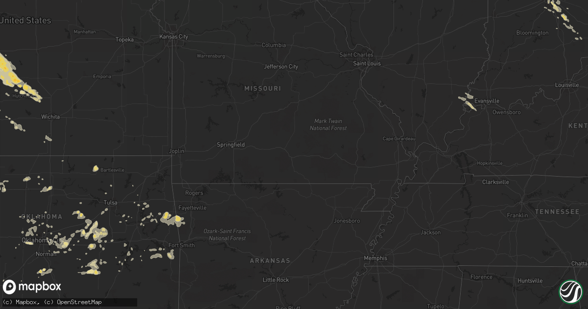
Hail Map in Oklahoma on August 9, 2011
Get this storm
August 9 map
$229
one time, instant access
Download today. No call, no setup
Keep the $229
Bought the map and want the full workflow? Apply the entire $229 to a subscription within 7 days. None of it is wasted.
Every map, not just this one
This buys you this map. Subscription and you get every map we run, in the markets you choose from a few cities to whole states to nationwide. Plus real-time alerts the moment a storm fires.
Contact data
Name, contact info, occupancy, even credit band for addresses in the footprint. You go from where it hit to who to call.
Become the source they trust
Unlimited branding weather history reports on demand. You already have the documented answer ready for the property owner, and you are the one who showed up with it.
Property data and RoofTrace estimates
Pull up any address you have got, its value and the exact code rules for that jurisdiction, straight from One Click Code. Then RoofTrace estimates the squares, pitch, and roof value, priced the way you price.
Storm reports in Oklahoma
Oklahoma
| Date | Description |
|---|---|
| 08/09/20116:22 AM CDT | Pnc asos |
| 08/09/20115:05 AM CDT | Numerous large limbs broken. Estimated wind at over 60 mph. |
| 08/09/20115:05 AM CDT | Trees blown down into roadway |
| 08/09/20115:00 AM CDT | Winds 60 or more. Shook mobile home hard. |
| 08/09/20114:36 AM CDT | Tree down. |
| 08/09/20114:35 AM CDT | Top of a barn lifted and thrown across road. Corner of a roof of a home peeled up. Trees and power poles downed. All along a 3 to 4 mile stretch to the south of atwood. |
| 08/09/20113:36 AM CDT | *** 1 fatal *** mobile home destroyed. One fatality. |
| 08/09/20113:36 AM CDT | Structural damage to house. |
| 08/09/20113:36 AM CDT | Structural damage to mobile home. |
| 08/09/20113:14 AM CDT | Barn roof blown off |
| 08/09/20113:10 AM CDT | Just south of highway 412 in wagoner county off of 4200 road. Large tree branches blocking the road in places. Power lines down. |
| 08/09/20113:10 AM CDT | Wind blew almost all shingles off north side of house down to planking near 81st street and 305. |
| 08/09/20113:10 AM CDT | Outbuildings and garages damaged. Roofs ripped off buildings. |
| 08/09/20112:50 AM CDT | Hard rock hotel sustained damage to outside of building. |
| 08/09/20112:39 AM CDT | Moble home damaged near highway 97 |
| 08/09/20112:20 AM CDT | Tree limbs down at national weather service office. 11th st. And highway 169. |
| 08/09/20112:13 AM CDT | Tree down |
| 08/09/20112:09 AM CDT | Roof partially torn off of school. |
| 08/09/20112:09 AM CDT | Numerous tree limbs down. |
| 08/09/20111:52 AM CDT | Tree down |
| 08/09/20111:45 AM CDT | A local report indicates 62 MPH wind near 3 NNE SPARKS |
| 08/09/20111:40 AM CDT | A local report indicates 67 MPH wind near 3 ENE PAWNEE |
| 08/09/20111:35 AM CDT | A local report indicates 58 MPH wind near 3 NNE SPARKS |
| 08/09/20111:35 AM CDT | A local report indicates 68 MPH wind near CHANDLER |
| 08/09/20111:01 AM CDT | A local report indicates 62 MPH wind near 2 SE GUTHRIE |
| 08/09/20111:00 AM CDT | 6 to 8 inch diameter trees downed along with minor sign damage |
| 08/09/20111:00 AM CDT | Reports of numerous trees down and at least one power pole snapped...along with structural damage to metal outbuildings |
| 08/09/201112:55 AM CDT | Estmiated 70 mph wind gusts along with substantial tree damage |
| 08/09/201112:50 AM CDT | 10 inch diameter trees blown down with damage to street signs along north bryant ave |
| 08/09/201112:42 AM CDT | A local report indicates 60 MPH wind near 2 SW EDMOND |
| 08/09/201112:40 AM CDT | Estimated 60 to 70 mph winds. Small trees and street signs blown down. |
| 08/09/201112:35 AM CDT | A local report indicates 60 MPH wind near CASHION |
| 08/08/201110:55 PM CDT | Estimated 60 mph winds with downed tree limbs |
| 08/08/201110:40 PM CDT | A local report indicates 58 MPH wind near 4 WSW WEATHERFORD |
| 08/08/201110:32 PM CDT | A local report indicates 60 MPH wind near 3 SE HOBART |
| 08/08/201110:05 PM CDT | A local report indicates 58 MPH wind near 10 ENE WILLOW |
| 08/08/20119:05 PM CDT | A local report indicates 58 MPH wind near 6 SW CHEYENNE |
| 08/08/20118:35 PM CDT | Numerous power poles blown down in and around forgan. |
| 08/08/20118:24 PM CDT | A local report indicates 1.50 inch wind near FORGAN |
| 08/08/20118:18 PM CDT | Reported quarter size hail in forgan |
| 08/08/20118:15 PM CDT | A total of five hog farms were damaged by strong winds. Two of the hog farms were significantly damaged with the roofs blown off with damage to the side of the building |
| 08/08/20118:05 PM CDT | 2 outbuildings were destroyed...irrigation equipment overturned...and trees were downed. Estimated 70 mph winds. |
| 08/08/20117:57 PM CDT | A local report indicates 60 MPH wind near 12 W BEAVER |
| 08/08/20117:45 PM CDT | A local report indicates 1.00 inch wind near TURPIN |
All States Impacted by Hail Map on August 9, 2011
Cities Impacted by Hail Map on August 9, 2011
- White Deer, TX
- Claude, TX
- Lewellen, NE
- Lemoyne, NE
- Wheatland, WY
- Glendo, WY
- Guernsey, WY
- Nova, OH
- Imperial, NE
- Wakeeney, KS
- Brownell, KS
- Ransom, KS
- Gray, GA
- Hillsboro, GA
- Sylvester, GA
- Lindsay, OK
- Landenberg, PA
- Montchanin, DE
- Pedricktown, NJ
- Salem, NJ
- Claymont, DE
- Wilmington, DE
- Bear, DE
- Chadds Ford, PA
- Woodstown, NJ
- Avondale, PA
- Penns Grove, NJ
- Yorklyn, DE
- Hockessin, DE
- Rockland, DE
- Kennett Square, PA
- Newark, DE
- Toughkenamon, PA
- Swedesboro, NJ
- New Castle, DE
- Pennsville, NJ
- Selden, KS
- Magee, MS
- Mendenhall, MS
- Vega, TX
- Carmi, IL
- Stratton, NE
- Pampa, TX
- Bloomville, OH
- Republic, OH
- Attica, OH
- Defiance, OH
- Wallace, NE
- Winslow, AR
- Chester, AR
- Venango, NE
- Julesburg, CO
- Pineland, SC
- Garnett, SC
- Grant, NE
- Holyoke, CO
- Jamestown, IN
- New Ross, IN
- North Salem, IN
- Lizton, IN
- Hunter, OK
- Morland, KS
- Forgan, OK
- Mount Vernon, IN
- Wadesville, IN
- New Harmony, IN
- Oshkosh, NE
- Mendon, OH
- Spencerville, OH
- Venedocia, OH
- Rockford, OH
- Ohio City, OH
- New London, OH
- Beaver, OK
- Maysville, OK
- McCook, NE
- Proctor, OK
- Stilwell, OK
- Trenton, NE
- Culbertson, NE
- La Crosse, KS
- Alexander, KS
- Rush Center, KS
- Nekoma, KS
- Douglas, WY
- Midville, GA
- Twin City, GA
- Perryton, TX
- Wapakoneta, OH
- Inman, KS
- Power, MT
- Poteau, OK
- Spiro, OK
- Bokoshe, OK
- Shady Point, OK
- Cameron, OK
- Collyer, KS
- Indianapolis, IN
- Greenwood, IN
- Keota, OK
- Wakarusa, IN
- Bremen, IN
- Mishawaka, IN
- South Bend, IN
- Atwood, KS
- Meridian, MS
- Cushing, OK
- McDonald, KS
- Panhandle, TX
- Green Springs, OH
- Crook, CO
- Benkelman, NE
- Parks, NE
- Hill City, KS
- Penokee, KS
- Lenora, KS
- Gay, GA
- Brule, NE
- Oberlin, KS
- Norcatur, KS
- Indianola, NE
- Danbury, NE
- Lebanon, NE
- Wauneta, NE
- Palisade, NE
- Arthur, NE
- Ashland, OH
- Greenwich, OH
- Chapin, SC
- Hayes Center, NE
- Dix, NE
- Potter, NE
- Harrisburg, NE
- Canehill, AR
- Hawk Springs, WY
- Independence, OH
- Cleveland, OH
- Oklahoma City, OK
- Edmond, OK
- Maywood, NE
- Hoisington, KS
- Russell, KS
- Soperton, GA
- Elsie, NE
- Garrett, WY
- Paxton, NE
- Anton, TX
- Leesburg, GA
- De Soto, GA
- Thermopolis, WY
- Enders, NE
- Lyons, KS
- Hazlehurst, GA
- Swainsboro, GA
- Balko, OK
- Turpin, OK
- Mustang, OK
- El Reno, OK
- Yukon, OK
- Ellis, KS
- Hays, KS
- Paden, OK
- Goshen, IN
- Bonifay, FL
- North Baltimore, OH
- Norton, KS
- Herndon, KS
- Allen, OK
- Holdenville, OK
- Atwood, OK
- St John, KS
- Waynetown, IN
- Okemah, OK
- Amherst, CO
- Hinesville, GA
- Ludowici, GA
- Fort Stewart, GA
- Purcell, OK
- Larned, KS
- Wilmot, OH
- Dundee, OH
- Morrow, AR
- Evansville, AR
- Lincoln, AR
- Gillette, WY
- Hardesty, OK
- Hooker, OK
- Homerville, GA
- Buhler, KS
- Apple Creek, OH
- Farwell, TX
- Texico, NM
- Bovina, TX
- Chappell, NE
- Plainville, KS
- Bluffton, IN
- Monroe, IN
- Decatur, IN
- Metter, GA
- Kimball, NE
- Lyons, GA
- Collins, GA
- Reidsville, GA
- Fremont, OH
- Crescent, OK
- Arcadia, OK
- Dimmitt, TX
- Gorham, KS
- Palco, KS
- Ogallah, KS
- Hoxie, KS
- Victoria, KS
- Barnwell, SC
- Quinter, KS
- Sherwood, OH
- Mark Center, OH
- Wildorado, TX
- Keystone, NE
- Sedgwick, CO
- Wawaka, IN
- Cheyenne, WY
- Westville, FL
- Quitman, MS
- Alpine, TX
- Mooreland, OK
- Chester, OK
- Big Springs, NE
- Ovid, CO
- Vicksburg, MS
- Satartia, MS
- Strasburg, OH
- Dover, OH
- Sugarcreek, OH
- Orrville, AL
- Glenrock, WY
- Logan, KS
- Stockton, KS
- Glade, KS
- Champion, NE
- Enterprise, MS
- Peetz, CO
- Wellington, OH
- Spencer, OH
- Laurel, MS
- Hutchinson, KS
- Charleston, AR
- Cecil, AR
- Ozark, AR
- Otis, KS
- Jennings, KS
- Clayton, KS
- Garfield, GA
- Wadley, GA
- Millen, GA
- Continental, OH
- New Bavaria, OH
- Collins, OH
- Wakeman, OH
- Anna, OH
- Hillsdale, MI
- Osseo, MI
- Lincoln University, PA
- Oxford, PA
- Yoder, WY
- Woodward, OK
- Fort Supply, OK
- Claflin, KS
- Sidney, NE
- Perry, OK
- Spearman, TX
- Spencer, OK
- Osborne, KS
- Waldo, KS
- Torrington, WY
- Veteran, WY
- Adrian, TX
- Hereford, TX
- Lodgepole, NE
- Van Wert, OH
- Convoy, OH
- Masterson, TX
- Channing, TX
- Clinton, AR
- Jerusalem, AR
- Ludell, KS
- Middlebury, IN
- Bristol, IN
- Seville, OH
- Bogue, KS
- Damar, KS
- Calvin, OK
- Lima, OH
- Saint Marys, OH
- Edgerton, OH
- Gibsonburg, OH
- Tiffin, OH
- Clyde, OH
- Borger, TX
- Madill, OK
- Shubuta, MS
- Crawfordsville, IN
- Bedford, OH
- Moultrie, GA
- Alger, OH
- Ada, OH
- Harrod, OH
- Fargo, OK
- Dumas, TX
- Norwalk, OH
- North Fairfield, OH
- Jacksonville, GA
- Broxton, GA
- Homosassa, FL
- Ridgeville, SC
- Ravenel, SC
- Summerville, SC
- Little Rock, MS
- Union, MS
- Wellfleet, NE
- North Platte, NE
- Dennison, OH
- Bowerston, OH
- Talbotton, GA
- Estill, SC
- Minter, AL
- Lavaca, AR
- Skellytown, TX
- Gurley, NE
- Kingman, KS
- Lakeview, OH
- South Bloomingville, OH
- Ladoga, IN
- Pittsboro, IN
- Sasakwa, OK
- New Philadelphia, OH
- Ottawa, OH
- Dickens, NE
- Laurelville, OH
- Bunker Hill, KS
- Greenfield, IN
- Stafford, KS
- Sherrodsville, OH
- Pryor, OK
- Alma, GA
- Maud, OK
- North Vernon, IN
- Butlerville, IN
- Granger, IN
- Rushsylvania, OH
- Bellefontaine, OH
- Macksville, KS
- Sutherland, NE
- Ringwood, OK
- Baxley, GA
- Ashland, KS
- Englewood, KS
- Goodwell, OK
- Newnan, GA
- Sharpsburg, GA
- Moreland, GA
- Senoia, GA
- Greenville, GA
- Luthersville, GA
- Catharine, KS
- Natoma, KS
- Westville, OK
- Dalton, NE
- Angola, IN
- Tahlequah, OK
- Union City, OK
- Park Hill, OK
- Sterling, KS
- Paulding, MS
- Canadian, TX
- Bristow, OK
- Raleigh, MS
- Laverne, OK
- McCracken, KS
- Gruver, TX
- Ashley, IN
- Waterloo, IN
- Hamilton, IN
- Paulding, OH
- Castle, OK
- Locust Grove, OK
- Pachuta, MS
- Elmer, NJ
- Shipshewana, IN
- Sunray, TX
- Forsyth, GA
- Barnesville, GA
- Inola, OK
- Skiatook, OK
- Ramona, OK
- Grove City, OH
- Dresden, KS
- Fostoria, OH
- Porum, OK
- Chase, KS
- Macedonia, OH
- Brecksville, OH
- Northfield, OH
- Ogallala, NE
- Madrid, NE
- Max, NE
- Dorrance, KS
- Bronwood, GA
- Dawson, GA
- Hulbert, OK
- Archbold, OH
- Ridgeville Corners, OH
- Napoleon, OH
- Buffalo, OK
- Rosston, OK
- Pawnee Rock, KS
- Urbana, OH
- Lamar, OK
- Burrton, KS
- Halstead, KS
- Saint Clair Shores, MI
- Eastpointe, MI
- Blackville, SC
- Tecumseh, OK
- Shawnee, OK
- Sayre, OK
- Botkins, OH
- Sardis, AL
- Selma, AL
- Saint Paris, OH
- Mechanicsburg, OH
- Cable, OH
- Kirk, CO
- Brownsburg, IN
- Kaycee, WY
- West Fork, AR
- Thomaston, GA
- Burgoon, OH
- Old Fort, OH
- Bradner, OH
- Risingsun, OH
- Bettsville, OH
- Helena, OH
- Willard, OH
- Kansas, OH
- Bellevue, OH
- Fort Jennings, OH
- Grover Hill, OH
- Middle Point, OH
- Columbus, IN
- Rozel, KS
- Bazine, KS
- Williamson, GA
- Needham, IN
- Franklin, IN
- Groom, TX
- Lavina, MT
- Plains, GA
- Smithville, GA
- Stigler, OK
- Ashby, NE
- East Liberty, OH
- Zanesfield, OH
- Glennville, GA
- Carlisle, SC
- Cope, CO
- Bingham, NE
- Elk City, OK
- Carter, OK
- Uvalda, GA
- Pawhuska, OK
- Sperry, OK
- Portal, GA
- Brandon, MS
- Mansfield, OH
- Shiloh, OH
- Shelby, OH
- Roundup, MT
- Chouteau, OK
- Lewistown, OH
- Jackson Center, OH
- Waverly, KY
- Mcloud, OK
- Woodland, GA
- Lagrange, OH
- Anton, CO
- Wilsonville, NE
- Bridgeport, NE
- Eufaula, OK
- Martin, SC
- Tulsa, OK
- Sapulpa, OK
- Milford, MI
- Logan, OH
- Rockbridge, OH
- Canadian, OK
- Tyler, AL
- Shelbyville, IN
- Hershey, NE
- Harrah, OK
- Wellston, OK
- Luther, OK
- Kremlin, OK
- Mize, MS
- Ellsworth, NE
- Denton, GA
- Nicholls, GA
- West Green, GA
- Memphis, TX
- Curtis, NE
- Bartley, NE
- Stamford, NE
- Beaver City, NE
- Ellinwood, KS
- Woodston, KS
- Alton, KS
- Phillipsburg, KS
- Muenster, TX
- Saint Jo, TX
- Newcastle, WY
- Daleville, AL
- Cameron, SC
- Mcalester, OK
- Clinton, MI
- Tipton, MI
- Little Mountain, SC
- Prosperity, SC
- Port Jefferson, OH
- Maplewood, OH
- Sidney, OH
- Okmulgee, OK
- Rolling Fork, MS
- Ada, OK
- Ligonier, IN
- Bison, KS
- Celina, OH
- Weleetka, OK
- Welling, OK
- Natural Dam, AR
- Bunch, OK
- Prairie Grove, AR
- Boggstown, IN
- Fairland, IN
- Whiteland, IN
- Beech Grove, IN
- Cobbtown, GA
- Vidalia, GA
- Oakwood, OH
- Sylvania, GA
- Fritch, TX
- Boley, OK
- Depew, OK
- Wauseon, OH
- Homerville, OH
- West Salem, OH
- Chancellor, AL
- Flat Rock, IN
- Bird City, KS
- Hamilton, GA
- Sullivan, OH
- Chugwater, WY
- Lizella, GA
- Macon, GA
- Britton, MI
- Milan, MI
- Saline, MI
- Wilmore, KS
- Melvin, AL
- Gilbertown, AL
- Wewoka, OK
- Bushton, KS
- Holyrood, KS
- Geneseo, KS
- Lorraine, KS
- Mount Sterling, OH
- London, OH
- Pomaria, SC
- Stroud, OK
- Drumright, OK
- Skipperville, AL
- Indianola, OK
- Amarillo, TX
- Lower Peach Tree, AL
- Griffin, GA
- Milner, GA
- Wooster, OH
- Jones, OK
- Marion Junction, AL
- Butler, AL
- Jachin, AL
- Roanoke, IN
- Norwich, KS
- Seminole, OK
- Cleo Springs, OK
- Plymouth, OH
- Coldwater, KS
- Polk, OH
- Cunningham, KS
- Billings, OK
- Garber, OK
- Covington, OK
- Wellington, KS
- Angora, NE
- Lisman, AL
- Heidelberg, MS
- Vossburg, MS
- Bluffton, SC
- Lakeland, GA
- Valdosta, GA
- Naylor, GA
- Mena, AR
- Mccurtain, OK
- Haskell, OK
- Porter, OK
- Enigma, GA
- Alapaha, GA
- West Chester, PA
- Wadsworth, OH
- Rittman, OH
- Howe, IN
- Choctaw, OK
- Sea Isle City, NJ
- Thomasville, GA
- Paradise, KS
- Little River, KS
- Wilson, KS
- Raymond, KS
- Prairie View, KS
- Ellsworth, KS
- Alden, KS
- Pfeifer, KS
- Walker, KS
- Cecil, OH
- Woodbury, GA
- Chelsea, OK
- Claremore, OK
- Naubinway, MI
- Fort Gibson, OK
- Muskogee, OK
- Kingfisher, OK
- Auburn, IN
- Madison, FL
- Manchester, MI
- Hendley, NE
- Kinta, OK
- Lakewood, OH
- Shiloh, GA
- Manchester, GA
- Bellaire, MI
- Sparks, OK
- Chandler, OK
- Prague, OK
- Medina, OH
- Lodi, OH
- Mooresville, IN
- Early Branch, SC
- Mulberry, AR
- Navarre, OH
- South Vienna, OH
- Jesup, GA
- Cloverdale, OH
- Stuart, OK
- Vassar, MI
- Caro, MI
- Plevna, KS
- Millington, MI
- Otisville, MI
- Newkirk, OK
- Tifton, GA
- Grass Range, MT
- Forest Grove, MT
- Remus, MI
- Weidman, MI
- Olmitz, KS
- Stringer, MS
- Taylorsville, MS
- Bay Springs, MS
- Ozark, AL
- Aline, OK
- Round O, SC
- Walterboro, SC
- Mason, MI
- Okemos, MI
- Albion, IN
- Lingle, WY
- Fort Laramie, WY
- Allen, MI
- West Bloomfield, MI
- Dellroy, OH
- Sentinel, OK
- Galloway, OH
- West Jefferson, OH
- Greensburg, IN
- Hope, IN
- Columbia City, IN
- Deford, MI
- Cass City, MI
- Milan, GA
- McRae Helena, GA
- Tillman, SC
- Tyrone, OK
- Commerce Township, MI
- Walled Lake, MI
- Social Circle, GA
- Mansfield, GA
- Huntsville, OH
- Black, AL
- Geneva, AL
- Hartford, AL
- Beatrice, AL
- Coweta, OK
- Deshler, OH
- Lenox, GA
- Hartville, WY
- Orangeburg, SC
- Guthrie, OK
- Wetumka, OK
- Ridgeland, SC
- Varnville, SC
- Grosse Pointe, MI
- Stinnett, TX
- Alamo, GA
- Lula, GA
- Pleasant Lake, IN
- Hudson, IN
- Wayne, OK
- Fort Recovery, OH
- Coldwater, OH
- Cygnet, OH
- McComb, OH
- Van Buren, OH
- Bloomdale, OH
- Newalla, OK
- Meeker, OK
- Albin, WY
- Edgemont, SD
- Norman, OK
- Gate, OK
- Liberty Center, OH
- Lindon, CO
- Almena, KS
- Sedgwick, KS
- Haigler, NE
- Utica, KS
- Windom, KS
- Moundridge, KS
- Colby, KS
- Bayard, NE
- Corydon, KY
- Marietta, OK
- Elkhart, IN
- West Point, GA
- Wallingford, PA
- Glen Mills, PA
- Swarthmore, PA
- Cheyney, PA
- Media, PA
- Thornton, PA
- Aston, PA
- Brookhaven, PA
- Belle Center, OH
- Holton, IN
- Columbia, SC
- Brooks, GA
- Westport, IN
- Arcadia, OH
- Findlay, OH
- Lisco, NE
- Edison, GA
- Willacoochee, GA
- Clovis, NM
- Melrose, OH
- Bridgeton, NJ
- Lyman, NE
- Redbird, OK
- Amanda, OH
- Nickerson, KS
- Mendon, MI
- Arapaho, OK
- Norman Park, GA
- Ladson, SC
- Claxton, GA
- Briscoe, TX
- Jonesville, MI
- Doerun, GA
- Minco, OK
- Bryan, OH
- Gainesville, TX
- Whitesboro, TX
- Thackerville, OK
- West Liberty, OH
- North Lewisburg, OH
- Hogansville, GA
- Lagrange, GA
- Soso, MS
- Nashville, GA
- Abbyville, KS
- Canton, MS
- Kendallville, IN
- Corunna, IN
- Avilla, IN
- Lagrange, IN
- Mineral City, OH
- Magnolia, OH
- Mauk, GA
- Cary, MS
- Hamler, OH
- Leipsic, OH
- Lawton, OK
- Elgin, OK
- Lancaster, OH
- Sugar Grove, OH
- Rose Hill, MS
- Wellington, TX
- Turon, KS
- Custer City, OK
- Clinton, OK
- Bartow, GA
- Kite, GA
- Fairhope, AL
- Carmen, OK
- Helena, OK
- Piedmont, OK
- Saint Francis, KS
- Konawa, OK
- Joes, CO
- Fountaintown, IN
- New Palestine, IN
- Mount Pleasant, MI
- Huntsville, AR
- Hindsville, AR
- Cashion, OK
- Rutledge, GA
- Silverwood, MI
- Mayville, MI
- Ray City, GA
- Hawkinsville, GA
- Jerome, MI
- Waynoka, OK
- Henryetta, OK
- Sweet Water, AL
- Columbus Grove, OH
- Butler, IN
- Sycamore, OH
- McCutchenville, OH
- Pearson, GA
- Pond Creek, OK
- Enid, OK
- Payne, OH
- Woodburn, IN
- Antwerp, OH
- Springfield, GA
- Rincon, GA
- Marlow, OK
- Dardanelle, AR
- Galena, OH
- Edinburgh, IN
- Rockwood, MI
- Flat Rock, MI
- Yale, OK
- South Whitley, IN
- Elkton, MD
- Bluffton, OH
- Topeka, IN
- Ellisville, MS
- Sterling, OH
- Poulan, GA
- Hartsville, IN
- Athens, OH
- Peggs, OK
- Spivey, KS
- Onsted, MI
- Omega, GA
- Statesboro, GA
- Wolcottville, IN
- Miami, TX
- Williamston, MI
- Quinton, OK
- Kellyville, OK
- Stockville, NE
- Forestburg, TX
- Rocky River, OH
- Protection, KS
- Silas, AL
- Waynesboro, MS
- De Graff, OH
- Broadview Heights, OH
- Saint Henry, OH
- Ney, OH
- Hartsfield, GA
- Bargersville, IN
- Whitney, NE
- Hudson, KS
- Chunky, MS
- Stonewall, MS
- Garryowen, MT


