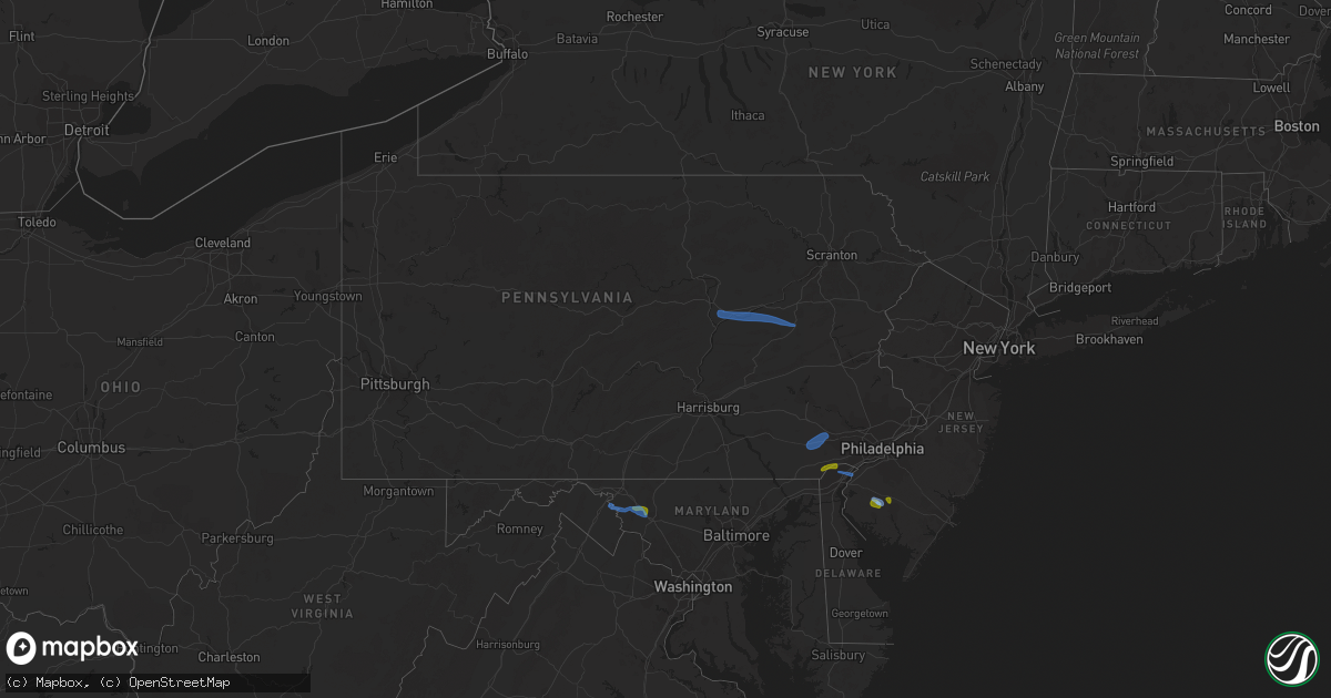
Hail Map in Pennsylvania on August 7, 2020
Get this storm
August 7 map
$229
one time, instant access
Download today. No call, no setup
Keep the $229
Bought the map and want the full workflow? Apply the entire $229 to a subscription within 7 days. None of it is wasted.
Every map, not just this one
This buys you this map. Subscription and you get every map we run, in the markets you choose from a few cities to whole states to nationwide. Plus real-time alerts the moment a storm fires.
Contact data
Name, contact info, occupancy, even credit band for addresses in the footprint. You go from where it hit to who to call.
Become the source they trust
Unlimited branding weather history reports on demand. You already have the documented answer ready for the property owner, and you are the one who showed up with it.
Property data and RoofTrace estimates
Pull up any address you have got, its value and the exact code rules for that jurisdiction, straight from One Click Code. Then RoofTrace estimates the squares, pitch, and roof value, priced the way you price.
Storm reports in Pennsylvania
Pennsylvania
| Date | Description |
|---|---|
| 08/07/20205:50 PM CDT | Several trees and wires reported down in the area of yardley and woodside. Time estimated from radar. |
| 08/07/20205:15 PM CDT | Several trees down across the southern portion of delaware county. Time estimated from radar. |
| 08/07/20204:50 PM CDT | Tree reported down at black horse rd in west vincent township. Time estimated from dispatch. |
| 08/07/20204:40 PM CDT | Downed tree in wires on westtown thornton road and five points road. Time estimated from radar. |
| 08/07/20204:12 PM CDT | Several trees and poles down just north of fisherville road. Time estimated from radar. |
| 08/07/20204:08 PM CDT | Several trees down along portions of route 41. Time estimated from radar. |
| 08/07/20204:05 PM CDT | Tree blown down blocking southbound lane at the intersection of limestone rd and gap newport pike. Time estimated from radar. |
| 08/07/20204:03 PM CDT | Downed tree into wires on pa 472 near oxford. Time estimated from radar. |
| 08/07/20204:02 PM CDT | Down tree in wires on old wilmington road and oak street. Time estimated from radar. |
| 08/07/202010:50 AM CDT | Trees down along a recreational trail just south of reeds gap state park. |
| 08/07/20209:18 AM CDT | Trees down on wires. |
| 08/07/20209:14 AM CDT | Trees down on wires on old reading road and creek road. |
| 08/07/20209:00 AM CDT | Point township drive-in theater screen blew over reported at point township... Pa. |
| 08/07/20208:55 AM CDT | Multiple trees and wires down. Reported at mountour and columbia county. |
| 08/07/20208:42 AM CDT | Trees down on road reported at 300 block legion rd montour county. |
| 08/07/20208:30 AM CDT | Multiple large trees down on ave f. |
| 08/07/20207:20 AM CDT | Multiple trees down alongside interstate 80 near mile marker 197. |
| 08/07/20206:37 AM CDT | At 1137 AM EDT, a severe thunderstorm was located over Milroy, moving east at 15 mph. HAZARD...60 mph wind gusts and quarter size hail. SOURCE...Radar indicated. IMPACT...Hail damage to vehicles is expected. Expect wind damage to trees, roofs, and siding. Locations impacted include... Milroy, Reedsville, Alfarata, Belltown, Seven Mountains, Reeds Gap State Park, Wagner and Siglerville. |
| 08/07/20205:34 AM CDT | At 1033 AM EDT, a severe thunderstorm was located over Sheppton, or near Mahanoy City, moving east at 30 mph. HAZARD...60 mph wind gusts and penny size hail. SOURCE...Radar indicated. IMPACT...Damage to roofs, siding, trees, and power lines is possible. Locations impacted include... Lehighton, Palmerton, Jim Thorpe, Slatington, Nesquehoning, Weatherly, New Mahoning, Beltzville State Park, New Tripoli, Jordan Valley, Emerald, Lansford, Summit Hill, Bowmanstown, Beaver Meadows, Parryville, Weissport, Weissport East and Tresckow.This includes Northeast Extension between mile markers 69 and 85. |
| 08/07/20205:16 AM CDT | At 1015 AM EDT, a severe thunderstorm was located over Shumans, or 8 miles south of Berwick, moving east at 25 mph. HAZARD...60 mph wind gusts and quarter size hail. SOURCE...Radar indicated. IMPACT...Hail damage to vehicles is expected. Expect wind damage to roofs, siding, and trees. Locations impacted include... Hazleton, West Hazleton, Conyngham, Rock Glen, Weston, Ashmore, Deringer, Jeanesville, Fern Glen and Stockton. |
| 08/07/20205:10 AM CDT | At 1009 AM EDT, a severe thunderstorm was located over Shumans, moving east at 25 mph. HAZARD...60 mph wind gusts. SOURCE...Trained weather spotters. IMPACT...Expect damage to trees, roofs, and siding. Locations impacted include... Tamaqua, Shenandoah, Mahanoy City, Mcadoo, Hometown, Mifflinville, Almedia, Oneida, Grier City-Park Crest, Delano, Nuremburg, Numidia, Sheppton, Brandonville, Coaldale, Slabtown, Mainville, Shumans, Espy and Shenandoah Heights.For those driving on Interstate 80, this includes areas between theBloomsburg-Light Street and Nescopek exits, specifically near milemarker 237...and from mile markers 242 to 247.This includes Interstate 81 from mile markers 131 to 139. |
| 08/07/20203:08 AM CDT | At 808 AM EDT, a severe thunderstorm was located near Carroll, moving east at 25 mph. HAZARD...60 mph wind gusts and quarter size hail. SOURCE...Radar indicated. IMPACT...Hail damage to vehicles is expected. Expect wind damage to trees, roofs, and siding. Locations impacted include... Lewisburg, Linntown, New Columbia, Allenwood, Elimsport, Forest Hill, Sand Bridge State Park, R.B. Winter State Park, Spruce Run Reservoir, West Milton and Bucknell.For those driving on Interstate 80, this includes areas between theJersey Shore and Milton-Williamsport exits, specifically from milemarkers 195 to 210. |
| 08/07/20202:26 AM CDT | At 725 AM EDT, a severe thunderstorm was located over Mill Hall, moving east at 20 mph. HAZARD...Quarter size hail. SOURCE...Radar indicated. IMPACT...Damage to vehicles is expected. Locations impacted include... Lock Haven, Carroll, Lamar, Mill Hall, Avis, Dunnstown, Flemington, Castanea, McElhattan, Mackeyville, Beech Creek, Loganton and Lock Haven University.For those driving on Interstate 80, this includes areas between theBellefonte and Mile Run exits, specifically from mile markers 171 to194. |
| 08/07/20201:39 AM CDT | At 638 PM EDT, a severe thunderstorm was located over Washington Crossing, or 8 miles northwest of Trenton, moving southeast at 20 mph. HAZARD...60 mph wind gusts and quarter size hail. SOURCE...Radar indicated. IMPACT...Minor damage to vehicles is possible. Wind damage to roofs, siding, trees, and power lines is possible. Locations impacted include... Trenton, Ewing, Princeton, Florence, Bordentown, Pennington, New Hope, Yardley, Newtown, Tullytown, Langhorne, Washington Crossing, Windsor, Florence-Roebling, Woodside, Georgetown, Richboro, Edinburg, Crosswicks and White Horse.This includes the following highways... New Jersey Turnpike between exits 6 and 8. Pennsylvania Turnpike between mile markers 358 and 359. Interstate 195 in New Jersey between mile markers 0 and 7. Interstate 295 in New Jersey between mile markers 52 and 76. |
All States Impacted by Hail Map on August 7, 2020
Cities Impacted by Hail Map on August 7, 2020
- Solway, MN
- Bagley, MN
- Shevlin, MN
- Naytahwaush, MN
- Cass Lake, MN
- Park Rapids, MN
- Laporte, MN
- Walker, MN
- Lake George, MN
- Ogema, MN
- Bena, MN
- Waubun, MN
- Grand Rapids, MN
- Goodland, MN
- Hibbing, MN
- Cohasset, MN
- Deer River, MN
- Bovey, MN
- Remer, MN
- Warba, MN
- Beulah, ND
- Zap, ND
- Hazen, ND
- Hebron, ND
- Glen Ullin, ND
- New Salem, ND
- Almont, ND
- Flasher, ND
- Carson, ND
- Raleigh, ND
- Upham, ND
- Kramer, ND
- Bottineau, ND
- Hockessin, DE
- Avondale, PA
- Landenberg, PA
- Kennett Square, PA
- Chadds Ford, PA
- Wilmington, DE
- Yorklyn, DE
- Elmer, NJ
- Bridgeton, NJ
- Vineland, NJ
- Newfield, NJ
- Ulen, MN
- Twin Valley, MN
- Nevis, MN
- Akeley, MN
- Hackensack, MN
- Backus, MN
- Osage, MN
- Mcadoo, PA
- Catawissa, PA
- Riverside, PA
- Hazleton, PA
- Sheppton, PA
- Zion Grove, PA
- Ringtown, PA
- Northumberland, PA
- Bloomsburg, PA
- Danville, PA
- Downingtown, PA
- Coatesville, PA
- Thorndale, PA
- Parkesburg, PA
- Glenmoore, PA
- Exton, PA
- Pedricktown, NJ
- Penns Grove, NJ
- Frederick, MD
- Middletown, MD
- Myersville, MD
- Statesboro, GA
- Buckhead, GA
- Greensboro, GA
- Deadwood, SD
- Lead, SD
- Keedysville, MD
- Boonsboro, MD
- Shepherdstown, WV
- Sharpsburg, MD
- Martinsburg, WV
- Williamsport, MD
- Karlstad, MN
- Kennedy, MN
- Ponsford, MN
- Palisade, MN
- Swatara, MN
- Greeley, KS
- Lane, KS
- Richmond, KS
- Franklin, WV
- Riverton, WV
- Circleville, WV
- Osteen, FL
- Geneva, FL
- Albany, MO
- Marcus Hook, PA
- Claymont, DE
- Swedesboro, NJ
- Webbers Falls, OK
- Vian, OK
- Porum, OK
- Neche, ND
- Walhalla, ND
- Gordon, WI
- Vassar, KS
- Quenemo, KS
- Pomona, KS
- Mahnomen, MN
- Dupree, SD
- Underwood, ND
- Stanton, ND
- Park Falls, WI
- Butternut, WI
- Cromwell, MN
- Mcgregor, MN
- Sturgeon Lake, MN
- Kettle River, MN
- Barnum, MN
- McGrath, MN
- Tamarack, MN
- Moose Lake, MN
- Milroy, PA
- Phillips, WI
- Madison, GA
- Keyes, OK
- Morton, TX
- Levelland, TX
- Ruso, ND
- Benedict, ND
- Clarkfield, MN
- Montevideo, MN
- Cochranville, PA
- Morristown, SD
- Keldron, SD
- Lemmon, SD
- Hill City, SD
- Aitkin, MN
- Pennington, MN
- Bemidji, MN
- Carrollton, MO
- Boyd, MN
- Minong, WI
- Williston, SC
- Lodgepole, SD
- Hatley, WI
- Lewisburg, PA
- Springfield, GA
- Waskish, MN
- Kelliher, MN
- Max, ND
- Oviedo, FL
- Enochs, TX
- Mifflinburg, PA
- Loganton, PA
- Amarillo, TX
- Muleshoe, TX
- Douglas, ND
- Rebersburg, PA
- Atglen, PA
- Ottawa, KS
- Amherst, TX
- Selfridge, ND
- Woodstown, NJ
- Franklinville, NJ
- Glassboro, NJ
- Mullica Hill, NJ
- Monroeville, NJ
- Pequot Lakes, MN
- Langdon, ND
- Emily, MN
- Pine River, MN
- Crosslake, MN
- Crosby, MN
- McFall, MO
- Watauga, SD
- McIntosh, SD
- Kingston, MO
- Hamilton, MO
- Rose, OK
- Peggs, OK
- Pembroke, NC
- Lumberton, NC
- Edgewood, MD
- Upper Falls, MD
- Joppa, MD
- Kingsville, MD
- Hopkins, SC
- Stigler, OK
- South Range, WI
- Lugoff, SC
- Berryton, KS
- Kenansville, FL
- Garrison, ND
- Mud Butte, SD
- Chester, PA
- Bathgate, ND
- Meadow, SD
- Hydes, MD
- Glen Arm, MD
- Eastover, SC
- Muskogee, OK
- Gore, OK
- Aston, PA
- Garnet Valley, PA
- Glen Mills, PA
- Bison, SD
- Rockland, DE
- Montchanin, DE
- Brookhaven, PA
- Hulbert, OK
- Tahlequah, OK
- Strandquist, MN
- Outing, MN
- Hayward, WI
- Tripoli, WI
- Maysville, MO
- King City, MO
- Norborne, MO
- Rapid City, SD
- Le Roy, KS
- Slater, MO
- New Bern, NC
- Blythewood, SC
- Elgin, SC
- Winter Garden, FL
- Aiken, SC
- Clewiston, FL
- Okeechobee, FL
- Drayton, ND
- Hallock, MN
- Danbury, WI
- Rozet, WY
- Tomahawk, WI
- Kennan, WI
- Malaga, NJ
- Bridgeport, NJ
- Toughkenamon, PA
- West Chester, PA
- Newark, DE
- Alloway, NJ
- West Grove, PA
- Clayton, NJ
- Calpine, CA
- Faison, NC
- Paola, KS
- Bennettsville, SC
- Burlington, KS
- Gridley, KS
- Dearing, GA
- Hephzibah, GA
- Blythe, GA
- Varnville, SC
- Estill, SC
- Saint Thomas, ND
- Bantry, ND
- Deering, ND
- Middle River, MN
- Elgin, ND
- Solon Springs, WI
- Quarryville, PA
- Christiana, PA
- Paradise, PA
- Granite Falls, MN
- Hanley Falls, MN
- Echo, MN
- Wood Lake, MN
- Havre De Grace, MD
- Aberdeen, MD
- Manheim, PA
- Bel Air, MD
- Churchville, MD
- Osawatomie, KS
- Tecumseh, KS
- Lecompton, KS
- Newton Grove, NC
- Williamsburg, KS
- Johnsonville, SC
- Mayesville, SC
- Register, GA
- Towner, ND
- Goodridge, MN
- Wright, MN
- McLaughlin, SD
- New Leipzig, ND
- Lawrence, KS
- Pattonsburg, MO
- Prentice, WI
- Rosendale, MO
- Savannah, MO
- Sierraville, CA
- Burlingame, KS
- Lyndon, KS
- Scranton, KS
- Newark, MD
- Snow Hill, MD
- Mount Olive, NC
- Coffeyville, KS
- Independence, KS
- Waverly, KS
- Hartsville, SC
- Interlachen, FL
- Galivants Ferry, SC
- Mullins, SC
- Nichols, SC
- Springfield, SC
- Salley, SC
- Gadsden, SC
- Cloquet, MN
- Kaycee, WY
- Waverly, MO
- Harveyville, KS
- Phoenix, MD
- Cameron, MO
- Kidder, MO
- Pelion, SC
- Winder, GA
- Statham, GA
- Maxton, NC
- McColl, SC
- Fort Myers, FL
- De Leon Springs, FL
- Gary, MN
- Wrenshall, MN
- Carlton, MN
- Bejou, MN
- Princeton, KS
- Keota, OK
- Greenville, NC
- Shelby, NC
- Manning, SC
- Columbia, SC
- Loris, SC
- Green Sea, SC
- East Palatka, FL
- Palatka, FL
- Elloree, SC
- Neeses, SC
- Lathrop, MO
- Fifty Lakes, MN
- Sandstone, MN
- Osborn, MO
- Parker, KS
- Zebulon, NC
- Wendell, NC
- Garnett, KS
- Rohrersville, MD
- Fairplay, MD
- Blackville, SC
- Red Springs, NC
- Shannon, NC
- Guyton, GA
- Crescent City, FL
- Deltona, FL
- Blackduck, MN
- Hitterdal, MN
- Gillette, WY
- Dundalk, MD
- Middle River, MD
- Edgerton, KS
- Benedict, KS
- Thayer, KS
- Altoona, KS
- Rockingham, NC
- Cameron, SC
- Orlando, FL
- Sundance, WY
- Sauk Centre, MN
- Jameson, MO
- Dawson, MN
- Chanute, KS
- Gainesville, FL
- Altha, FL
- Kinston, NC
- Bishopville, SC
- Swainsboro, GA
- Pierson, FL
- Bunnell, FL
- Osage City, KS
- Gap, PA
- Clio, SC
- Shields, ND
- Linton, ND
- Lexington, SC
- Orangeburg, SC
- Nottingham, MD
- Perry Hall, MD
- White Marsh, MD
- Fork, MD
- Fallston, MD
- Baldwin, MD
- Hartford, KS
- Bowman, SC
- Callahan, FL
- Helena, MO
- Union Star, MO
- Media, PA
- Pasadena, MD
- Thonotosassa, FL


