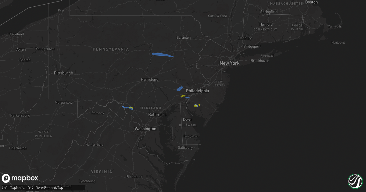
Hail Map on August 7, 2020
Get this storm
August 7 map
$229
one time, instant access
Download today. No call, no setup
Keep the $229
Bought the map and want the full workflow? Apply the entire $229 to a subscription within 7 days. None of it is wasted.
Every map, not just this one
This buys you this map. Subscription and you get every map we run, in the markets you choose from a few cities to whole states to nationwide. Plus real-time alerts the moment a storm fires.
Contact data
Name, contact info, occupancy, even credit band for addresses in the footprint. You go from where it hit to who to call.
Become the source they trust
Unlimited branding weather history reports on demand. You already have the documented answer ready for the property owner, and you are the one who showed up with it.
Property data and RoofTrace estimates
Pull up any address you have got, its value and the exact code rules for that jurisdiction, straight from One Click Code. Then RoofTrace estimates the squares, pitch, and roof value, priced the way you price.
States Impacted by Hail Map on August 7, 2020
Storm reports
West Virginia
| Date | Description |
|---|---|
| 08/07/20203:22 PM CDT | A tree was down along veterans memorial highway in ridgeley. |
| 08/07/202012:40 AM CDT | At 540 PM EDT, a severe thunderstorm was located near Franklin, moving northeast at 20 mph. HAZARD...60 mph wind gusts and quarter size hail. SOURCE...Radar indicated. IMPACT...Damaging winds will cause some trees and large branches to fall. This could injure those outdoors, as well as damage homes and vehicles. Roadways may become blocked by downed trees. Localized power outages are possible. Unsecured light objects may become projectiles. Locations impacted include... Franklin, Upper Tract, Ruddle, Deer Run, Oak Flat and Brushy Run. |
| 08/07/202012:15 AM CDT | At 514 PM EDT, a severe thunderstorm was located 9 miles west of Franklin, moving northeast at 15 mph. HAZARD...60 mph wind gusts and quarter size hail. SOURCE...Radar indicated. IMPACT...Damaging winds will cause some trees and large branches to fall. This could injure those outdoors, as well as damage homes and vehicles. Roadways may become blocked by downed trees. Localized power outages are possible. Unsecured light objects may become projectiles. Locations impacted include... Franklin, Circleville, Riverton and Cherry Grove. |
| 08/06/202011:53 PM CDT | At 453 PM EDT, a severe thunderstorm was located near Westernport, moving southeast at 15 mph. HAZARD...60 mph wind gusts. SOURCE...Radar indicated. IMPACT...Damaging winds will cause some trees and large branches to fall. This could injure those outdoors, as well as damage homes and vehicles. Roadways may become blocked by downed trees. Localized power outages are possible. Unsecured light objects may become projectiles. Locations impacted include... Keyser, Westernport, Fort Ashby, Barton, Franklin, Mccoole, Reeses Mill, Dogwood Flats, Reynolds and Headsville. |
| 08/06/202011:26 PM CDT | At 426 PM EDT, severe thunderstorms were located along a line extending from Ridgeley to near Bel Air, moving east at 15 mph. HAZARD...60 mph wind gusts. SOURCE...Radar indicated. IMPACT...Damaging winds will cause some trees and large branches to fall. This could injure those outdoors, as well as damage homes and vehicles. Roadways may become blocked by downed trees. Localized power outages are possible. Unsecured light objects may become projectiles. Locations impacted include... Cumberland, Frostburg, Bel Air, La Vale, Fort Ashby, Lonaconing, Ridgeley, Cresaptown, Potomac Park, Wiley Ford, Eckhart Mines, Rawlings, Barton, Midland, Midlothian, Woodland, Spring Gap, Patterson Creek, Pinto and Short Gap. |
| 08/06/20209:08 PM CDT | At 207 PM EDT, a severe thunderstorm was located near Williamsport, or near Shepherdstown, moving east at 20 mph. HAZARD...60 mph wind gusts and quarter size hail. SOURCE...Radar indicated. IMPACT...Damaging winds will cause some trees and large branches to fall. This could injure those outdoors, as well as damage homes and vehicles. Roadways may become blocked by downed trees. Localized power outages are possible. Unsecured light objects may become projectiles. Locations impacted include... Boonsboro, Mount Aetna, Mount Lena, San Mar, Wolfsville, Saint James, Myersville, Keedysville, Sharpsburg, Fairplay, Rohrersville, Pleasant Walk, Bolivar and Middletown In Frederick Md. |
South Carolina
| Date | Description |
|---|---|
| 08/07/20203:20 PM CDT | Steeple blow off and shingles ripped off longtown presbyterian church. Time estimated from radar. |
| 08/06/202011:34 PM CDT | At 434 PM EDT, severe thunderstorms were located along a line extending from near Shawnee to near Nevils, moving northwest at 5 mph. HAZARD...60 mph wind gusts and quarter size hail. SOURCE...Radar indicated. IMPACT...Minor hail damage to vehicles is possible. Expect wind damage to trees and powerlines. Locations impacted include... Statesboro, Springfield, Guyton, Brooklet, Oliver, Register, Egypt, Shawnee, Nevils, Georgia Southern, Denmark, Leefield, Clyo, Kildare and Stilson.This warning includes I-16 between mile markers 117 and 128. |
North Carolina
| Date | Description |
|---|---|
| 08/07/20203:51 AM CDT | At 851 PM EDT, severe thunderstorms were located along a line extending from 16 miles west of Lincolnton to 6 miles south of Shelby to 6 miles south of Gaffney, moving east at 15 mph. HAZARD...60 mph wind gusts and quarter size hail. SOURCE...Radar indicated. IMPACT...Minor hail damage to vehicles is expected. Expect wind damage to trees and power lines. Locations impacted include... Shelby, Gaffney, Lincolnton, Kings Mountain, Cherryville, Bessemer City, Boiling Springs NC, Blacksburg, Belwood and Grover. |
| 08/07/20201:58 AM CDT | At 657 PM EDT, a severe thunderstorm was located near Fairmont, or 13 miles east of Dillon, moving east at 25 mph. HAZARD...60 mph wind gusts. SOURCE...Radar indicated. IMPACT...Expect wind damage to trees and power lines. Locations impacted include... Lumberton, Fairmont, Boardman, Hestertown, Barnesville, Marietta, Proctorville, Orrum and Southeastern Regional Medical Center. |
Maryland
| Date | Description |
|---|---|
| 08/07/20206:44 PM CDT | Delayed report. Wind-blown debris closed state highway 302 near bear pond road. Time estimated from radar. |
| 08/07/20206:44 PM CDT | Tree down on the 900 block of west jarrettsville road |
| 08/07/20206:38 PM CDT | Tree down in the 1100 block of clayton road |
| 08/07/20206:21 PM CDT | Delayed report. Wind-blown debris closed state highway 292 near state highway 566. Time estimated from radar. |
| 08/07/20206:08 PM CDT | Tree limbs and powerlines down on the 300 block of regina drive |
| 08/07/20205:58 PM CDT | Tree down across roadway at the intersection of singer rd and winters run rd. |
| 08/07/20205:18 PM CDT | Tree across wires near 12 chesapeake ct. |
| 08/07/20205:14 PM CDT | Trees down on us-1 belair road near new cut road. Trees down on md-152 fallston road near connolly road. |
| 08/07/20205:10 PM CDT | Large tree down blocking the roadway on park forrest lane. |
| 08/07/20204:58 PM CDT | Tree down across roadway near 711 w jarrettsville rd. |
| 08/07/20203:27 PM CDT | Report of tree damage on private property near the railroad tracks in cumberland. |
| 08/07/20202:11 PM CDT | Tree down near the overpass of harmony road and route 40 |
| 08/07/20202:04 PM CDT | Tree down near the intersection of myersville road and bidle hill court |
| 08/07/20201:57 PM CDT | Measured near mile-marker 46 on i-70 near middletown... Md |
| 08/07/20201:56 PM CDT | A local report indicates 1.00 inch wind near 2 SSE MYERSVILLE |
| 08/07/20201:54 PM CDT | Tree down on the 1700 block of old national pike |
| 08/07/20201:52 PM CDT | Multiple trees down on us-40 baltimore national pike near harmony road and on md-17 myersville road at near ventrie court. |
| 08/07/20201:40 PM CDT | Wires down on tilghmanton rd |
| 08/07/20201:21 PM CDT | Trees down on md-65 sharpsburg pike near dunker church road. |
| 08/07/20202:04 AM CDT | At 704 PM EDT, a severe thunderstorm was located near Warwick, or near Middletown, moving east at 30 mph. HAZARD...60 mph wind gusts. SOURCE...Radar indicated. IMPACT...Damage to roofs, siding, trees, and power lines is possible. Locations impacted include... Dover, Middletown, Smyrna, Clayton, Cheswold, Cecilton, Millington, Sudlersville, Betterton, Hartly, Warwick, Woodland Beach, Bohemias Mills, Port Penn, Delaney Corner, Crumpton, Sassafras, Mount Pleasant, Green Spring and Cayots. |
| 08/07/20201:12 AM CDT | At 612 PM EDT, severe thunderstorms were located along a line extending from Kingsville to Carney, moving east at 20 mph. HAZARD...60 mph wind gusts. SOURCE...Radar indicated. IMPACT...Damaging winds will cause some trees and large branches to fall. This could injure those outdoors, as well as damage homes and vehicles. Roadways may become blocked by downed trees. Localized power outages are possible. Unsecured light objects may become projectiles. Locations impacted include... Middle River, Towson, Bel Air South, Parkville, Carney, Perry Hall, Rossville, White Marsh, Bowleys Quarters, Hampton, Kingsville, Pleasant Hills, Edgewood, Joppatowne, Nottingham, Fork, Bradshaw, Joppa, Martin State Airport and Upper Falls. |
| 08/07/20201:12 AM CDT | At 611 PM EDT, a severe thunderstorm was located over Aberdeen, moving east at 30 mph. HAZARD...60 mph wind gusts. SOURCE...Radar indicated. IMPACT...Damage to roofs, siding, trees, and power lines is possible. Locations impacted include... Dover, Middletown, Elkton, Smyrna, North East, Clayton, Delaware City, Cheswold, Charlestown, Cecilton, Millington, Betterton, Hartly, Warwick, Woodland Beach, Bohemias Mills, Port Penn, Brantwood, Delaney Corner and Crumpton.This includes Interstate 95 in Maryland between mile markers 91 and99. |
| 08/07/20201:04 AM CDT | At 603 PM EDT, a severe thunderstorm was located over Riverside, or near Aberdeen, moving east at 15 mph. HAZARD...60 mph wind gusts. SOURCE...Radar indicated. IMPACT...Damaging winds will cause some trees and large branches to fall. This could injure those outdoors, as well as damage homes and vehicles. Roadways may become blocked by downed trees. Localized power outages are possible. Unsecured light objects may become projectiles. Locations impacted include... Aberdeen, Havre De Grace, Aberdeen Proving Ground, Bel Air South, Riverside, Perryman, Edgewood, Churchville, Harford Furnace, Abingdon, Carsins and Belcamp. |
| 08/07/202012:38 AM CDT | At 538 PM EDT, a severe thunderstorm was located over Kennett Square, or 7 miles southwest of West Chester, moving east at 20 mph. HAZARD...60 mph wind gusts and quarter size hail. SOURCE...Radar indicated. IMPACT...Minor damage to vehicles is possible. Wind damage to roofs, siding, trees, and power lines is possible. Locations impacted include... Philadelphia, Wilmington, Newark, West Chester, Chester, Pennsville, Westtown, Carneys Point, Downingtown, Conshohocken, Swarthmore, Elsmere, Kennett Square, New Castle, Penns Grove, Narberth, West Grove, Newport, Arden and Stanton.This includes the following highways... Pennsylvania Turnpike between mile markers 316 and 317. Interstate 95 in Pennsylvania between mile markers 0 and 4. Interstate 95 in Delaware between mile markers 7 and 23. Interstate 76 in Pennsylvania between mile markers 328 and 337. Interstate 476 in Pennsylvania between mile markers 2 and 17. |
| 08/07/202012:36 AM CDT | At 536 PM EDT, severe thunderstorms were located along a line extending from near Bel Air North to near Cockeysville, moving east at 15 mph. HAZARD...60 mph wind gusts. SOURCE...Radar indicated. IMPACT...Damaging winds will cause some trees and large branches to fall. This could injure those outdoors, as well as damage homes and vehicles. Roadways may become blocked by downed trees. Localized power outages are possible. Unsecured light objects may become projectiles. Locations impacted include... Cockeysville, Bel Air South, Bel Air North, Timonium, Fallston, Hampton, Kingsville, Pleasant Hills, Jarrettsville, Lutherville-Timonium, Darlington, Glen Arm, Fork, Churchville, Long Green, Forest Hill, Phoenix, Street, Jacksonville and Hickory. |
| 08/07/202012:03 AM CDT | At 503 PM EDT, a severe thunderstorm was located near Fort Ashby, or 10 miles southeast of Bel Air, moving east at 10 mph. HAZARD...60 mph wind gusts and quarter size hail. SOURCE...Radar indicated. IMPACT...Damaging winds will cause some trees and large branches to fall. This could injure those outdoors, as well as damage homes and vehicles. Roadways may become blocked by downed trees. Localized power outages are possible. Unsecured light objects may become projectiles. Locations impacted include... Paw Paw, Springfield, Green Spring, Oldtown, Points, Three Churches, Levels, Higginsville and Wagoner. |
| 08/07/202012:00 AM CDT | At 459 PM EDT, a severe thunderstorm was located over Parkesburg, or 12 miles southeast of New Holland, moving east at 15 mph. HAZARD...60 mph wind gusts. SOURCE...Radar indicated. IMPACT...Damage to roofs, siding, trees, and power lines is possible. Locations impacted include... West Chester, Coatesville, Downingtown, Kennett Square, Oxford, Parkesburg, West Grove, Honey Brook, Homeville, Glen Roy, Cochranville, Mount Vernon, Marshallton, Lionville-Marchwood, Glenmoore, Paoli, Lionville, Ladenberg, Kemblesville and North Star.This includes Pennsylvania Turnpike between mile markers 307 and 323. |
| 08/06/20209:48 PM CDT | At 247 PM EDT, a severe thunderstorm was located near Boonsboro, or 8 miles northwest of Frederick, moving east at 20 mph. HAZARD...65 mph wind gusts and half dollar size hail. SOURCE...Radar indicated. IMPACT...Damaging winds will cause some trees and large branches to fall. This could injure those outdoors, as well as damage homes and vehicles. Roadways may become blocked by downed trees. Localized power outages are possible. Unsecured light objects may become projectiles. Locations impacted include... Frederick, Thurmont, Harry Grove Stadium, Ballenger Creek, Mount Airy, Walkersville, Braddock Heights, New Market, Clover Hill, Discovery-Spring Garden, Linganore-Bartonsville, New Windsor, Woodsboro, Union Bridge, Libertytown, Monrovia, New Midway, Utica, Linwood and Uniontown. |
Minnesota
| Date | Description |
|---|---|
| 08/07/20206:30 PM CDT | Trees down hwy 71 and glidden rd |
| 08/07/20206:25 PM CDT | A few poplar trees snapped around lake minnie. Report posted via social media. Time estimated based on radar. |
| 08/07/20205:50 PM CDT | A local report indicates 1.00 inch wind near LAKE ITASCA |
| 08/07/20205:50 PM CDT | Near the main lodge. |
| 08/07/20205:27 PM CDT | A few quarter to half dollar sized hail fell along hwy 113. Time estimated based on radar. |
| 08/07/20205:05 PM CDT | A couple of trees blown down along cr144. Time estimated based on radar. |
| 08/07/20204:55 PM CDT | A local report indicates 1.00 inch wind near WAUBUN |
| 08/07/20204:25 PM CDT | Lots of golf ball and larger sized hail. |
| 08/07/20204:21 PM CDT | Large hail and very heavy rain. |
| 08/07/20204:29 AM CDT | At 929 PM CDT, severe thunderstorms were located along a line extending from Pengilly, to 6 miles west of Warba, to 6 miles northwest of Hill City, moving east at 35 mph. HAZARD...60 mph wind gusts. SOURCE...Radar indicated. IMPACT...Expect damage to roofs, siding, and trees. Locations impacted include... Hibbing, Grand Rapids, Cohasset, Coleraine, Keewatin, Nashwauk, Cherry, Swan River, Hill City, Taconite, Warba, Toivola, Gunn, Pengilly, Jacobson, Blackberry, Bovey, Marble, La Prairie, and Hart Lake. |
| 08/07/20204:16 AM CDT | At 916 PM CDT, a severe thunderstorm was located over Backus, or 18 miles south of Walker, moving east at 20 mph. HAZARD...60 mph wind gusts and half dollar size hail. SOURCE...Radar indicated. IMPACT...Hail damage to vehicles is expected. Expect wind damage to roofs, siding, and trees. Locations impacted include... Breezy Point, Crosslake, Pine River, Fifty Lakes, Hackensack, Backus, Oshawa, Chickamaw Beach, Manhattan Beach, Lower Hay Lake, Pheasant Lake, Lake Ada, Swanburg, Lower Whitefish Lake, Big Trout Lake, Pontoria, and Big Portage Lake. |
| 08/07/20204:00 AM CDT | At 900 PM CDT, severe thunderstorms were located along a line extending from Chamberlain to near Dorset, moving east at 10 mph. HAZARD...60 mph wind gusts and quarter size hail. SOURCE...Radar indicated. IMPACT...Hail damage to vehicles is expected. Expect wind damage to roofs, siding, and trees. Severe thunderstorms will be near... Chamberlain and Badoura around 905 PM CDT. Nevis around 950 PM CDT. Akeley around 1000 PM CDT. |
| 08/07/20203:47 AM CDT | At 847 PM CDT, a severe thunderstorm was located over Chamberlain, or 40 miles south of Bemidji, moving east at 15 mph. HAZARD...Ping pong ball size hail and 60 mph wind gusts. SOURCE...Radar indicated. IMPACT...People and animals outdoors will be injured. Expect hail damage to roofs, siding, windows, and vehicles. Expect wind damage to roofs, siding, and trees. This severe thunderstorm will remain over mainly rural areas of southeastern Hubbard County. |
| 08/07/20203:28 AM CDT | At 827 PM CDT, a severe thunderstorm was located over Nevis, or 15 miles southwest of Walker, moving east at 20 mph. HAZARD...Ping pong ball size hail and 60 mph wind gusts. SOURCE...Radar indicated. IMPACT...People and animals outdoors will be injured. Expect hail damage to roofs, siding, windows, and vehicles. Expect wind damage to roofs, siding, and trees. Locations impacted include... Hackensack, Backus, and Ten Mile Lake. |
| 08/07/20201:43 AM CDT | At 643 PM CDT, a severe thunderstorm was located over Laporte, or 11 miles northwest of Walker, moving east at 25 mph. HAZARD...60 mph wind gusts and penny size hail. SOURCE...Radar indicated. IMPACT...Expect damage to roofs, siding, and trees. Locations impacted include... Walker, Federal Dam, Leech Lake, Cass Lake, Wilkinson, Whipholt, Brevik, and Portage Lake. |
| 08/07/20201:30 AM CDT | Multiple 8 inch diameter trees were down along with blown over corn stalks. |
| 08/07/20201:18 AM CDT | At 618 PM CDT, severe thunderstorms were located along a line extending from near Wilton to Lake George, moving east at 30 mph. HAZARD...60 mph wind gusts and nickel size hail. SOURCE...Radar indicated. IMPACT...Expect damage to roofs, siding, and trees. Severe thunderstorms will be near... Wilton and Camp Wilderness around 620 PM CDT. Bemidji around 625 PM CDT. Kabekona around 630 PM CDT. Lake Bemidji State Park and Lavinia around 635 PM CDT. Guthrie around 640 PM CDT.Other locations impacted by these severe thunderstorms include CampThunderbird East and Camp Thunderbird West. |
| 08/07/20201:10 AM CDT | A few trees were down by the moose lake golf club on sand lake. Time estimated by radar. |
| 08/07/20201:02 AM CDT | Two 6 to 8 inch diameter trees down. |
| 08/07/202012:30 AM CDT | At 529 PM CDT, severe thunderstorms were located along a line extending from near Rice Lake to near Bad Medicine Lake, moving east at 35 mph. HAZARD...60 mph wind gusts and quarter size hail. SOURCE...Radar indicated. IMPACT...Hail damage to vehicles is expected. Expect wind damage to roofs, siding, and trees. Severe thunderstorms will be near... Zerkel around 535 PM CDT. Upper Rice Lake around 545 PM CDT. Alida, Two Inlets and Itasca State Park around 550 PM CDT. Becida around 600 PM CDT. Lake George and Emmaville around 610 PM CDT.Other locations impacted by these severe thunderstorms include CampThunderbird East, Camp Thunderbird West and Many Point Scout Camp. |
| 08/06/202011:57 PM CDT | At 456 PM CDT, a severe thunderstorm was located near White Earth, or 23 miles north of Detroit Lakes, moving east at 20 mph. HAZARD...60 mph wind gusts and quarter size hail. SOURCE...Radar indicated. IMPACT...Hail damage to vehicles is expected. Expect wind damage to roofs, siding, and trees. This severe thunderstorm will be near... Tulaby Lake around 520 PM CDT. Many Point Lake around 530 PM CDT. Long Lost Lake around 545 PM CDT. Bad Medicine Lake around 550 PM CDT.Other locations impacted by this severe thunderstorm include ManyPoint Scout Camp. |
| 08/06/202011:17 PM CDT | At 417 PM CDT, a severe thunderstorm was located near Syre, or 28 miles northwest of Detroit Lakes, moving northeast at 20 mph. HAZARD...60 mph wind gusts and quarter size hail. SOURCE...Radar indicated. IMPACT...Hail damage to vehicles is expected. Expect wind damage to roofs, siding, and trees. This severe thunderstorm will be near... Flom around 430 PM CDT. Faith around 445 PM CDT. Waubun around 455 PM CDT. Mahnomen around 505 PM CDT. |
| 08/06/202011:05 PM CDT | A local report indicates 1.00 inch wind near 5 S SWANBURG |
| 08/06/202010:57 PM CDT | A few small trees down along shoreline of big sandy lake. Time estimated off radar. |
| 08/06/202010:35 PM CDT | Tree down across highway 1. |
| 08/06/202010:00 PM CDT | Reported at chisholm... Mn lake street. Picture of medium sized tree down next to apartment. |
| 08/06/20209:50 PM CDT | Quarter to half dollar ized hail in very heavy rain. |
| 08/06/20209:20 PM CDT | Large spiked hailstones near lower ojibway lake. Photo and report posated via social media. Time estimated based on radar. |
| 08/06/20208:50 PM CDT | A few trees blown down across southeast white oak township. |
| 08/06/20208:10 PM CDT | Near lake belle taine |
| 08/06/20208:05 PM CDT | A tornado likely wrapped in heavy rain and down burst winds tracked for roughly 6 miles to around 3 ese of nevis by 825 pm cdt. It crossed portions of shallow lake... T |
| 08/06/20207:50 PM CDT | A local report indicates 1.50 inch wind near DORSET |
| 08/06/20207:45 PM CDT | Numerous trees blown down across southern emma township from potatoe lake into big sand lake. |
| 08/06/20207:30 PM CDT | Video and spotter reports of sustained wall cloud with multiple funnels and multiple brief touchdowns over few minute period west of fishhook lake and near hwy 71. Spot |
| 08/06/20207:30 PM CDT | Possible tornado touchdown west side of fishhook lake near hwy 71. Video and numerous pictures would indicate touchdown... But in all pictures the very bottom is obscur |
| 08/06/20207:00 PM CDT | Trees blocking power dam road and connor road |
South Dakota
| Date | Description |
|---|---|
| 08/07/20205:58 PM CDT | A local report indicates 1.00 inch wind near ROCHFORD |
| 08/07/20205:35 PM CDT | A local report indicates 1.75 inch wind near 3 N ROCHFORD |
| 08/07/20205:30 AM CDT | Tree branches blown down which caused power outages. |
| 08/07/20205:25 AM CDT | Corrected to fix time |
| 08/07/20204:45 AM CDT | Corrected to fix time |
| 08/07/20203:25 AM CDT | A local report indicates 60 MPH wind near 4 ENE GLAD VALLEY |
| 08/07/20202:45 AM CDT | A local report indicates 1.00 inch wind near 5 NE BISON |
| 08/06/202011:22 PM CDT | At 421 PM MDT, a severe thunderstorm was located near Roubaix Lake, or 11 miles south of Lead, moving east at 15 mph. HAZARD...Ping pong ball size hail and 60 mph wind gusts. SOURCE...Radar indicated. IMPACT...People and animals outdoors will be injured. Expect hail damage to roofs, siding, windows, and vehicles. Expect wind damage to roofs, siding, and trees. This severe thunderstorm will be near... Roubaix Lake around 430 PM MDT. Mystic around 440 PM MDT. Nemo, Silver City, Pactola Reservoir and Dalton Lake around 455 PM MDT. Summerset and Johnson Siding around 515 PM MDT.This includes Interstate 90 in South Dakota between Mile Markers 45and 49. |
| 08/06/20208:10 PM CDT | At 110 AM CDT/1210 AM MDT/, a severe thunderstorm was located over southern Lake Oahe, or 13 miles northwest of Fort Pierre, moving east at 40 mph. HAZARD...60 mph wind gusts. SOURCE...Radar indicated. IMPACT...Expect damage to roofs, siding, and trees. Locations impacted include... Pierre, Fort Pierre, Onida, Blunt, Grey Goose, Bush'S Landing, Rousseau, Spring Creek Rec Area, Little Bend Rec Area, Oahe Mission Rec Area, Canning, Wendte, Chantier Creek Recreation Area, Sully Lake, Okobojo Point Rec Area, Overlook Rec Area, Cow Creek Rec Area and West Shore Rec Area. |
North Dakota
| Date | Description |
|---|---|
| 08/07/20206:25 PM CDT | Relayed via broadcast media. |
| 08/07/20206:20 PM CDT | A local report indicates 1.25 inch wind near 1 SSW BEULAH |
| 08/07/20205:32 AM CDT | At 1032 PM CDT, a severe thunderstorm was located near Bottineau, moving northeast at 25 mph. HAZARD...60 mph wind gusts and quarter size hail. SOURCE...Radar indicated. IMPACT...Hail damage to vehicles is expected. Expect wind damage to roofs, siding, and trees. This severe thunderstorm will be near... Bottineau around 1045 PM CDT. Lake Metigoshe State Park around 1110 PM CDT.Other locations impacted by this severe thunderstorm include Gardenaand Carbury. |
| 08/07/20204:33 AM CDT | At 932 PM CDT, a severe thunderstorm was located over Upham, or 21 miles southwest of Bottineau, moving northeast at 25 mph. HAZARD...60 mph wind gusts and quarter size hail. SOURCE...Radar indicated. IMPACT...Hail damage to vehicles is expected. Expect wind damage to roofs, siding, and trees. This severe thunderstorm will be near... Willow City around 1015 PM CDT.Other locations impacted by this severe thunderstorm include Omemee,Gardena, Bantry and Kramer. |
| 08/07/20204:02 AM CDT | At 901 PM MDT, a severe thunderstorm was located 13 miles west of Shields, or 23 miles southeast of Elgin, moving southeast at 10 mph. HAZARD...60 mph wind gusts and half dollar size hail. SOURCE...Radar indicated. IMPACT...Hail damage to vehicles is expected. Expect wind damage to roofs, siding, and trees. This severe thunderstorm will remain over mainly rural areas of southeastern Grant County, including the following locations... St. Gertrude and Raleigh. |
| 08/07/20203:53 AM CDT | At 853 PM CDT, a severe thunderstorm was located 7 miles north of Flasher, or 22 miles southwest of Mandan, moving southeast at 15 mph. HAZARD...60 mph wind gusts and quarter size hail. SOURCE...Radar indicated. IMPACT...Hail damage to vehicles is expected. Expect wind damage to roofs, siding, and trees. This severe thunderstorm will remain over mainly rural areas of southeastern Morton County, including the following locations... Breien. |
| 08/07/20203:00 AM CDT | At 800 PM MDT, a severe thunderstorm was located 5 miles east of Carson, or 18 miles east of Elgin, moving southeast at 10 mph. HAZARD...60 mph wind gusts and quarter size hail. SOURCE...Radar indicated. IMPACT...Hail damage to vehicles is expected. Expect wind damage to roofs, siding, and trees. Locations impacted include... Carson, Lark, Raleigh, Leith, Heil and St. Gertrude. |
| 08/07/20202:45 AM CDT | At 744 PM CDT/644 PM MDT/, severe thunderstorms were located along a line extending from 4 miles north of New Salem to 5 miles southeast of Heart Butte Dam, moving east at 15 mph. HAZARD...60 mph wind gusts and half dollar size hail. SOURCE...Radar indicated. IMPACT...Hail damage to vehicles is expected. Expect wind damage to roofs, siding, and trees. Severe thunderstorms will be near... Almont and New Salem around 750 PM CDT.Other locations impacted by these severe thunderstorms include Lark,Sweet Briar Lake, Judson and Crown Butte Lake. |
| 08/07/20202:05 AM CDT | Delayed report. Time estimated based on radar. |
| 08/07/20201:55 AM CDT | At 654 PM CDT, severe thunderstorms were located along a line extending from 7 miles northwest of Hannover to near Glen Ullin, moving east at 30 mph. HAZARD...60 mph wind gusts and half dollar size hail. SOURCE...Radar indicated. IMPACT...Hail damage to vehicles is expected. Expect wind damage to roofs, siding, and trees. Severe thunderstorms will be near... Hannover around 700 PM CDT. Almont around 720 PM CDT. New Salem around 735 PM CDT.Other locations impacted by these severe thunderstorms include FortClark, Sweet Briar Lake, Judson and Nelson Lake. |
| 08/07/20201:16 AM CDT | At 616 PM CDT, a severe thunderstorm was located near Beulah, moving east at 15 mph. HAZARD...60 mph wind gusts and quarter size hail. SOURCE...Radar indicated. IMPACT...Hail damage to vehicles is expected. Expect wind damage to roofs, siding, and trees. This severe thunderstorm will be near... Beulah around 625 PM CDT. Hazen around 655 PM CDT. Stanton around 715 PM CDT. |
| 08/06/20209:05 PM CDT | Delayed report. Time estimated from radar. |
| 08/06/20208:55 PM CDT | Delayed report. Mostly small hail with a few quarters mixed in. Time estimated from radar. |
| 08/06/20208:50 PM CDT | A local report indicates 1.25 inch wind near CARSON |
| 08/06/20207:45 PM CDT | Relayed from broadcast media. |
| 08/06/20207:35 PM CDT | Hail was accompanied by strong winds that damaged wind breaks. Relayed via broadcast media. |
New Jersey
| Date | Description |
|---|---|
| 08/07/20206:45 PM CDT | Telephone pones snapped in half with wires down on brewster and forest grove roads. Time estimated by radar. |
| 08/07/20206:17 PM CDT | 69 mph thunderstorm wind gust measured on route 77 at mile marker 9. |
| 08/07/20206:05 PM CDT | Rutgers agricultural research and extension center at upper deerfield... Nj. |
| 08/07/20206:00 PM CDT | Downed tree... Pole and wires on nj 41 both directions north of good intent road in deptford township. All lanes closed. Time estimated from radar. |
| 08/07/20205:50 PM CDT | Some trees down in the woodstown area. Time estimated from radar. |
| 08/07/20203:02 AM CDT | At 802 PM EDT, severe thunderstorms were located along a line extending from Hammonton to near Estell Manor to near Fortesque, moving southeast at 25 mph. HAZARD...60 mph wind gusts. SOURCE...Radar indicated. IMPACT...Damage to roofs, siding, trees, and power lines is possible. Locations impacted include... Vineland, Atlantic City, Millville, Ocean City, Cape May, Cumberland, Pleasantville, Hammonton, Somers Point, Ventnor City, Brigantine, Northfield, Absecon, Margate City, Buena, Egg Harbor City, North Wildwood, Laurel Lake, Tuckerton and Wildwood Crest.This includes the following highways... Garden State Parkway between mile markers 0 and 62. Atlantic City Expressway between mile markers 0 and 34. |
| 08/07/20202:28 AM CDT | At 727 PM EDT, severe thunderstorms were located along a line extending from near Monroe Township to South Vineland to 6 miles southeast of Woodland Beach, moving southeast at 25 mph. HAZARD...70 mph wind gusts. SOURCE...Radar indicated. IMPACT...Expect considerable tree damage. Damage is likely to mobile homes, roofs, and outbuildings. Locations impacted include... Vineland, Millville, Bridgeton, Cumberland, Glassboro, Hammonton, Pitman, Clayton, Shamong, Buena, Laurel Lake, Weymouth, Woodbine, Estell Manor, Chesilhurst, Newfield, Elmer, Greenwich, Shiloh and Corbin City.This includes Atlantic City Expressway between mile markers 18 and43. |
| 08/06/20208:18 PM CDT | Tree down on garden state parkway near mile marker 21.9. |
| 08/06/20207:50 PM CDT | Corrects previous tstm wnd dmg report from 1 ene seaville. Tree down on garden state parkway near mile marker 21.9. Time estimated by radar. |
Delaware
| Date | Description |
|---|---|
| 08/07/20206:28 PM CDT | Delayed report. Downed tree and wires near shaws corner road southeast of kenton. Time estimated from radar. |
| 08/07/20206:28 PM CDT | Delayed report. Downed tree and wires near woodland beach. Time estimated from radar. |
| 08/07/20205:09 PM CDT | Trees and wires down at kennett pike and old kennett road. |
| 08/07/20204:57 PM CDT | Tree onto a house with people trapped in edgemoor gardens. Power lines down. Time estimated from radar. |
| 08/07/20204:55 PM CDT | Large tree uprooted and blocking school road in alapocas. Time estimated from radar. |
| 08/07/20204:55 PM CDT | Trees down or snapped on north madison street between west 9th and west 10th streets in wilmington. Time estimated from radar. |
| 08/07/20204:55 PM CDT | Tree down onto power lines at wilmington washington street extension and hanover road in north wilmington. Time estimated from radar. |
| 08/07/20204:55 PM CDT | Several reports of trees down in wilmington. Time estimated from radar. |
| 08/07/20204:52 PM CDT | Trees and power poles down in greenville. Time estimated from radar. |
| 08/07/20204:50 PM CDT | Trees down in greenville. Time estimated by radar. |
| 08/07/20204:50 PM CDT | Numerous trees down or snapped with some onto homes. Time estimated from radar. |
| 08/07/20204:50 PM CDT | Trees and wires down along montchanin rd north of wilminton. Time estimated by radar. |
| 08/07/20204:50 PM CDT | Several trees down along centerville road in western greenville. Time estimated from radar and nearby reports. |
| 08/07/20204:41 PM CDT | Significant straight-line wind damage occurred due to a severe rear-flank downdraft with winds up to 95 mph. This occurred from greenville to wilmington in northern del |
| 08/07/20204:40 PM CDT | An ef1 tornado with winds to 105 mph touched down in ashland and tracked to montchanin in northern delaware. Numerous trees were downed... Snapped or uprooted. A noted |
| 08/07/20204:38 PM CDT | Some trees down in hockessin. Time estimated from radar. |
| 08/07/20201:57 AM CDT | At 657 PM EDT, severe thunderstorms were located along a line extending from Pitman to Olivet to Greenwich, moving southeast at 25 mph. HAZARD...60 mph wind gusts. SOURCE...Radar indicated. IMPACT...Damage to roofs, siding, trees, and power lines is possible. Locations impacted include... Vineland, Millville, Bridgeton, Deptford, West Deptford, Glassboro, Lindenwold, Pennsville, Woodbury, Pitman, Clayton, Berlin, Paulsboro, Salem, Buena, Laurel Lake, Woodstown, Alloway, Woodbury Heights and Quinton.This includes the following highways... New Jersey Turnpike between exits 1 and 2. Interstate 295 in New Jersey between mile markers 7 and 21. Atlantic City Expressway between mile markers 34 and 44. |
| 08/07/20201:41 AM CDT | At 641 PM EDT, severe thunderstorms were located along a line extending from Gibbstown to near Woodstown to near Newport Meadows, moving southeast at 25 mph. HAZARD...60 mph wind gusts. SOURCE...Radar indicated. IMPACT...Damage to roofs, siding, trees, and power lines is possible. Locations impacted include... Vineland, Millville, Bridgeton, Deptford, West Deptford, Glassboro, Lindenwold, Pennsville, Woodbury, Pitman, Clayton, Berlin, Paulsboro, Salem, Buena, Laurel Lake, Woodstown, Alloway, Woodbury Heights and Quinton.This includes the following highways... New Jersey Turnpike between exits 1 and 2. Interstate 295 in New Jersey between mile markers 7 and 21. Atlantic City Expressway between mile markers 34 and 44. |
| 08/07/202012:57 AM CDT | At 557 PM EDT, a severe thunderstorm was located over Arden, or near Wilmington, moving east at 30 mph. HAZARD...70 mph wind gusts. SOURCE...Radar indicated. IMPACT...Expect considerable tree damage. Damage is likely to mobile homes, roofs, and outbuildings. Locations impacted include... Philadelphia, Wilmington, Vineland, Millville, Bridgeton, Gloucester City, Chester, Deptford, Voorhees, West Deptford, Glassboro, Lindenwold, Pennsville, Bellmawr, Yeadon, Woodbury, Pitman, Clayton, Carneys Point and Berlin.This includes the following highways... New Jersey Turnpike between exits 1 and 3. Interstate 95 in Pennsylvania between mile markers 0 and 17. Interstate 95 in Delaware between mile markers 9 and 23. Interstate 76 in New Jersey between mile markers 0 and 1. Interstate 295 in New Jersey between mile markers 0 and 29. Interstate 476 in Pennsylvania between mile markers 0 and 5. Atlantic City Expressway between mile markers 33 and 44. |
Texas
| Date | Description |
|---|---|
| 08/07/20201:11 AM CDT | At 611 PM CDT, a severe thunderstorm was located 13 miles east of Valley De Oro, or 16 miles north of Amarillo, moving north at 15 mph. HAZARD...60 mph wind gusts. SOURCE...Radar indicated. IMPACT...Minor damage to roofs, siding, and trees is possible. Locations impacted include... Amarillo, Fritch, Valley De Oro and Pantex. |
Pennsylvania
| Date | Description |
|---|---|
| 08/07/20205:50 PM CDT | Several trees and wires reported down in the area of yardley and woodside. Time estimated from radar. |
| 08/07/20205:15 PM CDT | Several trees down across the southern portion of delaware county. Time estimated from radar. |
| 08/07/20204:50 PM CDT | Tree reported down at black horse rd in west vincent township. Time estimated from dispatch. |
| 08/07/20204:40 PM CDT | Downed tree in wires on westtown thornton road and five points road. Time estimated from radar. |
| 08/07/20204:12 PM CDT | Several trees and poles down just north of fisherville road. Time estimated from radar. |
| 08/07/20204:08 PM CDT | Several trees down along portions of route 41. Time estimated from radar. |
| 08/07/20204:05 PM CDT | Tree blown down blocking southbound lane at the intersection of limestone rd and gap newport pike. Time estimated from radar. |
| 08/07/20204:03 PM CDT | Downed tree into wires on pa 472 near oxford. Time estimated from radar. |
| 08/07/20204:02 PM CDT | Down tree in wires on old wilmington road and oak street. Time estimated from radar. |
| 08/07/202010:50 AM CDT | Trees down along a recreational trail just south of reeds gap state park. |
| 08/07/20209:18 AM CDT | Trees down on wires. |
| 08/07/20209:14 AM CDT | Trees down on wires on old reading road and creek road. |
| 08/07/20209:00 AM CDT | Point township drive-in theater screen blew over reported at point township... Pa. |
| 08/07/20208:55 AM CDT | Multiple trees and wires down. Reported at mountour and columbia county. |
| 08/07/20208:42 AM CDT | Trees down on road reported at 300 block legion rd montour county. |
| 08/07/20208:30 AM CDT | Multiple large trees down on ave f. |
| 08/07/20207:20 AM CDT | Multiple trees down alongside interstate 80 near mile marker 197. |
| 08/07/20206:37 AM CDT | At 1137 AM EDT, a severe thunderstorm was located over Milroy, moving east at 15 mph. HAZARD...60 mph wind gusts and quarter size hail. SOURCE...Radar indicated. IMPACT...Hail damage to vehicles is expected. Expect wind damage to trees, roofs, and siding. Locations impacted include... Milroy, Reedsville, Alfarata, Belltown, Seven Mountains, Reeds Gap State Park, Wagner and Siglerville. |
| 08/07/20205:34 AM CDT | At 1033 AM EDT, a severe thunderstorm was located over Sheppton, or near Mahanoy City, moving east at 30 mph. HAZARD...60 mph wind gusts and penny size hail. SOURCE...Radar indicated. IMPACT...Damage to roofs, siding, trees, and power lines is possible. Locations impacted include... Lehighton, Palmerton, Jim Thorpe, Slatington, Nesquehoning, Weatherly, New Mahoning, Beltzville State Park, New Tripoli, Jordan Valley, Emerald, Lansford, Summit Hill, Bowmanstown, Beaver Meadows, Parryville, Weissport, Weissport East and Tresckow.This includes Northeast Extension between mile markers 69 and 85. |
| 08/07/20205:16 AM CDT | At 1015 AM EDT, a severe thunderstorm was located over Shumans, or 8 miles south of Berwick, moving east at 25 mph. HAZARD...60 mph wind gusts and quarter size hail. SOURCE...Radar indicated. IMPACT...Hail damage to vehicles is expected. Expect wind damage to roofs, siding, and trees. Locations impacted include... Hazleton, West Hazleton, Conyngham, Rock Glen, Weston, Ashmore, Deringer, Jeanesville, Fern Glen and Stockton. |
| 08/07/20205:10 AM CDT | At 1009 AM EDT, a severe thunderstorm was located over Shumans, moving east at 25 mph. HAZARD...60 mph wind gusts. SOURCE...Trained weather spotters. IMPACT...Expect damage to trees, roofs, and siding. Locations impacted include... Tamaqua, Shenandoah, Mahanoy City, Mcadoo, Hometown, Mifflinville, Almedia, Oneida, Grier City-Park Crest, Delano, Nuremburg, Numidia, Sheppton, Brandonville, Coaldale, Slabtown, Mainville, Shumans, Espy and Shenandoah Heights.For those driving on Interstate 80, this includes areas between theBloomsburg-Light Street and Nescopek exits, specifically near milemarker 237...and from mile markers 242 to 247.This includes Interstate 81 from mile markers 131 to 139. |
| 08/07/20203:08 AM CDT | At 808 AM EDT, a severe thunderstorm was located near Carroll, moving east at 25 mph. HAZARD...60 mph wind gusts and quarter size hail. SOURCE...Radar indicated. IMPACT...Hail damage to vehicles is expected. Expect wind damage to trees, roofs, and siding. Locations impacted include... Lewisburg, Linntown, New Columbia, Allenwood, Elimsport, Forest Hill, Sand Bridge State Park, R.B. Winter State Park, Spruce Run Reservoir, West Milton and Bucknell.For those driving on Interstate 80, this includes areas between theJersey Shore and Milton-Williamsport exits, specifically from milemarkers 195 to 210. |
| 08/07/20202:26 AM CDT | At 725 AM EDT, a severe thunderstorm was located over Mill Hall, moving east at 20 mph. HAZARD...Quarter size hail. SOURCE...Radar indicated. IMPACT...Damage to vehicles is expected. Locations impacted include... Lock Haven, Carroll, Lamar, Mill Hall, Avis, Dunnstown, Flemington, Castanea, McElhattan, Mackeyville, Beech Creek, Loganton and Lock Haven University.For those driving on Interstate 80, this includes areas between theBellefonte and Mile Run exits, specifically from mile markers 171 to194. |
| 08/07/20201:39 AM CDT | At 638 PM EDT, a severe thunderstorm was located over Washington Crossing, or 8 miles northwest of Trenton, moving southeast at 20 mph. HAZARD...60 mph wind gusts and quarter size hail. SOURCE...Radar indicated. IMPACT...Minor damage to vehicles is possible. Wind damage to roofs, siding, trees, and power lines is possible. Locations impacted include... Trenton, Ewing, Princeton, Florence, Bordentown, Pennington, New Hope, Yardley, Newtown, Tullytown, Langhorne, Washington Crossing, Windsor, Florence-Roebling, Woodside, Georgetown, Richboro, Edinburg, Crosswicks and White Horse.This includes the following highways... New Jersey Turnpike between exits 6 and 8. Pennsylvania Turnpike between mile markers 358 and 359. Interstate 195 in New Jersey between mile markers 0 and 7. Interstate 295 in New Jersey between mile markers 52 and 76. |
Virginia
| Date | Description |
|---|---|
| 08/07/20206:11 PM CDT | Tree fell onto power lines on partridge ct. |
| 08/07/20204:57 PM CDT | Numerous trees and wires down including on cars on us-340 eastside highway and on va-608 battlefield road. |
| 08/07/20204:23 PM CDT | Numerous trees and wires down including on cars on us-340 eastside highway and on va-608 battlefield road. |
| 08/07/20204:17 PM CDT | Numerous trees down... Some on cars... On va-608 battlefield road. |
| 08/07/20204:06 AM CDT | At 906 PM EDT, a severe thunderstorm was located near Montebello, or 10 miles north of Forks Of Buffalo, moving southeast at 10 mph. HAZARD...60 mph wind gusts and quarter size hail. SOURCE...Radar indicated. IMPACT...Damaging winds will cause some trees and large branches to fall. This could injure those outdoors, as well as damage homes and vehicles. Roadways may become blocked by downed trees. Localized power outages are possible. Unsecured light objects may become projectiles. Locations impacted include... Montebello, Bryant, Piney River, Jonesboro, Roseland, Tyro and Massies Mill. |
| 08/07/20204:04 AM CDT | At 904 PM EDT, a severe thunderstorm was located near Alto, or 9 miles north of Forks Of Buffalo, moving southeast at 5 mph. HAZARD...60 mph wind gusts and quarter size hail. SOURCE...Radar indicated. IMPACT...Hail damage to vehicles is expected. Expect wind damage to roofs, siding, and trees. Locations impacted include... Buena Vista... Forks Of Buffalo... Cornwall... Pleasant View... Lowesville... Alto... and Oronoco. |
| 08/07/20202:08 AM CDT | At 708 PM EDT, a severe thunderstorm was located near Stuarts Draft, or near Staunton, moving southeast at 20 mph. HAZARD...60 mph wind gusts. SOURCE...Radar indicated. IMPACT...Damaging winds will cause some trees and large branches to fall. This could injure those outdoors, as well as damage homes and vehicles. Roadways may become blocked by downed trees. Localized power outages are possible. Unsecured light objects may become projectiles. Locations impacted include... Waynesboro, Stuarts Draft, Sherando, Fishersville, Lyndhurst, Mint Spring and Afton Mountain. |
| 08/07/202012:13 AM CDT | At 512 PM EDT, a severe thunderstorm was located near Crimora, or 8 miles northeast of Staunton, moving southeast at 20 mph. HAZARD...60 mph wind gusts and quarter size hail. SOURCE...Radar indicated. IMPACT...Damaging winds will cause some trees and large branches to fall. This could injure those outdoors, as well as damage homes and vehicles. Roadways may become blocked by downed trees. Localized power outages are possible. Unsecured light objects may become projectiles. Locations impacted include... Waynesboro, Grottoes, Crimora, Fishersville, Verona, New Hope, Hermitage and Afton Mountain. |
| 08/06/202011:39 PM CDT | At 439 PM EDT, severe thunderstorms were located along a line extending from near Bridgewater to 10 miles north of Staunton, moving southeast at 10 mph. HAZARD...60 mph wind gusts. SOURCE...Radar indicated. IMPACT...Damaging winds will cause some trees and large branches to fall. This could injure those outdoors, as well as damage homes and vehicles. Roadways may become blocked by downed trees. Localized power outages are possible. Unsecured light objects may become projectiles. Locations impacted include... Staunton, Bridgewater, Grottoes, Verona, Weyers Cave, New Hope, Mount Sidney, Mount Crawford, Churchville, Port Republic, Moscow, Mount Solon, Fort Defiance and Staunton Airport. |
| 08/06/20209:33 PM CDT | At 232 PM EDT, a severe thunderstorm was located 7 miles south of Brandywine, or 8 miles south of Franklin, moving east at 15 mph. HAZARD...60 mph wind gusts and quarter size hail. SOURCE...Radar indicated. IMPACT...Damaging winds will cause some trees and large branches to fall. This could injure those outdoors, as well as damage homes and vehicles. Roadways may become blocked by downed trees. Localized power outages are possible. Unsecured light objects may become projectiles. Locations impacted include... Sugar Grove. |
| 08/06/20207:45 PM CDT | Tree down. |
Georgia
| Date | Description |
|---|---|
| 08/07/20206:03 PM CDT | Multiple trees down along i-20 in between mile markers 123 and 126 east of buckhead. |
| 08/07/20205:31 PM CDT | Multiple trees reported down near the intersection of cochran rd and kingston rd. |
| 08/07/20204:40 PM CDT | A tree was reported down near the intersection of beagle rd and george l. Smith park rd. |
| 08/07/20202:53 AM CDT | At 752 PM EDT, a severe thunderstorm was located near Philomath, or 11 miles south of Lexington, moving east at 15 mph. HAZARD...60 mph wind gusts and quarter size hail. SOURCE...Radar indicated. IMPACT...Hail damage to vehicles is expected. Expect wind damage to roofs, siding, and trees. Locations impacted include... Washington, Woodville, Rayle, Newtown, Lundberg, Celeste, Philomath, Carters Grove and Daniel Springs. |
| 08/07/20202:47 AM CDT | At 746 PM EDT, a severe thunderstorm was located over Bear Creek Reservoir, or 8 miles south of Jefferson, moving east at 15 mph. HAZARD...60 mph wind gusts and quarter size hail. SOURCE...Radar indicated. IMPACT...Hail damage to vehicles is expected. Expect wind damage to roofs, siding, and trees. Locations impacted include... Jefferson, Athens, Statham, Arcade, Nicholson, Bogart, Hull, Athens-Clarke County, Westgate Park, James Holland Youth Sports Cmpx, Bear Creek Reservoir, Diamond Hill, Beechwood Hills, Sandy Creek Recreation Area, Oconee Heights, Barretts Mill and Neese. |
| 08/07/20201:53 AM CDT | At 653 PM EDT, a severe thunderstorm was located over Harmony, or 9 miles north of Eatonton, moving northeast at 15 mph. HAZARD...60 mph wind gusts and quarter size hail. SOURCE...Radar indicated. IMPACT...Hail damage to vehicles is expected. Expect wind damage to roofs, siding, and trees. Locations impacted include... Greensboro, Buckhead, Phoenix, Reynolds at Lake Oconee, Liberty, Rock Eagle 4-H Center, Veazey, Parks Mill, Carey, Swords and Harmony. |
| 08/07/202012:51 AM CDT | At 550 PM EDT, a severe thunderstorm was located near Wadley, or 12 miles south of Louisville, moving north at 15 mph. HAZARD...60 mph wind gusts and quarter size hail. SOURCE...Radar indicated. IMPACT...Hail damage to vehicles is expected. Expect wind damage to roofs, siding, and trees. Locations impacted include... Swainsboro, Louisville, Wadley, Twin City, Bartow, Garfield, Summertown, Kite, Modoc, Canoochee, Blundale, Three Points, Moxley, Dellwood and Colemans Lake. |
| 08/06/20208:18 PM CDT | Report of trees downed near the intersection of mansell rd and westside parkway... As well as nickel-sized hail. |
| 08/06/20207:06 PM CDT | A tree was reported down across a driveway along providence circle. |
| 08/06/20207:05 PM CDT | A couple large trees were downed on spruce lane se. |
| 08/06/20207:05 PM CDT | Damage to docks at glade marina on lake allatoona and several trees and power lines down |
Florida
| Date | Description |
|---|---|
| 08/07/202012:48 AM CDT | At 547 PM EDT, a severe thunderstorm was located over Osteen, or near Deltona, moving east at 5 mph. HAZARD...60 mph wind gusts and penny size hail. SOURCE...Radar indicated. IMPACT...Expect damage to roofs, siding, and trees. Locations impacted include... Deltona, Port Orange, Sanford, Winter Springs and New Smyrna Beach. |
| 08/06/202010:41 PM CDT | At 340 PM EDT, a severe thunderstorm was located over Bardin, or near Palatka, moving northeast at 10 mph. HAZARD...60 mph wind gusts and nickel size hail. SOURCE...Radar indicated. IMPACT...Expect damage to roofs, siding, and trees. Locations impacted include... Palatka, Hastings, East Palatka, Bostwick, Federal Point, Orange Mills, Bardin, San Mateo and Carraway. |
| 08/06/202010:15 PM CDT | At 315 PM EDT, a severe thunderstorm was located 9 miles west of Yulee, or 9 miles northeast of Callahan, moving northeast at 5 mph. HAZARD...60 mph wind gusts and nickel size hail. SOURCE...Radar indicated. IMPACT...Expect damage to roofs, siding, and trees. Locations impacted include... St. Marys, Kingsland, Kings Bay Base and Yulee. |
Oklahoma
| Date | Description |
|---|---|
| 08/07/20203:11 AM CDT | At 811 AM CDT, severe thunderstorms were located along a line extending from 3 miles southwest of Lake Tenkiller State Park to 5 miles southwest of Tamaha, moving east at 15 mph. HAZARD...60 mph wind gusts and quarter size hail. SOURCE...Radar indicated. IMPACT...Hail damage to vehicles is expected. Expect wind damage to roofs, siding, and trees. Locations in or near the path include... Sallisaw... Vian... Gore... Webbers Falls... Keota... Marble City... Braggs... Tamaha... Greenleaf State Park... Brushy Lake State Park... Lake Tenkiller State Park... Kanima... Box... Mc Key...This includes Interstate 40 in Oklahoma between mile markers 281 and306. |
Kansas
| Date | Description |
|---|---|
| 08/06/20209:47 PM CDT | At 247 AM CDT, a severe thunderstorm was located 10 miles east of Manchester, or 13 miles west of Caldwell, moving northeast at 10 mph. HAZARD...Half dollar size hail. SOURCE...Radar indicated. IMPACT...Damage to vehicles is expected. Locations impacted include... Milan, Bluff City and Freeport. |
| 08/06/20208:34 PM CDT | At 133 AM CDT, a severe thunderstorm was located over Rexford, or 16 miles northwest of Hoxie, moving northeast at 25 mph. HAZARD...60 mph wind gusts and quarter size hail. SOURCE...Radar indicated. IMPACT...Hail damage to vehicles is expected. Expect wind damage to roofs, siding, and trees. Locations impacted include... Rexford, Selden, Menlo, Dresden and Leoville. |
Cities Impacted by Hail Map on August 7, 2020
- Solway, MN
- Bagley, MN
- Shevlin, MN
- Naytahwaush, MN
- Cass Lake, MN
- Park Rapids, MN
- Laporte, MN
- Walker, MN
- Lake George, MN
- Ogema, MN
- Bena, MN
- Waubun, MN
- Grand Rapids, MN
- Goodland, MN
- Hibbing, MN
- Cohasset, MN
- Deer River, MN
- Bovey, MN
- Remer, MN
- Warba, MN
- Beulah, ND
- Zap, ND
- Hazen, ND
- Hebron, ND
- Glen Ullin, ND
- New Salem, ND
- Almont, ND
- Flasher, ND
- Carson, ND
- Raleigh, ND
- Upham, ND
- Kramer, ND
- Bottineau, ND
- Hockessin, DE
- Avondale, PA
- Landenberg, PA
- Kennett Square, PA
- Chadds Ford, PA
- Wilmington, DE
- Yorklyn, DE
- Elmer, NJ
- Bridgeton, NJ
- Vineland, NJ
- Newfield, NJ
- Ulen, MN
- Twin Valley, MN
- Nevis, MN
- Akeley, MN
- Hackensack, MN
- Backus, MN
- Osage, MN
- Mcadoo, PA
- Catawissa, PA
- Riverside, PA
- Hazleton, PA
- Sheppton, PA
- Zion Grove, PA
- Ringtown, PA
- Northumberland, PA
- Bloomsburg, PA
- Danville, PA
- Downingtown, PA
- Coatesville, PA
- Thorndale, PA
- Parkesburg, PA
- Glenmoore, PA
- Exton, PA
- Pedricktown, NJ
- Penns Grove, NJ
- Frederick, MD
- Middletown, MD
- Myersville, MD
- Statesboro, GA
- Buckhead, GA
- Greensboro, GA
- Deadwood, SD
- Lead, SD
- Keedysville, MD
- Boonsboro, MD
- Shepherdstown, WV
- Sharpsburg, MD
- Martinsburg, WV
- Williamsport, MD
- Karlstad, MN
- Kennedy, MN
- Ponsford, MN
- Palisade, MN
- Swatara, MN
- Greeley, KS
- Lane, KS
- Richmond, KS
- Franklin, WV
- Riverton, WV
- Circleville, WV
- Osteen, FL
- Geneva, FL
- Albany, MO
- Marcus Hook, PA
- Claymont, DE
- Swedesboro, NJ
- Webbers Falls, OK
- Vian, OK
- Porum, OK
- Neche, ND
- Walhalla, ND
- Gordon, WI
- Vassar, KS
- Quenemo, KS
- Pomona, KS
- Mahnomen, MN
- Dupree, SD
- Underwood, ND
- Stanton, ND
- Park Falls, WI
- Butternut, WI
- Cromwell, MN
- Mcgregor, MN
- Sturgeon Lake, MN
- Kettle River, MN
- Barnum, MN
- McGrath, MN
- Tamarack, MN
- Moose Lake, MN
- Milroy, PA
- Phillips, WI
- Madison, GA
- Keyes, OK
- Morton, TX
- Levelland, TX
- Ruso, ND
- Benedict, ND
- Clarkfield, MN
- Montevideo, MN
- Cochranville, PA
- Morristown, SD
- Keldron, SD
- Lemmon, SD
- Hill City, SD
- Aitkin, MN
- Pennington, MN
- Bemidji, MN
- Carrollton, MO
- Boyd, MN
- Minong, WI
- Williston, SC
- Lodgepole, SD
- Hatley, WI
- Lewisburg, PA
- Springfield, GA
- Waskish, MN
- Kelliher, MN
- Max, ND
- Oviedo, FL
- Enochs, TX
- Mifflinburg, PA
- Loganton, PA
- Amarillo, TX
- Muleshoe, TX
- Douglas, ND
- Rebersburg, PA
- Atglen, PA
- Ottawa, KS
- Amherst, TX
- Selfridge, ND
- Woodstown, NJ
- Franklinville, NJ
- Glassboro, NJ
- Mullica Hill, NJ
- Monroeville, NJ
- Pequot Lakes, MN
- Langdon, ND
- Emily, MN
- Pine River, MN
- Crosslake, MN
- Crosby, MN
- McFall, MO
- Watauga, SD
- McIntosh, SD
- Kingston, MO
- Hamilton, MO
- Rose, OK
- Peggs, OK
- Pembroke, NC
- Lumberton, NC
- Edgewood, MD
- Upper Falls, MD
- Joppa, MD
- Kingsville, MD
- Hopkins, SC
- Stigler, OK
- South Range, WI
- Lugoff, SC
- Berryton, KS
- Kenansville, FL
- Garrison, ND
- Mud Butte, SD
- Chester, PA
- Bathgate, ND
- Meadow, SD
- Hydes, MD
- Glen Arm, MD
- Eastover, SC
- Muskogee, OK
- Gore, OK
- Aston, PA
- Garnet Valley, PA
- Glen Mills, PA
- Bison, SD
- Rockland, DE
- Montchanin, DE
- Brookhaven, PA
- Hulbert, OK
- Tahlequah, OK
- Strandquist, MN
- Outing, MN
- Hayward, WI
- Tripoli, WI
- Maysville, MO
- King City, MO
- Norborne, MO
- Rapid City, SD
- Le Roy, KS
- Slater, MO
- New Bern, NC
- Blythewood, SC
- Elgin, SC
- Winter Garden, FL
- Aiken, SC
- Clewiston, FL
- Okeechobee, FL
- Drayton, ND
- Hallock, MN
- Danbury, WI
- Rozet, WY
- Tomahawk, WI
- Kennan, WI
- Malaga, NJ
- Bridgeport, NJ
- Toughkenamon, PA
- West Chester, PA
- Newark, DE
- Alloway, NJ
- West Grove, PA
- Clayton, NJ
- Calpine, CA
- Faison, NC
- Paola, KS
- Bennettsville, SC
- Burlington, KS
- Gridley, KS
- Dearing, GA
- Hephzibah, GA
- Blythe, GA
- Varnville, SC
- Estill, SC
- Saint Thomas, ND
- Bantry, ND
- Deering, ND
- Middle River, MN
- Elgin, ND
- Solon Springs, WI
- Quarryville, PA
- Christiana, PA
- Paradise, PA
- Granite Falls, MN
- Hanley Falls, MN
- Echo, MN
- Wood Lake, MN
- Havre De Grace, MD
- Aberdeen, MD
- Manheim, PA
- Bel Air, MD
- Churchville, MD
- Osawatomie, KS
- Tecumseh, KS
- Lecompton, KS
- Newton Grove, NC
- Williamsburg, KS
- Johnsonville, SC
- Mayesville, SC
- Register, GA
- Towner, ND
- Goodridge, MN
- Wright, MN
- McLaughlin, SD
- New Leipzig, ND
- Lawrence, KS
- Pattonsburg, MO
- Prentice, WI
- Rosendale, MO
- Savannah, MO
- Sierraville, CA
- Burlingame, KS
- Lyndon, KS
- Scranton, KS
- Newark, MD
- Snow Hill, MD
- Mount Olive, NC
- Coffeyville, KS
- Independence, KS
- Waverly, KS
- Hartsville, SC
- Interlachen, FL
- Galivants Ferry, SC
- Mullins, SC
- Nichols, SC
- Springfield, SC
- Salley, SC
- Gadsden, SC
- Cloquet, MN
- Kaycee, WY
- Waverly, MO
- Harveyville, KS
- Phoenix, MD
- Cameron, MO
- Kidder, MO
- Pelion, SC
- Winder, GA
- Statham, GA
- Maxton, NC
- McColl, SC
- Fort Myers, FL
- De Leon Springs, FL
- Gary, MN
- Wrenshall, MN
- Carlton, MN
- Bejou, MN
- Princeton, KS
- Keota, OK
- Greenville, NC
- Shelby, NC
- Manning, SC
- Columbia, SC
- Loris, SC
- Green Sea, SC
- East Palatka, FL
- Palatka, FL
- Elloree, SC
- Neeses, SC
- Lathrop, MO
- Fifty Lakes, MN
- Sandstone, MN
- Osborn, MO
- Parker, KS
- Zebulon, NC
- Wendell, NC
- Garnett, KS
- Rohrersville, MD
- Fairplay, MD
- Blackville, SC
- Red Springs, NC
- Shannon, NC
- Guyton, GA
- Crescent City, FL
- Deltona, FL
- Blackduck, MN
- Hitterdal, MN
- Gillette, WY
- Dundalk, MD
- Middle River, MD
- Edgerton, KS
- Benedict, KS
- Thayer, KS
- Altoona, KS
- Rockingham, NC
- Cameron, SC
- Orlando, FL
- Sundance, WY
- Sauk Centre, MN
- Jameson, MO
- Dawson, MN
- Chanute, KS
- Gainesville, FL
- Altha, FL
- Kinston, NC
- Bishopville, SC
- Swainsboro, GA
- Pierson, FL
- Bunnell, FL
- Osage City, KS
- Gap, PA
- Clio, SC
- Shields, ND
- Linton, ND
- Lexington, SC
- Orangeburg, SC
- Nottingham, MD
- Perry Hall, MD
- White Marsh, MD
- Fork, MD
- Fallston, MD
- Baldwin, MD
- Hartford, KS
- Bowman, SC
- Callahan, FL
- Helena, MO
- Union Star, MO
- Media, PA
- Pasadena, MD
- Thonotosassa, FL