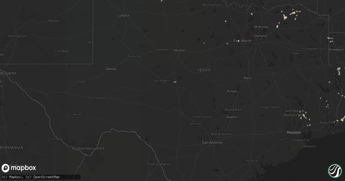
Hail Map in Texas on July 27, 2021
Get this storm
July 27 map
$229
one time, instant access
Download today. No call, no setup
Keep the $229
Bought the map and want the full workflow? Apply the entire $229 to a subscription within 7 days. None of it is wasted.
Every map, not just this one
This buys you this map. Subscription and you get every map we run, in the markets you choose from a few cities to whole states to nationwide. Plus real-time alerts the moment a storm fires.
Contact data
Name, contact info, occupancy, even credit band for addresses in the footprint. You go from where it hit to who to call.
Become the source they trust
Unlimited branding weather history reports on demand. You already have the documented answer ready for the property owner, and you are the one who showed up with it.
Property data and RoofTrace estimates
Pull up any address you have got, its value and the exact code rules for that jurisdiction, straight from One Click Code. Then RoofTrace estimates the squares, pitch, and roof value, priced the way you price.
Storm reports in Texas
Texas
| Date | Description |
|---|---|
| 07/27/20216:35 PM CDT | Tree damage reported in haltom city. Also reported very heavy rain and sudden wind changes as storm passed. |
| 07/27/20215:44 PM CDT | Home damage was reported in lake bridgeport. |
| 07/27/20215:40 PM CDT | Roof blown off homes in lake bridgeport. |
| 07/27/20215:26 PM CDT | 60 mph wind gust with tree damage and power outages in bridgeport. |
| 07/27/20214:55 PM CDT | 76 mph wind gust reported by the decatur municipal airport awos. |
| 07/27/20214:00 PM CDT | Sunset post office roof damaged. |
| 07/27/20211:49 AM CDT | At 648 PM CDT, a severe thunderstorm was located over White Settlement, and another severe thunderstorm over Annette South. These storms are moving southwest at 10 mph. HAZARD...60 mph wind gusts. SOURCE...Radar indicated. IMPACT...Expect damage to roofs, siding, and trees. Locations impacted include... Fort Worth, Benbrook, White Settlement, River Oaks, Sansom Park, Lake Worth, Willow Park, Aledo, Westworth Village, Annetta, Westover Hills, Annetta South, and Annetta North. |
| 07/27/20211:40 AM CDT | At 640 PM CDT, a severe thunderstorm was located near Campbell, or near Commerce, moving southwest at 10 mph. HAZARD...60 mph wind gusts. SOURCE...Radar indicated. IMPACT...Expect damage to roofs, siding, and trees. Locations impacted include... Greenville, Commerce, Caddo Mills, Campbell, Lone Oak, and Neylandville.This includes Interstate 30 between mile markers 87 and 109. |
| 07/27/20211:31 AM CDT | At 631 PM CDT, a severe thunderstorm was located over Haltom City, moving west at 10 mph. HAZARD...60 mph wind gusts. SOURCE...Radar indicated. IMPACT...Expect damage to roofs, siding, and trees. Locations impacted include... Fort Worth, Arlington, Euless, Bedford, Haltom City, Keller, Hurst, Watauga, Colleyville, Saginaw, Forest Hill, Richland Hills, River Oaks, Sansom Park, Lake Worth, Eagle Mountain, North Richland Hills, Edgecliff Village, and Blue Mound. |
| 07/27/20211:19 AM CDT | At 619 PM CDT, a severe thunderstorm was located near Zwolle, or 29 miles south of Mansfield, moving southwest at 15 mph. HAZARD...60 mph wind gusts. SOURCE...Radar indicated. IMPACT...Expect damage to roofs, siding, and trees. Locations impacted include... Many, Zwolle and Negreet. |
| 07/27/20211:14 AM CDT | At 613 PM CDT, a severe thunderstorm was located over Springtown, or 7 miles west of Briar, and is nearly stationary. HAZARD...70 mph wind gusts. SOURCE...Radar indicated. IMPACT...Expect considerable tree damage. Damage is likely to mobile homes, roofs, and outbuildings. Locations impacted include... Briar, Reno, Springtown, and Poolville. |
| 07/27/202112:57 AM CDT | At 556 PM CDT, a severe thunderstorm was located near Bridgeport, moving south at 5 mph. HAZARD...60 mph wind gusts. SOURCE...Radar indicated. IMPACT...Expect damage to roofs, siding, and trees. Locations impacted include... Bridgeport, Briar, Paradise, Boonsville, Cottondale, Runaway Bay and Lake Bridgeport. |
| 07/27/202112:38 AM CDT | At 537 PM CDT, severe thunderstorms were located along a line extending from Bridgeport to Graford, moving southwest at 5 mph. HAZARD...65 mph wind gusts. SOURCE...Radar indicated. IMPACT...Expect damage to roofs, siding, and trees. Locations impacted include... Bridgeport, Graford, Poolville, Boonsville, Runaway Bay and Lake Bridgeport. |
| 07/27/202112:02 AM CDT | At 501 PM CDT, a severe thunderstorm was located over Decatur, moving southwest at 5 mph. HAZARD...60 mph wind gusts. SOURCE...Radar indicated. IMPACT...Expect damage to roofs, siding, and trees. Locations impacted include... Decatur, Bridgeport, Alvord, New Fairview, Boyd, Chico, Paradise, Cottondale, and Lake Bridgeport. |
| 07/26/20217:00 PM CDT | Trained spotter estimated 60 mph winds along with heavy rain and minor flooding. |
All States Impacted by Hail Map on July 27, 2021
Cities Impacted by Hail Map on July 27, 2021
- Norcross, MN
- Herman, MN
- Dumont, MN
- Cyrus, MN
- Elbow Lake, MN
- Hancock, MN
- Tintah, MN
- Chokio, MN
- Starbuck, MN
- Donnelly, MN
- Morris, MN
- Mildred, PA
- Dushore, PA
- Osakis, MN
- Sauk Centre, MN
- Sulphur, LA
- Decorah, IA
- Waukon, IA
- Postville, IA
- Dorchester, IA
- Unadilla, GA
- Willard, WI
- Fairchild, WI
- Commerce, TX
- Greenville, TX
- Campbell, TX
- Park Rapids, MN
- Shevlin, MN
- Kirbyville, TX
- Blossom, TX
- Wahpeton, ND
- Ettrick, WI
- Melrose, WI
- Mindoro, WI
- Galesville, WI
- Holmen, WI
- Rockland, WI
- Taylor, WI
- Bangor, WI
- West Salem, WI
- Arcadia, WI
- Luana, IA
- Monona, IA
- Nashoba, OK
- Rattan, OK
- Snow, OK
- Hoffman Estates, IL
- Palatine, IL
- Barrington, IL
- Arlington Heights, IL
- Rolling Meadows, IL
- Ponce De Leon, FL
- Cleveland, TX
- North Wilkesboro, NC
- Wilkesboro, NC
- Campbell, MN
- Fairmount, ND
- Lenox, MA
- Pittsfield, MA
- Livingston, WI
- Stitzer, WI
- Platteville, WI
- Lancaster, WI
- Chidester, AR
- Glen Haven, WI
- Bloomington, WI
- Bagley, WI
- Sabin, MN
- Wolverton, MN
- Moorhead, MN
- Taylorsville, NC
- Vienna, GA
- Blair, WI
- Trempealeau, WI
- Dodge, WI
- Sparta, WI
- Menahga, MN
- Nevis, MN
- Winthrop, AR
- Horatio, AR
- Maynard, IA
- Gainesville, TX
- Whitesboro, TX
- Oakfield, GA
- Damascus, GA
- Orange, TX
- Hixton, WI
- Richmond, MA
- Becket, MA
- Lee, MA
- Dalton, MA
- Ignacio, CO
- Honey Grove, TX
- Elko, GA
- East Dubuque, IL
- Bellevue, IA
- Eagle Bend, MN
- Hawkeye, IA
- Quasqueton, IA
- Stanley, IA
- Randalia, IA
- Independence, IA
- Waucoma, IA
- Lawler, IA
- Sumner, IA
- Oelwein, IA
- Fayette, IA
- Hazleton, IA
- Fredericksburg, IA
- New Hampton, IA
- Aurora, IA
- Winthrop, IA
- Arlington, IA
- Westgate, IA
- West Union, IA
- Brandon, MS
- Bienville, LA
- Albany, GA
- Sylvester, GA
- Stoddard, WI
- Gillham, AR
- De Queen, AR
- Farmersburg, IA
- Ronda, NC
- Hokah, MN
- Holy Cross, IA
- North Buena Vista, IA
- Cassville, WI
- Guttenberg, IA
- Staples, MN
- Sebeka, MN
- Horace, ND
- Kindred, ND
- Genoa, WI
- Roaring River, NC
- Columbiana, AL
- Alabaster, AL
- Brantley, AL
- Elba, AL
- Ben Franklin, TX
- Black River Falls, WI
- South Beloit, IL
- Clinton, WI
- Burkeville, TX
- Houston, MN
- Caledonia, MN
- Dublin, GA
- Alpharetta, GA
- Naytahwaush, MN
- La Valle, WI
- Cazenovia, WI
- Weedsport, NY
- Auburn, NY
- Elbridge, NY
- Osseo, WI
- Oregon, WI
- Cragford, AL
- Dassel, MN
- Hutchinson, MN
- Cokato, MN
- Detroit, TX
- Paris, TX
- Roanoke, AL
- Wadley, AL
- Melrose, MN
- Cuba City, WI
- Belmont, WI
- Coushatta, LA
- Campti, LA
- Wyndmere, ND
- Leonard, ND
- Walcott, ND
- Frazee, MN
- Camp Hill, AL
- Kelly, LA
- Grayson, LA
- Chester, IA
- Alexander City, AL
- Kellyton, AL
- Lowell, IN
- Crown Point, IN
- Winger, MN
- Bejou, MN
- Mahnomen, MN
- Harrisonburg, LA
- Dayton, TX
- Fort Worth, TX
- De Soto, WI
- Beecher, IL
- Arkadelphia, AR
- Bagley, MN
- Ponsford, MN
- Plainfield, IL
- Naperville, IL
- Roslyn, SD
- Grenville, SD
- Washington, AR
- Roswell, GA
- Enterprise, MS
- Elgin, MN
- Nashua, MN
- Joliet, IL
- Shorewood, IL
- Pittsview, AL
- Parkers Prairie, MN
- Miltona, MN
- Carlos, MN
- Enderlin, ND
- Deridder, LA
- Hiddenite, NC
- Statesville, NC
- Rembert, SC
- Adrian, GA
- East Dublin, GA
- Ball, LA
- Lafayette, AL
- Galena, IL
- Columbus, GA
- Brownsville, MN
- Glenmora, LA
- Winona, MN
- Jasper, GA
- Ball Ground, GA
- Canton, GA
- Stockbridge, GA
- Wheatland, ND
- Shepherd, TX
- Sheldon, ND
- Chatfield, MN
- Louisville, AL
- Jasper, TX
- Fosston, MN
- Fertile, MN
- Boscobel, WI
- Mount Hope, WI
- Fennimore, WI
- Wauzeka, WI
- Woodman, WI
- Roxton, TX
- Cooper, TX
- Villard, MN
- Glenwood, MN
- Dubuque, IA
- Arlington, GA
- Leary, GA
- La Crosse, WI
- New Albin, IA
- Chaseburg, WI
- Lansing, IA
- Harpers Ferry, IA
- Dakota, MN
- Ferryville, WI
- Coon Valley, WI
- La Crescent, MN
- Viroqua, WI
- Onalaska, WI
- Calera, AL
- Liberty, TX
- Alma Center, WI
- Elkin, NC
- Daviston, AL
- Honobia, OK
- Smithville, OK
- Vicksburg, MS
- Converse, LA
- Pelican, LA
- Colmesneil, TX
- Jordan, NY
- Moravian Falls, NC
- Fort Atkinson, IA
- Saint Lucas, IA
- Riceville, IA
- Le Roy, MN
- Oswego, IL
- Gladstone, VA
- Lawrenceville, GA
- Eyota, MN
- Bronson, TX
- Mount Carroll, IL
- Port Byron, NY
- Watson, OK
- Pollock, LA
- Barrett, MN
- Newton, GA
- Belfield, ND
- Deer Creek, MN
- Saline, LA
- Eufaula, AL
- Granite Falls, NC
- Christine, ND
- Barnesville, MN
- Deport, TX
- Bogata, TX
- Madill, OK
- Mannsville, OK
- Oscar, LA
- Ventress, LA
- Jarreau, LA
- Verona, WI
- Madison, WI
- Alma, WI
- Cochrane, WI
- Lime Springs, IA
- Alta Vista, IA
- Elma, IA
- Langford, SD
- Weatherford, TX
- Spring Valley, MN
- Sharon, WI
- Delta, AL
- Lineville, AL
- Ashland, AL
- Reynolds, GA
- Butler, GA
- Clinton, IA
- Miles, IA
- Johnston, SC
- Warwick, GA
- Fonda, NY
- Opp, AL
- Wetumpka, AL
- Elmore, AL
- Traphill, NC
- Hays, NC
- Dadeville, AL
- Kellogg, MN
- Colesburg, IA
- Sherrill, IA
- Boyce, LA
- Elmer, LA
- Childersburg, AL
- Jacksons Gap, AL
- Belgrade, MN
- Brooten, MN
- Alapaha, GA
- Bluffton, MN
- Wadena, MN
- New York Mills, MN
- Marietta, GA
- Eastaboga, AL
- Oxford, AL
- Munford, AL
- Decatur, GA
- Atlanta, GA
- Motley, MN
- Pine River, MN
- Prairie Du Chien, WI
- Paint Rock, TX
- Eden, TX
- Hineston, LA
- Ladonia, TX
- Cordele, GA
- Springtown, TX
- Long Prairie, MN
- Heavener, OK
- Pinehurst, GA
- Altura, MN
- Rex, GA
- Ellenwood, GA
- Sylacauga, AL
- Lenoir, NC
- Fred, TX
- Cashton, WI
- Norwalk, WI
- Stewartville, MN
- Wykoff, MN
- Cross Hill, SC
- Mountville, SC
- Pittsville, WI
- Marshfield, WI
- Granton, WI
- Jackson Springs, NC
- Mount Holly, AR
- Peosta, IA
- Paducah, TX
- Snellville, GA
- Belcher, LA
- Leonard, MN
- Wilmot, SD
- Henning, MN
- Protivin, IA
- Calmar, IA
- Cresco, IA
- Ridgeway, IA
- Red Oak, OK
- Wister, OK
- Lengby, MN
- Eastman, WI
- Robeline, LA
- Pleasant Hill, LA
- Marthaville, LA
- Harpersville, AL
- Evans, LA
- Leesville, LA
- Freeport, MN
- Paynesville, MN
- Milburn, OK
- Tishomingo, OK
- Saratoga, AR
- Ashdown, AR
- Fulton, AR
- Pittsburg, OK
- Humbird, WI
- Bertha, MN
- Hewitt, MN
- Morganton, NC
- Valdese, NC
- Talihina, OK
- Wilburton, OK
- Hawkinsville, GA
- Woodstock, GA
- Eitzen, MN
- Coleman, GA
- Merrillan, WI
- Neillsville, WI
- Headland, AL
- Ashford, AL
- Webb, AL
- Alexandria, LA
- Dothan, AL
- Cowarts, AL
- Zwolle, LA
- Noble, LA
- Muncy Valley, PA
- Lopez, PA
- Colfax, ND
- Bedford, VA
- Wewoka, OK
- Colquitt, GA
- Janesville, WI
- Peever, SD
- Douglas, GA
- Willacoochee, GA
- Savanna, IL
- Mapleton, ND
- Mooringsport, LA
- Oil City, LA
- Iowa, LA
- Shullsburg, WI
- Scales Mound, IL
- Molena, GA
- Thomaston, GA
- Fitzhugh, OK
- Blakely, GA
- Garnavillo, IA
- Epworth, IA
- Durango, IA
- Beloit, WI
- Patagonia, AZ
- Duluth, GA
- Hanover, IL
- Elizabeth, IL
- Wickes, AR
- Stapleton, GA
- Rayville, LA
- Candor, NC
- Sicily Island, LA
- Lake Charles, LA
- Dequincy, LA
- Kinder, LA
- Ragley, LA
- Fargo, ND
- West Fargo, ND
- Smithville, GA
- Leesburg, GA
- Fort Payne, AL
- Wilton, WI
- Ontario, WI
- Haynesville, LA
- Breckenridge, TX
- Caddo, TX
- Preston, MN
- Harmony, MN
- Boonville, NC
- State Road, NC
- Jonesville, NC
- Jacksboro, TX
- Richmond, MN
- Ostrander, MN
- Olla, LA
- Ada, OK
- Doerun, GA
- Augusta, WI
- Spring Grove, MN
- Elkader, IA
- Saint Olaf, IA
- Columbia, AL
- Newville, AL
- Mittie, LA
- Dry Creek, LA
- Vinton, LA
- Foreman, AR
- Mcleod, ND
- Hebron, IN
- Bagwell, TX
- Clarksville, TX
- Henning, TN
- Ripley, TN
- Vivian, LA
- Lithonia, GA
- Camilla, GA
- Sale City, GA
- Whitehall, WI
- Winthrop, MN
- Jefferson, TX
- Fountain City, WI
- Uniontown, AR
- Rudy, AR
- Chester, AR
- Van Buren, AR
- Cedarville, AR
- Hartshorne, OK
- Elizabeth, LA
- Pitkin, LA
- Defuniak Springs, FL
- Dover, MN
- Rochester, MN
- Millville, MN
- Zumbro Falls, MN
- Pineville, LA
- Deville, LA
- Faber, VA
- Lovingston, VA
- Nellysford, VA
- Alpine, AL
- Talladega, AL
- Morris, GA
- Sumner, GA
- Ashburn, GA
- Lamont, IA
- Bath, NY
- Montour Falls, NY
- Beaver Dams, NY
- Millport, NY
- Watkins Glen, NY
- Prattsburgh, NY
- Dundee, NY
- Bradford, NY
- Hammondsport, NY
- Rock Stream, NY
- Maine, NY
- Newark Valley, NY
- Thompson, PA
- Preston Park, PA
- Starrucca, PA
- Brackney, PA
- Lake Como, PA
- Hancock, NY
- Johnson City, NY
- Lakewood, PA
- Castle Creek, NY
- Binghamton, NY
- Windsor, NY
- Glen Aubrey, NY
- Hallstead, PA
- Kirkwood, NY
- Starlight, PA
- Great Bend, PA
- Equinunk, PA
- Conklin, NY
- Susquehanna, PA
- Endicott, NY
- Greenwood, WI


