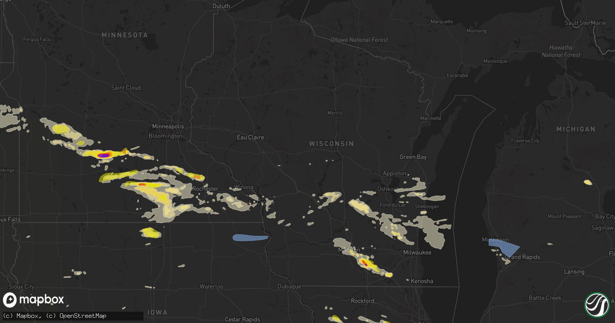
Hail Map in Wisconsin on July 23, 2022
Get this storm
July 23 map
$229
one time, instant access
Download today. No call, no setup
Keep the $229
Bought the map and want the full workflow? Apply the entire $229 to a subscription within 7 days. None of it is wasted.
Every map, not just this one
This buys you this map. Subscription and you get every map we run, in the markets you choose from a few cities to whole states to nationwide. Plus real-time alerts the moment a storm fires.
Contact data
Name, contact info, occupancy, even credit band for addresses in the footprint. You go from where it hit to who to call.
Become the source they trust
Unlimited branding weather history reports on demand. You already have the documented answer ready for the property owner, and you are the one who showed up with it.
Property data and RoofTrace estimates
Pull up any address you have got, its value and the exact code rules for that jurisdiction, straight from One Click Code. Then RoofTrace estimates the squares, pitch, and roof value, priced the way you price.
Storm reports in Wisconsin
Wisconsin
| Date | Description |
|---|---|
| 07/23/20226:59 PM CDT | A local report indicates 60 MPH wind near 2 SW CEDARBURG |
| 07/23/20226:56 PM CDT | A local report indicates 65 MPH wind near SHEBOYGAN |
| 07/23/20226:53 PM CDT | Trees down on power lines which knocked out power. |
| 07/23/20226:49 PM CDT | Trees down on highway 29 east of townline rd. Time estimated by radar. |
| 07/23/20226:47 PM CDT | A few trees down on the north side of manitowoc. |
| 07/23/20226:45 PM CDT | Trees down. Report via social media. Time estimated by radar. |
| 07/23/20226:38 PM CDT | Large tree uprooted and landed on a house. |
| 07/23/20226:37 PM CDT | Trees down in the 2200 block of oneida street. |
| 07/23/20226:37 PM CDT | Report from mping: 3-inch tree limbs broken; power poles broken. |
| 07/23/20226:36 PM CDT | Power line down. |
| 07/23/20226:32 PM CDT | Report from mping: 1-inch tree limbs broken; shingles blown off. |
| 07/23/20226:30 PM CDT | Report from mping: 3-inch tree limbs broken; power poles broken. |
| 07/23/20226:28 PM CDT | Report from mping: 3-inch tree limbs broken; power poles broken. |
| 07/23/20226:27 PM CDT | Report from mping: trees uprooted or snapped; roof blown off. |
| 07/23/20226:25 PM CDT | Report from mping: 1-inch tree limbs broken; shingles blown off. |
| 07/23/20226:22 PM CDT | Report from mping: 3-inch tree limbs broken; power poles broken. |
| 07/23/20226:20 PM CDT | Bra |
| 07/23/20226:20 PM CDT | Branches and a street light down. |
| 07/23/20226:07 PM CDT | A local report indicates 68 MPH wind near 1 NW HIGH CLIFF STATE P |
| 07/23/20226:05 PM CDT | Strong thunderstorm winds destroyed a dock on lake winnebago. |
| 07/23/20226:03 PM CDT | A tree fell onto 2 campers at high cliff state park. Two injuries were reported. |
| 07/23/20225:59 PM CDT | A local report indicates 60 MPH wind near RANDOLPH |
| 07/23/20225:58 PM CDT | A local report indicates 59 MPH wind near 2 WNW APPLETON |
| 07/23/20225:55 PM CDT | Approximately 15 inch diameter tree snapped. Located in fox crossing west of 41. Report and photo via social media. Time estimated by radar. |
| 07/23/20225:55 PM CDT | Small trees bent over. Heard one tree crack. Estimated wind gusts to around 60 mph. Located about 1.5 nw miles from the airport. |
| 07/23/20225:54 PM CDT | Several trees down on the southwest side of appleton. |
| 07/23/20225:54 PM CDT | S |
| 07/23/20225:53 PM CDT | Report from mping: 3-inch tree limbs broken; power poles broken. |
| 07/23/20225:52 PM CDT | Report from mping: 1-inch tree limbs broken; shingles blown off. |
| 07/23/20225:50 PM CDT | 50 foot tall willows down on power lines. Lines down across driveway. West edge of oshkosh on sand pit road. Photos and reports via social media. Time estimated by rada |
| 07/23/20225:50 PM CDT | Trees down around scott street and main street in oshkosh. Time estimated by radar. |
| 07/23/20225:50 PM CDT | Photo and report of very large tree limb down. |
| 07/23/20225:50 PM CDT | Reports of trees and power lines down on 10th avenue in oshkosh. Report via social media. Time estimated by radar. |
| 07/23/20225:50 PM CDT | Photo and report of tree down and covering 17th avenue in oshkosh. Time estimated by radar. |
| 07/23/20225:50 PM CDT | Measured wind gust off highway 45 in oshkosh. Spotter noted a few trees down. Time estimated by radar. |
| 07/23/20225:50 PM CDT | Plane flipped and tree fell on car on eaa grounds. |
| 07/23/20225:50 PM CDT | A local report indicates 58 MPH wind near WITTMAN FIELD |
| 07/23/20225:43 PM CDT | Report from mping: 1-inch tree limbs broken; shingles blown off. |
| 07/23/20225:42 PM CDT | Numerous trees down. |
| 07/23/20225:38 PM CDT | Branches down. Report from social media. Time estimated by radar. |
| 07/23/20225:38 PM CDT | Corrects previous tstm wnd dmg report from winneconne. Branches down along with a few trees down. Report from social media. Time estimated by radar. |
| 07/23/20225:35 PM CDT | Several trees and power lines down. Several power poles were snapped. |
| 07/23/20225:33 PM CDT | Gusts estimated at 60-65 mph. |
| 07/23/20225:32 PM CDT | Report on social media of trees and power lines down. Time estimated by radar. |
| 07/23/20225:30 PM CDT | Tree down in road. Estimated 60 mph. |
| 07/23/20225:30 PM CDT | Multiple tree limbs on the roof of a house. |
| 07/23/20225:28 PM CDT | Trees down in yard. Report via social media. Time estimated by radar. |
| 07/23/20225:21 PM CDT | Trees down on county highway ee. |
| 07/23/20225:21 PM CDT | Tree limbs and branches down across green lake campground. |
| 07/23/20225:20 PM CDT | Report and photo of mid sized tree down in the middle of driveway. Time approximate. Report via social media. |
| 07/23/20225:10 PM CDT | Reports of of tree damage in the northern part of sauk county. Relayed bylaw enforcement. Estimated winds 60 mph. |
| 07/23/20225:00 PM CDT | Corrects previous non-tstm wnd dmg report from spring lake. Two trees down. Report via social media. Time estimated. |
| 07/23/20224:43 PM CDT | Large tree snapped down the middle. |
| 07/23/20224:31 PM CDT | Trees down all over the county. |
| 07/23/20224:28 PM CDT | Several large branches blown down. |
| 07/23/20224:15 PM CDT | Several trees blown down. |
| 07/23/20224:15 PM CDT | Several trees blown down. |
| 07/23/20224:03 PM CDT | A local report indicates 60 MPH wind near 3 W NORWALK |
| 07/23/20224:03 PM CDT | Report from mping: 3-inch tree limbs broken; power poles broken. |
| 07/23/20224:01 PM CDT | Several large tree blown down. |
| 07/23/20223:52 PM CDT | Several large tree blown down. |
| 07/23/20223:33 PM CDT | 2 large pine trees blown down. |
| 07/23/20223:33 PM CDT | 2 large pine trees blown down |
| 07/23/20223:30 PM CDT | A local report indicates 60 MPH wind near FRENCH ISLAND |
| 07/23/20223:25 PM CDT | Multiple large trees downed throughout the city of la crosse... Some causing damage to homes and other structures. |
| 07/23/20223:22 PM CDT | Lots of tree damage in stoddard and genoa areas. |
| 07/23/20223:22 PM CDT | Lots of tree damage in stoddard and genoa areas |
| 07/23/20223:21 PM CDT | Numerous trees and powerlines blown down. Flattened corn fields. |
| 07/23/20223:20 PM CDT | Time estimated. Campers flipped and trees down blocking rail line. |
| 07/23/20227:16 AM CDT | At 1215 AM CDT, a severe thunderstorm was located near Pulaski, or 16 miles northwest of Green Bay, moving southeast at 25 mph. HAZARD...60 mph wind gusts and quarter size hail. SOURCE...Radar indicated. IMPACT...Hail damage to vehicles is expected. Expect wind damage to roofs, siding, and trees. This severe thunderstorm will be near... Bay Shore Park around 1255 AM CDT. Luxemburg around 100 AM CDT.Other locations impacted by this severe thunderstorm include Krok,Slovan, Gregorville, Rankin, Ellisville, Euren, Sobieski, Humboldt,South Chase and Morgan. |
| 07/23/20226:53 AM CDT | At 1152 PM CDT, severe thunderstorms were located along a line extending from near Lansing to near Harpers Ferry to near Monona, moving east at 70 mph. HAZARD...60 mph wind gusts. SOURCE...Law enforcement. IMPACT...Expect damage to roofs, siding, and trees. These severe thunderstorms will remain over mainly rural areas of northwestern Clayton, southeastern Allamakee and western Crawford Counties, including the following locations... County Roads A 52 And X 52, Volney, Highway 35 And County D, Spook Cave Campground, Waterville, Eastman and Rush Creek. |
| 07/23/20226:24 AM CDT | At 1124 PM CDT, severe thunderstorms were located along a line extending from near Spring Grove to near Decorah, moving east at 70 mph. HAZARD...60 mph wind gusts. SOURCE...Radar indicated. IMPACT...Expect damage to roofs, siding, and trees. Severe thunderstorms will be near... Waukon and New Albin around 1140 PM CDT. Lansing around 1150 PM CDT.Other locations impacted by these severe thunderstorms includeHanover, County Roads A 52 And X 52, County Roads A 52 And W 60,Waterville, State Road 76 And County X 16, Nordness andHighlandville. |
| 07/23/20226:12 AM CDT | At 1112 PM CDT, severe thunderstorms were located along a line extending from 8 miles northeast of Bayside to near Germantown to 6 miles south of Hustisford, moving southeast at 45 mph. HAZARD...60 mph wind gusts and penny size hail. SOURCE...Radar indicated. IMPACT...Expect damage to roofs, siding, and trees. Locations impacted include... Milwaukee, Waukesha, West Allis, Wauwatosa, New Berlin, Brookfield, Greenfield, Menomonee Falls, Oak Creek, Muskego, South Milwaukee, Cudahy, Whitefish Bay, Greendale, Pewaukee, Brown Deer, Sussex, St. Francis, Hartland and Hales Corners.People attending The Waukesha County Fair , SA: Wisconsin State FairPark , Konkel Park , The Milwaukee Air and Water Show , and HartlandParty in the Park should seek safe shelter immediately!This includes the following Locations Schlitz Audobon Nature Center,Boerner Botanical Gardens, General Mitchell International Airport,Timmerman Airport, Froedert & the Medical College, Fiserv Forum, andPewaukee Lake. |
| 07/23/20225:48 AM CDT | At 1048 PM CDT, severe thunderstorms were located along a line extending from near West Bend to near Hartford, moving east at 35 mph. HAZARD...60 mph wind gusts and nickel size hail. SOURCE...Radar indicated. IMPACT...Expect damage to roofs, siding, and trees. Locations impacted include... West Bend, Mequon, Hartford, Grafton, Cedarburg, Port Washington, Jackson, Slinger, Saukville, Kewaskum, Thiensville, Germantown, Fredonia, Newburg, Richfield, Addison, Ashippun, Rubicon, Neosho and Waubeka. |
| 07/23/20225:37 AM CDT | At 1036 PM CDT, a severe thunderstorm was located near Belgium, or near Port Washington, moving east at 30 mph. HAZARD...60 mph wind gusts and quarter size hail. SOURCE...Radar indicated. IMPACT...Hail damage to vehicles is expected. Expect wind damage to roofs, siding, and trees. Locations impacted include... Port Washington, Belgium, Fredonia, Newburg, Harrington Beach St Park and Waubeka. |
| 07/23/20225:08 AM CDT | At 1008 PM CDT, a severe thunderstorm was located near Horicon, moving southeast at 35 mph. HAZARD...60 mph wind gusts and quarter size hail. SOURCE...Radar indicated. IMPACT...Hail damage to vehicles is expected. Expect wind damage to roofs, siding, and trees. Locations impacted include... West Bend, Beaver Dam, Hartford, Mayville, Slinger, Kewaskum, Horicon, Juneau, Lomira, Theresa, Hustisford, Oakfield, Iron Ridge, Burnett, Addison, Ashippun, Rubicon, Ashford, Lebanon and Woodland.This includes the following Location Horicon Marsh. |
| 07/23/20224:39 AM CDT | At 938 PM CDT, a severe thunderstorm was located near Randolph, or 17 miles west of Waupun, moving southeast at 35 mph. HAZARD...60 mph wind gusts and quarter size hail. SOURCE...Radar indicated. IMPACT...Hail damage to vehicles is expected. Expect wind damage to roofs, siding, and trees. Locations impacted include... Beaver Dam, Waupun, Randolph, Markesan, Oakfield, Brandon, Cambria, Burnett, Fox Lake, Alto, Manchester, Fairwater, Friesland, Kingston, Atwater, Astico, Oak Center, Lagoda, South Beaver Dam and Dalton.This includes the following Location Horicon Marsh. |
| 07/23/20224:20 AM CDT | At 919 PM CDT, a severe thunderstorm was located near Princeton, or 16 miles west of Ripon, moving east at 40 mph. HAZARD...Quarter size hail. SOURCE...Radar indicated. IMPACT...Damage to vehicles is expected. Locations impacted include... Ripon, Montello, Markesan, Princeton, Green Lake, Brandon, Alto, Manchester, Mecan, Fairwater, Kingston, Marquette, Glen Oak, Dalton and West Rosendale.This includes the following Location Puckaway Lake. |
| 07/23/20222:57 AM CDT | Numerous power lines down in elkhorn from tree limbs falling onto them. |
| 07/23/20222:44 AM CDT | Large tree uprooted. |
| 07/23/20222:28 AM CDT | Reports of multiple trees damaged around fort atkinson. Time estimated based on radar. |
| 07/23/20222:26 AM CDT | Multiple trees down across sauk county from both rounds of storms over the past hour. |
| 07/23/20222:23 AM CDT | Top of a tree snapped. Report via social media. |
| 07/23/20222:22 AM CDT | Report from mping: 3-inch tree limbs broken; power poles broken. |
| 07/23/20222:21 AM CDT | Damage includes several tree branches... Couple larger branches... And the powerline to the home was taken down. |
| 07/23/20222:17 AM CDT | At 717 PM CDT, a severe thunderstorm was located near Stoughton, moving southeast at 20 mph. HAZARD...60 mph wind gusts and quarter size hail. SOURCE...Radar indicated. IMPACT...Hail damage to vehicles is expected. Expect wind damage to roofs, siding, and trees. Locations impacted include... Janesville, Whitewater, Stoughton, Fort Atkinson, Oregon, Jefferson, Milton, Edgerton, Evansville, Deerfield, Palmyra, Cambridge, Lake Ripley, Lake Koshkonong, Richmond, Fulton, La Grange, Albion, Hebron and Utica. |
| 07/23/20222:15 AM CDT | Large tree limbs snapped off of a tree. |
| 07/23/20222:13 AM CDT | Many trees down... Half of the city without power. Also 5.5 inches of rainfall. |
| 07/23/20222:08 AM CDT | At 708 PM CDT, severe thunderstorms were located along a line extending from near Thiensville to Delafield, moving southeast at 25 mph. HAZARD...60 mph wind gusts. SOURCE...Trained weather spotters. IMPACT...Expect damage to roofs, siding, and trees. Locations impacted include... Milwaukee, Waukesha, West Allis, Wauwatosa, New Berlin, Brookfield, Greenfield, Menomonee Falls, Oak Creek, Muskego, South Milwaukee, Cudahy, Whitefish Bay, Greendale, Pewaukee, Brown Deer, Sussex, St. Francis, Hartland and Hales Corners.People attending The Waukesha County Fair , Hartland Party in thePark , and SA: Wisconsin State Fair Park should seek safe shelterimmediately!This includes the following Locations Schlitz Audobon Nature Center,Boerner Botanical Gardens, General Mitchell International Airport,Timmerman Airport, Froedert & the Medical College, Fiserv Forum, andPewaukee Lake. |
| 07/23/20222:05 AM CDT | A local report indicates 65 MPH wind near 1 SSW SUN PRAIRIE |
| 07/23/20222:00 AM CDT | Power outages across northern green county and southern dane county. |
| 07/23/20221:59 AM CDT | Large tree down that took down a power line. |
| 07/23/20221:55 AM CDT | A local report indicates 61 MPH wind near JUNEAU |
| 07/23/20221:50 AM CDT | Two trees blown over and snapped at the base. |
| 07/23/20221:44 AM CDT | Estimated winds 60-65 relayed on social media. |
| 07/23/20221:38 AM CDT | At 637 PM CDT, severe thunderstorms were located along a line extending from near Slinger to 7 miles north of Lac La Belle to near Waterloo, moving southeast at 30 mph. HAZARD...60 mph wind gusts. SOURCE...Radar indicated. IMPACT...Expect damage to roofs, siding, and trees. Locations impacted include... Watertown, Hartford, Horicon, Juneau, Hustisford, Iron Ridge, Ashippun, Rubicon, Lebanon, Woodland, Reeseville, Neosho, Richwood, Clyman, Lowell, Danville and Leipsig. |
| 07/23/20221:37 AM CDT | Trees down on a house and power pole. Many small branches down. |
| 07/23/20221:37 AM CDT | Tree damage in the north freedom/sauk city area off county highway c. Corn blown down and trees snapped. |
| 07/23/20221:34 AM CDT | At 634 PM CDT, severe thunderstorms were located along a line extending from near Green Bay to Bellevue Town to Denmark to 11 miles northwest of Manitowoc to near Valders, moving northeast at 45 mph. HAZARD...60 mph wind gusts. SOURCE...Radar indicated. IMPACT...Expect damage to roofs, siding, and trees. Severe thunderstorms will be near... Luxemburg around 650 PM CDT. Kewaunee around 700 PM CDT. Algoma around 710 PM CDT.Other locations impacted by these severe thunderstorms include Krok,Curran, Slovan, Gregorville, Rankin, Ellisville, Euren, East Krok,Kodan and Alaska. |
| 07/23/20221:30 AM CDT | Wind damage to tree limbs and a tarp on a car port type structure. |
| 07/23/20221:22 AM CDT | Lots of trees and wind damage. |
| 07/23/20221:21 AM CDT | At 620 PM CDT, severe thunderstorms were located along a line extending from near Campbellsport to near Hustisford to 6 miles east of Waterloo, moving southeast at 45 mph. HAZARD...60 mph wind gusts. SOURCE...Radar indicated. IMPACT...Expect damage to roofs, siding, and trees. Locations impacted include... West Bend, Mequon, Hartford, Brown Deer, Grafton, Cedarburg, Port Washington, Jackson, Slinger, Saukville, Bayside, Kewaskum, Thiensville, Germantown, Belgium, Fredonia, Newburg, Richfield, Addison and Wayne. |
| 07/23/20221:17 AM CDT | At 616 PM CDT, severe thunderstorms were located along a line extending from near St Anna to near Lomira, moving east at 45 mph. HAZARD...60 mph wind gusts. SOURCE...Radar indicated. IMPACT...Expect damage to roofs, siding, and trees. Locations impacted include... Sheboygan, Fond Du Lac, Plymouth, Sheboygan Falls, North Fond Du Lac, Howards Grove, Oostburg, Kohler, Cedar Grove, Campbellsport, Random Lake, Elkhart Lake, Southern Lake Winnebago, Taycheedah, Ashford, Greenbush, Eden, Mount Calvary, Cascade and Adell.People attending The Fond du Lac County Fair should seek safe shelter immediately! |
| 07/23/20221:12 AM CDT | At 611 PM CDT, severe thunderstorms were located along a line extending from near Columbus to 8 miles northeast of Dodgeville, moving southeast at 25 mph. HAZARD...60 mph wind gusts. SOURCE...Radar indicated. IMPACT...Expect damage to roofs, siding, and trees. Locations impacted include... Madison, Sun Prairie, Fitchburg, Watertown, Middleton, Stoughton, Waunakee, Verona, Oregon, Jefferson, McFarland, Monona, Mount Horeb, Windsor, Lake Mills, Columbus, Dodgeville, Marshall, Waterloo and Okauchee Lake.People attending The Dane County Fair in Madison should seek safeshelter immediately!This includes the following Locations Wisconsin State Capitol, Hyde'sMill, and The House on the Rock. |
| 07/23/20221:08 AM CDT | At 607 PM CDT, severe thunderstorms were located along a line extending from 6 miles south of Black Creek to Kaukauna to near Brillion to near Chilton to near St. Nazianz, moving northeast at 60 mph. HAZARD...70 mph wind gusts. SOURCE...Trained weather spotters. IMPACT...Expect considerable tree damage. Damage is likely to mobile homes, roofs, and outbuildings. Severe thunderstorms will be near... Valders around 615 PM CDT. Manitowoc around 620 PM CDT. Green Bay, Denmark and Bellevue Town around 630 PM CDT. Bay Shore Park around 640 PM CDT. Two Creeks around 645 PM CDT.Other locations impacted by these severe thunderstorms includeMaribel, Larrabee, Wayside, Morrison, Humboldt, Ledgeview, Leo FrigoBridge, Askeaton, Howard and Shirley. |
| 07/23/20221:02 AM CDT | Trees down and uprooted rewey/linden areas. Power lines down from trees landing on them. |
| 07/23/20221:01 AM CDT | Tree snapped at base. Relayed by nbc 15 madison. |
| 07/23/202212:50 AM CDT | At 549 PM CDT, severe thunderstorms were located along a line extending from 11 miles southeast of New London to near Menasha to near Northern Lake Winnebago to near Oshkosh to near Central Lake Winnebago, moving northeast at 60 mph. HAZARD...70 mph wind gusts. SOURCE...Trained weather spotters. IMPACT...Expect considerable tree damage. Damage is likely to mobile homes, roofs, and outbuildings. Severe thunderstorms will be near... Menasha around 555 PM CDT. Appleton, Kimberly, Darboy and Northern Lake Winnebago around 600 PM CDT. Kaukauna, Little Chute, Chilton and High Cliff State Park around 605 PM CDT. Brillion around 615 PM CDT.Other locations impacted by these severe thunderstorms includeKillsnake Wildlife Area, Mackville, Jericho, Freedom, Charlesburg,Brothertown, Medina, Twelve Corners, Five Corners and St John. |
| 07/23/202212:44 AM CDT | At 544 PM CDT, severe thunderstorms were located along a line extending from near Markesan to near Rio to 6 miles southeast of Sauk City, moving east at 50 mph. HAZARD...60 mph wind gusts. SOURCE...Law enforcement. IMPACT...Expect damage to roofs, siding, and trees. Locations impacted include... Fond Du Lac, Watertown, Beaver Dam, Hartford, Waupun, Mayville, Horicon, Juneau, Lomira, Theresa, Hustisford, Oakfield, Iron Ridge, Brandon, Burnett, Ashippun, Rubicon, Lamartine, Lebanon and Byron.This includes the following Location Horicon Marsh. |
| 07/23/202212:37 AM CDT | Large tree limb snapped at base. Relayed via nbc 15 madison. |
| 07/23/202212:23 AM CDT | At 522 PM CDT, severe thunderstorms were located along a line extending from near Redgranite to near Ripon to near Brandon, moving northeast at 45 mph. HAZARD...60 mph wind gusts. SOURCE...Radar indicated. IMPACT...Expect damage to roofs, siding, and trees. Locations impacted include... Fond Du Lac, Ripon, Berlin, North Fond Du Lac, Rosendale, Green Lake, Brandon, Southern Lake Winnebago, Lamartine, Eldorado, Fairwater, Van Dyne, Lagoda and West Rosendale.People attending The Fond du Lac County Fair should seek safe shelter immediately! |
| 07/23/202212:18 AM CDT | At 518 PM CDT, severe thunderstorms were located along a line extending from near Baraboo to 9 miles north of Spring Green, moving east at 40 mph. HAZARD...60 mph wind gusts. SOURCE...Radar indicated. IMPACT...Expect damage to roofs, siding, and trees. Locations impacted include... Sun Prairie, Waunakee, Windsor, Columbus, Prairie Du Sac, Sauk City, Lake Wisconsin, Deforest, Lodi, Poynette, Fall River, Dane, Arlington, Bluffview, Otsego, Merrimac, Doylestown, East Bristol, Harmony Grove and Morrisonville.This includes the following Location Gibraltar Rock Natural AreaCounty Park. |
| 07/23/202212:17 AM CDT | At 516 PM CDT, severe thunderstorms were located along a line extending from 6 miles southwest of Redgranite to near Princeton to near Markesan, moving northeast at 50 mph. HAZARD...60 mph wind gusts and penny size hail. SOURCE...Radar indicated. IMPACT...Expect damage to roofs, siding, and trees. Severe thunderstorms will be near... Redgranite around 525 PM CDT. Rush Lake around 530 PM CDT. Lake Poygan around 540 PM CDT. Oshkosh around 555 PM CDT. Central Lake Winnebago around 600 PM CDT. Menasha and Northern Lake Winnebago around 605 PM CDT. Appleton around 610 PM CDT.Other locations impacted by these severe thunderstorms includePickett, Butte Des Morts, Larsen, Lake Butte Des Morts, Rivermoor,Borth, Winneconne, Harbor Springs, Allenville and Lake Butte Des Mor. |
| 07/23/202212:04 AM CDT | At 503 PM CDT, severe thunderstorms were located along a line extending from 10 miles southwest of Westfield to 6 miles east of Wisconsin Dells to near Lake Delton, moving northeast at 50 mph. Additional severe thunderstorms are moving northeast at 50 mph across Marquette and Green Lake counties. HAZARD...60 mph wind gusts. SOURCE...Radar indicated. IMPACT...Expect damage to roofs, siding, and trees. Locations impacted include... Baraboo, Portage, Berlin, Lake Wisconsin, Pardeeville, Randolph, Montello, Markesan, Westfield, Princeton, Rio, Green Lake, Cambria, Lawrence, Packwaukee, Manchester, Wyocena, Mecan, Oxford and Endeavor.This includes the following Locations Pine Island State WildlifeArea, Historic Indian Agency House, French Creek Wildlife Area,Alliant Energy Portage Power Plant, and Puckaway Lake. |
| 07/22/202211:58 PM CDT | Large tree limb down. Time estimated from radar. |
| 07/22/202211:30 PM CDT | 35 to 40 foot spruce. Snapped off at about 12 feet of main trunk. |
| 07/22/202211:23 PM CDT | Several trees blown down. |
| 07/22/202211:15 PM CDT | At 415 PM CDT, a severe thunderstorm was located near Adams, or near Friendship, moving east at 40 mph. HAZARD...60 mph wind gusts and half dollar size hail. SOURCE...Radar indicated. IMPACT...Hail damage to vehicles is expected. Expect wind damage to roofs, siding, and trees. Locations impacted include... Westfield, Lawrence, Neshkoro, Springfield Corners and Harrisville. |
| 07/22/202211:14 PM CDT | At 414 PM CDT, a severe thunderstorm was located near Adams, or 7 miles southeast of Friendship, moving northeast at 45 mph. HAZARD...60 mph wind gusts and half dollar size hail. SOURCE...Radar indicated. IMPACT...Hail damage to vehicles is expected. Expect wind damage to roofs, siding, and trees. This severe thunderstorm will be near... Wautoma around 450 PM CDT. Redgranite and Napowan Scout Camp around 500 PM CDT.Other locations impacted by this severe thunderstorm includeSaxeville, Coloma, Mount Morris, Auroraville, Wild Rose, Hancock,Borth, Silver Lake, Spring Lake and Lohrville. |
| 07/22/202211:13 PM CDT | At 413 PM CDT, severe thunderstorms were located along a line extending from 9 miles south of Tomah to 6 miles west of Elroy to near Hillsboro, moving east at 45 mph. HAZARD...70 mph wind gusts and quarter size hail. SOURCE...Radar indicated. IMPACT...Hail damage to vehicles is expected. Expect considerable tree damage. Wind damage is also likely to mobile homes, roofs, and outbuildings. Severe thunderstorms will be near... Elroy around 425 PM CDT. Wonewoc around 430 PM CDT. New Lisbon around 435 PM CDT. Mauston around 440 PM CDT.Other locations impacted by these severe thunderstorms include CountyRoads B And P, Dells Timberland Campground, County Roads B And K, TheTown Of Quincy, Johnson Hill, Lyndon Station and Stand RockCampground.This includes Interstate 90/94 between mile markers 57 and 86. |
| 07/22/202211:11 PM CDT | At 409 PM CDT, severe thunderstorms were located along a line extending from near Sparta to 12 miles northwest of Hillsboro to 6 miles southeast of La Farge to 14 miles northwest of Boscobel, moving east at 40 mph. HAZARD...70 mph wind gusts. SOURCE...Radar indicated. IMPACT...Expect considerable tree damage. Damage is likely to mobile homes, roofs, and outbuildings. Locations impacted include... Baraboo, Reedsburg, Wisconsin Dells, Lake Delton, Spring Green, West Baraboo, Plain, Bluffview, North Freedom, La Valle, Rock Springs, Loganville, Ironton, Lime Ridge, Devils Lake St Park and Hill Point.People attending Bulls and Barrels in LaValle should seek safe shelter immediately!This includes the following Locations Mirror Lake State Park andKilbourn Dam. |
| 07/22/202210:55 PM CDT | Delayed report of a healthy 6 to 8 inch diameter tree branch down. |
| 07/22/202210:50 PM CDT | At 349 PM CDT, severe thunderstorms were located along a line extending from near Viroqua to 16 miles south of Westby, moving east at 50 mph. HAZARD...70 mph wind gusts. SOURCE...Radar indicated. IMPACT...Expect considerable tree damage. Damage is likely to mobile homes, roofs, and outbuildings.Other locations impacted by these severe thunderstorms includeHorrigan Ridge, Eagle Corners, Highway 80 And County C C, Woodstock,Gillingham, Bloom City and Fairview.PRECAUTIONARY/PREPAREDNESS ACTIONS...For your protection move to an interior room on the lowest floor of abuilding. |
| 07/22/202210:41 PM CDT | At 340 AM CDT, severe thunderstorms were located along a line extending from near Apple Canyon Lake to near South Sabula Lake Park, moving east at 50 mph. HAZARD...60 mph wind gusts and quarter size hail. SOURCE...Radar indicated. IMPACT...Hail damage to vehicles is expected. Expect wind damage to roofs, siding, and trees. Locations impacted include... Freeport, Mount Carroll, Savanna, Lena, Stockton, Lanark, Warren, Milledgeville, Pearl City, Elizabeth, Shannon, Cedarville, Davis, Woodbine, Sabula, Chadwick, Dakota, German Valley, Apple River and Winslow. |
| 07/22/202210:30 PM CDT | At 330 PM CDT, severe thunderstorms were located along a line extending from near West Salem to 8 miles southeast of Stoddard, moving east at 50 mph. HAZARD...70 mph wind gusts. SOURCE...Radar indicated. IMPACT...Expect considerable tree damage. Damage is likely to mobile homes, roofs, and outbuildings.Other locations impacted by these severe thunderstorms includeWildcat Mountain State Park, Jersey Valley County Park, BartonsCorners, Portland, Oakdale, Glendale and Benders Corners.This includes the following highways... Interstate 94 between mile markers 143 and 147. Interstate 90/94 between mile markers 46 and 52. Interstate 90 in Wisconsin between mile markers 21 and 45.PRECAUTIONARY/PREPAREDNESS ACTIONS...For your protection move to an interior room on the lowest floor of abuilding. |
| 07/22/202210:27 PM CDT | Multiple trees down. A large one in city park... Another in primary cemetery. One fell on a parked vehicle on a city street. |
| 07/22/202210:16 PM CDT | Large tree limbs blown down. Relayed via nbc 15 madison. |
| 07/22/202210:11 PM CDT | At 310 PM CDT, severe thunderstorms were located along a line extending from near La Crescent to near Caledonia, moving east at 50 mph. HAZARD...70 mph wind gusts. SOURCE...Radar indicated. IMPACT...Expect considerable tree damage. Damage is likely to mobile homes, roofs, and outbuildings. Severe thunderstorms will be near... La Crescent, Hokah and Brownsville around 315 PM CDT. La Crosse and French Island around 320 PM CDT. Stoddard around 330 PM CDT. Coon Valley around 335 PM CDT.Other locations impacted by these severe thunderstorms include Brinkman Ridge, Irish Hill, North Side Of La Crosse, South Side Of La Crosse, Esofea and Goose Island. |
| 07/22/202210:07 PM CDT | Reports of sporadic tree damage across the north half of dodge county... North of highway 60. Couple reports of limbs on houses and cars. One report of a lightning stri |
| 07/22/20229:40 PM CDT | At 240 PM CDT, a severe thunderstorm was located near Rushford, or 16 miles southwest of Winona, moving east at 45 mph. HAZARD...60 mph wind gusts and quarter size hail. SOURCE...Radar indicated. IMPACT...Hail damage to vehicles is expected. Expect wind damage to roofs, siding, and trees. This severe thunderstorm will be near... Dakota around 315 PM CDT.Other locations impacted by this severe thunderstorm include Witoka,Dresbach, Wyattville, Wilson, Nodine, Hart and Ridgeway.This includes Interstate 90 in Minnesota between mile markers 243 and276. |
| 07/22/20229:36 PM CDT | Trained spotter law enforcement report. Pea size hail. |
| 07/22/20228:48 PM CDT | A local report indicates 1.00 inch wind near ELKHORN |
| 07/22/20228:01 PM CDT | Large tree uprooted... But mainly rotted out/dead. Relayed via nbc 15 madison. |
| 07/22/20228:00 PM CDT | Reported via social media. |
| 07/22/20228:00 PM CDT | A local report indicates 2.00 inch wind near 2 E EDGERTON |
| 07/22/20227:55 PM CDT | Report via social media. |
| 07/22/20227:51 PM CDT | Relayed via nbc 15 madison. |
| 07/22/20227:50 PM CDT | Report from mping: 1-inch tree limbs broken; shingles blown off. |
| 07/22/20227:48 PM CDT | Broadcast media relayed a report of golf ball to near egg sized hail in the albion area near lake koshkonong. Time estimated based on radar. |
| 07/22/20227:47 PM CDT | Relayed via nbc 15 madison. |
| 07/22/20227:45 PM CDT | A local report indicates 1.00 inch wind near 3 N EDGERTON |
| 07/22/20227:45 PM CDT | In albion. |
| 07/22/20227:43 PM CDT | A local report indicates 2.50 inch wind near 3 NNE EDGERTON |
| 07/22/20227:39 PM CDT | Report from mping: 1-inch tree limbs broken; shingles blown off. |
| 07/22/20227:19 PM CDT | Report from mping: 3-inch tree limbs broken; power poles broken. |
| 07/22/20227:06 PM CDT | Report from mping: quarter |
| 07/22/20227:01 PM CDT | Report from mping: 3-inch tree limbs broken; power poles broken. |
All States Impacted by Hail Map on July 23, 2022
Cities Impacted by Hail Map on July 23, 2022
- Byron, MN
- Hayfield, MN
- Stewartville, MN
- Lonsdale, MN
- Montgomery, MN
- Elroy, WI
- Alger, MI
- Gladwin, MI
- Ortley, SD
- Wallace, SD
- Florence, SD
- Stevens Point, WI
- Rudolph, WI
- Grand Haven, MI
- Spring Lake, MI
- Peever, SD
- Webster, SD
- Waubay, SD
- Spring Valley, MN
- Rochester, MN
- Eyota, MN
- Glenbeulah, WI
- Bangor, WI
- Saint Paul, NE
- Wolbach, NE
- Hillsboro, WI
- Wonewoc, WI
- Smithland, IA
- Hornick, IA
- Plainfield, IL
- South Shore, SD
- Milbank, SD
- Marvin, SD
- Ortonville, MN
- Bellingham, MN
- Stockholm, SD
- Marietta, MN
- Goodwin, SD
- Revillo, SD
- Odessa, MN
- Big Stone City, SD
- Labolt, SD
- Watertown, SD
- Summit, SD
- Strandburg, SD
- Twin Brooks, SD
- Hillpoint, WI
- La Valle, WI
- Cazenovia, WI
- Pittsville, WI
- Poynette, WI
- Farwell, NE
- Miller, NE
- Rockville, NE
- Dannebrog, NE
- Boelus, NE
- Ravenna, NE
- Bertrand, NE
- Lexington, NE
- Elm Creek, NE
- Sumner, NE
- Hazard, NE
- Loup City, NE
- Amherst, NE
- Palmer, NE
- Smithfield, NE
- Overton, NE
- Elba, NE
- Ashton, NE
- Pleasanton, NE
- Bowling Green, OH
- Riverdale, NE
- Greensburg, PA
- Jeannette, PA
- Morgan, MN
- Sleepy Eye, MN
- Bristow, IA
- Aredale, IA
- Dumont, IA
- Watertown, WI
- Lake Mills, WI
- Williams, IA
- Northwood, IA
- Bowerston, OH
- Winamac, IN
- Star City, IN
- Kewanna, IN
- Middlebourne, WV
- New Creek, WV
- Grand Meadow, MN
- Racine, MN
- Doon, IA
- Wisconsin Rapids, WI
- West Olive, MI
- Hanley Falls, MN
- Belle Plaine, MN
- Gibbon, MN
- Gaylord, MN
- Madison, MN
- Granite Falls, MN
- Belview, MN
- Morton, MN
- Henderson, MN
- Watson, MN
- Clarkfield, MN
- Echo, MN
- Bird Island, MN
- Montevideo, MN
- Franklin, MN
- Sacred Heart, MN
- Wood Lake, MN
- Maynard, MN
- Arlington, MN
- Winthrop, MN
- Redwood Falls, MN
- Le Sueur, MN
- Dawson, MN
- Danube, MN
- Clara City, MN
- New Prague, MN
- Milan, MN
- Lafayette, MN
- New Ulm, MN
- Olivia, MN
- Renville, MN
- Le Center, MN
- Fairfax, MN
- Saint Peter, MN
- Berlin, WI
- Ripon, WI
- East Tawas, MI
- Friendship, WI
- Mauston, WI
- Wisconsin Dells, WI
- Lyndon Station, WI
- Coloma, WI
- Adams, WI
- Westfield, WI
- Grand Marsh, WI
- Oxford, WI
- Custar, OH
- Weston, OH
- Creola, OH
- Canaan, VT
- Norton, VT
- Averill, VT
- Van Wert, OH
- Middle Point, OH
- Newton, WV
- Left Hand, WV
- Chatfield, MN
- Easton, MN
- Minnesota Lake, MN
- Channahon, IL
- Belle Vernon, PA
- West Newton, PA
- Smithton, PA
- Brillion, WI
- Leechburg, PA
- New Kensington, PA
- Fort Atkinson, WI
- Jefferson, WI
- Newell, IA
- Albert City, IA
- Storm Lake, IA
- Hector, MN
- Beaver Dam, WI
- Stratford, SD
- Andover, SD
- Conde, SD
- Ferney, SD
- Bristol, SD
- Groton, SD
- Mikado, MI
- Greenbush, MI
- New Lisbon, WI
- Whitelaw, WI
- Valders, WI
- Newton, WI
- New Holstein, WI
- Chilton, WI
- Manitowoc, WI
- Saint Nazianz, WI
- Reedsville, WI
- Kiel, WI
- Pittsburg, NH
- Malone, WI
- Saint Cloud, WI
- Lanesboro, MN
- Preston, MN
- Dover, MN
- La Crosse, WI
- Coon Valley, WI
- West Salem, WI
- Stoddard, WI
- Chaseburg, WI
- Winona, MN
- Lewiston, MN
- La Crescent, MN
- Houston, MN
- Caledonia, MN
- Hokah, MN
- Derby Line, VT
- Deerfield, WI
- Marshall, WI
- Salem, WI
- Saukville, WI
- Port Washington, WI
- Random Lake, WI
- Oostburg, WI
- Belgium, WI
- Fredonia, WI
- Kewaskum, WI
- West Bend, WI
- Cedar Grove, WI
- Princeton, WI
- Neshkoro, WI
- Johnson Creek, WI
- Hartford, WI
- Black River Falls, WI
- Schleswig, IA
- Lake Mills, IA
- Fertile, IA
- Joice, IA
- Thompson, IA
- Hanlontown, IA
- Leland, IA
- Forest City, IA
- Everett, PA
- Bedford, PA
- Boyd, MN
- Webster City, IA
- Blairsburg, IA
- Coraopolis, PA
- Sewickley, PA
- Pittsburgh, PA
- Adell, WI
- Campbellsport, WI
- Sheboygan, WI
- Sheboygan Falls, WI
- Chatsworth, IL
- Piper City, IL
- Roberts, IL
- Westby, WI
- Genoa, WI
- Viroqua, WI
- Marion, NC
- Milton, WI
- Avalon, WI
- Mazomanie, WI
- Cross Plains, WI
- Middleton, WI
- Waunakee, WI
- Black Earth, WI
- Lake Geneva, WI
- Stoughton, WI
- Delavan, WI
- Edgerton, WI
- Whitewater, WI
- Janesville, WI
- Elkhorn, WI
- Oregon, WI
- Madison, WI
- Deforest, WI
- Sauk City, WI
- Dane, WI
- Lodi, WI
- Mcfarland, WI
- Cambridge, WI
- Cottage Grove, WI
- Broadway, NC
- Lillington, NC
- Wheaton, IL
- Lindsay, NE
- Saint Edward, NE
- Newman Grove, NE
- Primrose, NE
- Madison, NE
- Albion, NE
- Spalding, NE
- Humphrey, NE
- Cedar Rapids, NE
- Marquette, WI
- Dalton, WI
- Montello, WI
- Kingston, WI
- Markesan, WI
- Randolph, WI
- Buckhorn, KY
- Oneida, KY
- Greenup, KY
- Burgettstown, PA
- Georgetown, PA
- Moorefield, WV
- Mount Gilead, OH
- Cardington, OH
- Riverton, WV
- Upper Tract, WV
- Seneca Rocks, WV
- Flatwoods, WV
- Ohio City, OH
- Old Fields, WV
- Baker, WV
- Fisher, WV
- Rio, WV
- Webbville, KY
- Grayson, KY
- Sandy Hook, KY
- Pine Island, MN
- Olive Hill, KY
- Vanceburg, KY
- Emerson, KY
- Nebo, NC
- New Haven, IN
- Fort Wayne, IN
- Monroeville, IN
- Delphos, OH
- Glenshaw, PA
- Pontiac, IL
- Lamar, CO
- Chenoa, IL
- McCook, NE
- Letart, WV
- Hartford, WV
- Racine, OH
- Pomeroy, OH
- Syracuse, OH
- New Haven, WV
- Mason, WV
- Mount Pleasant, SC
- Cooksville, IL
- Colfax, IL
- Arrowsmith, IL
- Anchor, IL
- Foosland, IL
- Forrest, IL
- Gibson City, IL
- Bellflower, IL
- Cropsey, IL
- Saybrook, IL
- Fairbury, IL
- Lexington, IL
- Sibley, IL
- Fisher, IL
- Strawn, IL
- Petersburg, WV
- Ashland, KY
- Garrison, KY
- Rush, KY
- Argillite, KY
- Buckley, IL
- Bulger, PA
- Vanlue, OH
- Carey, OH
- Findlay, OH
- Alvada, OH
- Rayland, OH
- Yorkville, OH
- Tiltonsville, OH
- Decatur, IN
- Newport, OH
- Leicester, NC
- Alexander, NC
- Charleston, TN
- Cameron, NC
- Sanford, NC
- Vass, NC
- Eagle Rock, VA
- Helenwood, TN
- Oneida, TN
- Claremont, MN
- Dodge Center, MN
- Eustis, NE
- Fuquay Varina, NC
- Louisa, KY
- Bowling Green, KY
- Utica, MN
- Peterson, MN
- Wanamingo, MN
- West Concord, MN
- Seminole, FL
- Saint Petersburg, FL
- Clearwater, FL
- Largo, FL
- Pinellas Park, FL
- Kasota, MN
- Morehead, KY
- Salt Lick, KY
- Tampa, FL
- Manchester, KY
- Irwin, PA
- Adamsburg, PA
- Odessa, FL
- New Port Richey, FL
- Land O'Lakes, FL
- Sheldon, IL
- Crescent City, IL
- Milford, IL
- Fowler, IN
- Onarga, IL
- Watseka, IL
- Earl Park, IN
- Stockland, IL
- Cissna Park, IL
- Hubertus, WI
- Richfield, WI
- Colebrook, NH
- Owatonna, MN
- Blooming Prairie, MN
- Fenwick, MI
- Sheridan, MI
- Walterboro, SC
- Genoa, WV
- Wayne, WV
- Prichard, WV
- Fort Gay, WV
- Jacksonburg, WV
- Smithfield, WV
- Oldtown, MD
- Green Spring, WV
- Springfield, WV
- Fort Ashby, WV
- Levels, WV
- Burlington, WV
- Keyser, WV
- Romney, WV
- Olympia, KY
- Kingstree, SC
- Nesmith, SC
- Ronda, NC
- Roaring River, NC
- Hamptonville, NC
- Jonesville, NC
- Hayward, MN
- Waldorf, MN
- Brownsdale, MN
- Pemberton, MN
- Good Thunder, MN
- Eagle Lake, MN
- Hollandale, MN
- Mankato, MN
- Lansing, MN
- Waseca, MN
- Mapleton, MN
- Clarks Grove, MN
- Austin, MN
- Albert Lea, MN
- Geneva, MN
- Dexter, MN
- Janesville, MN
- Hartland, MN
- New Richland, MN
- Ellendale, MN
- Saint Clair, MN
- Glenville, MN
- Hoagland, IN
- Payne, OH
- Fort Jennings, OH
- Peotone, IL
- East Waterford, PA
- Blairs Mills, PA
- Shade Gap, PA
- Orbisonia, PA
- West Jefferson, NC
- Bourbonnais, IL
- Pembroke Township, IL
- Grant Park, IL
- Kankakee, IL
- Manteno, IL
- Wilmington, IL
- Manhattan, IL
- Momence, IL
- State Road, NC
- Elkin, NC
- Middlesboro, KY
- Winkelman, AZ
- Seneca, IL
- Ransom, IL
- Remington, IN
- Minooka, IL
- Continental, OH
- Ottawa, OH
- Albany, OH
- Arcadia, FL
- Fox Lake, WI
- Kenyon, MN
- Mapleton, IA
- Oto, IA
- Brilliant, OH
- Mingo Junction, OH
- Wellsburg, WV
- Lane, SC
- Andrews, SC
- Hillsboro, OH
- Alum Bridge, WV
- Troy, WV
- Linn, WV
- Coxs Mills, WV
- Fostoria, OH
- Kansas, OH
- Sardis, OH
- Wingett Run, OH
- New Matamoras, OH
- Graysville, OH
- Marietta, OH
- Portland, OH
- Maple Park, IL
- Point Pleasant, WV
- Slinger, WI
- Germantown, WI
- Lomira, WI
- Menomonee Falls, WI
- Allenton, WI
- Mayville, WI
- Iron Ridge, WI
- Theresa, WI
- Hustisford, WI
- Neosho, WI
- Jackson, WI
- Lannon, WI
- Horicon, WI
- Milwaukee, WI
- Rubicon, WI
- Burnett, WI
- Brownsville, WI
- Colgate, WI
- Sussex, WI
- Juneau, WI
- New Martinsville, WV
- Lewisburg, WV
- Maxwelton, WV
- Ivel, KY
- Gilman, IL
- Ashkum, IL
- Dana, IA
- Paton, IA
- Allison Park, PA
- Martinsburg, WV
- Kearneysville, WV
- Shepherdstown, WV
- New Vienna, OH
- Leesburg, OH
- Sabina, OH
- Rushford, MN
- Mount Pleasant, PA
- Kernersville, NC
- High Point, NC
- Herminie, PA
- Darragh, PA
- New Stanton, PA
- Arona, PA
- Medford, MN
- Faribault, MN
- Morganton, NC
- Deshler, OH
- Lake Crystal, MN
- Whiteriver, AZ
- Tazewell, VA
- Bastian, VA
- Bryson City, NC
- Overgaard, AZ
- Madison Lake, MN
- Newberry, FL
- Pioneer, TN
- La Follette, TN
- Savannah, GA
- Oronoco, MN
- Mazeppa, MN
- Oswego, IL
- Aurora, IL
- Bolingbrook, IL
- Montgomery, IL
- Naperville, IL
- Winfield, TN
- Prestonsburg, KY
- Cabins, WV
- Salyersville, KY
- West Liberty, KY
- Rensselaer, IN
- Valley Grove, WV
- West Alexander, PA
- Dallas, WV
- Triadelphia, WV
- West Finley, PA
- Tiffin, OH
- Rochelle, IL
- New Riegel, OH
- Franklin Grove, IL
- Dixon, IL
- Sistersville, WV
- Lutz, FL
- Hanska, MN
- Eidson, TN
- Walden, CO
- Batavia, IL
- Lisle, IL
- North Aurora, IL
- Warrenville, IL
- Whitesburg, KY
- Mallie, KY
- Isom, KY
- Premium, KY
- North Charleston, SC
- Charleston, SC
- Romeoville, IL
- Lockport, IL
- Crest Hill, IL
- Roaring Gap, NC
- Indianola, NE
- Corning, IA
- Jackson, KY
- Hueysville, KY
- Vest, KY
- Jamestown, TN
- Clarkrange, TN
- Dunlow, WV
- Rutland, IL
- North Wilkesboro, NC
- Venice, FL
- Francesville, IN
- Hedgesville, WV
- West Lafayette, IN
- Reddick, IL
- Toluca, IL
- Minonk, IL
- Washburn, IL
- Peridot, AZ
- Port Charlotte, FL
- Saint Anne, IL
- Beaverville, IL
- Friendly, WV
- Homer Glen, IL
- Benson, IL
- Roanoke, IL
- Dana, IL
- Lowpoint, IL
- Varna, IL
- Flanagan, IL
- Lacon, IL
- El Paso, IL
- Metamora, IL
- Aroma Park, IL
- Fair Oaks, IN
- Donovan, IL
- Union Hill, IL
- Martinton, IL
- Braceville, IL
- Wolcott, IN
- Bonfield, IL
- Braidwood, IL
- Monon, IN
- Buckingham, IL
- Goodland, IN
- Clifton, IL
- Kempton, IL
- Herscher, IL
- Brookston, IN
- Reynolds, IN
- Gardner, IL
- Chebanse, IL
- Kentland, IN
- South Wilmington, IL
- Mazon, IL
- Essex, IL
- Brook, IN
- Chalmers, IN
- Danforth, IL
- Iroquois, IL
- Cullom, IL
- Morocco, IN
- Jacksonville, FL
- Yulee, FL
- Huger, SC
- Saint Charles, MN
- Truesdale, IA
- Alta, IA
- Northfield, MN
- Zumbro Falls, MN
- Nerstrand, MN
- Lafayette, IN
- Morris, IL
- Coal City, IL
- Little Orleans, MD
- Big Cove Tannery, PA
- Hancock, MD
- Needmore, PA
- Mercersburg, PA
- Great Cacapon, WV
- Berkeley Springs, WV
- Warfordsburg, PA
- Republic, OH
- Avella, PA
- Colliers, WV
- Creston, NE
- Britt, IA
- Garner, IA
- New Cumberland, WV
- Hilbert, WI
- Mount Morris, IL
- Oregon, IL
- Polo, IL
- Monticello, IN
- Englewood, FL
- Nokomis, FL
- North Port, FL
- Hundred, WV
- New Freeport, PA
- Littleton, WV
- Napoleon, OH
- Clinton, PA
- Onalaska, WI
- Henrico, VA
- Glen Allen, VA
- Readstown, WI
- Homosassa, FL
- Willshire, OH
- Wren, OH
- London, KY
- Hudson, FL
- Spring Hill, FL
- Crystal River, FL
- Inverness, FL
- Carthage, NC
- West End, NC
- Nicollet, MN
- Garden City, MN
- Saint James, MN
- Hope, MN
- Courtland, MN
- Emmons, MN
- Conger, MN
- Kasson, MN
- Twin Lakes, MN
- Warsaw, MN
- Waterville, MN
- Ostrander, MN
- Kiester, MN
- Sargeant, MN
- Morristown, MN
- Bricelyn, MN
- Madelia, MN
- Cleveland, MN
- Wells, MN
- Elkton, MN
- Waltham, MN
- Wykoff, MN
- Elysian, MN
- Mantorville, MN
- Alden, MN
- Union Grove, NC
- Cleveland, WI
- Frankfort, IL
- Joliet, IL
- Elwood, IL
- Mokena, IL
- New Lenox, IL
- Clearville, PA
- Saint Marys, OH
- Wapakoneta, OH
- Purgitsville, WV
- Benton, TN
- Reliance, TN
- Mount Calvary, WI
- Green Lake, WI
- Cambria, WI
- Waupun, WI
- Elkhart Lake, WI
- Fremont, OH
- Pittsboro, NC
- Todd, NC
- Weaverville, NC
- Adel, GA
- Blountstown, FL
- Dakota, MN
- Danbury, IA
- Clear Lake, SD
- Gary, SD
- Shannon, IL
- Lanark, IL
- Cortland, IL
- Big Rock, IL
- Sugar Grove, IL
- Mooseheart, IL
- Malta, IL
- Bristol, IL
- Sycamore, IL
- Waterman, IL
- Dekalb, IL
- Plano, IL
- Esmond, IL
- Chana, IL
- Hinckley, IL
- Yorkville, IL
- Shabbona, IL
- Elburn, IL
- Hampshire, IL
- Aurelia, IA
- Convoy, OH
- Kilkenny, MN
- Springfield, OH
- Archbold, OH
- Lake Village, IN
- Latrobe, PA
- Morgantown, WV
- Viper, KY
- Smilax, KY
- Hazard, KY
- Holland, MI
- Zeeland, MI
- Hudsonville, MI
- Greeley, NE
- Spruce Pine, NC
- Burnsville, NC
- Moorefield, NE
- Elwood, NE
- Winston Salem, NC
- Raton, NM
- Fernandina Beach, FL
- Viola, WI
- Allardt, TN
- Breezewood, PA
- Crystal Spring, PA
- Meadow Grove, NE
- Dillwyn, VA
- Singer, LA
- Mount Nebo, WV
- Glen Saint Mary, FL
- Vienna, WV
- Hays, NC
- Arcadia, OH
- North Baltimore, OH
- Van Buren, OH
- Bloomdale, OH
- Avonmore, PA
- Wewahitchka, FL
- Arcola, IN
- Livingston, LA
- Ruffin, SC
- Hillsboro, KY
- Larwill, IN
- Pierceton, IN
- South Whitley, IN
- Milledgeville, IL
- Woosung, IL
- Verona, IL
- Ottawa, IL
- Marseilles, IL
- Grand Ridge, IL
- Kinsman, IL
- Pikeville, KY
- Wytheville, VA
- Dublin, VA
- Fountain, MN
- Huntsville, TN
- Rollingstone, MN
- Altura, MN
- Green Isle, MN
- Sun Prairie, WI
- Burton, WV
- New Alexandria, PA
- Dexter City, OH
- Macksburg, OH
- Upper Sandusky, OH
- Harpster, OH
- McDonald, PA
- Midway, PA
- Sycamore, PA
- Prosperity, PA
- Graysville, PA
- Morral, OH
- Marion, OH
- Urbana, OH
- Dundas, MN
- Buffalo Lake, MN
- Stewart, MN
- Holdrege, NE
- Medaryville, IN
- Wheatfield, IN
- North Judson, IN
- La Crosse, IN
- San Pierre, IN
- Raymond, MN
- Prinsburg, MN
- North Freedom, WI
- Friesland, WI
- Baraboo, WI
- Norwalk, WI
- Ontario, WI
- Portage, WI
- Sparta, WI
- Pardeeville, WI
- Reedsburg, WI
- Endeavor, WI
- Camp Douglas, WI
- Merrimac, WI
- Briggsville, WI
- Brownsville, MN
- La Farge, WI
- Richland Center, WI
- Wilton, WI
- Rose Creek, MN
- Rockland, WI
- Cashton, WI
- Holmen, WI
- Kendall, WI
- Rock Springs, WI
- Appleton, WI
- Greenville, WI
- Poy Sippi, WI
- Fremont, WI
- Wautoma, WI
- Kaukauna, WI
- Omro, WI
- Black Creek, WI
- Menasha, WI
- Wrightstown, WI
- Oneida, WI
- Redgranite, WI
- Neenah, WI
- Seymour, WI
- Green Bay, WI
- Butte Des Morts, WI
- Pickett, WI
- Winneconne, WI
- Combined Locks, WI
- Forest Junction, WI
- Larsen, WI
- Kimberly, WI
- Little Chute, WI
- Oshkosh, WI
- Hortonville, WI
- De Pere, WI
- Greenleaf, WI
- Pine River, WI
- Sherwood, WI
- Waterloo, WI
- Mount Horeb, WI
- Belleville, WI
- Verona, WI
- Palmyra, WI
- Amsterdam, OH
- Hammondsville, OH
- Bergholz, OH
- Salineville, OH
- Irondale, OH
- Carrollton, OH
- Mineral City, OH
- Sherrodsville, OH
- Dennison, OH
- Scio, OH
- Mechanicstown, OH
- New Philadelphia, OH
- Uhrichsville, OH
- Middleport, OH
- Cheshire, OH
- Bidwell, OH
- Rutland, OH
- West Columbia, WV
- Long Bottom, OH
- Ravenswood, WV
- Wheeling, WV
- West Liberty, WV
- Bethany, WV
- Howells, NE
- Dodge, NE
- Clarkson, NE
- Leigh, NE
- Scribner, NE
- Snyder, NE
- Kirkman, IA
- Little Sioux, IA
- Blair, NE
- Magnolia, IA
- Pisgah, IA
- Portsmouth, IA
- Modale, IA
- Missouri Valley, IA
- Logan, IA
- Woodbine, IA
- Mondamin, IA
- Persia, IA
- Shelby, IA
- Tekamah, NE
- Harlan, IA
- Herman, NE
- Panama, IA
- Garden City, SD
- Aberdeen, SD
- Turton, SD
- Warner, SD
- Clark, SD
- Mellette, SD
- Bradley, SD
- Bath, SD
- Raymond, SD
- Brentford, SD
- Mansfield, SD
- Henry, SD
- Cheswick, PA
- Monroeville, PA
- West Mifflin, PA
- Russellton, PA
- Murrysville, PA
- Tarentum, PA
- Harwick, PA
- Oakmont, PA
- Springdale, PA
- Mckeesport, PA
- Turtle Creek, PA
- Glassport, PA
- Indianola, PA
- Verona, PA
- East Pittsburgh, PA
- Clairton, PA
- East McKeesport, PA
- Braddock, PA
- McKees Rocks, PA
- Wilmerding, PA
- Dravosburg, PA
- Duquesne, PA
- Creighton, PA
- North Versailles, PA
- Homestead, PA
- Trafford, PA
- Pitcairn, PA
- Waukon, IA
- Waterville, IA
- Lansing, IA
- Postville, IA
- Calmar, IA
- Decorah, IA
- Harpers Ferry, IA
- Comfrey, MN
- Zumbrota, MN
- Troy, OH
- Allendale, MI
- Grandville, MI
- Coopersville, MI
- Ravenna, MI
- Conklin, MI
- Nunica, MI
- Marne, MI
- Jenison, MI
- Muskegon, MI
- Grand Rapids, MI
- Wyoming, MI
- Comstock Park, MI
- Fruitport, MI
- Sparta, MI
- Jefferson, NC
- Maysville, WV
- Bryant, IN
- Saint Paris, OH
- Twelve Mile, IN
- West Milton, OH
- Onward, IN
- Hartford City, IN
- Ludlow Falls, OH
- Bluffton, IN
- Fletcher, OH
- Christiansburg, OH
- Peru, IN
- Matthews, IN
- Celina, OH
- Sweetser, IN
- Tipp City, OH
- Palestine, OH
- Clayton, OH
- Conover, OH
- Albany, IN
- Galveston, IN
- Mexico, IN
- Pleasant Hill, OH
- Hollansburg, OH
- Pennville, IN
- Arcanum, OH
- Van Buren, IN
- Greenville, OH
- Swayzee, IN
- Pitsburg, OH
- Englewood, OH
- Versailles, OH
- Greentown, IN
- La Fontaine, IN
- Yorkshire, OH
- Marion, IN
- Union City, IN
- Poneto, IN
- Walton, IN
- Jonesboro, IN
- Burkettsville, OH
- Fountain City, IN
- Ridgeville, IN
- Burnettsville, IN
- Eaton, IN
- Redkey, IN
- Lewisburg, OH
- Royal Center, IN
- Union City, OH
- Muncie, IN
- Fort Recovery, OH
- Idaville, IN
- Verona, OH
- Osgood, OH
- Keystone, IN
- Portland, IN
- Alexandria, IN
- West Manchester, OH
- Salamonia, IN
- Fort Loramie, OH
- Wabash, IN
- New Paris, OH
- Summitville, IN
- Houston, OH
- Bradford, OH
- Sharpsville, IN
- Saint Henry, OH
- Miami, IN
- Petroleum, IN
- Fowlerton, IN
- Warren, IN
- Rossburg, OH
- Richmond, IN
- Logansport, IN
- Dunkirk, IN
- New Waverly, IN
- New Madison, OH
- Berne, IN
- Russia, OH
- Lucerne, IN
- Ansonia, OH
- Bunker Hill, IN
- Casstown, OH
- Delphi, IN
- Kokomo, IN
- Amboy, IN
- New Weston, OH
- Bringhurst, IN
- Saratoga, IN
- Winchester, IN
- Farmland, IN
- Fairmount, IN
- Laura, OH
- Grissom Arb, IN
- Buffalo, IN
- Covington, OH
- Flora, IN
- Coldwater, OH
- Converse, IN
- Dayton, OH
- Gas City, IN
- Upland, IN
- Piqua, OH
- Phillipsburg, OH
- Yeoman, IN
- Camden, IN
- Brookville, OH
- Elwood, IN
- Montpelier, IN
- Russiaville, IN
- Gaston, IN
- New Carlisle, OH
- Geneva, IN
- Maria Stein, OH
- Lynn, IN
- Vandalia, OH
- Eldorado, OH
- Gettysburg, OH
- Young America, IN
- Yoder, IN
- Zanesville, IN
- Ossian, IN
- Columbia City, IN
- Huntington, IN
- Roanoke, IN
- Uniondale, IN
- Markle, IN
- Lima, OH
- Mendon, OH
- Spencerville, OH
- Rockford, OH
- Venedocia, OH
- Litchfield, NE


