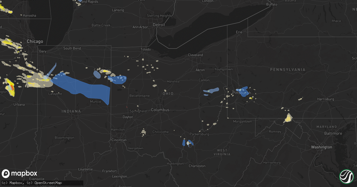
Hail Map in Ohio on July 23, 2022
Get this storm
July 23 map
$229
one time, instant access
Download today. No call, no setup
Keep the $229
Bought the map and want the full workflow? Apply the entire $229 to a subscription within 7 days. None of it is wasted.
Every map, not just this one
This buys you this map. Subscription and you get every map we run, in the markets you choose from a few cities to whole states to nationwide. Plus real-time alerts the moment a storm fires.
Contact data
Name, contact info, occupancy, even credit band for addresses in the footprint. You go from where it hit to who to call.
Become the source they trust
Unlimited branding weather history reports on demand. You already have the documented answer ready for the property owner, and you are the one who showed up with it.
Property data and RoofTrace estimates
Pull up any address you have got, its value and the exact code rules for that jurisdiction, straight from One Click Code. Then RoofTrace estimates the squares, pitch, and roof value, priced the way you price.
Storm reports in Ohio
Ohio
| Date | Description |
|---|---|
| 07/23/20221:35 PM CDT | Report of trees down along state route 255. Time estimated based on radar. |
| 07/23/20221:35 PM CDT | Report of power lines down. Time estimated based on radar. |
| 07/23/20221:18 PM CDT | Multiple trees on powerlines down across the county. |
| 07/23/20221:17 PM CDT | Report of trees and power lines down across southern portion of columbiana county. Location and time estimated based on radar. |
| 07/23/20221:07 PM CDT | Report of multiple trees down along state route 148. Time estimated based on radar. |
| 07/23/20221:07 PM CDT | Report of numerous trees down in the area. Time estimated based on radar. |
| 07/23/20221:05 PM CDT | Over a dozen shingles blown from a roof on a house. |
| 07/23/20221:00 PM CDT | Report from mping: 1-inch tree limbs broken; shingles blown off. |
| 07/23/20221:00 PM CDT | Report of multiple trees down. Time estimated based on radar. |
| 07/23/202212:59 PM CDT | Report of multiple trees down along state route 148. Time estimated based on radar. |
| 07/23/202212:58 PM CDT | Report of power lines down and power outages around richmond. Time estimated based on radar. |
| 07/23/202212:55 PM CDT | Report of multiple trees down creating issues on state route 147. Time estimated based on radar. |
| 07/23/202212:54 PM CDT | Multiple trees on powerlines down across the county. |
| 07/23/202212:50 PM CDT | Trees and power lines down. |
| 07/23/202212:36 PM CDT | Trees down. Time estimated on radar. |
| 07/23/202212:34 PM CDT | Trees down. Time estimated by radar. |
| 07/23/202212:30 PM CDT | Multiple trees down on polerlines across the county. |
| 07/23/202212:24 PM CDT | Report of power lines down. Time estimated based on radar. |
| 07/23/202212:16 PM CDT | Reports of power lines down. Time estimated based on radar. |
| 07/23/202212:15 PM CDT | A local report indicates 58 MPH wind near NEWCOMERSTOWN |
| 07/23/202212:15 PM CDT | A local report indicates 60 MPH wind near NEW PHILADELPHIA |
| 07/23/202212:12 PM CDT | Report of power lines down. Time estimated based on radar. |
| 07/23/202212:12 PM CDT | Reports of power lines down. Time estimated based on radar. |
| 07/23/202212:10 PM CDT | Multiple large trees down. Power lines down. |
| 07/23/202212:00 PM CDT | Large tree fell in house... Knocking down power lines. Photo verified. Time estimated from radar. |
| 07/23/202212:00 PM CDT | Numerous trees and powerlines down in west lafayette and west of coshocton along us 36 and county road 621. Powerlines and trees down and on fire along county road 6. |
| 07/23/202211:27 AM CDT | Trees down on east main street near a gazebo. Photo verified. Time estimated from radar. |
| 07/23/202211:26 AM CDT | Observer witnessed 8-10 inch healthy tree branch fall. |
| 07/23/202211:22 AM CDT | Reports of several small trees down across the southwest part of holmes county. |
| 07/23/202211:19 AM CDT | Smaller trees and branches down. Photo verified. Time estimated from radar. |
| 07/23/202211:14 AM CDT | Large branch fell on house on south hinde. Photo verified. Time estimated from radar. |
| 07/23/202211:09 AM CDT | Numerous trees down across knox county... Especially in fredericktown... Mt vernon... And martinsburg. |
| 07/23/202211:00 AM CDT | Tree down at township rd 15 and county rd 15. |
| 07/23/202210:54 AM CDT | Large decaying tree fell. Photo verified. Time estimated. |
| 07/23/202210:54 AM CDT | Tree on roof in hilltop neighborhood. Photo verified. Time estimated from radar. |
| 07/23/202210:52 AM CDT | Numerous reports of trees and power poles down... Mainly in sunbury area and east part of delaware county. Time estimated from radar. |
| 07/23/202210:51 AM CDT | A few 6 inch limbs down. Time estimated from radar. |
| 07/23/202210:49 AM CDT | Very small branches down morse and high street. Photo verified. |
| 07/23/202210:49 AM CDT | From personal weather station. |
| 07/23/202210:49 AM CDT | Tree on wires. Photo verified. Time estimated from radar. |
| 07/23/202210:47 AM CDT | Several trees down in the marengo area. |
| 07/23/202210:45 AM CDT | Several branches down from one tree. Photo verified. Time estimated from radar. |
| 07/23/202210:43 AM CDT | Large branch down at indian springs school. Photo verified. Time estimated from radar. |
| 07/23/202210:42 AM CDT | Roof damage reported to 911. Also... Numerous calls throughout madison county reporting trees and power poles down. Time estimated from radar. |
| 07/23/202210:37 AM CDT | 4 inch diameter tree down. |
| 07/23/202210:35 AM CDT | From personal weather station. |
| 07/23/202210:31 AM CDT | 2 trees down in bucyrus - one down on a power line in aumiller park and one down blocking a road. |
| 07/23/202210:24 AM CDT | Corrects previous tstm wnd dmg report from 1 s marion. Poles and lines down on barks rd at southland pkwy... Temporarily closing the road down. |
| 07/23/202210:24 AM CDT | Power lines down... Closing a portion of the road. |
| 07/23/202210:21 AM CDT | Medium-sized branch down. Photo verified. Time estimated from radar. |
| 07/23/202210:20 AM CDT | Numerous reports of trees down between richwood and milford center. Time estimated from radar. |
| 07/23/202210:07 AM CDT | Power pole fell. Photo verified. Time estimated from radar. |
| 07/23/202210:06 AM CDT | One large tree uprooted into power lines.... Another large tree down. Photo verified. Time estimated from radar. |
| 07/23/202210:04 AM CDT | Numerous reports of trees and power poles down throughout champaign county. Time estimated from radar. |
| 07/23/202210:02 AM CDT | Power pole down on east carpenter drive. Time estimated from radar. |
| 07/23/202210:02 AM CDT | Power pole down on north main street. Time estimated from radar. |
| 07/23/20229:58 AM CDT | Power pole down on east newell street. Time estimated from radar. |
| 07/23/20229:54 AM CDT | Power poles down on township hwy 199 west. Time estimated from radar. |
| 07/23/20229:47 AM CDT | First financial bank sign damaged from winds. Photo verified. Time estimated from radar. |
| 07/23/20229:46 AM CDT | Numerous trees down near ridge avenue. Photo verified. Time estimated from radar. |
| 07/23/20229:43 AM CDT | 256 calls came in to the 911 center regarding storm damage throughout the county. Numerous trees and power poles down. Time estimated from radar. |
| 07/23/20229:39 AM CDT | Several large branches and a fence down near washington primary school. Photo verified. Time estimated from radar. |
| 07/23/20229:38 AM CDT | Large branches down... As well as power pole snapped. |
| 07/23/20229:34 AM CDT | Tree down on power line. |
| 07/23/20229:33 AM CDT | Tree fell on wires. Time estimated from radar. |
| 07/23/20229:32 AM CDT | Tree down over road. Time estimated from radar. |
| 07/23/20229:31 AM CDT | Trees and poles down in new paris area. Time estimated from radar. |
| 07/23/20229:28 AM CDT | Tree down over road. Time estimated from radar. |
| 07/23/20229:27 AM CDT | Power pole down on state route 119. Time estimated from radar. |
| 07/23/20229:27 AM CDT | Large branch and several smaller branches down. Photo verified. Time estimated from radar. |
| 07/23/20229:26 AM CDT | Trees down. Time estimated from radar |
| 07/23/20229:21 AM CDT | Numerous trees and power poles down primarily between versailles... Greenville... And ansonia. Time estimated from radar. |
| 07/23/20229:20 AM CDT | Estimated frequent 50-60 mph gusts in bluffton near the hancock/allen county line... Perhaps briefly stronger. |
| 07/23/20229:18 AM CDT | Tree down on indian trail road. Time estimated from radar. |
| 07/23/20229:08 AM CDT | Tree down on greenville road. Removed by law enforcement. Time estimated from radar. |
| 07/23/20228:35 AM CDT | Numerous trees and power lines down. Park shelter destroyed. Time estimated from radar. |
| 07/23/20226:27 AM CDT | At 1126 AM EDT, severe thunderstorms were located along a line extending from near Crestline to Waldo, moving east at 40 mph. HAZARD...60 mph wind gusts. SOURCE...Radar indicated. IMPACT...Expect damage to trees and power lines. Locations impacted include... Mansfield, Marion, Bucyrus, Mount Gilead, Galion, Shelby, Ontario, Lexington, Crestline, Fredericktown, Cardington, Bellville, Plymouth, Ashley, Prospect, New Washington, Waldo, Chesterville, Sparta and Waterford. |
| 07/23/20226:13 AM CDT | At 1112 AM EDT, severe thunderstorms were located along a line extending from West Mansfield to Springfield, moving east at 40 mph. HAZARD...60 mph wind gusts and penny size hail. SOURCE...Radar indicated. IMPACT...Expect damage to trees and power lines. Locations impacted include... Columbus, Springfield, Dublin, Delaware, Hilliard, Marysville, Urbana, London, Jefferson, Powell, Plain City, West Jefferson, Richwood, South Charleston, Mechanicsburg, North Lewisburg, Ashley, West Mansfield, Choctaw Lake and New California.This includes I-70 in Ohio between mile markers 52 and 91. |
| 07/23/20225:46 AM CDT | At 1045 AM EDT, severe thunderstorms were located along a line extending from near Sycamore to near Kenton, moving east at 45 mph. HAZARD...60 mph wind gusts and penny size hail. SOURCE...Public. IMPACT...Expect damage to trees and power lines. Locations impacted include... Marion, Bucyrus, Upper Sandusky, Galion, Crestline, Prospect, New Washington, Sycamore, La Rue, Morral, Waldo, Chatfield, Marseilles, Benton, Nevada, Caledonia, New Bloomington, Green Camp, Tiro and North Robinson. |
| 07/23/20225:38 AM CDT | At 1037 AM EDT, severe thunderstorms were located along a line extending from near New Riegel to 6 miles east of Vanlue, moving east at 35 mph. HAZARD...60 mph wind gusts. SOURCE...Public. IMPACT...Expect damage to trees and power lines. Locations impacted include... Tiffin, Bloomville, New Riegel, Attica, Republic and Bascom. |
| 07/23/20225:37 AM CDT | At 1036 AM EDT, severe thunderstorms were located along a line extending from near Lakeview to near Piqua, moving east at 55 mph. HAZARD...60 mph wind gusts and penny size hail. SOURCE...Radar indicated. IMPACT...Expect damage to trees and power lines. Locations impacted include... Springfield, Bellefontaine, Urbana, New Carlisle, St. Paris, West Liberty, Mechanicsburg, North Lewisburg, Russells Point, De Graff, Lakeview, Belle Center, West Mansfield, Chippewa Park, Northwood, Quincy, Christiansburg, Rushsylvania, North Hampton and Huntsville. |
| 07/23/20225:25 AM CDT | At 1024 AM EDT, severe thunderstorms were located along a line extending from near Rawson to near Ada, moving east at 40 mph. At 1022 AM, public reports estimated 60 mph winds just east of Bluffton. HAZARD...60 mph wind gusts and penny size hail. SOURCE...Public. IMPACT...Expect damage to trees and power lines. Locations impacted include... Findlay, Upper Sandusky, Bluffton, Forest, Arlington, Sycamore, Rawson, Vanlue, Marseilles, Carey, Mount Blanchard, Wharton, Benton Ridge, Jenera, Mount Cory, Kirby and Williamstown. |
| 07/23/20225:17 AM CDT | At 1017 AM EDT, severe thunderstorms were located along a line extending from Minster to New Madison, moving southeast at 45 mph. HAZARD...60 mph wind gusts and penny size hail. SOURCE...Radar indicated. IMPACT...Expect damage to trees and power lines. Locations impacted include... Troy, Sidney, Piqua, Tipp City, West Milton, New Bremen, Minster, Covington, Newport, Bradford, Anna, Fort Loramie, Pleasant Hill, Botkins, Hardin, Union, Russia, Laura, Fletcher and Port Jefferson.This includes I-75 in Ohio between mile markers 67 and 102. |
| 07/23/20224:59 AM CDT | At 959 AM EDT, severe thunderstorms were located along a line extending from near Portland to 7 miles west of Winchester to 8 miles south of Muncie, moving southeast at 60 mph. HAZARD...60 mph wind gusts and penny size hail. SOURCE...Radar indicated. IMPACT...Expect damage to trees and power lines. Locations impacted include... Richmond, Greenville, Coldwater, Centerville, Cambridge City, Versailles, St. Henry, Arcanum, Hagerstown, Union City, New Paris, Fort Recovery, Ansonia, New Madison, Fountain City, Dublin, Franklin, Webster, Wayne Lakes and Gettysburg.This includes the following Interstates... I-70 in Indiana between mile markers 134 and 156. I-70 in Ohio between mile markers 0 and 11. |
| 07/23/20224:57 AM CDT | At 957 AM EDT, a severe thunderstorm was located 9 miles west of Winchester, or 12 miles east of Muncie, moving southeast at 55 mph. HAZARD...60 mph wind gusts. SOURCE...Radar indicated. IMPACT...Expect damage to roofs, siding, and trees. This severe thunderstorm will be near... Winchester around 1005 AM EDT. Lynn around 1015 AM EDT. |
| 07/23/20224:46 AM CDT | At 946 AM EDT, severe thunderstorms were located along a line extending from near Ottoville to near Spencerville, moving east at 40 mph. HAZARD...70 mph wind gusts. SOURCE...Radar indicated. IMPACT...Expect considerable tree damage. Damage is likely to mobile homes, roofs, and outbuildings. Locations impacted include... Lima, Delphos, Ottawa, Bluffton, Fort Shawnee, Spencerville, Columbus Grove, Elida, Kalida, Pandora, Spencerville In Allen County, Cairo, Fort Jennings, Harrod, Beaverdam, Yoder, Westminster, Rushmore, Gomer and Rimer.This includes Interstate 75 between mile markers 119 and 141. |
| 07/23/20224:44 AM CDT | At 944 AM EDT, severe thunderstorms were located along a line extending from near Pennville to near Albany, moving southeast at 60 mph. HAZARD...70 mph wind gusts. SOURCE...Radar indicated. IMPACT...Expect considerable tree damage. Damage is likely to mobile homes, roofs, and outbuildings. Locations impacted include... Portland, Berne, Dunkirk, Redkey, Geneva, Pennville, Westchester, Center, Nottingham, Bryant, Salamonia, Trinity, Brice, Mill Grove, Como, Bellfountain, Collett, Domestic, Balbec and New Mount Pleasant. |
| 07/23/20224:18 AM CDT | At 917 AM EDT, severe thunderstorms were located along a line extending from near Convoy to near Geneva, moving east at 40 mph. HAZARD...60 mph wind gusts and penny size hail. SOURCE...Radar indicated. IMPACT...Expect damage to trees and power lines. Locations impacted include... Celina, Wapakoneta, St. Marys, Coldwater, Fort Shawnee, New Bremen, Minster, St. Henry, Cridersville, Fort Recovery, Rockford, New Knoxville, Moulton, Wabash, Mendon, Chickasaw, Burkettsville, Buckland, Montezuma and Tama.This includes I-75 in Ohio between mile markers 113 and 118. |
| 07/23/20224:13 AM CDT | At 913 AM EDT, severe thunderstorms were located along a line extending from near Monroeville to Decatur, moving east at 35 mph. HAZARD...70 mph wind gusts. SOURCE...Radar indicated. IMPACT...Expect considerable tree damage. Damage is likely to mobile homes, roofs, and outbuildings. Locations impacted include... Van Wert, Decatur, Delphos, Kalida, Monroeville, Convoy, Ottoville, Ohio City, Middlebury, Preble, Middle Point, Dixon, Fort Jennings, Scott, Wren, Venedocia, Elgin, Peterson, Cavett and Dull. |
| 07/23/20224:06 AM CDT | At 906 AM EDT, severe thunderstorms were located along a line extending from near Decatur to near Bluffton, moving southeast at 45 mph. HAZARD...70 mph wind gusts. SOURCE...Radar indicated. IMPACT...Expect considerable tree damage. Damage is likely to mobile homes, roofs, and outbuildings. Locations impacted include... Berne, Geneva, Monroe, Westchester, Willshire, Bryant, Vera Cruz, Trinity, Craigville, Ceylon, Reiffsburg, Peterson, Petroleum, Bellfountain, Abanaka, Linn Grove, Domestic, New Corydon, Schumm and Curryville. |
| 07/23/20223:30 AM CDT | At 829 AM EDT, severe thunderstorms were located along a line extending from near Butler to near New Haven to near Markle, moving east at 45 mph. HAZARD...60 mph wind gusts. SOURCE...Radar indicated. IMPACT...Expect damage to roofs, siding, and trees. Locations impacted include... Fort Wayne, Huntington, Defiance, New Haven, Van Wert, Decatur, Ossian, Paulding, Antwerp, Woodburn, Monroeville, Payne, Convoy, Grabill, Aboite, Leo-cedarville, Middletown, Roanoke, Middlebury and Preble.This includes the following highways... Interstate 469 between mile markers 0 and 30. Interstate 69 in Indiana between mile markers 288 and 321. |
| 07/22/20229:47 PM CDT | At 246 PM EDT, a severe thunderstorm was located over Ripley, moving southeast at 40 mph. HAZARD...60 mph wind gusts. SOURCE...Radar indicated. IMPACT...Expect damage to roofs, siding, and trees. Locations impacted include... Ripley, Spencer, Ravenswood, Clendenin, Sandyville, Kenna, Amma, Mount Alto, Statts Mills, Harmony, Tariff, Given, Kentuck, Walton, Cottageville, Left Hand, Evans, Looneyville, Leroy and Fairplain.This includes the following highways... Interstate 79 between mile markers 14 and 30. Interstate 77 in West Virginia between mile markers 125 and 155. |
| 07/22/20229:41 PM CDT | At 240 PM EDT, severe thunderstorms were located along a line extending from near Cameron to near Paden City, moving east at 50 mph. HAZARD...60 mph wind gusts. SOURCE...Radar indicated. IMPACT...Expect damage to trees and power lines, resulting in some power outages. Locations impacted include... New Martinsville, Mannington, Paden City, Cameron, Pine Grove, Fairview, Hundred, Jacksonburg, Grant Town, Sardis, Farmington, and Aleppo. |
| 07/22/20229:11 PM CDT | At 210 PM EDT, a severe thunderstorm was located near Racine, moving southeast at 50 mph. HAZARD...60 mph wind gusts and quarter size hail. SOURCE...Radar indicated. IMPACT...Hail damage to vehicles is expected. Expect wind damage to roofs, siding, and trees. Locations impacted include... Ripley, Spencer, Pomeroy, Racine, Forked Run State Park, Ravenswood, New Haven, Mason, Sandyville, Kenna, Middleport, Syracuse, Hartford City, Cheshire, Portland, Statts Mills, Lakin, Given, Kentuck and Cottageville.This includes Interstate 77 in West Virginia between mile markers 121and 155. |
| 07/22/20228:43 PM CDT | At 143 PM EDT, a severe thunderstorm was located near Albany, moving east at 35 mph. HAZARD...60 mph wind gusts and nickel size hail. SOURCE...Radar indicated. IMPACT...Expect damage to roofs, siding, and trees. Locations impacted include... Mcarthur, Lake Hope State Park, Hamden, Zaleski, Creola, Allensville and Radcliffe. |
| 07/22/20228:41 PM CDT | At 141 PM EDT, a severe thunderstorm was located 7 miles south of Carrollton, moving east at 25 mph. HAZARD...60 mph wind gusts and quarter size hail. SOURCE...Radar indicated. IMPACT...Minor hail damage to vehicles is possible. Expect wind damage to trees and power lines, resulting in some power outages. Locations impacted include... Carrollton, Hopedale, Scio, Jewett, Bergholz, Amsterdam, Bowerston, Dellroy, Leesville, Kilgore, Leesville Lake Park, and Harlem Springs. |
| 07/22/20228:32 PM CDT | At 131 PM EDT, outflow from severe thunderstorms was located along a line extending from near Cadiz to 7 miles west of Barnesville, moving southeast at 35 mph. Thunderstorms will follow the outflow across the warning area. HAZARD...60 mph wind gusts. SOURCE...Radar indicated. IMPACT...Expect damage to trees and power lines, resulting in some power outages. Locations impacted include... St. Clairsville, Barnesville, Cadiz, Freeport, Byesville, Bethesda, Antrim, Flushing, Adena, Dillonvale, Quaker City, and Mount Pleasant. |
| 07/22/20228:22 PM CDT | At 122 PM EDT, a severe thunderstorm was located near Mcarthur, moving southeast at 35 mph. HAZARD...60 mph wind gusts and nickel size hail. SOURCE...Radar indicated. IMPACT...Expect damage to roofs, siding, and trees. Locations impacted include... Mcarthur, Lake Hope State Park, Hamden, Zaleski, Creola, Allensville and Radcliffe. |
| 07/22/20228:11 PM CDT | At 110 PM EDT, a severe thunderstorm was located near New Philadelphia, moving east at 40 mph. HAZARD...60 mph wind gusts. SOURCE...Radar indicated. IMPACT...Expect damage to trees and power lines, resulting in some power outages. Locations impacted include... New Philadelphia, Dover, Uhrichsville, Carrollton, Midvale, Mineral City, Bowerston, Barnhill, Dellroy, Sherrodsville, Roswell, and Zoar. |
| 07/22/20228:05 PM CDT | At 105 PM EDT, severe thunderstorms were located along a line extending from 7 miles southwest of New Philadelphia to 6 miles east of Zanesville, moving east at 50 mph. HAZARD...60 mph wind gusts. SOURCE...Radar indicated. IMPACT...Expect damage to trees and power lines, resulting in some power outages. Locations impacted include... Zanesville, Cambridge, Uhrichsville, Barnesville, Cadiz, Freeport, Newcomerstown, Dennison, New Concord, Byesville, Gnadenhutten, and Antrim. |
All States Impacted by Hail Map on July 23, 2022
Cities Impacted by Hail Map on July 23, 2022
- Byron, MN
- Hayfield, MN
- Stewartville, MN
- Lonsdale, MN
- Montgomery, MN
- Elroy, WI
- Alger, MI
- Gladwin, MI
- Ortley, SD
- Wallace, SD
- Florence, SD
- Stevens Point, WI
- Rudolph, WI
- Grand Haven, MI
- Spring Lake, MI
- Peever, SD
- Webster, SD
- Waubay, SD
- Spring Valley, MN
- Rochester, MN
- Eyota, MN
- Glenbeulah, WI
- Bangor, WI
- Saint Paul, NE
- Wolbach, NE
- Hillsboro, WI
- Wonewoc, WI
- Smithland, IA
- Hornick, IA
- Plainfield, IL
- South Shore, SD
- Milbank, SD
- Marvin, SD
- Ortonville, MN
- Bellingham, MN
- Stockholm, SD
- Marietta, MN
- Goodwin, SD
- Revillo, SD
- Odessa, MN
- Big Stone City, SD
- Labolt, SD
- Watertown, SD
- Summit, SD
- Strandburg, SD
- Twin Brooks, SD
- Hillpoint, WI
- La Valle, WI
- Cazenovia, WI
- Pittsville, WI
- Poynette, WI
- Farwell, NE
- Miller, NE
- Rockville, NE
- Dannebrog, NE
- Boelus, NE
- Ravenna, NE
- Bertrand, NE
- Lexington, NE
- Elm Creek, NE
- Sumner, NE
- Hazard, NE
- Loup City, NE
- Amherst, NE
- Palmer, NE
- Smithfield, NE
- Overton, NE
- Elba, NE
- Ashton, NE
- Pleasanton, NE
- Bowling Green, OH
- Riverdale, NE
- Greensburg, PA
- Jeannette, PA
- Morgan, MN
- Sleepy Eye, MN
- Bristow, IA
- Aredale, IA
- Dumont, IA
- Watertown, WI
- Lake Mills, WI
- Williams, IA
- Northwood, IA
- Bowerston, OH
- Winamac, IN
- Star City, IN
- Kewanna, IN
- Middlebourne, WV
- New Creek, WV
- Grand Meadow, MN
- Racine, MN
- Doon, IA
- Wisconsin Rapids, WI
- West Olive, MI
- Hanley Falls, MN
- Belle Plaine, MN
- Gibbon, MN
- Gaylord, MN
- Madison, MN
- Granite Falls, MN
- Belview, MN
- Morton, MN
- Henderson, MN
- Watson, MN
- Clarkfield, MN
- Echo, MN
- Bird Island, MN
- Montevideo, MN
- Franklin, MN
- Sacred Heart, MN
- Wood Lake, MN
- Maynard, MN
- Arlington, MN
- Winthrop, MN
- Redwood Falls, MN
- Le Sueur, MN
- Dawson, MN
- Danube, MN
- Clara City, MN
- New Prague, MN
- Milan, MN
- Lafayette, MN
- New Ulm, MN
- Olivia, MN
- Renville, MN
- Le Center, MN
- Fairfax, MN
- Saint Peter, MN
- Berlin, WI
- Ripon, WI
- East Tawas, MI
- Friendship, WI
- Mauston, WI
- Wisconsin Dells, WI
- Lyndon Station, WI
- Coloma, WI
- Adams, WI
- Westfield, WI
- Grand Marsh, WI
- Oxford, WI
- Custar, OH
- Weston, OH
- Creola, OH
- Canaan, VT
- Norton, VT
- Averill, VT
- Van Wert, OH
- Middle Point, OH
- Newton, WV
- Left Hand, WV
- Chatfield, MN
- Easton, MN
- Minnesota Lake, MN
- Channahon, IL
- Belle Vernon, PA
- West Newton, PA
- Smithton, PA
- Brillion, WI
- Leechburg, PA
- New Kensington, PA
- Fort Atkinson, WI
- Jefferson, WI
- Newell, IA
- Albert City, IA
- Storm Lake, IA
- Hector, MN
- Beaver Dam, WI
- Stratford, SD
- Andover, SD
- Conde, SD
- Ferney, SD
- Bristol, SD
- Groton, SD
- Mikado, MI
- Greenbush, MI
- New Lisbon, WI
- Whitelaw, WI
- Valders, WI
- Newton, WI
- New Holstein, WI
- Chilton, WI
- Manitowoc, WI
- Saint Nazianz, WI
- Reedsville, WI
- Kiel, WI
- Pittsburg, NH
- Malone, WI
- Saint Cloud, WI
- Lanesboro, MN
- Preston, MN
- Dover, MN
- La Crosse, WI
- Coon Valley, WI
- West Salem, WI
- Stoddard, WI
- Chaseburg, WI
- Winona, MN
- Lewiston, MN
- La Crescent, MN
- Houston, MN
- Caledonia, MN
- Hokah, MN
- Derby Line, VT
- Deerfield, WI
- Marshall, WI
- Salem, WI
- Saukville, WI
- Port Washington, WI
- Random Lake, WI
- Oostburg, WI
- Belgium, WI
- Fredonia, WI
- Kewaskum, WI
- West Bend, WI
- Cedar Grove, WI
- Princeton, WI
- Neshkoro, WI
- Johnson Creek, WI
- Hartford, WI
- Black River Falls, WI
- Schleswig, IA
- Lake Mills, IA
- Fertile, IA
- Joice, IA
- Thompson, IA
- Hanlontown, IA
- Leland, IA
- Forest City, IA
- Everett, PA
- Bedford, PA
- Boyd, MN
- Webster City, IA
- Blairsburg, IA
- Coraopolis, PA
- Sewickley, PA
- Pittsburgh, PA
- Adell, WI
- Campbellsport, WI
- Sheboygan, WI
- Sheboygan Falls, WI
- Chatsworth, IL
- Piper City, IL
- Roberts, IL
- Westby, WI
- Genoa, WI
- Viroqua, WI
- Marion, NC
- Milton, WI
- Avalon, WI
- Mazomanie, WI
- Cross Plains, WI
- Middleton, WI
- Waunakee, WI
- Black Earth, WI
- Lake Geneva, WI
- Stoughton, WI
- Delavan, WI
- Edgerton, WI
- Whitewater, WI
- Janesville, WI
- Elkhorn, WI
- Oregon, WI
- Madison, WI
- Deforest, WI
- Sauk City, WI
- Dane, WI
- Lodi, WI
- Mcfarland, WI
- Cambridge, WI
- Cottage Grove, WI
- Broadway, NC
- Lillington, NC
- Wheaton, IL
- Lindsay, NE
- Saint Edward, NE
- Newman Grove, NE
- Primrose, NE
- Madison, NE
- Albion, NE
- Spalding, NE
- Humphrey, NE
- Cedar Rapids, NE
- Marquette, WI
- Dalton, WI
- Montello, WI
- Kingston, WI
- Markesan, WI
- Randolph, WI
- Buckhorn, KY
- Oneida, KY
- Greenup, KY
- Burgettstown, PA
- Georgetown, PA
- Moorefield, WV
- Mount Gilead, OH
- Cardington, OH
- Riverton, WV
- Upper Tract, WV
- Seneca Rocks, WV
- Flatwoods, WV
- Ohio City, OH
- Old Fields, WV
- Baker, WV
- Fisher, WV
- Rio, WV
- Webbville, KY
- Grayson, KY
- Sandy Hook, KY
- Pine Island, MN
- Olive Hill, KY
- Vanceburg, KY
- Emerson, KY
- Nebo, NC
- New Haven, IN
- Fort Wayne, IN
- Monroeville, IN
- Delphos, OH
- Glenshaw, PA
- Pontiac, IL
- Lamar, CO
- Chenoa, IL
- McCook, NE
- Letart, WV
- Hartford, WV
- Racine, OH
- Pomeroy, OH
- Syracuse, OH
- New Haven, WV
- Mason, WV
- Mount Pleasant, SC
- Cooksville, IL
- Colfax, IL
- Arrowsmith, IL
- Anchor, IL
- Foosland, IL
- Forrest, IL
- Gibson City, IL
- Bellflower, IL
- Cropsey, IL
- Saybrook, IL
- Fairbury, IL
- Lexington, IL
- Sibley, IL
- Fisher, IL
- Strawn, IL
- Petersburg, WV
- Ashland, KY
- Garrison, KY
- Rush, KY
- Argillite, KY
- Buckley, IL
- Bulger, PA
- Vanlue, OH
- Carey, OH
- Findlay, OH
- Alvada, OH
- Rayland, OH
- Yorkville, OH
- Tiltonsville, OH
- Decatur, IN
- Newport, OH
- Leicester, NC
- Alexander, NC
- Charleston, TN
- Cameron, NC
- Sanford, NC
- Vass, NC
- Eagle Rock, VA
- Helenwood, TN
- Oneida, TN
- Claremont, MN
- Dodge Center, MN
- Eustis, NE
- Fuquay Varina, NC
- Louisa, KY
- Bowling Green, KY
- Utica, MN
- Peterson, MN
- Wanamingo, MN
- West Concord, MN
- Seminole, FL
- Saint Petersburg, FL
- Clearwater, FL
- Largo, FL
- Pinellas Park, FL
- Kasota, MN
- Morehead, KY
- Salt Lick, KY
- Tampa, FL
- Manchester, KY
- Irwin, PA
- Adamsburg, PA
- Odessa, FL
- New Port Richey, FL
- Land O'Lakes, FL
- Sheldon, IL
- Crescent City, IL
- Milford, IL
- Fowler, IN
- Onarga, IL
- Watseka, IL
- Earl Park, IN
- Stockland, IL
- Cissna Park, IL
- Hubertus, WI
- Richfield, WI
- Colebrook, NH
- Owatonna, MN
- Blooming Prairie, MN
- Fenwick, MI
- Sheridan, MI
- Walterboro, SC
- Genoa, WV
- Wayne, WV
- Prichard, WV
- Fort Gay, WV
- Jacksonburg, WV
- Smithfield, WV
- Oldtown, MD
- Green Spring, WV
- Springfield, WV
- Fort Ashby, WV
- Levels, WV
- Burlington, WV
- Keyser, WV
- Romney, WV
- Olympia, KY
- Kingstree, SC
- Nesmith, SC
- Ronda, NC
- Roaring River, NC
- Hamptonville, NC
- Jonesville, NC
- Hayward, MN
- Waldorf, MN
- Brownsdale, MN
- Pemberton, MN
- Good Thunder, MN
- Eagle Lake, MN
- Hollandale, MN
- Mankato, MN
- Lansing, MN
- Waseca, MN
- Mapleton, MN
- Clarks Grove, MN
- Austin, MN
- Albert Lea, MN
- Geneva, MN
- Dexter, MN
- Janesville, MN
- Hartland, MN
- New Richland, MN
- Ellendale, MN
- Saint Clair, MN
- Glenville, MN
- Hoagland, IN
- Payne, OH
- Fort Jennings, OH
- Peotone, IL
- East Waterford, PA
- Blairs Mills, PA
- Shade Gap, PA
- Orbisonia, PA
- West Jefferson, NC
- Bourbonnais, IL
- Pembroke Township, IL
- Grant Park, IL
- Kankakee, IL
- Manteno, IL
- Wilmington, IL
- Manhattan, IL
- Momence, IL
- State Road, NC
- Elkin, NC
- Middlesboro, KY
- Winkelman, AZ
- Seneca, IL
- Ransom, IL
- Remington, IN
- Minooka, IL
- Continental, OH
- Ottawa, OH
- Albany, OH
- Arcadia, FL
- Fox Lake, WI
- Kenyon, MN
- Mapleton, IA
- Oto, IA
- Brilliant, OH
- Mingo Junction, OH
- Wellsburg, WV
- Lane, SC
- Andrews, SC
- Hillsboro, OH
- Alum Bridge, WV
- Troy, WV
- Linn, WV
- Coxs Mills, WV
- Fostoria, OH
- Kansas, OH
- Sardis, OH
- Wingett Run, OH
- New Matamoras, OH
- Graysville, OH
- Marietta, OH
- Portland, OH
- Maple Park, IL
- Point Pleasant, WV
- Slinger, WI
- Germantown, WI
- Lomira, WI
- Menomonee Falls, WI
- Allenton, WI
- Mayville, WI
- Iron Ridge, WI
- Theresa, WI
- Hustisford, WI
- Neosho, WI
- Jackson, WI
- Lannon, WI
- Horicon, WI
- Milwaukee, WI
- Rubicon, WI
- Burnett, WI
- Brownsville, WI
- Colgate, WI
- Sussex, WI
- Juneau, WI
- New Martinsville, WV
- Lewisburg, WV
- Maxwelton, WV
- Ivel, KY
- Gilman, IL
- Ashkum, IL
- Dana, IA
- Paton, IA
- Allison Park, PA
- Martinsburg, WV
- Kearneysville, WV
- Shepherdstown, WV
- New Vienna, OH
- Leesburg, OH
- Sabina, OH
- Rushford, MN
- Mount Pleasant, PA
- Kernersville, NC
- High Point, NC
- Herminie, PA
- Darragh, PA
- New Stanton, PA
- Arona, PA
- Medford, MN
- Faribault, MN
- Morganton, NC
- Deshler, OH
- Lake Crystal, MN
- Whiteriver, AZ
- Tazewell, VA
- Bastian, VA
- Bryson City, NC
- Overgaard, AZ
- Madison Lake, MN
- Newberry, FL
- Pioneer, TN
- La Follette, TN
- Savannah, GA
- Oronoco, MN
- Mazeppa, MN
- Oswego, IL
- Aurora, IL
- Bolingbrook, IL
- Montgomery, IL
- Naperville, IL
- Winfield, TN
- Prestonsburg, KY
- Cabins, WV
- Salyersville, KY
- West Liberty, KY
- Rensselaer, IN
- Valley Grove, WV
- West Alexander, PA
- Dallas, WV
- Triadelphia, WV
- West Finley, PA
- Tiffin, OH
- Rochelle, IL
- New Riegel, OH
- Franklin Grove, IL
- Dixon, IL
- Sistersville, WV
- Lutz, FL
- Hanska, MN
- Eidson, TN
- Walden, CO
- Batavia, IL
- Lisle, IL
- North Aurora, IL
- Warrenville, IL
- Whitesburg, KY
- Mallie, KY
- Isom, KY
- Premium, KY
- North Charleston, SC
- Charleston, SC
- Romeoville, IL
- Lockport, IL
- Crest Hill, IL
- Roaring Gap, NC
- Indianola, NE
- Corning, IA
- Jackson, KY
- Hueysville, KY
- Vest, KY
- Jamestown, TN
- Clarkrange, TN
- Dunlow, WV
- Rutland, IL
- North Wilkesboro, NC
- Venice, FL
- Francesville, IN
- Hedgesville, WV
- West Lafayette, IN
- Reddick, IL
- Toluca, IL
- Minonk, IL
- Washburn, IL
- Peridot, AZ
- Port Charlotte, FL
- Saint Anne, IL
- Beaverville, IL
- Friendly, WV
- Homer Glen, IL
- Benson, IL
- Roanoke, IL
- Dana, IL
- Lowpoint, IL
- Varna, IL
- Flanagan, IL
- Lacon, IL
- El Paso, IL
- Metamora, IL
- Aroma Park, IL
- Fair Oaks, IN
- Donovan, IL
- Union Hill, IL
- Martinton, IL
- Braceville, IL
- Wolcott, IN
- Bonfield, IL
- Braidwood, IL
- Monon, IN
- Buckingham, IL
- Goodland, IN
- Clifton, IL
- Kempton, IL
- Herscher, IL
- Brookston, IN
- Reynolds, IN
- Gardner, IL
- Chebanse, IL
- Kentland, IN
- South Wilmington, IL
- Mazon, IL
- Essex, IL
- Brook, IN
- Chalmers, IN
- Danforth, IL
- Iroquois, IL
- Cullom, IL
- Morocco, IN
- Jacksonville, FL
- Yulee, FL
- Huger, SC
- Saint Charles, MN
- Truesdale, IA
- Alta, IA
- Northfield, MN
- Zumbro Falls, MN
- Nerstrand, MN
- Lafayette, IN
- Morris, IL
- Coal City, IL
- Little Orleans, MD
- Big Cove Tannery, PA
- Hancock, MD
- Needmore, PA
- Mercersburg, PA
- Great Cacapon, WV
- Berkeley Springs, WV
- Warfordsburg, PA
- Republic, OH
- Avella, PA
- Colliers, WV
- Creston, NE
- Britt, IA
- Garner, IA
- New Cumberland, WV
- Hilbert, WI
- Mount Morris, IL
- Oregon, IL
- Polo, IL
- Monticello, IN
- Englewood, FL
- Nokomis, FL
- North Port, FL
- Hundred, WV
- New Freeport, PA
- Littleton, WV
- Napoleon, OH
- Clinton, PA
- Onalaska, WI
- Henrico, VA
- Glen Allen, VA
- Readstown, WI
- Homosassa, FL
- Willshire, OH
- Wren, OH
- London, KY
- Hudson, FL
- Spring Hill, FL
- Crystal River, FL
- Inverness, FL
- Carthage, NC
- West End, NC
- Nicollet, MN
- Garden City, MN
- Saint James, MN
- Hope, MN
- Courtland, MN
- Emmons, MN
- Conger, MN
- Kasson, MN
- Twin Lakes, MN
- Warsaw, MN
- Waterville, MN
- Ostrander, MN
- Kiester, MN
- Sargeant, MN
- Morristown, MN
- Bricelyn, MN
- Madelia, MN
- Cleveland, MN
- Wells, MN
- Elkton, MN
- Waltham, MN
- Wykoff, MN
- Elysian, MN
- Mantorville, MN
- Alden, MN
- Union Grove, NC
- Cleveland, WI
- Frankfort, IL
- Joliet, IL
- Elwood, IL
- Mokena, IL
- New Lenox, IL
- Clearville, PA
- Saint Marys, OH
- Wapakoneta, OH
- Purgitsville, WV
- Benton, TN
- Reliance, TN
- Mount Calvary, WI
- Green Lake, WI
- Cambria, WI
- Waupun, WI
- Elkhart Lake, WI
- Fremont, OH
- Pittsboro, NC
- Todd, NC
- Weaverville, NC
- Adel, GA
- Blountstown, FL
- Dakota, MN
- Danbury, IA
- Clear Lake, SD
- Gary, SD
- Shannon, IL
- Lanark, IL
- Cortland, IL
- Big Rock, IL
- Sugar Grove, IL
- Mooseheart, IL
- Malta, IL
- Bristol, IL
- Sycamore, IL
- Waterman, IL
- Dekalb, IL
- Plano, IL
- Esmond, IL
- Chana, IL
- Hinckley, IL
- Yorkville, IL
- Shabbona, IL
- Elburn, IL
- Hampshire, IL
- Aurelia, IA
- Convoy, OH
- Kilkenny, MN
- Springfield, OH
- Archbold, OH
- Lake Village, IN
- Latrobe, PA
- Morgantown, WV
- Viper, KY
- Smilax, KY
- Hazard, KY
- Holland, MI
- Zeeland, MI
- Hudsonville, MI
- Greeley, NE
- Spruce Pine, NC
- Burnsville, NC
- Moorefield, NE
- Elwood, NE
- Winston Salem, NC
- Raton, NM
- Fernandina Beach, FL
- Viola, WI
- Allardt, TN
- Breezewood, PA
- Crystal Spring, PA
- Meadow Grove, NE
- Dillwyn, VA
- Singer, LA
- Mount Nebo, WV
- Glen Saint Mary, FL
- Vienna, WV
- Hays, NC
- Arcadia, OH
- North Baltimore, OH
- Van Buren, OH
- Bloomdale, OH
- Avonmore, PA
- Wewahitchka, FL
- Arcola, IN
- Livingston, LA
- Ruffin, SC
- Hillsboro, KY
- Larwill, IN
- Pierceton, IN
- South Whitley, IN
- Milledgeville, IL
- Woosung, IL
- Verona, IL
- Ottawa, IL
- Marseilles, IL
- Grand Ridge, IL
- Kinsman, IL
- Pikeville, KY
- Wytheville, VA
- Dublin, VA
- Fountain, MN
- Huntsville, TN
- Rollingstone, MN
- Altura, MN
- Green Isle, MN
- Sun Prairie, WI
- Burton, WV
- New Alexandria, PA
- Dexter City, OH
- Macksburg, OH
- Upper Sandusky, OH
- Harpster, OH
- McDonald, PA
- Midway, PA
- Sycamore, PA
- Prosperity, PA
- Graysville, PA
- Morral, OH
- Marion, OH
- Urbana, OH
- Dundas, MN
- Buffalo Lake, MN
- Stewart, MN
- Holdrege, NE
- Medaryville, IN
- Wheatfield, IN
- North Judson, IN
- La Crosse, IN
- San Pierre, IN
- Raymond, MN
- Prinsburg, MN
- North Freedom, WI
- Friesland, WI
- Baraboo, WI
- Norwalk, WI
- Ontario, WI
- Portage, WI
- Sparta, WI
- Pardeeville, WI
- Reedsburg, WI
- Endeavor, WI
- Camp Douglas, WI
- Merrimac, WI
- Briggsville, WI
- Brownsville, MN
- La Farge, WI
- Richland Center, WI
- Wilton, WI
- Rose Creek, MN
- Rockland, WI
- Cashton, WI
- Holmen, WI
- Kendall, WI
- Rock Springs, WI
- Appleton, WI
- Greenville, WI
- Poy Sippi, WI
- Fremont, WI
- Wautoma, WI
- Kaukauna, WI
- Omro, WI
- Black Creek, WI
- Menasha, WI
- Wrightstown, WI
- Oneida, WI
- Redgranite, WI
- Neenah, WI
- Seymour, WI
- Green Bay, WI
- Butte Des Morts, WI
- Pickett, WI
- Winneconne, WI
- Combined Locks, WI
- Forest Junction, WI
- Larsen, WI
- Kimberly, WI
- Little Chute, WI
- Oshkosh, WI
- Hortonville, WI
- De Pere, WI
- Greenleaf, WI
- Pine River, WI
- Sherwood, WI
- Waterloo, WI
- Mount Horeb, WI
- Belleville, WI
- Verona, WI
- Palmyra, WI
- Amsterdam, OH
- Hammondsville, OH
- Bergholz, OH
- Salineville, OH
- Irondale, OH
- Carrollton, OH
- Mineral City, OH
- Sherrodsville, OH
- Dennison, OH
- Scio, OH
- Mechanicstown, OH
- New Philadelphia, OH
- Uhrichsville, OH
- Middleport, OH
- Cheshire, OH
- Bidwell, OH
- Rutland, OH
- West Columbia, WV
- Long Bottom, OH
- Ravenswood, WV
- Wheeling, WV
- West Liberty, WV
- Bethany, WV
- Howells, NE
- Dodge, NE
- Clarkson, NE
- Leigh, NE
- Scribner, NE
- Snyder, NE
- Kirkman, IA
- Little Sioux, IA
- Blair, NE
- Magnolia, IA
- Pisgah, IA
- Portsmouth, IA
- Modale, IA
- Missouri Valley, IA
- Logan, IA
- Woodbine, IA
- Mondamin, IA
- Persia, IA
- Shelby, IA
- Tekamah, NE
- Harlan, IA
- Herman, NE
- Panama, IA
- Garden City, SD
- Aberdeen, SD
- Turton, SD
- Warner, SD
- Clark, SD
- Mellette, SD
- Bradley, SD
- Bath, SD
- Raymond, SD
- Brentford, SD
- Mansfield, SD
- Henry, SD
- Cheswick, PA
- Monroeville, PA
- West Mifflin, PA
- Russellton, PA
- Murrysville, PA
- Tarentum, PA
- Harwick, PA
- Oakmont, PA
- Springdale, PA
- Mckeesport, PA
- Turtle Creek, PA
- Glassport, PA
- Indianola, PA
- Verona, PA
- East Pittsburgh, PA
- Clairton, PA
- East McKeesport, PA
- Braddock, PA
- McKees Rocks, PA
- Wilmerding, PA
- Dravosburg, PA
- Duquesne, PA
- Creighton, PA
- North Versailles, PA
- Homestead, PA
- Trafford, PA
- Pitcairn, PA
- Waukon, IA
- Waterville, IA
- Lansing, IA
- Postville, IA
- Calmar, IA
- Decorah, IA
- Harpers Ferry, IA
- Comfrey, MN
- Zumbrota, MN
- Troy, OH
- Allendale, MI
- Grandville, MI
- Coopersville, MI
- Ravenna, MI
- Conklin, MI
- Nunica, MI
- Marne, MI
- Jenison, MI
- Muskegon, MI
- Grand Rapids, MI
- Wyoming, MI
- Comstock Park, MI
- Fruitport, MI
- Sparta, MI
- Jefferson, NC
- Maysville, WV
- Bryant, IN
- Saint Paris, OH
- Twelve Mile, IN
- West Milton, OH
- Onward, IN
- Hartford City, IN
- Ludlow Falls, OH
- Bluffton, IN
- Fletcher, OH
- Christiansburg, OH
- Peru, IN
- Matthews, IN
- Celina, OH
- Sweetser, IN
- Tipp City, OH
- Palestine, OH
- Clayton, OH
- Conover, OH
- Albany, IN
- Galveston, IN
- Mexico, IN
- Pleasant Hill, OH
- Hollansburg, OH
- Pennville, IN
- Arcanum, OH
- Van Buren, IN
- Greenville, OH
- Swayzee, IN
- Pitsburg, OH
- Englewood, OH
- Versailles, OH
- Greentown, IN
- La Fontaine, IN
- Yorkshire, OH
- Marion, IN
- Union City, IN
- Poneto, IN
- Walton, IN
- Jonesboro, IN
- Burkettsville, OH
- Fountain City, IN
- Ridgeville, IN
- Burnettsville, IN
- Eaton, IN
- Redkey, IN
- Lewisburg, OH
- Royal Center, IN
- Union City, OH
- Muncie, IN
- Fort Recovery, OH
- Idaville, IN
- Verona, OH
- Osgood, OH
- Keystone, IN
- Portland, IN
- Alexandria, IN
- West Manchester, OH
- Salamonia, IN
- Fort Loramie, OH
- Wabash, IN
- New Paris, OH
- Summitville, IN
- Houston, OH
- Bradford, OH
- Sharpsville, IN
- Saint Henry, OH
- Miami, IN
- Petroleum, IN
- Fowlerton, IN
- Warren, IN
- Rossburg, OH
- Richmond, IN
- Logansport, IN
- Dunkirk, IN
- New Waverly, IN
- New Madison, OH
- Berne, IN
- Russia, OH
- Lucerne, IN
- Ansonia, OH
- Bunker Hill, IN
- Casstown, OH
- Delphi, IN
- Kokomo, IN
- Amboy, IN
- New Weston, OH
- Bringhurst, IN
- Saratoga, IN
- Winchester, IN
- Farmland, IN
- Fairmount, IN
- Laura, OH
- Grissom Arb, IN
- Buffalo, IN
- Covington, OH
- Flora, IN
- Coldwater, OH
- Converse, IN
- Dayton, OH
- Gas City, IN
- Upland, IN
- Piqua, OH
- Phillipsburg, OH
- Yeoman, IN
- Camden, IN
- Brookville, OH
- Elwood, IN
- Montpelier, IN
- Russiaville, IN
- Gaston, IN
- New Carlisle, OH
- Geneva, IN
- Maria Stein, OH
- Lynn, IN
- Vandalia, OH
- Eldorado, OH
- Gettysburg, OH
- Young America, IN
- Yoder, IN
- Zanesville, IN
- Ossian, IN
- Columbia City, IN
- Huntington, IN
- Roanoke, IN
- Uniondale, IN
- Markle, IN
- Lima, OH
- Mendon, OH
- Spencerville, OH
- Rockford, OH
- Venedocia, OH
- Litchfield, NE


