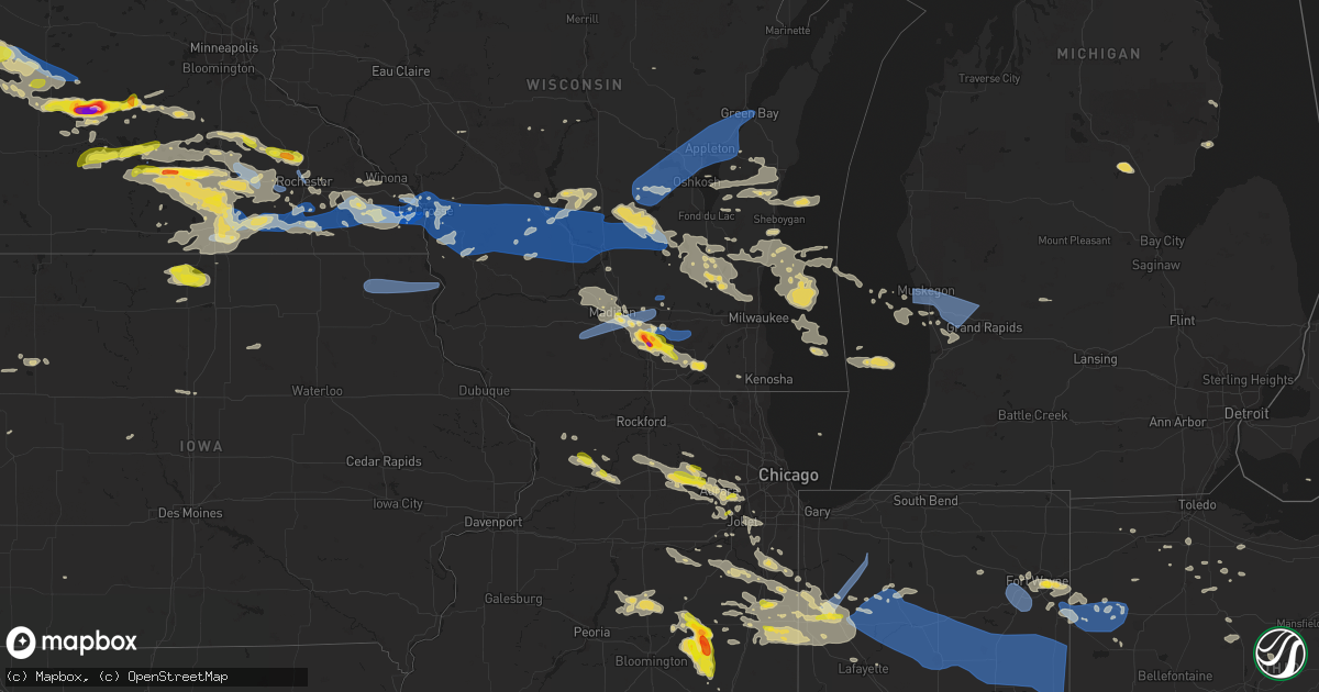
Hail Map on July 23, 2022
Get this storm
July 23 map
$229
one time, instant access
Download today. No call, no setup
Keep the $229
Bought the map and want the full workflow? Apply the entire $229 to a subscription within 7 days. None of it is wasted.
Every map, not just this one
This buys you this map. Subscription and you get every map we run, in the markets you choose from a few cities to whole states to nationwide. Plus real-time alerts the moment a storm fires.
Contact data
Name, contact info, occupancy, even credit band for addresses in the footprint. You go from where it hit to who to call.
Become the source they trust
Unlimited branding weather history reports on demand. You already have the documented answer ready for the property owner, and you are the one who showed up with it.
Property data and RoofTrace estimates
Pull up any address you have got, its value and the exact code rules for that jurisdiction, straight from One Click Code. Then RoofTrace estimates the squares, pitch, and roof value, priced the way you price.
States Impacted by Hail Map on July 23, 2022
Storm reports
South Carolina
| Date | Description |
|---|---|
| 07/23/20223:29 PM CDT | A tree fell across a power line near the intersection of church creek drive and mona avenue. Time estimated by radar. |
| 07/23/20223:23 PM CDT | Picture shared of a tree down on ashley river road near maclaura hall. Time estimated based on radar. |
| 07/23/20223:00 PM CDT | A towing company near the co0per river reported 50-60 mph winds for several minutes with a gust to 80 mph atop the roof that is approximately 40-50 feet above the groun |
| 07/23/20222:50 PM CDT | A picture of quarter-sized hail near the intersection of clements ferry road and beresford run was shared on social media. |
| 07/23/20222:50 PM CDT | A picture of quarter-sized hail on clements ferry road was shared on socal media. |
| 07/23/20222:30 PM CDT | Trained spotter reported a tree down on his vehicle on royal assembly drive and shared a picture. It could have been brought down by thunderstorm outflow or a lightning |
| 07/23/20222:30 PM CDT | Trained spotter reported a tree down on his vehicle and shared a picture. It could have been brought down by thunderstorm outflow or a lightning strike. |
| 07/23/20222:12 AM CDT | At 711 PM EDT, a severe thunderstorm was located over Hendersonville, and is nearly stationary. HAZARD...60 mph wind gusts and quarter size hail. SOURCE...Radar indicated. IMPACT...Minor hail damage to vehicles is possible. Expect wind damage to trees and powerlines. Locations impacted include: Walterboro, Hendersonville, Ritter and White Hall. This warning includes I-95 in South Carolina between mile markers 44and 62. |
| 07/22/202211:20 PM CDT | At 419 PM EDT, a severe thunderstorm was located over I-26/I-526 Interchange, moving south at 10 mph. HAZARD...60 mph wind gusts and nickel size hail. SOURCE...Radar indicated. IMPACT...Expect damage to trees and powerlines. Locations impacted include: North Charleston, Summerville, Hanahan, West Ashley, I-26/I-526 Interchange, Downtown Charleston, James Island, Johns Island, Hollywood, Ravenel, Charleston Airport, Magnolia Gardens, Maybank Bridge and Charles Towne Landing.This warning includes the following interstates: I-26 between mile markers 209 and 218. I-526 between mile markers 11 and 22. |
| 07/22/202210:55 PM CDT | At 355 PM EDT, a severe thunderstorm was located over Charleston Naval Complex, moving south at 10 mph. HAZARD...60 mph wind gusts and quarter size hail. SOURCE...Radar indicated. IMPACT...Minor hail damage to vehicles is possible. Expect wind damage to trees and powerlines. Locations impacted include: North Charleston, Mount Pleasant, Downtown Charleston, Daniel Island, Fort Sumter, West Ashley, Isle Of Palms, Folly Beach, Sullivan's Island, Boone Hall Plantation, Mount Pleasant Regional Airport, Sullivans Island, Fort Johnson, Don Holt Bridge and Mount Pleasant Towne Centre.This warning includes the following interstates: I-26 between mile markers 216 and 221. I-526 between mile markers 20 and 31. |
| 07/22/20229:53 PM CDT | At 253 PM EDT, a severe thunderstorm was located near Indiantown, or 11 miles east of Kingstree, moving east at 15 mph. HAZARD...60 mph wind gusts. SOURCE...Radar indicated. IMPACT...Expect wind damage to trees and power lines. Locations impacted include... Hemingway, Rhems, Outland, Nesmith, Morrisville, Indiantown, Henry and Stuckey. |
New York
| Date | Description |
|---|---|
| 07/23/20223:35 PM CDT | Report of multiple trees down across little valley... Ellicottville... And franklinville. |
Pennsylvania
| Date | Description |
|---|---|
| 07/23/20224:55 PM CDT | A few trees down between flickerville rd and the 5000 block of pleasant grove rd. |
| 07/23/20224:05 PM CDT | Several trees down in snakes spring township. |
| 07/23/20224:03 PM CDT | Multiple trees down near bedford. |
| 07/23/20223:40 PM CDT | Minor damage across the county. Main area of damage across the city of johnstown. Tree and wires down in johnstown. |
| 07/23/20222:49 PM CDT | Trees down |
| 07/23/20222:36 PM CDT | A local report indicates 1.25 inch wind near 2 N YOUNGWOOD |
| 07/23/20222:35 PM CDT | Trees down |
| 07/23/20222:20 PM CDT | Tree down on route 88 |
| 07/23/20222:13 PM CDT | Large tree down blocking greer way in oakmont. |
| 07/23/20222:13 PM CDT | A local report indicates 1.00 inch wind near 1 W CHURCHILL |
| 07/23/20222:09 PM CDT | A local report indicates 60 MPH wind near 1 W WEST MIFFLIN |
| 07/23/20222:08 PM CDT | Report of large tree branches down. |
| 07/23/20222:08 PM CDT | Report of large tree branches down along route 48. |
| 07/23/20222:05 PM CDT | Tree down near ppg paints arena. |
| 07/23/20222:05 PM CDT | Tree down in schenley park |
| 07/23/20222:04 PM CDT | Report of large tree limbs down in baldwin. |
| 07/23/20222:00 PM CDT | Numerous trees down. |
| 07/23/20221:59 PM CDT | A local report indicates 1.00 inch wind near ROSS TOWNSHIP |
| 07/23/20221:59 PM CDT | A local report indicates 1.00 inch wind near WEST VIEW |
| 07/23/20221:55 PM CDT | Report of large tree limbs down in collier township. |
| 07/23/20221:53 PM CDT | Estimated wind gust of 60 mph plus report of branches and wires down. |
| 07/23/20221:53 PM CDT | Estimated wind gust of 60 mph plus report of branches and wires down. |
| 07/23/20221:49 PM CDT | 2 trees snapped and 2 trees uprooted. |
| 07/23/20221:49 PM CDT | Large tree down on a car. No injuries. |
| 07/23/20221:49 PM CDT | Report of tree and power line down. |
| 07/23/20221:45 PM CDT | Report of trees and power lines down. Time estimated based on radar. |
| 07/23/20221:36 PM CDT | A local report indicates 64 MPH wind near WEST ALEXANDER |
| 07/23/20221:35 PM CDT | Report of tree down. |
| 07/23/20221:32 PM CDT | Report of multiple trees and power lines down. |
| 07/23/20221:12 PM CDT | Report of split tree and several tree branches down. Time estimated based on radar. |
| 07/23/20226:44 AM CDT | Two trees down near the american legion post |
| 07/23/20226:15 AM CDT | Numerous trees reported down on beham ridge road in wes |
| 07/23/20226:15 AM CDT | Numerous trees reported down on beham ridge road in west findley township. |
| 07/23/20221:51 AM CDT | At 650 PM EDT, severe thunderstorms were located along a line extending from near Paramount-Long Meadow to near Berryville, moving east at 40 mph. HAZARD...60 mph wind gusts and quarter size hail. SOURCE...Radar indicated. IMPACT...Damaging winds will cause some trees and large branches to fall. This could injure those outdoors, as well as damage homes and vehicles. Roadways may become blocked by downed trees. Localized power outages are possible. Unsecured light objects may become projectiles. Locations impacted include... Frederick, Hagerstown, Thurmont, Charles Town, Emmitsburg, Shepherdstown, Municipal Stadium, Purcellville, Robinwood, Brunswick, Fountainhead-Orchard Hills, Ranson, Berryville, Boonsboro, Smithsburg, Braddock Heights, Paramount-Long Meadow, Mount Aetna, Round Hill and Mount Lena. |
| 07/23/20221:26 AM CDT | At 625 PM EDT, a severe thunderstorm was located over Big Spring State Park, moving east at 45 mph. HAZARD...60 mph wind gusts and nickel size hail. SOURCE...Radar indicated. IMPACT...Expect damage to roofs, siding, and trees. Locations impacted include... Newville, Honey Grove, Spruce Hill, Rockhill Furnace, East Waterford, Bloserville, Roxbury, Perulack, Big Spring State Park, Doylesburg, Colonel Denning State Park and Willow Hill.This includes the following Interstates... The Pennsylvania Turnpike from mile markers 185 to 216. Interstate 81 from mile markers 36 to 38. |
| 07/23/202212:26 AM CDT | At 526 PM EDT, a severe thunderstorm was located over Crystal Springs, moving east at 50 mph. HAZARD...60 mph wind gusts and nickel size hail. SOURCE...Radar indicated. IMPACT...Expect damage to roofs, siding, and trees. Locations impacted include... Breezewood, Clearville, McConnellsburg, Harrisonville, Big Cove Tannery, Crystal Springs, Fort Littleton, Needmore, Valley-Hi, Saluvia, Sideling Hill Rest Area and Locust Grove.This includes the following Interstates... Interstate 70 from mile markers 147 to 165. The Pennsylvania Turnpike from mile markers 157 to 183. |
| 07/23/202212:00 AM CDT | At 459 PM EDT, a severe thunderstorm was located over Bedford, moving east at 20 mph. HAZARD...60 mph wind gusts and nickel size hail. SOURCE...Radar indicated. IMPACT...Expect damage to roofs, siding, and trees. Locations impacted include... Bedford, Breezewood, Everett, Cessna, Saxton, Defiance and Hopewell.This includes the following Interstates... Interstate 70 near mile marker 147. The Pennsylvania Turnpike between mile markers 142 and 159, and nearmile marker 165. Interstate 99 from mile markers 0 to 1. |
| 07/22/202210:29 PM CDT | At 329 PM EDT, a severe thunderstorm was located near Apollo, moving east at 35 mph. HAZARD...60 mph wind gusts and quarter size hail. SOURCE...Radar indicated. IMPACT...Minor hail damage to vehicles is possible. Expect wind damage to trees and power lines, resulting in some power outages. Locations impacted include... Greensburg, Indiana, Latrobe, Vandergrift, Kittanning, Homer City, Apollo, Mount Pleasant, Scottdale, McChesneytown-Loyalhanna, Blairsville, and Youngwood. |
| 07/22/202210:14 PM CDT | At 314 PM EDT, severe thunderstorms were located along a line extending from 9 miles south of Waynesburg to 8 miles north of Salem, moving southeast at 40 mph. HAZARD...60 mph wind gusts. SOURCE...Radar indicated. IMPACT...Expect damage to trees and power lines, resulting in some power outages. Locations impacted include... Morgantown, Fairmont, Westover, Mannington, Star City, Pleasant Valley, Winfield, Barrackville, Monongah, Granville, Fairview, and Hundred. |
| 07/22/20229:38 PM CDT | At 237 PM EDT, a severe thunderstorm was located over Aliquippa, moving east at 40 mph. HAZARD...60 mph wind gusts and quarter size hail. SOURCE...Radar indicated. IMPACT...Minor hail damage to vehicles is possible. Expect wind damage to trees and power lines, resulting in some power outages. Locations impacted include... Cranberry, Moon Township, Butler, Franklin Park, Aliquippa, Beaver Falls, Monaca, Hampton Township, Economy, Ellwood City, Ambridge, and Wexford. |
| 07/22/20229:26 PM CDT | At 225 PM EDT, a severe thunderstorm was located near McDonald, or 8 miles northeast of Avella, moving east at 40 mph. HAZARD...60 mph wind gusts and quarter size hail. SOURCE...Radar indicated. IMPACT...Minor hail damage to vehicles is possible. Expect wind damage to trees and power lines, resulting in some power outages. Locations impacted include... Pittsburgh, Penn Hills, Mount Lebanon, Bethel Park, Ross Township, Wheeling, McCandless Township, Monroeville, Cranberry, Moon Township, McMurray, and Weirton. |
| 07/22/20228:50 PM CDT | At 150 PM EDT, a severe thunderstorm was located 7 miles east of Cadiz, moving east at 45 mph. HAZARD...60 mph wind gusts and quarter size hail. SOURCE...Radar indicated. IMPACT...Minor hail damage to vehicles is possible. Expect wind damage to trees and power lines, resulting in some power outages. Locations impacted include... Wheeling, Moon Township, Weirton, Steubenville, Washington, East Liverpool, Martins Ferry, St. Clairsville, Bellaire, Wellsville, Warwood, and Wellsburg. |
Virginia
| Date | Description |
|---|---|
| 07/23/20226:17 PM CDT | Tree down along muse road. |
| 07/23/20226:14 PM CDT | One tree down due to thunderstorm winds along the 300 block of muse road. |
| 07/23/20226:09 PM CDT | Multiple trees and large branches down along sr602 and sr39. |
| 07/23/20226:07 PM CDT | One tree down due to thunderstorm winds along the 400 block of maury river road. |
| 07/23/20226:06 PM CDT | Trees down along little creek highway. |
| 07/23/20225:56 PM CDT | One tree down due to thunderstorms winds at the intersection of flowing spring road and springwood road. |
| 07/23/20225:53 PM CDT | Tree down at intersection of springwood road and flowing spring road. |
| 07/23/20225:53 PM CDT | Multiple trees down due to thunderstorm winds in the rockbridge baths area. |
| 07/23/20225:48 PM CDT | Tree down along wilderness road. |
| 07/23/20225:48 PM CDT | Multiple trees down in bastian. |
| 07/23/20225:39 PM CDT | Tree down on vehicle at 7-eleven in woodstock off of i-81. |
| 07/23/20225:26 PM CDT | Two trees down due to thunderstorm winds in the goshen area. |
| 07/23/20225:24 PM CDT | Tree down along craig creek road. |
| 07/23/20224:54 AM CDT | At 954 PM EDT, a severe thunderstorm was located over Laurel, or near Tuckahoe, moving east at 15 mph. HAZARD...60 mph wind gusts and penny size hail. SOURCE...Radar indicated. IMPACT...Expect damage to trees and powerlines. Locations impacted include... Richmond, Downtown Richmond, Virginia Union University, Mechanicsville, Virginia Commonwealth University, Tuckahoe, University Of Richmond, Laurel, Lakeside, Glen Allen, East Highland Park, Longdale, Solomons Store, Chamberlayne, Atlee, Greendale, Roslyn Hills, Dumbarton and Short Pump. |
| 07/23/20221:41 AM CDT | At 641 PM EDT, a severe thunderstorm was located over Long Spur, or 8 miles north of Max Meadows, moving southeast at 10 mph. HAZARD...60 mph wind gusts and quarter size hail. SOURCE...Radar indicated. IMPACT...Hail damage to vehicles is expected. Expect wind damage to roofs, siding, and trees. Locations impacted include... Pulaski... Max Meadows... Rocky Gap... Long Spur... Mechanicsburg... Fort Chiswell... and Draper. |
| 07/23/20221:35 AM CDT | At 635 PM EDT, a severe thunderstorm was located near Broadford, or near Saltville, moving southeast at 10 mph. HAZARD...60 mph wind gusts and quarter size hail. SOURCE...Radar indicated. IMPACT...Hail damage to vehicles is expected. Expect wind damage to roofs, siding, and trees. Locations impacted include... Marion... Saltville... Chilhowie... Adwolf... Hungry Mother State Park... Broadford... and Thomas Bridge. |
| 07/23/20221:29 AM CDT | At 629 PM EDT, a severe thunderstorm was located over Tillie, or near Whitesburg, moving south at 5 mph. HAZARD...60 mph wind gusts and quarter size hail. SOURCE...Radar indicated. IMPACT...Hail damage to vehicles is expected. Expect wind damage to roofs, siding, and trees. This severe thunderstorm will be near... Southdown around 640 PM EDT. Van around 645 PM EDT.Other locations in the path of this severe thunderstorm include Crownand Whitesburg. |
| 07/23/20221:20 AM CDT | At 620 PM EDT, a severe thunderstorm was located near Gala, or near Oriskany, moving east at 25 mph. HAZARD...60 mph wind gusts and quarter size hail. SOURCE...Radar indicated. IMPACT...Hail damage to vehicles is expected. Expect wind damage to roofs, siding, and trees. Locations impacted include... Eagle Rock... Oriskany... Arcadia... Natural Bridge... and Gala. |
| 07/23/20221:17 AM CDT | At 616 PM EDT, a severe thunderstorm was located 10 miles southeast of Jonesville, and is nearly stationary. HAZARD...60 mph wind gusts and penny size hail. SOURCE...Radar indicated. IMPACT...Expect damage to roofs, siding, and trees. Locations impacted include... Kyles Ford. |
| 07/23/202212:39 AM CDT | At 538 PM EDT, a severe thunderstorm was located 8 miles north of Wardensville, or 11 miles southeast of Romney, moving east at 40 mph. HAZARD...60 mph wind gusts and quarter size hail. SOURCE...Radar indicated. IMPACT...Damaging winds will cause some trees and large branches to fall. This could injure those outdoors, as well as damage homes and vehicles. Roadways may become blocked by downed trees. Localized power outages are possible. Unsecured light objects may become projectiles. Locations impacted include... Capon Bridge, Yellow Spring, High View, High View Manor, Gainesboro, Delray, Cross Junction, Rock Enon Springs, Rio, Gore, Whitacre, Timber Ridge and Lehew. |
| 07/23/202212:29 AM CDT | At 528 PM EDT, a severe thunderstorm was located over Frankford, or near Renick, moving east at 20 mph. HAZARD...60 mph wind gusts and quarter size hail. SOURCE...Radar indicated. IMPACT...Hail damage to vehicles is expected. Expect wind damage to roofs, siding, and trees. Locations impacted include... White Sulphur Springs... Renick... Neola... Falling Spring... Lewisburg Airport... Alvon... and Maxwelton. |
| 07/23/202212:06 AM CDT | At 506 PM EDT, a severe thunderstorm was located 11 miles northwest of Franklin, moving east at 30 mph. HAZARD...60 mph wind gusts and quarter size hail. SOURCE...Radar indicated. IMPACT...Damaging winds will cause some trees and large branches to fall. This could injure those outdoors, as well as damage homes and vehicles. Roadways may become blocked by downed trees. Localized power outages are possible. Unsecured light objects may become projectiles. Locations impacted include... Franklin, Brandywine, Upper Tract, Circleville, Ruddle, Seneca Rocks, Onego, Oak Flat, Brushy Run, Cherry Grove, Riverton and Deer Run. |
| 07/22/20229:00 PM CDT | Trees down and around 2...000 power outages between short pump and henrico likely caused by storm. Time estimated. |
Georgia
| Date | Description |
|---|---|
| 07/23/20226:35 PM CDT | Several large trees were blown down near the area of highway 37 and indian creek rd and were blocking the highway. |
| 07/23/20226:23 PM CDT | Minor damage reported along cowart dr associated with a downburst. |
| 07/23/20222:16 AM CDT | At 716 PM EDT, a severe thunderstorm was located near Adel, moving north at 15 mph. HAZARD...60 mph wind gusts and penny size hail. SOURCE...Radar indicated. IMPACT...Expect damage to roofs, siding, and trees. Locations impacted include... Adel, Sparks, Cecil, Reed Bingham State Park, Cook Co A/P, Massee, Greggs, Barneyville, Laconte and Pine Valley. |
| 07/23/20221:31 AM CDT | At 631 PM EDT, a severe thunderstorm was located near Jasper, moving west at 10 mph. HAZARD...60 mph wind gusts and penny size hail. SOURCE...Radar indicated. IMPACT...Expect damage to roofs, siding, and trees. Locations impacted include... Jasper, Jennings and Crossroads. |
Illinois
| Date | Description |
|---|---|
| 07/23/20225:20 PM CDT | Power line down and two power poles leaning over. Time estimated. |
| 07/23/20222:47 PM CDT | Tree downed on pine st. In gibson city. Time estimated from radar. |
| 07/23/20222:17 PM CDT | Delayed report. Em reports significant tree damage in town. Numerous tree limbs down on cars and two houses with trees through the roof. Power lines down. Large trees u |
| 07/23/20222:17 PM CDT | Large tree limbs blow down. Time estimated. |
| 07/23/20222:09 PM CDT | A local report indicates 1.75 inch wind near 3 W CROPSEY |
| 07/23/20222:09 PM CDT | A local report indicates 70 MPH wind near 3 W CROPSEY |
| 07/23/20221:46 PM CDT | Delayed report... Hail damaged corn near fairbury. Time and location estimated from radar. |
| 07/23/20221:42 PM CDT | Delayed report... Trees were downed in fairbury. Time estimated from radar. |
| 07/23/20221:26 PM CDT | Large tree limb blown down. Relayed by media. Time estimated. |
| 07/23/202210:22 AM CDT | Several reports of nickel to quarter size hail on the south side of naperville. |
| 07/23/202210:12 AM CDT | Largest hailstones were about quarter size. |
| 07/23/20227:33 AM CDT | At 1233 AM CDT, a severe thunderstorm was located over Lake Villa, moving east at 35 mph. Another severe thunderstorm was near Waukegan also moving east at 35 mph. HAZARD...Quarter size hail. SOURCE...Radar indicated. IMPACT...Damage to vehicles is expected. Locations impacted include... Waukegan, North Chicago, Gurnee, Mundelein, Round Lake Beach, Vernon Hills, Zion, Grayslake, Libertyville, Lake Forest, Round Lake, Antioch, Wauconda, Fox Lake, Lake Villa, Island Lake, Lindenhurst, Beach Park, Gages Lake and Long Grove.Including the following interstates... I-94 between mile markers 1 and 17. I-294 between mile markers 1 and 17. |
| 07/23/20227:24 AM CDT | Photo shared via social media. |
| 07/23/20225:22 AM CDT | At 1022 AM CDT, a severe thunderstorm was located near Sugar Grove, or near Aurora, moving east at 20 mph. HAZARD...60 mph wind gusts and quarter size hail. SOURCE...Radar indicated. IMPACT...Hail damage to vehicles is expected. Expect wind damage to roofs, siding, and trees. Locations impacted include... Aurora, Naperville, Bolingbrook, Wheaton, Downers Grove, Lombard, Woodridge, Hinsdale, Lemont, Burr Ridge, Oak Brook, Westmont, Lisle, Darien, Warrenville, Willowbrook, Clarendon Hills and Willow Springs.Including the following interstates... I-55 between mile markers 268 and 276. I-88 between mile markers 121 and 134. I-355 between mile markers 12 and 22.This includes... Argonne National Laboratory, BenedictineUniversity, Morton Arboretum, and North Central College. |
| 07/23/20224:08 AM CDT | At 908 AM CDT, a severe thunderstorm was located near Hinckley, or 9 miles southeast of DeKalb, moving east at 35 mph. HAZARD...60 mph wind gusts and half dollar size hail. SOURCE...Radar indicated. IMPACT...Hail damage to vehicles is expected. Expect wind damage to roofs, siding, and trees. Locations impacted include... Aurora, DeKalb, Oswego, Batavia, Geneva, Yorkville, Montgomery, North Aurora, Sugar Grove, Boulder Hill, Elburn, Cortland, Hinckley, Waterman, Maple Park, Big Rock, Kaneville, Bristol and Little Rock.Including the following interstate... I-88 between mile markers 94 and 120. This includes... Aurora University, Fermilab, IL Math and ScienceAcademy, and Waubonsee Community College. |
| 07/23/20223:17 AM CDT | At 816 PM CDT, a severe thunderstorm was located near Whitewater, moving southeast at 20 mph. HAZARD...60 mph wind gusts and half dollar size hail. SOURCE...Radar indicated. IMPACT...Hail damage to vehicles is expected. Expect wind damage to roofs, siding, and trees. Locations impacted include... Janesville, Whitewater, Elkhorn, Delavan, Lake Geneva, Milton, Williams Bay, Walworth, Clinton, Fontana-On-Geneva Lake, Sharon, Darien, Como, Richmond, Springfield, La Grange, Tiffany, Millard, Avalon and Delavan Lake.People attending Jimmy Buffet at Alpine Valley should seek safe shelter immediately! |
| 07/23/20221:46 AM CDT | At 646 AM CDT/746 AM EDT/, severe thunderstorms were located along a line extending from near Kouts to near Roselawn to 6 miles south of Hopkins Park, moving southeast at 55 mph. HAZARD...60 mph wind gusts. SOURCE...Radar indicated. IMPACT...Expect damage to roofs, siding, and trees. Locations impacted include... Rensselaer, DeMotte, Fowler, Kentland, Otterbein, Remington, Morocco, Wheatfield, Roselawn, Oxford, Goodland, Brook, Boswell, Earl Park, Hanging Grove, Collegeville, Mount Ayr, Stoutsburg, Foresman and Fair Oaks.Including the following interstate... Indiana I-65 between mile markers 200 and 232. This includes... US 41 Dragway. |
| 07/23/20221:42 AM CDT | At 642 AM CDT, a severe thunderstorm was located over Peru, moving east at 40 mph. HAZARD...60 mph wind gusts and penny size hail. SOURCE...Radar indicated. IMPACT...Expect damage to roofs, siding, and trees. Locations impacted include... Ottawa, Peru, La Salle, Spring Valley, Oglesby, North Utica, Tonica, Grand Ridge, Naplate, Cedar Point and Leonore.Including the following interstates... I-39 between mile markers 49 and 62. I-80 between mile markers 73 and 92.This includes...Buffalo Rock State Park, Illinois Valley Community College, Matthiessen State Park, and Starved Rock State Park. |
| 07/23/20221:22 AM CDT | Report of tree down at the apple canyon camp grounds... Time estimated from radar. |
| 07/23/20221:15 AM CDT | At 615 AM CDT, a severe thunderstorm was located near Walnut, or 10 miles northwest of Princeton, moving east at 30 mph. HAZARD...60 mph wind gusts and nickel size hail. SOURCE...Radar indicated. IMPACT...Expect damage to roofs, siding, and trees. Locations impacted include... Princeton, Walnut, La Moille, Ohio, Cherry, Malden, Manlius, Arlington, Dover, Zearing, Kasbeer, Van Orin and Normandy. |
| 07/23/20221:03 AM CDT | Tree down on house in the city limits... Per law enforcement... Time estimated by radar. |
| 07/23/202212:32 AM CDT | At 532 AM CDT, severe thunderstorms were located along a line extending from Streamwood to North Aurora to Plano, moving east at 40 mph. The strongest winds are occurring well behind the initial thunderstorms. Rochelle recently gusted to 58 mph. HAZARD...60 mph wind gusts. SOURCE...Surface observations. IMPACT...Expect damage to roofs, siding, and trees. Locations impacted include... Aurora, Joliet, Elgin, Bartlett, Plainfield, St. Charles, Oswego, West Chicago, Batavia, Huntley, Geneva, Yorkville, Campton Hills, Minooka, Plano, Sandwich, South Elgin, Montgomery, North Aurora and Sugar Grove.Including the following interstates... I-80 between mile markers 120 and 122. I-88 between mile markers 102 and 120. I-90 between mile markers 47 and 56.This includes... Aurora University, Elgin Community College,Fermilab, IL Math and Science Academy, Kane County Cougars Ballpark,and Waubonsee Community College. |
| 07/23/202212:26 AM CDT | At 525 AM CDT, a severe thunderstorm was located over Leon Corners, or 14 miles south of Morrison, moving northeast at 40 mph. HAZARD...60 mph wind gusts and nickel size hail. SOURCE...Radar indicated. IMPACT...Expect damage to roofs, siding, and trees. Locations impacted include... Sterling, Rock Falls, Prophetstown, Sheffield, Tampico, Lyndon, Buda, Deer Grove, Emerson, Neponset, Yorktown, Round Grove, Manlius, Mineral, New Bedford, Portland Corners, Como, Denrock, Douglas Park and Agnew. |
| 07/23/202212:22 AM CDT | At 521 PM CDT, a severe thunderstorm was located near Minonk, or 17 miles west of Pontiac, moving east at 15 mph. HAZARD...Golf ball size hail and 60 mph wind gusts. SOURCE...Radar indicated. IMPACT...People and animals outdoors will be injured. Expect hail damage to roofs, siding, windows, and vehicles. Expect wind damage to roofs, siding, and trees. This severe thunderstorm will be near... Flanagan around 545 PM CDT.Other locations impacted by this severe thunderstorm include Dana andRutland. |
| 07/23/202212:17 AM CDT | At 517 PM CDT, a severe thunderstorm was located over Minonk, or 18 miles southwest of Streator, moving east at 25 mph. HAZARD...Golf ball size hail and 60 mph wind gusts. SOURCE...Radar indicated. IMPACT...People and animals outdoors will be injured. Expect hail damage to roofs, siding, windows, and vehicles. Expect wind damage to roofs, siding, and trees. This severe thunderstorm will remain over mainly rural areas of southeastern Marshall and northeastern Woodford Counties, including the following locations... Benson.This includes Interstate 39 between mile markers 20 and 33. |
| 07/23/202212:10 AM CDT | At 510 AM CDT, a severe thunderstorm was located over Geneseo, or 11 miles north of Cambridge, moving east at 30 mph. HAZARD...60 mph wind gusts and nickel size hail. SOURCE...Radar indicated. IMPACT...Expect damage to roofs, siding, and trees. Locations impacted include... Cambridge, Geneseo, Atkinson, Annawan, Hooppole, Osco, Henry County Fairgrounds, German Corner, Shady Beach, Johnson-Sauk Trail State Park and Morristown. |
| 07/22/202211:56 PM CDT | At 456 AM CDT, a severe thunderstorm was located over Hoffman Estates, moving east at 40 mph. HAZARD...60 mph wind gusts and quarter size hail. SOURCE...Radar indicated. IMPACT...Hail damage to vehicles is expected. Expect wind damage to roofs, siding, and trees. Locations impacted include... Chicago, Elgin, Cicero, Arlington Heights, Evanston, Schaumburg, Palatine, Skokie, Des Plaines, Berwyn, Mount Prospect, Wheaton, Hoffman Estates, Oak Park, Glenview, Elmhurst, Lombard, Buffalo Grove, Bartlett and Ohare Airport.Including the following interstates... I-55 between mile markers 288 and 294. I-88 between mile markers 139 and 140. I-90 between mile markers 50 and 84. I-94 between mile markers 26 and 57. I-290 between mile markers 1 and 29. I-294 between mile markers 26 and 57. I-355 between mile markers 26 and 30.This includes... Lincoln Park Zoo, Loyola University, OaktonCommunity College, Schaumburg Boomers Baseball, Triton College, ElginCommunity College, Harper College, Hawthorne Park, NortheasternIllinois University, Northwestern University, Soldier Field,University of Illinois Chicago, Guaranteed Rate Field...IL Instituteof Technology, Wrigley Field, The Loop, Museum Campus, and NortherlyIsland. |
| 07/22/202211:49 PM CDT | At 448 AM CDT, a severe thunderstorm was located near Ashton, or 8 miles west of Rochelle, moving east at 35 mph. HAZARD...60 mph wind gusts and quarter size hail. SOURCE...Radar indicated. IMPACT...Hail damage to vehicles is expected. Expect wind damage to roofs, siding, and trees. Locations impacted include... DeKalb, Sycamore, Rochelle, Sandwich, Genoa, Shabbona, Cortland, Davis Junction, Hinckley, Somonauk, Kirkland, Waterman, Hillcrest, Maple Park, Kingston, Malta, Paw Paw, Creston, Lindenwood and Monroe Center.Including the following interstates... I-39 between mile markers 78 and 114. I-88 between mile markers 69 and 101.This includes... Northern Illinois University and SandwichFairgrounds. |
| 07/22/202211:09 PM CDT | At 408 AM CDT, a severe thunderstorm was located over Milledgeville, or 10 miles west of Polo, moving east at 30 mph. HAZARD...60 mph wind gusts and quarter size hail. SOURCE...Radar indicated. IMPACT...Hail damage to vehicles is expected. Expect wind damage to roofs, siding, and trees. Locations impacted include... Dixon, Byron, Oregon, Mount Morris, Amboy, Polo, Forreston, Stillman Valley, Franklin Grove, Ashton, Lost Nation, Leaf River, Grand Detour, Nelson, Woodland Shores, Adeline, Eldena, Baileyville, Woosung and Lee Center.Including the following interstate... I-88 between mile markers 45 and 70. This includes... Castle Rock State Park, Lee County Fairgrounds,Lowden State Park, Ogle County Fairgrounds, Sauk Valley College, andWhite Pines State Park. |
| 07/22/202211:05 PM CDT | At 405 AM CDT, a severe thunderstorm was located over Coleta, or 9 miles northeast of Morrison, moving east at 50 mph. HAZARD...60 mph wind gusts and nickel size hail. SOURCE...Radar indicated. IMPACT...Expect damage to roofs, siding, and trees. Locations impacted include... Sterling, Milledgeville, Coleta, Franklin Corners, Carroll County Fairgrounds, Penrose, Malvern and White Pigeon. |
| 07/22/202210:19 PM CDT | At 319 PM CDT, a severe thunderstorm was located near Fairbury, moving east at 30 mph. HAZARD...Quarter size hail. SOURCE...Radar indicated. IMPACT...Damage to vehicles is expected. Locations impacted include... Fairbury, Chatsworth and Forrest. |
| 07/22/202210:09 PM CDT | At 308 PM CDT, a severe thunderstorm was located near Saybrook, or 8 miles southwest of Gibson City, moving south at 15 mph. HAZARD...Ping pong ball size hail and 60 mph wind gusts. SOURCE...Radar indicated. IMPACT...People and animals outdoors will be injured. Expect hail damage to roofs, siding, windows, and vehicles. Expect wind damage to roofs, siding, and trees. This severe thunderstorm will be near... Fisher around 320 PM CDT.Other locations in the path of this severe thunderstorm includeMahomet, Mansfield and Lake Of The Woods.This includes the following highways... Interstate 57 between mile markers 240 and 249. Interstate 74 between mile markers 157 and 175. |
| 07/22/20229:57 PM CDT | At 257 PM CDT, a severe thunderstorm was located near Gibson City, moving south at 15 mph. HAZARD...60 mph wind gusts and quarter size hail. SOURCE...Radar indicated. IMPACT...Hail damage to vehicles is expected. Expect wind damage to roofs, siding, and trees. Locations impacted include... Gibson City, Elliott and Sibley. |
| 07/22/20229:38 PM CDT | At 238 PM CDT, a severe thunderstorm was located near Colfax, or 12 miles west of Gibson City, moving south at 15 mph. HAZARD...Golf ball size hail and 70 mph wind gusts. SOURCE...Trained weather spotters. IMPACT...People and animals outdoors will be injured. Expect hail damage to roofs, siding, windows, and vehicles. Expect considerable tree damage. Wind damage is also likely to mobile homes, roofs, and outbuildings. Locations impacted include... Saybrook and Le Roy.This includes Interstate 74 near mile marker 148. |
| 07/22/20228:57 PM CDT | At 157 PM CDT, a severe thunderstorm was located over Colfax, or 13 miles southwest of Fairbury, moving south at 20 mph. HAZARD...60 mph wind gusts and quarter size hail. SOURCE...Radar indicated. IMPACT...Hail damage to vehicles is expected. Expect wind damage to roofs, siding, and trees. This severe thunderstorm will be near... Cooksville around 205 PM CDT.Other locations in the path of this severe thunderstorm includeSaybrook and Le Roy.This includes Interstate 74 between mile markers 148 and 154. |
| 07/22/20228:45 PM CDT | At 145 PM CDT, a severe thunderstorm was located near Fairbury, moving southeast at 25 mph. HAZARD...Golf ball size hail and 70 mph wind gusts. The most intense part of this storm will move toward Sibley and gibson City. SOURCE...Radar indicated. IMPACT...People and animals outdoors will be injured. Expect hail damage to roofs, siding, windows, and vehicles. Expect considerable tree damage. Wind damage is also likely to mobile homes, roofs, and outbuildings. Locations impacted include... Paxton, Gibson City, Melvin, Elliott and Sibley. Including the following interstate... I-57 near mile marker 258. |
| 07/22/20228:24 PM CDT | At 122 PM CDT, a severe thunderstorm was located near Fairbury, moving east at 30 mph. HAZARD...60 mph wind gusts and quarter size hail. SOURCE...Radar indicated. IMPACT...Hail damage to vehicles is expected. Expect wind damage to roofs, siding, and trees. This severe thunderstorm will remain over mainly rural areas of northeastern McLean County, including the following locations... Weston, Cropsey and Anchor.This includes Interstate 55 between mile markers 185 and 187. |
| 07/22/20228:23 PM CDT | At 122 AM CDT, two severe thunderstorms were located over central Lake County. One was 3 miles west of Grayslake, and the other near Mundelein. Both were moving east at 40 mph. HAZARD...Half dollar size hail. SOURCE...Radar indicated. IMPACT...Damage to vehicles is expected. Locations impacted include... Waukegan, Arlington Heights, Palatine, Buffalo Grove, Wheeling, Northbrook, North Chicago, Gurnee, Mundelein, Highland Park, Vernon Hills, Zion, Grayslake, Libertyville, Lake Forest, Deerfield, Lindenhurst, Beach Park, Gages Lake and Glencoe.Including the following interstates... I-94 between mile markers 6 and 26. I-294 between mile markers 6 and 26. |
| 07/22/20228:14 PM CDT | At 114 PM CDT, a severe thunderstorm was located near Pontiac, moving southeast at 25 mph. HAZARD...60 mph wind gusts and quarter size hail. SOURCE...Radar indicated. IMPACT...Hail damage to vehicles is expected. Expect wind damage to roofs, siding, and trees. Locations impacted include... Pontiac, Fairbury, Chatsworth, Forrest and Strawn. Including the following interstate... I-55 between mile markers 189 and 197. |
New Hampshire
| Date | Description |
|---|---|
| 07/23/20226:50 PM CDT | Observed hail for about 6-7 minutes on reed road north of highway 26. Largest hail stones were 1.25 inches in diameter. Time estimated by radar. |
| 07/23/20226:45 PM CDT | Hail observed north of downtown colebrook. Biggest hail was the size of half dollars. Time estimated by radar. |
| 07/23/20226:43 PM CDT | Downed trees and branches across nh hwy 145. Time estimated by radar. |
| 07/23/20223:05 AM CDT | At 805 PM EDT, a severe thunderstorm was located near Dixville, or 14 miles east of Colebrook, moving east at 30 mph. HAZARD...60 mph wind gusts and quarter size hail. SOURCE...Radar indicated. IMPACT...Hail damage to vehicles is expected. Expect wind damage to roofs, siding, and trees. Locations impacted include... Colebrook, Andover, Errol, Dixville, Columbia, Clarksville, Magalloway Plantation, Richardsontown, South Arm, Lincoln Plantation, Wentworth Location, Adamstown, Upton and Rangeley Plantation. |
| 07/23/20221:57 AM CDT | At 657 PM EDT, a severe thunderstorm was located near Norton, moving east at 30 mph. HAZARD...60 mph wind gusts and quarter size hail. SOURCE...Radar indicated. IMPACT...Minor hail damage to vehicles is possible. Expect wind damage to trees and powerlines. Locations impacted include... Canaan, Averill, Warren Gore, Warners Grant, Norton, Averys Gore, Holland, Morgan, Lemington, Lewis and Beecher Falls. |
Wisconsin
| Date | Description |
|---|---|
| 07/23/20226:59 PM CDT | A local report indicates 60 MPH wind near 2 SW CEDARBURG |
| 07/23/20226:56 PM CDT | A local report indicates 65 MPH wind near SHEBOYGAN |
| 07/23/20226:53 PM CDT | Trees down on power lines which knocked out power. |
| 07/23/20226:49 PM CDT | Trees down on highway 29 east of townline rd. Time estimated by radar. |
| 07/23/20226:47 PM CDT | A few trees down on the north side of manitowoc. |
| 07/23/20226:45 PM CDT | Trees down. Report via social media. Time estimated by radar. |
| 07/23/20226:38 PM CDT | Large tree uprooted and landed on a house. |
| 07/23/20226:37 PM CDT | Trees down in the 2200 block of oneida street. |
| 07/23/20226:37 PM CDT | Report from mping: 3-inch tree limbs broken; power poles broken. |
| 07/23/20226:36 PM CDT | Power line down. |
| 07/23/20226:32 PM CDT | Report from mping: 1-inch tree limbs broken; shingles blown off. |
| 07/23/20226:30 PM CDT | Report from mping: 3-inch tree limbs broken; power poles broken. |
| 07/23/20226:28 PM CDT | Report from mping: 3-inch tree limbs broken; power poles broken. |
| 07/23/20226:27 PM CDT | Report from mping: trees uprooted or snapped; roof blown off. |
| 07/23/20226:25 PM CDT | Report from mping: 1-inch tree limbs broken; shingles blown off. |
| 07/23/20226:22 PM CDT | Report from mping: 3-inch tree limbs broken; power poles broken. |
| 07/23/20226:20 PM CDT | Branches and a street light down. |
| 07/23/20226:20 PM CDT | Bra |
| 07/23/20226:07 PM CDT | A local report indicates 68 MPH wind near 1 NW HIGH CLIFF STATE P |
| 07/23/20226:05 PM CDT | Strong thunderstorm winds destroyed a dock on lake winnebago. |
| 07/23/20226:03 PM CDT | A tree fell onto 2 campers at high cliff state park. Two injuries were reported. |
| 07/23/20225:59 PM CDT | A local report indicates 60 MPH wind near RANDOLPH |
| 07/23/20225:58 PM CDT | A local report indicates 59 MPH wind near 2 WNW APPLETON |
| 07/23/20225:55 PM CDT | Small trees bent over. Heard one tree crack. Estimated wind gusts to around 60 mph. Located about 1.5 nw miles from the airport. |
| 07/23/20225:55 PM CDT | Approximately 15 inch diameter tree snapped. Located in fox crossing west of 41. Report and photo via social media. Time estimated by radar. |
| 07/23/20225:54 PM CDT | S |
| 07/23/20225:54 PM CDT | Several trees down on the southwest side of appleton. |
| 07/23/20225:53 PM CDT | Report from mping: 3-inch tree limbs broken; power poles broken. |
| 07/23/20225:52 PM CDT | Report from mping: 1-inch tree limbs broken; shingles blown off. |
| 07/23/20225:50 PM CDT | Reports of trees and power lines down on 10th avenue in oshkosh. Report via social media. Time estimated by radar. |
| 07/23/20225:50 PM CDT | Plane flipped and tree fell on car on eaa grounds. |
| 07/23/20225:50 PM CDT | Photo and report of very large tree limb down. |
| 07/23/20225:50 PM CDT | 50 foot tall willows down on power lines. Lines down across driveway. West edge of oshkosh on sand pit road. Photos and reports via social media. Time estimated by rada |
| 07/23/20225:50 PM CDT | Trees down around scott street and main street in oshkosh. Time estimated by radar. |
| 07/23/20225:50 PM CDT | Measured wind gust off highway 45 in oshkosh. Spotter noted a few trees down. Time estimated by radar. |
| 07/23/20225:50 PM CDT | A local report indicates 58 MPH wind near WITTMAN FIELD |
| 07/23/20225:50 PM CDT | Photo and report of tree down and covering 17th avenue in oshkosh. Time estimated by radar. |
| 07/23/20225:43 PM CDT | Report from mping: 1-inch tree limbs broken; shingles blown off. |
| 07/23/20225:42 PM CDT | Numerous trees down. |
| 07/23/20225:38 PM CDT | Branches down. Report from social media. Time estimated by radar. |
| 07/23/20225:38 PM CDT | Corrects previous tstm wnd dmg report from winneconne. Branches down along with a few trees down. Report from social media. Time estimated by radar. |
| 07/23/20225:35 PM CDT | Several trees and power lines down. Several power poles were snapped. |
| 07/23/20225:33 PM CDT | Gusts estimated at 60-65 mph. |
| 07/23/20225:32 PM CDT | Report on social media of trees and power lines down. Time estimated by radar. |
| 07/23/20225:30 PM CDT | Multiple tree limbs on the roof of a house. |
| 07/23/20225:30 PM CDT | Tree down in road. Estimated 60 mph. |
| 07/23/20225:28 PM CDT | Trees down in yard. Report via social media. Time estimated by radar. |
| 07/23/20225:21 PM CDT | Tree limbs and branches down across green lake campground. |
| 07/23/20225:21 PM CDT | Trees down on county highway ee. |
| 07/23/20225:20 PM CDT | Report and photo of mid sized tree down in the middle of driveway. Time approximate. Report via social media. |
| 07/23/20225:10 PM CDT | Reports of of tree damage in the northern part of sauk county. Relayed bylaw enforcement. Estimated winds 60 mph. |
| 07/23/20225:00 PM CDT | Corrects previous non-tstm wnd dmg report from spring lake. Two trees down. Report via social media. Time estimated. |
| 07/23/20224:43 PM CDT | Large tree snapped down the middle. |
| 07/23/20224:31 PM CDT | Trees down all over the county. |
| 07/23/20224:28 PM CDT | Several large branches blown down. |
| 07/23/20224:15 PM CDT | Several trees blown down. |
| 07/23/20224:15 PM CDT | Several trees blown down. |
| 07/23/20224:03 PM CDT | A local report indicates 60 MPH wind near 3 W NORWALK |
| 07/23/20224:03 PM CDT | Report from mping: 3-inch tree limbs broken; power poles broken. |
| 07/23/20224:01 PM CDT | Several large tree blown down. |
| 07/23/20223:52 PM CDT | Several large tree blown down. |
| 07/23/20223:33 PM CDT | 2 large pine trees blown down. |
| 07/23/20223:33 PM CDT | 2 large pine trees blown down |
| 07/23/20223:30 PM CDT | A local report indicates 60 MPH wind near FRENCH ISLAND |
| 07/23/20223:25 PM CDT | Multiple large trees downed throughout the city of la crosse... Some causing damage to homes and other structures. |
| 07/23/20223:22 PM CDT | Lots of tree damage in stoddard and genoa areas |
| 07/23/20223:22 PM CDT | Lots of tree damage in stoddard and genoa areas. |
| 07/23/20223:21 PM CDT | Numerous trees and powerlines blown down. Flattened corn fields. |
| 07/23/20223:20 PM CDT | Time estimated. Campers flipped and trees down blocking rail line. |
| 07/23/20227:16 AM CDT | At 1215 AM CDT, a severe thunderstorm was located near Pulaski, or 16 miles northwest of Green Bay, moving southeast at 25 mph. HAZARD...60 mph wind gusts and quarter size hail. SOURCE...Radar indicated. IMPACT...Hail damage to vehicles is expected. Expect wind damage to roofs, siding, and trees. This severe thunderstorm will be near... Bay Shore Park around 1255 AM CDT. Luxemburg around 100 AM CDT.Other locations impacted by this severe thunderstorm include Krok,Slovan, Gregorville, Rankin, Ellisville, Euren, Sobieski, Humboldt,South Chase and Morgan. |
| 07/23/20226:53 AM CDT | At 1152 PM CDT, severe thunderstorms were located along a line extending from near Lansing to near Harpers Ferry to near Monona, moving east at 70 mph. HAZARD...60 mph wind gusts. SOURCE...Law enforcement. IMPACT...Expect damage to roofs, siding, and trees. These severe thunderstorms will remain over mainly rural areas of northwestern Clayton, southeastern Allamakee and western Crawford Counties, including the following locations... County Roads A 52 And X 52, Volney, Highway 35 And County D, Spook Cave Campground, Waterville, Eastman and Rush Creek. |
| 07/23/20226:24 AM CDT | At 1124 PM CDT, severe thunderstorms were located along a line extending from near Spring Grove to near Decorah, moving east at 70 mph. HAZARD...60 mph wind gusts. SOURCE...Radar indicated. IMPACT...Expect damage to roofs, siding, and trees. Severe thunderstorms will be near... Waukon and New Albin around 1140 PM CDT. Lansing around 1150 PM CDT.Other locations impacted by these severe thunderstorms includeHanover, County Roads A 52 And X 52, County Roads A 52 And W 60,Waterville, State Road 76 And County X 16, Nordness andHighlandville. |
| 07/23/20226:12 AM CDT | At 1112 PM CDT, severe thunderstorms were located along a line extending from 8 miles northeast of Bayside to near Germantown to 6 miles south of Hustisford, moving southeast at 45 mph. HAZARD...60 mph wind gusts and penny size hail. SOURCE...Radar indicated. IMPACT...Expect damage to roofs, siding, and trees. Locations impacted include... Milwaukee, Waukesha, West Allis, Wauwatosa, New Berlin, Brookfield, Greenfield, Menomonee Falls, Oak Creek, Muskego, South Milwaukee, Cudahy, Whitefish Bay, Greendale, Pewaukee, Brown Deer, Sussex, St. Francis, Hartland and Hales Corners.People attending The Waukesha County Fair , SA: Wisconsin State FairPark , Konkel Park , The Milwaukee Air and Water Show , and HartlandParty in the Park should seek safe shelter immediately!This includes the following Locations Schlitz Audobon Nature Center,Boerner Botanical Gardens, General Mitchell International Airport,Timmerman Airport, Froedert & the Medical College, Fiserv Forum, andPewaukee Lake. |
| 07/23/20225:48 AM CDT | At 1048 PM CDT, severe thunderstorms were located along a line extending from near West Bend to near Hartford, moving east at 35 mph. HAZARD...60 mph wind gusts and nickel size hail. SOURCE...Radar indicated. IMPACT...Expect damage to roofs, siding, and trees. Locations impacted include... West Bend, Mequon, Hartford, Grafton, Cedarburg, Port Washington, Jackson, Slinger, Saukville, Kewaskum, Thiensville, Germantown, Fredonia, Newburg, Richfield, Addison, Ashippun, Rubicon, Neosho and Waubeka. |
| 07/23/20225:37 AM CDT | At 1036 PM CDT, a severe thunderstorm was located near Belgium, or near Port Washington, moving east at 30 mph. HAZARD...60 mph wind gusts and quarter size hail. SOURCE...Radar indicated. IMPACT...Hail damage to vehicles is expected. Expect wind damage to roofs, siding, and trees. Locations impacted include... Port Washington, Belgium, Fredonia, Newburg, Harrington Beach St Park and Waubeka. |
| 07/23/20225:08 AM CDT | At 1008 PM CDT, a severe thunderstorm was located near Horicon, moving southeast at 35 mph. HAZARD...60 mph wind gusts and quarter size hail. SOURCE...Radar indicated. IMPACT...Hail damage to vehicles is expected. Expect wind damage to roofs, siding, and trees. Locations impacted include... West Bend, Beaver Dam, Hartford, Mayville, Slinger, Kewaskum, Horicon, Juneau, Lomira, Theresa, Hustisford, Oakfield, Iron Ridge, Burnett, Addison, Ashippun, Rubicon, Ashford, Lebanon and Woodland.This includes the following Location Horicon Marsh. |
| 07/23/20224:39 AM CDT | At 938 PM CDT, a severe thunderstorm was located near Randolph, or 17 miles west of Waupun, moving southeast at 35 mph. HAZARD...60 mph wind gusts and quarter size hail. SOURCE...Radar indicated. IMPACT...Hail damage to vehicles is expected. Expect wind damage to roofs, siding, and trees. Locations impacted include... Beaver Dam, Waupun, Randolph, Markesan, Oakfield, Brandon, Cambria, Burnett, Fox Lake, Alto, Manchester, Fairwater, Friesland, Kingston, Atwater, Astico, Oak Center, Lagoda, South Beaver Dam and Dalton.This includes the following Location Horicon Marsh. |
| 07/23/20224:20 AM CDT | At 919 PM CDT, a severe thunderstorm was located near Princeton, or 16 miles west of Ripon, moving east at 40 mph. HAZARD...Quarter size hail. SOURCE...Radar indicated. IMPACT...Damage to vehicles is expected. Locations impacted include... Ripon, Montello, Markesan, Princeton, Green Lake, Brandon, Alto, Manchester, Mecan, Fairwater, Kingston, Marquette, Glen Oak, Dalton and West Rosendale.This includes the following Location Puckaway Lake. |
| 07/23/20222:57 AM CDT | Numerous power lines down in elkhorn from tree limbs falling onto them. |
| 07/23/20222:44 AM CDT | Large tree uprooted. |
| 07/23/20222:28 AM CDT | Reports of multiple trees damaged around fort atkinson. Time estimated based on radar. |
| 07/23/20222:26 AM CDT | Multiple trees down across sauk county from both rounds of storms over the past hour. |
| 07/23/20222:23 AM CDT | Top of a tree snapped. Report via social media. |
| 07/23/20222:22 AM CDT | Report from mping: 3-inch tree limbs broken; power poles broken. |
| 07/23/20222:21 AM CDT | Damage includes several tree branches... Couple larger branches... And the powerline to the home was taken down. |
| 07/23/20222:17 AM CDT | At 717 PM CDT, a severe thunderstorm was located near Stoughton, moving southeast at 20 mph. HAZARD...60 mph wind gusts and quarter size hail. SOURCE...Radar indicated. IMPACT...Hail damage to vehicles is expected. Expect wind damage to roofs, siding, and trees. Locations impacted include... Janesville, Whitewater, Stoughton, Fort Atkinson, Oregon, Jefferson, Milton, Edgerton, Evansville, Deerfield, Palmyra, Cambridge, Lake Ripley, Lake Koshkonong, Richmond, Fulton, La Grange, Albion, Hebron and Utica. |
| 07/23/20222:15 AM CDT | Large tree limbs snapped off of a tree. |
| 07/23/20222:13 AM CDT | Many trees down... Half of the city without power. Also 5.5 inches of rainfall. |
| 07/23/20222:08 AM CDT | At 708 PM CDT, severe thunderstorms were located along a line extending from near Thiensville to Delafield, moving southeast at 25 mph. HAZARD...60 mph wind gusts. SOURCE...Trained weather spotters. IMPACT...Expect damage to roofs, siding, and trees. Locations impacted include... Milwaukee, Waukesha, West Allis, Wauwatosa, New Berlin, Brookfield, Greenfield, Menomonee Falls, Oak Creek, Muskego, South Milwaukee, Cudahy, Whitefish Bay, Greendale, Pewaukee, Brown Deer, Sussex, St. Francis, Hartland and Hales Corners.People attending The Waukesha County Fair , Hartland Party in thePark , and SA: Wisconsin State Fair Park should seek safe shelterimmediately!This includes the following Locations Schlitz Audobon Nature Center,Boerner Botanical Gardens, General Mitchell International Airport,Timmerman Airport, Froedert & the Medical College, Fiserv Forum, andPewaukee Lake. |
| 07/23/20222:05 AM CDT | A local report indicates 65 MPH wind near 1 SSW SUN PRAIRIE |
| 07/23/20222:00 AM CDT | Power outages across northern green county and southern dane county. |
| 07/23/20221:59 AM CDT | Large tree down that took down a power line. |
| 07/23/20221:55 AM CDT | A local report indicates 61 MPH wind near JUNEAU |
| 07/23/20221:50 AM CDT | Two trees blown over and snapped at the base. |
| 07/23/20221:44 AM CDT | Estimated winds 60-65 relayed on social media. |
| 07/23/20221:38 AM CDT | At 637 PM CDT, severe thunderstorms were located along a line extending from near Slinger to 7 miles north of Lac La Belle to near Waterloo, moving southeast at 30 mph. HAZARD...60 mph wind gusts. SOURCE...Radar indicated. IMPACT...Expect damage to roofs, siding, and trees. Locations impacted include... Watertown, Hartford, Horicon, Juneau, Hustisford, Iron Ridge, Ashippun, Rubicon, Lebanon, Woodland, Reeseville, Neosho, Richwood, Clyman, Lowell, Danville and Leipsig. |
| 07/23/20221:37 AM CDT | Tree damage in the north freedom/sauk city area off county highway c. Corn blown down and trees snapped. |
| 07/23/20221:37 AM CDT | Trees down on a house and power pole. Many small branches down. |
| 07/23/20221:34 AM CDT | At 634 PM CDT, severe thunderstorms were located along a line extending from near Green Bay to Bellevue Town to Denmark to 11 miles northwest of Manitowoc to near Valders, moving northeast at 45 mph. HAZARD...60 mph wind gusts. SOURCE...Radar indicated. IMPACT...Expect damage to roofs, siding, and trees. Severe thunderstorms will be near... Luxemburg around 650 PM CDT. Kewaunee around 700 PM CDT. Algoma around 710 PM CDT.Other locations impacted by these severe thunderstorms include Krok,Curran, Slovan, Gregorville, Rankin, Ellisville, Euren, East Krok,Kodan and Alaska. |
| 07/23/20221:30 AM CDT | Wind damage to tree limbs and a tarp on a car port type structure. |
| 07/23/20221:22 AM CDT | Lots of trees and wind damage. |
| 07/23/20221:21 AM CDT | At 620 PM CDT, severe thunderstorms were located along a line extending from near Campbellsport to near Hustisford to 6 miles east of Waterloo, moving southeast at 45 mph. HAZARD...60 mph wind gusts. SOURCE...Radar indicated. IMPACT...Expect damage to roofs, siding, and trees. Locations impacted include... West Bend, Mequon, Hartford, Brown Deer, Grafton, Cedarburg, Port Washington, Jackson, Slinger, Saukville, Bayside, Kewaskum, Thiensville, Germantown, Belgium, Fredonia, Newburg, Richfield, Addison and Wayne. |
| 07/23/20221:17 AM CDT | At 616 PM CDT, severe thunderstorms were located along a line extending from near St Anna to near Lomira, moving east at 45 mph. HAZARD...60 mph wind gusts. SOURCE...Radar indicated. IMPACT...Expect damage to roofs, siding, and trees. Locations impacted include... Sheboygan, Fond Du Lac, Plymouth, Sheboygan Falls, North Fond Du Lac, Howards Grove, Oostburg, Kohler, Cedar Grove, Campbellsport, Random Lake, Elkhart Lake, Southern Lake Winnebago, Taycheedah, Ashford, Greenbush, Eden, Mount Calvary, Cascade and Adell.People attending The Fond du Lac County Fair should seek safe shelter immediately! |
| 07/23/20221:12 AM CDT | At 611 PM CDT, severe thunderstorms were located along a line extending from near Columbus to 8 miles northeast of Dodgeville, moving southeast at 25 mph. HAZARD...60 mph wind gusts. SOURCE...Radar indicated. IMPACT...Expect damage to roofs, siding, and trees. Locations impacted include... Madison, Sun Prairie, Fitchburg, Watertown, Middleton, Stoughton, Waunakee, Verona, Oregon, Jefferson, McFarland, Monona, Mount Horeb, Windsor, Lake Mills, Columbus, Dodgeville, Marshall, Waterloo and Okauchee Lake.People attending The Dane County Fair in Madison should seek safeshelter immediately!This includes the following Locations Wisconsin State Capitol, Hyde'sMill, and The House on the Rock. |
| 07/23/20221:08 AM CDT | At 607 PM CDT, severe thunderstorms were located along a line extending from 6 miles south of Black Creek to Kaukauna to near Brillion to near Chilton to near St. Nazianz, moving northeast at 60 mph. HAZARD...70 mph wind gusts. SOURCE...Trained weather spotters. IMPACT...Expect considerable tree damage. Damage is likely to mobile homes, roofs, and outbuildings. Severe thunderstorms will be near... Valders around 615 PM CDT. Manitowoc around 620 PM CDT. Green Bay, Denmark and Bellevue Town around 630 PM CDT. Bay Shore Park around 640 PM CDT. Two Creeks around 645 PM CDT.Other locations impacted by these severe thunderstorms includeMaribel, Larrabee, Wayside, Morrison, Humboldt, Ledgeview, Leo FrigoBridge, Askeaton, Howard and Shirley. |
| 07/23/20221:02 AM CDT | Trees down and uprooted rewey/linden areas. Power lines down from trees landing on them. |
| 07/23/20221:01 AM CDT | Tree snapped at base. Relayed by nbc 15 madison. |
| 07/23/202212:50 AM CDT | At 549 PM CDT, severe thunderstorms were located along a line extending from 11 miles southeast of New London to near Menasha to near Northern Lake Winnebago to near Oshkosh to near Central Lake Winnebago, moving northeast at 60 mph. HAZARD...70 mph wind gusts. SOURCE...Trained weather spotters. IMPACT...Expect considerable tree damage. Damage is likely to mobile homes, roofs, and outbuildings. Severe thunderstorms will be near... Menasha around 555 PM CDT. Appleton, Kimberly, Darboy and Northern Lake Winnebago around 600 PM CDT. Kaukauna, Little Chute, Chilton and High Cliff State Park around 605 PM CDT. Brillion around 615 PM CDT.Other locations impacted by these severe thunderstorms includeKillsnake Wildlife Area, Mackville, Jericho, Freedom, Charlesburg,Brothertown, Medina, Twelve Corners, Five Corners and St John. |
| 07/23/202212:44 AM CDT | At 544 PM CDT, severe thunderstorms were located along a line extending from near Markesan to near Rio to 6 miles southeast of Sauk City, moving east at 50 mph. HAZARD...60 mph wind gusts. SOURCE...Law enforcement. IMPACT...Expect damage to roofs, siding, and trees. Locations impacted include... Fond Du Lac, Watertown, Beaver Dam, Hartford, Waupun, Mayville, Horicon, Juneau, Lomira, Theresa, Hustisford, Oakfield, Iron Ridge, Brandon, Burnett, Ashippun, Rubicon, Lamartine, Lebanon and Byron.This includes the following Location Horicon Marsh. |
| 07/23/202212:37 AM CDT | Large tree limb snapped at base. Relayed via nbc 15 madison. |
| 07/23/202212:23 AM CDT | At 522 PM CDT, severe thunderstorms were located along a line extending from near Redgranite to near Ripon to near Brandon, moving northeast at 45 mph. HAZARD...60 mph wind gusts. SOURCE...Radar indicated. IMPACT...Expect damage to roofs, siding, and trees. Locations impacted include... Fond Du Lac, Ripon, Berlin, North Fond Du Lac, Rosendale, Green Lake, Brandon, Southern Lake Winnebago, Lamartine, Eldorado, Fairwater, Van Dyne, Lagoda and West Rosendale.People attending The Fond du Lac County Fair should seek safe shelter immediately! |
| 07/23/202212:18 AM CDT | At 518 PM CDT, severe thunderstorms were located along a line extending from near Baraboo to 9 miles north of Spring Green, moving east at 40 mph. HAZARD...60 mph wind gusts. SOURCE...Radar indicated. IMPACT...Expect damage to roofs, siding, and trees. Locations impacted include... Sun Prairie, Waunakee, Windsor, Columbus, Prairie Du Sac, Sauk City, Lake Wisconsin, Deforest, Lodi, Poynette, Fall River, Dane, Arlington, Bluffview, Otsego, Merrimac, Doylestown, East Bristol, Harmony Grove and Morrisonville.This includes the following Location Gibraltar Rock Natural AreaCounty Park. |
| 07/23/202212:17 AM CDT | At 516 PM CDT, severe thunderstorms were located along a line extending from 6 miles southwest of Redgranite to near Princeton to near Markesan, moving northeast at 50 mph. HAZARD...60 mph wind gusts and penny size hail. SOURCE...Radar indicated. IMPACT...Expect damage to roofs, siding, and trees. Severe thunderstorms will be near... Redgranite around 525 PM CDT. Rush Lake around 530 PM CDT. Lake Poygan around 540 PM CDT. Oshkosh around 555 PM CDT. Central Lake Winnebago around 600 PM CDT. Menasha and Northern Lake Winnebago around 605 PM CDT. Appleton around 610 PM CDT.Other locations impacted by these severe thunderstorms includePickett, Butte Des Morts, Larsen, Lake Butte Des Morts, Rivermoor,Borth, Winneconne, Harbor Springs, Allenville and Lake Butte Des Mor. |
| 07/23/202212:04 AM CDT | At 503 PM CDT, severe thunderstorms were located along a line extending from 10 miles southwest of Westfield to 6 miles east of Wisconsin Dells to near Lake Delton, moving northeast at 50 mph. Additional severe thunderstorms are moving northeast at 50 mph across Marquette and Green Lake counties. HAZARD...60 mph wind gusts. SOURCE...Radar indicated. IMPACT...Expect damage to roofs, siding, and trees. Locations impacted include... Baraboo, Portage, Berlin, Lake Wisconsin, Pardeeville, Randolph, Montello, Markesan, Westfield, Princeton, Rio, Green Lake, Cambria, Lawrence, Packwaukee, Manchester, Wyocena, Mecan, Oxford and Endeavor.This includes the following Locations Pine Island State WildlifeArea, Historic Indian Agency House, French Creek Wildlife Area,Alliant Energy Portage Power Plant, and Puckaway Lake. |
| 07/22/202211:58 PM CDT | Large tree limb down. Time estimated from radar. |
| 07/22/202211:30 PM CDT | 35 to 40 foot spruce. Snapped off at about 12 feet of main trunk. |
| 07/22/202211:23 PM CDT | Several trees blown down. |
| 07/22/202211:15 PM CDT | At 415 PM CDT, a severe thunderstorm was located near Adams, or near Friendship, moving east at 40 mph. HAZARD...60 mph wind gusts and half dollar size hail. SOURCE...Radar indicated. IMPACT...Hail damage to vehicles is expected. Expect wind damage to roofs, siding, and trees. Locations impacted include... Westfield, Lawrence, Neshkoro, Springfield Corners and Harrisville. |
| 07/22/202211:14 PM CDT | At 414 PM CDT, a severe thunderstorm was located near Adams, or 7 miles southeast of Friendship, moving northeast at 45 mph. HAZARD...60 mph wind gusts and half dollar size hail. SOURCE...Radar indicated. IMPACT...Hail damage to vehicles is expected. Expect wind damage to roofs, siding, and trees. This severe thunderstorm will be near... Wautoma around 450 PM CDT. Redgranite and Napowan Scout Camp around 500 PM CDT.Other locations impacted by this severe thunderstorm includeSaxeville, Coloma, Mount Morris, Auroraville, Wild Rose, Hancock,Borth, Silver Lake, Spring Lake and Lohrville. |
| 07/22/202211:13 PM CDT | At 413 PM CDT, severe thunderstorms were located along a line extending from 9 miles south of Tomah to 6 miles west of Elroy to near Hillsboro, moving east at 45 mph. HAZARD...70 mph wind gusts and quarter size hail. SOURCE...Radar indicated. IMPACT...Hail damage to vehicles is expected. Expect considerable tree damage. Wind damage is also likely to mobile homes, roofs, and outbuildings. Severe thunderstorms will be near... Elroy around 425 PM CDT. Wonewoc around 430 PM CDT. New Lisbon around 435 PM CDT. Mauston around 440 PM CDT.Other locations impacted by these severe thunderstorms include CountyRoads B And P, Dells Timberland Campground, County Roads B And K, TheTown Of Quincy, Johnson Hill, Lyndon Station and Stand RockCampground.This includes Interstate 90/94 between mile markers 57 and 86. |
| 07/22/202211:11 PM CDT | At 409 PM CDT, severe thunderstorms were located along a line extending from near Sparta to 12 miles northwest of Hillsboro to 6 miles southeast of La Farge to 14 miles northwest of Boscobel, moving east at 40 mph. HAZARD...70 mph wind gusts. SOURCE...Radar indicated. IMPACT...Expect considerable tree damage. Damage is likely to mobile homes, roofs, and outbuildings. Locations impacted include... Baraboo, Reedsburg, Wisconsin Dells, Lake Delton, Spring Green, West Baraboo, Plain, Bluffview, North Freedom, La Valle, Rock Springs, Loganville, Ironton, Lime Ridge, Devils Lake St Park and Hill Point.People attending Bulls and Barrels in LaValle should seek safe shelter immediately!This includes the following Locations Mirror Lake State Park andKilbourn Dam. |
| 07/22/202210:55 PM CDT | Delayed report of a healthy 6 to 8 inch diameter tree branch down. |
| 07/22/202210:50 PM CDT | At 349 PM CDT, severe thunderstorms were located along a line extending from near Viroqua to 16 miles south of Westby, moving east at 50 mph. HAZARD...70 mph wind gusts. SOURCE...Radar indicated. IMPACT...Expect considerable tree damage. Damage is likely to mobile homes, roofs, and outbuildings.Other locations impacted by these severe thunderstorms includeHorrigan Ridge, Eagle Corners, Highway 80 And County C C, Woodstock,Gillingham, Bloom City and Fairview.PRECAUTIONARY/PREPAREDNESS ACTIONS...For your protection move to an interior room on the lowest floor of abuilding. |
| 07/22/202210:41 PM CDT | At 340 AM CDT, severe thunderstorms were located along a line extending from near Apple Canyon Lake to near South Sabula Lake Park, moving east at 50 mph. HAZARD...60 mph wind gusts and quarter size hail. SOURCE...Radar indicated. IMPACT...Hail damage to vehicles is expected. Expect wind damage to roofs, siding, and trees. Locations impacted include... Freeport, Mount Carroll, Savanna, Lena, Stockton, Lanark, Warren, Milledgeville, Pearl City, Elizabeth, Shannon, Cedarville, Davis, Woodbine, Sabula, Chadwick, Dakota, German Valley, Apple River and Winslow. |
| 07/22/202210:30 PM CDT | At 330 PM CDT, severe thunderstorms were located along a line extending from near West Salem to 8 miles southeast of Stoddard, moving east at 50 mph. HAZARD...70 mph wind gusts. SOURCE...Radar indicated. IMPACT...Expect considerable tree damage. Damage is likely to mobile homes, roofs, and outbuildings.Other locations impacted by these severe thunderstorms includeWildcat Mountain State Park, Jersey Valley County Park, BartonsCorners, Portland, Oakdale, Glendale and Benders Corners.This includes the following highways... Interstate 94 between mile markers 143 and 147. Interstate 90/94 between mile markers 46 and 52. Interstate 90 in Wisconsin between mile markers 21 and 45.PRECAUTIONARY/PREPAREDNESS ACTIONS...For your protection move to an interior room on the lowest floor of abuilding. |
| 07/22/202210:27 PM CDT | Multiple trees down. A large one in city park... Another in primary cemetery. One fell on a parked vehicle on a city street. |
| 07/22/202210:16 PM CDT | Large tree limbs blown down. Relayed via nbc 15 madison. |
| 07/22/202210:11 PM CDT | At 310 PM CDT, severe thunderstorms were located along a line extending from near La Crescent to near Caledonia, moving east at 50 mph. HAZARD...70 mph wind gusts. SOURCE...Radar indicated. IMPACT...Expect considerable tree damage. Damage is likely to mobile homes, roofs, and outbuildings. Severe thunderstorms will be near... La Crescent, Hokah and Brownsville around 315 PM CDT. La Crosse and French Island around 320 PM CDT. Stoddard around 330 PM CDT. Coon Valley around 335 PM CDT.Other locations impacted by these severe thunderstorms include Brinkman Ridge, Irish Hill, North Side Of La Crosse, South Side Of La Crosse, Esofea and Goose Island. |
| 07/22/202210:07 PM CDT | Reports of sporadic tree damage across the north half of dodge county... North of highway 60. Couple reports of limbs on houses and cars. One report of a lightning stri |
| 07/22/20229:40 PM CDT | At 240 PM CDT, a severe thunderstorm was located near Rushford, or 16 miles southwest of Winona, moving east at 45 mph. HAZARD...60 mph wind gusts and quarter size hail. SOURCE...Radar indicated. IMPACT...Hail damage to vehicles is expected. Expect wind damage to roofs, siding, and trees. This severe thunderstorm will be near... Dakota around 315 PM CDT.Other locations impacted by this severe thunderstorm include Witoka,Dresbach, Wyattville, Wilson, Nodine, Hart and Ridgeway.This includes Interstate 90 in Minnesota between mile markers 243 and276. |
| 07/22/20229:36 PM CDT | Trained spotter law enforcement report. Pea size hail. |
| 07/22/20228:48 PM CDT | A local report indicates 1.00 inch wind near ELKHORN |
| 07/22/20228:01 PM CDT | Large tree uprooted... But mainly rotted out/dead. Relayed via nbc 15 madison. |
| 07/22/20228:00 PM CDT | A local report indicates 2.00 inch wind near 2 E EDGERTON |
| 07/22/20228:00 PM CDT | Reported via social media. |
| 07/22/20227:55 PM CDT | Report via social media. |
| 07/22/20227:51 PM CDT | Relayed via nbc 15 madison. |
| 07/22/20227:50 PM CDT | Report from mping: 1-inch tree limbs broken; shingles blown off. |
| 07/22/20227:48 PM CDT | Broadcast media relayed a report of golf ball to near egg sized hail in the albion area near lake koshkonong. Time estimated based on radar. |
| 07/22/20227:47 PM CDT | Relayed via nbc 15 madison. |
| 07/22/20227:45 PM CDT | In albion. |
| 07/22/20227:45 PM CDT | A local report indicates 1.00 inch wind near 3 N EDGERTON |
| 07/22/20227:43 PM CDT | A local report indicates 2.50 inch wind near 3 NNE EDGERTON |
| 07/22/20227:39 PM CDT | Report from mping: 1-inch tree limbs broken; shingles blown off. |
| 07/22/20227:19 PM CDT | Report from mping: 3-inch tree limbs broken; power poles broken. |
| 07/22/20227:06 PM CDT | Report from mping: quarter |
| 07/22/20227:01 PM CDT | Report from mping: 3-inch tree limbs broken; power poles broken. |
Nebraska
| Date | Description |
|---|---|
| 07/23/20226:47 PM CDT | A local report indicates 1.25 inch wind near ALBION |
| 07/23/20226:35 PM CDT | Trained spotter reported ping pong ball sized hail. |
| 07/23/20226:21 PM CDT | Time estimated from radar. Large tree blown over. |
| 07/23/20226:07 PM CDT | 8-10 inch tree branches down around town. |
| 07/23/20225:59 PM CDT | Knecushi1. |
| 07/23/20225:52 PM CDT | Received a twitter report of tree damage across town and was confirmed by howard county dispatch. Time estimated from radar. |
| 07/23/20225:52 PM CDT | Updates previous tstm wnd dmg report from saint paul. Received a twitter report of tree damage across town and was confirmed by howard county dispatch. Time estimated f |
| 07/23/20225:52 PM CDT | Received a twitter report of tree damage across town and was confirmed by howard county dispatch. Time e |
| 07/23/20225:46 PM CDT | Several 13 inch diameter tree limbs snapped off as well as trees blown down. Estimated 60 to 70 mph wind gusts. |
| 07/23/20225:44 PM CDT | Hail up to quarter size. Also estimated winds to around 50 mph with small branches down. Time estimated from radar. |
| 07/23/20225:37 PM CDT | Delayed facebook report of tree damage and pivots overturned... With corn almost laying flat. Time estimated from radar. |
| 07/23/20225:07 PM CDT | Quarter to half dollar size hail. Time estimated from radar. |
| 07/23/20224:54 PM CDT | Davis weatherlink station. |
| 07/23/20224:46 PM CDT | Spotter network report of several 4 inch diameter branches down on west side of overton. Time of event estimated from radar. |
| 07/23/20224:45 PM CDT | Facebook photo of hail that appears to be at least half dollar size. Time estimated from radar. |
| 07/23/20224:40 PM CDT | Spotter relayed second hand report of hail at sartoria. Time estimated from radar. |
| 07/23/20224:37 PM CDT | Estimated 50 to 60 mph winds. |
| 07/23/20224:13 PM CDT | Facebook video depicts hail to at least quarter size at overton golf course. |
| 07/23/20224:07 PM CDT | Public report and video relayed to dispatcher. |
| 07/23/20224:02 PM CDT | A local report indicates 70 MPH wind near 3 ESE INDIANOLA |
| 07/23/20223:36 PM CDT | Thunderstorm wind gust of 60 to 70 mph estimated at this location. |
| 07/23/20223:29 PM CDT | A local report indicates 59 MPH wind near 1 ENE MCCOOK |
| 07/23/20223:07 PM CDT | A local report indicates 61 MPH wind near 1 ENE MCCOOK |
| 07/23/20227:56 AM CDT | At 1255 AM CDT, a severe thunderstorm was located near Gibbon, or 11 miles northeast of Kearney, moving southeast at 20 mph. HAZARD...60 mph wind gusts and half dollar size hail. SOURCE...Radar indicated. IMPACT...Hail damage to vehicles is expected. Expect wind damage to roofs, siding, and trees. This severe thunderstorm will be near... Gibbon around 110 AM CDT.Other locations in the path of this severe thunderstorm includeShelton.This includes Interstate 80 between mile markers 283 and 292. |
| 07/23/20227:30 AM CDT | At 1230 AM CDT, a severe thunderstorm was located near Poole, or 15 miles north of Kearney, moving east at 10 mph. HAZARD...Quarter size hail. SOURCE...Radar indicated. IMPACT...Damage to vehicles is expected. This severe thunderstorm will be near... Poole around 1250 AM CDT.Other locations in the path of this severe thunderstorm includeRavenna. |
| 07/23/20222:29 AM CDT | At 729 PM CDT, a severe thunderstorm was located 6 miles south of Dodge, or 18 miles southwest of West Point, moving east at 55 mph. HAZARD...60 mph wind gusts and quarter size hail. SOURCE...Radar indicated. IMPACT...Hail damage to vehicles is expected. Expect wind damage to roofs, siding, and trees. This severe thunderstorm will be near... Snyder around 735 PM CDT. Scribner around 745 PM CDT.Other locations in the path of this severe thunderstorm includeHooper, Nickerson and Arlington. |
| 07/23/20222:26 AM CDT | At 726 PM CDT, a severe thunderstorm was located 5 miles southeast of Humphrey, or 13 miles north of Columbus, moving east at 40 mph. HAZARD...60 mph wind gusts and quarter size hail. SOURCE...Radar indicated. IMPACT...Hail damage to vehicles is expected. Expect wind damage to roofs, siding, and trees. This severe thunderstorm will be near... Creston and Lakeview around 730 PM CDT. Leigh around 740 PM CDT. |
| 07/23/20222:05 AM CDT | At 704 PM CDT, a severe thunderstorm was located near Creston, or 20 miles south of Norfolk, moving east at 35 mph. HAZARD...60 mph wind gusts and quarter size hail. SOURCE...Radar indicated. IMPACT...Hail damage to vehicles is expected. Expect wind damage to roofs, siding, and trees. This severe thunderstorm will be near... Leigh around 715 PM CDT.Other locations in the path of this severe thunderstorm includeClarkson and Howells. |
| 07/23/20221:45 AM CDT | At 644 PM CDT, a severe thunderstorm was located 6 miles north of St. Edward, or 8 miles east of Albion, moving east at 40 mph. HAZARD...Ping pong ball size hail and 60 mph wind gusts. SOURCE...Trained weather spotters. This storm has a history of producing ping pong ball sized hail. IMPACT...People and animals outdoors will be injured. Expect hail damage to roofs, siding, windows, and vehicles. Expect wind damage to roofs, siding, and trees. This severe thunderstorm will be near... Lindsay around 655 PM CDT.Other locations in the path of this severe thunderstorm includeHumphrey. |
| 07/23/20221:26 AM CDT | At 626 PM CDT, a severe thunderstorm was located 5 miles northeast of Primrose, or 8 miles west of Albion, moving east at 25 mph. HAZARD...Ping pong ball size hail and 60 mph wind gusts. SOURCE...Radar indicated. IMPACT...People and animals outdoors will be injured. Expect hail damage to roofs, siding, windows, and vehicles. Expect wind damage to roofs, siding, and trees. This severe thunderstorm will be near... Albion around 645 PM CDT. |
| 07/23/20221:21 AM CDT | At 621 PM CDT, a severe thunderstorm was located 7 miles north of Newman Grove, or 17 miles northeast of Albion, moving east at 25 mph. HAZARD...60 mph wind gusts and quarter size hail. SOURCE...Radar indicated. IMPACT...Hail damage to vehicles is expected. Expect wind damage to roofs, siding, and trees. Locations impacted include... Madison. |
| 07/23/20221:14 AM CDT | At 614 PM CDT, a severe thunderstorm was located 5 miles southwest of Cedar Rapids, or 17 miles southwest of Albion, moving east at 35 mph. HAZARD...60 mph wind gusts and quarter size hail. SOURCE...Radar indicated. IMPACT...Hail damage to vehicles is expected. Expect wind damage to roofs, siding, and trees. This severe thunderstorm will be near... Cedar Rapids around 620 PM CDT.Other locations in the path of this severe thunderstorm include St.Edward. |
| 07/23/20221:06 AM CDT | At 606 PM CDT, a severe thunderstorm was located over Wolbach, or 30 miles southeast of Ord, moving east at 40 mph. HAZARD...60 mph wind gusts and quarter size hail. SOURCE...Radar indicated. IMPACT...Hail damage to vehicles is expected. Expect wind damage to roofs, siding, and trees. Locations impacted include... Fullerton and Belgrade. |
| 07/23/202212:37 AM CDT | At 537 PM CDT, a severe thunderstorm was located near Ashton, or 26 miles northwest of Grand Island, moving east at 30 mph. HAZARD...60 mph wind gusts and quarter size hail. SOURCE...Radar indicated. IMPACT...Hail damage to vehicles is expected. Expect wind damage to roofs, siding, and trees. This severe thunderstorm will be near... Farwell around 550 PM CDT. Dannebrog around 555 PM CDT.Other locations in the path of this severe thunderstorm include Elba,St. Paul and Cushing. |
| 07/23/202212:18 AM CDT | At 518 PM CDT, a severe thunderstorm was located near Rockville, or 31 miles northwest of Grand Island, moving northeast at 30 mph. HAZARD...60 mph wind gusts and quarter size hail. SOURCE...Radar indicated. IMPACT...Hail damage to vehicles is expected. Expect wind damage to roofs, siding, and trees. This severe thunderstorm will be near... Ashton around 535 PM CDT.Other locations in the path of this severe thunderstorm includeFarwell. |
| 07/23/202212:01 AM CDT | At 501 PM CDT, a severe thunderstorm was located over Hazard, or 24 miles north of Kearney, moving northeast at 25 mph. HAZARD...60 mph wind gusts and half dollar size hail. SOURCE...Radar indicated. IMPACT...Hail damage to vehicles is expected. Expect wind damage to roofs, siding, and trees. This severe thunderstorm will be near... Hazard around 505 PM CDT. Ravenna around 520 PM CDT.Other locations in the path of this severe thunderstorm includeRockville. |
| 07/22/202211:50 PM CDT | At 450 PM CDT, a severe thunderstorm was located over Overton, or 12 miles east of Lexington, moving northeast at 40 mph. HAZARD...60 mph wind gusts and quarter size hail. SOURCE...Radar indicated. IMPACT...Hail damage to vehicles is expected. Expect wind damage to roofs, siding, and trees. This severe thunderstorm will be near... Elm Creek around 500 PM CDT. Odessa around 505 PM CDT. Amherst around 510 PM CDT.Other locations in the path of this severe thunderstorm includeRiverdale.This includes Interstate 80 between mile markers 249 and 264. |
| 07/22/202211:33 PM CDT | At 433 PM CDT, a severe thunderstorm was located near Miller, or 20 miles northwest of Kearney, moving east at 20 mph. HAZARD...60 mph wind gusts and half dollar size hail. SOURCE...Radar indicated. IMPACT...Hail damage to vehicles is expected. Expect wind damage to roofs, siding, and trees. Locations impacted include... Pleasanton. |
| 07/22/202211:26 PM CDT | At 425 PM CDT, a severe thunderstorm was located near Overton, or 14 miles east of Lexington, moving east at 30 mph. HAZARD...60 mph wind gusts and quarter size hail. SOURCE...Public reported quarter size hail on Facebook near Overton. IMPACT...Hail damage to vehicles is expected. Expect wind damage to roofs, siding, and trees. This severe thunderstorm will be near... Elm Creek around 435 PM CDT.Other locations in the path of this severe thunderstorm includeOdessa and Riverdale.This includes Interstate 80 between mile markers 251 and 269. |
| 07/22/202211:09 PM CDT | At 409 PM CDT, a severe thunderstorm was located near Lexington, moving northeast at 15 mph. HAZARD...Ping pong ball size hail and 60 mph wind gusts. SOURCE...Trained weather spotters reported ping pong ball size hail near Lexington. IMPACT...People and animals outdoors will be injured. Expect hail damage to roofs, siding, windows, and vehicles. Expect wind damage to roofs, siding, and trees. This severe thunderstorm will be near... Overton around 425 PM CDT.Other locations in the path of this severe thunderstorm includeSumner and Miller. |
| 07/22/202210:39 PM CDT | At 339 PM CDT, a severe thunderstorm was located 10 miles southwest of Elwood, or 24 miles southwest of Lexington, moving east at 25 mph. HAZARD...70 mph wind gusts and quarter size hail. SOURCE...Trained weather spotters reported nickel size hail and 70 mph wind. IMPACT...Hail damage to vehicles is expected. Expect considerable tree damage. Wind damage is also likely to mobile homes, roofs, and outbuildings. Locations impacted include... Elwood and Smithfield. |
| 07/22/202210:37 PM CDT | At 336 PM CDT, a severe thunderstorm was located 10 miles south of Eustis, or 23 miles southwest of Lexington, moving northeast at 25 mph. HAZARD...70 mph wind gusts. SOURCE...Public. IMPACT...Expect considerable tree damage. Damage is likely to mobile homes, roofs, and outbuildings. This severe thunderstorm will remain over mainly rural areas of east central Frontier County. |
| 07/22/20228:57 PM CDT | At 157 AM CDT, a severe thunderstorm was located near Juniata, or 10 miles west of Hastings, moving southeast at 20 mph. HAZARD...Quarter size hail. SOURCE...Radar indicated. IMPACT...Damage to vehicles is expected. This severe thunderstorm will be near... Juniata around 205 AM CDT. Roseland around 210 AM CDT.Other locations in the path of this severe thunderstorm include Ayr. |
| 07/22/20228:27 PM CDT | At 126 AM CDT, a severe thunderstorm was located near Kenesaw, or 17 miles east of Kearney, moving east at 15 mph. HAZARD...Half dollar size hail. SOURCE...Radar indicated. IMPACT...Damage to vehicles is expected. Locations impacted include... Kenesaw, Prosser and Juniata.This includes Interstate 80 between mile markers 288 and 297. |
| 07/22/20228:25 PM CDT | Updates previous tstm wnd gst report from tekamah asos. Peak sustained measured wind was 51 mph and peak measured gust was 75 mph. |
| 07/22/20228:15 PM CDT | Law enforcement relayed reports of several medium to large size trees down in the city. Additionally... A car was blown off the road west of town. |
| 07/22/20228:15 PM CDT | Tekamah asos measured a peak wind gust of 74 mph. |
| 07/22/20228:10 PM CDT | A local report indicates 87 MPH wind near CRAIG |
| 07/22/20227:50 PM CDT | Corrects time of previous tstm wnd dmg report from 3 sse central city. Time estimated from radar. Large tree blown over. |
| 07/22/20227:45 PM CDT | Delayed report. Numerous tree branches down. |
| 07/22/20227:26 PM CDT | Updates previous tstm wnd gst report from 3 ssw norfolk. |
| 07/22/20227:15 PM CDT | A local report indicates 60 MPH wind near 2 N CRESTON |
| 07/22/20227:11 PM CDT | A local report indicates 59 MPH wind near 3 SSW NORFOLK |
Kentucky
| Date | Description |
|---|---|
| 07/23/20224:33 PM CDT | Public video of tree down on powerline. Time estimated from radar shows outflow moving through the area. |
| 07/23/20223:05 PM CDT | Multiple trees down across roads. |
| 07/23/20222:10 PM CDT | Multiple trees down along county roads. |
| 07/23/20227:35 AM CDT | Tree down on elk mountain rd. Time estimated by radar. |
| 07/23/20223:20 AM CDT | At 819 PM EDT, a severe thunderstorm was located over Littleton, or near Manchester, moving southwest at 15 mph. HAZARD...60 mph wind gusts and quarter size hail. SOURCE...Radar indicated. IMPACT...Hail damage to vehicles is expected. Expect wind damage to roofs, siding, and trees. This severe thunderstorm will be near... Manchester around 830 PM EDT. Horse Creek Junction around 835 PM EDT.Other locations in the path of this severe thunderstorm include Himaand Sibert. |
| 07/23/20222:52 AM CDT | At 751 PM EDT, a severe thunderstorm was located over Brutus, or 12 miles northeast of Manchester, moving southwest at 10 mph. HAZARD...60 mph wind gusts and quarter size hail. SOURCE...Radar indicated. IMPACT...Hail damage to vehicles is expected. Expect wind damage to roofs, siding, and trees. This severe thunderstorm will be near... Jacks Creek around 805 PM EDT. Barcreek around 810 PM EDT.Other locations in the path of this severe thunderstorm includeEnline. |
| 07/23/20221:00 AM CDT | At 600 PM EDT, a severe thunderstorm was located over Evanston, or 14 miles north of Hindman, moving southeast at 10 mph. HAZARD...60 mph wind gusts and quarter size hail. SOURCE...Radar indicated. IMPACT...Hail damage to vehicles is expected. Expect wind damage to roofs, siding, and trees. This severe thunderstorm will be near... Vail around 615 PM EDT.Other locations in the path of this severe thunderstorm includeElmrock. |
| 07/22/202211:36 PM CDT | At 436 PM EDT, a severe thunderstorm was located over Bethanna, or near Salyersville, moving south at 10 mph. HAZARD...60 mph wind gusts and quarter size hail. SOURCE...Radar indicated. IMPACT...Hail damage to vehicles is expected. Expect wind damage to roofs, siding, and trees. This severe thunderstorm will be near... Kernie around 445 PM EDT. Stella around 450 PM EDT. Ova around 455 PM EDT.Other locations in the path of this severe thunderstorm includeFritz. |
| 07/22/20229:59 PM CDT | At 259 PM EDT, a severe thunderstorm was located over Ramey, or near Morehead, moving east at 15 mph. HAZARD...60 mph wind gusts and quarter size hail. SOURCE...Radar indicated. IMPACT...Hail damage to vehicles is expected. Expect wind damage to roofs, siding, and trees. This severe thunderstorm will be near... Hilda around 310 PM EDT.Other locations in the path of this severe thunderstorm includeMunson, Clearfield and Morehead. |
| 07/22/20227:35 PM CDT | Corrects previous tstm wnd dmg report from 2 e boho. Tree down on elk mountain rd. Time estimated by radar. |
| 07/22/20227:10 PM CDT | Multiple trees down along hwy 66. Time estimated by radar. |
| 07/22/20227:10 PM CDT | Multiple trees down along rt 149. Time estimated by radar. |
Kansas
| Date | Description |
|---|---|
| 07/23/20224:28 PM CDT | A local report indicates 66 MPH wind near 2 WNW LYLE |
| 07/22/202211:34 PM CDT | At 433 PM CDT, a severe thunderstorm was located 5 miles southwest of Lebanon, or 15 miles northeast of Oberlin, moving east at 30 mph. HAZARD...70 mph wind gusts and penny size hail. SOURCE...Public. At 428 PM CDT...a 66 mph wind gust was reported 5 miles southeast of Danbury, Nebraska. IMPACT...Expect considerable tree damage. Damage is likely to mobile homes, roofs, and outbuildings. This severe thunderstorm will remain over mainly rural areas of northwestern Norton and northeastern Decatur Counties. |
| 07/22/202211:14 PM CDT | At 413 PM CDT, a severe thunderstorm was located 4 miles northeast of Danbury, or 15 miles southeast of McCook, moving east at 30 mph. HAZARD...70 mph wind gusts. SOURCE...Public. At 402 PM CDT, a 70 mph wind gust was reported 4 miles southwest of Bartley. IMPACT...Expect considerable tree damage. Damage is likely to mobile homes, roofs, and outbuildings. This severe thunderstorm will be near... Lebanon around 425 PM CDT. |
| 07/22/202210:42 PM CDT | At 342 PM CDT, a severe thunderstorm was located 4 miles south of McCook, moving east at 30 mph. HAZARD...60 mph wind gusts and quarter size hail. SOURCE...Radar indicated. IMPACT...Hail damage to vehicles is expected. Expect wind damage to roofs, siding, and trees. This severe thunderstorm will remain over mainly rural areas of southwestern Red Willow County. |
| 07/22/202210:33 PM CDT | At 333 PM CDT, a severe thunderstorm was located near Indianola, or 8 miles east of McCook, moving east at 20 mph. HAZARD...60 mph wind gusts and quarter size hail. SOURCE...Radar indicated. IMPACT...Hail damage to vehicles is expected. Expect wind damage to roofs, siding, and trees. Locations impacted include... Cambridge and Wilsonville. |
| 07/22/202210:14 PM CDT | At 313 PM CDT, a severe thunderstorm was located near McCook, moving east at 15 mph. HAZARD...60 mph wind gusts and penny size hail. SOURCE...Radar indicated. At 310 PM CDT, a 61 MPH wind gust was reported at the McCook Municipal Airport. IMPACT...Expect damage to roofs, siding, and trees. Locations impacted include... Indianola, Bartley and Lebanon. |
Maryland
| Date | Description |
|---|---|
| 07/23/20225:55 PM CDT | Tree down on md-180 near cemetery circle. |
| 07/23/20225:53 PM CDT | Numerous trees were reported down near halfway blvd and virginia ave. |
| 07/23/20225:53 PM CDT | Tree and numerous large branches down near pangborn park. |
| 07/23/20225:52 PM CDT | Tree down on route 40 westbound near cleveland avenue. |
| 07/23/20225:39 PM CDT | Tree down on vehicle at 7-eleven in woodstock off of i-81. |
| 07/23/20225:36 PM CDT | Numerous trees blew down along 4 locks rd. |
| 07/23/20225:34 PM CDT | Numerous trees blew down in the area of st paul rd. |
| 07/23/20225:16 PM CDT | Tree down on i-70 near millstone road. |
| 07/23/20225:12 PM CDT | Main street in hancock closed due to downed trees... Branches... And wires. Additional trees down just outside of hancock. |
| 07/23/20225:08 PM CDT | Numerous trees and powerlines were reported down along w main st in hancock md. |
| 07/23/20224:48 PM CDT | Several trees blew down on md-51 on the md side of the md/wv line. |
| 07/23/20223:49 PM CDT | Tree down on power lines in 1800 block of garrett highway. |
| 07/23/20223:39 PM CDT | A tree blew down near the 8600 block of rock lodge rd. |
| 07/23/202212:55 AM CDT | At 555 PM EDT, a severe thunderstorm was located near Paw Paw, moving northeast at 35 mph. HAZARD...60 mph wind gusts and quarter size hail. SOURCE...Radar indicated. IMPACT...Damaging winds will cause some trees and large branches to fall. This could injure those outdoors, as well as damage homes and vehicles. Roadways may become blocked by downed trees. Localized power outages are possible. Unsecured light objects may become projectiles. Locations impacted include... Hancock, Paw Paw, Berkeley Springs, Great Cacapon, Pecktonville, Little Orleans, Johnsons Mill, Cherry Run, Lineburg, Valley View, Fishers Bridge, Spohrs Crossroads, Spruce Pine Hollow, Magnolia, Forest Park, Bellegrove, Smith Crossroads, Berryville, New Hope and Green Ridge. |
| 07/23/202212:54 AM CDT | At 554 PM EDT, severe thunderstorms were located along a line extending from Needmore to Hancock, moving east at 25 mph. HAZARD...60 mph wind gusts and nickel size hail. SOURCE...Radar indicated. IMPACT...Expect damage to roofs, siding, and trees. Locations impacted include... St. Thomas, Warfordsburg, Mercersburg, McConnellsburg, Fort Loudon, Big Cove Tannery, Needmore, Claylick, Locust Grove, Williamson, Upton and Whitetail Ski Area.This includes Interstate 70 from mile markers 160 to 170. |
| 07/23/202212:17 AM CDT | At 517 PM EDT, a severe thunderstorm was located over Fort Ashby, or 9 miles southeast of Bel Air, moving northeast at 40 mph. HAZARD...60 mph wind gusts and quarter size hail. SOURCE...Radar indicated. IMPACT...Damaging winds will cause some trees and large branches to fall. This could injure those outdoors, as well as damage homes and vehicles. Roadways may become blocked by downed trees. Localized power outages are possible. Unsecured light objects may become projectiles. Locations impacted include... Fort Ashby, Springfield, Green Spring, Flintstone, Oldtown, Spring Gap, Little Orleans, Wagoner, Pumpkin Center, Points, Levels, Wapocomo and Green Ridge. |
| 07/22/202211:29 PM CDT | At 429 PM EDT, a severe thunderstorm was located near Elk Garden, or 9 miles southwest of Keyser, moving northeast at 10 mph. HAZARD...60 mph wind gusts and quarter size hail. SOURCE...Radar indicated. IMPACT...Damaging winds will cause some trees and large branches to fall. This could injure those outdoors, as well as damage homes and vehicles. Roadways may become blocked by downed trees. Localized power outages are possible. Unsecured light objects may become projectiles. Locations impacted include... Keyser, Burlington, Mccoole, Reeses Mill, New Creek, Martin, Antioch, Ridgeville and Headsville. |
| 07/22/202211:14 PM CDT | At 414 PM EDT, a severe thunderstorm was located near Kingwood, moving east at 30 mph. HAZARD...60 mph wind gusts and quarter size hail. SOURCE...Radar indicated. IMPACT...Minor hail damage to vehicles is possible. Expect wind damage to trees and power lines, resulting in some power outages. Locations impacted include... Kingwood, Parsons, Terra Alta, Davis, Thomas, Rowlesburg, Newburg, Hendricks, Hambleton, Albright, Tunnelton, and Markleysburg. |
| 07/22/202211:10 PM CDT | At 409 PM EDT, severe thunderstorms were located along a line extending from near Indiana to near Westmont to Acosta to near Friendsville, moving east at 40 mph. HAZARD...60 mph wind gusts and penny size hail. SOURCE...Radar indicated. IMPACT...Expect damage to roofs, siding, and trees. Locations impacted include... Johnstown, Somerset, Westmont, Windber, Ebensburg, Belmont, Nanty-Glo, Portage, Northern Cambria, Geistown, Southmont and Meyersdale.This includes The Pennsylvania Turnpike from mile markers 101 to 130. |
| 07/22/202210:37 PM CDT | At 337 PM EDT, a severe thunderstorm was located over Morgantown, moving east at 50 mph. HAZARD...60 mph wind gusts and quarter size hail. SOURCE...Radar indicated. IMPACT...Minor hail damage to vehicles is possible. Expect wind damage to trees and power lines, resulting in some power outages. Locations impacted include... Morgantown, Fairmont, Uniontown, Connellsville, Westover, Kingwood, Star City, Terra Alta, Rowlesburg, Scottdale, Pleasant Valley, and Winfield. |
Minnesota
| Date | Description |
|---|---|
| 07/23/20224:49 PM CDT | Report from mping: 3-inch tree limbs broken; power poles broken. |
| 07/23/20224:20 PM CDT | Report from mping: 3-inch tree limbs broken; power poles broken. |
| 07/23/20223:09 PM CDT | Several large branches blown down. |
| 07/23/20223:06 PM CDT | Trees blown down |
| 07/23/20223:06 PM CDT | Trees blown down. |
| 07/23/20223:05 PM CDT | A local report indicates 66 MPH wind near 3 NE SHELDON |
| 07/23/20223:00 PM CDT | Trees blown down. |
| 07/23/20223:00 PM CDT | Trees blown down |
| 07/23/20222:53 PM CDT | Several trees blown down. |
| 07/23/20222:45 PM CDT | Several large tree branches blown down. |
| 07/23/20222:45 PM CDT | Several trees blown down. |
| 07/23/20222:33 PM CDT | Several trees blown down. |
| 07/23/20222:27 PM CDT | Corrects previous tstm wnd dmg report from 1 nne saratoga. Several large tree branches blown down. |
| 07/23/20221:55 PM CDT | Several large branches and a sign blown down. |
| 07/23/20221:54 PM CDT | Report from mping: trees uprooted or snapped; roof blown off. |
| 07/23/20221:50 PM CDT | Reports of trees down on southwest and northwest side of town. Time estimated. |
| 07/23/20221:49 PM CDT | Report from mping: trees uprooted or snapped; roof blown off. |
| 07/23/20221:44 PM CDT | A local report indicates 66 MPH wind near 3 N BROWNSDALE |
| 07/23/20221:40 PM CDT | A local report indicates 62 MPH wind near 2 NNE ROCHESTER |
| 07/23/20221:38 PM CDT | Several 8-12 inch diameter branches blown down. |
| 07/23/20221:35 PM CDT | A local report indicates 59 MPH wind near 2 NNE ROCHESTER |
| 07/23/20221:35 PM CDT | Rochester mayo helipad k9mn reported a wind gust of 66 mph. |
| 07/23/20221:34 PM CDT | At mayo heliport. |
| 07/23/20221:33 PM CDT | Numerous trees blown down. Time estimated. |
| 07/23/20221:15 PM CDT | A local report indicates 1.00 inch wind near ORONOCO |
| 07/23/20221:11 PM CDT | A local report indicates 1.00 inch wind near 5 WNW ORONOCO |
| 07/23/202212:53 PM CDT | A couple structures damaged in claremont area |
| 07/23/202212:53 PM CDT | Sheriff office reported that a shed had its roof blown off. In addition several large trees were blown down. |
| 07/23/202212:53 PM CDT | A couple structures damaged in claremont area. |
| 07/23/202212:45 PM CDT | Multiple 10 to 15 inch diameter trees down... Power lines down... And branches down in kenyon. |
| 07/23/202211:20 AM CDT | Mndot wind sensor. |
| 07/23/202211:03 AM CDT | A local report indicates 1.50 inch wind near GAYLORD |
| 07/23/202210:50 AM CDT | Several trees were blown down around buffalo lake. Time is estimated based on radar and duration. |
| 07/23/202210:43 AM CDT | A local report indicates 60 MPH wind near 5 NE BRAINERD |
| 07/23/202210:30 AM CDT | Various tree limbs down... Some large in size. |
| 07/23/202210:30 AM CDT | Picture relayed to nws by emergency management. |
| 07/23/202210:28 AM CDT | Kovl - airport. |
| 07/23/202210:18 AM CDT | Several trees and power lines were blown down between renville and olivia. Time is estimated based on radar and duration. |
| 07/23/202210:18 AM CDT | Report from mping: golf ball |
| 07/23/202210:18 AM CDT | Mping report. |
| 07/23/202210:09 AM CDT | A local report indicates 2.00 inch wind near 1 E FAIRFAX |
| 07/23/202210:05 AM CDT | Mndot wind sensor west of clara city. |
| 07/23/202210:00 AM CDT | Mndot wind sensor west of clara city. |
| 07/23/20229:50 AM CDT | A local report indicates 1.00 inch wind near 1 E FRANKLIN |
| 07/23/20229:34 AM CDT | Report from mping: quarter |
| 07/23/20229:34 AM CDT | Mping report. |
| 07/23/20227:29 AM CDT | At 1229 PM CDT, severe thunderstorms were located along a line extending from near Medford to 6 miles northeast of Ellendale, moving east at 30 mph. HAZARD...60 mph wind gusts and quarter size hail. SOURCE...Radar indicated. IMPACT...Hail damage to vehicles is expected. Expect wind damage to roofs, siding, and trees. Severe thunderstorms will be near... Blooming Prairie around 1250 PM CDT. West Concord around 1255 PM CDT. Hayfield around 105 PM CDT. Mantorville and Kasson around 110 PM CDT.Other locations impacted by these severe thunderstorms include CountyRoads 20 And 5, Oslo, Concord, Eden, Highway 57 And 570th Street,County Roads 6 And 15 and County Roads 5 And 6. |
| 07/23/20226:57 AM CDT | At 1157 AM CDT, a severe thunderstorm was located over Janesville, or 13 miles east of Mankato, moving east at 40 mph. HAZARD...60 mph wind gusts and quarter size hail. SOURCE...Radar indicated. IMPACT...Hail damage to vehicles is expected. Expect wind damage to roofs, siding, and trees. This severe thunderstorm will be near... Elysian around 1200 PM CDT. Waseca and Waterville around 1210 PM CDT.Other locations in the path of this severe thunderstorm includeOwatonna and Medford. |
| 07/23/20226:52 AM CDT | At 1152 AM CDT, a severe thunderstorm was located over New Prague, or 20 miles west of Northfield, moving east at 45 mph. HAZARD...60 mph wind gusts and quarter size hail. SOURCE...Radar indicated. IMPACT...Hail damage to vehicles is expected. Expect wind damage to roofs, siding, and trees. This severe thunderstorm will be near... Lonsdale around 1200 PM CDT. Webster and Elko New Market around 1205 PM CDT.Other locations in the path of this severe thunderstorm includeNorthfield and Dundas. |
| 07/23/20226:01 AM CDT | At 1101 AM CDT, a severe thunderstorm was located over Nicollet, or 10 miles northwest of Mankato, moving northeast at 30 mph. HAZARD...60 mph wind gusts and quarter size hail. SOURCE...Radar indicated. IMPACT...Hail damage to vehicles is expected. Expect wind damage to roofs, siding, and trees. This severe thunderstorm will be near... St. Peter and Kasota around 1120 AM CDT. |
| 07/23/20225:50 AM CDT | At 1047 AM CDT, a severe thunderstorm was located over Hector, or 19 miles southwest of Hutchinson, moving east at 40 mph. HAZARD...60 mph wind gusts and nickel size hail. SOURCE...Radar indicated. At 1030AM a 70 MPH gust was reported near Olivia. IMPACT...Expect damage to roofs, siding, and trees. This severe thunderstorm will be near... Buffalo Lake around 1055 AM CDT. Stewart around 1105 AM CDT.Other locations in the path of this severe thunderstorm includeBrownton and Hutchinson. |
| 07/23/20225:37 AM CDT | At 1037 AM CDT, a severe thunderstorm was located near Gaylord, or 20 miles south of Hutchinson, moving east at 35 mph. HAZARD...60 mph wind gusts and half dollar size hail. SOURCE...Trained weather spotters have consistently been reporting 1 inch to 1.5 inch hail with this storm. IMPACT...Hail damage to vehicles is expected. Expect wind damage to roofs, siding, and trees. This severe thunderstorm will be near... Gaylord around 1040 AM CDT. Arlington around 1055 AM CDT.Other locations in the path of this severe thunderstorm include GreenIsle. |
| 07/23/20225:26 AM CDT | At 1026 AM CDT, a severe thunderstorm was located near Hanska, or 8 miles southwest of New Ulm, moving northeast at 45 mph. HAZARD...60 mph wind gusts and quarter size hail. SOURCE...Radar indicated. IMPACT...Hail damage to vehicles is expected. Expect wind damage to roofs, siding, and trees. This severe thunderstorm will be near... New Ulm around 1035 AM CDT. Courtland around 1045 AM CDT.Other locations in the path of this severe thunderstorm includeNicollet. |
| 07/23/20225:07 AM CDT | At 1007 AM CDT, a severe thunderstorm was located near Gibbon, or 16 miles northwest of New Ulm, moving east at 40 mph. HAZARD...60 mph wind gusts and half dollar size hail. SOURCE...Radar indicated. IMPACT...Hail damage to vehicles is expected. Expect wind damage to roofs, siding, and trees. This severe thunderstorm will be near... Winthrop and Lafayette around 1025 AM CDT.Other locations in the path of this severe thunderstorm includeGaylord. |
| 07/23/20225:01 AM CDT | At 1001 AM CDT, severe thunderstorms were located along a line extending from near Kerkhoven to near Clara City to near Wood Lake, moving east at 45 mph. HAZARD...60 mph wind gusts and quarter size hail. SOURCE...Radar indicated. IMPACT...Hail damage to vehicles is expected. Expect wind damage to roofs, siding, and trees. Severe thunderstorms will be near... Raymond and Sacred Heart around 1010 AM CDT. Prinsburg around 1015 AM CDT. Willmar around 1020 AM CDT.Other locations in the path of these severe thunderstorms includeOlivia, Atwater and Bird Island. |
| 07/23/20224:34 AM CDT | At 933 PM CDT, a severe thunderstorm was located over New Richland, or 16 miles northwest of Albert Lea, moving southeast at 40 mph. HAZARD...60 mph wind gusts and quarter size hail. SOURCE...Radar indicated. IMPACT...Hail damage to vehicles is expected. Expect wind damage to roofs, siding, and trees. This severe thunderstorm will be near... Ellendale around 945 PM CDT. Clarks Grove and Geneva around 950 PM CDT.Other locations in the path of this severe thunderstorm includeHollandale. |
| 07/23/20224:33 AM CDT | At 932 AM CDT, a severe thunderstorm was located over Morton, or 7 miles northeast of Redwood Falls, moving east at 50 mph. HAZARD...60 mph wind gusts and quarter size hail. SOURCE...Radar indicated. IMPACT...Hail damage to vehicles is expected. Expect wind damage to roofs, siding, and trees. This severe thunderstorm will be near... Fairfax around 950 AM CDT. |
| 07/23/20224:13 AM CDT | At 913 PM CDT, a severe thunderstorm was located near Waldorf, or 18 miles southeast of Mankato, moving east at 55 mph. HAZARD...60 mph wind gusts and quarter size hail. SOURCE...Radar indicated. IMPACT...Hail damage to vehicles is expected. Expect wind damage to roofs, siding, and trees. This severe thunderstorm will be near... New Richland around 925 PM CDT. |
| 07/23/20223:58 AM CDT | At 857 AM CDT, severe thunderstorms were located along a line extending from near Correll to near Madison to near Toronto, moving east at 50 mph. HAZARD...60 mph wind gusts and penny size hail. SOURCE...Radar indicated. IMPACT...Expect damage to roofs, siding, and trees. Severe thunderstorms will be near... Correll and Artichoke Lake around 900 AM CDT. |
| 07/23/20223:44 AM CDT | At 844 PM CDT, a severe thunderstorm was located near Claremont, or near Owatonna, moving east at 60 mph. HAZARD...60 mph wind gusts and nickel size hail. SOURCE...Radar indicated. IMPACT...Expect damage to roofs, siding, and trees. This severe thunderstorm will be near... Claremont around 850 PM CDT. Dodge Center and West Concord around 855 PM CDT. Mantorville around 900 PM CDT. Kasson around 905 PM CDT.Other locations impacted by this severe thunderstorm include CountyRoads 20 And 5, Oslo, Concord, Eden, Highway 57 And 570th Street,County Roads 6 And 15 and County Roads 5 And 6. |
| 07/23/20223:39 AM CDT | At 838 AM CDT, severe thunderstorms were located along a line extending from near Ortonville to near Albee to near Tunerville, moving east at 45 mph. HAZARD...70 mph wind gusts and quarter size hail. SOURCE...Radar indicated. IMPACT...Hail damage to vehicles is expected. Expect considerable tree damage. Wind damage is also likely to mobile homes, roofs, and outbuildings. Severe thunderstorms will be near... Marietta around 845 AM CDT. Bellingham around 855 AM CDT.Other locations in the path of these severe thunderstorms includeMadison, Lake Oliver, Appleton, Milan and Dawson. |
| 07/23/20223:17 AM CDT | At 817 PM CDT, a severe thunderstorm was located over Janesville, or 16 miles east of Mankato, moving east at 50 mph. HAZARD...60 mph wind gusts and quarter size hail. SOURCE...Radar indicated. IMPACT...Hail damage to vehicles is expected. Expect wind damage to roofs, siding, and trees. This severe thunderstorm will be near... Waseca around 825 PM CDT. Medford around 840 PM CDT. Owatonna around 845 PM CDT.Other locations impacted by this severe thunderstorm include ClintonFalls, Waseca Airport, Alma City, Lemond, Merton, Bixby, Deerfield,Owatonna Airport, Smiths Mill and Moland. |
| 07/23/20222:59 AM CDT | At 759 AM CDT, severe thunderstorms were located along a line extending from near Browns Valley to Garden City, moving southeast at 40 mph. HAZARD...60 mph wind gusts and penny size hail. SOURCE...Radar indicated. IMPACT...Expect damage to roofs, siding, and trees. Severe thunderstorms will be near... Browns Valley, Lake Traverse Housing Units and Peever Flats Housing around 805 AM CDT. Long Lake around 810 AM CDT. Beardsley, Yankeetown and Tinkertown around 815 AM CDT.Other locations in the path of these severe thunderstorms includeHazel, Bonanza Grove, Barry, Goose Lake, Big Stone Lake, LismoreColony, Thomas, Kellerton Church, Big Stone Colony, Clinton, HamlinEducation Center, Hayti and Lagoona Beach. |
| 07/22/202210:23 PM CDT | At 323 PM CDT, a severe thunderstorm was located over La Crosse Airport, or near La Crescent, moving east at 35 mph. HAZARD...60 mph wind gusts. SOURCE...Radar indicated. IMPACT...Expect damage to roofs, siding, and trees. This severe thunderstorm will be near... West Salem around 340 PM CDT. Bangor around 345 PM CDT.Other locations impacted by this severe thunderstorm include TheValley View Mall, Highway 162 And County E E, Rockland, County RoadsD E And E, County Roads M And W, Mindoro Cut and Dresbach.People attending the La Crosse Interstate Fairgrounds should seeksafe shelter immediately!This includes the following highways... Interstate 90 in Minnesota between mile markers 270 and 276. Interstate 90 in Wisconsin between mile markers 1 and 20. |
| 07/22/20229:45 PM CDT | At 244 AM CDT, severe thunderstorms were located along a line extending from Upper Red Lake to Turtle River to near Lake George, moving east at 50 mph. HAZARD...60 mph wind gusts. SOURCE...Radar indicated. IMPACT...Expect damage to roofs, siding, and trees. Severe thunderstorms will be near... Shotley, Turtle River and Tenstrike around 250 AM CDT. Otto and Kabekona around 255 AM CDT. Laporte and Pennington around 300 AM CDT.Other locations in the path of these severe thunderstorms includeBenedict. |
| 07/22/20229:15 PM CDT | Photos relayed via social media. Time estimated based on radar barn destroyed... Outbuilding roof collapsed. |
| 07/22/20229:07 PM CDT | At 207 PM CDT, a severe thunderstorm was located near Lake Mills, or 9 miles north of Forest City, moving east at 30 mph. HAZARD...60 mph wind gusts and quarter size hail. SOURCE...Radar indicated. IMPACT...Hail damage to vehicles is expected. Expect wind damage to roofs, siding, and trees. This severe thunderstorm will be near... Scarville around 210 PM CDT. Lake Mills and Hogsback Wildlife Area around 215 PM CDT. Rice Lake, Lake Mills Municipal Airport and Rice Lake State Park around 220 PM CDT. Emmons and Joice around 225 PM CDT.Other locations in the path of this severe thunderstorm includeNorthwood, Kensett, Northwood Municipal, Bolan and Carpenter.This includes Interstate 35 between mile markers 204 and 218. |
| 07/22/20229:03 PM CDT | At 203 PM CDT, severe thunderstorms were located along a line extending from near Altura to Stewartville, moving east at 30 mph. HAZARD...60 mph wind gusts and quarter size hail. SOURCE...Radar indicated. IMPACT...Hail damage to vehicles is expected. Expect wind damage to roofs, siding, and trees. Severe thunderstorms will be near... St. Charles around 210 PM CDT. Altura around 215 PM CDT. Chatfield around 230 PM CDT.Other locations impacted by these severe thunderstorms includeSaratoga, Whitewater State Park, Predmore, County Roads 9 And 10,County Roads 6 And 33, Elba and County Roads 137 And 136.This includes Interstate 90 in Minnesota between mile markers 213 and242. |
| 07/22/20228:40 PM CDT | At 139 AM CDT, severe thunderstorms were located along a line extending from Dakota Junction to near Mentor to near Twin Valley, moving east at 55 mph. HAZARD...70 mph wind gusts and quarter size hail. SOURCE...Radar indicated. IMPACT...Hail damage to vehicles is expected. Expect considerable tree damage. Wind damage is also likely to mobile homes, roofs, and outbuildings. Severe thunderstorms will be near... Thief River Falls, Mentor and Terrebonne around 140 AM CDT. Erskine and Brooks around 145 AM CDT. Faith, McIntosh and Oklee around 150 AM CDT. Mavie around 155 AM CDT.Other locations in the path of these severe thunderstorms includeGoodridge, Waubun and Trail. |
| 07/22/20228:35 PM CDT | Measured at the airport. |
| 07/22/20228:29 PM CDT | At 128 PM CDT, a severe thunderstorm was located near Kasson, or near Mantorville, moving east at 25 mph. HAZARD...60 mph wind gusts and quarter size hail. SOURCE...Radar indicated. IMPACT...Hail damage to vehicles is expected. Expect wind damage to roofs, siding, and trees. This severe thunderstorm will remain over mainly rural areas of southern Dodge County, including the following locations... Oslo, Highway 30 And County 3, County Roads 6 And 15, County Roads 6 And 9, County Roads 3 And 6, County Roads 5 And 6 and Highway 56 And County 6. |
| 07/22/20228:05 PM CDT | At 105 PM CDT, a severe thunderstorm was located over Oronoco, or 10 miles northeast of Mantorville, moving southeast at 45 mph. HAZARD...60 mph wind gusts and quarter size hail. SOURCE...Radar indicated. IMPACT...Hail damage to vehicles is expected. Expect wind damage to roofs, siding, and trees. This severe thunderstorm will be near... Rochester around 120 PM CDT. Elgin around 125 PM CDT. Eyota around 130 PM CDT. Dover around 140 PM CDT.Other locations impacted by this severe thunderstorm include CountyRoads 9 And 10, Potsdam, County Roads 3 And 108, Salem Corners,Hidden Meadows R V Park, Rock Dell and Rochester Airport.This includes Interstate 90 in Minnesota between mile markers 205 and232. |
| 07/22/20228:05 PM CDT | At 105 PM CDT, severe thunderstorms were located along a line extending from 5 miles north of Ellendale to near Clarks Grove to near Conger, moving southeast at 30 mph. HAZARD...60 mph wind gusts and quarter size hail. SOURCE...Radar indicated. IMPACT...Hail damage to vehicles is expected. Expect wind damage to roofs, siding, and trees. Severe thunderstorms will be near... Clarks Grove, Geneva, Emmons and Twin Lakes around 115 PM CDT. Hollandale around 125 PM CDT.Other locations in the path of these severe thunderstorms includeBlooming Prairie, Glenville, Hayward and London. |
Florida
| Date | Description |
|---|---|
| 07/23/20224:05 PM CDT | Social media picture with large tree downed blocking roadway. |
| 07/23/20222:35 PM CDT | Tree limb fell on a power line along orange ave and resulted in a power outage. |
| 07/23/202212:02 AM CDT | At 501 PM EDT, a severe thunderstorm was located 10 miles south of High Springs, or 11 miles east of Trenton, moving northwest at 5 mph. HAZARD...60 mph wind gusts and penny size hail. SOURCE...Radar indicated. IMPACT...Expect damage to roofs, siding, and trees. Locations impacted include... High Springs and Newberry. |
| 07/23/202212:01 AM CDT | At 501 PM EDT, a severe thunderstorm was located over Tampa International Airport, or near Tampa, moving northwest at 5 mph. HAZARD...60 mph wind gusts and quarter size hail. SOURCE...Radar indicated. IMPACT...Hail damage to vehicles is expected. Expect wind damage to roofs, siding, and trees. Locations impacted include... Tampa, West Park, Oldsmar, Raymond James Stadium, Westchase, Citrus Park, Greater Carrollwood, Greater Northdale, Town N Country and Tampa International Airport. |
| 07/22/202210:46 PM CDT | At 346 PM EDT, a severe thunderstorm was located 13 miles east of Stonemill Creek, or 23 miles south of Blountstown, and is nearly stationary. HAZARD...60 mph wind gusts and quarter size hail. SOURCE...Radar indicated. IMPACT...Hail damage to vehicles is expected. Expect wind damage to roofs, siding, and trees. Locations impacted include... Twin Pole, Central City, Kern and Wilma. |
| 07/22/202210:27 PM CDT | At 327 PM EDT, a severe thunderstorm was located near Florida A And M, or near Tallahassee, moving east at 10 mph. HAZARD...60 mph wind gusts and penny size hail. SOURCE...Radar indicated. IMPACT...Expect damage to roofs, siding, and trees. Locations impacted include... Tallahassee, Woodville, Belair, Ralford Greenway, Apalachee Regional Park, Indian Head Acres, Chaires Crossroads, Tallahassee Memorial Hosp, Lutterloh, Fallschase, Chaires, Southwood, Lake Ella, North Florida Fairgrounds, Winthrop Park, Kleman Plaza, Tom Brown Park, State Capital Complex and Governors Square Mall. |
Ohio
| Date | Description |
|---|---|
| 07/23/20221:35 PM CDT | Report of trees down along state route 255. Time estimated based on radar. |
| 07/23/20221:35 PM CDT | Report of power lines down. Time estimated based on radar. |
| 07/23/20221:18 PM CDT | Multiple trees on powerlines down across the county. |
| 07/23/20221:17 PM CDT | Report of trees and power lines down across southern portion of columbiana county. Location and time estimated based on radar. |
| 07/23/20221:07 PM CDT | Report of numerous trees down in the area. Time estimated based on radar. |
| 07/23/20221:07 PM CDT | Report of multiple trees down along state route 148. Time estimated based on radar. |
| 07/23/20221:05 PM CDT | Over a dozen shingles blown from a roof on a house. |
| 07/23/20221:00 PM CDT | Report of multiple trees down. Time estimated based on radar. |
| 07/23/20221:00 PM CDT | Report from mping: 1-inch tree limbs broken; shingles blown off. |
| 07/23/202212:59 PM CDT | Report of multiple trees down along state route 148. Time estimated based on radar. |
| 07/23/202212:58 PM CDT | Report of power lines down and power outages around richmond. Time estimated based on radar. |
| 07/23/202212:55 PM CDT | Report of multiple trees down creating issues on state route 147. Time estimated based on radar. |
| 07/23/202212:54 PM CDT | Multiple trees on powerlines down across the county. |
| 07/23/202212:50 PM CDT | Trees and power lines down. |
| 07/23/202212:36 PM CDT | Trees down. Time estimated on radar. |
| 07/23/202212:34 PM CDT | Trees down. Time estimated by radar. |
| 07/23/202212:30 PM CDT | Multiple trees down on polerlines across the county. |
| 07/23/202212:24 PM CDT | Report of power lines down. Time estimated based on radar. |
| 07/23/202212:16 PM CDT | Reports of power lines down. Time estimated based on radar. |
| 07/23/202212:15 PM CDT | A local report indicates 60 MPH wind near NEW PHILADELPHIA |
| 07/23/202212:15 PM CDT | A local report indicates 58 MPH wind near NEWCOMERSTOWN |
| 07/23/202212:12 PM CDT | Reports of power lines down. Time estimated based on radar. |
| 07/23/202212:12 PM CDT | Report of power lines down. Time estimated based on radar. |
| 07/23/202212:10 PM CDT | Multiple large trees down. Power lines down. |
| 07/23/202212:00 PM CDT | Large tree fell in house... Knocking down power lines. Photo verified. Time estimated from radar. |
| 07/23/202212:00 PM CDT | Numerous trees and powerlines down in west lafayette and west of coshocton along us 36 and county road 621. Powerlines and trees down and on fire along county road 6. |
| 07/23/202211:27 AM CDT | Trees down on east main street near a gazebo. Photo verified. Time estimated from radar. |
| 07/23/202211:26 AM CDT | Observer witnessed 8-10 inch healthy tree branch fall. |
| 07/23/202211:22 AM CDT | Reports of several small trees down across the southwest part of holmes county. |
| 07/23/202211:19 AM CDT | Smaller trees and branches down. Photo verified. Time estimated from radar. |
| 07/23/202211:14 AM CDT | Large branch fell on house on south hinde. Photo verified. Time estimated from radar. |
| 07/23/202211:09 AM CDT | Numerous trees down across knox county... Especially in fredericktown... Mt vernon... And martinsburg. |
| 07/23/202211:00 AM CDT | Tree down at township rd 15 and county rd 15. |
| 07/23/202210:54 AM CDT | Tree on roof in hilltop neighborhood. Photo verified. Time estimated from radar. |
| 07/23/202210:54 AM CDT | Large decaying tree fell. Photo verified. Time estimated. |
| 07/23/202210:52 AM CDT | Numerous reports of trees and power poles down... Mainly in sunbury area and east part of delaware county. Time estimated from radar. |
| 07/23/202210:51 AM CDT | A few 6 inch limbs down. Time estimated from radar. |
| 07/23/202210:49 AM CDT | Very small branches down morse and high street. Photo verified. |
| 07/23/202210:49 AM CDT | From personal weather station. |
| 07/23/202210:49 AM CDT | Tree on wires. Photo verified. Time estimated from radar. |
| 07/23/202210:47 AM CDT | Several trees down in the marengo area. |
| 07/23/202210:45 AM CDT | Several branches down from one tree. Photo verified. Time estimated from radar. |
| 07/23/202210:43 AM CDT | Large branch down at indian springs school. Photo verified. Time estimated from radar. |
| 07/23/202210:42 AM CDT | Roof damage reported to 911. Also... Numerous calls throughout madison county reporting trees and power poles down. Time estimated from radar. |
| 07/23/202210:37 AM CDT | 4 inch diameter tree down. |
| 07/23/202210:35 AM CDT | From personal weather station. |
| 07/23/202210:31 AM CDT | 2 trees down in bucyrus - one down on a power line in aumiller park and one down blocking a road. |
| 07/23/202210:24 AM CDT | Power lines down... Closing a portion of the road. |
| 07/23/202210:24 AM CDT | Corrects previous tstm wnd dmg report from 1 s marion. Poles and lines down on barks rd at southland pkwy... Temporarily closing the road down. |
| 07/23/202210:21 AM CDT | Medium-sized branch down. Photo verified. Time estimated from radar. |
| 07/23/202210:20 AM CDT | Numerous reports of trees down between richwood and milford center. Time estimated from radar. |
| 07/23/202210:07 AM CDT | Power pole fell. Photo verified. Time estimated from radar. |
| 07/23/202210:06 AM CDT | One large tree uprooted into power lines.... Another large tree down. Photo verified. Time estimated from radar. |
| 07/23/202210:04 AM CDT | Numerous reports of trees and power poles down throughout champaign county. Time estimated from radar. |
| 07/23/202210:02 AM CDT | Power pole down on east carpenter drive. Time estimated from radar. |
| 07/23/202210:02 AM CDT | Power pole down on north main street. Time estimated from radar. |
| 07/23/20229:58 AM CDT | Power pole down on east newell street. Time estimated from radar. |
| 07/23/20229:54 AM CDT | Power poles down on township hwy 199 west. Time estimated from radar. |
| 07/23/20229:47 AM CDT | First financial bank sign damaged from winds. Photo verified. Time estimated from radar. |
| 07/23/20229:46 AM CDT | Numerous trees down near ridge avenue. Photo verified. Time estimated from radar. |
| 07/23/20229:43 AM CDT | 256 calls came in to the 911 center regarding storm damage throughout the county. Numerous trees and power poles down. Time estimated from radar. |
| 07/23/20229:39 AM CDT | Several large branches and a fence down near washington primary school. Photo verified. Time estimated from radar. |
| 07/23/20229:38 AM CDT | Large branches down... As well as power pole snapped. |
| 07/23/20229:34 AM CDT | Tree down on power line. |
| 07/23/20229:33 AM CDT | Tree fell on wires. Time estimated from radar. |
| 07/23/20229:32 AM CDT | Tree down over road. Time estimated from radar. |
| 07/23/20229:31 AM CDT | Trees and poles down in new paris area. Time estimated from radar. |
| 07/23/20229:28 AM CDT | Tree down over road. Time estimated from radar. |
| 07/23/20229:27 AM CDT | Large branch and several smaller branches down. Photo verified. Time estimated from radar. |
| 07/23/20229:27 AM CDT | Power pole down on state route 119. Time estimated from radar. |
| 07/23/20229:26 AM CDT | Trees down. Time estimated from radar |
| 07/23/20229:21 AM CDT | Numerous trees and power poles down primarily between versailles... Greenville... And ansonia. Time estimated from radar. |
| 07/23/20229:20 AM CDT | Estimated frequent 50-60 mph gusts in bluffton near the hancock/allen county line... Perhaps briefly stronger. |
| 07/23/20229:18 AM CDT | Tree down on indian trail road. Time estimated from radar. |
| 07/23/20229:08 AM CDT | Tree down on greenville road. Removed by law enforcement. Time estimated from radar. |
| 07/23/20228:35 AM CDT | Numerous trees and power lines down. Park shelter destroyed. Time estimated from radar. |
| 07/23/20226:27 AM CDT | At 1126 AM EDT, severe thunderstorms were located along a line extending from near Crestline to Waldo, moving east at 40 mph. HAZARD...60 mph wind gusts. SOURCE...Radar indicated. IMPACT...Expect damage to trees and power lines. Locations impacted include... Mansfield, Marion, Bucyrus, Mount Gilead, Galion, Shelby, Ontario, Lexington, Crestline, Fredericktown, Cardington, Bellville, Plymouth, Ashley, Prospect, New Washington, Waldo, Chesterville, Sparta and Waterford. |
| 07/23/20226:13 AM CDT | At 1112 AM EDT, severe thunderstorms were located along a line extending from West Mansfield to Springfield, moving east at 40 mph. HAZARD...60 mph wind gusts and penny size hail. SOURCE...Radar indicated. IMPACT...Expect damage to trees and power lines. Locations impacted include... Columbus, Springfield, Dublin, Delaware, Hilliard, Marysville, Urbana, London, Jefferson, Powell, Plain City, West Jefferson, Richwood, South Charleston, Mechanicsburg, North Lewisburg, Ashley, West Mansfield, Choctaw Lake and New California.This includes I-70 in Ohio between mile markers 52 and 91. |
| 07/23/20225:46 AM CDT | At 1045 AM EDT, severe thunderstorms were located along a line extending from near Sycamore to near Kenton, moving east at 45 mph. HAZARD...60 mph wind gusts and penny size hail. SOURCE...Public. IMPACT...Expect damage to trees and power lines. Locations impacted include... Marion, Bucyrus, Upper Sandusky, Galion, Crestline, Prospect, New Washington, Sycamore, La Rue, Morral, Waldo, Chatfield, Marseilles, Benton, Nevada, Caledonia, New Bloomington, Green Camp, Tiro and North Robinson. |
| 07/23/20225:38 AM CDT | At 1037 AM EDT, severe thunderstorms were located along a line extending from near New Riegel to 6 miles east of Vanlue, moving east at 35 mph. HAZARD...60 mph wind gusts. SOURCE...Public. IMPACT...Expect damage to trees and power lines. Locations impacted include... Tiffin, Bloomville, New Riegel, Attica, Republic and Bascom. |
| 07/23/20225:37 AM CDT | At 1036 AM EDT, severe thunderstorms were located along a line extending from near Lakeview to near Piqua, moving east at 55 mph. HAZARD...60 mph wind gusts and penny size hail. SOURCE...Radar indicated. IMPACT...Expect damage to trees and power lines. Locations impacted include... Springfield, Bellefontaine, Urbana, New Carlisle, St. Paris, West Liberty, Mechanicsburg, North Lewisburg, Russells Point, De Graff, Lakeview, Belle Center, West Mansfield, Chippewa Park, Northwood, Quincy, Christiansburg, Rushsylvania, North Hampton and Huntsville. |
| 07/23/20225:25 AM CDT | At 1024 AM EDT, severe thunderstorms were located along a line extending from near Rawson to near Ada, moving east at 40 mph. At 1022 AM, public reports estimated 60 mph winds just east of Bluffton. HAZARD...60 mph wind gusts and penny size hail. SOURCE...Public. IMPACT...Expect damage to trees and power lines. Locations impacted include... Findlay, Upper Sandusky, Bluffton, Forest, Arlington, Sycamore, Rawson, Vanlue, Marseilles, Carey, Mount Blanchard, Wharton, Benton Ridge, Jenera, Mount Cory, Kirby and Williamstown. |
| 07/23/20225:17 AM CDT | At 1017 AM EDT, severe thunderstorms were located along a line extending from Minster to New Madison, moving southeast at 45 mph. HAZARD...60 mph wind gusts and penny size hail. SOURCE...Radar indicated. IMPACT...Expect damage to trees and power lines. Locations impacted include... Troy, Sidney, Piqua, Tipp City, West Milton, New Bremen, Minster, Covington, Newport, Bradford, Anna, Fort Loramie, Pleasant Hill, Botkins, Hardin, Union, Russia, Laura, Fletcher and Port Jefferson.This includes I-75 in Ohio between mile markers 67 and 102. |
| 07/23/20224:59 AM CDT | At 959 AM EDT, severe thunderstorms were located along a line extending from near Portland to 7 miles west of Winchester to 8 miles south of Muncie, moving southeast at 60 mph. HAZARD...60 mph wind gusts and penny size hail. SOURCE...Radar indicated. IMPACT...Expect damage to trees and power lines. Locations impacted include... Richmond, Greenville, Coldwater, Centerville, Cambridge City, Versailles, St. Henry, Arcanum, Hagerstown, Union City, New Paris, Fort Recovery, Ansonia, New Madison, Fountain City, Dublin, Franklin, Webster, Wayne Lakes and Gettysburg.This includes the following Interstates... I-70 in Indiana between mile markers 134 and 156. I-70 in Ohio between mile markers 0 and 11. |
| 07/23/20224:57 AM CDT | At 957 AM EDT, a severe thunderstorm was located 9 miles west of Winchester, or 12 miles east of Muncie, moving southeast at 55 mph. HAZARD...60 mph wind gusts. SOURCE...Radar indicated. IMPACT...Expect damage to roofs, siding, and trees. This severe thunderstorm will be near... Winchester around 1005 AM EDT. Lynn around 1015 AM EDT. |
| 07/23/20224:46 AM CDT | At 946 AM EDT, severe thunderstorms were located along a line extending from near Ottoville to near Spencerville, moving east at 40 mph. HAZARD...70 mph wind gusts. SOURCE...Radar indicated. IMPACT...Expect considerable tree damage. Damage is likely to mobile homes, roofs, and outbuildings. Locations impacted include... Lima, Delphos, Ottawa, Bluffton, Fort Shawnee, Spencerville, Columbus Grove, Elida, Kalida, Pandora, Spencerville In Allen County, Cairo, Fort Jennings, Harrod, Beaverdam, Yoder, Westminster, Rushmore, Gomer and Rimer.This includes Interstate 75 between mile markers 119 and 141. |
| 07/23/20224:44 AM CDT | At 944 AM EDT, severe thunderstorms were located along a line extending from near Pennville to near Albany, moving southeast at 60 mph. HAZARD...70 mph wind gusts. SOURCE...Radar indicated. IMPACT...Expect considerable tree damage. Damage is likely to mobile homes, roofs, and outbuildings. Locations impacted include... Portland, Berne, Dunkirk, Redkey, Geneva, Pennville, Westchester, Center, Nottingham, Bryant, Salamonia, Trinity, Brice, Mill Grove, Como, Bellfountain, Collett, Domestic, Balbec and New Mount Pleasant. |
| 07/23/20224:18 AM CDT | At 917 AM EDT, severe thunderstorms were located along a line extending from near Convoy to near Geneva, moving east at 40 mph. HAZARD...60 mph wind gusts and penny size hail. SOURCE...Radar indicated. IMPACT...Expect damage to trees and power lines. Locations impacted include... Celina, Wapakoneta, St. Marys, Coldwater, Fort Shawnee, New Bremen, Minster, St. Henry, Cridersville, Fort Recovery, Rockford, New Knoxville, Moulton, Wabash, Mendon, Chickasaw, Burkettsville, Buckland, Montezuma and Tama.This includes I-75 in Ohio between mile markers 113 and 118. |
| 07/23/20224:13 AM CDT | At 913 AM EDT, severe thunderstorms were located along a line extending from near Monroeville to Decatur, moving east at 35 mph. HAZARD...70 mph wind gusts. SOURCE...Radar indicated. IMPACT...Expect considerable tree damage. Damage is likely to mobile homes, roofs, and outbuildings. Locations impacted include... Van Wert, Decatur, Delphos, Kalida, Monroeville, Convoy, Ottoville, Ohio City, Middlebury, Preble, Middle Point, Dixon, Fort Jennings, Scott, Wren, Venedocia, Elgin, Peterson, Cavett and Dull. |
| 07/23/20224:06 AM CDT | At 906 AM EDT, severe thunderstorms were located along a line extending from near Decatur to near Bluffton, moving southeast at 45 mph. HAZARD...70 mph wind gusts. SOURCE...Radar indicated. IMPACT...Expect considerable tree damage. Damage is likely to mobile homes, roofs, and outbuildings. Locations impacted include... Berne, Geneva, Monroe, Westchester, Willshire, Bryant, Vera Cruz, Trinity, Craigville, Ceylon, Reiffsburg, Peterson, Petroleum, Bellfountain, Abanaka, Linn Grove, Domestic, New Corydon, Schumm and Curryville. |
| 07/23/20223:30 AM CDT | At 829 AM EDT, severe thunderstorms were located along a line extending from near Butler to near New Haven to near Markle, moving east at 45 mph. HAZARD...60 mph wind gusts. SOURCE...Radar indicated. IMPACT...Expect damage to roofs, siding, and trees. Locations impacted include... Fort Wayne, Huntington, Defiance, New Haven, Van Wert, Decatur, Ossian, Paulding, Antwerp, Woodburn, Monroeville, Payne, Convoy, Grabill, Aboite, Leo-cedarville, Middletown, Roanoke, Middlebury and Preble.This includes the following highways... Interstate 469 between mile markers 0 and 30. Interstate 69 in Indiana between mile markers 288 and 321. |
| 07/22/20229:47 PM CDT | At 246 PM EDT, a severe thunderstorm was located over Ripley, moving southeast at 40 mph. HAZARD...60 mph wind gusts. SOURCE...Radar indicated. IMPACT...Expect damage to roofs, siding, and trees. Locations impacted include... Ripley, Spencer, Ravenswood, Clendenin, Sandyville, Kenna, Amma, Mount Alto, Statts Mills, Harmony, Tariff, Given, Kentuck, Walton, Cottageville, Left Hand, Evans, Looneyville, Leroy and Fairplain.This includes the following highways... Interstate 79 between mile markers 14 and 30. Interstate 77 in West Virginia between mile markers 125 and 155. |
| 07/22/20229:41 PM CDT | At 240 PM EDT, severe thunderstorms were located along a line extending from near Cameron to near Paden City, moving east at 50 mph. HAZARD...60 mph wind gusts. SOURCE...Radar indicated. IMPACT...Expect damage to trees and power lines, resulting in some power outages. Locations impacted include... New Martinsville, Mannington, Paden City, Cameron, Pine Grove, Fairview, Hundred, Jacksonburg, Grant Town, Sardis, Farmington, and Aleppo. |
| 07/22/20229:11 PM CDT | At 210 PM EDT, a severe thunderstorm was located near Racine, moving southeast at 50 mph. HAZARD...60 mph wind gusts and quarter size hail. SOURCE...Radar indicated. IMPACT...Hail damage to vehicles is expected. Expect wind damage to roofs, siding, and trees. Locations impacted include... Ripley, Spencer, Pomeroy, Racine, Forked Run State Park, Ravenswood, New Haven, Mason, Sandyville, Kenna, Middleport, Syracuse, Hartford City, Cheshire, Portland, Statts Mills, Lakin, Given, Kentuck and Cottageville.This includes Interstate 77 in West Virginia between mile markers 121and 155. |
| 07/22/20228:43 PM CDT | At 143 PM EDT, a severe thunderstorm was located near Albany, moving east at 35 mph. HAZARD...60 mph wind gusts and nickel size hail. SOURCE...Radar indicated. IMPACT...Expect damage to roofs, siding, and trees. Locations impacted include... Mcarthur, Lake Hope State Park, Hamden, Zaleski, Creola, Allensville and Radcliffe. |
| 07/22/20228:41 PM CDT | At 141 PM EDT, a severe thunderstorm was located 7 miles south of Carrollton, moving east at 25 mph. HAZARD...60 mph wind gusts and quarter size hail. SOURCE...Radar indicated. IMPACT...Minor hail damage to vehicles is possible. Expect wind damage to trees and power lines, resulting in some power outages. Locations impacted include... Carrollton, Hopedale, Scio, Jewett, Bergholz, Amsterdam, Bowerston, Dellroy, Leesville, Kilgore, Leesville Lake Park, and Harlem Springs. |
| 07/22/20228:32 PM CDT | At 131 PM EDT, outflow from severe thunderstorms was located along a line extending from near Cadiz to 7 miles west of Barnesville, moving southeast at 35 mph. Thunderstorms will follow the outflow across the warning area. HAZARD...60 mph wind gusts. SOURCE...Radar indicated. IMPACT...Expect damage to trees and power lines, resulting in some power outages. Locations impacted include... St. Clairsville, Barnesville, Cadiz, Freeport, Byesville, Bethesda, Antrim, Flushing, Adena, Dillonvale, Quaker City, and Mount Pleasant. |
| 07/22/20228:22 PM CDT | At 122 PM EDT, a severe thunderstorm was located near Mcarthur, moving southeast at 35 mph. HAZARD...60 mph wind gusts and nickel size hail. SOURCE...Radar indicated. IMPACT...Expect damage to roofs, siding, and trees. Locations impacted include... Mcarthur, Lake Hope State Park, Hamden, Zaleski, Creola, Allensville and Radcliffe. |
| 07/22/20228:11 PM CDT | At 110 PM EDT, a severe thunderstorm was located near New Philadelphia, moving east at 40 mph. HAZARD...60 mph wind gusts. SOURCE...Radar indicated. IMPACT...Expect damage to trees and power lines, resulting in some power outages. Locations impacted include... New Philadelphia, Dover, Uhrichsville, Carrollton, Midvale, Mineral City, Bowerston, Barnhill, Dellroy, Sherrodsville, Roswell, and Zoar. |
| 07/22/20228:05 PM CDT | At 105 PM EDT, severe thunderstorms were located along a line extending from 7 miles southwest of New Philadelphia to 6 miles east of Zanesville, moving east at 50 mph. HAZARD...60 mph wind gusts. SOURCE...Radar indicated. IMPACT...Expect damage to trees and power lines, resulting in some power outages. Locations impacted include... Zanesville, Cambridge, Uhrichsville, Barnesville, Cadiz, Freeport, Newcomerstown, Dennison, New Concord, Byesville, Gnadenhutten, and Antrim. |
North Carolina
| Date | Description |
|---|---|
| 07/23/20226:33 PM CDT | A local report indicates 1.00 inch wind near 1 NNE WEST JEFFERSON |
| 07/23/20226:33 PM CDT | Trees down in west jefferson. |
| 07/23/20225:36 PM CDT | Trees were reported down on power lines near west morganton road near u.s. Highway 1. |
| 07/23/20225:03 PM CDT | Numerous trees were reported down in cameron. |
| 07/23/20224:18 PM CDT | Trees were reported down along sacred lane near lloyd stewart road. |
| 07/23/20222:31 PM CDT | Report of trees and power lines down at address on goodman lake road. |
| 07/23/202210:23 AM CDT | Public report of trees down. Time estimated by radar. |
| 07/23/20226:21 AM CDT | At 1120 PM EDT, a severe thunderstorm was located near High Point, moving southeast at 20 mph. HAZARD...60 mph wind gusts and penny size hail. SOURCE...Radar indicated. IMPACT...Expect damage to roofs, siding, and trees. Locations impacted include... Greensboro, High Point, Thomasville, Kernersville, Archdale, Trinity, Pleasant Garden, Jamestown, Randleman Regional Reservior Marina and Oak Hollow Marina. |
| 07/23/20226:00 AM CDT | At 1059 PM EDT, a severe thunderstorm was located 9 miles southeast of Marion, or 7 miles south of Lake James State Park, moving south at 10 mph. HAZARD...60 mph wind gusts and quarter size hail. SOURCE...Radar indicated. IMPACT...Minor hail damage to vehicles is expected. Expect wind damage to trees and power lines. Locations impacted include... Glen Alpine, Casar, Lake James State Park, South Mountains State Park, Nebo, Glenwood, Sunshine, Union Mills, Fero and Dysartsville. |
| 07/23/20225:17 AM CDT | At 1017 PM EDT, a severe thunderstorm was located 7 miles northeast of Marion, or over Lake James, moving southeast at 5 mph. HAZARD...60 mph wind gusts and quarter size hail. SOURCE...Radar indicated. IMPACT...Minor hail damage to vehicles is expected. Expect wind damage to trees and power lines. Locations impacted include... Glen Alpine, Lake James State Park, Lake James, Nebo, Dysartsville, Marion, Oak Hill, Glenwood, Morganton and South Mountains State Park. |
| 07/23/20225:11 AM CDT | At 1011 PM EDT, severe thunderstorms were located along a line extending from 10 miles southwest of Winston-Salem to 11 miles southwest of Mocksville to 8 miles west of Statesville, moving south at 35 mph. HAZARD...60 mph wind gusts and penny size hail. SOURCE...Radar indicated. IMPACT...Expect damage to trees and power lines. Locations impacted include... Salisbury, Statesville, Mocksville, Mooresville, China Grove, Spencer, Landis, Enochville, Granite Quarry and Rockwell. |
| 07/23/20225:05 AM CDT | At 1005 PM EDT, a severe thunderstorm was located near Spruce Pine, moving southeast at 5 mph. HAZARD...60 mph wind gusts and quarter size hail. SOURCE...Radar indicated. IMPACT...Minor hail damage to vehicles is expected. Expect wind damage to trees and power lines. Locations impacted include... Spruce Pine, Linville Falls, Ingalls, Altamont, Ashford, Woodlawn, North Cove, Little Switzerland, Pleasant Gardens and Table Rock. |
| 07/23/20224:44 AM CDT | At 943 PM EDT, a severe thunderstorm was located over Swancreek, or over Jonesville, moving south at 25 mph. HAZARD...60 mph wind gusts and quarter size hail. SOURCE...Radar indicated. IMPACT...Hail damage to vehicles is expected. Expect wind damage to roofs, siding, and trees. Locations impacted include... Elkin... Fairview... Yadkinville... Jonesville... Boonville... Ronda... and Windy Gap. |
| 07/23/20224:43 AM CDT | At 943 PM EDT, severe thunderstorms were located along a line extending from 4 miles west of East Bend to 12 miles northeast of Taylorsville, moving southeast at 20 mph. HAZARD...60 mph wind gusts and quarter size hail. SOURCE...Radar indicated. IMPACT...Minor hail damage to vehicles is expected. Expect wind damage to trees and power lines. Locations impacted include... Statesville, Mocksville, Troutman, Bermuda Run, Cooleemee, Harmony, Love Valley, Fork Church, Advance and Turnersburg. |
| 07/23/20224:31 AM CDT | At 931 PM EDT, a severe thunderstorm was located 8 miles southeast of Newland, or 4 miles southeast of B.R. Parkway-Linville Falls To Grandfather, and is nearly stationary. HAZARD...60 mph wind gusts and quarter size hail. SOURCE...Radar indicated. IMPACT...Minor hail damage to vehicles is expected. Expect wind damage to trees and power lines. Locations impacted include... Table Rock, B.R. Parkway-Linville Falls To Grandfather, Edgemont, Globe, Pineola, Collettsville, Upton, Jonas Ridge, Patterson and Crossnore. |
| 07/23/20224:10 AM CDT | At 910 PM EDT, a severe thunderstorm was located 12 miles north of Downtown Asheville, or 6 miles north of B.R. Parkway-East Asheville To Craggy Gardens, and is nearly stationary. HAZARD...60 mph wind gusts and quarter size hail. SOURCE...Radar indicated. IMPACT...Minor hail damage to vehicles is expected. Expect wind damage to trees and power lines. Locations impacted include... North Asheville, Black Mountain, Woodfin, Weaverville, Mars Hill, B.R. Parkway-East Asheville To Craggy Gardens, Barnardsville, Flat Creek and Swannanoa. |
| 07/23/20223:48 AM CDT | At 848 PM EDT, a severe thunderstorm was located 8 miles southwest of Bryson City, and is nearly stationary. HAZARD...60 mph wind gusts and quarter size hail. SOURCE...Radar indicated. IMPACT...Minor hail damage to vehicles is expected. Expect wind damage to trees and power lines. Locations impacted include... Nantahala Lake, Wesser, Stecoah, Kyle, Nantahala, Luada, Almond, Alarka, Aquone and Cowee. |
| 07/23/20223:35 AM CDT | At 835 PM EDT, a severe thunderstorm was located 10 miles south of Burnsville, or near Mount Mitchell State Park, and is nearly stationary. HAZARD...60 mph wind gusts and quarter size hail. SOURCE...Radar indicated. IMPACT...Minor hail damage to vehicles is expected. Expect wind damage to trees and power lines. Locations impacted include... Old Fort, B.R. Parkway-East Asheville To Craggy Gardens, Mount Mitchell State Park, B.R. Parkway-Craggy To Little Switzerland, Montreat, Busick and Barnardsville. |
| 07/23/20223:07 AM CDT | At 807 PM EDT, a severe thunderstorm was located 5 miles south of Marshall, or 4 miles north of Leicester, moving southeast at 5 mph. HAZARD...60 mph wind gusts and quarter size hail. SOURCE...Radar indicated. IMPACT...Minor hail damage to vehicles is expected. Expect wind damage to trees and power lines. Locations impacted include... Downtown Asheville, West Asheville, North Asheville, Woodfin, Weaverville, Leicester, B.R. Parkway-East Asheville To Craggy Gardens, UNC-Asheville, Enka and Flat Creek. |
| 07/23/20222:18 AM CDT | At 718 PM EDT, a severe thunderstorm was located near Todd, moving east at 15 mph. HAZARD...60 mph wind gusts and quarter size hail. SOURCE...Radar indicated. IMPACT...Hail damage to vehicles is expected. Expect wind damage to roofs, siding, and trees. Locations impacted include... Jefferson... West Jefferson... Glendale Springs... Deep Gap... Todd... Ashland... and Rutherwood. |
| 07/23/20222:17 AM CDT | At 717 PM EDT, a severe thunderstorm was located 10 miles north of Waynesville, or 5 miles east of Smoky Mountains-Cataloochee, and is nearly stationary. HAZARD...60 mph wind gusts and quarter size hail. SOURCE...Radar indicated. IMPACT...Minor hail damage to vehicles is expected. Expect wind damage to trees and power lines. Locations impacted include... Smoky Mountains-Cataloochee, Cove Creek, Luck, Fines Creek and Smoky Mountains-Big Creek. |
| 07/23/20221:51 AM CDT | At 650 PM EDT, a severe thunderstorm was located near Carthage, and is nearly stationary. HAZARD...60 mph wind gusts. SOURCE...Radar indicated. IMPACT...Expect damage to roofs, siding, and trees. Locations impacted include... Carthage, Biscoe, Robbins, Star, Candor, Seven Lakes, Highfalls and Eagle Springs. |
| 07/23/202212:58 AM CDT | At 557 PM EDT, a severe thunderstorm was located 12 miles south of Sanford, moving southwest at 10 mph. HAZARD...60 mph wind gusts. SOURCE...Radar indicated. IMPACT...Expect damage to roofs, siding, and trees. Locations impacted include... Southern Pines, Whispering Pines, Vass, Cameron and Pineview. |
| 07/22/202211:55 PM CDT | At 455 PM EDT, a severe thunderstorm was located 5 miles northeast of Kannapolis, or near China Grove, and is nearly stationary. HAZARD...60 mph wind gusts and quarter size hail. SOURCE...Radar indicated. IMPACT...Minor hail damage to vehicles is expected. Expect wind damage to trees and power lines. Locations impacted include... Kannapolis, China Grove, Landis, Enochville, Granite Quarry, Rockwell, Mt Pleasant, Faith, Downtown Concord and Salisbury. |
| 07/22/202211:47 PM CDT | At 447 PM EDT, a severe thunderstorm was located near Lillington, moving southeast at 15 mph. HAZARD...60 mph wind gusts. SOURCE...Radar indicated. IMPACT...Expect damage to roofs, siding, and trees. Locations impacted include... Lillington, Dunn, Angier, Erwin, Coats, Anderson Creek, Timberlake, Seminole, Raven Rock State Park and Buies Creek. |
| 07/22/202210:46 PM CDT | Power outage caused by fallen trees damaging equipment. Time estimated by radar. |
| 07/22/202210:23 PM CDT | Corrects previous tstm wnd dmg report from 4 nnw high point. Public report of trees down. Time estimated by radar. |
| 07/22/202210:08 PM CDT | Trees down at highway 64 and 226. |
| 07/22/202210:05 PM CDT | Trees and powerlines down along walker rd. |
| 07/22/20229:55 PM CDT | County reports trees down along sain rd. |
| 07/22/20229:53 PM CDT | Trees down on linville st. |
| 07/22/20229:44 PM CDT | Multiple trees down from airport road north toward cannon rd. |
| 07/22/20229:35 PM CDT | At 235 PM EDT, a severe thunderstorm was located near Shelby, moving northeast at 10 mph. HAZARD...60 mph wind gusts and quarter size hail. SOURCE...Radar indicated. IMPACT...Minor hail damage to vehicles is expected. Expect wind damage to trees and power lines. Locations impacted include... Shelby, Cherryville, Bessemer City, Patterson Springs, Fallston, Waco, Crouse, Dallas and Kings Mountain. |
| 07/22/20229:03 PM CDT | Thunderstorm winds blew down a tree at 2712 sloans mill road. Several other trees blown down in the hamptonville area. |
| 07/22/20228:58 PM CDT | Multiple trees blown down in northwest part of the county. |
| 07/22/20228:54 PM CDT | Trees down across roadway on sloans mill rd and pioneer rd. |
| 07/22/20228:54 PM CDT | Trees down blocking entire roadway on east houstonville rd and harmony hwy. |
| 07/22/20228:45 PM CDT | Thunderstorm winds blew down a tree near the intersection of longtown road and u.s. 21. Several other trees blown down around hamptonville. |
| 07/22/20228:36 PM CDT | Tree down near intersection of cc camp road and friendship church road. |
| 07/22/20228:33 PM CDT | Tree down along joe layne mill road. |
| 07/22/20228:33 PM CDT | Tree down along i-77 south near elkin. |
| 07/22/20228:13 PM CDT | Tree down along dobbins mill road. |
| 07/22/20228:10 PM CDT | County reports scattered trees down all around the highway 28 and u.s. 74 corridor with most concentrated trees and lines down in and around almond. |
| 07/22/20227:26 PM CDT | Four trees blown down near shepard branch road and south toward jenkins valley road. |
Vermont
| Date | Description |
|---|---|
| 07/23/20226:30 PM CDT | Hail fell along route 114e. |
| 07/23/20226:18 PM CDT | Hail fell for 10-12 minutes with hail briefly covering the ground. Hail size ranged from dimes to quarters. |
| 07/23/20226:12 PM CDT | A local report indicates 1.25 inch wind near AVERILL |
| 07/23/20222:18 AM CDT | At 717 PM EDT, a severe thunderstorm was located 7 miles northwest of Colebrook, moving east at 25 mph. HAZARD...60 mph wind gusts and quarter size hail. SOURCE...Radar indicated. IMPACT...Hail damage to vehicles is expected. Expect wind damage to roofs, siding, and trees. Locations impacted include... Colebrook, Pittsburg, Dixville, Clarksville, Stewartstown, Wentworth Location, Parmachenee, Lynchtown and Parkertown. |
Iowa
| Date | Description |
|---|---|
| 07/23/20222:18 PM CDT | Few hailstones of half dollar size. |
| 07/23/202211:38 AM CDT | Heavy tree and some building damage on the south side of town. Some of the roof blown off the bank. Power has been off since last night. |
| 07/23/20226:56 AM CDT | At 1156 PM CDT, a severe thunderstorm was located over Winthrop Golf Course, or 7 miles west of Manchester, moving east at 50 mph. HAZARD...60 mph wind gusts. SOURCE...Radar indicated. IMPACT...Expect damage to roofs, siding, and trees. Locations impacted include... Manchester, Dyersville, Edgewood, Earlville, Colesburg, Greeley, Dundee, Delaware, Masonville, Oneida, Delaware County Fairgrounds, Manchester Airport, Coffins Grove Park, Twin Bridges Park, Petersburg and Backbone State Park. |
| 07/23/20226:32 AM CDT | At 1131 PM CDT, severe thunderstorms were located along a line extending from near Fairbank to near Belle Plaine, moving east at 50 mph. HAZARD...60 mph wind gusts. SOURCE...Radar indicated. IMPACT...Expect damage to roofs, siding, and trees. Locations impacted include... Independence, Vinton, Robins, Jesup, Center Point, Urbana, Dysart, Fairbank, Palo, Shellsburg, Winthrop, Hazleton, Walker, Van Horne, Alburnett, Keystone, Quasqueton, Lamont, Garrison and Brandon. |
| 07/23/20225:07 AM CDT | At 1007 PM CDT, a severe thunderstorm was located 11 miles north of Ogden, or 14 miles northwest of Boone, moving east at 55 mph. HAZARD...60 mph wind gusts and penny size hail. SOURCE...Radar indicated. IMPACT...Expect damage to roofs, siding, and trees. Locations impacted include... Story City, Roland, Jewell Junction, Gilbert, Gowrie, Dayton, Stratford, Ellsworth, Stanhope, Harcourt, Paton, Boxholm, Pilot Mound, Randall, Fraser and Dana.This includes Interstate 35 between mile markers 119 and 137. |
| 07/23/20224:55 AM CDT | At 955 PM CDT, a severe thunderstorm was located near Pocahontas, moving east at 50 mph. HAZARD...60 mph wind gusts and quarter size hail. SOURCE...Radar indicated. IMPACT...Hail damage to vehicles is expected. Expect wind damage to roofs, siding, and trees. Locations impacted include... Pocahontas, Dakota City, Humboldt, Laurens, Fonda, Rolfe, Gilmore City, Livermore, Bode, Lu Verne, Thor, Palmer, Havelock, Rutland, Bradgate, Plover, Varina, St. Joseph, Ottosen and Hardy. |
| 07/23/20224:51 AM CDT | At 951 PM CDT, a severe thunderstorm was located near Truesdale, or near Storm Lake, moving east at 35 mph. HAZARD...60 mph wind gusts and quarter size hail. SOURCE...Radar indicated. IMPACT...Hail damage to vehicles is expected. Expect wind damage to roofs, siding, and trees. This severe thunderstorm will be near... Newell around 1000 PM CDT. Albert City around 1005 PM CDT. |
| 07/23/20224:15 AM CDT | At 915 PM CDT, a severe thunderstorm was located over Coon Rapids, or 13 miles northwest of Guthrie Center, moving east at 70 mph. HAZARD...60 mph wind gusts and penny size hail. SOURCE...Radar indicated. IMPACT...Expect damage to roofs, siding, and trees. This severe thunderstorm will be near... Bayard around 920 PM CDT. Lake Panorama, Bagley and Springbrook State Park around 925 PM CDT. Yale, Jamaica and Lakin Slough Game Management Area around 930 PM CDT. Rippey, Dawson and Perry Municipal Airport around 935 PM CDT.Other locations in the path of this severe thunderstorm includePerry.This includes Interstate 80 between mile markers 107 and 112. |
| 07/23/20224:05 AM CDT | At 905 PM CDT, a severe thunderstorm was located near Lake City, or near Rockwell City, moving east at 50 mph. HAZARD...70 mph wind gusts. SOURCE...Radar indicated. IMPACT...Expect considerable tree damage. Damage is likely to mobile homes, roofs, and outbuildings. This severe thunderstorm will be near... Lohrville around 910 PM CDT. Rinard around 915 PM CDT. Farnhamville, Somers and Knierim around 920 PM CDT.Other locations in the path of this severe thunderstorm includeGowrie, Callender and Moorland. |
| 07/23/20223:59 AM CDT | At 858 PM CDT, a severe thunderstorm was located near Harlan, or 18 miles southwest of Audubon, moving east at 40 mph. HAZARD...60 mph wind gusts and penny size hail. SOURCE...Radar indicated. IMPACT...Expect damage to roofs, siding, and trees. This severe thunderstorm will be near... Elk Horn and Kimballton around 915 PM CDT.Other locations in the path of this severe thunderstorm includeBrayton, Audubon, Exira and Audubon County Airport. |
| 07/23/20223:55 AM CDT | At 855 PM CDT, a severe thunderstorm was located 7 miles north of Denison, moving east at 45 mph. HAZARD...60 mph wind gusts and penny size hail. SOURCE...Radar indicated. IMPACT...Expect damage to roofs, siding, and trees. This severe thunderstorm will be near... Vail around 900 PM CDT. Arcadia and Westside around 910 PM CDT. Wall Lake Municipal Airport around 915 PM CDT.Other locations in the path of this severe thunderstorm includeBreda, Carroll and Auburn. |
| 07/23/20223:49 AM CDT | At 849 PM CDT, a severe thunderstorm was located near Black Hawk Lake, or 10 miles southeast of Sac City, moving east at 50 mph. HAZARD...60 mph wind gusts and penny size hail. SOURCE...Trained weather spotters. IMPACT...Expect damage to roofs, siding, and trees. This severe thunderstorm will be near... Lake City around 900 PM CDT.Other locations in the path of this severe thunderstorm includeRockwell City, Lohrville, Rockwell City Municipal Airport, Rinard,Farnhamville, Somers, Knierim, Gowrie, Callender and Moorland. |
| 07/23/20223:38 AM CDT | At 836 PM CDT, severe thunderstorms were located along a line extending from 2 miles north of Woodbine to 6 miles east of Logan to 5 miles northwest of Neola, moving east at 60 mph. THESE ARE DESTRUCTIVE STORMS FOR SHELBY, TENNANT, AND HARLAN. HAZARD...80 mph wind gusts. SOURCE...Emergency management. These storms have a history of producing an 87 mph wind gust in Craig, NE, and a 74 mph wind gust in Tekamah, NE. IMPACT...Flying debris will be dangerous to those caught without shelter. Mobile homes will be heavily damaged. Expect considerable damage to roofs, windows, and vehicles. Extensive tree damage and power outages are likely. Severe thunderstorms will be near... Shelby, Earling and Panama around 850 PM CDT. Harlan, Avoca, Defiance and Hancock around 855 PM CDT.Other locations in the path of these severe thunderstorms includeWalnut and Irwin.People attending East Pottawattamie County Fair Grounds should seeksafe shelter immediately!This includes Interstate 80 in Iowa between mile markers 34 and 48. |
| 07/23/20223:27 AM CDT | At 826 PM CDT, severe thunderstorms were located along a line extending from near Onawa to 4 miles east of Blencoe to 2 miles northwest of Pisgah, moving northeast at 55 mph. HAZARD...70 mph wind gusts. SOURCE...Emergency management. These storms produced a 74 mph wind gust in Tekamah. IMPACT...Expect considerable tree damage. Damage is likely to mobile homes, roofs, and outbuildings. Severe thunderstorms will be near... Moorhead and Castana around 835 PM CDT. Soldier around 840 PM CDT. Mapleton and Ute around 845 PM CDT.This includes Interstate 29 between mile markers 107 and 115. |
| 07/23/20223:20 AM CDT | At 819 PM CDT, severe thunderstorms were located along a line extending from 5 miles east of Tekamah to 4 miles northwest of Modale to 3 miles east of Blair, moving east at 50 mph. THESE ARE DESTRUCTIVE STORMS FOR MONDAMIN, MAGNOLIA, AND MISSOURI VALLEY. HAZARD...80 mph wind gusts. SOURCE...Emergency management. IMPACT...Flying debris will be dangerous to those caught without shelter. Mobile homes will be heavily damaged. Expect considerable damage to roofs, windows, and vehicles. Extensive tree damage and power outages are likely. Severe thunderstorms will be near... Missouri Valley and Pisgah around 830 PM CDT. Logan and Magnolia around 835 PM CDT.Other locations in the path of these severe thunderstorms includeWoodbine, Neola, Persia and Minden.People attending Harrison County Fair should seek safe shelterimmediately!This includes the following highways... Interstate 29 between mile markers 68 and 99. Interstate 80 in Iowa between mile markers 23 and 31. |
| 07/23/202212:53 AM CDT | A local report indicates 67 MPH wind near DUBUQUE REGIONAL ARPT |
| 07/23/202212:48 AM CDT | 3 trees down at this location based on public facebook report. |
| 07/23/202212:48 AM CDT | A local report indicates 60 MPH wind near SAGEVILLE |
| 07/23/202212:48 AM CDT | 2 inch weeping willow sapling snapped in half by storms. |
| 07/23/202212:30 AM CDT | Powerline blown down. |
| 07/23/202212:20 AM CDT | Trees down over roads. |
| 07/23/202212:19 AM CDT | Pictures from twitter shows a few branches near 6 inches down along with the trunk of a tree snapped. Time based on radar. |
| 07/23/202212:15 AM CDT | Power lines down in manchester. |
| 07/23/202212:15 AM CDT | Power lines down; estimated 1600 people without power. |
| 07/23/202212:10 AM CDT | Report of tree down in greeley. Relayed from em. |
| 07/23/202212:02 AM CDT | Reports of power lines down. |
| 07/23/202212:02 AM CDT | Reports of power lines down |
| 07/22/202211:55 PM CDT | Awos station kiib independence arpt. |
| 07/22/202211:45 PM CDT | Small branches down in town along with some minor flooding. |
| 07/22/202211:44 PM CDT | Roof blown off vet clinic. Partial roof blown off a residence. Other businesses in downtown area had some roof damage. Several flagpoles... Trees... And signs blown dow |
| 07/22/202211:42 PM CDT | A farm lost a barn... 2 silos... And 2 power poles. |
| 07/22/202211:41 PM CDT | Deputy estimated at intersection of highways 9 and 51. |
| 07/22/202211:41 PM CDT | Deputy estimated at intersection of highways 9 and 51 |
| 07/22/202211:40 PM CDT | Estimated 50-60 mph and lasted for 5 minutes. |
| 07/22/202211:27 PM CDT | Report of a roof off a house and cars overturned near the northeast iowa community college campus. Time estimated from radar. |
| 07/22/202211:25 PM CDT | Many trees and powerlines down across central winneshiek county from north of decorah to fort atkinson. Time estimated from radar. |
| 07/22/202211:25 PM CDT | Trees down in freeport. Tree completely blocking road near church/cemetery down from wellington. Another in the road but can get through across from recycling center. |
| 07/22/202211:19 PM CDT | At 418 AM CDT, a severe thunderstorm was located over Rock Creek Marina and Campground, or 7 miles southwest of Clinton, moving east at 50 mph. HAZARD...60 mph wind gusts. SOURCE...Radar indicated. IMPACT...Expect damage to roofs, siding, and trees. Locations impacted include... Clinton, Morrison, Camanche, Fulton, Prophetstown, Erie, Garden Plain, Albany, Princeton, Cordova, Lyndon, Low Moor, East Clinton, Union Grove, Ustick, Fenton, Hillsdale, Portland Corners, Folletts and Spring Hill. |
| 07/22/202210:56 PM CDT | 51 knot gust at asos station kmcw mason city airport. |
| 07/22/202210:45 PM CDT | Numerous trees and power lines blown down. |
| 07/22/202210:12 PM CDT | At 312 AM CDT, a severe thunderstorm was located over Zwingle, or 13 miles south of Dubuque, moving east at 50 mph. HAZARD...60 mph wind gusts and quarter size hail. SOURCE...Radar indicated. IMPACT...Hail damage to vehicles is expected. Expect wind damage to roofs, siding, and trees. Locations impacted include... Dubuque, Maquoketa, Galena, Savanna, Bellevue, Stockton, Warren, Hanover, Elizabeth, Woodbine, Sabula, Andrew, Scales Mound, La Motte, Menominee, Springbrook, Council Hill, St. Donatus, Zwingle and Spragueville. |
| 07/22/202210:08 PM CDT | Trees down in neighborhood with power outage. Delayed report... Time estimated via radar. |
| 07/22/20229:47 PM CDT | At 247 PM CDT, severe thunderstorms were located along a line extending from Rushford to near Canton, moving east at 50 mph. HAZARD...60 mph wind gusts and quarter size hail. SOURCE...Radar indicated. IMPACT...Hail damage to vehicles is expected. Expect wind damage to roofs, siding, and trees. Severe thunderstorms will be near... Houston around 300 PM CDT. Spring Grove around 305 PM CDT. Caledonia around 310 PM CDT. La Crescent and Hokah around 315 PM CDT. La Crosse around 320 PM CDT. New Albin around 325 PM CDT.Other locations impacted by these severe thunderstorms include County16 And 4 Corners Drive, Perkins, Mound Prairie, Riceford, County 5And Peyton Road, Money Creek and Newhouse. |
| 07/22/20229:31 PM CDT | At 230 AM CDT, a severe thunderstorm was located over Langworthy, or near Anamosa, moving east at 30 mph. HAZARD...60 mph wind gusts and quarter size hail. SOURCE...Radar indicated. IMPACT...Hail damage to vehicles is expected. Expect wind damage to roofs, siding, and trees. Locations impacted include... Anamosa, Monticello, Cascade, Onslow, Monmouth, Bernard, Center Junction, Nashville, Langworthy, Canton, Baldwin, Emeline, South Gary Owen, Garry Owen, Fillmore, Maquoketa Caves State Park, Ironhills, Washington Mills, Monticello Municipal Airport and Jones County Fairgrounds. |
| 07/22/20229:28 PM CDT | Entire trees down and power out in lake view. Delayed report. |
| 07/22/20229:15 PM CDT | Power poles down east of odebolt... Damage to trees... Grain bin... And shed. Delayed report... Time estimated via radar. |
| 07/22/20229:06 PM CDT | At 205 PM CDT, severe thunderstorms were located along a line extending from near Stewartville to near Adams, moving east at 35 mph. HAZARD...70 mph wind gusts and quarter size hail. SOURCE...Law enforcement reported 70+ mph wind gusts. IMPACT...Hail damage to vehicles is expected. Expect considerable tree damage. Wind damage is also likely to mobile homes, roofs, and outbuildings.Other locations impacted by these severe thunderstorms includeForestville State Park, Choice, York, Isinours, Hutton, Fillmore andPeterson.People attending the Fillmore County Fairgrounds should seek safeshelter immediately!PRECAUTIONARY/PREPAREDNESS ACTIONS...For your protection move to an interior room on the lowest floor of abuilding. |
| 07/22/20229:03 PM CDT | Harlan airport awos measured a peak wind gust of 63 mph. |
| 07/22/20229:02 PM CDT | A local report indicates 69 MPH wind near 1 W DENISON |
| 07/22/20229:00 PM CDT | At 200 AM CDT, a severe thunderstorm was located over Marion, or 7 miles northeast of Cedar Rapids, moving east at 35 mph. HAZARD...60 mph wind gusts and quarter size hail. SOURCE...Radar indicated. IMPACT...Hail damage to vehicles is expected. Expect wind damage to roofs, siding, and trees. Locations impacted include... Cedar Rapids, Anamosa, Marion, Hiawatha, Robins, Springville, Olin, Martelle, Morley, Center Junction, Whittier, Stone City, Viola, Langworthy, Matsell Bridge Natural Area, Wapsipinicon State Park, Squaw Creek Park, Hale, Marion Airport and Scotch Grove. |
| 07/22/20228:45 PM CDT | A local report indicates 60 MPH wind near LAKE VIEW |
| 07/22/20228:33 PM CDT | Trees and branches down. Time estimated from radar. |
| 07/22/20228:30 PM CDT | Emergency management relayed report of downed large trees destroying a couple of houses. |
| 07/22/20228:25 PM CDT | Coop observer estimated wind gusts at 65 to 70 mph and reported tree damage in the area. |
| 07/22/20228:22 PM CDT | At 122 PM CDT, severe thunderstorms were located along a line extending from near Blooming Prairie to near Glenville, moving east at 30 mph. HAZARD...60 mph wind gusts and quarter size hail. SOURCE...Radar indicated. IMPACT...Hail damage to vehicles is expected. Expect wind damage to roofs, siding, and trees. Severe thunderstorms will be near... Austin around 135 PM CDT. Brownsdale around 145 PM CDT. Lyle around 150 PM CDT. Adams around 210 PM CDT. Grand Meadow around 215 PM CDT. Le Roy around 230 PM CDT.Other locations impacted by these severe thunderstorms includeSargeant, County Roads 1 And 7, County Roads 56 And 5, Mapleview,Lansing, Brookside Campground and Mayville.This includes Interstate 90 in Minnesota between mile markers 175 and204. |
Indiana
| Date | Description |
|---|---|
| 07/23/202212:00 PM CDT | Trees and power lines down. |
| 07/23/202211:36 AM CDT | Report from mping: quarter |
| 07/23/20229:29 AM CDT | A couple of medium-sized branches down. Photo verified. Time estimated from radar. |
| 07/23/20229:25 AM CDT | 8 trees down scattered througout wayne county. All reports north of i-70. Time estimated from radar. |
| 07/23/20229:21 AM CDT | Large tree down on us35 and round barn. Time estimated from radar. |
| 07/23/20229:21 AM CDT | Numerous reports of trees and power lines down across hamilton county. |
| 07/23/20229:19 AM CDT | Large tree down on washington street. Time estimated from radar. |
| 07/23/20229:11 AM CDT | Report from mping: 3-inch tree limbs broken; power poles broken. |
| 07/23/20229:10 AM CDT | Report from mping: 1-inch tree limbs broken; shingles blown off. |
| 07/23/20229:05 AM CDT | Various locations have limbs down in the northern part of county |
| 07/23/20229:00 AM CDT | Numerous reports of trees and power lines reported down across the county. |
| 07/23/20228:25 AM CDT | Tree down on power line. Time estimated from radar. |
| 07/23/20228:22 AM CDT | Heard on scanner report of tree on house and power lines. |
| 07/23/20228:21 AM CDT | Report from mping: 1-inch tree limbs broken; shingles blown off. |
| 07/23/20228:20 AM CDT | Heard over scanner reports of trees down and debris in roadway. |
| 07/23/20228:13 AM CDT | Report from mping: 1-inch tree limbs broken; shingles blown off. |
| 07/23/20227:56 AM CDT | A local report indicates 62 MPH wind near GRISSOM AFB |
| 07/23/20227:55 AM CDT | Monticello white county airport. |
| 07/23/20227:44 AM CDT | Trees and powerlines over road. Time estimated from radar. |
| 07/23/20227:44 AM CDT | Multiple trees down on 1500 block of 3rd st in logansport. Time estimated from radar. |
| 07/23/20227:42 AM CDT | At 1242 PM EDT, a severe thunderstorm was located over Perkins, moving east at 35 mph. HAZARD...60 mph wind gusts and quarter size hail. SOURCE...Radar indicated. IMPACT...Hail damage to vehicles is expected. Expect wind damage to roofs, siding, and trees. Locations impacted include... Monticello, Monon, Wolcott, Reynolds, Chalmers, Burnettsville, Smithson, Headlee, Golden Hill, Indiana Beach, Norway, Idaville, Sitka, Cedar Point, Bell Center and Buffalo.This includes Interstate 65 between mile markers 191 and 198. |
| 07/23/20227:35 AM CDT | Report from mping: golf ball. |
| 07/23/20227:30 AM CDT | Tree down. Time estimated from radar. |
| 07/23/20227:30 AM CDT | Roof off a house... Damage to another house from fallen trees. Crop damage in numerous locations. Time estimated from radar. |
| 07/23/20227:27 AM CDT | Tree down. Time estimated from radar. |
| 07/23/20227:25 AM CDT | Tree down. Time estimated from radar. |
| 07/23/20227:25 AM CDT | Trees and utility lines down. Time estimated from radar. |
| 07/23/20227:25 AM CDT | Tree down. Time estimated from radar. |
| 07/23/20227:20 AM CDT | Tree down. Time estimated from radar. |
| 07/23/20227:15 AM CDT | Tree down. Time estimated from radar. |
| 07/23/20227:10 AM CDT | Health 10 inch diameter tree limb broke. Via facebook. |
| 07/23/20227:00 AM CDT | Measured 67 mph wind gust with a mobile anemometer at the intersection of sr 10 and 49 in wheatfield. |
| 07/23/20226:37 AM CDT | At 1137 AM CDT, a severe thunderstorm was located near Remington, moving east at 40 mph. HAZARD...60 mph wind gusts and quarter size hail. SOURCE...Radar indicated. IMPACT...Hail damage to vehicles is expected. Expect wind damage to roofs, siding, and trees. Locations impacted include... Remington.Including the following interstate... Indiana I-65 between mile markers 200 and 209. |
| 07/23/20224:12 AM CDT | At 912 AM EDT, a severe thunderstorm was located near Kokomo, moving southeast at 55 mph. HAZARD...60 mph wind gusts. SOURCE...Radar indicated. IMPACT...Expect damage to roofs, siding, and trees. This severe thunderstorm will be near... Tipton and Windfall around 920 AM EDT. Elwood around 930 AM EDT.Other locations in the path of this severe thunderstorm includeOrestes, Alexandria and Frankton. |
| 07/23/20224:04 AM CDT | At 904 AM EDT, severe thunderstorms were located along a line extending from near Andrews to near La Fontaine to near Kokomo, moving south at 40 mph. HAZARD...70 mph wind gusts. SOURCE...Radar indicated. IMPACT...Expect considerable tree damage. Damage is likely to mobile homes, roofs, and outbuildings. Locations impacted include... Marion, Huntington, Wabash, Hartford City, Gas City, Upland, Fairmount, Grissom Afb, Montpelier, Jonesboro, Sweetser, Andrews, Swayzee, Bunker Hill, La Fontaine, Van Buren, Matthews, Lincoln, Sims and Galveston.This includes Interstate 69 in Indiana between mile markers 252 and279. |
| 07/23/20223:40 AM CDT | At 839 AM EDT, a severe thunderstorm was located 7 miles east of Monticello, moving southeast at 45 mph. HAZARD...60 mph wind gusts. SOURCE...Radar indicated. IMPACT...Expect damage to roofs, siding, and trees. This severe thunderstorm will be near... Camden around 850 AM EDT.Other locations in the path of this severe thunderstorm includeKokomo.This includes Interstate 65 between mile markers 175 and 184. |
| 07/23/20223:08 AM CDT | At 808 AM EDT/708 AM CDT/, severe thunderstorms were located along a line extending from near North Judson to near Medaryville to Brook, moving southeast at 45 mph. HAZARD...60 mph wind gusts and penny size hail. SOURCE...Radar indicated. IMPACT...Expect damage to roofs, siding, and trees. Locations impacted include... Logansport, Rochester, Monticello, Winamac, Monon, North Judson, Brookston, Akron, Wolcott, Francesville, Royal Center, Medaryville, Pulaski, Ripley, Kewanna, Reynolds, Chalmers, Burnettsville, Fulton and Macy.This includes Interstate 65 between mile markers 185 and 198. |
| 07/23/20222:53 AM CDT | At 753 AM EDT, severe thunderstorms were located along a line extending from near Topeka to near Tri-lakes to near North Manchester, moving southeast at 40 mph. HAZARD...70 mph wind gusts. SOURCE...Radar indicated. IMPACT...Expect considerable tree damage. Damage is likely to mobile homes, roofs, and outbuildings. Locations impacted include... Fort Wayne, Huntington, Warsaw, Auburn, Kendallville, Columbia City, Garrett, North Manchester, Winona Lake, Ligonier, Tri-lakes, Huntertown, Avilla, Albion, Churubusco, South Whitley, Rome City, North Webster, Pierceton and Aboite.This includes the following highways... Interstate 469 near mile marker 0, between mile markers 2 and 3, andbetween mile markers 7 and 8, and near mile marker 30. Interstate 69 in Indiana near mile marker 291, and between milemarkers 294 and 329. |
| 07/23/20222:25 AM CDT | At 725 AM EDT/625 AM CDT/, severe thunderstorms were located along a line extending from near Bourbon to near Culver to near North Judson, moving southeast at 20 mph. HAZARD...60 mph wind gusts and quarter size hail. SOURCE...Radar indicated. IMPACT...Hail damage to vehicles is expected. Expect wind damage to roofs, siding, and trees. Locations impacted include... Plymouth, Rochester, Knox, Winamac, North Judson, Argos, Culver, Mentone, Hamlet, Koontz Lake, Walnut, Tippecanoe, Oak Grove, Ripley, La Paz, Claypool, Monterey, Burket, Lomax and Beardstown. |
| 07/23/20222:16 AM CDT | At 716 AM EDT, severe thunderstorms were located along a line extending from near Middlebury to near Bourbon, moving east at 45 mph. HAZARD...70 mph wind gusts. SOURCE...Radar indicated. IMPACT...Expect considerable tree damage. Damage is likely to mobile homes, roofs, and outbuildings. Locations impacted include... Warsaw, Kendallville, Columbia City, Nappanee, Winona Lake, Bremen, Ligonier, Syracuse, Tri-lakes, Albion, Bourbon, Milford, Rome City, North Webster, Pierceton, Etna, Wolcottville, Etna Green, Leesburg and Cromwell. |
| 07/23/20221:57 AM CDT | At 657 AM EDT, severe thunderstorms were located along a line extending from near Edwardsburg to near Osceola to near Bremen, moving east at 50 mph. HAZARD...60 mph wind gusts and penny size hail. SOURCE...Radar indicated. IMPACT...Expect damage to roofs, siding, and trees. Locations impacted include... South Bend, Elkhart, Mishawaka, Goshen, Niles, Sturgis, Nappanee, Bremen, Ligonier, Georgetown, Syracuse, Lagrange, Gulivoire Park, Granger, Dunlap, Simonton Lake, Middlebury, Osceola, Constantine and Wakarusa.This includes Interstate 80 in Indiana between mile markers 72 and121. |
| 07/23/20221:34 AM CDT | At 634 AM EDT/534 AM CDT/, a severe thunderstorm was located near La Porte, moving southeast at 30 mph. HAZARD...60 mph wind gusts and half dollar size hail. SOURCE...Radar indicated. IMPACT...Hail damage to vehicles is expected. Expect wind damage to roofs, siding, and trees. Locations impacted include... Plymouth, Knox, Walkerton, North Liberty, Kingsford Heights, Wanatah, Hamlet, La Crosse, Koontz Lake, Oak Grove, Hanna, La Paz, Kingsbury, Lomax, Ober, Teegarden, English Lake, Salem Heights, Fish Lake and Brems. |
| 07/23/20221:20 AM CDT | At 620 AM CDT, severe thunderstorms were located along a line extending from Portage to near Beecher to 6 miles south of Lakewood Shores, moving southeast at 55 mph. These storms have a history of producing wind damage. HAZARD...60 mph wind gusts. SOURCE...Radar indicated. IMPACT...Expect damage to roofs, siding, and trees. Locations impacted include... Hammond, Gary, Portage, Merrillville, East Chicago, Schererville, Hobart, Kankakee, Crown Point, Highland, Munster, Bourbonnais, Bradley, Cedar Lake, Lowell, Manteno, Momence, Herscher, Lake Village and Griffith.Including the following interstates... I-57 between mile markers 303 and 324. Indiana I-80 between mile markers 1 and 15. Indiana I-90 between mile markers 3 and 21. Indiana I-94 near mile marker 16. Indiana I-65 between mile markers 233 and 261.This includes... Indiana University Northwest, Purdue UniversityNorthwest Hammond, Illiana Motor Speedway, Kankakee CommunityCollege, Kankakee County Fairgrounds and Speedway, Kankakee RiverState Park, Lake County Fairgrounds, Olivet Nazarine University, andSouth Shore Rail Cats Baseball. |
| 07/23/202212:29 AM CDT | At 528 AM CDT, severe thunderstorms were located along a line extending from Edgewater to Maywood to Lisle, moving southeast at 35 mph. O'Hare airport gusted to 58 mph with these storms. HAZARD...60 mph wind gusts and quarter size hail. SOURCE...Surface observations. IMPACT...Hail damage to vehicles is expected. Expect wind damage to roofs, siding, and trees. Locations impacted include... Chicago, Aurora, Joliet, Naperville, Hammond, Bolingbrook, Orland Park, Tinley Park, Oak Lawn, Berwyn, Wheaton, Downers Grove, Lombard, Romeoville, Plainfield, Calumet City, Woodridge, Chicago Heights, Chicago Lawn and Englewood.This includes... Argonne National Laboratory, Brookfield Zoo,SeatGeek Stadium, University of St. Francis, Windy City ThunderboltsBaseball, Benedictine University, Channahon State Park, ChicagolandSpeedway...Route 66 Raceway, College of DuPage, DuPage CountyFairgrounds, Hollywood Casino Amphitheatre, Governors StateUniversity, Joliet Junior College, Joliet Slammers Baseball, LewisUniversity, Moraine Valley Community College, Morton Arboretum,Prairie State College, South Suburban College, Wheaton College, WillCounty Fairgrounds, and North Central College. |
| 07/23/202212:05 AM CDT | At 505 AM CDT, a severe thunderstorm was located over Chesterton, moving east at 40 mph. HAZARD...60 mph wind gusts and half dollar size hail. SOURCE...Radar indicated. IMPACT...Hail damage to vehicles is expected. Expect wind damage to roofs, siding, and trees. Locations impacted include... Michigan City, La Porte, Westville, Trail Creek, Kingsford Heights, Long Beach, Wanatah, Pottawattamie Park, Hanna, Michiana Shores, Kingsbury, Thomaston, Waterford, Pinhook, South Wanatah, Otis, Pottawattomie Park, Union Mills, Pinola and Springville.This includes the following highways... Interstate 80 in Indiana between mile markers 38 and 53. Interstate 94 in Indiana between mile markers 33 and 45. |
| 07/22/202211:58 PM CDT | At 458 AM CDT, a severe thunderstorm was located near Chesterton, moving east at 30 mph. HAZARD...60 mph wind gusts and half dollar size hail. SOURCE...Radar indicated. IMPACT...Hail damage to vehicles is expected. Expect wind damage to roofs, siding, and trees. Locations impacted include... Portage, Valparaiso, Chesterton, South Haven, Porter, Burns Harbor, Ogden Dunes, Town of Pines, Beverly Shores, Wheeler and Dune Acres.Including the following interstates... Indiana I-80 near mile marker 16. Indiana I-90 between mile markers 22 and 37. Indiana I-94 between mile markers 17 and 32.This includes... Valparaiso University, Indiana Dunes State Park,and Porter County Fairgrounds. |
South Dakota
| Date | Description |
|---|---|
| 07/23/20228:24 AM CDT | Asos station katy watertown muni ap. |
| 07/23/20228:18 AM CDT | Radio station. |
| 07/23/20228:15 AM CDT | South shore mesonet. |
| 07/23/20227:57 AM CDT | Mesonet station 200 wallace |
| 07/23/20227:47 AM CDT | Mesonet station 182 waubay |
| 07/23/20227:46 AM CDT | Mesonet station 291 4n altamont |
| 07/23/20222:20 AM CDT | At 719 AM CDT, a severe thunderstorm was located near Ferney, or 11 miles south of Groton, moving east at 60 mph. HAZARD...60 mph wind gusts and penny size hail. SOURCE...Radar indicated. IMPACT...Expect damage to roofs, siding, and trees. This severe thunderstorm will be near... Bristol around 730 AM CDT. Butler and Lily around 735 AM CDT.Other locations in the path of this severe thunderstorm includeWebster, Antelope Lake, Rush Lake, Waubay, Bitter Lake and Blue DogLake. |
| 07/23/20221:38 AM CDT | At 638 AM CDT, a severe thunderstorm was located near Long Lake Colony, or 12 miles northeast of Ipswich, moving east at 50 mph. HAZARD...60 mph wind gusts and half dollar size hail. SOURCE...Radar indicated. IMPACT...Hail damage to vehicles is expected. Expect wind damage to roofs, siding, and trees. This severe thunderstorm will be near... Richmond Lake Rec Area around 650 AM CDT. Aberdeen around 655 AM CDT.Other locations in the path of this severe thunderstorm include Bath,Columbia, Tacoma Park, Putney and Groton. |
| 07/23/202212:58 AM CDT | At 558 AM CDT, a severe thunderstorm was located over Verdon, or 14 miles south of Groton, moving east at 50 mph. HAZARD...60 mph wind gusts and half dollar size hail. SOURCE...Radar indicated. IMPACT...Hail damage to vehicles is expected. Expect wind damage to roofs, siding, and trees. This severe thunderstorm will be near... Crandall around 605 AM CDT. Bristol around 615 AM CDT.Other locations in the path of this severe thunderstorm includeButler, Lily, Webster, Swan Lake, Antelope Lake, Rush Lake and BitterLake. |
| 07/23/202212:23 AM CDT | At 523 AM CDT, a severe thunderstorm was located over Hague, or 21 miles southeast of Linton, moving east at 45 mph. HAZARD...60 mph wind gusts and quarter size hail. SOURCE...Radar indicated. IMPACT...Hail damage to vehicles is expected. Expect wind damage to roofs, siding, and trees. This severe thunderstorm will be near... Zeeland around 535 AM CDT. |
| 07/23/202212:20 AM CDT | At 520 AM CDT, a severe thunderstorm was located over Warner, or 11 miles south of Aberdeen, moving east at 35 mph. HAZARD...60 mph wind gusts and quarter size hail. SOURCE...Radar indicated. IMPACT...Hail damage to vehicles is expected. Expect wind damage to roofs, siding, and trees. This severe thunderstorm will be near... Stratford around 540 AM CDT.Other locations in the path of this severe thunderstorm includeVerdon and Ferney. |
North Dakota
| Date | Description |
|---|---|
| 07/23/20227:43 AM CDT | At 1243 AM CDT, severe thunderstorms were located along a line extending from 6 miles south of Alvarado to near Reynolds to 6 miles northeast of Hope, moving east at 85 mph. THESE ARE DESTRUCTIVE STORMS. HAZARD...80 mph wind gusts and quarter size hail. SOURCE...Radar indicated. IMPACT...Flying debris will be dangerous to those caught without shelter. Mobile homes will be heavily damaged. Expect considerable damage to roofs, windows, and vehicles. Extensive tree damage and power outages are likely. Severe thunderstorms will be near... Reynolds, Buxton and Thompson around 1245 AM CDT. Tabor, Sherack and Roseville around 1250 AM CDT. Eldred, Angus and Blanchard around 1255 AM CDT. Hillsboro around 100 AM CDT.Other locations in the path of these severe thunderstorms includeHarold, Kelso and Greenview.This includes Interstate 29 between mile markers 94 and 159. |
| 07/23/20227:00 AM CDT | At 1156 PM CDT, severe thunderstorms were located along a line extending from near McVille to near Red Willow Lake to near Glenfield, moving southeast at 60 mph. THESE ARE DESTRUCTIVE STORMS. HAZARD...80 mph wind gusts and quarter size hail. SOURCE...Radar indicated. IMPACT...Flying debris will be dangerous to those caught without shelter. Mobile homes will be heavily damaged. Expect considerable damage to roofs, windows, and vehicles. Extensive tree damage and power outages are likely. Severe thunderstorms will be near... Sutton around 1200 AM CDT. Kloten, Jessie and Revere around 1205 AM CDT. Aneta around 1210 AM CDT. Sharon, Cooperstown and Wimbledon around 1215 AM CDT.Other locations in the path of these severe thunderstorms includeLeal and Dazey.This includes Interstate 94 in North Dakota between mile markers 286and 291. |
| 07/23/20221:14 AM CDT | At 614 AM CDT, a severe thunderstorm was located near Long Lake, or 20 miles southeast of Ashley, moving east at 45 mph. HAZARD...60 mph wind gusts and quarter size hail. SOURCE...Radar indicated. IMPACT...Hail damage to vehicles is expected. Expect wind damage to roofs, siding, and trees. This severe thunderstorm will be near... Leola around 630 AM CDT.Other locations in the path of this severe thunderstorm includeGrassland Colony, Elm Lake, Frederick and Barnard. |
| 07/23/202212:28 AM CDT | At 528 AM CDT, a severe thunderstorm was located over Artas, or 13 miles northwest of Eureka, moving east at 45 mph. HAZARD...60 mph wind gusts and quarter size hail. SOURCE...Radar indicated. IMPACT...Hail damage to vehicles is expected. Expect wind damage to roofs, siding, and trees. This severe thunderstorm will be near... Greenway around 535 AM CDT. Eureka around 545 AM CDT.Other locations in the path of this severe thunderstorm include NewTown Corner and Long Lake. |
| 07/22/202210:32 PM CDT | At 332 AM CDT/232 AM MDT/, a severe thunderstorm was located 11 miles southeast of Carson, or 23 miles east of Elgin, moving east at 40 mph. HAZARD...60 mph wind gusts and half dollar size hail. SOURCE...Radar indicated. IMPACT...Hail damage to vehicles is expected. Expect wind damage to roofs, siding, and trees. This severe thunderstorm will be near... Shields around 250 AM MDT.Other locations in the path of this severe thunderstorm includeSolen. |
Colorado
| Date | Description |
|---|---|
| 07/23/20222:08 AM CDT | At 708 PM MDT, a severe thunderstorm was located near Bristol, or 13 miles northeast of Lamar, moving east at 15 mph. HAZARD...60 mph wind gusts. SOURCE...Radar indicated. IMPACT...Expect damage to roofs, siding, and trees. This severe thunderstorm will be near... Bristol around 715 PM MDT.Other locations in the path of this severe thunderstorm includeHartman. |
| 07/23/20221:42 AM CDT | At 642 PM MDT, a severe thunderstorm was located near Lamar, moving east at 10 mph. HAZARD...70 mph wind gusts and quarter size hail. SOURCE...Radar indicated. IMPACT...Hail damage to vehicles is expected. Expect considerable tree damage. Wind damage is also likely to mobile homes, roofs, and outbuildings. This severe thunderstorm will be near... Lamar around 655 PM MDT. |
| 07/23/20221:37 AM CDT | At 636 PM MDT, a severe thunderstorm was located 7 miles south of Sheridan Lake, or 25 miles northeast of Lamar, moving east at 10 mph. HAZARD...60 mph wind gusts and nickel size hail. SOURCE...Radar indicated. IMPACT...Expect damage to roofs, siding, and trees. This severe thunderstorm will remain over mainly rural areas of northeastern Prowers and southeastern Kiowa Counties. |
| 07/22/20228:14 PM CDT | Corrects previous tstm wnd gst report from 4 wsw lamar. |
| 07/22/20228:01 PM CDT | Asos station klaa lamar airport. |
| 07/22/20228:00 PM CDT | Corrects previous tstm wnd dmg report from lamar. Numerous trees blown down across town. Roof damage to kl lamar radio station from estimated 75 mph winds believed to b |
| 07/22/20228:00 PM CDT | A local report indicates 75 MPH wind near LAMAR |
| 07/22/20228:00 PM CDT | Numerous trees blown down across town. Roof blown off of kl lamar radio station. Widespread structual damage reported around town. |
| 07/22/20227:59 PM CDT | Large tree reported down in downtown area. |
| 07/22/20227:59 PM CDT | A local report indicates 70 MPH wind near LAMAR |
Michigan
| Date | Description |
|---|---|
| 07/23/20225:15 PM CDT | Report on facebook of trees down in northeastern gladwin county. |
| 07/23/202212:24 PM CDT | Late report: photos of downed trees and limbs. Report forwarded from broadcast media...via social media. |
| 07/23/20226:14 AM CDT | At 1113 PM EDT, severe thunderstorms were located along a line extending from 6 miles southeast of Ithaca to near Elsie to near Edgemont Park to near Potterville, moving east at 50 mph. HAZARD...60 mph wind gusts. SOURCE...Radar indicated. IMPACT...Expect damage to roofs, siding, and trees. Severe thunderstorms will be near... Laingsburg and Marion Springs around 1125 PM EDT. Owosso and Henderson around 1130 PM EDT. Chesaning, Perry, St. Charles, Corunna, Morrice and Oakley around 1135 PM EDT. New Lothrop, Bancroft and Lennon around 1145 PM EDT. Fowlerville, Cohoctah, Byron and Oak Grove around 1150 PM EDT. Howell around 1200 AM EDT.Other locations impacted by these severe thunderstorms include Brant,Parkers Corners, Juddville, Fenmore, Layton Corners, Bennington,Conway Township, Shaftsburg, Carland and Vernon. |
| 07/23/20225:58 AM CDT | At 1058 PM EDT, severe thunderstorms were located along a line extending from 6 miles northwest of Carson City to 6 miles northwest of St. Johns to 5 miles west of Charlotte, moving east at 55 mph. HAZARD...60 mph wind gusts and quarter size hail. SOURCE...Radar indicated. IMPACT...Hail damage to vehicles is expected. Expect wind damage to roofs, siding, and trees. Locations impacted include... Lansing... Mason... St. Johns... Ithaca... East Lansing... Grand Ledge... Williamston... Elsie... Edgemont Park... DeWitt... Eureka... Sumner... Ovid... Webberville... Fowler... North Star... Westphalia... Maple Rapids... Dansville... Ashley... |
| 07/23/20225:38 AM CDT | At 1037 PM EDT, severe thunderstorms were located along a line extending from near Lake Odessa to near Hastings, moving east at 55 mph. HAZARD...60 mph wind gusts and quarter size hail. SOURCE...Radar indicated. IMPACT...Hail damage to vehicles is expected. Expect wind damage to roofs, siding, and trees. Locations impacted include... Lansing... Charlotte... Grand Ledge... Potterville... Edgemont Park... Kalamo... Dimondale... Vermontville... Sunfield... Mulliken... Waverly... Gresham... |
| 07/23/20225:17 AM CDT | At 1016 PM EDT, severe thunderstorms were located along a line extending from near Caledonia to 6 miles south of Fennville, moving east at 65 mph. HAZARD...60 mph wind gusts and quarter size hail. SOURCE...Radar indicated. IMPACT...Hail damage to vehicles is expected. Expect wind damage to roofs, siding, and trees. Locations impacted include... Hastings... Allegan... Wayland... Otsego... Plainwell... Middleville... Nashville... Fennville... Freeport... Martin... Dorr... Orangeville... Irving... Assyria... Hopkins... Woodland... Delton... Bradley... Yankee Springs... Hickory Corners... |
| 07/23/20225:16 AM CDT | At 1016 PM EDT, severe thunderstorms were located along a line extending from 5 miles southwest of Howard City to 6 miles southeast of Rockford to near Caledonia, moving east at 40 mph. HAZARD...60 mph wind gusts. SOURCE...Radar indicated. IMPACT...Expect damage to roofs, siding, and trees. Locations impacted include... Ionia... Greenville... Belding... Portland... Stanton... Lake Odessa... Howard City... Saranac... Edmore... Carson City... Lakeview... Orleans... Crystal... Sidney... Sebewa... Lyons... Sheridan... Muir... Mulliken... Pewamo... |
| 07/23/20224:43 AM CDT | At 942 PM EDT, severe thunderstorms were located along a line extending from near Ravenna to 5 miles southwest of Allendale, moving east at 45 mph. HAZARD...60 mph wind gusts and penny size hail. SOURCE...Radar indicated. At 55 mph was reported at 934 pm on the North Muskegon Pier. IMPACT...Expect damage to roofs, siding, and trees.Power outages have been reported with this line of storms in Muskegon County. Locations impacted include... Grand Rapids... Lowell... Wyoming... Kentwood... Walker... Grandville... East Grand Rapids... Rockford... Sparta... Caledonia... Ada... Grattan... Cedar Springs... Kent City... Sand Lake... Casnovia... Cutlerville... Belmont... Alto... Alaska... |
| 07/23/20224:39 AM CDT | At 939 PM EDT, severe thunderstorms were located along a line extending from near Fremont to 6 miles northwest of Ravenna, moving east at 40 mph. HAZARD...60 mph wind gusts and penny size hail. SOURCE...Radar indicated. IMPACT...Expect damage to roofs, siding, and trees. Locations impacted include... Newaygo... Fremont... Grant... Croton... Bridgeton... Reeman... Croton Heights... |
| 07/23/20224:37 AM CDT | At 936 PM EDT, a severe thunderstorm was located over Curran, or 10 miles northwest of Glennie, moving east at 15 mph. HAZARD...Ping pong ball size hail and 60 mph wind gusts. SOURCE...Radar indicated. IMPACT...People and animals outdoors will be injured. Expect hail damage to roofs, siding, windows, and vehicles. Expect wind damage to roofs, siding, and trees. Locations impacted include... Barton City and Lincoln. |
| 07/23/20223:43 AM CDT | At 843 PM EDT, severe thunderstorms were located along a line extending from 22 miles west of Silver Lake SP to 30 miles southwest of Montague to 16 miles east of Cudahy, moving southeast at 40 mph. HAZARD...60 mph wind gusts and penny size hail. SOURCE...Radar indicated. IMPACT...Expect damage to roofs, siding, and trees. Severe thunderstorms will be near... Grand Haven, Whitehall and Montague around 930 PM EDT. Ferrysburg and Spring Lake around 935 PM EDT. Lakewood Club around 940 PM EDT. North Muskegon around 945 PM EDT. Muskegon around 950 PM EDT. Holland around 955 PM EDT. Zeeland and Allendale around 1000 PM EDT. Hudsonville, Ravenna and Jenison around 1005 PM EDT.Other locations impacted by these severe thunderstorms include PortSheldon, Conklin, Crockery Lake, Lamont, Wright, Drenthe,Cloverville, Dalton, Olive Center and Bailey. |
| 07/23/20221:13 AM CDT | At 613 PM EDT, a severe thunderstorm was located near Alger, and is nearly stationary. HAZARD...60 mph wind gusts and half dollar size hail. SOURCE...Radar indicated. IMPACT...Hail damage to vehicles is expected. Expect wind damage to roofs, siding, and trees. Locations impacted include... Alger and Sterling. |
| 07/23/202212:30 AM CDT | At 530 PM EDT, a severe thunderstorm was located over Bowmanville, or 7 miles west of Alger, moving east at 20 mph. HAZARD...60 mph wind gusts and quarter size hail. SOURCE...Radar indicated. IMPACT...Hail damage to vehicles is expected. Expect wind damage to roofs, siding, and trees. Locations impacted include... Alger, Bowmanville and Skidway Lake. |
| 07/22/202210:39 PM CDT | Report from mping: trees uprooted or snapped. |
| 07/22/202210:38 PM CDT | Shiawassee county central dispatch reports several trees and wires down throughout the county... Particularly across northern areas. |
| 07/22/202210:16 PM CDT | Report from mping: 3-inch tree limbs broken; power poles broken. |
| 07/22/202210:15 PM CDT | Asos station klan lansing. |
| 07/22/202210:00 PM CDT | Wwmt reports power poles down in kalamazoo. |
| 07/22/20229:54 PM CDT | Snapped trees and large limbs down. |
| 07/22/20229:47 PM CDT | Report from mping: 3-inch tree limbs broken; power poles broken. |
| 07/22/20229:40 PM CDT | Time is estimated. Spotter also reported pea size hail. Relayed by woodtv. |
| 07/22/20229:35 PM CDT | 10 inch tree limbs blocking m-43 south of podunk lake. Time estimated from radar. |
| 07/22/20229:34 PM CDT | Late report: photos of snapped trees and large limbs down at the morrison lake golf club...via social media. Time estimated from radar. |
| 07/22/20229:28 PM CDT | Delayed report: photo of collapsed silo... Apparently from thunderstorm winds. Report forwarded from broadcast media...via social media. Time estimated from radar. |
| 07/22/20229:06 PM CDT | Gust measured in new salem. Via twitter. |
| 07/22/20229:05 PM CDT | Tree down over lake michigan drive. Time estimated from radar. Report from twitter. |
| 07/22/20229:04 PM CDT | 24-30 inch large limb down. Limb/tree mainly healthy. |
| 07/22/20229:04 PM CDT | 5 trees uprooted trees uprooted and facing east northeast in lookout park. Time estimated from radar. |
| 07/22/20229:01 PM CDT | Concentrated area of tree/limb damage in northwest grand rapids neighborhoods. Trees snapped and uprooted as well as many medium to large tree limbs down. Worst area... |
| 07/22/20228:57 PM CDT | Large branches down on waverly between chicago drive and 8th. |
| 07/22/20228:24 PM CDT | Station kmimuske100. |
Arizona
| Date | Description |
|---|---|
| 07/23/20221:44 AM CDT | Asos station kalk pioneer airfield. |
| 07/22/202211:36 PM CDT | At 435 PM MST, a severe thunderstorm was located near Sedona and Oak Creek, moving northeast at 15 mph. HAZARD...60 mph wind gusts and nickel size hail. SOURCE...Radar indicated. IMPACT...Expect damage to roofs, siding, and trees. Locations impacted include... Sedona, Village At Oak Creek and Red Rock State Park. |
| 07/22/20229:44 PM CDT | At 243 AM MST, a severe thunderstorm was located over Three Points, or 20 miles northwest of Sahuarita, moving west at 5 mph. HAZARD...60 mph wind gusts and quarter size hail. SOURCE...Radar indicated. IMPACT...Hail damage to vehicles is expected. Expect wind damage to roofs, siding, and trees. Locations impacted include... Three Points, Valencia West, Tucson Estates, San Pedro and Ryan AirField. |
Tennessee
| Date | Description |
|---|---|
| 07/23/20226:35 PM CDT | Report via social media of two medium sized trees down with time estimated from radar. |
| 07/23/20225:25 PM CDT | Dispatch received call of a tree down. Time radar estimated. |
| 07/23/20226:19 AM CDT | At 1119 PM EDT, a severe thunderstorm was located 9 miles east of Knoxville, moving east at 5 mph. HAZARD...60 mph wind gusts and quarter size hail. SOURCE...Radar indicated. IMPACT...Hail damage to vehicles is expected. Expect wind damage to roofs, siding, and trees. Locations impacted include... Knoxville, Lake Forest, McMahan, Seymour, Kimberlin Heights and Wildwood.This includes Interstate 40 in Tennessee between mile markers 401 and405. |
| 07/23/20226:06 AM CDT | At 1106 PM EDT, a severe thunderstorm was located 9 miles east of Sevierville, moving east at 5 mph. HAZARD...60 mph wind gusts and quarter size hail. SOURCE...Radar indicated. IMPACT...Hail damage to vehicles is expected. Expect wind damage to roofs, siding, and trees. Locations impacted include... Sevierville, Harrisburg, Bird Crossing and Fairgarden. |
| 07/23/20221:11 AM CDT | At 611 PM EDT, a severe thunderstorm was located near Helenwood, or near Oneida, and is nearly stationary. HAZARD...60 mph wind gusts and quarter size hail. SOURCE...Radar indicated. IMPACT...Hail damage to vehicles is expected. Expect wind damage to roofs, siding, and trees. Locations impacted include... Oneida, Helenwood and Big South Fork National Park. |
| 07/23/202212:43 AM CDT | At 543 PM EDT, a severe thunderstorm was located near Huntsville, or 9 miles southeast of Oneida, moving northeast at 10 mph. HAZARD...60 mph wind gusts and quarter size hail. SOURCE...Radar indicated. IMPACT...Hail damage to vehicles is expected. Expect wind damage to roofs, siding, and trees. Locations impacted include... Huntsville and Norma. |
| 07/22/202210:30 PM CDT | Report of a tree laying on power lines via automated 911 emails. Time radar estimated. |
| 07/22/202210:30 PM CDT | Downed tree blocking lane near kimberlin heights rd and french rd via automated 911 emails. Time radar estimated. |
West Virginia
| Date | Description |
|---|---|
| 07/23/20225:12 PM CDT | Trees down on river road... Hancock road... Fairview drive... And pious ridge road. |
| 07/23/20225:09 PM CDT | Numerous reports of trees... Wires... And branches down in berkley springs. |
| 07/23/20225:07 PM CDT | A tree blew down near hancock rd and river rd. |
| 07/23/20224:41 PM CDT | Tree down along anthony road. |
| 07/23/20224:39 PM CDT | Tree down on boones mountain road. |
| 07/23/20224:38 PM CDT | Numerous trees down on ford hill road near kirby. |
| 07/23/20224:36 PM CDT | Numerous trees down on sweedlin valley road. |
| 07/23/20224:31 PM CDT | Tree down on blue gray trail near kiser gap road. Trees also down on kiser gap road. Wires down too. |
| 07/23/20224:29 PM CDT | Tree down on constable hollow road near inkerman. |
| 07/23/20224:28 PM CDT | A tree blew down at a residence 2 mi south of franklin. |
| 07/23/20224:27 PM CDT | Tree down in renick. |
| 07/23/20224:23 PM CDT | Two trees blew down on springfield pike near magnolia pl. |
| 07/23/20224:18 PM CDT | Large tree down along trough rd and clover dr. |
| 07/23/20224:15 PM CDT | Several trees down near intersection of reynolds gap rd and us rt 220 |
| 07/23/20224:14 PM CDT | Few trees down near intersection of old fields rd and us rt 220 |
| 07/23/20224:12 PM CDT | Tree down on petersburg pike. |
| 07/23/20224:05 PM CDT | Tree down on petersburg pike near brushy run road. |
| 07/23/20224:01 PM CDT | A tree blew down and downed power lines near the 1200 block of rogers rd. |
| 07/23/20223:59 PM CDT | Two trees down south of fishers near the south potomac river on river road. |
| 07/23/20223:58 PM CDT | A tree blew down near upper patterson creek rd and ed welsh rd. |
| 07/23/20223:43 PM CDT | Tree down 7200 block of northwestern turnpike. |
| 07/23/20223:42 PM CDT | Multiple trees down reported across the town. |
| 07/23/20223:40 PM CDT | A tree blew down near brick school rd and ridge rd. |
| 07/23/20223:36 PM CDT | Multiple trees on powerlines down at point momentum. |
| 07/23/20223:35 PM CDT | Trees and lines were blown down on north fork hwy near corners rd. |
| 07/23/20223:30 PM CDT | Multiple trees down at diana. |
| 07/23/20223:30 PM CDT | Trees down. |
| 07/23/20223:27 PM CDT | Tree down and branches down on us-50 near the s-curves east of skyline. |
| 07/23/20223:22 PM CDT | Multiple trees and powelines down across the town. |
| 07/23/20223:18 PM CDT | Several trees down on powelines. |
| 07/23/20223:15 PM CDT | Multiple trees down on few phone lines at mount nebo. |
| 07/23/20223:14 PM CDT | Trees down in preston county |
| 07/23/20223:04 PM CDT | Report of trees and power lines down. |
| 07/23/20222:58 PM CDT | Multiple trees down across the town. |
| 07/23/20222:54 PM CDT | Multiple trees down at sand fork. |
| 07/23/20222:48 PM CDT | Tree down at crooked run road. |
| 07/23/20222:48 PM CDT | Tree down at shinnston pike. |
| 07/23/20222:42 PM CDT | Tree down. |
| 07/23/20222:42 PM CDT | Tree down. |
| 07/23/20222:30 PM CDT | Multiple trees down and power outages. |
| 07/23/20222:22 PM CDT | Report of trees and power lines down. |
| 07/23/20222:18 PM CDT | Multiple trees and powerlines down at gandeeville. |
| 07/23/20222:12 PM CDT | Multiple trees and powerlines down. |
| 07/23/20222:04 PM CDT | Report of trees and power lines down. |
| 07/23/20222:00 PM CDT | Ten trees down across roads and power outages. |
| 07/23/20221:57 PM CDT | Multiple trees down on roadway. |
| 07/23/20221:45 PM CDT | Report of trees and power lines down. Time estimated based on radar. |
| 07/23/20221:41 PM CDT | Power outages and several trees down. |
| 07/23/20221:21 PM CDT | Half of a 12 inch apple tree knocked down... Fence blown down and moved a few feet... Smaller maple tree knocked over... Piece of roof blown off of barn. |
| 07/23/20221:16 PM CDT | A local report indicates 60 MPH wind near 3 W WEST LIBERTY |
| 07/23/20226:12 AM CDT | Numerous trees and wires reported down in the vicinity of triadelphia. |
| 07/23/20221:19 AM CDT | At 619 PM EDT, a severe thunderstorm was located near Hancock, moving east at 40 mph. HAZARD...60 mph wind gusts and quarter size hail. SOURCE...Radar indicated. IMPACT...Damaging winds will cause some trees and large branches to fall. This could injure those outdoors, as well as damage homes and vehicles. Roadways may become blocked by downed trees. Localized power outages are possible. Unsecured light objects may become projectiles. Locations impacted include... Hagerstown, Municipal Stadium, Robinwood, Fountainhead-Orchard Hills, Paramount-Long Meadow, Wilson-Conococheague, Williamsport, Mount Aetna, Long Meadow, Saint James, Halfway, Maugansville, Cavetown, Funkstown, Leitersburg, Clear Spring, Chewsville, Pecktonville, Big Spring and Big Pool. |
| 07/23/202212:22 AM CDT | At 522 PM EDT, a severe thunderstorm was located 7 miles northeast of Moorefield, moving northeast at 35 mph. HAZARD...60 mph wind gusts and quarter size hail. SOURCE...Radar indicated. IMPACT...Damaging winds will cause some trees and large branches to fall. This could injure those outdoors, as well as damage homes and vehicles. Roadways may become blocked by downed trees. Localized power outages are possible. Unsecured light objects may become projectiles. Locations impacted include... Romney, Augusta, Mcneill, Old Fields, Shanks, Frenchburg, Inkerman and Kirby. |
| 07/23/202212:01 AM CDT | At 501 PM EDT, a severe thunderstorm was located near Rough Run, moving east at 20 mph. HAZARD...60 mph wind gusts and quarter size hail. SOURCE...Radar indicated. IMPACT...Damaging winds will cause some trees and large branches to fall. This could injure those outdoors, as well as damage homes and vehicles. Roadways may become blocked by downed trees. Localized power outages are possible. Unsecured light objects may become projectiles. Locations impacted include... Rough Run, Milam, Landes, Brake and Brushy Run. |
| 07/22/202211:54 PM CDT | At 454 PM EDT, a severe thunderstorm was located near Petersburg, moving east at 20 mph. HAZARD...60 mph wind gusts and quarter size hail. SOURCE...Radar indicated. IMPACT...Damaging winds will cause some trees and large branches to fall. This could injure those outdoors, as well as damage homes and vehicles. Roadways may become blocked by downed trees. Localized power outages are possible. Unsecured light objects may become projectiles. Locations impacted include... Moorefield, Petersburg, Rig, Bean Settlement, Welton, Lost City, Lost River, Arthur, Fisher and Seymourville. |
| 07/22/202211:52 PM CDT | At 452 PM EDT, a severe thunderstorm was located near Keyser, moving east at 15 mph. HAZARD...60 mph wind gusts and quarter size hail. SOURCE...Radar indicated. IMPACT...Damaging winds will cause some trees and large branches to fall. This could injure those outdoors, as well as damage homes and vehicles. Roadways may become blocked by downed trees. Localized power outages are possible. Unsecured light objects may become projectiles. Locations impacted include... Romney, Burlington, Reeses Mill, Headsville and Wapocomo. |
| 07/22/202211:27 PM CDT | At 427 PM EDT, a severe thunderstorm was located near Summersville, moving southeast at 10 mph. HAZARD...60 mph wind gusts and quarter size hail. SOURCE...Radar indicated. IMPACT...Hail damage to vehicles is expected. Expect wind damage to roofs, siding, and trees. Locations impacted include... Summersville, Richwood, Craigsville, Nettie, Canvas and Mount Nebo.This includes Route 19 between mile markers 31 and 44. |
| 07/22/202211:24 PM CDT | At 424 PM EDT, a severe thunderstorm was located near Marlinton, moving east at 15 mph. HAZARD...60 mph wind gusts and quarter size hail. SOURCE...Radar indicated. IMPACT...Hail damage to vehicles is expected. Expect wind damage to roofs, siding, and trees. Locations impacted include... Marlinton, Cass Scenic Railroad, Snowshoe, Mingo, Durbin, Edray, Cheat Bridge, Bartow, Slaty Fork, Valley Head and Boyer. |
| 07/22/202211:16 PM CDT | At 416 PM EDT, a severe thunderstorm was located 11 miles west of Petersburg, moving northeast at 20 mph. HAZARD...60 mph wind gusts and quarter size hail. SOURCE...Radar indicated. IMPACT...Damaging winds will cause some trees and large branches to fall. This could injure those outdoors, as well as damage homes and vehicles. Roadways may become blocked by downed trees. Localized power outages are possible. Unsecured light objects may become projectiles. Locations impacted include... Petersburg, Streby, Maysville, Cabins, Hopeville, Arthur, Kline Gap and Seymourville. |
| 07/22/202211:05 PM CDT | At 405 PM EDT, a severe thunderstorm was located near Sutton, moving southeast at 30 mph. HAZARD...60 mph wind gusts. SOURCE...Radar indicated. IMPACT...Expect damage to roofs, siding, and trees. Locations impacted include... Sutton, Webster Springs, Gassaway, Addison (Webster Springs), Holly River State Park, Cowen, Flatwoods, Diana, Upper Glade, Little Birch, Heaters, Hacker Valley, Centralia, Erbacon, Falls Mills and Boggs.This includes the following highways... Interstate 79 between mile markers 58 and 76. Route 19 near mile marker 68. |
| 07/22/202211:00 PM CDT | At 400 PM EDT, a severe thunderstorm was located near Weston, moving southeast at 30 mph. HAZARD...60 mph wind gusts and penny size hail. SOURCE...Radar indicated. IMPACT...Expect damage to roofs, siding, and trees. Locations impacted include... Clarksburg, Elkins, Buckhannon, Grafton, Weston, Philippi, Audra State Park, Bridgeport, Shinnston, Belington, Stonewood, Nutter Fort, Anmoore, Mill Creek, Jackson Mill, Dailey, Stonewall Jackson, Rock Cave, Beverly and West Milford.This includes the following highways... Interstate 79 between mile markers 87 and 129. Route 50 in West Virginia between mile markers 76 and 82. Route 33 between mile markers 1 and 35. |
| 07/22/202210:56 PM CDT | At 355 PM EDT, severe thunderstorms were located along a line extending from near Seven Springs to near Philippi, moving east at 60 mph. HAZARD...60 mph wind gusts and quarter size hail. SOURCE...Radar indicated. IMPACT...Damaging winds will cause some trees and large branches to fall. This could injure those outdoors, as well as damage homes and vehicles. Roadways may become blocked by downed trees. Localized power outages are possible. Unsecured light objects may become projectiles. Locations impacted include... Frostburg, Mountain Lake Park, Oakland, Westernport, Bayard, Bittinger, Lonaconing, Piedmont, Grantsville, Loch Lynn Heights, Friendsville, Deer Park, Accident, Elk Garden, Kitzmiller, Eckhart Mines, Mount Savage, Barton, Midland and Midlothian. |
| 07/22/202210:38 PM CDT | At 338 PM EDT, a severe thunderstorm was located over Durbin, or 7 miles northeast of Yatesville Lake State Park, moving southeast at 25 mph. HAZARD...60 mph wind gusts and quarter size hail. SOURCE...Radar indicated. IMPACT...Hail damage to vehicles is expected. Expect wind damage to roofs, siding, and trees. Locations impacted include... Louisa, Wayne, Blaine, Beech Fork State Park, Yatesville Lake State Park, Kenova, Catlettsburg, Ceredo, Fort Gay, Webbville, Burnaugh, Durbin, Ulysses, East Lynn Lake, Charley, Centerville, Kiahsville, Dunlow, Lockwood and Crum.This includes the following highways... Interstate 64 in Kentucky between mile markers 188 and 191. Interstate 64 in West Virginia between mile markers 1 and 2. |
| 07/22/202210:28 PM CDT | At 328 PM EDT, a severe thunderstorm was located near Jackson Mill, or 8 miles northwest of Weston, moving southeast at 50 mph. HAZARD...60 mph wind gusts and penny size hail. SOURCE...Radar indicated. IMPACT...Expect damage to roofs, siding, and trees. Locations impacted include... Clarksburg, Weston, Bridgeport, Shinnston, Stonewood, Nutter Fort, Salem, Lumberport, Anmoore, Stonewall Jackson, Jackson Mill, Enterprise, West Milford, Lost Creek, Jane Lew, Camden, Avon, Wolf Summit, Wallace and Alum Bridge.This includes the following highways... Interstate 79 between mile markers 86 and 129. Route 50 in West Virginia between mile markers 63 and 82. Route 33 between mile markers 1 and 7. |
| 07/22/202210:02 PM CDT | At 302 PM EDT, a severe thunderstorm was located over North Braddock, or near McKeesport, moving east at 40 mph. HAZARD...70 mph wind gusts and quarter size hail. SOURCE...Radar indicated. IMPACT...Minor hail damage to vehicles is possible. Trees snapped and uprooted. Power outages can be expected. Locations impacted include... Pittsburgh, Penn Hills, Ross Township, McCandless Township, Monroeville, Greensburg, McKeesport, Uniontown, Jeannette, Connellsville, Vandergrift, and Waynesburg. |
| 07/22/20229:58 PM CDT | At 258 PM EDT, a severe thunderstorm was located near Oldtown, or near Grayson, moving southeast at 25 mph. HAZARD...60 mph wind gusts and penny size hail. SOURCE...Radar indicated. IMPACT...Expect damage to roofs, siding, and trees. Locations impacted include... Grayson, Cannonsburg, Princess, Durbin, Coalton, Denton, Gesling, Greenbo Lake, Oldtown, Naples, Rush, Hopewell, Summit, Hitchins and Mavity.This includes Interstate 64 in Kentucky between mile markers 166 and191. |
| 07/22/20229:55 PM CDT | At 255 PM EDT, a severe thunderstorm was located near Middlebourne, moving southeast at 25 mph. HAZARD...60 mph wind gusts and quarter size hail. SOURCE...Radar indicated. IMPACT...Hail damage to vehicles is expected. Expect wind damage to roofs, siding, and trees. Locations impacted include... Middlebourne, Pennsboro, West Union, Ellenboro, Alma, Greenwood, Blandville, Avon, Grove, New Milton, Smithburg, Wick, Mountain, Lima, Pike, Center Point, Sedalia, Canton and Highland.This includes Route 50 in West Virginia between mile markers 38 and64. |
| 07/22/20229:29 PM CDT | At 228 PM EDT, a severe thunderstorm was located over Williamstown, or over Marietta, moving southeast at 30 mph. HAZARD...60 mph wind gusts and quarter size hail. SOURCE...Radar indicated. IMPACT...Hail damage to vehicles is expected. Expect wind damage to roofs, siding, and trees. Locations impacted include... Parkersburg, Marietta, Belpre, St. Marys, Elizabeth, Vienna, Williamstown, Sistersville, Belmont, Washington, Mineralwells, Lubeck, Boaz, Newport, Matamoras, North Hills, Friendly, Lower Salem, Maxwell and Schultz.This includes the following highways... Interstate 77 in West Virginia between mile markers 156 and 186. Interstate 77 in Ohio between mile markers 1 and 7. Route 50 in West Virginia between mile markers 1 and 32. |
| 07/22/20229:13 PM CDT | At 212 PM EDT, severe thunderstorms were located along a line extending from Shadyside to 13 miles southwest of Woodsfield, moving east at 50 mph. HAZARD...60 mph wind gusts. SOURCE...Radar indicated. IMPACT...Expect damage to trees and power lines, resulting in some power outages. Locations impacted include... Moundsville, New Martinsville, Woodsfield, Paden City, Powhatan Point, Glen Dale, Sardis, Beallsville, Clarington, Lewisville, Jerusalem, and Dexter City. |
| 07/22/20229:06 PM CDT | At 205 PM EDT, a severe thunderstorm was located over Chester, or near East Liverpool, moving east at 30 mph. HAZARD...60 mph wind gusts and quarter size hail. SOURCE...Radar indicated. IMPACT...Minor hail damage to vehicles is possible. Expect wind damage to trees and power lines, resulting in some power outages. Locations impacted include... Cranberry, Moon Township, New Castle, Franklin Park, East Liverpool, Aliquippa, Beaver Falls, Columbiana, Monaca, East Palestine, Economy, and Ellwood City. |
| 07/22/20228:47 PM CDT | At 146 PM EDT, a severe thunderstorm was located over Albany, moving east at 35 mph. HAZARD...60 mph wind gusts and nickel size hail. SOURCE...Radar indicated. IMPACT...Expect damage to roofs, siding, and trees. Locations impacted include... Athens, Nelsonville, Pomeroy, Glouster, Albany, Racine, Coolville, Rutland, Chesterhill, Forked Run State Park, New Haven, Mason, Tuppers Plains, Middleport, Chester, Chauncey, Syracuse, Hartford City, Buchtel and Stockport. |
New Mexico
| Date | Description |
|---|---|
| 07/23/20221:00 AM CDT | A local report indicates 59 MPH wind near 2 NE GILA |
Cities Impacted by Hail Map on July 23, 2022
- Byron, MN
- Hayfield, MN
- Stewartville, MN
- Lonsdale, MN
- Montgomery, MN
- Elroy, WI
- Alger, MI
- Gladwin, MI
- Ortley, SD
- Wallace, SD
- Florence, SD
- Stevens Point, WI
- Rudolph, WI
- Grand Haven, MI
- Spring Lake, MI
- Peever, SD
- Webster, SD
- Waubay, SD
- Spring Valley, MN
- Rochester, MN
- Eyota, MN
- Glenbeulah, WI
- Bangor, WI
- Saint Paul, NE
- Wolbach, NE
- Hillsboro, WI
- Wonewoc, WI
- Smithland, IA
- Hornick, IA
- Plainfield, IL
- South Shore, SD
- Milbank, SD
- Marvin, SD
- Ortonville, MN
- Bellingham, MN
- Stockholm, SD
- Marietta, MN
- Goodwin, SD
- Revillo, SD
- Odessa, MN
- Big Stone City, SD
- Labolt, SD
- Watertown, SD
- Summit, SD
- Strandburg, SD
- Twin Brooks, SD
- Hillpoint, WI
- La Valle, WI
- Cazenovia, WI
- Pittsville, WI
- Poynette, WI
- Farwell, NE
- Miller, NE
- Rockville, NE
- Dannebrog, NE
- Boelus, NE
- Ravenna, NE
- Bertrand, NE
- Lexington, NE
- Elm Creek, NE
- Sumner, NE
- Hazard, NE
- Loup City, NE
- Amherst, NE
- Palmer, NE
- Smithfield, NE
- Overton, NE
- Elba, NE
- Ashton, NE
- Pleasanton, NE
- Bowling Green, OH
- Riverdale, NE
- Greensburg, PA
- Jeannette, PA
- Morgan, MN
- Sleepy Eye, MN
- Bristow, IA
- Aredale, IA
- Dumont, IA
- Watertown, WI
- Lake Mills, WI
- Williams, IA
- Northwood, IA
- Bowerston, OH
- Winamac, IN
- Star City, IN
- Kewanna, IN
- Middlebourne, WV
- New Creek, WV
- Grand Meadow, MN
- Racine, MN
- Doon, IA
- Wisconsin Rapids, WI
- West Olive, MI
- Hanley Falls, MN
- Belle Plaine, MN
- Gibbon, MN
- Gaylord, MN
- Madison, MN
- Granite Falls, MN
- Belview, MN
- Morton, MN
- Henderson, MN
- Watson, MN
- Clarkfield, MN
- Echo, MN
- Bird Island, MN
- Montevideo, MN
- Franklin, MN
- Sacred Heart, MN
- Wood Lake, MN
- Maynard, MN
- Arlington, MN
- Winthrop, MN
- Redwood Falls, MN
- Le Sueur, MN
- Dawson, MN
- Danube, MN
- Clara City, MN
- New Prague, MN
- Milan, MN
- Lafayette, MN
- New Ulm, MN
- Olivia, MN
- Renville, MN
- Le Center, MN
- Fairfax, MN
- Saint Peter, MN
- Berlin, WI
- Ripon, WI
- East Tawas, MI
- Friendship, WI
- Mauston, WI
- Wisconsin Dells, WI
- Lyndon Station, WI
- Coloma, WI
- Adams, WI
- Westfield, WI
- Grand Marsh, WI
- Oxford, WI
- Custar, OH
- Weston, OH
- Creola, OH
- Canaan, VT
- Norton, VT
- Averill, VT
- Van Wert, OH
- Middle Point, OH
- Newton, WV
- Left Hand, WV
- Chatfield, MN
- Easton, MN
- Minnesota Lake, MN
- Channahon, IL
- Belle Vernon, PA
- West Newton, PA
- Smithton, PA
- Brillion, WI
- Leechburg, PA
- New Kensington, PA
- Fort Atkinson, WI
- Jefferson, WI
- Newell, IA
- Albert City, IA
- Storm Lake, IA
- Hector, MN
- Beaver Dam, WI
- Stratford, SD
- Andover, SD
- Conde, SD
- Ferney, SD
- Bristol, SD
- Groton, SD
- Mikado, MI
- Greenbush, MI
- New Lisbon, WI
- Whitelaw, WI
- Valders, WI
- Newton, WI
- New Holstein, WI
- Chilton, WI
- Manitowoc, WI
- Saint Nazianz, WI
- Reedsville, WI
- Kiel, WI
- Pittsburg, NH
- Malone, WI
- Saint Cloud, WI
- Lanesboro, MN
- Preston, MN
- Dover, MN
- La Crosse, WI
- Coon Valley, WI
- West Salem, WI
- Stoddard, WI
- Chaseburg, WI
- Winona, MN
- Lewiston, MN
- La Crescent, MN
- Houston, MN
- Caledonia, MN
- Hokah, MN
- Derby Line, VT
- Deerfield, WI
- Marshall, WI
- Salem, WI
- Saukville, WI
- Port Washington, WI
- Random Lake, WI
- Oostburg, WI
- Belgium, WI
- Fredonia, WI
- Kewaskum, WI
- West Bend, WI
- Cedar Grove, WI
- Princeton, WI
- Neshkoro, WI
- Johnson Creek, WI
- Hartford, WI
- Black River Falls, WI
- Schleswig, IA
- Lake Mills, IA
- Fertile, IA
- Joice, IA
- Thompson, IA
- Hanlontown, IA
- Leland, IA
- Forest City, IA
- Everett, PA
- Bedford, PA
- Boyd, MN
- Webster City, IA
- Blairsburg, IA
- Coraopolis, PA
- Sewickley, PA
- Pittsburgh, PA
- Adell, WI
- Campbellsport, WI
- Sheboygan, WI
- Sheboygan Falls, WI
- Chatsworth, IL
- Piper City, IL
- Roberts, IL
- Westby, WI
- Genoa, WI
- Viroqua, WI
- Marion, NC
- Milton, WI
- Avalon, WI
- Mazomanie, WI
- Cross Plains, WI
- Middleton, WI
- Waunakee, WI
- Black Earth, WI
- Lake Geneva, WI
- Stoughton, WI
- Delavan, WI
- Edgerton, WI
- Whitewater, WI
- Janesville, WI
- Elkhorn, WI
- Oregon, WI
- Madison, WI
- Deforest, WI
- Sauk City, WI
- Dane, WI
- Lodi, WI
- Mcfarland, WI
- Cambridge, WI
- Cottage Grove, WI
- Broadway, NC
- Lillington, NC
- Wheaton, IL
- Lindsay, NE
- Saint Edward, NE
- Newman Grove, NE
- Primrose, NE
- Madison, NE
- Albion, NE
- Spalding, NE
- Humphrey, NE
- Cedar Rapids, NE
- Marquette, WI
- Dalton, WI
- Montello, WI
- Kingston, WI
- Markesan, WI
- Randolph, WI
- Buckhorn, KY
- Oneida, KY
- Greenup, KY
- Burgettstown, PA
- Georgetown, PA
- Moorefield, WV
- Mount Gilead, OH
- Cardington, OH
- Riverton, WV
- Upper Tract, WV
- Seneca Rocks, WV
- Flatwoods, WV
- Ohio City, OH
- Old Fields, WV
- Baker, WV
- Fisher, WV
- Rio, WV
- Webbville, KY
- Grayson, KY
- Sandy Hook, KY
- Pine Island, MN
- Olive Hill, KY
- Vanceburg, KY
- Emerson, KY
- Nebo, NC
- New Haven, IN
- Fort Wayne, IN
- Monroeville, IN
- Delphos, OH
- Glenshaw, PA
- Pontiac, IL
- Lamar, CO
- Chenoa, IL
- McCook, NE
- Letart, WV
- Hartford, WV
- Racine, OH
- Pomeroy, OH
- Syracuse, OH
- New Haven, WV
- Mason, WV
- Mount Pleasant, SC
- Cooksville, IL
- Colfax, IL
- Arrowsmith, IL
- Anchor, IL
- Foosland, IL
- Forrest, IL
- Gibson City, IL
- Bellflower, IL
- Cropsey, IL
- Saybrook, IL
- Fairbury, IL
- Lexington, IL
- Sibley, IL
- Fisher, IL
- Strawn, IL
- Petersburg, WV
- Ashland, KY
- Garrison, KY
- Rush, KY
- Argillite, KY
- Buckley, IL
- Bulger, PA
- Vanlue, OH
- Carey, OH
- Findlay, OH
- Alvada, OH
- Rayland, OH
- Yorkville, OH
- Tiltonsville, OH
- Decatur, IN
- Newport, OH
- Leicester, NC
- Alexander, NC
- Charleston, TN
- Cameron, NC
- Sanford, NC
- Vass, NC
- Eagle Rock, VA
- Helenwood, TN
- Oneida, TN
- Claremont, MN
- Dodge Center, MN
- Eustis, NE
- Fuquay Varina, NC
- Louisa, KY
- Bowling Green, KY
- Utica, MN
- Peterson, MN
- Wanamingo, MN
- West Concord, MN
- Seminole, FL
- Saint Petersburg, FL
- Clearwater, FL
- Largo, FL
- Pinellas Park, FL
- Kasota, MN
- Morehead, KY
- Salt Lick, KY
- Tampa, FL
- Manchester, KY
- Irwin, PA
- Adamsburg, PA
- Odessa, FL
- New Port Richey, FL
- Land O'Lakes, FL
- Sheldon, IL
- Crescent City, IL
- Milford, IL
- Fowler, IN
- Onarga, IL
- Watseka, IL
- Earl Park, IN
- Stockland, IL
- Cissna Park, IL
- Hubertus, WI
- Richfield, WI
- Colebrook, NH
- Owatonna, MN
- Blooming Prairie, MN
- Fenwick, MI
- Sheridan, MI
- Walterboro, SC
- Genoa, WV
- Wayne, WV
- Prichard, WV
- Fort Gay, WV
- Jacksonburg, WV
- Smithfield, WV
- Oldtown, MD
- Green Spring, WV
- Springfield, WV
- Fort Ashby, WV
- Levels, WV
- Burlington, WV
- Keyser, WV
- Romney, WV
- Olympia, KY
- Kingstree, SC
- Nesmith, SC
- Ronda, NC
- Roaring River, NC
- Hamptonville, NC
- Jonesville, NC
- Hayward, MN
- Waldorf, MN
- Brownsdale, MN
- Pemberton, MN
- Good Thunder, MN
- Eagle Lake, MN
- Hollandale, MN
- Mankato, MN
- Lansing, MN
- Waseca, MN
- Mapleton, MN
- Clarks Grove, MN
- Austin, MN
- Albert Lea, MN
- Geneva, MN
- Dexter, MN
- Janesville, MN
- Hartland, MN
- New Richland, MN
- Ellendale, MN
- Saint Clair, MN
- Glenville, MN
- Hoagland, IN
- Payne, OH
- Fort Jennings, OH
- Peotone, IL
- East Waterford, PA
- Blairs Mills, PA
- Shade Gap, PA
- Orbisonia, PA
- West Jefferson, NC
- Bourbonnais, IL
- Pembroke Township, IL
- Grant Park, IL
- Kankakee, IL
- Manteno, IL
- Wilmington, IL
- Manhattan, IL
- Momence, IL
- State Road, NC
- Elkin, NC
- Middlesboro, KY
- Winkelman, AZ
- Seneca, IL
- Ransom, IL
- Remington, IN
- Minooka, IL
- Continental, OH
- Ottawa, OH
- Albany, OH
- Arcadia, FL
- Fox Lake, WI
- Kenyon, MN
- Mapleton, IA
- Oto, IA
- Brilliant, OH
- Mingo Junction, OH
- Wellsburg, WV
- Lane, SC
- Andrews, SC
- Hillsboro, OH
- Alum Bridge, WV
- Troy, WV
- Linn, WV
- Coxs Mills, WV
- Fostoria, OH
- Kansas, OH
- Sardis, OH
- Wingett Run, OH
- New Matamoras, OH
- Graysville, OH
- Marietta, OH
- Portland, OH
- Maple Park, IL
- Point Pleasant, WV
- Slinger, WI
- Germantown, WI
- Lomira, WI
- Menomonee Falls, WI
- Allenton, WI
- Mayville, WI
- Iron Ridge, WI
- Theresa, WI
- Hustisford, WI
- Neosho, WI
- Jackson, WI
- Lannon, WI
- Horicon, WI
- Milwaukee, WI
- Rubicon, WI
- Burnett, WI
- Brownsville, WI
- Colgate, WI
- Sussex, WI
- Juneau, WI
- New Martinsville, WV
- Lewisburg, WV
- Maxwelton, WV
- Ivel, KY
- Gilman, IL
- Ashkum, IL
- Dana, IA
- Paton, IA
- Allison Park, PA
- Martinsburg, WV
- Kearneysville, WV
- Shepherdstown, WV
- New Vienna, OH
- Leesburg, OH
- Sabina, OH
- Rushford, MN
- Mount Pleasant, PA
- Kernersville, NC
- High Point, NC
- Herminie, PA
- Darragh, PA
- New Stanton, PA
- Arona, PA
- Medford, MN
- Faribault, MN
- Morganton, NC
- Deshler, OH
- Lake Crystal, MN
- Whiteriver, AZ
- Tazewell, VA
- Bastian, VA
- Bryson City, NC
- Overgaard, AZ
- Madison Lake, MN
- Newberry, FL
- Pioneer, TN
- La Follette, TN
- Savannah, GA
- Oronoco, MN
- Mazeppa, MN
- Oswego, IL
- Aurora, IL
- Bolingbrook, IL
- Montgomery, IL
- Naperville, IL
- Winfield, TN
- Prestonsburg, KY
- Cabins, WV
- Salyersville, KY
- West Liberty, KY
- Rensselaer, IN
- Valley Grove, WV
- West Alexander, PA
- Dallas, WV
- Triadelphia, WV
- West Finley, PA
- Tiffin, OH
- Rochelle, IL
- New Riegel, OH
- Franklin Grove, IL
- Dixon, IL
- Sistersville, WV
- Lutz, FL
- Hanska, MN
- Eidson, TN
- Walden, CO
- Batavia, IL
- Lisle, IL
- North Aurora, IL
- Warrenville, IL
- Whitesburg, KY
- Mallie, KY
- Isom, KY
- Premium, KY
- North Charleston, SC
- Charleston, SC
- Romeoville, IL
- Lockport, IL
- Crest Hill, IL
- Roaring Gap, NC
- Indianola, NE
- Corning, IA
- Jackson, KY
- Hueysville, KY
- Vest, KY
- Jamestown, TN
- Clarkrange, TN
- Dunlow, WV
- Rutland, IL
- North Wilkesboro, NC
- Venice, FL
- Francesville, IN
- Hedgesville, WV
- West Lafayette, IN
- Reddick, IL
- Toluca, IL
- Minonk, IL
- Washburn, IL
- Peridot, AZ
- Port Charlotte, FL
- Saint Anne, IL
- Beaverville, IL
- Friendly, WV
- Homer Glen, IL
- Benson, IL
- Roanoke, IL
- Dana, IL
- Lowpoint, IL
- Varna, IL
- Flanagan, IL
- Lacon, IL
- El Paso, IL
- Metamora, IL
- Aroma Park, IL
- Fair Oaks, IN
- Donovan, IL
- Union Hill, IL
- Martinton, IL
- Braceville, IL
- Wolcott, IN
- Bonfield, IL
- Braidwood, IL
- Monon, IN
- Buckingham, IL
- Goodland, IN
- Clifton, IL
- Kempton, IL
- Herscher, IL
- Brookston, IN
- Reynolds, IN
- Gardner, IL
- Chebanse, IL
- Kentland, IN
- South Wilmington, IL
- Mazon, IL
- Essex, IL
- Brook, IN
- Chalmers, IN
- Danforth, IL
- Iroquois, IL
- Cullom, IL
- Morocco, IN
- Jacksonville, FL
- Yulee, FL
- Huger, SC
- Saint Charles, MN
- Truesdale, IA
- Alta, IA
- Northfield, MN
- Zumbro Falls, MN
- Nerstrand, MN
- Lafayette, IN
- Morris, IL
- Coal City, IL
- Little Orleans, MD
- Big Cove Tannery, PA
- Hancock, MD
- Needmore, PA
- Mercersburg, PA
- Great Cacapon, WV
- Berkeley Springs, WV
- Warfordsburg, PA
- Republic, OH
- Avella, PA
- Colliers, WV
- Creston, NE
- Britt, IA
- Garner, IA
- New Cumberland, WV
- Hilbert, WI
- Mount Morris, IL
- Oregon, IL
- Polo, IL
- Monticello, IN
- Englewood, FL
- Nokomis, FL
- North Port, FL
- Hundred, WV
- New Freeport, PA
- Littleton, WV
- Napoleon, OH
- Clinton, PA
- Onalaska, WI
- Henrico, VA
- Glen Allen, VA
- Readstown, WI
- Homosassa, FL
- Willshire, OH
- Wren, OH
- London, KY
- Hudson, FL
- Spring Hill, FL
- Crystal River, FL
- Inverness, FL
- Carthage, NC
- West End, NC
- Nicollet, MN
- Garden City, MN
- Saint James, MN
- Hope, MN
- Courtland, MN
- Emmons, MN
- Conger, MN
- Kasson, MN
- Twin Lakes, MN
- Warsaw, MN
- Waterville, MN
- Ostrander, MN
- Kiester, MN
- Sargeant, MN
- Morristown, MN
- Bricelyn, MN
- Madelia, MN
- Cleveland, MN
- Wells, MN
- Elkton, MN
- Waltham, MN
- Wykoff, MN
- Elysian, MN
- Mantorville, MN
- Alden, MN
- Union Grove, NC
- Cleveland, WI
- Frankfort, IL
- Joliet, IL
- Elwood, IL
- Mokena, IL
- New Lenox, IL
- Clearville, PA
- Saint Marys, OH
- Wapakoneta, OH
- Purgitsville, WV
- Benton, TN
- Reliance, TN
- Mount Calvary, WI
- Green Lake, WI
- Cambria, WI
- Waupun, WI
- Elkhart Lake, WI
- Fremont, OH
- Pittsboro, NC
- Todd, NC
- Weaverville, NC
- Adel, GA
- Blountstown, FL
- Dakota, MN
- Danbury, IA
- Clear Lake, SD
- Gary, SD
- Shannon, IL
- Lanark, IL
- Cortland, IL
- Big Rock, IL
- Sugar Grove, IL
- Mooseheart, IL
- Malta, IL
- Bristol, IL
- Sycamore, IL
- Waterman, IL
- Dekalb, IL
- Plano, IL
- Esmond, IL
- Chana, IL
- Hinckley, IL
- Yorkville, IL
- Shabbona, IL
- Elburn, IL
- Hampshire, IL
- Aurelia, IA
- Convoy, OH
- Kilkenny, MN
- Springfield, OH
- Archbold, OH
- Lake Village, IN
- Latrobe, PA
- Morgantown, WV
- Viper, KY
- Smilax, KY
- Hazard, KY
- Holland, MI
- Zeeland, MI
- Hudsonville, MI
- Greeley, NE
- Spruce Pine, NC
- Burnsville, NC
- Moorefield, NE
- Elwood, NE
- Winston Salem, NC
- Raton, NM
- Fernandina Beach, FL
- Viola, WI
- Allardt, TN
- Breezewood, PA
- Crystal Spring, PA
- Meadow Grove, NE
- Dillwyn, VA
- Singer, LA
- Mount Nebo, WV
- Glen Saint Mary, FL
- Vienna, WV
- Hays, NC
- Arcadia, OH
- North Baltimore, OH
- Van Buren, OH
- Bloomdale, OH
- Avonmore, PA
- Wewahitchka, FL
- Arcola, IN
- Livingston, LA
- Ruffin, SC
- Hillsboro, KY
- Larwill, IN
- Pierceton, IN
- South Whitley, IN
- Milledgeville, IL
- Woosung, IL
- Verona, IL
- Ottawa, IL
- Marseilles, IL
- Grand Ridge, IL
- Kinsman, IL
- Pikeville, KY
- Wytheville, VA
- Dublin, VA
- Fountain, MN
- Huntsville, TN
- Rollingstone, MN
- Altura, MN
- Green Isle, MN
- Sun Prairie, WI
- Burton, WV
- New Alexandria, PA
- Dexter City, OH
- Macksburg, OH
- Upper Sandusky, OH
- Harpster, OH
- McDonald, PA
- Midway, PA
- Sycamore, PA
- Prosperity, PA
- Graysville, PA
- Morral, OH
- Marion, OH
- Urbana, OH
- Dundas, MN
- Buffalo Lake, MN
- Stewart, MN
- Holdrege, NE
- Medaryville, IN
- Wheatfield, IN
- North Judson, IN
- La Crosse, IN
- San Pierre, IN
- Raymond, MN
- Prinsburg, MN
- North Freedom, WI
- Friesland, WI
- Baraboo, WI
- Norwalk, WI
- Ontario, WI
- Portage, WI
- Sparta, WI
- Pardeeville, WI
- Reedsburg, WI
- Endeavor, WI
- Camp Douglas, WI
- Merrimac, WI
- Briggsville, WI
- Brownsville, MN
- La Farge, WI
- Richland Center, WI
- Wilton, WI
- Rose Creek, MN
- Rockland, WI
- Cashton, WI
- Holmen, WI
- Kendall, WI
- Rock Springs, WI
- Appleton, WI
- Greenville, WI
- Poy Sippi, WI
- Fremont, WI
- Wautoma, WI
- Kaukauna, WI
- Omro, WI
- Black Creek, WI
- Menasha, WI
- Wrightstown, WI
- Oneida, WI
- Redgranite, WI
- Neenah, WI
- Seymour, WI
- Green Bay, WI
- Butte Des Morts, WI
- Pickett, WI
- Winneconne, WI
- Combined Locks, WI
- Forest Junction, WI
- Larsen, WI
- Kimberly, WI
- Little Chute, WI
- Oshkosh, WI
- Hortonville, WI
- De Pere, WI
- Greenleaf, WI
- Pine River, WI
- Sherwood, WI
- Waterloo, WI
- Mount Horeb, WI
- Belleville, WI
- Verona, WI
- Palmyra, WI
- Amsterdam, OH
- Hammondsville, OH
- Bergholz, OH
- Salineville, OH
- Irondale, OH
- Carrollton, OH
- Mineral City, OH
- Sherrodsville, OH
- Dennison, OH
- Scio, OH
- Mechanicstown, OH
- New Philadelphia, OH
- Uhrichsville, OH
- Middleport, OH
- Cheshire, OH
- Bidwell, OH
- Rutland, OH
- West Columbia, WV
- Long Bottom, OH
- Ravenswood, WV
- Wheeling, WV
- West Liberty, WV
- Bethany, WV
- Howells, NE
- Dodge, NE
- Clarkson, NE
- Leigh, NE
- Scribner, NE
- Snyder, NE
- Kirkman, IA
- Little Sioux, IA
- Blair, NE
- Magnolia, IA
- Pisgah, IA
- Portsmouth, IA
- Modale, IA
- Missouri Valley, IA
- Logan, IA
- Woodbine, IA
- Mondamin, IA
- Persia, IA
- Shelby, IA
- Tekamah, NE
- Harlan, IA
- Herman, NE
- Panama, IA
- Garden City, SD
- Aberdeen, SD
- Turton, SD
- Warner, SD
- Clark, SD
- Mellette, SD
- Bradley, SD
- Bath, SD
- Raymond, SD
- Brentford, SD
- Mansfield, SD
- Henry, SD
- Cheswick, PA
- Monroeville, PA
- West Mifflin, PA
- Russellton, PA
- Murrysville, PA
- Tarentum, PA
- Harwick, PA
- Oakmont, PA
- Springdale, PA
- Mckeesport, PA
- Turtle Creek, PA
- Glassport, PA
- Indianola, PA
- Verona, PA
- East Pittsburgh, PA
- Clairton, PA
- East McKeesport, PA
- Braddock, PA
- McKees Rocks, PA
- Wilmerding, PA
- Dravosburg, PA
- Duquesne, PA
- Creighton, PA
- North Versailles, PA
- Homestead, PA
- Trafford, PA
- Pitcairn, PA
- Waukon, IA
- Waterville, IA
- Lansing, IA
- Postville, IA
- Calmar, IA
- Decorah, IA
- Harpers Ferry, IA
- Comfrey, MN
- Zumbrota, MN
- Troy, OH
- Allendale, MI
- Grandville, MI
- Coopersville, MI
- Ravenna, MI
- Conklin, MI
- Nunica, MI
- Marne, MI
- Jenison, MI
- Muskegon, MI
- Grand Rapids, MI
- Wyoming, MI
- Comstock Park, MI
- Fruitport, MI
- Sparta, MI
- Jefferson, NC
- Maysville, WV
- Bryant, IN
- Saint Paris, OH
- Twelve Mile, IN
- West Milton, OH
- Onward, IN
- Hartford City, IN
- Ludlow Falls, OH
- Bluffton, IN
- Fletcher, OH
- Christiansburg, OH
- Peru, IN
- Matthews, IN
- Celina, OH
- Sweetser, IN
- Tipp City, OH
- Palestine, OH
- Clayton, OH
- Conover, OH
- Albany, IN
- Galveston, IN
- Mexico, IN
- Pleasant Hill, OH
- Hollansburg, OH
- Pennville, IN
- Arcanum, OH
- Van Buren, IN
- Greenville, OH
- Swayzee, IN
- Pitsburg, OH
- Englewood, OH
- Versailles, OH
- Greentown, IN
- La Fontaine, IN
- Yorkshire, OH
- Marion, IN
- Union City, IN
- Poneto, IN
- Walton, IN
- Jonesboro, IN
- Burkettsville, OH
- Fountain City, IN
- Ridgeville, IN
- Burnettsville, IN
- Eaton, IN
- Redkey, IN
- Lewisburg, OH
- Royal Center, IN
- Union City, OH
- Muncie, IN
- Fort Recovery, OH
- Idaville, IN
- Verona, OH
- Osgood, OH
- Keystone, IN
- Portland, IN
- Alexandria, IN
- West Manchester, OH
- Salamonia, IN
- Fort Loramie, OH
- Wabash, IN
- New Paris, OH
- Summitville, IN
- Houston, OH
- Bradford, OH
- Sharpsville, IN
- Saint Henry, OH
- Miami, IN
- Petroleum, IN
- Fowlerton, IN
- Warren, IN
- Rossburg, OH
- Richmond, IN
- Logansport, IN
- Dunkirk, IN
- New Waverly, IN
- New Madison, OH
- Berne, IN
- Russia, OH
- Lucerne, IN
- Ansonia, OH
- Bunker Hill, IN
- Casstown, OH
- Delphi, IN
- Kokomo, IN
- Amboy, IN
- New Weston, OH
- Bringhurst, IN
- Saratoga, IN
- Winchester, IN
- Farmland, IN
- Fairmount, IN
- Laura, OH
- Grissom Arb, IN
- Buffalo, IN
- Covington, OH
- Flora, IN
- Coldwater, OH
- Converse, IN
- Dayton, OH
- Gas City, IN
- Upland, IN
- Piqua, OH
- Phillipsburg, OH
- Yeoman, IN
- Camden, IN
- Brookville, OH
- Elwood, IN
- Montpelier, IN
- Russiaville, IN
- Gaston, IN
- New Carlisle, OH
- Geneva, IN
- Maria Stein, OH
- Lynn, IN
- Vandalia, OH
- Eldorado, OH
- Gettysburg, OH
- Young America, IN
- Yoder, IN
- Zanesville, IN
- Ossian, IN
- Columbia City, IN
- Huntington, IN
- Roanoke, IN
- Uniondale, IN
- Markle, IN
- Lima, OH
- Mendon, OH
- Spencerville, OH
- Rockford, OH
- Venedocia, OH
- Litchfield, NE