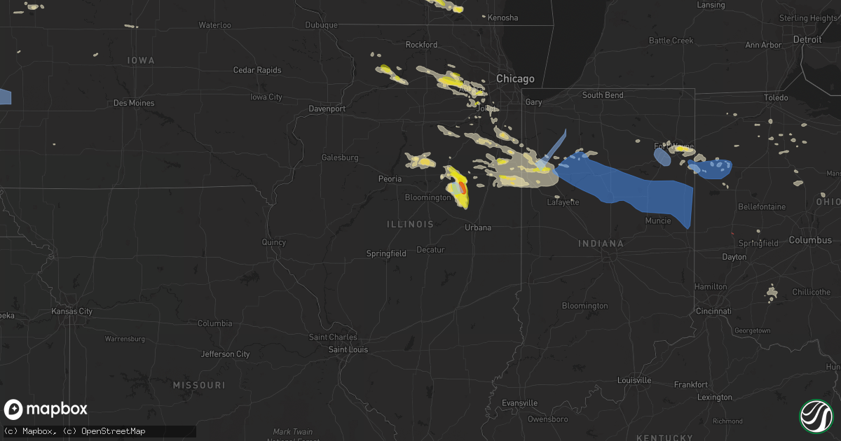
Hail Map in Illinois on July 23, 2022
Get this storm
July 23 map
$229
one time, instant access
Download today. No call, no setup
Keep the $229
Bought the map and want the full workflow? Apply the entire $229 to a subscription within 7 days. None of it is wasted.
Every map, not just this one
This buys you this map. Subscription and you get every map we run, in the markets you choose from a few cities to whole states to nationwide. Plus real-time alerts the moment a storm fires.
Contact data
Name, contact info, occupancy, even credit band for addresses in the footprint. You go from where it hit to who to call.
Become the source they trust
Unlimited branding weather history reports on demand. You already have the documented answer ready for the property owner, and you are the one who showed up with it.
Property data and RoofTrace estimates
Pull up any address you have got, its value and the exact code rules for that jurisdiction, straight from One Click Code. Then RoofTrace estimates the squares, pitch, and roof value, priced the way you price.
Storm reports in Illinois
Illinois
| Date | Description |
|---|---|
| 07/23/20225:20 PM CDT | Power line down and two power poles leaning over. Time estimated. |
| 07/23/20222:47 PM CDT | Tree downed on pine st. In gibson city. Time estimated from radar. |
| 07/23/20222:17 PM CDT | Large tree limbs blow down. Time estimated. |
| 07/23/20222:17 PM CDT | Delayed report. Em reports significant tree damage in town. Numerous tree limbs down on cars and two houses with trees through the roof. Power lines down. Large trees u |
| 07/23/20222:09 PM CDT | A local report indicates 1.75 inch wind near 3 W CROPSEY |
| 07/23/20222:09 PM CDT | A local report indicates 70 MPH wind near 3 W CROPSEY |
| 07/23/20221:46 PM CDT | Delayed report... Hail damaged corn near fairbury. Time and location estimated from radar. |
| 07/23/20221:42 PM CDT | Delayed report... Trees were downed in fairbury. Time estimated from radar. |
| 07/23/20221:26 PM CDT | Large tree limb blown down. Relayed by media. Time estimated. |
| 07/23/202210:22 AM CDT | Several reports of nickel to quarter size hail on the south side of naperville. |
| 07/23/202210:12 AM CDT | Largest hailstones were about quarter size. |
| 07/23/20227:33 AM CDT | At 1233 AM CDT, a severe thunderstorm was located over Lake Villa, moving east at 35 mph. Another severe thunderstorm was near Waukegan also moving east at 35 mph. HAZARD...Quarter size hail. SOURCE...Radar indicated. IMPACT...Damage to vehicles is expected. Locations impacted include... Waukegan, North Chicago, Gurnee, Mundelein, Round Lake Beach, Vernon Hills, Zion, Grayslake, Libertyville, Lake Forest, Round Lake, Antioch, Wauconda, Fox Lake, Lake Villa, Island Lake, Lindenhurst, Beach Park, Gages Lake and Long Grove.Including the following interstates... I-94 between mile markers 1 and 17. I-294 between mile markers 1 and 17. |
| 07/23/20227:24 AM CDT | Photo shared via social media. |
| 07/23/20225:22 AM CDT | At 1022 AM CDT, a severe thunderstorm was located near Sugar Grove, or near Aurora, moving east at 20 mph. HAZARD...60 mph wind gusts and quarter size hail. SOURCE...Radar indicated. IMPACT...Hail damage to vehicles is expected. Expect wind damage to roofs, siding, and trees. Locations impacted include... Aurora, Naperville, Bolingbrook, Wheaton, Downers Grove, Lombard, Woodridge, Hinsdale, Lemont, Burr Ridge, Oak Brook, Westmont, Lisle, Darien, Warrenville, Willowbrook, Clarendon Hills and Willow Springs.Including the following interstates... I-55 between mile markers 268 and 276. I-88 between mile markers 121 and 134. I-355 between mile markers 12 and 22.This includes... Argonne National Laboratory, BenedictineUniversity, Morton Arboretum, and North Central College. |
| 07/23/20224:08 AM CDT | At 908 AM CDT, a severe thunderstorm was located near Hinckley, or 9 miles southeast of DeKalb, moving east at 35 mph. HAZARD...60 mph wind gusts and half dollar size hail. SOURCE...Radar indicated. IMPACT...Hail damage to vehicles is expected. Expect wind damage to roofs, siding, and trees. Locations impacted include... Aurora, DeKalb, Oswego, Batavia, Geneva, Yorkville, Montgomery, North Aurora, Sugar Grove, Boulder Hill, Elburn, Cortland, Hinckley, Waterman, Maple Park, Big Rock, Kaneville, Bristol and Little Rock.Including the following interstate... I-88 between mile markers 94 and 120. This includes... Aurora University, Fermilab, IL Math and ScienceAcademy, and Waubonsee Community College. |
| 07/23/20223:17 AM CDT | At 816 PM CDT, a severe thunderstorm was located near Whitewater, moving southeast at 20 mph. HAZARD...60 mph wind gusts and half dollar size hail. SOURCE...Radar indicated. IMPACT...Hail damage to vehicles is expected. Expect wind damage to roofs, siding, and trees. Locations impacted include... Janesville, Whitewater, Elkhorn, Delavan, Lake Geneva, Milton, Williams Bay, Walworth, Clinton, Fontana-On-Geneva Lake, Sharon, Darien, Como, Richmond, Springfield, La Grange, Tiffany, Millard, Avalon and Delavan Lake.People attending Jimmy Buffet at Alpine Valley should seek safe shelter immediately! |
| 07/23/20221:46 AM CDT | At 646 AM CDT/746 AM EDT/, severe thunderstorms were located along a line extending from near Kouts to near Roselawn to 6 miles south of Hopkins Park, moving southeast at 55 mph. HAZARD...60 mph wind gusts. SOURCE...Radar indicated. IMPACT...Expect damage to roofs, siding, and trees. Locations impacted include... Rensselaer, DeMotte, Fowler, Kentland, Otterbein, Remington, Morocco, Wheatfield, Roselawn, Oxford, Goodland, Brook, Boswell, Earl Park, Hanging Grove, Collegeville, Mount Ayr, Stoutsburg, Foresman and Fair Oaks.Including the following interstate... Indiana I-65 between mile markers 200 and 232. This includes... US 41 Dragway. |
| 07/23/20221:42 AM CDT | At 642 AM CDT, a severe thunderstorm was located over Peru, moving east at 40 mph. HAZARD...60 mph wind gusts and penny size hail. SOURCE...Radar indicated. IMPACT...Expect damage to roofs, siding, and trees. Locations impacted include... Ottawa, Peru, La Salle, Spring Valley, Oglesby, North Utica, Tonica, Grand Ridge, Naplate, Cedar Point and Leonore.Including the following interstates... I-39 between mile markers 49 and 62. I-80 between mile markers 73 and 92.This includes...Buffalo Rock State Park, Illinois Valley Community College, Matthiessen State Park, and Starved Rock State Park. |
| 07/23/20221:22 AM CDT | Report of tree down at the apple canyon camp grounds... Time estimated from radar. |
| 07/23/20221:15 AM CDT | At 615 AM CDT, a severe thunderstorm was located near Walnut, or 10 miles northwest of Princeton, moving east at 30 mph. HAZARD...60 mph wind gusts and nickel size hail. SOURCE...Radar indicated. IMPACT...Expect damage to roofs, siding, and trees. Locations impacted include... Princeton, Walnut, La Moille, Ohio, Cherry, Malden, Manlius, Arlington, Dover, Zearing, Kasbeer, Van Orin and Normandy. |
| 07/23/20221:03 AM CDT | Tree down on house in the city limits... Per law enforcement... Time estimated by radar. |
| 07/23/202212:32 AM CDT | At 532 AM CDT, severe thunderstorms were located along a line extending from Streamwood to North Aurora to Plano, moving east at 40 mph. The strongest winds are occurring well behind the initial thunderstorms. Rochelle recently gusted to 58 mph. HAZARD...60 mph wind gusts. SOURCE...Surface observations. IMPACT...Expect damage to roofs, siding, and trees. Locations impacted include... Aurora, Joliet, Elgin, Bartlett, Plainfield, St. Charles, Oswego, West Chicago, Batavia, Huntley, Geneva, Yorkville, Campton Hills, Minooka, Plano, Sandwich, South Elgin, Montgomery, North Aurora and Sugar Grove.Including the following interstates... I-80 between mile markers 120 and 122. I-88 between mile markers 102 and 120. I-90 between mile markers 47 and 56.This includes... Aurora University, Elgin Community College,Fermilab, IL Math and Science Academy, Kane County Cougars Ballpark,and Waubonsee Community College. |
| 07/23/202212:26 AM CDT | At 525 AM CDT, a severe thunderstorm was located over Leon Corners, or 14 miles south of Morrison, moving northeast at 40 mph. HAZARD...60 mph wind gusts and nickel size hail. SOURCE...Radar indicated. IMPACT...Expect damage to roofs, siding, and trees. Locations impacted include... Sterling, Rock Falls, Prophetstown, Sheffield, Tampico, Lyndon, Buda, Deer Grove, Emerson, Neponset, Yorktown, Round Grove, Manlius, Mineral, New Bedford, Portland Corners, Como, Denrock, Douglas Park and Agnew. |
| 07/23/202212:22 AM CDT | At 521 PM CDT, a severe thunderstorm was located near Minonk, or 17 miles west of Pontiac, moving east at 15 mph. HAZARD...Golf ball size hail and 60 mph wind gusts. SOURCE...Radar indicated. IMPACT...People and animals outdoors will be injured. Expect hail damage to roofs, siding, windows, and vehicles. Expect wind damage to roofs, siding, and trees. This severe thunderstorm will be near... Flanagan around 545 PM CDT.Other locations impacted by this severe thunderstorm include Dana andRutland. |
| 07/23/202212:17 AM CDT | At 517 PM CDT, a severe thunderstorm was located over Minonk, or 18 miles southwest of Streator, moving east at 25 mph. HAZARD...Golf ball size hail and 60 mph wind gusts. SOURCE...Radar indicated. IMPACT...People and animals outdoors will be injured. Expect hail damage to roofs, siding, windows, and vehicles. Expect wind damage to roofs, siding, and trees. This severe thunderstorm will remain over mainly rural areas of southeastern Marshall and northeastern Woodford Counties, including the following locations... Benson.This includes Interstate 39 between mile markers 20 and 33. |
| 07/23/202212:10 AM CDT | At 510 AM CDT, a severe thunderstorm was located over Geneseo, or 11 miles north of Cambridge, moving east at 30 mph. HAZARD...60 mph wind gusts and nickel size hail. SOURCE...Radar indicated. IMPACT...Expect damage to roofs, siding, and trees. Locations impacted include... Cambridge, Geneseo, Atkinson, Annawan, Hooppole, Osco, Henry County Fairgrounds, German Corner, Shady Beach, Johnson-Sauk Trail State Park and Morristown. |
| 07/22/202211:56 PM CDT | At 456 AM CDT, a severe thunderstorm was located over Hoffman Estates, moving east at 40 mph. HAZARD...60 mph wind gusts and quarter size hail. SOURCE...Radar indicated. IMPACT...Hail damage to vehicles is expected. Expect wind damage to roofs, siding, and trees. Locations impacted include... Chicago, Elgin, Cicero, Arlington Heights, Evanston, Schaumburg, Palatine, Skokie, Des Plaines, Berwyn, Mount Prospect, Wheaton, Hoffman Estates, Oak Park, Glenview, Elmhurst, Lombard, Buffalo Grove, Bartlett and Ohare Airport.Including the following interstates... I-55 between mile markers 288 and 294. I-88 between mile markers 139 and 140. I-90 between mile markers 50 and 84. I-94 between mile markers 26 and 57. I-290 between mile markers 1 and 29. I-294 between mile markers 26 and 57. I-355 between mile markers 26 and 30.This includes... Lincoln Park Zoo, Loyola University, OaktonCommunity College, Schaumburg Boomers Baseball, Triton College, ElginCommunity College, Harper College, Hawthorne Park, NortheasternIllinois University, Northwestern University, Soldier Field,University of Illinois Chicago, Guaranteed Rate Field...IL Instituteof Technology, Wrigley Field, The Loop, Museum Campus, and NortherlyIsland. |
| 07/22/202211:49 PM CDT | At 448 AM CDT, a severe thunderstorm was located near Ashton, or 8 miles west of Rochelle, moving east at 35 mph. HAZARD...60 mph wind gusts and quarter size hail. SOURCE...Radar indicated. IMPACT...Hail damage to vehicles is expected. Expect wind damage to roofs, siding, and trees. Locations impacted include... DeKalb, Sycamore, Rochelle, Sandwich, Genoa, Shabbona, Cortland, Davis Junction, Hinckley, Somonauk, Kirkland, Waterman, Hillcrest, Maple Park, Kingston, Malta, Paw Paw, Creston, Lindenwood and Monroe Center.Including the following interstates... I-39 between mile markers 78 and 114. I-88 between mile markers 69 and 101.This includes... Northern Illinois University and SandwichFairgrounds. |
| 07/22/202211:09 PM CDT | At 408 AM CDT, a severe thunderstorm was located over Milledgeville, or 10 miles west of Polo, moving east at 30 mph. HAZARD...60 mph wind gusts and quarter size hail. SOURCE...Radar indicated. IMPACT...Hail damage to vehicles is expected. Expect wind damage to roofs, siding, and trees. Locations impacted include... Dixon, Byron, Oregon, Mount Morris, Amboy, Polo, Forreston, Stillman Valley, Franklin Grove, Ashton, Lost Nation, Leaf River, Grand Detour, Nelson, Woodland Shores, Adeline, Eldena, Baileyville, Woosung and Lee Center.Including the following interstate... I-88 between mile markers 45 and 70. This includes... Castle Rock State Park, Lee County Fairgrounds,Lowden State Park, Ogle County Fairgrounds, Sauk Valley College, andWhite Pines State Park. |
| 07/22/202211:05 PM CDT | At 405 AM CDT, a severe thunderstorm was located over Coleta, or 9 miles northeast of Morrison, moving east at 50 mph. HAZARD...60 mph wind gusts and nickel size hail. SOURCE...Radar indicated. IMPACT...Expect damage to roofs, siding, and trees. Locations impacted include... Sterling, Milledgeville, Coleta, Franklin Corners, Carroll County Fairgrounds, Penrose, Malvern and White Pigeon. |
| 07/22/202210:19 PM CDT | At 319 PM CDT, a severe thunderstorm was located near Fairbury, moving east at 30 mph. HAZARD...Quarter size hail. SOURCE...Radar indicated. IMPACT...Damage to vehicles is expected. Locations impacted include... Fairbury, Chatsworth and Forrest. |
| 07/22/202210:09 PM CDT | At 308 PM CDT, a severe thunderstorm was located near Saybrook, or 8 miles southwest of Gibson City, moving south at 15 mph. HAZARD...Ping pong ball size hail and 60 mph wind gusts. SOURCE...Radar indicated. IMPACT...People and animals outdoors will be injured. Expect hail damage to roofs, siding, windows, and vehicles. Expect wind damage to roofs, siding, and trees. This severe thunderstorm will be near... Fisher around 320 PM CDT.Other locations in the path of this severe thunderstorm includeMahomet, Mansfield and Lake Of The Woods.This includes the following highways... Interstate 57 between mile markers 240 and 249. Interstate 74 between mile markers 157 and 175. |
| 07/22/20229:57 PM CDT | At 257 PM CDT, a severe thunderstorm was located near Gibson City, moving south at 15 mph. HAZARD...60 mph wind gusts and quarter size hail. SOURCE...Radar indicated. IMPACT...Hail damage to vehicles is expected. Expect wind damage to roofs, siding, and trees. Locations impacted include... Gibson City, Elliott and Sibley. |
| 07/22/20229:38 PM CDT | At 238 PM CDT, a severe thunderstorm was located near Colfax, or 12 miles west of Gibson City, moving south at 15 mph. HAZARD...Golf ball size hail and 70 mph wind gusts. SOURCE...Trained weather spotters. IMPACT...People and animals outdoors will be injured. Expect hail damage to roofs, siding, windows, and vehicles. Expect considerable tree damage. Wind damage is also likely to mobile homes, roofs, and outbuildings. Locations impacted include... Saybrook and Le Roy.This includes Interstate 74 near mile marker 148. |
| 07/22/20228:57 PM CDT | At 157 PM CDT, a severe thunderstorm was located over Colfax, or 13 miles southwest of Fairbury, moving south at 20 mph. HAZARD...60 mph wind gusts and quarter size hail. SOURCE...Radar indicated. IMPACT...Hail damage to vehicles is expected. Expect wind damage to roofs, siding, and trees. This severe thunderstorm will be near... Cooksville around 205 PM CDT.Other locations in the path of this severe thunderstorm includeSaybrook and Le Roy.This includes Interstate 74 between mile markers 148 and 154. |
| 07/22/20228:45 PM CDT | At 145 PM CDT, a severe thunderstorm was located near Fairbury, moving southeast at 25 mph. HAZARD...Golf ball size hail and 70 mph wind gusts. The most intense part of this storm will move toward Sibley and gibson City. SOURCE...Radar indicated. IMPACT...People and animals outdoors will be injured. Expect hail damage to roofs, siding, windows, and vehicles. Expect considerable tree damage. Wind damage is also likely to mobile homes, roofs, and outbuildings. Locations impacted include... Paxton, Gibson City, Melvin, Elliott and Sibley. Including the following interstate... I-57 near mile marker 258. |
| 07/22/20228:24 PM CDT | At 122 PM CDT, a severe thunderstorm was located near Fairbury, moving east at 30 mph. HAZARD...60 mph wind gusts and quarter size hail. SOURCE...Radar indicated. IMPACT...Hail damage to vehicles is expected. Expect wind damage to roofs, siding, and trees. This severe thunderstorm will remain over mainly rural areas of northeastern McLean County, including the following locations... Weston, Cropsey and Anchor.This includes Interstate 55 between mile markers 185 and 187. |
| 07/22/20228:23 PM CDT | At 122 AM CDT, two severe thunderstorms were located over central Lake County. One was 3 miles west of Grayslake, and the other near Mundelein. Both were moving east at 40 mph. HAZARD...Half dollar size hail. SOURCE...Radar indicated. IMPACT...Damage to vehicles is expected. Locations impacted include... Waukegan, Arlington Heights, Palatine, Buffalo Grove, Wheeling, Northbrook, North Chicago, Gurnee, Mundelein, Highland Park, Vernon Hills, Zion, Grayslake, Libertyville, Lake Forest, Deerfield, Lindenhurst, Beach Park, Gages Lake and Glencoe.Including the following interstates... I-94 between mile markers 6 and 26. I-294 between mile markers 6 and 26. |
| 07/22/20228:14 PM CDT | At 114 PM CDT, a severe thunderstorm was located near Pontiac, moving southeast at 25 mph. HAZARD...60 mph wind gusts and quarter size hail. SOURCE...Radar indicated. IMPACT...Hail damage to vehicles is expected. Expect wind damage to roofs, siding, and trees. Locations impacted include... Pontiac, Fairbury, Chatsworth, Forrest and Strawn. Including the following interstate... I-55 between mile markers 189 and 197. |
All States Impacted by Hail Map on July 23, 2022
Cities Impacted by Hail Map on July 23, 2022
- Byron, MN
- Hayfield, MN
- Stewartville, MN
- Lonsdale, MN
- Montgomery, MN
- Elroy, WI
- Alger, MI
- Gladwin, MI
- Ortley, SD
- Wallace, SD
- Florence, SD
- Stevens Point, WI
- Rudolph, WI
- Grand Haven, MI
- Spring Lake, MI
- Peever, SD
- Webster, SD
- Waubay, SD
- Spring Valley, MN
- Rochester, MN
- Eyota, MN
- Glenbeulah, WI
- Bangor, WI
- Saint Paul, NE
- Wolbach, NE
- Hillsboro, WI
- Wonewoc, WI
- Smithland, IA
- Hornick, IA
- Plainfield, IL
- South Shore, SD
- Milbank, SD
- Marvin, SD
- Ortonville, MN
- Bellingham, MN
- Stockholm, SD
- Marietta, MN
- Goodwin, SD
- Revillo, SD
- Odessa, MN
- Big Stone City, SD
- Labolt, SD
- Watertown, SD
- Summit, SD
- Strandburg, SD
- Twin Brooks, SD
- Hillpoint, WI
- La Valle, WI
- Cazenovia, WI
- Pittsville, WI
- Poynette, WI
- Farwell, NE
- Miller, NE
- Rockville, NE
- Dannebrog, NE
- Boelus, NE
- Ravenna, NE
- Bertrand, NE
- Lexington, NE
- Elm Creek, NE
- Sumner, NE
- Hazard, NE
- Loup City, NE
- Amherst, NE
- Palmer, NE
- Smithfield, NE
- Overton, NE
- Elba, NE
- Ashton, NE
- Pleasanton, NE
- Bowling Green, OH
- Riverdale, NE
- Greensburg, PA
- Jeannette, PA
- Morgan, MN
- Sleepy Eye, MN
- Bristow, IA
- Aredale, IA
- Dumont, IA
- Watertown, WI
- Lake Mills, WI
- Williams, IA
- Northwood, IA
- Bowerston, OH
- Winamac, IN
- Star City, IN
- Kewanna, IN
- Middlebourne, WV
- New Creek, WV
- Grand Meadow, MN
- Racine, MN
- Doon, IA
- Wisconsin Rapids, WI
- West Olive, MI
- Hanley Falls, MN
- Belle Plaine, MN
- Gibbon, MN
- Gaylord, MN
- Madison, MN
- Granite Falls, MN
- Belview, MN
- Morton, MN
- Henderson, MN
- Watson, MN
- Clarkfield, MN
- Echo, MN
- Bird Island, MN
- Montevideo, MN
- Franklin, MN
- Sacred Heart, MN
- Wood Lake, MN
- Maynard, MN
- Arlington, MN
- Winthrop, MN
- Redwood Falls, MN
- Le Sueur, MN
- Dawson, MN
- Danube, MN
- Clara City, MN
- New Prague, MN
- Milan, MN
- Lafayette, MN
- New Ulm, MN
- Olivia, MN
- Renville, MN
- Le Center, MN
- Fairfax, MN
- Saint Peter, MN
- Berlin, WI
- Ripon, WI
- East Tawas, MI
- Friendship, WI
- Mauston, WI
- Wisconsin Dells, WI
- Lyndon Station, WI
- Coloma, WI
- Adams, WI
- Westfield, WI
- Grand Marsh, WI
- Oxford, WI
- Custar, OH
- Weston, OH
- Creola, OH
- Canaan, VT
- Norton, VT
- Averill, VT
- Van Wert, OH
- Middle Point, OH
- Newton, WV
- Left Hand, WV
- Chatfield, MN
- Easton, MN
- Minnesota Lake, MN
- Channahon, IL
- Belle Vernon, PA
- West Newton, PA
- Smithton, PA
- Brillion, WI
- Leechburg, PA
- New Kensington, PA
- Fort Atkinson, WI
- Jefferson, WI
- Newell, IA
- Albert City, IA
- Storm Lake, IA
- Hector, MN
- Beaver Dam, WI
- Stratford, SD
- Andover, SD
- Conde, SD
- Ferney, SD
- Bristol, SD
- Groton, SD
- Mikado, MI
- Greenbush, MI
- New Lisbon, WI
- Whitelaw, WI
- Valders, WI
- Newton, WI
- New Holstein, WI
- Chilton, WI
- Manitowoc, WI
- Saint Nazianz, WI
- Reedsville, WI
- Kiel, WI
- Pittsburg, NH
- Malone, WI
- Saint Cloud, WI
- Lanesboro, MN
- Preston, MN
- Dover, MN
- La Crosse, WI
- Coon Valley, WI
- West Salem, WI
- Stoddard, WI
- Chaseburg, WI
- Winona, MN
- Lewiston, MN
- La Crescent, MN
- Houston, MN
- Caledonia, MN
- Hokah, MN
- Derby Line, VT
- Deerfield, WI
- Marshall, WI
- Salem, WI
- Saukville, WI
- Port Washington, WI
- Random Lake, WI
- Oostburg, WI
- Belgium, WI
- Fredonia, WI
- Kewaskum, WI
- West Bend, WI
- Cedar Grove, WI
- Princeton, WI
- Neshkoro, WI
- Johnson Creek, WI
- Hartford, WI
- Black River Falls, WI
- Schleswig, IA
- Lake Mills, IA
- Fertile, IA
- Joice, IA
- Thompson, IA
- Hanlontown, IA
- Leland, IA
- Forest City, IA
- Everett, PA
- Bedford, PA
- Boyd, MN
- Webster City, IA
- Blairsburg, IA
- Coraopolis, PA
- Sewickley, PA
- Pittsburgh, PA
- Adell, WI
- Campbellsport, WI
- Sheboygan, WI
- Sheboygan Falls, WI
- Chatsworth, IL
- Piper City, IL
- Roberts, IL
- Westby, WI
- Genoa, WI
- Viroqua, WI
- Marion, NC
- Milton, WI
- Avalon, WI
- Mazomanie, WI
- Cross Plains, WI
- Middleton, WI
- Waunakee, WI
- Black Earth, WI
- Lake Geneva, WI
- Stoughton, WI
- Delavan, WI
- Edgerton, WI
- Whitewater, WI
- Janesville, WI
- Elkhorn, WI
- Oregon, WI
- Madison, WI
- Deforest, WI
- Sauk City, WI
- Dane, WI
- Lodi, WI
- Mcfarland, WI
- Cambridge, WI
- Cottage Grove, WI
- Broadway, NC
- Lillington, NC
- Wheaton, IL
- Lindsay, NE
- Saint Edward, NE
- Newman Grove, NE
- Primrose, NE
- Madison, NE
- Albion, NE
- Spalding, NE
- Humphrey, NE
- Cedar Rapids, NE
- Marquette, WI
- Dalton, WI
- Montello, WI
- Kingston, WI
- Markesan, WI
- Randolph, WI
- Buckhorn, KY
- Oneida, KY
- Greenup, KY
- Burgettstown, PA
- Georgetown, PA
- Moorefield, WV
- Mount Gilead, OH
- Cardington, OH
- Riverton, WV
- Upper Tract, WV
- Seneca Rocks, WV
- Flatwoods, WV
- Ohio City, OH
- Old Fields, WV
- Baker, WV
- Fisher, WV
- Rio, WV
- Webbville, KY
- Grayson, KY
- Sandy Hook, KY
- Pine Island, MN
- Olive Hill, KY
- Vanceburg, KY
- Emerson, KY
- Nebo, NC
- New Haven, IN
- Fort Wayne, IN
- Monroeville, IN
- Delphos, OH
- Glenshaw, PA
- Pontiac, IL
- Lamar, CO
- Chenoa, IL
- McCook, NE
- Letart, WV
- Hartford, WV
- Racine, OH
- Pomeroy, OH
- Syracuse, OH
- New Haven, WV
- Mason, WV
- Mount Pleasant, SC
- Cooksville, IL
- Colfax, IL
- Arrowsmith, IL
- Anchor, IL
- Foosland, IL
- Forrest, IL
- Gibson City, IL
- Bellflower, IL
- Cropsey, IL
- Saybrook, IL
- Fairbury, IL
- Lexington, IL
- Sibley, IL
- Fisher, IL
- Strawn, IL
- Petersburg, WV
- Ashland, KY
- Garrison, KY
- Rush, KY
- Argillite, KY
- Buckley, IL
- Bulger, PA
- Vanlue, OH
- Carey, OH
- Findlay, OH
- Alvada, OH
- Rayland, OH
- Yorkville, OH
- Tiltonsville, OH
- Decatur, IN
- Newport, OH
- Leicester, NC
- Alexander, NC
- Charleston, TN
- Cameron, NC
- Sanford, NC
- Vass, NC
- Eagle Rock, VA
- Helenwood, TN
- Oneida, TN
- Claremont, MN
- Dodge Center, MN
- Eustis, NE
- Fuquay Varina, NC
- Louisa, KY
- Bowling Green, KY
- Utica, MN
- Peterson, MN
- Wanamingo, MN
- West Concord, MN
- Seminole, FL
- Saint Petersburg, FL
- Clearwater, FL
- Largo, FL
- Pinellas Park, FL
- Kasota, MN
- Morehead, KY
- Salt Lick, KY
- Tampa, FL
- Manchester, KY
- Irwin, PA
- Adamsburg, PA
- Odessa, FL
- New Port Richey, FL
- Land O'Lakes, FL
- Sheldon, IL
- Crescent City, IL
- Milford, IL
- Fowler, IN
- Onarga, IL
- Watseka, IL
- Earl Park, IN
- Stockland, IL
- Cissna Park, IL
- Hubertus, WI
- Richfield, WI
- Colebrook, NH
- Owatonna, MN
- Blooming Prairie, MN
- Fenwick, MI
- Sheridan, MI
- Walterboro, SC
- Genoa, WV
- Wayne, WV
- Prichard, WV
- Fort Gay, WV
- Jacksonburg, WV
- Smithfield, WV
- Oldtown, MD
- Green Spring, WV
- Springfield, WV
- Fort Ashby, WV
- Levels, WV
- Burlington, WV
- Keyser, WV
- Romney, WV
- Olympia, KY
- Kingstree, SC
- Nesmith, SC
- Ronda, NC
- Roaring River, NC
- Hamptonville, NC
- Jonesville, NC
- Hayward, MN
- Waldorf, MN
- Brownsdale, MN
- Pemberton, MN
- Good Thunder, MN
- Eagle Lake, MN
- Hollandale, MN
- Mankato, MN
- Lansing, MN
- Waseca, MN
- Mapleton, MN
- Clarks Grove, MN
- Austin, MN
- Albert Lea, MN
- Geneva, MN
- Dexter, MN
- Janesville, MN
- Hartland, MN
- New Richland, MN
- Ellendale, MN
- Saint Clair, MN
- Glenville, MN
- Hoagland, IN
- Payne, OH
- Fort Jennings, OH
- Peotone, IL
- East Waterford, PA
- Blairs Mills, PA
- Shade Gap, PA
- Orbisonia, PA
- West Jefferson, NC
- Bourbonnais, IL
- Pembroke Township, IL
- Grant Park, IL
- Kankakee, IL
- Manteno, IL
- Wilmington, IL
- Manhattan, IL
- Momence, IL
- State Road, NC
- Elkin, NC
- Middlesboro, KY
- Winkelman, AZ
- Seneca, IL
- Ransom, IL
- Remington, IN
- Minooka, IL
- Continental, OH
- Ottawa, OH
- Albany, OH
- Arcadia, FL
- Fox Lake, WI
- Kenyon, MN
- Mapleton, IA
- Oto, IA
- Brilliant, OH
- Mingo Junction, OH
- Wellsburg, WV
- Lane, SC
- Andrews, SC
- Hillsboro, OH
- Alum Bridge, WV
- Troy, WV
- Linn, WV
- Coxs Mills, WV
- Fostoria, OH
- Kansas, OH
- Sardis, OH
- Wingett Run, OH
- New Matamoras, OH
- Graysville, OH
- Marietta, OH
- Portland, OH
- Maple Park, IL
- Point Pleasant, WV
- Slinger, WI
- Germantown, WI
- Lomira, WI
- Menomonee Falls, WI
- Allenton, WI
- Mayville, WI
- Iron Ridge, WI
- Theresa, WI
- Hustisford, WI
- Neosho, WI
- Jackson, WI
- Lannon, WI
- Horicon, WI
- Milwaukee, WI
- Rubicon, WI
- Burnett, WI
- Brownsville, WI
- Colgate, WI
- Sussex, WI
- Juneau, WI
- New Martinsville, WV
- Lewisburg, WV
- Maxwelton, WV
- Ivel, KY
- Gilman, IL
- Ashkum, IL
- Dana, IA
- Paton, IA
- Allison Park, PA
- Martinsburg, WV
- Kearneysville, WV
- Shepherdstown, WV
- New Vienna, OH
- Leesburg, OH
- Sabina, OH
- Rushford, MN
- Mount Pleasant, PA
- Kernersville, NC
- High Point, NC
- Herminie, PA
- Darragh, PA
- New Stanton, PA
- Arona, PA
- Medford, MN
- Faribault, MN
- Morganton, NC
- Deshler, OH
- Lake Crystal, MN
- Whiteriver, AZ
- Tazewell, VA
- Bastian, VA
- Bryson City, NC
- Overgaard, AZ
- Madison Lake, MN
- Newberry, FL
- Pioneer, TN
- La Follette, TN
- Savannah, GA
- Oronoco, MN
- Mazeppa, MN
- Oswego, IL
- Aurora, IL
- Bolingbrook, IL
- Montgomery, IL
- Naperville, IL
- Winfield, TN
- Prestonsburg, KY
- Cabins, WV
- Salyersville, KY
- West Liberty, KY
- Rensselaer, IN
- Valley Grove, WV
- West Alexander, PA
- Dallas, WV
- Triadelphia, WV
- West Finley, PA
- Tiffin, OH
- Rochelle, IL
- New Riegel, OH
- Franklin Grove, IL
- Dixon, IL
- Sistersville, WV
- Lutz, FL
- Hanska, MN
- Eidson, TN
- Walden, CO
- Batavia, IL
- Lisle, IL
- North Aurora, IL
- Warrenville, IL
- Whitesburg, KY
- Mallie, KY
- Isom, KY
- Premium, KY
- North Charleston, SC
- Charleston, SC
- Romeoville, IL
- Lockport, IL
- Crest Hill, IL
- Roaring Gap, NC
- Indianola, NE
- Corning, IA
- Jackson, KY
- Hueysville, KY
- Vest, KY
- Jamestown, TN
- Clarkrange, TN
- Dunlow, WV
- Rutland, IL
- North Wilkesboro, NC
- Venice, FL
- Francesville, IN
- Hedgesville, WV
- West Lafayette, IN
- Reddick, IL
- Toluca, IL
- Minonk, IL
- Washburn, IL
- Peridot, AZ
- Port Charlotte, FL
- Saint Anne, IL
- Beaverville, IL
- Friendly, WV
- Homer Glen, IL
- Benson, IL
- Roanoke, IL
- Dana, IL
- Lowpoint, IL
- Varna, IL
- Flanagan, IL
- Lacon, IL
- El Paso, IL
- Metamora, IL
- Aroma Park, IL
- Fair Oaks, IN
- Donovan, IL
- Union Hill, IL
- Martinton, IL
- Braceville, IL
- Wolcott, IN
- Bonfield, IL
- Braidwood, IL
- Monon, IN
- Buckingham, IL
- Goodland, IN
- Clifton, IL
- Kempton, IL
- Herscher, IL
- Brookston, IN
- Reynolds, IN
- Gardner, IL
- Chebanse, IL
- Kentland, IN
- South Wilmington, IL
- Mazon, IL
- Essex, IL
- Brook, IN
- Chalmers, IN
- Danforth, IL
- Iroquois, IL
- Cullom, IL
- Morocco, IN
- Jacksonville, FL
- Yulee, FL
- Huger, SC
- Saint Charles, MN
- Truesdale, IA
- Alta, IA
- Northfield, MN
- Zumbro Falls, MN
- Nerstrand, MN
- Lafayette, IN
- Morris, IL
- Coal City, IL
- Little Orleans, MD
- Big Cove Tannery, PA
- Hancock, MD
- Needmore, PA
- Mercersburg, PA
- Great Cacapon, WV
- Berkeley Springs, WV
- Warfordsburg, PA
- Republic, OH
- Avella, PA
- Colliers, WV
- Creston, NE
- Britt, IA
- Garner, IA
- New Cumberland, WV
- Hilbert, WI
- Mount Morris, IL
- Oregon, IL
- Polo, IL
- Monticello, IN
- Englewood, FL
- Nokomis, FL
- North Port, FL
- Hundred, WV
- New Freeport, PA
- Littleton, WV
- Napoleon, OH
- Clinton, PA
- Onalaska, WI
- Henrico, VA
- Glen Allen, VA
- Readstown, WI
- Homosassa, FL
- Willshire, OH
- Wren, OH
- London, KY
- Hudson, FL
- Spring Hill, FL
- Crystal River, FL
- Inverness, FL
- Carthage, NC
- West End, NC
- Nicollet, MN
- Garden City, MN
- Saint James, MN
- Hope, MN
- Courtland, MN
- Emmons, MN
- Conger, MN
- Kasson, MN
- Twin Lakes, MN
- Warsaw, MN
- Waterville, MN
- Ostrander, MN
- Kiester, MN
- Sargeant, MN
- Morristown, MN
- Bricelyn, MN
- Madelia, MN
- Cleveland, MN
- Wells, MN
- Elkton, MN
- Waltham, MN
- Wykoff, MN
- Elysian, MN
- Mantorville, MN
- Alden, MN
- Union Grove, NC
- Cleveland, WI
- Frankfort, IL
- Joliet, IL
- Elwood, IL
- Mokena, IL
- New Lenox, IL
- Clearville, PA
- Saint Marys, OH
- Wapakoneta, OH
- Purgitsville, WV
- Benton, TN
- Reliance, TN
- Mount Calvary, WI
- Green Lake, WI
- Cambria, WI
- Waupun, WI
- Elkhart Lake, WI
- Fremont, OH
- Pittsboro, NC
- Todd, NC
- Weaverville, NC
- Adel, GA
- Blountstown, FL
- Dakota, MN
- Danbury, IA
- Clear Lake, SD
- Gary, SD
- Shannon, IL
- Lanark, IL
- Cortland, IL
- Big Rock, IL
- Sugar Grove, IL
- Mooseheart, IL
- Malta, IL
- Bristol, IL
- Sycamore, IL
- Waterman, IL
- Dekalb, IL
- Plano, IL
- Esmond, IL
- Chana, IL
- Hinckley, IL
- Yorkville, IL
- Shabbona, IL
- Elburn, IL
- Hampshire, IL
- Aurelia, IA
- Convoy, OH
- Kilkenny, MN
- Springfield, OH
- Archbold, OH
- Lake Village, IN
- Latrobe, PA
- Morgantown, WV
- Viper, KY
- Smilax, KY
- Hazard, KY
- Holland, MI
- Zeeland, MI
- Hudsonville, MI
- Greeley, NE
- Spruce Pine, NC
- Burnsville, NC
- Moorefield, NE
- Elwood, NE
- Winston Salem, NC
- Raton, NM
- Fernandina Beach, FL
- Viola, WI
- Allardt, TN
- Breezewood, PA
- Crystal Spring, PA
- Meadow Grove, NE
- Dillwyn, VA
- Singer, LA
- Mount Nebo, WV
- Glen Saint Mary, FL
- Vienna, WV
- Hays, NC
- Arcadia, OH
- North Baltimore, OH
- Van Buren, OH
- Bloomdale, OH
- Avonmore, PA
- Wewahitchka, FL
- Arcola, IN
- Livingston, LA
- Ruffin, SC
- Hillsboro, KY
- Larwill, IN
- Pierceton, IN
- South Whitley, IN
- Milledgeville, IL
- Woosung, IL
- Verona, IL
- Ottawa, IL
- Marseilles, IL
- Grand Ridge, IL
- Kinsman, IL
- Pikeville, KY
- Wytheville, VA
- Dublin, VA
- Fountain, MN
- Huntsville, TN
- Rollingstone, MN
- Altura, MN
- Green Isle, MN
- Sun Prairie, WI
- Burton, WV
- New Alexandria, PA
- Dexter City, OH
- Macksburg, OH
- Upper Sandusky, OH
- Harpster, OH
- McDonald, PA
- Midway, PA
- Sycamore, PA
- Prosperity, PA
- Graysville, PA
- Morral, OH
- Marion, OH
- Urbana, OH
- Dundas, MN
- Buffalo Lake, MN
- Stewart, MN
- Holdrege, NE
- Medaryville, IN
- Wheatfield, IN
- North Judson, IN
- La Crosse, IN
- San Pierre, IN
- Raymond, MN
- Prinsburg, MN
- North Freedom, WI
- Friesland, WI
- Baraboo, WI
- Norwalk, WI
- Ontario, WI
- Portage, WI
- Sparta, WI
- Pardeeville, WI
- Reedsburg, WI
- Endeavor, WI
- Camp Douglas, WI
- Merrimac, WI
- Briggsville, WI
- Brownsville, MN
- La Farge, WI
- Richland Center, WI
- Wilton, WI
- Rose Creek, MN
- Rockland, WI
- Cashton, WI
- Holmen, WI
- Kendall, WI
- Rock Springs, WI
- Appleton, WI
- Greenville, WI
- Poy Sippi, WI
- Fremont, WI
- Wautoma, WI
- Kaukauna, WI
- Omro, WI
- Black Creek, WI
- Menasha, WI
- Wrightstown, WI
- Oneida, WI
- Redgranite, WI
- Neenah, WI
- Seymour, WI
- Green Bay, WI
- Butte Des Morts, WI
- Pickett, WI
- Winneconne, WI
- Combined Locks, WI
- Forest Junction, WI
- Larsen, WI
- Kimberly, WI
- Little Chute, WI
- Oshkosh, WI
- Hortonville, WI
- De Pere, WI
- Greenleaf, WI
- Pine River, WI
- Sherwood, WI
- Waterloo, WI
- Mount Horeb, WI
- Belleville, WI
- Verona, WI
- Palmyra, WI
- Amsterdam, OH
- Hammondsville, OH
- Bergholz, OH
- Salineville, OH
- Irondale, OH
- Carrollton, OH
- Mineral City, OH
- Sherrodsville, OH
- Dennison, OH
- Scio, OH
- Mechanicstown, OH
- New Philadelphia, OH
- Uhrichsville, OH
- Middleport, OH
- Cheshire, OH
- Bidwell, OH
- Rutland, OH
- West Columbia, WV
- Long Bottom, OH
- Ravenswood, WV
- Wheeling, WV
- West Liberty, WV
- Bethany, WV
- Howells, NE
- Dodge, NE
- Clarkson, NE
- Leigh, NE
- Scribner, NE
- Snyder, NE
- Kirkman, IA
- Little Sioux, IA
- Blair, NE
- Magnolia, IA
- Pisgah, IA
- Portsmouth, IA
- Modale, IA
- Missouri Valley, IA
- Logan, IA
- Woodbine, IA
- Mondamin, IA
- Persia, IA
- Shelby, IA
- Tekamah, NE
- Harlan, IA
- Herman, NE
- Panama, IA
- Garden City, SD
- Aberdeen, SD
- Turton, SD
- Warner, SD
- Clark, SD
- Mellette, SD
- Bradley, SD
- Bath, SD
- Raymond, SD
- Brentford, SD
- Mansfield, SD
- Henry, SD
- Cheswick, PA
- Monroeville, PA
- West Mifflin, PA
- Russellton, PA
- Murrysville, PA
- Tarentum, PA
- Harwick, PA
- Oakmont, PA
- Springdale, PA
- Mckeesport, PA
- Turtle Creek, PA
- Glassport, PA
- Indianola, PA
- Verona, PA
- East Pittsburgh, PA
- Clairton, PA
- East McKeesport, PA
- Braddock, PA
- McKees Rocks, PA
- Wilmerding, PA
- Dravosburg, PA
- Duquesne, PA
- Creighton, PA
- North Versailles, PA
- Homestead, PA
- Trafford, PA
- Pitcairn, PA
- Waukon, IA
- Waterville, IA
- Lansing, IA
- Postville, IA
- Calmar, IA
- Decorah, IA
- Harpers Ferry, IA
- Comfrey, MN
- Zumbrota, MN
- Troy, OH
- Allendale, MI
- Grandville, MI
- Coopersville, MI
- Ravenna, MI
- Conklin, MI
- Nunica, MI
- Marne, MI
- Jenison, MI
- Muskegon, MI
- Grand Rapids, MI
- Wyoming, MI
- Comstock Park, MI
- Fruitport, MI
- Sparta, MI
- Jefferson, NC
- Maysville, WV
- Bryant, IN
- Saint Paris, OH
- Twelve Mile, IN
- West Milton, OH
- Onward, IN
- Hartford City, IN
- Ludlow Falls, OH
- Bluffton, IN
- Fletcher, OH
- Christiansburg, OH
- Peru, IN
- Matthews, IN
- Celina, OH
- Sweetser, IN
- Tipp City, OH
- Palestine, OH
- Clayton, OH
- Conover, OH
- Albany, IN
- Galveston, IN
- Mexico, IN
- Pleasant Hill, OH
- Hollansburg, OH
- Pennville, IN
- Arcanum, OH
- Van Buren, IN
- Greenville, OH
- Swayzee, IN
- Pitsburg, OH
- Englewood, OH
- Versailles, OH
- Greentown, IN
- La Fontaine, IN
- Yorkshire, OH
- Marion, IN
- Union City, IN
- Poneto, IN
- Walton, IN
- Jonesboro, IN
- Burkettsville, OH
- Fountain City, IN
- Ridgeville, IN
- Burnettsville, IN
- Eaton, IN
- Redkey, IN
- Lewisburg, OH
- Royal Center, IN
- Union City, OH
- Muncie, IN
- Fort Recovery, OH
- Idaville, IN
- Verona, OH
- Osgood, OH
- Keystone, IN
- Portland, IN
- Alexandria, IN
- West Manchester, OH
- Salamonia, IN
- Fort Loramie, OH
- Wabash, IN
- New Paris, OH
- Summitville, IN
- Houston, OH
- Bradford, OH
- Sharpsville, IN
- Saint Henry, OH
- Miami, IN
- Petroleum, IN
- Fowlerton, IN
- Warren, IN
- Rossburg, OH
- Richmond, IN
- Logansport, IN
- Dunkirk, IN
- New Waverly, IN
- New Madison, OH
- Berne, IN
- Russia, OH
- Lucerne, IN
- Ansonia, OH
- Bunker Hill, IN
- Casstown, OH
- Delphi, IN
- Kokomo, IN
- Amboy, IN
- New Weston, OH
- Bringhurst, IN
- Saratoga, IN
- Winchester, IN
- Farmland, IN
- Fairmount, IN
- Laura, OH
- Grissom Arb, IN
- Buffalo, IN
- Covington, OH
- Flora, IN
- Coldwater, OH
- Converse, IN
- Dayton, OH
- Gas City, IN
- Upland, IN
- Piqua, OH
- Phillipsburg, OH
- Yeoman, IN
- Camden, IN
- Brookville, OH
- Elwood, IN
- Montpelier, IN
- Russiaville, IN
- Gaston, IN
- New Carlisle, OH
- Geneva, IN
- Maria Stein, OH
- Lynn, IN
- Vandalia, OH
- Eldorado, OH
- Gettysburg, OH
- Young America, IN
- Yoder, IN
- Zanesville, IN
- Ossian, IN
- Columbia City, IN
- Huntington, IN
- Roanoke, IN
- Uniondale, IN
- Markle, IN
- Lima, OH
- Mendon, OH
- Spencerville, OH
- Rockford, OH
- Venedocia, OH
- Litchfield, NE


