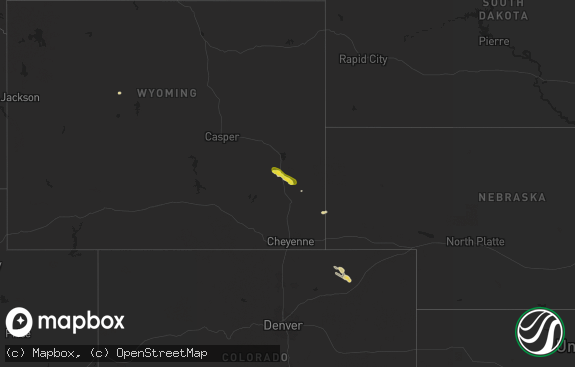
Hail Map in Wyoming on July 16, 2018
The weather event in Wyoming on July 16, 2018 includes Hail map. 27 states and 351 cities were impacted and suffered possible damage. The total estimated number of properties impacted is 168.

Hail
168
Estimated number of impacted properties by a 1.00" hail or larger0
Estimated number of impacted properties by a 1.75" hail or larger0
Estimated number of impacted properties by a 2.50" hail or largerStorm reports in Wyoming
Wyoming
| Date | Description |
|---|---|
| 07/16/20186:35 PM CDT | Quarter sized hail was reported. |
| 07/16/201812:02 AM CDT | At 501 PM MDT, a severe thunderstorm was located over Goldeneye Reservoir, or 20 miles northwest of Casper, moving east at 25 mph. HAZARD...60 mph wind gusts and half dollar size hail. SOURCE...Radar indicated. IMPACT...Hail damage to vehicles is expected. Expect wind damage to roofs, siding, and trees. This severe thunderstorm will be near... Natrona County Airport around 535 PM MDT. Homa Hills around 540 PM MDT. Western Casper, Mills, Bar Nunn and Paradise Valley around 545 PM MDT.This includes Interstate 25 between mile markers 192 and 201. |
| 07/15/201811:41 PM CDT | At 440 PM MDT, a severe thunderstorm was located 16 miles southwest of Bill, or 19 miles north of Douglas, moving southeast at 25 mph. HAZARD...60 mph wind gusts and half dollar size hail. SOURCE...Radar indicated. IMPACT...Hail damage to vehicles is expected. Expect wind damage to roofs, siding, and trees. This severe thunderstorm will remain over mainly rural areas of central Converse County. |
| 07/15/20188:33 PM CDT | At 133 AM MDT, a severe thunderstorm was located 19 miles south of Echeta, or 20 miles west of Gillette, moving east at 20 mph. HAZARD...60 mph wind gusts and half dollar size hail. SOURCE...Radar indicated. IMPACT...Hail damage to vehicles is expected. Expect wind damage to roofs, siding, and trees. Locations impacted include... Western Gillette.This Includes Interstate 90 in Wyoming between Mile Markers 98 and119. |
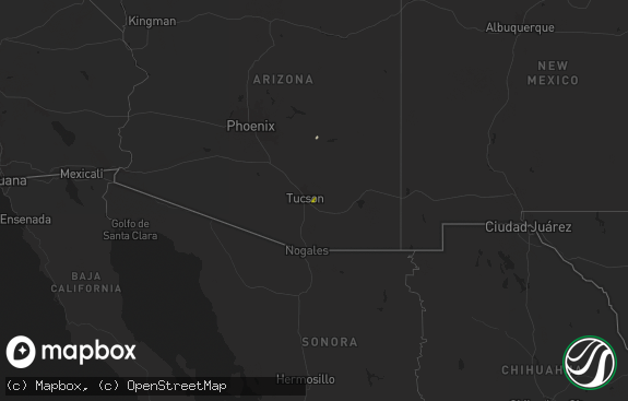
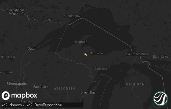
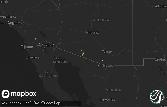
All States Impacted by Hail Map on July 16, 2018
Cities Impacted by Hail Map on July 16, 2018
- Thedford, NE
- Alma, NY
- Bolivar, NY
- New Raymer, CO
- Weldona, CO
- Fort Morgan, CO
- Chadron, NE
- Grant, NE
- Madrid, NE
- Phillipsburg, KS
- Cubero, NM
- Rexford, KS
- Colby, KS
- Newcastle, UT
- White Hall, AR
- Pine Bluff, AR
- Prairie View, KS
- Logan, KS
- Long Island, KS
- Harper, KS
- Attica, KS
- Danville, AR
- Rover, AR
- Wauneta, NE
- Merriman, NE
- Gordon, NE
- Hay Springs, NE
- Marsland, NE
- Hemingford, NE
- Paxton, NE
- Hampton, GA
- Casper, WY
- Elsie, NE
- Oxford, NE
- Custer, SD
- Ellsworth, NE
- Rushville, NE
- Hays, KS
- White River, SD
- Imperial, NE
- Transylvania, LA
- Bushnell, NE
- Sedona, AZ
- Thermopolis, WY
- Manville, WY
- Shawnee, WY
- Orleans, NE
- Hill City, SD
- Hermosa, SD
- Keystone, SD
- Fairburn, SD
- Meadville, PA
- Clare, MI
- Wood Lake, NE
- Johnstown, NE
- Valentine, NE
- Elsmere, NE
- Guy, AR
- Greenbrier, AR
- Quitman, AR
- Mitchell, NE
- Scottsbluff, NE
- Gering, NE
- Drasco, AR
- Stuttgart, AR
- Bentonia, MS
- Flora, MS
- Canton, MS
- Pass Christian, MS
- Gulfport, MS
- Kimball, NE
- Clarksdale, MS
- Crumrod, AR
- Oberlin, KS
- Holly, MI
- Fenton, MI
- Saint Francis, SD
- Mission, SD
- Tuthill, SD
- Culbertson, NE
- Palisade, NE
- Trenton, NE
- Hayes Center, NE
- Bunker Hill, KS
- Russell, KS
- Alpena, MI
- Bayard, NE
- Statesboro, GA
- Portal, GA
- Minneola, KS
- Plainville, KS
- Poplarville, MS
- Harrison, NE
- Crawford, NE
- Conway, AR
- North Little Rock, AR
- Mayflower, AR
- Gillette, WY
- Waldron, KS
- Claflin, KS
- Leakesville, MS
- Naponee, NE
- Stamford, NE
- Alma, NE
- Agra, KS
- Republican City, NE
- Bushton, KS
- Chase, KS
- Lyons, KS
- Ellinwood, KS
- Geneseo, KS
- Sheridan, AR
- Rosebud, SD
- Aurora, CO
- McCook, NE
- Herron, MI
- Hubbard Lake, MI
- Bertrand, NE
- Parmelee, SD
- Wood, SD
- Dalton, NE
- Potter, NE
- Oneill, NE
- Atkinson, NE
- Sidney, NE
- Gurley, NE
- Harrisburg, NE
- Glenrock, WY
- Girard, KS
- Ashby, NE
- Hyannis, NE
- Silver City, NM
- Wiggins, CO
- Holcomb, MS
- Protection, KS
- Atwood, KS
- Collinsville, OK
- Claremore, OK
- Padroni, CO
- Sumrall, MS
- Lumberton, MS
- Purvis, MS
- Eads, CO
- Naper, NE
- Edgemont, AR
- Higden, AR
- Walworth, NY
- Norton, KS
- Leola, AR
- Grove, OK
- Wyandotte, OK
- Mikado, MI
- Wright, WY
- Howard City, MI
- Douglas, WY
- Gothenburg, NE
- Hennessey, OK
- Herndon, KS
- Ashland, KS
- Paducah, KY
- Ledbetter, KY
- Wray, CO
- Holyoke, CO
- Kit Carson, CO
- Mountain Grove, MO
- Hotevilla, AZ
- Holyrood, KS
- Sulphur Rock, AR
- Concord, VA
- Lynchburg, VA
- Advance, MO
- Brownwood, MO
- Sturdivant, MO
- Zalma, MO
- Bloomfield, MO
- Batesville, AR
- Watkins, CO
- Deeth, NV
- Afton, OK
- Harbor Beach, MI
- Bingham, NE
- San Manuel, AZ
- Parker, CO
- Poyen, AR
- Vernon, FL
- Wallace, NE
- Crook, CO
- Lodgepole, NE
- Williams, AZ
- Grapevine, AR
- Buffalo, OK
- Halsey, NE
- Dix, NE
- Midland, MI
- Rhodes, MI
- Alliance, NE
- Kayenta, AZ
- Danbury, NE
- Indianola, NE
- Stratton, NE
- Selden, KS
- Nauvoo, AL
- Carbon Hill, AL
- Jackson, MS
- Madison, MS
- Ridgeland, MS
- Ellis, KS
- Vicksburg, MS
- Oakley, KS
- Patton, PA
- Fallentimber, PA
- Dysart, PA
- Ashville, PA
- Flinton, PA
- Glendale, UT
- Alton, UT
- Bell City, MO
- Salley, SC
- Woodston, KS
- Alton, KS
- Derby, KS
- Bosler, WY
- Sallis, MS
- Stapleton, NE
- Naples, FL
- Prattsville, AR
- Union, MS
- Richton, MS
- Essex, MO
- Darien, GA
- Brunswick, GA
- Townsend, GA
- Mansfield, PA
- Mainesburg, PA
- De Witt, NE
- Damascus, AR
- Bee Branch, AR
- Dudley, MO
- Puxico, MO
- Paron, AR
- Greenwood, MS
- Crown Point, IN
- Plymouth, NE
- Gorham, KS
- Danville, KS
- Martin, SD
- Cody, NE
- Meadville, MS
- Benton, AR
- Argonia, KS
- Champion, NE
- Linden, MI
- Howell, MI
- Hartland, MI
- White Lake, MI
- Davisburg, MI
- Highland, MI
- Enterprise, UT
- Miami, OK
- Linwood, MI
- Hardeeville, SC
- Kaycee, WY
- Glade, KS
- Bogalusa, LA
- Terreton, ID
- Hanover, NM
- Bayard, NM
- Traskwood, AR
- Hoisington, KS
- Lusk, WY
- Covington, LA
- Brookport, IL
- Lucedale, MS
- East Tawas, MI
- Kentwood, LA
- Salem, KY
- Dexter, MO
- Monument, KS
- West, MS
- Fairview, MO
- Wheatland, WY
- Stoneham, CO
- Red Oak, OK
- Mccurtain, OK
- Lander, WY
- Mobile, AL
- Kosciusko, MS
- Hope, MI
- Parma, MO
- Haswell, CO
- Philipp, MS
- Pinon, AZ
- Astor, FL
- Benton, MS
- Diamondhead, MS
- Amite, LA
- Lena, MS
- Brandon, MS
- Vilonia, AR
- Ubly, MI
- Holly Springs, MS
- Norcatur, KS
- Durant, MS
- Tallulah, LA
- Carthage, AR
- North Street, MI
- Fort Gratiot, MI
- Stone Ridge, NY
- Accord, NY
- Arthur, NE
- Edison, NE
- Beaver City, NE
- Lehigh Acres, FL
- Oscoda, MI
- Coalport, PA
- Booker, TX
- Alexander, AR
- Tawas City, MI
- Fairland, OK
- Beccaria, PA
- Appomattox, VA
- Stigler, OK
- Pryor, OK
- Folsom, LA
- Bush, LA
- Kilgore, NE
- Torrington, WY
- McLain, MS
- Castle Rock, CO
- Montello, NV
- Ludell, KS
- Waukomis, OK
- Bison, OK
- Eureka, NV
- Mountain View, OK
- Oxford, MS
- Louise, MS
- Silver City, MS
- Prim, AR
- La Crosse, VA
- Brodnax, VA
- Brooklet, GA
- Beaverton, MI
- Ruth, MI
- Minden City, MI
- Wellington, KS
- Canastota, NY
- Saint Francis, KS
- Chunky, MS
- Hickory, MS
- Maumelle, AR


