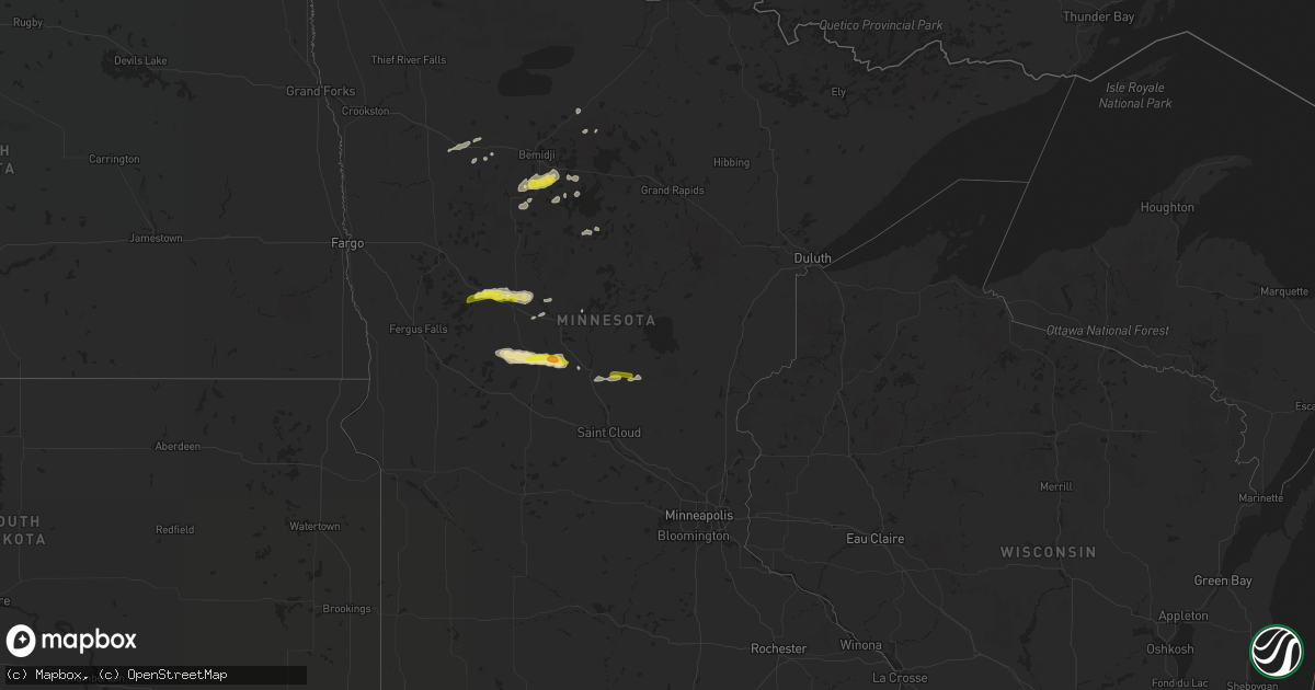
Hail Map in Minnesota on July 13, 2020
Get this storm
July 13 map
$229
one time, instant access
Download today. No call, no setup
Keep the $229
Bought the map and want the full workflow? Apply the entire $229 to a subscription within 7 days. None of it is wasted.
Every map, not just this one
This buys you this map. Subscription and you get every map we run, in the markets you choose from a few cities to whole states to nationwide. Plus real-time alerts the moment a storm fires.
Contact data
Name, contact info, occupancy, even credit band for addresses in the footprint. You go from where it hit to who to call.
Become the source they trust
Unlimited branding weather history reports on demand. You already have the documented answer ready for the property owner, and you are the one who showed up with it.
Property data and RoofTrace estimates
Pull up any address you have got, its value and the exact code rules for that jurisdiction, straight from One Click Code. Then RoofTrace estimates the squares, pitch, and roof value, priced the way you price.
Storm reports in Minnesota
Minnesota
| Date | Description |
|---|---|
| 07/13/20206:34 AM CDT | At 1134 PM CDT, severe thunderstorms were located along a line extending from Lastrup to near Pierz to near Little Falls, moving east at 30 mph. HAZARD...60 mph wind gusts and quarter size hail. SOURCE...Radar indicated. IMPACT...Hail damage to vehicles is expected. Expect wind damage to roofs, siding, and trees. Severe thunderstorms will be near... Pierz and Lastrup around 1140 PM CDT. Onamia around 1210 AM CDT.Other locations impacted by these severe thunderstorms includeBuckman, Hillman and Genola. |
| 07/13/20206:23 AM CDT | At 1123 PM CDT, severe thunderstorms were located along a line extending from Boundary Waters Canoe Area Wilderness, to 7 miles east of Fall Lake, to near Birch Lake, to near Babbitt, moving east at 45 mph. HAZARD...60 mph wind gusts and nickel size hail. SOURCE...Radar indicated. IMPACT...Expect damage to roofs, siding, and trees. Locations impacted include... Babbitt, Clear Lake, Basswood Lake, Sea Gull Lake, Birch Lake, Snowbank Lake, southern Boundary Waters Canoe Area Wilderness, Forest Center, Little Saganaga Lake, Alpine Lake, Isabella, Dumbbell Lake, Fall Lake, Saganaga Lake, Ensign Lake, Kekekabic Lake, Bald Eagle Lake, Gabbro Lake, Alice Lake, and Perent Lake. |
| 07/13/20206:10 AM CDT | At 1110 PM CDT, severe thunderstorms were located along a line extending from near Buhl, to near Toivola, to near Jacobson, moving east at 45 mph. HAZARD...60 mph wind gusts and quarter size hail. SOURCE...Radar indicated. IMPACT...Hail damage to vehicles is expected. Expect wind damage to roofs, siding, and trees. Severe thunderstorms will be near... Buhl, Cherry and Toivola around 1115 PM CDT. Virginia and Eveleth around 1120 PM CDT. Meadowlands around 1125 PM CDT. Gilbert around 1130 PM CDT. Floodwood around 1135 PM CDT. Cotton and Canyon around 1140 PM CDT. Whiteface Reservoir around 1150 PM CDT. Brookston, Fairbanks, Boulder Lake and Island Lake around 1200 AM CDT.Other locations impacted by these severe thunderstorms includeComstock Lake, Iron Junction, Kinney, Kelsey, Shaw, Elmer, Silica,Little Swan, Prosit and Nichols Lake. |
| 07/13/20205:49 AM CDT | At 1048 PM CDT, severe thunderstorms were located along a line extending from 14 miles east of Buyck, to 10 miles northeast of Lake Vermilion, to near Tower, to 11 miles north of Mountain Iron, moving east at 50 mph. HAZARD...60 mph wind gusts and nickel size hail. SOURCE...Radar indicated. IMPACT...Expect damage to roofs, siding, and trees. Locations impacted include... Ely, Lake Vermilion, Hoyt Lakes, Babbitt, Embarrass, Tower, Winton, Basswood Lake, Fall Lake, Boundary Waters Canoe Area Wilderness Near Trout Lake, Birch Lake, Burntside Lake, White Iron Lake, Snowbank Lake, southwestern Boundary Waters Canoe Area Wilderness, Robinson, Forest Center, Ensign Lake, Kekekabic Lake, and Bald Eagle Lake. |
| 07/13/20205:35 AM CDT | At 1035 PM CDT, severe thunderstorms were located along a line extending from 8 miles northwest of Nashwauk, to near Gunn, to near Hill City, moving east at 45 mph. HAZARD...60 mph wind gusts and quarter size hail. SOURCE...Radar indicated. IMPACT...Hail damage to vehicles is expected. Expect wind damage to roofs, siding, and trees. Severe thunderstorms will be near... Hibbing, Keewatin, Nashwauk and Warba around 1050 PM CDT. Jacobson around 1055 PM CDT. Chisholm and Swan River around 1100 PM CDT. Buhl around 1110 PM CDT. Eveleth, Cherry, Floodwood, Toivola and Meadowlands around 1115 PM CDT.Other locations impacted by these severe thunderstorms include BuckLake, Iron Junction, Blackberry, Kinney, Calumet, Kelsey, Swan Lake,Bovey, Elmer and Silica. |
| 07/13/20205:26 AM CDT | At 1025 PM CDT, a severe thunderstorm was located near Browerville, or 20 miles west of Little Falls, moving east at 30 mph. HAZARD...Ping pong ball size hail and 60 mph wind gusts. SOURCE...Radar indicated. IMPACT...People and animals outdoors will be injured. Expect hail damage to roofs, siding, windows, and vehicles. Expect wind damage to roofs, siding, and trees. This severe thunderstorm will be near... Randall around 1050 PM CDT. Little Falls and Camp Ripley around 1105 PM CDT.Other locations impacted by this severe thunderstorm include CampRipley Junction and Little Falls Airport.This includes U.S. Highway 10 in Minnesota between mile markers 127and 150. |
| 07/13/20204:50 AM CDT | At 950 PM CDT, a severe thunderstorm was located over Eagle Bend, or 21 miles northeast of Alexandria, moving east at 40 mph. HAZARD...60 mph wind gusts and half dollar size hail. SOURCE...Radar indicated. IMPACT...Hail damage to vehicles is expected. Expect wind damage to roofs, siding, and trees. This severe thunderstorm will be near... Clarissa around 1000 PM CDT. Browerville around 1005 PM CDT.Other locations impacted by this severe thunderstorm include Clotho.This includes U.S. Highway 71 between mile markers 187 and 208. |
| 07/13/20203:39 AM CDT | At 838 PM CDT, a severe thunderstorm was located near New York Mills, or 28 miles southeast of Detroit Lakes, moving east at 40 mph. HAZARD...60 mph wind gusts and quarter size hail. SOURCE...Radar indicated. IMPACT...Hail damage to vehicles is expected. Expect wind damage to roofs, siding, and trees. This severe thunderstorm will be near... New York Mills around 845 PM CDT. Deer Creek around 850 PM CDT. Bluffton around 855 PM CDT. Wadena around 900 PM CDT. Blue Grass and Verndale around 910 PM CDT. |
| 07/13/20203:39 AM CDT | At 838 PM CDT, a severe thunderstorm was located near Laporte, or 14 miles south of Bemidji, moving east at 50 mph. HAZARD...60 mph wind gusts and half dollar size hail. SOURCE...Radar indicated. IMPACT...Hail damage to vehicles is expected. Expect wind damage to roofs, siding, and trees. This severe thunderstorm will be near... Federal Dam around 910 PM CDT. Bena around 915 PM CDT. Ball Club around 925 PM CDT.Other locations impacted by this severe thunderstorm include Six MileLake, Bowstring Lake, Cut Foot Sioux Lake, Ball Club Lake, PortageLake, Cass Lake, Wilkinson and Schley. |
| 07/13/20203:07 AM CDT | At 806 PM CDT, severe thunderstorms were located along a line extending from Wilton to Itasca State Park, moving east at 40 mph. HAZARD...60 mph wind gusts and quarter size hail. SOURCE...Radar indicated. IMPACT...Hail damage to vehicles is expected. Expect wind damage to roofs, siding, and trees. Severe thunderstorms will be near... Wilton and Bemidji around 810 PM CDT. Lavinia and Lake Bemidji State Park around 820 PM CDT. Lake George, Camp Wilderness and Turtle River around 825 PM CDT. Kabekona around 830 PM CDT. Laporte around 840 PM CDT.Other locations impacted by these severe thunderstorms include CampThunderbird East and Camp Thunderbird West. |
| 07/13/20202:10 AM CDT | At 710 PM CDT, a severe thunderstorm was located near Ebro, or 30 miles west of Bemidji, moving east at 40 mph. HAZARD...60 mph wind gusts and quarter size hail. SOURCE...Radar indicated. IMPACT...Hail damage to vehicles is expected. Expect wind damage to roofs, siding, and trees. Locations impacted include... Clearbrook, Lengby, Leonard, Pinewood, Puposky, Island Lake in Beltrami County and Debs. |
| 07/12/202011:38 PM CDT | A local report indicates 1.00 inch wind near 1 NW PIERZ |
| 07/12/202011:20 PM CDT | Report called in to the st. Louis county sheriffs dept. Of downed trees. Time estimated from radar. |
| 07/12/202010:30 PM CDT | Report called in to the st. Louis county sheriffs dept. Of downed trees. Time estimated from radar. |
| 07/12/202010:10 PM CDT | Pictures sent in via social media show a pole barn destroyed. Pole barn appears to have sustained heavy damage and has completely collapsed. The person who sent in the |
| 07/12/20209:42 PM CDT | Small limbs were downed. Approximately 1-2 inches in diameter. |
| 07/12/20209:28 PM CDT | Tree with a diameter of roughly 4 inches snapped. Photo of tree damage received via social media. |
| 07/12/20208:48 PM CDT | A few dime to quarter sized hail in very heavy rain. Small 1 to 2 inch branches broken down as well. |
| 07/12/20208:39 PM CDT | A few quarter sized hail...with strong winds and heavy rain. |
All States Impacted by Hail Map on July 13, 2020
Cities Impacted by Hail Map on July 13, 2020
- Deadwood, SD
- Sundance, WY
- Lead, SD
- Purdum, NE
- Brewster, NE
- Saint Francis, KS
- Colby, KS
- Goodland, KS
- Benkelman, NE
- Yuma, CO
- Haxtun, CO
- Holyoke, CO
- Rockingham, NC
- Maple Hill, NC
- Bemidji, MN
- Laporte, MN
- Cass Lake, MN
- Lake George, MN
- Winona, KS
- Burlington, CO
- Edson, KS
- Weskan, KS
- Cando, ND
- Cheyenne, WY
- Sharon Springs, KS
- Cambridge, NE
- Chesterfield, SC
- Saint Johns, AZ
- Galivants Ferry, SC
- Gresham, SC
- Conway, SC
- Aynor, SC
- New Bern, NC
- Fleming, CO
- Otis, CO
- Mcalester, OK
- Wayne, NE
- Bricelyn, MN
- Loris, SC
- Longs, SC
- Sterling, CO
- Burwell, NE
- Amelia, NE
- Chambers, NE
- Hill City, KS
- Stuart, NE
- Indianola, NE
- Culbertson, NE
- McCook, NE
- Parks, NE
- Seven Springs, NC
- Andrews, SC
- Georgetown, SC
- Munich, ND
- Taylor, NE
- Krebs, OK
- Stratton, NE
- Trenton, NE
- Laramie, WY
- Maywood, NE
- Imperial, NE
- New Raymer, CO
- Spalding, NE
- Norfolk, NE
- Myrtle Beach, SC
- Maple, NC
- Barco, NC
- Egeland, ND
- Starkweather, ND
- Tryon, NE
- Sutherland, NE
- North Platte, NE
- Hershey, NE
- Enders, NE
- Vancleave, MS
- Stratton, CO
- Indianola, OK
- Dalhart, TX
- Ericson, NE
- Bluffton, MN
- Wadena, MN
- New York Mills, MN
- Sebeka, MN
- Verndale, MN
- Sinton, TX
- Taft, TX
- Maysville, NC
- Wallace, KS
- Rocklake, ND
- Middlesex, NC
- Wallace, SC
- Society Hill, SC
- Burns, WY
- Wolford, ND
- Rugby, ND
- Eagle Bend, MN
- Idalia, CO
- Polkton, NC
- Wadesboro, NC
- Bethune, CO
- Raleigh, NC
- Willow Spring, NC
- Lexington, NE
- Leoti, KS
- Long Prairie, MN
- Clarissa, MN
- Miltona, MN
- Browerville, MN
- Parkers Prairie, MN
- Atkinson, NE
- Long Pine, NE
- Pollocksville, NC
- Randall, MN
- Maxwell, NE
- Hoxie, KS
- Jacksonville, NC
- Oneill, NE
- Quinn, SD
- Philip, SD
- Wall, SD
- Goldsboro, NC
- La Grange, NC
- Bagley, MN
- Oberlin, KS
- Wellfleet, NE
- Nisswa, MN
- Pillager, MN
- South Tamworth, NH
- Center Sandwich, NH
- North Sandwich, NH
- Moultonborough, NH
- Blackduck, MN
- Bogue, KS
- Arapahoe, CO
- Hayes Center, NE
- Hendley, NE
- Wilsonville, NE
- Norton, KS
- Champion, NE
- Cozad, NE
- Eustis, NE
- Jamestown, SC
- Newbury, VT
- Broadway, NC
- Wallace, NE
- Brookville, KS
- Fuquay Varina, NC
- South Strafford, VT
- Lyme, NH
- Piermont, NH
- Post Mills, VT
- Fairlee, VT
- Thetford Center, VT
- Orford, NH
- West Fairlee, VT
- Bradford, VT
- Oakley, KS
- Wray, CO
- Haigler, NE
- Tribune, KS
- Springfield, CO
- Pierce, NE
- Wauneta, NE
- Etna, NH
- Lebanon, NH
- Hanover, NH
- Enfield, NH
- Little Falls, MN
- Campton, NH
- Holderness, NH
- Baker, FL
- Edenton, NC
- Brewster, KS
- Grant, NE
- Grinnell, KS
- Apex, NC
- Garner, NC
- Atwood, OK
- Holdenville, OK
- New Iberia, LA
- Loreauville, LA
- Box Elder, SD
- New Underwood, SD
- Piedmont, SD
- Sturgis, SD
- Magnolia, NC
- Clearwater, NE
- Ewing, NE
- Wood Lake, NE
- Canaan, NH
- West Lebanon, NH
- Rumney, NH
- Bethune, SC
- Granite Canon, WY
- Tie Siding, WY
- Meadow Grove, NE
- Battle Creek, NE
- Mount Olive, NC
- Florence, SC
- Langdon, ND
- Pierz, MN
- Hillman, MN
- Springview, NE
- Farnam, NE
- Orrum, NC
- Fairmont, NC
- Petersburg, NE
- Tilden, NE
- Morland, KS
- Winside, NE
- Lancaster, MN
- Dunning, NE
- Elwood, NE
- Curtis, NE
- Moorefield, NE
- Brady, NE
- Fosston, MN
- Lengby, MN
- Hackensack, MN
- Danbury, NE
- Jeanerette, LA
- Emerald Isle, NC
- Greeley, NE
- Bassett, NE
- Bird City, KS
- Stockton, KS
- Conway, NC
- Marion, SC
- Levant, KS
- Kanorado, KS
- Wingate, NC
- Monroe, NC
- Frost, MN
- Blue Earth, MN
- Linden, NC
- Bunnlevel, NC
- Staples, MN
- Swansboro, NC
- Ainsworth, NE
- Wells, MN
- Madrid, NE
- Anacoco, LA
- Osnabrock, ND
- Bladenboro, NC
- Naper, NE
- Cove City, NC
- Lebanon, NE
- Mylo, ND
- Wales, ND
- Waves, NC
- Herndon, KS
- Elgin, NE
- Mathis, TX
- Maple, WI
- Stuart, OK
- Alsen, ND
- Aldrich, MN
- Moorcroft, WY
- Tabor City, NC
- Penokee, KS
- Bartley, NE
- Mount Croghan, SC
- Peachland, NC
- Ruby, SC
- Vilas, CO
- Walsh, CO
- Walker, MN
- Saint Martinville, LA
- Bison, KS
- Otis, KS
- Longville, MN
- Marston, NC
- Laurel Hill, NC
- Smithfield, NC
- Campo, CO
- Elmore, MN
- Neligh, NE
- Grainfield, KS
- Colfax, WI
- Chippewa Falls, WI
- North Haverhill, NH
- Plymouth, NH
- Dustin, OK
- Lamar, OK
- Swanville, MN
- Cushing, MN
- Pittsburg, OK
- Cut Off, LA
- Ogallala, NE
- Lenora, KS
- Great Bend, KS
- Albert, KS
- McDonald, KS
- Sneads Ferry, NC
- Holly Ridge, NC
- Black Hawk, SD
- Nemo, SD
- Valentine, NE
- Leeds, ND
- Elm Creek, NE
- Woodland, NC
- Murfreesboro, NC
- Thornton, NH
- Sanford, NC
- Hoskins, NE
- Nichols, SC
- Bennettsville, SC
- Snowflake, AZ
- Hobucken, NC
- Dover, NC
- Cedar Island, NC
- Thibodaux, LA
- Currituck, NC
- Fairmont, MN
- Swea City, IA
- Armstrong, IA
- Granada, MN
- Elizabethtown, NC
- Park Rapids, MN
- Plainview, NE
- Brunswick, NE
- Royalton, MN
- Park, KS
- Spencer, NE
- Stockville, NE
- Trenton, NC
- Gilman, WI
- Clayton, NC
- Shawboro, NC
- Wewoka, OK
- White River Junction, VT
- Plainfield, NH
- North Hartland, VT
- Mobile, AL
- Johnstown, NE
- Winner, SD
- Elsie, NE
- Ernul, NC
- Bloomer, WI
- Ellsworth, KS
- Paxton, NE
- La Crosse, KS
- Mission, SD
- Vandemere, NC
- Arapahoe, NE
- Upton, WY
- McDavid, FL
- Perham, MN
- Ottertail, MN
- Overton, NE
- Fayetteville, NC
- Corrales, NM
- Bernalillo, NM
- Albuquerque, NM
- Algodones, NM
- Rio Rancho, NM
- Laguna, NM
- Cubero, NM
- Casa Blanca, NM
- Gem, KS
- Nunn, CO
- Briggsdale, CO
- Weldona, CO
- Orchard, CO
- Carpenter, WY
- Fe Warren Afb, WY
- Carr, CO
- Buford, WY
- Grover, CO
- Ault, CO
- Jelm, WY
- Hereford, CO
- Centennial, WY
- Wellington, CO
- Vona, CO
- Dunbarton, NH
- Bow, NH


