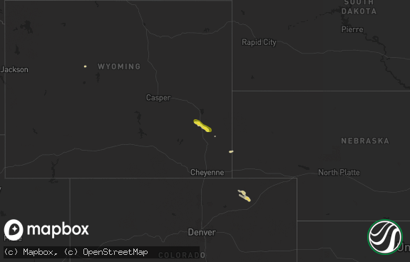
Hail Map in Wyoming on July 7, 2019
The weather event in Wyoming on July 7, 2019 includes Hail and Wind maps. 23 states and 204 cities were impacted and suffered possible damage. The total estimated number of properties impacted is 13.

Hail
Wind
13
Estimated number of impacted properties by a 1.00" hail or larger0
Estimated number of impacted properties by a 1.75" hail or larger0
Estimated number of impacted properties by a 2.50" hail or largerStorm reports in Wyoming
Wyoming
| Date | Description |
|---|---|
| 07/07/20196:02 PM CDT | A local report indicates 1.00 inch wind near 3 NNW WHITAKER |
| 07/07/20192:49 AM CDT | At 748 PM MDT, a severe thunderstorm was located near Chugwater, or 24 miles south of Wheatland, moving northeast at 15 mph. HAZARD...60 mph wind gusts and quarter size hail. SOURCE...Radar indicated. IMPACT...Hail damage to vehicles is expected. Expect wind damage to roofs, siding, and trees. Locations impacted include... Chugwater and Slater. This includes Interstate 25 in Wyoming between mile markers 48 and59. |
| 07/07/20191:21 AM CDT | At 621 PM MDT, a severe thunderstorm was located 5 miles southwest of Wright, moving northeast at 20 mph. HAZARD...60 mph wind gusts and half dollar size hail. SOURCE...Radar indicated. IMPACT...Hail damage to vehicles is expected. Expect wind damage to roofs, siding, and trees. Locations impacted include... Wright and Reno Junction. |
| 07/07/201912:56 AM CDT | At 556 PM MDT, a severe thunderstorm was located 11 miles north of Recluse, or 40 miles southwest of Broadus, moving east at 15 mph. HAZARD...60 mph wind gusts and quarter size hail. SOURCE...Radar indicated. IMPACT...Hail damage to vehicles is expected. Expect wind damage to roofs, siding, and trees. This severe thunderstorm will remain over mainly rural areas of north central Campbell County. |
| 07/07/201912:20 AM CDT | At 519 PM MDT, a severe thunderstorm was located 19 miles north of Spotted Horse, or 40 miles southwest of Broadus, moving northeast at 25 mph. HAZARD...Ping pong ball size hail and 60 mph wind gusts. SOURCE...Radar indicated. IMPACT...People and animals outdoors will be injured. Expect hail damage to roofs, siding, windows, and vehicles. Expect wind damage to roofs, siding, and trees. This severe thunderstorm will remain over mainly rural areas of northwestern Campbell County. |
| 07/07/201912:09 AM CDT | At 509 PM MDT, a severe thunderstorm was located near Deer Creek, or 16 miles west of Douglas, moving north at 20 mph. HAZARD...60 mph wind gusts and quarter size hail. SOURCE...Radar indicated. IMPACT...Hail damage to vehicles is expected. Expect wind damage to roofs, siding, and trees. Locations impacted include... Deer Creek and Laprele Reservoir. This includes Interstate 25 in Wyoming between mile markers 149 and162. |
| 07/06/201911:38 PM CDT | At 437 PM MDT, a severe thunderstorm was located near Whitaker, or 23 miles north of Cheyenne, moving north at 10 mph. HAZARD...60 mph wind gusts and quarter size hail. SOURCE...Radar indicated. IMPACT...Hail damage to vehicles is expected. Expect wind damage to roofs, siding, and trees. This severe thunderstorm will remain over mainly rural areas of north central Laramie County.This includes Interstate 25 in Wyoming between mile markers 31 and43. |
| 07/06/201910:58 PM CDT | At 358 PM MDT, a severe thunderstorm was located 10 miles northwest of Westview Circle, or 15 miles west of Wheatland, moving north at 50 mph. HAZARD...60 mph wind gusts and quarter size hail. SOURCE...Radar indicated. IMPACT...Hail damage to vehicles is expected. Expect wind damage to roofs, siding, and trees. Locations impacted include... Glendo, Esterbrook Campground, Esterbrook, Sibley Peak, Glendo Reservoir, Harris Park, Two Moon Campground and Westview Circle.This includes Interstate 25 in Wyoming between mile markers 93 and123. |
All States Impacted by Hail Map on July 7, 2019
Cities Impacted by Hail Map on July 7, 2019
- Vernon, TX
- Amelia Court House, VA
- Fortuna, ND
- Miles City, MT
- Wright, WY
- Wolf Point, MT
- Gillette, WY
- Dunseith, ND
- Peerless, MT
- Camilla, GA
- Lame Deer, MT
- Rosebud, MT
- Volborg, MT
- Hathaway, MT
- Big Timber, MT
- Bogata, TX
- Scobey, MT
- Whitetail, MT
- Frazer, MT
- Malta, MT
- Cohagen, MT
- Terry, MT
- Otter, MT
- Saint John, ND
- Belcourt, ND
- Bottineau, ND
- Rolla, ND
- Noxapater, MS
- Nashua, MT
- Wheatland, WY
- Garrett, WY
- Dryden, TX
- Ardmore, TN
- Prospect, TN
- Quanah, TX
- Bushnell, NE
- Pine Bluffs, WY
- Lodge Grass, MT
- Dill City, OK
- Sentinel, OK
- Souris, ND
- Twin Falls, ID
- Comanche, OK
- Tipton, OK
- Davidson, OK
- Frederick, OK
- Altha, FL
- Vida, MT
- Poplar, MT
- Mantee, MS
- Woodland, MS
- Anson, TX
- Hawley, TX
- Merkel, TX
- Linden, TN
- Castalia, NC
- Plains, KS
- Columbus, MS
- Meridian, MS
- Quitman, MS
- Defuniak Springs, FL
- Forsyth, MT
- Busby, MT
- Douglas, WY
- Spring Hope, NC
- Jonesville, LA
- Tyner, NC
- Chattahoochee, FL
- Bainbridge, GA
- Worden, MT
- Lobelville, TN
- Waverly, TN
- Circle, MT
- Forgan, OK
- Glendive, MT
- Halifax, NC
- Cheyenne, WY
- Scottsburg, VA
- Columbia, TN
- Lewisburg, TN
- Brockway, MT
- Elk City, OK
- Louisburg, NC
- Belvidere, NC
- Livingston, MT
- Omaha, TX
- Mayo, FL
- Kinsey, MT
- Robert Lee, TX
- Bronte, TX
- Thomasville, NC
- Lexington, NC
- Hinsdale, MT
- Union City, TN
- Pauls Valley, OK
- Platteville, CO
- Rule, TX
- Old Glory, TX
- Marianna, FL
- Waynesboro, TN
- Mylo, ND
- Rolette, ND
- Canute, OK
- Aberdeen, MS
- Fletcher, OK
- Fort Peck, MT
- Natchez, MS
- Crawfordsville, AR
- Louisville, CO
- Huntington, WV
- Barboursville, WV
- Glasgow, MT
- Seymour, TX
- Lone Wolf, OK
- Clyde Park, MT
- Wilsall, MT
- Clarksville, TX
- Lima, MT
- Cub Run, KY
- Mammoth Cave, KY
- Clarkson, KY
- Virginia City, MT
- Gilcrest, CO
- La Salle, CO
- Pattonville, TX
- Paris, TX
- Deport, TX
- Linden, AL
- Paducah, TX
- Crawford, MS
- Starkville, MS
- Metaline Falls, WA
- Mountain View, OK
- Loring, MT
- Smithfield, NC
- Four Oaks, NC
- Anaconda, MT
- Bee Spring, KY
- Sweeden, KY
- Fort Cobb, OK
- Pheba, MS
- Cedarbluff, MS
- Longmont, CO
- Woodson, TX
- Hamilton, MT
- Chipley, FL
- Hertford, NC
- High Point, NC
- Grenora, ND
- Westby, MT
- Doerun, GA
- Brookston, TX
- Deer Lodge, MT
- Albany, TX
- Big Sandy, TN
- Carnegie, OK
- Childress, TX
- Edenton, NC
- Larslan, MT
- Apache, OK
- Preston, MS
- Lawton, OK
- Throckmorton, TX
- Butler, AL
- Wellington, TX
- Peetz, CO
- Bossier City, LA
- Elm Grove, LA
- Jordan, MT
- Crawfordville, FL
- Garryowen, MT
- Winnsboro, SC
- Matador, TX
- Hortense, GA
- Murtaugh, ID
- Hazelton, ID
- Grover, CO
- Louisville, MS
- Hansen, ID
- Kimberly, ID
- Ivor, VA
- Elizabeth City, NC
- Lindsay, MT
- Erie, CO
- Stratford, OK
- Colquitt, GA
- Hohenwald, TN
- Newcastle, TX
- Roxton, TX
- Springer, OK
- Graham, OK
- Ellabell, GA
- Evening Shade, AR
- West Plains, MO
- Albin, WY
- Duke, OK
- Martin, TN
- Brooksville, MS
- Chesapeake, VA
- Iowa Park, TX
- Electra, TX
- Fort Sill, OK
- Elgin, OK
- Brooker, FL


