Hail Map in Texas on July 7, 2019
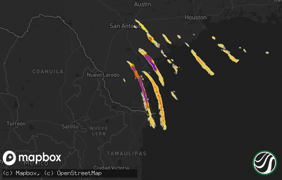
The weather event in Texas on July 7, 2019 includes Hail and Wind maps. 23 states and 204 cities were impacted and suffered possible damage. The total estimated number of properties impacted is 0.

Hail
Wind
0
Estimated number of impacted properties by a 1.00" hail or larger0
Estimated number of impacted properties by a 1.75" hail or larger0
Estimated number of impacted properties by a 2.50" hail or largerStorm reports in Texas
Texas
| Date | Description |
|---|---|
| 07/07/20192:02 AM CDT | At 701 PM CDT, a severe thunderstorm was located near Seymour, moving northeast at 15 mph. Other strong to severe storms areapproaching Westover and Megargel. HAZARD...60 mph wind gusts. SOURCE...Radar indicated. IMPACT...Expect damage to roofs, siding, and trees. Locations impacted include... Seymour, Archer City, Megargel, Red Springs, Lake Kemp, Mabelle, Westover, Lake Kickapoo, Bomarton and southwestern Lake Diversion. |
| 07/07/20191:18 AM CDT | At 617 PM CDT, a severe thunderstorm was located near Gilliland, moving north at 20 mph. HAZARD...60 mph wind gusts and quarter size hail. SOURCE...Radar indicated. IMPACT...Hail damage to vehicles is expected. Expect wind damage to roofs, siding, and trees. Locations impacted include... Crowell, Gilliland and Vera. |
| 07/06/20198:14 PM CDT | Message in nwschat... Relayed through skywarn. |
All States Impacted by Hail Map on July 7, 2019
Cities Impacted by Hail Map on July 7, 2019
- Vernon, TX
- Amelia Court House, VA
- Fortuna, ND
- Miles City, MT
- Wright, WY
- Wolf Point, MT
- Gillette, WY
- Dunseith, ND
- Peerless, MT
- Camilla, GA
- Lame Deer, MT
- Rosebud, MT
- Volborg, MT
- Hathaway, MT
- Big Timber, MT
- Bogata, TX
- Scobey, MT
- Whitetail, MT
- Frazer, MT
- Malta, MT
- Cohagen, MT
- Terry, MT
- Otter, MT
- Saint John, ND
- Belcourt, ND
- Bottineau, ND
- Rolla, ND
- Noxapater, MS
- Nashua, MT
- Wheatland, WY
- Garrett, WY
- Dryden, TX
- Ardmore, TN
- Prospect, TN
- Quanah, TX
- Bushnell, NE
- Pine Bluffs, WY
- Lodge Grass, MT
- Dill City, OK
- Sentinel, OK
- Souris, ND
- Twin Falls, ID
- Comanche, OK
- Tipton, OK
- Davidson, OK
- Frederick, OK
- Altha, FL
- Vida, MT
- Poplar, MT
- Mantee, MS
- Woodland, MS
- Anson, TX
- Hawley, TX
- Merkel, TX
- Linden, TN
- Castalia, NC
- Plains, KS
- Columbus, MS
- Meridian, MS
- Quitman, MS
- Defuniak Springs, FL
- Forsyth, MT
- Busby, MT
- Douglas, WY
- Spring Hope, NC
- Jonesville, LA
- Tyner, NC
- Chattahoochee, FL
- Bainbridge, GA
- Worden, MT
- Lobelville, TN
- Waverly, TN
- Circle, MT
- Forgan, OK
- Glendive, MT
- Halifax, NC
- Cheyenne, WY
- Scottsburg, VA
- Columbia, TN
- Lewisburg, TN
- Brockway, MT
- Elk City, OK
- Louisburg, NC
- Belvidere, NC
- Livingston, MT
- Omaha, TX
- Mayo, FL
- Kinsey, MT
- Robert Lee, TX
- Bronte, TX
- Thomasville, NC
- Lexington, NC
- Hinsdale, MT
- Union City, TN
- Pauls Valley, OK
- Platteville, CO
- Rule, TX
- Old Glory, TX
- Marianna, FL
- Waynesboro, TN
- Mylo, ND
- Rolette, ND
- Canute, OK
- Aberdeen, MS
- Fletcher, OK
- Fort Peck, MT
- Natchez, MS
- Crawfordsville, AR
- Louisville, CO
- Huntington, WV
- Barboursville, WV
- Glasgow, MT
- Seymour, TX
- Lone Wolf, OK
- Clyde Park, MT
- Wilsall, MT
- Clarksville, TX
- Lima, MT
- Cub Run, KY
- Mammoth Cave, KY
- Clarkson, KY
- Virginia City, MT
- Gilcrest, CO
- La Salle, CO
- Pattonville, TX
- Paris, TX
- Deport, TX
- Linden, AL
- Paducah, TX
- Crawford, MS
- Starkville, MS
- Metaline Falls, WA
- Mountain View, OK
- Loring, MT
- Smithfield, NC
- Four Oaks, NC
- Anaconda, MT
- Bee Spring, KY
- Sweeden, KY
- Fort Cobb, OK
- Pheba, MS
- Cedarbluff, MS
- Longmont, CO
- Woodson, TX
- Hamilton, MT
- Chipley, FL
- Hertford, NC
- High Point, NC
- Grenora, ND
- Westby, MT
- Doerun, GA
- Brookston, TX
- Deer Lodge, MT
- Albany, TX
- Big Sandy, TN
- Carnegie, OK
- Childress, TX
- Edenton, NC
- Larslan, MT
- Apache, OK
- Preston, MS
- Lawton, OK
- Throckmorton, TX
- Butler, AL
- Wellington, TX
- Peetz, CO
- Bossier City, LA
- Elm Grove, LA
- Jordan, MT
- Crawfordville, FL
- Garryowen, MT
- Winnsboro, SC
- Matador, TX
- Hortense, GA
- Murtaugh, ID
- Hazelton, ID
- Grover, CO
- Louisville, MS
- Hansen, ID
- Kimberly, ID
- Ivor, VA
- Elizabeth City, NC
- Lindsay, MT
- Erie, CO
- Stratford, OK
- Colquitt, GA
- Hohenwald, TN
- Newcastle, TX
- Roxton, TX
- Springer, OK
- Graham, OK
- Ellabell, GA
- Evening Shade, AR
- West Plains, MO
- Albin, WY
- Duke, OK
- Martin, TN
- Brooksville, MS
- Chesapeake, VA
- Iowa Park, TX
- Electra, TX
- Fort Sill, OK
- Elgin, OK
- Brooker, FL


