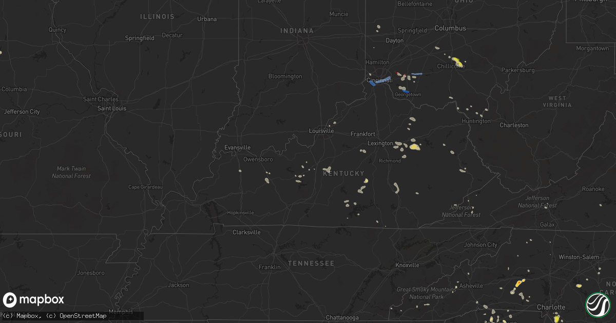
Hail Map in Kentucky on July 6, 2022
Get this storm
July 6 map
$229
one time, instant access
Download today. No call, no setup
Keep the $229
Bought the map and want the full workflow? Apply the entire $229 to a subscription within 7 days. None of it is wasted.
Every map, not just this one
This buys you this map. Subscription and you get every map we run, in the markets you choose from a few cities to whole states to nationwide. Plus real-time alerts the moment a storm fires.
Contact data
Name, contact info, occupancy, even credit band for addresses in the footprint. You go from where it hit to who to call.
Become the source they trust
Unlimited branding weather history reports on demand. You already have the documented answer ready for the property owner, and you are the one who showed up with it.
Property data and RoofTrace estimates
Pull up any address you have got, its value and the exact code rules for that jurisdiction, straight from One Click Code. Then RoofTrace estimates the squares, pitch, and roof value, priced the way you price.
Storm reports in Kentucky
Kentucky
| Date | Description |
|---|---|
| 07/06/20226:55 PM CDT | Multiple trees down in the isom area. |
| 07/06/20226:10 PM CDT | Trees down along highway 55 near mills road intersection. |
| 07/06/20225:12 PM CDT | Tree reported down on ky-1144. Time estimated via radar. |
| 07/06/20225:10 PM CDT | Public report of a large hackberry tree broken off about 5 feet above the ground... Landing in a hay field. Time of report was 645 pm... But time estimated from radar w |
| 07/06/20225:08 PM CDT | Trees down along goshen road outside of stanford... Kentucky. |
| 07/06/20225:06 PM CDT | Tree reported down on davis lane in west liberty. Time estimated via radar. |
| 07/06/20225:05 PM CDT | Report of a tree down on ky 1036 near mm 1. Time estimated from radar. |
| 07/06/20224:48 PM CDT | Tree reported down on devils fork road in sandy hook. Time estimated via radar. |
| 07/06/20224:45 PM CDT | Large tree limb fell on a power line on white oak rd. Time estimated by radar. |
| 07/06/20224:37 PM CDT | Tree down on a house on fallen timber branch rd. Time estimated by radar. |
| 07/06/20224:35 PM CDT | Tree down on hwy 82. Time estimated by radar. |
| 07/06/20224:30 PM CDT | Multiple trees down in the means area. Time estimated by radar. |
| 07/06/20224:29 PM CDT | Multiple trees and powerlines down at summitt. |
| 07/06/20224:25 PM CDT | Multiple trees down along kentucky hwy 1050. Time estimated by radar. |
| 07/06/20224:25 PM CDT | Multiple trees down along hwy 599. Time estimated by radar. |
| 07/06/20224:22 PM CDT | Metal structure sustained damage from severe thunderstorm winds off of anneta road. |
| 07/06/20224:18 PM CDT | Trees and power lines down at flatwoods. |
| 07/06/20224:16 PM CDT | At 5:16... Dispatch reported that a tree was down at the intersection of silver ridge road and ky-213 near jeffersonville... Ky. Timed based on call to dispatch. |
| 07/06/20224:16 PM CDT | At 5:16... Dispatch reported that a tree was down at the intersection of fogg and prewitt pikes near mt. Sterling... Ky. Timed based on call to dispatch. |
| 07/06/20224:16 PM CDT | Corrects previous tstm wnd gst report from prewitt. At 5:16... Dispatch reported that a tree was down at the intersection of fogg and prewitt pikes near mt. Sterling... |
| 07/06/20224:16 PM CDT | At 5:16... Dispatch reported that a tree was down at the intersection of silver ridge road and ky-599 near jeffersonville... Ky. Timed based on call to dispatch. |
| 07/06/20224:10 PM CDT | Trees down along highway 68 near the jessamine county line. Trees also down in other parts of the county. |
| 07/06/20224:05 PM CDT | Two trees down along highway 421 near the jackson county water company. |
| 07/06/20224:05 PM CDT | Corrects time of event for previous tstm wnd dmg report. Trees and power lines down at flatwoods. |
| 07/06/20224:01 PM CDT | Widespread reports of trees down across the county. Locations include winchester... Kentucky. |
| 07/06/20223:55 PM CDT | Multiple trees reported down on oakley pebble road. |
| 07/06/20223:49 PM CDT | Trees down at the intersection of bryan station road and hume road. Time estimated from radar. |
| 07/06/20223:47 PM CDT | Tree and power lines down on hamilton park. |
| 07/06/20223:44 PM CDT | The facade of a building in downtown georgetown collapsed. Time estimated from radar. |
| 07/06/20223:42 PM CDT | Trees down and large branches broken off in the masterson station area. |
| 07/06/20223:42 PM CDT | Reports of trees down along leitchfield rd in cecilia... Ky. |
| 07/06/20223:40 PM CDT | Report of a few trees down along west water street near downtown flemingsburg. |
| 07/06/20223:40 PM CDT | Trees reported down as well as a transformer blown along mt. Caramel rd in downtown flemingsburg. |
| 07/06/20223:34 PM CDT | Multiple trees down between garrison and black oak |
| 07/06/20223:33 PM CDT | Trees down across evergreen road near bridgeport road. Time estimated from radar. |
| 07/06/20223:31 PM CDT | Reports of trees down on the 200 block of e eagle drive. |
| 07/06/20223:30 PM CDT | Tree branches greater than 1 foot in diameter were blown down. Time estimated from radar. |
| 07/06/20223:26 PM CDT | Tree blown over along stonetown road. Nearby weather station observed 48 mph wind gust. Time estimated from radar. |
| 07/06/20223:24 PM CDT | Report of trees down along evergreen rd at the 3600 block and at bridgeport rd. |
| 07/06/20223:10 PM CDT | Trees down at the intersection of benson pike and elmburg road. Time estimated from radar. |
| 07/06/20223:08 PM CDT | Trees down at the intersection of harley-thompson road and benson pike. Time estimated from radar. |
| 07/06/20223:02 PM CDT | Power poles blown down at the intersection of beechwood avenue and plainview avenue in shelbyville. Time estimated from radar. |
| 07/06/20222:59 PM CDT | Numerous reports of trees down across northern portions of the county. Community of hillview and east of there hardest hit with trees and powerlines down. |
| 07/06/20222:49 PM CDT | Reports of multiple trees down along with power outages near stephensport and union star... Ky. |
| 07/06/20222:49 PM CDT | Trees and power lines down in eminence... Kentucky. |
| 07/06/20222:47 PM CDT | Powerlines down around 7500 arnoldtown road. |
| 07/06/20222:37 PM CDT | Tree down on west moody lane and elder park rd. |
| 07/06/20222:33 PM CDT | Reports of trees and powerlines down on 8000 block of todds point road. |
| 07/06/20222:29 PM CDT | Reports of powerline down on 1800 block of landing rd. |
| 07/06/20222:16 PM CDT | Trees down across us42... Including on top of vehicles. Us42 between oldham county line and rose island rd. Time of report was 353 pm. Time estimated from radar was 316 |
| 07/06/20222:12 PM CDT | Multiple reports of trees and powerlines down around downtown louisville including 600 block of e kentucky street... 1300 block of washington street... And the 200 bloc |
| 07/06/20222:10 PM CDT | Multiple reports of trees and powerlines down around downtown louisville including 18th & market and 8th & broadway. |
| 07/06/20221:50 PM CDT | Several downed trees blocking roads w of bromley |
| 07/06/20221:45 PM CDT | Numerous trees down. Time estimated from radar. |
| 07/06/20221:40 PM CDT | Branches down on ky-8. Time estimated from radar. |
| 07/06/20221:40 PM CDT | Branches down on ky-8. Time estimated from radar. |
| 07/06/20221:38 PM CDT | Parts of roofing blown off of home |
| 07/06/20221:00 PM CDT | Tree reported down on ky-149 at the 0.5mm. Time estimated via radar. |
| 07/06/202212:48 PM CDT | Tree reported down on ky-66 at the 27 mile mark. Time estimated via radar. |
| 07/06/202212:43 PM CDT | Large limbs |
| 07/06/202212:30 PM CDT | Tree reported down across red lick rd. At the intersection of murphys flat rd. |
| 07/06/202211:58 AM CDT | Tree reported down at the corner of spout springs road and hardwicks creek road. Time estimated via radar. |
| 07/06/20227:38 AM CDT | At 1238 PM EDT, a severe thunderstorm was located over Westbend, or 7 miles northwest of Stanton, moving southeast at 20 mph. HAZARD...60 mph wind gusts and penny size hail. SOURCE...Radar indicated. IMPACT...Expect damage to roofs, siding, and trees. This severe thunderstorm will be near... Virden around 1245 PM EDT. Clay City around 1250 PM EDT. Spout Springs around 1255 PM EDT.Other locations in the path of this severe thunderstorm includeStanton, Rosslyn and Cottage Furnace. |
| 07/06/20221:42 AM CDT | At 641 PM EDT/541 PM CDT/, severe thunderstorms were located along a line extending from 7 miles south of Liberty to 10 miles southwest of Columbia, moving east at 30 mph. HAZARD...60 mph wind gusts and penny size hail. SOURCE...Radar indicated. IMPACT...Expect damage to roofs, siding, and trees. Locations impacted include... Jamestown. |
| 07/06/20221:06 AM CDT | At 606 PM EDT, a severe thunderstorm was located over Alumbaugh, or 8 miles south of Irvine, moving east at 35 mph. HAZARD...60 mph wind gusts and penny size hail. SOURCE...Radar indicated. IMPACT...Expect damage to roofs, siding, and trees. This severe thunderstorm will be near... Evelyn around 610 PM EDT. Willow Shoals around 615 PM EDT. Heidelberg around 620 PM EDT. Beattyville around 625 PM EDT.Other locations in the path of this severe thunderstorm includeMaloney. |
| 07/06/20221:03 AM CDT | At 603 PM EDT, severe thunderstorms were located along a line extending from near Lancaster to 8 miles northeast of Liberty, moving southeast at 30 mph. HAZARD...60 mph wind gusts and penny size hail. SOURCE...Radar indicated. IMPACT...Expect damage to roofs, siding, and trees. These severe thunderstorms will remain over mainly rural areas of Lincoln, southeastern Garrard and southern Madison Counties, including the following locations... Crab Orchard, Boneyville, Duluth, Bighill, Ottenheim, Gilbert, Broughtentown, Geneva, Cartersville and Rowland. |
| 07/06/202212:42 AM CDT | At 541 PM EDT, severe thunderstorms were located along a line extending from Elliottville to Jinks, moving southeast at 30 mph. HAZARD...60 mph wind gusts and nickel size hail. SOURCE...Radar indicated. IMPACT...Expect damage to roofs, siding, and trees. Severe thunderstorms will be near... Wagner Store around 545 PM EDT. Fannin Valley around 550 PM EDT. Lytten around 555 PM EDT. Sandy Hook around 600 PM EDT.Other locations in the path of these severe thunderstorms include NewZion and Wild Dog. |
| 07/06/202212:31 AM CDT | At 531 PM EDT, severe thunderstorms were located along a line extending from Triplett to near Hope, moving southeast at 25 mph. HAZARD...60 mph wind gusts and nickel size hail. SOURCE...Radar indicated. IMPACT...Expect damage to roofs, siding, and trees. Severe thunderstorms will be near... Triplett around 535 PM EDT. Haldeman around 540 PM EDT. Sudith around 545 PM EDT. Frenchburg around 550 PM EDT.Other locations in the path of these severe thunderstorms includeMariba. |
| 07/06/202212:26 AM CDT | At 526 PM EDT, a severe thunderstorm was located over Hardwick, or near Irvine, moving southeast at 30 mph. HAZARD...60 mph wind gusts and penny size hail. SOURCE...Radar indicated. IMPACT...Expect damage to roofs, siding, and trees. This severe thunderstorm will be near... Cottage Furnace around 535 PM EDT. Fitchburg around 540 PM EDT. |
| 07/06/202212:15 AM CDT | At 515 PM EDT, severe thunderstorms were located along a line extending from near Waltz to Howards Mill, moving southeast at 25 mph. HAZARD...60 mph wind gusts and nickel size hail. SOURCE...Radar indicated. IMPACT...Expect damage to roofs, siding, and trees. Severe thunderstorms will be near... Waltz around 520 PM EDT. Triplett around 525 PM EDT. Olympia Springs around 535 PM EDT.Other locations in the path of these severe thunderstorms includeHaldeman and Frenchburg. |
| 07/06/202212:15 AM CDT | At 515 PM EDT, a severe thunderstorm was located near Hodgenville, moving east at 15 mph. HAZARD...60 mph wind gusts and penny size hail. SOURCE...Radar indicated. IMPACT...Expect damage to roofs, siding, and trees. This severe thunderstorm will remain over mainly rural areas of south central Nelson, central Larue, northwestern Marion and northern Taylor Counties, including the following locations... Saint Francis, Gethsemane, Athertonville, Boundary Oak, Attilla, Howardstown, Dant, Stiles, Gleanings and Holy Cross. |
| 07/06/202212:13 AM CDT | At 513 PM EDT/413 PM CDT/, a severe thunderstorm was located near Leitchfield, moving east at 15 mph. HAZARD...60 mph wind gusts and penny size hail. SOURCE...Radar indicated. IMPACT...Expect damage to roofs, siding, and trees. This severe thunderstorm will remain over mainly rural areas of east central Grayson and southwestern Hardin Counties, including the following locations... Spike, Spurrier, Rock Creek, Broad Ford, Peonia, West Clifty, Pearman, Snap, Grayson Springs and Clarkson. |
| 07/06/202212:10 AM CDT | At 509 PM EDT, a severe thunderstorm was located near Wades Mill, or 7 miles southwest of Mount Sterling, moving east at 25 mph. HAZARD...60 mph wind gusts and nickel size hail. SOURCE...Radar indicated. IMPACT...Expect damage to roofs, siding, and trees. This severe thunderstorm will be near... Klondike around 520 PM EDT. Levee around 525 PM EDT.Other locations in the path of this severe thunderstorm include MountSterling, Gatewoods Station, Upper Spencer and Jeffersonville. |
| 07/06/202212:06 AM CDT | At 505 PM EDT, severe thunderstorms were located along a line extending from near Fayette Mall to near Harrodsburg, moving east at 25 mph. HAZARD...60 mph wind gusts and penny size hail. SOURCE...Radar indicated. IMPACT...Expect damage to roofs, siding, and trees. Severe thunderstorms will be near... Nicholasville around 510 PM EDT.Other locations in the path of these severe thunderstorms includeLancaster and Richmond. |
| 07/05/202211:55 PM CDT | At 454 PM EDT, a severe thunderstorm was located over Poplar Plains, or near Flemingsburg, moving east at 25 mph. HAZARD...60 mph wind gusts and penny size hail. SOURCE...Radar indicated. IMPACT...Expect damage to roofs, siding, and trees. This severe thunderstorm will be near... Wallingford around 500 PM EDT. Goddard around 505 PM EDT.Other locations in the path of this severe thunderstorm include MusesMills and Waltz. |
| 07/05/202211:54 PM CDT | At 454 PM EDT, a severe thunderstorm was located 7 miles south of Elizabethtown, moving east at 15 mph. HAZARD...60 mph wind gusts and penny size hail. SOURCE...Radar indicated. IMPACT...Expect damage to roofs, siding, and trees. Locations impacted include... Hodgenville. |
| 07/05/202211:52 PM CDT | At 452 PM EDT, severe thunderstorms were located along a line extending from 6 miles southwest of Carlisle to near Cadentown, moving east at 60 mph. HAZARD...60 mph wind gusts and penny size hail. SOURCE...Radar indicated. IMPACT...Expect damage to roofs, siding, and trees. These severe thunderstorms will remain over mainly rural areas of Clark, eastern Jessamine, southeastern Bourbon, northeastern Madison and southeastern Fayette Counties, including the following locations... Goffs Corner, Chilesburg, Blacks Crossroads, Renick, Lyndale, Jackson Ferry, Stony Point, Locust Grove, Clintonville and Hunt. |
| 07/05/202211:47 PM CDT | At 447 PM EDT, a severe thunderstorm was located near Clarktown, moving east at 45 mph. HAZARD...60 mph wind gusts. SOURCE...Radar indicated. IMPACT...Expect damage to trees and power lines. Locations impacted include... Wheelersburg, Greenup, South Webster, Franklin Furnace, Sciotodale, Powellsville, Lyra and Haverhill. |
| 07/05/202211:44 PM CDT | At 443 PM EDT, severe thunderstorms were located along a line extending from near Versailles to 11 miles west of Harrodsburg, moving east at 25 mph. HAZARD...60 mph wind gusts and penny size hail. SOURCE...Radar indicated. IMPACT...Expect damage to roofs, siding, and trees. Severe thunderstorms will be near... Versailles around 450 PM EDT.Other locations in the path of these severe thunderstorms includeNicholasville and Harrodsburg. |
| 07/05/202211:44 PM CDT | At 444 PM EDT, a severe thunderstorm was located near Carlisle, or 13 miles southwest of Flemingsburg, moving southeast at 15 mph. HAZARD...60 mph wind gusts and nickel size hail. SOURCE...Radar indicated. IMPACT...Expect damage to roofs, siding, and trees. Locations impacted include... Bethel and Odessa. |
| 07/05/202211:39 PM CDT | At 439 PM EDT, a severe thunderstorm was located near Carlisle, moving east at 25 mph. HAZARD...60 mph wind gusts and penny size hail. SOURCE...Radar indicated. IMPACT...Expect damage to roofs, siding, and trees. This severe thunderstorm will remain over mainly rural areas of eastern Nicholas County, including the following locations... Sprout, East Union, Weston, Moorefield, Pleasant Valley and Myers. |
| 07/05/202211:33 PM CDT | At 432 PM EDT, a severe thunderstorm was located 10 miles west of Elizabethtown, moving east at 15 mph. HAZARD...60 mph wind gusts and penny size hail. SOURCE...Radar indicated. IMPACT...Expect damage to roofs, siding, and trees. Locations impacted include... Elizabethtown. |
| 07/05/202211:31 PM CDT | At 431 PM EDT, severe thunderstorms were located along a line extending from 8 miles northeast of Georgetown to near Versailles, moving southeast at 30 mph. HAZARD...60 mph wind gusts and penny size hail. SOURCE...Radar indicated. IMPACT...Expect damage to roofs, siding, and trees. Severe thunderstorms will be near... Georgetown around 435 PM EDT. Paris, Dunbar High School and Cardinal Hill around 445 PM EDT. Veterans Park, Fayette Mall, U K Arboretum and Chevy Chase around 450 PM EDT.Other locations in the path of these severe thunderstorms includeCadentown. |
| 07/05/202211:30 PM CDT | At 430 PM EDT, a severe thunderstorm was located near Foxport, moving east at 40 mph. HAZARD...60 mph wind gusts. SOURCE...Radar indicated. IMPACT...Expect damage to trees and power lines. Locations impacted include... Lewisburg, Head of Grassy, Peed, Fleming-Mason Airport, Petersville, Mount Gilead, Helena, Harris, Epworth and Emerson. |
| 07/05/202211:28 PM CDT | At 427 PM EDT, a severe thunderstorm was located near Nepton, or near Flemingsburg, moving east at 35 mph. HAZARD...60 mph wind gusts and penny size hail. SOURCE...Radar indicated. IMPACT...Expect damage to roofs, siding, and trees. This severe thunderstorm will be near... Mount Carmel around 440 PM EDT. Wallingford around 445 PM EDT.Other locations in the path of this severe thunderstorm includeGoddard and Muses Mills. |
| 07/05/202211:22 PM CDT | At 421 PM EDT, a severe thunderstorm was located 14 miles west of Elizabethtown, moving east at 15 mph. HAZARD...60 mph wind gusts and penny size hail. SOURCE...Radar indicated. IMPACT...Expect damage to roofs, siding, and trees. This severe thunderstorm will remain over mainly rural areas of southwestern Hardin County, including the following locations... Cecilia, Eastview, White Mills, Howe Valley, Vertrees, Hansbrough, Solway, White Mills Junction, Harcourt and Pierce Mill. |
| 07/05/202211:22 PM CDT | At 421 PM CDT, a severe thunderstorm was located near Leitchfield, moving east at 20 mph. HAZARD...60 mph wind gusts and quarter size hail. SOURCE...Radar indicated. IMPACT...Hail damage to vehicles is expected. Expect wind damage to roofs, siding, and trees. This severe thunderstorm will remain over mainly rural areas of southeastern Grayson and north central Edmonson Counties, including the following locations... Ponderosa, Peonia, Pearman, Wax, Meredith, Pine Springs, Conoloway, Huffman, Iberia and Dug Hill. |
| 07/05/202211:13 PM CDT | At 412 PM EDT, severe thunderstorms were located along a line extending from 9 miles northeast of Frankfort to 6 miles south of Shelbyville, moving east at 35 mph. HAZARD...60 mph wind gusts. Law enforcement has reported numerous trees down with this line as it passed through Shelby County. SOURCE...Law enforcement. IMPACT...Expect damage to roofs, siding, and trees. Locations impacted include... Georgetown and Lawrenceburg. |
| 07/05/202211:01 PM CDT | At 401 PM CDT, a severe thunderstorm was located near Hartford, moving southeast at 20 mph. HAZARD...60 mph wind gusts and nickel size hail. SOURCE...Radar indicated. IMPACT...Expect damage to roofs, siding, and trees. This severe thunderstorm will remain over mainly rural areas of northwestern Butler and southeastern Ohio Counties, including the following locations... Prentiss, Shultztown, Rosine, Horton, Windy Hill, Select, Mchenry, Beaver Dam, Rob Roy and Sandefur Crossing. |
| 07/05/202210:57 PM CDT | At 356 PM EDT, a severe thunderstorm was located over South Park View, moving east at 25 mph. HAZARD...60 mph wind gusts. SOURCE...Radar indicated. IMPACT...Expect damage to roofs, siding, and trees. This severe thunderstorm will be near... Pioneer Village and Fern Creek around 405 PM EDT. |
| 07/05/202210:53 PM CDT | At 353 PM EDT, severe thunderstorms were located along a line extending from near Marshall to near Seaman to near Ripley, moving east at 40 mph. HAZARD...60 mph wind gusts. SOURCE...Radar indicated. IMPACT...Expect damage to trees and power lines. Locations impacted include... Portsmouth, Maysville, Wheelersburg, Waverly, Washington, West Union, New Boston, Piketon, Manchester, Peebles, Ripley, Aberdeen, Vanceburg, Seaman, Rosemount, Clarktown, Camp Dix, Belfast, Rome and Lucasville. |
| 07/05/202210:48 PM CDT | At 348 PM EDT, a severe thunderstorm was located 7 miles north of Shelbyville, moving east at 35 mph. HAZARD...60 mph wind gusts and penny size hail. SOURCE...Radar indicated. IMPACT...Expect damage to roofs, siding, and trees. Locations impacted include... Frankfort. |
| 07/05/202210:26 PM CDT | At 325 PM EDT, a severe thunderstorm was located over Coldstream, moving east at 20 mph. HAZARD...60 mph wind gusts and quarter size hail. SOURCE...Radar indicated. IMPACT...Hail damage to vehicles is expected. Expect wind damage to roofs, siding, and trees. This severe thunderstorm will remain over mainly rural areas of Oldham, northwestern Shelby and northeastern Jefferson Counties, including the following locations... Simpsonville, Demplytown, Buckner, Floydsburg, Skylight, Ballardsville, Brownsboro, Centerfield, Pewee Valley and Crestwood. |
| 07/05/202210:10 PM CDT | At 310 PM EDT, a severe thunderstorm was located near Corydon, moving southeast at 20 mph. HAZARD...60 mph wind gusts and penny size hail. SOURCE...Radar indicated. IMPACT...Expect damage to roofs, siding, and trees. This severe thunderstorm will be near... Corydon around 315 PM EDT. |
| 07/05/20229:50 PM CDT | At 250 PM EDT, a severe thunderstorm was located near Harrogate, or 8 miles southeast of Middlesboro, moving east at 15 mph. HAZARD...60 mph wind gusts and nickel size hail. SOURCE...Radar indicated. IMPACT...Expect damage to roofs, siding, and trees. Locations impacted include... New Tazewell, Tazewell, Harrogate, Howard Quarter, Cumberland Gap, Arthur and Powell River Preserve. |
| 07/05/20228:59 PM CDT | At 159 PM EDT, a severe thunderstorm was located over Spurlock, or near Manchester, moving southeast at 15 mph. HAZARD...60 mph wind gusts and nickel size hail. SOURCE...Radar indicated. IMPACT...Expect damage to roofs, siding, and trees. This severe thunderstorm will be near... Hector around 205 PM EDT. Enline around 210 PM EDT. Peabody around 215 PM EDT.Other locations in the path of this severe thunderstorm include BigCreek and Marcum. |
| 07/05/20228:49 PM CDT | At 148 PM EDT, a severe thunderstorm was located over Osgood, moving east at 25 mph. HAZARD...70 mph wind gusts. SOURCE...Radar indicated. IMPACT...Expect considerable tree damage. Damage is likely to mobile homes, roofs, and outbuildings. Locations impacted include... Harrison, Lawrenceburg, Greendale, Aurora, Rising Sun, Bright, Hidden Valley, Burlington, Cleves, Milan, Warsaw, Dillsboro, Shawnee, Moores Hill, Taylor Creek, Miami Heights, Blue Jay, Mack, Guilford and Wilmington.This includes I-74 in Ohio between mile markers 4 and 8. |
| 07/05/20228:38 PM CDT | At 138 PM EDT, severe thunderstorms were located along a line extending from Leander to Blue River to Bolyn, moving east at 30 mph. HAZARD...60 mph wind gusts and penny size hail. SOURCE...Radar indicated. IMPACT...Expect damage to roofs, siding, and trees. Severe thunderstorms will be near... Martin around 145 PM EDT. Allen around 150 PM EDT. Prestonsburg around 155 PM EDT.Other locations in the path of these severe thunderstorms includeCraynor, Galveston and Pleasant. |
| 07/05/20228:10 PM CDT | At 109 PM EDT, severe thunderstorms were located along a line extending from Frenchburg to Rogers Chapel to Fox, moving east at 20 mph. HAZARD...60 mph wind gusts and nickel size hail. SOURCE...Radar indicated. IMPACT...Expect damage to roofs, siding, and trees. Severe thunderstorms will be near... Frenchburg around 115 PM EDT. Mariba around 120 PM EDT. North Irvine around 125 PM EDT.Other locations in the path of these severe thunderstorms includeIrvine, Ravenna and Rogers. |
All States Impacted by Hail Map on July 6, 2022
Cities Impacted by Hail Map on July 6, 2022
- Joplin, MT
- Chinook, MT
- Lavina, MT
- Roundup, MT
- Bowman, ND
- Frazer, MT
- Poplar, MT
- Avon, MT
- Hobson, MT
- Buffalo, MT
- Forsyth, MT
- Loma, MT
- Chester, MT
- Ledger, MT
- Fort Benton, MT
- Big Sandy, MT
- Inverness, MT
- Glendive, MT
- Lindsay, MT
- Terry, MT
- Brusett, MT
- Geyser, MT
- Grass Range, MT
- Elkfork, KY
- Sandy Hook, KY
- Axtell, KS
- Corning, KS
- Clearmont, MO
- Greensburg, IN
- Havensville, KS
- Mitchell, OR
- Lame Deer, MT
- Birney, MT
- Glendale, KY
- Cecilia, KY
- Martin, KY
- Banner, KY
- Allen, KY
- Prestonsburg, KY
- Dana, KY
- Apple Grove, WV
- Gallipolis Ferry, WV
- Hamptonville, NC
- Hartford, KY
- Akron, CO
- Max Meadows, VA
- Piedmont, SC
- Pelzer, SC
- Williamston, SC
- Booker, TX
- Perryton, TX
- Balko, OK
- Hettinger, ND
- Mott, ND
- New Leipzig, ND
- New Raymer, CO
- Grover, CO
- Havre, MT
- Kremlin, MT
- Rudyard, MT
- Hingham, MT
- Ryegate, MT
- Stanford, MT
- Shepherd, MT
- Huntley, MT
- Fairmont, NE
- Box Elder, MT
- Cheyenne Wells, CO
- Glenarm, IL
- Chatham, IL
- Hogeland, MT
- Harlem, MT
- Elizabeth, IN
- Towner, ND
- Rugby, ND
- Gillette, WY
- Haddam, KS
- Egnar, CO
- Othello, WA
- Batavia, OH
- Pleasant Plain, OH
- Blanchester, OH
- Goshen, OH
- Rocky Ford, CO
- Manzanola, CO
- Vida, MT
- Richey, MT
- Wolf Point, MT
- Limon, CO
- Matheson, CO
- Jordan, MT
- Cohagen, MT
- Powell, WY
- White Sulphur Springs, MT
- Winnett, MT
- Prineville, OR
- Goff, KS
- Atchison, KS
- Bethune, CO
- Narka, KS
- Culbertson, MT
- Lancaster, MN
- Musselshell, MT
- Gordon, NE
- Rushville, NE
- Malta, MT
- Zortman, MT
- Hays, MT
- Dodson, MT
- Lloyd, MT
- Jefferson City, MT
- Clancy, MT
- Boulder, MT
- Belfield, ND
- Crowley, CO
- Ordway, CO
- Olney Springs, CO
- Fallon, MT
- Hardy, NE
- Fairbury, NE
- Lewistown, MT
- Ingomar, MT
- Sand Springs, MT
- La Junta, CO
- Union Point, GA
- Blue Hill, NE
- Hurdle Mills, NC
- Owingsville, KY
- Mount Sterling, KY
- Frenchburg, KY
- Olympia, KY
- Means, KY
- Hope, KY
- Jeffersonville, KY
- Thompsonville, IL
- Ware Shoals, SC
- Laurens, SC
- McIntosh, SD
- Fort Peck, MT
- Amidon, ND
- Deaver, WY
- Marion, MT
- Raynesford, MT
- Belt, MT
- Morrisonville, IL
- Pawnee, IL
- Lead, SD
- Helmville, MT
- Willow Wood, OH
- Scottown, OH
- Chesapeake, OH
- Merino, CO
- Kila, MT
- Townsend, MT
- Bighorn, MT
- Verdon, NE
- Sebree, KY
- Ellis, KS
- Salt Lick, KY
- Williamsburg, OH
- Bethel, OH
- Georgetown, OH
- Hamersville, OH
- Mount Orab, OH
- Ramah, CO
- Calhan, CO
- Minneola, KS
- Kit Carson, CO
- Franktown, CO
- Castle Rock, CO
- Elbert, CO
- Bridger, MT
- Buffalo, WY
- Kaycee, WY
- Jetmore, KS
- Rineyville, KY
- Watauga, SD
- Selfridge, ND
- Morristown, SD
- Wray, CO
- Williamsport, OH
- Lawson, MO
- Springfield, OH
- South Charleston, OH
- Hinsdale, MT
- Geraldine, MT
- Whiting, KS
- Netawaka, KS
- Horton, KS
- Custer, SD
- Nezperce, ID
- Ferdinand, ID
- New England, ND
- South Heart, ND
- Lathrop, MO
- Turney, MO
- Keystone, SD
- Hermosa, SD
- Wetmore, KS
- Londonderry, OH
- Chillicothe, OH
- Laurelville, OH
- Kingston, OH
- Seneca, KS
- Wathena, KS
- Saint Joseph, MO
- Fort Morgan, CO
- Basin, MT
- Hot Springs, MT
- Plains, MT
- Brockton, MT
- Froid, MT
- Moore, MT
- Moccasin, MT
- Forest Grove, MT
- Craigmont, ID
- Lewiston, ID
- Imnaha, OR
- Enterprise, OR
- Cottonwood, ID
- Elizabethtown, IN
- Ewing, KY
- Mullinville, KS
- Randleman, NC
- Pleasant Garden, NC
- Andersonville, TN
- Heiskell, TN
- Strunk, KY
- Corydon, IN
- Winnsboro, SC
- Winchester, KY
- Inman, SC
- Campobello, SC
- Monroe, NC
- Brockway, MT
- Russell Springs, KY
- Glens Fork, KY
- Columbia, KY
- Ruskin, FL
- Flagler, CO
- Vona, CO
- Sunnyside, WA
- Grandview, WA
- Prosser, WA
- Mabton, WA
- Toppenish, WA
- Plattsburg, MO
- Blackstone, VA
- Seibert, CO
- South Bloomingville, OH
- Glenwood, MO
- Lancaster, MO
- Coatsville, MO
- Larkspur, CO
- Sedalia, CO
- Fayetteville, OH
- Spray, OR
- Belleville, KS
- Munden, KS
- Washington, KS
- Denton, NC
- Trinity, NC
- Lexington, NC
- Rush Center, KS
- Larned, KS
- Henderson, NE
- Sutton, NE
- Grafton, NE
- McCool Junction, NE
- Rozel, KS
- Shubert, NE
- Everest, KS
- Robinson, KS
- Kiowa, CO
- Bennett, CO
- Elizabeth, CO
- Red Cloud, NE
- Albany, KY
- Butlerville, IN
- Manchester, KY
- Bessemer City, NC
- Kings Mountain, NC
- Gurley, AL
- Procious, WV
- Sweetwater, TN
- Athens, TN
- Equality, IL
- Canon, GA
- Murphy, NC
- Waynesville, NC
- Hodgenville, KY
- New Hope, KY
- New Haven, KY
- Bowman, GA
- Royston, GA
- Central, SC
- Lutts, TN
- Sunbright, TN
- East Bernstadt, KY
- Livingston, KY
- Hillsboro, OH
- Lynchburg, OH
- Ayden, NC
- Ringgold, GA
- Laurel Springs, NC
- Pendleton, SC
- Fountain Inn, SC
- Simpsonville, SC
- Abilene, KS
- Spartanburg, SC
- Wellford, SC
- Hanston, KS
- Kinsley, KS
- Tell City, IN
- Ellinwood, KS
- Great Bend, KS
- Lilburn, GA
- Trimble, MO
- Scranton, SC
- Timmonsville, SC
- Olanta, SC
- Tellico Plains, TN
- Lamar, SC
- Matthews, NC
- Waxhaw, NC
- Indian Trail, NC
- Charlotte, NC
- Pacolet, SC
- Bowersville, GA
- Lavonia, GA
- Hartwell, GA
- Clifton Hill, MO
- Huntsville, MO
- Martin, GA
- Carnesville, GA
- Lewisburg, OH
- Linn, KS
- Rockwood, TN
- Maryville, MO
- Pickering, MO
- Strasburg, CO
- Morrowville, KS
- Peyton, CO
- Minneapolis, KS
- Greenville, SC
- Ford, KS
- Spearville, KS
- Hoisington, KS
- Albert, KS
- Olmitz, KS
- McCracken, KS
- Bison, KS
- Otis, KS
- La Crosse, KS
- Crestwood, KY
- La Grange, KY
- Buckner, KY
- Pedro, OH
- Weston, CO
- Capron, VA
- Yale, VA
- Salisbury, NC
- Richfield, NC
- Danielsville, GA
- Wendell, NC
- Raleigh, NC
- Wake Forest, NC
- Knightdale, NC
- Gable, SC
- Alcolu, SC
- New Zion, SC
- Stephens, GA
- Eatonton, GA
- Madison, GA
- Washington Court House, OH
- New Holland, OH
- Mount Sterling, OH
- Casar, NC
- Gladstone, VA
- Appomattox, VA
- Tribune, KS
- Holly, CO
- Marshall, NC
- Tazewell, TN
- Rainsville, AL
- Watertown, TN
- Milton, TN
- Dunn, NC
- Niota, TN
- Elloree, SC
- Santee, SC
- Clyde, NC
- Canton, NC
- Reevesville, SC
- Saint George, SC
- Inavale, NE
- Big Clifty, KY
- Thorn Hill, TN
- Mooresburg, TN
- Bean Station, TN
- Waverly, VA
- Petersburg, VA
- Carson, VA
- Stony Creek, VA
- Disputanta, VA
- Miami, TX
- Rosston, OK
- Rock Hill, SC
- Fort Mill, SC
- Lancaster, SC
- Hickory, NC
- Morganton, NC
- Connelly Springs, NC
- Vale, NC
- Hildebran, NC
- Oxford, NC
- Bullock, NC
- Henderson, NC
- State Road, NC
- Wise, VA
- Coeburn, VA
- Taylorsville, NC
- Ten Mile, TN
- Buckhead, GA
- Philadelphia, TN
- Idalia, CO
- Brownell, KS
- Arcanum, OH
- Jamesport, MO
- Chillicothe, MO
- Stewartsville, MO
- Briggsdale, CO
- Fairfield, NE
- Glenvil, NE
- Fairfax, MO
- Leitchfield, KY
- Flatgap, KY
- Oil Springs, KY
- West Liberty, KY
- Ironton, OH
- Baileyville, KS
- Centralia, KS
- Frankfort, KS
- Vermillion, KS
- Cleveland, TN
- McBee, SC
- Sardinia, OH
- Laverne, OK
- Partridge, KY
- Cumberland, KY
- Clay City, KY
- Irvine, KY
- Clintwood, VA
- Franklin, NC
- Shelby, NC
- Cherryville, NC
- Lawndale, NC
- Good Hope, GA
- Mountville, SC
- Apollo Beach, FL
- Soldier, KS
- Cedar Bluff, AL
- Gaylesville, AL
- Clifton, KS
- Cuba, KS
- Agenda, KS
- Karval, CO
- Simla, CO
- Hugo, CO
- Wild Horse, CO
- Effingham, KS
- Muscotah, KS
- Flemingsburg, KY
- Mayslick, KY
- Clendenin, WV
- Oakdale, TN
- Ashland, KS
- Leopold, IN
- Knoxville, TN
- Nebo, NC
- Belton, SC
- Etowah, TN
- Reliance, TN
- Toccoa, GA
- Westminster, SC
- Saint Matthews, SC
- Swansea, SC
- Turbeville, SC
- Lake City, SC
- Lyman, SC
- Bowman, SC
- Ridgeway, SC
- Jonesville, SC
- Lenoir, NC
- Englewood, TN
- Sumter, SC
- Manning, SC
- Liberty, KY
- Dunnville, KY
- Yosemite, KY
- Luttrell, TN
- Maynardville, TN
- Ruffin, SC
- Borger, TX
- Hollywood, AL
- Scottsboro, AL
- Fackler, AL
- Gainesville, GA
- Society Hill, SC
- Burlington, CO
- Syracuse, KS
- Guilford, MO
- Portsmouth, OH
- McDermott, OH
- Churchville, VA
- Staunton, VA
- Vesuvius, VA
- Hustonville, KY
- Amherst, VA
- Lynchburg, VA
- Forest, VA
- Pound, VA
- Beaver Dam, KY
- Centertown, KY
- Sumerco, WV
- Julian, WV
- Sugar City, CO
- Gaffney, SC
- Jefferson, NC
- Millers Creek, NC
- Landrum, SC
- Anderson, SC
- Eastanollee, GA
- Chocowinity, NC
- Sheridan Lake, CO
- Fraziers Bottom, WV
- Buffalo, WV
- Proctorville, OH
- Offerle, KS
- Clarkson, KY
- Camden, OH
- Vanceboro, NC
- Grimesland, NC
- Greenville, NC
- Lyons, KS
- Crouse, NC
- Smithville, MO
- Saluda, NC
- Columbus, NC
- Tryon, NC
- Rogersville, TN
- Falls City, NE
- Kirk, CO
- Kenna, WV
- Charleston, WV
- Given, WV
- Advent, WV
- Liberty, WV
- Harrodsburg, KY
- Salvisa, KY
- Salley, SC
- Wagener, SC
- Nokesville, VA
- Manassas, VA
- Woodbridge, VA
- Sparta, GA
- Lancing, TN
- Duluth, GA
- Suwanee, GA
- Cimarron, KS
- Greer, SC
- Phenix, VA
- Summerton, SC
- Stearns, KY
- Varnville, SC
- Bazine, KS
- Cross Plains, IN
- Canaan, IN
- Madison, IN
- Bennington, IN
- Versailles, IN
- Liebenthal, KS
- Madison Heights, VA
- Monroe, VA
- Lancaster, KS
- Denton, KS
- McDonald, TN
- Ooltewah, TN
- Raymond, KS
- Wakeeney, KS
- Chase, KS
- Hudson, KS
- St John, KS
- Alexander, KS
- Claflin, KS
- Pawnee Rock, KS
- Boiling Springs, SC
- Caryville, TN
- Franklin, TN
- Corryton, TN
- Kersey, CO
- Orchard, CO
- Weldona, CO
- Gill, CO
- Log Lane Village, CO
- Brush, CO
- Blue Rapids, KS
- Randolph, KS
- Lebanon, KS
- Troy, KS
- Bendena, KS
- Galatia, IL
- Carrier Mills, IL
- East Flat Rock, NC
- Hendersonville, NC
- Flat Rock, NC
- Collinwood, TN
- Eastview, KY
- Gray, GA
- La Fayette, GA
- Leicester, NC
- Townville, SC
- Oliver Springs, TN
- Oak Ridge, TN
- Osborn, MO
- Cameron, MO
- Palouse, WA
- Garfield, WA
- Onaga, KS
- Knightstown, IN
- Oregon, MO
- Forest City, MO
- Maitland, MO
- North Vernon, IN
- Smith Center, KS
- Westport, IN
- Fair Play, SC
- Monticello, KY
- Colerain, NC
- Vance, SC
- Rock Spring, GA
- Honea Path, SC
- Fritch, TX
- Agency, MO
- Easton, MO
- Ellenboro, NC
- Amazonia, MO
- Agate, CO
- Clinton, SC
- Godwin, NC
- Jamestown, KY
- Dry Branch, GA
- Canyon, TX
- Winfield, WV
- Hurricane, WV
- Milton, WV
- Glenwood, WV
- Williamston, NC
- Washington, NC
- Ocala, FL
- Una, SC
- Linden, TN
- Grandview, TN
- Andrews, NC
- Holt, MO
- Elkview, WV
- Walton, WV
- Prospect, KY
- Franklin Furnace, OH
- Sharpsburg, KY
- Moorefield, KY
- Mauldin, SC
- Deer Lodge, TN
- Zebulon, NC
- Islandton, SC
- Saint Albans, WV
- Nitro, WV
- Dunbar, WV
- Scott Depot, WV
- Cleves, OH
- Highland, KS
- Versailles, KY
- Kingston, TN
- Clarksdale, MO
- Helena, MO
- Cosby, MO
- Amity, MO
- Union Star, MO
- Courtland, KS
- Republic, KS
- Scandia, KS
- Crown City, OH
- Wytheville, VA
- Middleburg, KY
- Spring City, TN
- Roxboro, NC
- Social Circle, GA
- Rocky Mount, VA
- Glade Hill, VA
- Branchville, SC
- Lake Bronson, MN
- Outlook, WA
- Glasgow, MT
- Victor, MT
- Byers, CO
- Snyder, CO
- Galeton, CO
- Eaton, CO
- Yuma, CO
- Las Animas, CO
- Lamar, CO
- Lovell, WY
- Fairview, MT
- Nashua, MT
- Hardin, MT
- Crow Agency, MT
- Worden, MT
- Shelby, MT
- Highwood, MT
- Circle, MT
- Lincoln, KS
- Beverly, KS
- Sunman, IN
- Milan, IN
- Osgood, IN
- Moores Hill, IN
- Hebron, KY
- Burlington, KY
- Erlanger, KY
- Florence, KY
- Bellevue, KY
- Ft Mitchell, KY
- Latonia, KY
- Fort Thomas, KY
- Newport, KY
- Cincinnati, OH
- Covington, KY
- Terrace Park, OH
- Milford, OH


