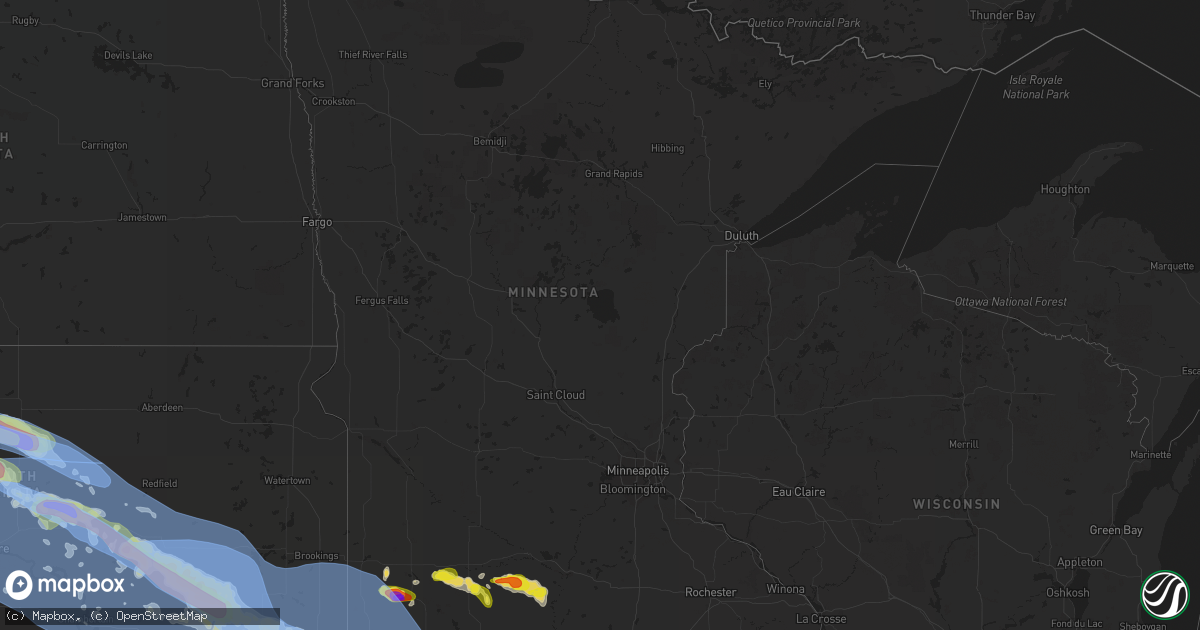
Hail Map in Minnesota on July 5, 2022
Get this storm
July 5 map
$229
one time, instant access
Download today. No call, no setup
Keep the $229
Bought the map and want the full workflow? Apply the entire $229 to a subscription within 7 days. None of it is wasted.
Every map, not just this one
This buys you this map. Subscription and you get every map we run, in the markets you choose from a few cities to whole states to nationwide. Plus real-time alerts the moment a storm fires.
Contact data
Name, contact info, occupancy, even credit band for addresses in the footprint. You go from where it hit to who to call.
Become the source they trust
Unlimited branding weather history reports on demand. You already have the documented answer ready for the property owner, and you are the one who showed up with it.
Property data and RoofTrace estimates
Pull up any address you have got, its value and the exact code rules for that jurisdiction, straight from One Click Code. Then RoofTrace estimates the squares, pitch, and roof value, priced the way you price.
Storm reports in Minnesota
Minnesota
| Date | Description |
|---|---|
| 07/05/20225:15 PM CDT | Penny size hail and multiple trees down... Including one that is 2 foot in diameter across 3rd ave. |
| 07/05/20225:05 PM CDT | A local report indicates 64 MPH wind near 1 WSW MAGNOLIA |
| 07/05/20224:42 PM CDT | Mn006: beaver creek i-90 mp 4. |
| 07/05/20223:59 PM CDT | Golf ball to baseball size hail. |
| 07/05/20222:12 AM CDT | At 711 PM CDT, severe thunderstorms were located along a line extending from near Elmore to 8 miles east of Forest City, moving north at 40 mph. HAZARD...60 mph wind gusts. SOURCE...Radar indicated. IMPACT...Expect damage to roofs, siding, and trees. Locations impacted include... Forest City, Lake Mills, Emmons, Rice Lake, Eagle Lake, Buffalo Center, Thompson, Titonka, Leland, Crystal Lake, Woden, Rake, Scarville, Miller, Hayfield, Pilot Knob State Park, Lake Mills Municipal Airport, Forest City Municipal Airport, Hogsback Wildlife Area and Eagle Lake State Park. |
| 07/05/20222:10 AM CDT | At 709 PM CDT, a severe thunderstorm was located over Conger, or 8 miles west of Albert Lea, moving east at 30 mph. HAZARD...60 mph wind gusts. SOURCE...Radar indicated. IMPACT...Expect damage to roofs, siding, and trees. This severe thunderstorm will be near... Twin Lakes around 720 PM CDT. Albert Lea around 725 PM CDT.Other locations in the path of this severe thunderstorm includeGlenville and Hayward. |
| 07/05/20222:09 AM CDT | At 708 PM CDT, severe thunderstorms were located along a line extending from near Lake Mills to near Manly to 7 miles west of Hampton, moving east at 55 mph. HAZARD...60 mph wind gusts. SOURCE...Trained weather spotters. Wind gusts to 60 mph have been measured with these storms over the last hour. IMPACT...Expect damage to roofs, siding, and trees. Severe thunderstorms will be near... St. Ansgar around 730 PM CDT. Osage around 735 PM CDT. Stacyville around 740 PM CDT. Lyle around 745 PM CDT. Riceville around 750 PM CDT. Nashua around 755 PM CDT.Other locations impacted by these severe thunderstorms include CountyRoads A 39 And S 70, Meyer, Toeterville, County Roads B 60 And T 18,Rock Creek, Idlewilde State Park and Otranto. |
| 07/05/20221:39 AM CDT | At 639 PM CDT, severe thunderstorms were located along a line extending from Lake Mills to near Forest City to 14 miles northwest of Clarion, moving east at 50 mph. HAZARD...60 mph wind gusts. SOURCE...Radar indicated. IMPACT...Expect damage to roofs, siding, and trees. Locations impacted include... Mason City, Garner, Northwood, Lake Mills, Manly, Rockwell, Emmons, Clear Lake, Mason City Municipal Airport, Rice Lake, Ventura, Klemme, Thornton, Plymouth, Fertile, Kensett, Meservey, Grafton, Hanlontown and Joice.This includes Interstate 35 between mile markers 179 and 218. |
| 07/05/20221:19 AM CDT | At 618 PM CDT, severe thunderstorms were located along a line extending from 6 miles north of Forest City to 9 miles east of Swan Lake, moving northeast at 45 mph. HAZARD...60 mph wind gusts and penny size hail. SOURCE...Radar indicated. IMPACT...Expect damage to roofs, siding, and trees. Severe thunderstorms will be near... Leland and Scarville around 625 PM CDT. Lake Mills, Rice Lake, Rice Lake State Park, Lake Mills Municipal Airport and Hogsback Wildlife Area around 630 PM CDT.Other locations in the path of these severe thunderstorms includeLakota, Ledyard and Rake. |
| 07/05/202212:51 AM CDT | At 551 PM CDT, a severe thunderstorm was located near Vernon Center, or 18 miles southwest of Mankato, moving east at 20 mph. HAZARD...60 mph wind gusts and half dollar size hail. SOURCE...Radar indicated. IMPACT...Hail damage to vehicles is expected. Expect wind damage to roofs, siding, and trees. This severe thunderstorm will be near... Vernon Center around 600 PM CDT. Amboy around 605 PM CDT. Good Thunder around 610 PM CDT. |
| 07/05/202212:31 AM CDT | At 530 PM CDT, severe thunderstorms were located along a line extending from near Spencer In Clay County to near Sioux Rapids to Storm Lake to near Galva, moving east at 45 mph. HAZARD...60 mph wind gusts. SOURCE...Radar indicated. IMPACT...Expect damage to roofs, siding, and trees. Locations impacted include... Estherville, Emmetsburg, Sac City, Pocahontas, Rockwell City, Manson, Laurens, Swan Lake, Five Island Lake, Ingham Lake, Iowa Lake, North Twin Lake, High Lake, Lost Island Lake, South Twin Lake, Okamanpedan Lake, Silver Lake, Rush Lake, Armstrong and Graettinger. |
| 07/05/202212:03 AM CDT | At 503 PM CDT, a severe thunderstorm was located near Madelia, or 17 miles south of New Ulm, moving east at 15 mph. HAZARD...60 mph wind gusts and half dollar size hail. SOURCE...Radar indicated. IMPACT...Hail damage to vehicles is expected. Expect wind damage to roofs, siding, and trees. Locations impacted include... Madelia and Lewisville. |
| 07/04/202211:54 PM CDT | At 454 PM CDT, severe thunderstorms were located along a line extending from Ocheyedan to near Marcus to 7 miles south of Remsen, moving east at 40 mph. HAZARD...60 mph wind gusts. SOURCE...Radar indicated. IMPACT...Expect damage to roofs, siding, and trees. Severe thunderstorms will be near... Ocheyedan and Harris around 500 PM CDT. Lake Park, Sutherland and Larrabee around 510 PM CDT.Other locations in the path of these severe thunderstorms includeQuimby, Okoboji, Wahpeton, Spencer In Clay County, Cherokee, SpiritLake, Milford, Arnolds Park, Orleans, Peterson, West Okoboji,Fostoria, Aurelia, Linn Grove, Terril, Superior, Alta, Sioux Rapidsand Greenville. |
| 07/04/202211:31 PM CDT | At 430 PM CDT, severe thunderstorms were located along a line extending from 9 miles south of Brookings to near Sherman, moving east at 45 mph. HAZARD...60 mph wind gusts. SOURCE...Radar indicated. IMPACT...Expect damage to roofs, siding, and trees. Severe thunderstorms will be near... Trosky around 445 PM CDT. Ward around 455 PM CDT. Pipestone and Pipestone National Monument around 500 PM CDT.Other locations impacted by these severe thunderstorms include Ihlenand Flandreau Santee Sioux Tribal Nation. |
| 07/04/202211:29 PM CDT | At 428 PM CDT, a severe thunderstorm was located 10 miles west of Hanska, or 16 miles southwest of New Ulm, moving northeast at 10 mph. HAZARD...Golf ball size hail and 60 mph wind gusts. SOURCE...Radar indicated. IMPACT...People and animals outdoors will be injured. Expect hail damage to roofs, siding, windows, and vehicles. Expect wind damage to roofs, siding, and trees. Locations impacted include... Hanska. |
| 07/04/202211:09 PM CDT | At 409 PM CDT, a severe thunderstorm was located near Slayton, moving east at 15 mph. HAZARD...Golf ball size hail and 60 mph wind gusts. SOURCE...Radar indicated. IMPACT...People and animals outdoors will be injured. Expect hail damage to roofs, siding, windows, and vehicles. Expect wind damage to roofs, siding, and trees. This severe thunderstorm will be near... Slayton around 425 PM CDT.Other locations in the path of this severe thunderstorm include LakeShetek State Park, Currie, Fulda, Westbrook, Storden and Dovray. |
| 07/04/202210:38 PM CDT | At 338 PM CDT, a severe thunderstorm was located near Lamberton, or 24 miles northwest of Windom, moving northeast at 10 mph. HAZARD...60 mph wind gusts and half dollar size hail. SOURCE...Radar indicated. IMPACT...Hail damage to vehicles is expected. Expect wind damage to roofs, siding, and trees. Locations impacted include... Lamberton. |
| 07/04/202210:30 PM CDT | At 330 PM CDT, severe thunderstorms were located along a line extending from near Oldham to near Chester, moving east at 40 mph. HAZARD...80 mph wind gusts and half dollar size hail. SOURCE...Radar indicated. IMPACT...Flying debris will be dangerous to those caught without shelter. Mobile homes will be heavily damaged. Expect considerable damage to roofs, windows, and vehicles. Extensive tree damage and power outages are likely. Severe thunderstorms will be near... Madison, Wentworth and Chester around 335 PM CDT. Colman around 345 PM CDT.Other locations in the path of these severe thunderstorms includeEgan, Trent, Nunda, Jasper, Pipestone, Pipestone National Monument,Trosky, Flandreau and Ward. |
| 07/04/202210:24 PM CDT | At 324 PM CDT, a severe thunderstorm was located near Woodstock, or 13 miles west of Slayton, moving northeast at 10 mph. HAZARD...60 mph wind gusts and half dollar size hail. SOURCE...Radar indicated. IMPACT...Hail damage to vehicles is expected. Expect wind damage to roofs, siding, and trees. Locations impacted include... Slayton, Current Lake, Currie and Lake Shetek State Park. |
| 07/04/20227:40 PM CDT | Broadcast media reported tree branches down approximately 6 inches in diameter. Time estimated by radar. |
All States Impacted by Hail Map on July 5, 2022
Cities Impacted by Hail Map on July 5, 2022
- Seneca, SD
- Ekalaka, MT
- Peerless, MT
- Meadow, SD
- Fort Pierre, SD
- Union Center, SD
- Cohagen, MT
- Ambrose, ND
- Fortuna, ND
- Malta, MT
- Brusett, MT
- Jordan, MT
- Roy, MT
- Grass Range, MT
- Sand Springs, MT
- Winnett, MT
- Hilger, MT
- Lewistown, MT
- Ingomar, MT
- Reserve, MT
- Williston, ND
- Wolf Point, MT
- Plentywood, MT
- Flaxville, MT
- Homestead, MT
- Richland, MT
- Froid, MT
- Dagmar, MT
- Grenora, ND
- Medicine Lake, MT
- Bainville, MT
- Larslan, MT
- Brockton, MT
- Redstone, MT
- Scobey, MT
- Poplar, MT
- Hammond, MT
- Capitol, MT
- Prairie City, SD
- Bison, SD
- Faith, SD
- Lodgepole, SD
- Reva, SD
- Dupree, SD
- Glasgow, MT
- Hinsdale, MT
- Frazer, MT
- Nashua, MT
- Miller, SD
- Saint Lawrence, SD
- Chandler, MN
- Lake Wilson, MN
- Woodstock, MN
- Pukwana, SD
- Platte, SD
- Chamberlain, SD
- Fort Thompson, SD
- Lower Brule, SD
- New Hampton, IA
- Saint Francis, SD
- Slayton, MN
- Currie, MN
- Irene, SD
- Volin, SD
- Mission Hill, SD
- Nora Springs, IA
- Floyd, IA
- Rockford, IA
- Ionia, IA
- Charles City, IA
- Rudd, IA
- Waukon, IA
- Burke, SD
- Herrick, SD
- Fairfax, SD
- Saint Charles, SD
- Bonesteel, SD
- Lime Springs, IA
- Cresco, IA
- Powers Lake, ND
- Orient, SD
- Sheridan, WY
- Kimball, SD
- Comfrey, MN
- Revere, MN
- Westbrook, MN
- Bingham Lake, MN
- Lamberton, MN
- Walnut Grove, MN
- Storden, MN
- Sanborn, MN
- Jeffers, MN
- Mountain Lake, MN
- Canton, SD
- Inwood, IA
- Alcester, SD
- Hawarden, IA
- Hudson, SD
- Terry, MT
- Lindsay, MT
- Brockway, MT
- Iona, MN
- Atkinson, NE
- Spencer, SD
- Woonsocket, SD
- Fulton, SD
- Howard, SD
- Humboldt, SD
- Montrose, SD
- Wessington Springs, SD
- Mount Vernon, SD
- Wessington, SD
- Plankinton, SD
- Canova, SD
- Mitchell, SD
- Virgil, SD
- Alpena, SD
- Canistota, SD
- Artesian, SD
- Carthage, SD
- Fedora, SD
- Hartford, SD
- Letcher, SD
- Cavour, SD
- Alexandria, SD
- Huron, SD
- Wolsey, SD
- Salem, SD
- Highmore, SD
- Biddle, MT
- Carson, ND
- Ralph, SD
- Ludlow, SD
- Nashua, IA
- Plainfield, IA
- Hollandale, WI
- Harpers Ferry, IA
- Prairie Du Chien, WI
- Luana, IA
- Postville, IA
- Monona, IA
- Wolcottville, IN
- Apple River, IL
- Warren, IL
- Sioux Rapids, IA
- Webb, IA
- Marathon, IA
- Torrington, WY
- Agar, SD
- Gettysburg, SD
- Ree Heights, SD
- Timber Lake, SD
- Holabird, SD
- Onida, SD
- Ridgeview, SD
- Isabel, SD
- Harrold, SD
- Eagle Butte, SD
- Blanchardville, WI
- Sioux Center, IA
- Orange City, IA
- Beresford, SD
- Springfield, MN
- Boyes, MT
- Stitzer, WI
- Livingston, WI
- Woodman, WI
- Mount Hope, WI
- Boscobel, WI
- Fennimore, WI
- Pierre, SD
- Hospers, IA
- Sheldon, IA
- Baldwin, IA
- Naper, NE
- Zahl, ND
- Lansing, IA
- De Soto, WI
- Harmony, MN
- Buffalo, SD
- Deerfield, WI
- Gillette, WY
- Freeman, SD
- Bridgewater, SD
- Lagrange, IN
- Topeka, IN
- Waterville, IA
- Marcus, IA
- Sutherland, IA
- Larrabee, IA
- Peterson, IA
- Cherokee, IA
- Everly, IA
- Granville, IA
- Royal, IA
- Paullina, IA
- Hartley, IA
- Primghar, IA
- Meriden, IA
- Greenville, IA
- Cleghorn, IA
- Alton, IA
- Archer, IA
- Milwaukee, WI
- Greendale, WI
- Decorah, IA
- Lynch, NE
- Edgerton, WI
- Fort Atkinson, WI
- Watauga, SD
- Akaska, SD
- Lemmon, SD
- Hoven, SD
- McLaughlin, SD
- Morristown, SD
- Lebanon, SD
- Trail City, SD
- Selby, SD
- Glencross, SD
- Keldron, SD
- McIntosh, SD
- Tolstoy, SD
- Elma, IA
- Upton, WY
- Jefferson, WI
- Linn Grove, IA
- Waukesha, WI
- New Berlin, WI
- Winthrop, IA
- White Lake, SD
- Bremen, IN
- Plymouth, IN
- Nevada, OH
- Upper Sandusky, OH
- Osage, IA
- Little Cedar, IA
- Darfur, MN
- Saint James, MN
- Madelia, MN
- Lewisville, MN
- Sleepy Eye, MN
- Hanska, MN
- Vernon Center, MN
- Lake Crystal, MN
- Garden City, MN
- Amboy, MN
- Ireton, IA
- Rock Valley, IA
- Hemingford, NE
- Ruthton, MN
- Balaton, MN
- Garnavillo, IA
- Farmersburg, IA
- Riceville, IA
- Carson, IA
- Hartington, NE
- Wynot, NE
- Delmar, IA
- Lost Nation, IA
- Lewellen, NE
- Leesburg, IN
- North Webster, IN
- Pierceton, IN
- Reading, MI
- Quincy, MI
- Garden Prairie, IL
- Burlington, IL
- Elgin, IL
- Roscoe, IL
- South Beloit, IL
- Genoa, IL
- Woodstock, IL
- Walworth, WI
- Clinton, WI
- Caledonia, IL
- Beloit, WI
- Marengo, IL
- Sycamore, IL
- Kirkland, IL
- Harvard, IL
- Union, IL
- Sharon, WI
- Poplar Grove, IL
- Clare, IL
- Hampshire, IL
- Capron, IL
- Kingston, IL
- Belvidere, IL
- Carey, OH
- Minden, IA
- Neola, IA
- McClelland, IA
- Verdigre, NE
- Urbana, IN
- North Manchester, IN
- Fordyce, NE
- Crofton, NE
- Waverly, NE
- Greenwood, NE
- Goshen, IN
- Middlebury, IN
- Millersburg, IN
- Elkhart, IN
- Knoxville, TN
- Heiskell, TN
- Powell, TN
- Coldwater, MI
- Bronson, MI
- Naponee, NE
- Wilcox, NE
- Republican City, NE
- Bloomington, NE
- Manville, WY
- Saint Paris, OH
- Urbana, OH
- Galax, VA
- Woodlawn, VA
- Rocky Top, TN
- Andersonville, TN
- Clinton, TN
- Brookville, IN
- Sunman, IN
- Baltimore, OH
- Pataskala, OH
- Pickerington, OH
- Millersport, OH
- Carroll, OH
- Douglas, WY
- Harrison, NE
- Marsland, NE
- Churubusco, IN
- Laotto, IN
- Galion, OH
- Morganton, NC
- Connelly Springs, NC
- Lebanon, TN
- Gallatin, TN
- Hillsdale, MI
- Ixonia, WI
- Watertown, WI
- Oconomowoc, WI
- Sierra Blanca, TX
- Brodhead, WI
- Orfordville, WI
- Alma, NE
- Orleans, NE
- Pauline, SC
- Jonesville, SC
- Buffalo, SC
- Liberty, MS
- Gloster, MS
- Oneida, TN
- Dorchester, IA
- Winkelman, AZ
- Evansville, WI
- Mission, SD
- Hazel Green, WI
- Cuba City, WI
- Vinton, VA
- Goodview, VA
- Glendo, WY
- Jay Em, WY
- Fort Wayne, IN
- Midwest, WY
- Hull, IA
- Montfort, WI
- Waverly, IA
- Janesville, IA
- Alliance, NE
- Lake View, IA
- Wall Lake, IA
- Crystal Lake, IL
- Camden, MI
- Milford, OH
- Georgetown, OH
- Bethel, OH
- Batavia, OH
- Camp Dennison, OH
- Cincinnati, OH
- Terrace Park, OH
- New Richmond, OH
- Loveland, OH
- Miamiville, OH
- Amelia, OH
- Hamersville, OH
- Felicity, OH
- Blountville, TN
- Brooksville, KY
- Montross, VA
- Decatur, AL
- Manilla, IN
- Rushville, IN
- Homer, IN
- Arlington, IN
- Caledonia, OH
- Lake Andes, SD
- Broadwater, NE
- Winnetoon, NE
- Creighton, NE
- Rock Rapids, IA
- Steen, MN
- Winner, SD
- Sac City, IA
- Bloomfield, NE
- McGregor, IA
- Walker, IA
- Coggon, IA
- Platteville, WI
- Belmont, WI
- Darlington, WI
- Geneva, IN
- Page, NE
- Ewing, NE
- Orchard, NE
- Debord, KY
- Inez, KY
- Warren, IN
- Norfolk, NE
- Stanton, NE
- Hartford City, IN
- Lancaster, OH
- Bremen, OH
- Lancaster, WI
- Frenchburg, KY
- Ridgeway, IA
- Martinsville, VA
- West Union, IA
- Ossian, IA
- Castalia, IA
- Spillville, IA
- Waucoma, IA
- Lawler, IA
- Fort Atkinson, IA
- Calmar, IA
- Protivin, IA
- Montpelier, IN
- Ney, OH
- Sherwood, OH
- Napoleon, OH
- Defiance, OH
- Reliance, TN
- Kimper, KY
- Canada, KY
- Fort Stockton, TX
- Chappell, NE
- Wise, VA
- Browntown, WI
- Independence, IA
- Lovington, NM
- Elizabeth, IL
- Stockton, IL
- Glenrock, WY
- Big Springs, NE
- Potter, NE
- Gurley, NE
- Sidney, NE
- Monticello, WI
- Argyle, WI
- Dalton, NE
- Mount Gilead, OH
- Benton Harbor, MI
- Hartford, MI
- Cloverdale, OH
- Fort Jennings, OH
- Harpster, OH
- Alpine, TX
- Valentine, TX
- Moravian Falls, NC
- Newland, NC
- Quincy, OH
- Sidney, OH
- Piqua, OH
- Fletcher, OH
- De Graff, OH
- Rosewood, OH
- Conover, OH
- New Glarus, WI
- Gratiot, WI
- Mount Horeb, WI
- Monroe, WI
- South Wayne, WI
- New Riegel, OH
- Alvada, OH
- Swanton, OH
- Lake Geneva, WI
- Wolcott, IN
- Reynolds, IN
- Williamsburg, KY
- Jellico, TN
- Pacolet, SC
- Page, AZ
- Emery, SD
- Van Wert, OH
- Hoagland, IN
- Monroeville, IN
- Convoy, OH
- New Haven, IN
- Rockford, OH
- Wren, OH
- Decatur, IN
- Ohio City, OH
- Willshire, OH
- Oshkosh, NE
- Ericson, NE
- Albion, IN
- Huntertown, IN
- Rewey, WI
- Mansfield, OH
- Omaha, NE
- Marion, NC
- Dunkirk, IN
- Boonville, IN
- Chandler, IN
- Osseo, MI
- Albany, WI
- Janesville, WI
- La Follette, TN
- Wellford, SC
- Startex, SC
- Spartanburg, SC
- Inman, SC
- Moore, SC
- Lyman, SC
- Woodruff, SC
- Duncan, SC
- Helenville, WI
- Fleming, CO
- Shawnee, WY
- Carthage, IN
- Benton, WI
- Shullsburg, WI
- Dubuque, IA
- East Dubuque, IL
- Scales Mound, IL
- Galena, IL
- Celina, OH
- Tiro, OH
- New Washington, OH
- Forest, OH
- Linden, WI
- Mineral Point, WI
- Westerville, OH
- Deep Gap, NC
- Ferguson, NC
- Boone, NC
- Granville, OH
- Alexandria, OH
- Concho, AZ
- Iaeger, WV
- Sergeant Bluff, IA
- Salix, IA
- Shipshewana, IN
- Leipsic, OH
- Ottawa, OH
- Miller City, OH
- Continental, OH
- Muncie, IN
- Granville, TN
- Somerset, KY
- Bloomville, OH
- Galena, OH
- Louisa, KY
- Ulysses, KY
- New Albany, OH
- Johnstown, OH
- Onarga, IL
- Ridgeville, IN
- Farmland, IN
- Manchester, KY
- Grandfalls, TX
- Hildreth, NE
- Winslow, AZ
- Sparta, NC
- Laurel Springs, NC
- Clearmont, WY
- Greer, SC
- Chuckey, TN
- Limestone, TN
- Afton, TN
- Ligonier, IN
- Wawaka, IN
- Morehead, KY
- Holdrege, NE
- Atlanta, NE
- Mason City, IA
- Northwood, IA
- Joice, IA
- Grafton, IA
- Kensett, IA
- Plymouth, IA
- Hanlontown, IA
- Manly, IA
- Burlington, WI
- Bucyrus, OH
- Thawville, IL
- Hobbs, NM
- Fairbank, IA
- Denver, IA
- Dunkerton, IA
- Hazleton, IA
- Readlyn, IA
- Jesup, IA
- White Pigeon, MI
- Bristol, IN
- Ashland, NE
- Stearns, KY
- Caryville, TN
- Jacksboro, TN
- Rogersville, TN
- Surgoinsville, TN
- Riverton, NE
- Bladen, NE
- Franklin, NE
- Upland, NE
- Campbell, NE
- Blue Hill, NE
- Inavale, NE
- Red Cloud, NE
- Guide Rock, NE
- Grove City, OH
- Purlear, NC
- Axtell, NE
- Maurice, IA
- Geddes, SD
- Armour, SD
- Gann Valley, SD
- Loomis, NE
- Bertrand, NE
- Smithfield, NE
- Springfield, SD
- Avon, SD
- Millport, AL
- Knightstown, IN
- Imperial, TX
- Axton, VA
- Yadkinville, NC
- New Leipzig, ND
- Blue River, WI
- Muscoda, WI
- Crawford, NE
- Oxford Junction, IA
- Sullivan, WI
- Johnson Creek, WI
- West Liberty, KY
- Salyersville, KY
- Rockford, IL
- Spencer, IA
- Galva, IA
- Schaller, IA
- Marathon, TX
- Cambridge, NE
- Bartley, NE
- Holbrook, NE
- Alzada, MT
- Commiskey, IN
- North Vernon, IN
- Presho, SD
- Oacoma, SD
- Larchwood, IA
- Lester, IA
- Advance, NC
- Andrews, IN
- Lagro, IN
- Adel, GA
- Sparks, GA
- Howe, IN
- Mason, OH
- Gaffney, SC
- Indianola, NE
- Gillett Grove, IA
- Richland Center, WI
- Vandalia, MI
- Jones, MI
- Marion, OH
- Lisco, NE
- Potosi, WI
- Mishawaka, IN
- Wakarusa, IN
- Roaring River, NC
- Clay, WV
- Prestonsburg, KY
- Spencer, NE
- Danville, AL
- Vinemont, AL
- Columbia City, IN
- Tulare, SD
- Hitchcock, SD
- Marion, SD
- Ryan, IA
- Lusk, WY
- Niobrara, NE
- Bridgeport, NE
- Crestline, OH
- Imperial, NE
- Benkelman, NE
- Brookston, IN
- Traphill, NC
- Hays, NC
- Stoughton, WI
- Cambridge, WI
- Lodgepole, NE
- Hicksville, OH
- Mukwonago, WI
- Constantine, MI
- Sturgis, MI
- Three Rivers, MI
- Morral, OH
- Central City, KY
- Bremen, KY
- Ashland, OH
- Seminole, TX
- Kingsley, IA
- Hinton, IA
- Avilla, IN
- Kendallville, IN
- Larwill, IN
- Kimmell, IN
- Rome City, IN
- Sitka, KY
- Flatgap, KY
- Staffordsville, KY
- Augusta, KY
- Raccoon, KY
- Pikeville, KY
- Monmouth, IA
- Wyoming, IA
- Lawndale, NC
- Gate City, VA
- Fries, VA
- Warfield, KY
- Kermit, WV
- Westby, MT
- Hettinger, ND
- Alamo, ND
- Crosby, ND
- Church Hill, TN
- Colfax, NC
- Kernersville, NC
- High Point, NC
- Greensboro, NC
- Whitehorse, SD
- Java, SD
- Onaka, SD
- Faulkton, SD
- Glenham, SD
- Meservey, IA
- Olin, IA
- Magnolia, MN
- Dayton, IA
- Allison, IA
- Rolfe, IA
- Bristow, NE
- Lowden, IA
- Leota, MN
- Titonka, IA
- Milford, IA
- Carpenter, SD
- Alexander, IA
- Ogden, IA
- North Sioux City, SD
- Ames, IA
- Edgerton, MN
- Graettinger, IA
- Lake City, IA
- Coleridge, NE
- Zearing, IA
- Clemons, IA
- Rockham, SD
- Jefferson, IA
- Rembrandt, IA
- Wheatland, IA
- Jolley, IA
- Armstrong, IA
- Laurel, NE
- Goldfield, IA
- Gayville, SD
- Wagner, SD
- Parkersburg, IA
- McCallsburg, IA
- Duncombe, IA
- Hampton, IA
- Wallingford, IA
- Willow Lake, SD
- Woolstock, IA
- Rutland, SD
- Dimock, SD
- Clarion, IA
- Magnet, NE
- Rockwell, IA
- Welton, IA
- Arlington, SD
- George, IA
- Burbank, SD
- Garner, IA
- Quasqueton, IA
- Fulda, MN
- Oran, IA
- Renner, SD
- Dumont, IA
- Whittemore, IA
- Bode, IA
- Alta Vista, IA
- Stephan, SD
- Ocheyedan, IA
- Stanley, IA
- Wesley, IA
- Williams, IA
- Rushmore, MN
- Bancroft, IA
- Stanwood, IA
- Odebolt, IA
- Ethan, SD
- Aredale, IA
- Estherville, IA
- Swea City, IA
- Rutland, IA
- Dike, IA
- Kennebec, SD
- Nunda, SD
- Vinton, IA
- Holland, IA
- Correctionville, IA
- Popejoy, IA
- Climbing Hill, IA
- Utica, SD
- Solon, IA
- Lohrville, IA
- Moville, IA
- Farnhamville, IA
- Reading, MN
- Madison, SD
- Chapin, IA
- Kenneth, MN
- Westgate, IA
- Otho, IA
- Jefferson, SD
- Iowa Falls, IA
- Mount Vernon, IA
- Aurora, SD
- Boxholm, IA
- Lisbon, IA
- Hawkeye, IA
- Buffalo Center, IA
- Robins, IA
- Stacyville, IA
- Brunsville, IA
- Stout, IA
- Gilmore City, IA
- Eagle Grove, IA
- Hardy, IA
- Calamus, IA
- Hardwick, MN
- Laurens, IA
- Brookings, SD
- Burnside, IA
- Little Rock, IA
- Masonville, IA
- Winnebago, NE
- Boone, IA
- Dewar, IA
- Fonda, IA
- Hubbard, IA
- Maynard, IA
- Ramona, SD
- Thompson, IA
- Oldham, SD
- Knierim, IA
- Morrison, IA
- Mount Auburn, IA
- Dana, IA
- Fenton, IA
- Aurelia, IA
- Delmont, SD
- Varina, IA
- Goodell, IA
- Ashton, IA
- Thornton, IA
- Bradford, IA
- Galt, IA
- Mclean, NE
- Blairsburg, IA
- Waterbury, NE
- Bristow, IA
- Lakefield, MN
- Frederika, IA
- Hurley, SD
- Moorland, IA
- Arthur, IA
- Dakota City, NE
- Kanawha, IA
- Lyons, SD
- Swisher, IA
- Nevada, IA
- Whitten, IA
- Eldora, IA
- Tyndall, SD
- Pocahontas, IA
- Saint Ansgar, IA
- Tripoli, IA
- Pickstown, SD
- Oto, IA
- Gilbert, IA
- Egan, SD
- Melvin, IA
- Hamill, SD
- Marble Rock, IA
- Randolph, NE
- Rowley, IA
- Aplington, IA
- Vermillion, SD
- Oelwein, IA
- Lehigh, IA
- Spirit Lake, IA
- Sioux Falls, SD
- West Bend, IA
- Monticello, IA
- Wellsburg, IA
- Dows, IA
- Center Junction, IA
- Fort Dodge, IA
- Hiawatha, IA
- Pierson, IA
- Clarksville, IA
- Albert City, IA
- Conrad, IA
- Arnolds Park, IA
- Ringsted, IA
- Quimby, IA
- New Providence, IA
- Carpenter, IA
- Ellsworth, MN
- Emmetsburg, IA
- McCausland, IA
- Jewell, IA
- Roland, IA
- Sloan, IA
- Story City, IA
- Gilbertville, IA
- Morley, IA
- Bronson, IA
- Fertile, IA
- Nemaha, IA
- Lu Verne, IA
- Raymond, IA
- Dante, SD
- De Smet, SD
- Bennett, IA
- Brandon, SD
- Coulter, IA
- Churdan, IA
- Danbury, IA
- Jackson, NE
- Lennox, SD
- Maskell, NE
- Stickney, SD
- Center Point, IA
- Lake Mills, IA
- Lyle, MN
- Low Moor, IA
- Mallard, IA
- Belmond, IA
- Matlock, IA
- Saint Anthony, IA
- Klemme, IA
- Sumner, IA
- Reinbeck, IA
- Geneva, IA
- Shellsburg, IA
- Blunt, SD
- Cushing, IA
- Dundee, IA
- Latimer, IA
- Merrill, IA
- Leland, IA
- Woden, IA
- Wausa, NE
- Akron, IA
- Webster City, IA
- Pipestone, MN
- Livermore, IA
- Elkton, SD
- Butte, NE
- Draper, SD
- Redfield, SD
- Tabor, SD
- Dixon, NE
- Early, IA
- McIntire, IA
- Oyens, IA
- Lawton, IA
- Thor, IA
- Alburnett, IA
- Plover, IA
- Newcastle, NE
- Kesley, IA
- Jasper, MN
- Fostoria, IA
- Burt, IA
- Anamosa, IA
- Anthon, IA
- Sanborn, IA
- Shell Rock, IA
- Scarville, IA
- Ellsworth, IA
- Dickens, IA
- Scotland, SD
- Brandon, IA
- Washta, IA
- Reliance, SD
- Hudson, IA
- Somers, IA
- Battle Creek, IA
- Clare, IA
- Clarence, IA
- Ackley, IA
- Cedar Falls, IA
- Ayrshire, IA
- Worthington, MN
- Wayne, NE
- Newell, IA
- Crystal Lake, IA
- Holland, MN
- Wilmont, MN
- Dakota City, IA
- Chatsworth, IA
- Menno, SD
- Barnum, IA
- Harcourt, IA
- Elk Point, SD
- Central City, IA
- Callender, IA
- Viborg, SD
- Lesterville, SD
- Beaver Creek, MN
- Carroll, NE
- Yankton, SD
- Colwell, IA
- Truesdale, IA
- Okoboji, IA
- Springville, IA
- Wentworth, SD
- La Porte City, IA
- Colton, SD
- Lakota, IA
- Doon, IA
- Urbana, IA
- Pomeroy, IA
- Luverne, MN
- Adrian, MN
- Bigelow, MN
- Clinton, IA
- Cedar Rapids, IA
- Union, IA
- Rockwell City, IA
- Remsen, IA
- Ida Grove, IA
- Calumet, IA
- Hubbard, NE
- Monroe, SD
- Bryant, IA
- Paton, IA
- Austinville, IA
- Lismore, MN
- Sioux City, IA
- Tea, SD
- Harrison, SD
- Worthing, SD
- Parkston, SD
- De Witt, IA
- Curlew, IA
- Osmond, NE
- Fredericksburg, IA
- Manchester, IA
- Davis, SD
- Long Grove, IA
- Tripp, SD
- Boyden, IA
- Garden City, IA
- Gowrie, IA
- Corsica, SD
- Swaledale, IA
- Holstein, IA
- Randall, IA
- Badger, IA
- Grundy Center, IA
- Alvord, IA
- Harrisburg, SD
- Belden, NE
- Gregory, SD
- Sibley, IA
- Radcliffe, IA
- Fairfax, IA
- Le Mars, IA
- Ruthven, IA
- Steamboat Rock, IA
- Martelle, IA
- Emerson, NE
- Center, NE
- Algona, IA
- Charlotte, IA
- Plainview, NE
- Volga, SD
- Flandreau, SD
- Garretson, SD
- Storm Lake, IA
- Yale, SD
- Palo, IA
- New Hartford, IA
- Grand Mound, IA
- Rowan, IA
- Hills, MN
- Arlington, IA
- Chester, SD
- Trent, SD
- Cylinder, IA
- Brewster, MN
- Crooks, SD
- Goose Lake, IA
- Dougherty, IA
- Aurora, IA
- Allen, NE
- Parker, SD
- Lake Park, IA
- Marion, IA
- Greene, IA
- Kaylor, SD
- Round Lake, MN
- Clear Lake, IA
- Rock Falls, IA
- Lake Preston, SD
- Ventura, IA
- Homer, NE
- Wakonda, SD
- Evansdale, IA
- Corwith, IA
- Kanaranzi, MN
- Orchard, IA
- Sheffield, IA
- Colman, SD
- Atkins, IA
- Vivian, SD
- South Sioux City, NE
- Saint Helena, NE
- Alta, IA
- Winfred, SD
- Bradgate, IA
- New Holland, SD
- Forest City, IA
- Ely, IA
- Westfield, IA
- Lamont, IA
- Humboldt, IA
- Chancellor, SD
- Wakefield, NE
- Stanhope, IA
- Camanche, IA
- Toddville, IA
- Havelock, IA
- Britt, IA
- Maquoketa, IA
- Valley Springs, SD
- Waterloo, IA
- Hornick, IA
- Tipton, IA
- Ponca, NE
- Iroquois, SD
- Harris, IA
- Stratford, IA
- Fairview, SD
- Baltic, SD
- Terril, IA
- Ottosen, IA
- Pilot Mound, IA
- Concord, NE
- Olivet, SD
- Vincent, IA
- Centerville, SD
- Randalia, IA
- Fayette, IA
- Lytton, IA
- Palmer, IA
- Dell Rapids, SD
- Kamrar, IA
- Auburn, IA
- Lone Rock, IA
- Renwick, IA
- Alden, IA
- Manson, IA
- Mechanicsville, IA
- Butterfield, MN
- Fort Peck, MT
- Forsyth, MT
- Powderville, MT
- Volborg, MT
- Ismay, MT
- Glendive, MT
- Circle, MT
- Bowie, MD
- Rozet, WY
- Scott, OH
- Payne, OH
- Grabill, IN
- Woodburn, IN


