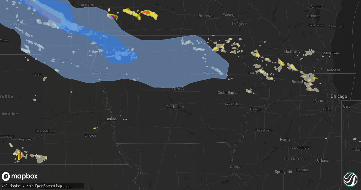
Hail Map in Iowa on July 5, 2022
Get this storm
July 5 map
$229
one time, instant access
Download today. No call, no setup
Keep the $229
Bought the map and want the full workflow? Apply the entire $229 to a subscription within 7 days. None of it is wasted.
Every map, not just this one
This buys you this map. Subscription and you get every map we run, in the markets you choose from a few cities to whole states to nationwide. Plus real-time alerts the moment a storm fires.
Contact data
Name, contact info, occupancy, even credit band for addresses in the footprint. You go from where it hit to who to call.
Become the source they trust
Unlimited branding weather history reports on demand. You already have the documented answer ready for the property owner, and you are the one who showed up with it.
Property data and RoofTrace estimates
Pull up any address you have got, its value and the exact code rules for that jurisdiction, straight from One Click Code. Then RoofTrace estimates the squares, pitch, and roof value, priced the way you price.
Storm reports in Iowa
Iowa
| Date | Description |
|---|---|
| 07/05/20226:54 PM CDT | 12 inch diameter trees and power lines down. Few trees uprooted. Time estimated from radar. |
| 07/05/20226:50 PM CDT | A local report indicates 1.00 inch wind near KENSETT |
| 07/05/20226:47 PM CDT | 61 mph gust. 2-4 in diameter limbs down. |
| 07/05/20226:38 PM CDT | Winds estimated to be 60 to 70 mph at this location... With numerous branches up to 3 inches in diameter downed. |
| 07/05/20226:30 PM CDT | The clay county em reported many downed trees just west of royal... Iowa. |
| 07/05/20226:15 PM CDT | A local report indicates 64 MPH wind near 2 W ALGONA |
| 07/05/20226:14 PM CDT | A local report indicates 60 MPH wind near 4 E SANBORN |
| 07/05/20226:00 PM CDT | A local report indicates 58 MPH wind near 2 WNW GRUVER |
| 07/05/20225:39 PM CDT | Personal weather station. |
| 07/05/20225:30 PM CDT | A local report indicates 64 MPH wind near 6 E ROCK RAPIDS |
| 07/05/20224:59 PM CDT | From a personal weather station near hartley. |
| 07/05/20224:52 PM CDT | Asos station ksux sioux gateway airport. |
| 07/05/20224:51 PM CDT | A trained spotter reported many snapped power poles... A 3 foot diameter tree down... And many 2 - 4 inch diameter branches down. |
| 07/05/202210:25 AM CDT | Delayed report. Several tree branches down on property. Time estimated from radar. |
| 07/05/20225:54 AM CDT | At 1054 PM CDT, severe thunderstorms were located along a line extending from near Miles to Fishermans Corner to Viola, moving east at 35 mph. HAZARD...60 mph wind gusts. SOURCE...Trained weather spotters. IMPACT...Expect damage to roofs, siding, and trees. Locations impacted include... Davenport, Moline, Rock Island, Bettendorf, Clinton, East Moline, Sterling, Kewanee, Rock Falls, Morrison, Cambridge, Silvis, Geneseo, DeWitt, Milan, Colona, Camanche, Le Claire, Coal Valley and Fulton. |
| 07/05/20225:51 AM CDT | At 1051 PM CDT, severe thunderstorms were located along a line extending from near Winslow to near Loran to Teeds Grove, moving east at 45 mph. HAZARD...60 mph wind gusts. SOURCE...Radar indicated. IMPACT...Expect damage to roofs, siding, and trees. Locations impacted include... Freeport, Mount Carroll, Savanna, Lena, Stockton, Lanark, Milledgeville, Fairhaven, Pearl City, Shannon, Cedarville, Davis, Sabula, Chadwick, Dakota, German Valley, Winslow, Rock City, Ridott and Nora. |
| 07/05/20225:49 AM CDT | At 1049 PM CDT, severe thunderstorms were located along a line extending from near Montrose to near La Belle to 7 miles east of Atlanta, moving southeast at 60 mph. HAZARD...60 mph wind gusts. SOURCE...Radar indicated. IMPACT...Expect damage to roofs, siding, and trees. Locations impacted include... Keokuk, Hamilton, Warsaw, Montrose, Augusta, Wayland, Bowen, West Point, Alexandria, St. Francisville, Winchester, Plymouth, Denver, Elvaston, Basco, Bentley, Keokuk Airport, Gregory Landing, Tioga and Stillwell. |
| 07/05/20225:31 AM CDT | At 1031 PM CDT, severe thunderstorms were located along a line extending from Gingle Corners to Denmark, moving southeast at 60 mph. HAZARD...60 mph wind gusts. SOURCE...Radar indicated. IMPACT...Expect damage to roofs, siding, and trees. Locations impacted include... Burlington, Macomb, Fort Madison, Monmouth, Aledo, Carthage, Oquawka, Nauvoo, Bushnell, West Burlington, Burgess, New London, Mediapolis, Colchester, La Harpe, Roseville, Viola, Dallas City, Danville and Stronghurst. |
| 07/05/20225:07 AM CDT | At 1007 PM CDT, severe thunderstorms were located along a line extending from near Monmouth to Lowden to near Columbus City, moving southeast at 45 mph. HAZARD...60 mph wind gusts. SOURCE...Radar indicated. IMPACT...Expect damage to roofs, siding, and trees. Locations impacted include... Davenport, Moline, Rock Island, Bettendorf, Clinton, Muscatine, East Moline, Maquoketa, Durant, Silvis, Eldridge, DeWitt, Milan, Camanche, Le Claire, Coal Valley, West Liberty, Wilton, Hampton and Port Byron. |
| 07/05/20224:24 AM CDT | At 924 PM CDT, a severe thunderstorm was located near Mount Vernon, or 9 miles northwest of Mechanicsville, moving southeast at 50 mph. HAZARD...60 mph wind gusts. SOURCE...Radar indicated. IMPACT...Expect damage to roofs, siding, and trees. Locations impacted include... Tipton, Durant, Mechanicsville, Stanwood, Solon, Lowden, Wyoming, Oxford Junction, Bennett, Buchanan, Clarence, Cedar Valley, Massillon Park, Cedar Bluff, Oxford Mills, Bennett Park, Sutliff, Sunbury, Cedar Valley Park and Tipton Matthews Airport. |
| 07/05/20224:00 AM CDT | At 900 PM CDT, a severe thunderstorm was located over Troy Mills, or 14 miles southeast of Independence, moving east at 40 mph. HAZARD...60 mph wind gusts. SOURCE...Radar indicated. IMPACT...Expect damage to roofs, siding, and trees. Locations impacted include... Cedar Rapids, Anamosa, Marion, Hiawatha, Mount Vernon, Monticello, Robins, Center Point, Lisbon, Urbana, Central City, Springville, Walker, Olin, Alburnett, Coggon, Hopkinton, Wyoming, Ryan and Bertram. |
| 07/05/20223:24 AM CDT | At 824 PM CDT, severe thunderstorms were located along a line extending from 6 miles northwest of Tripoli to near Reinbeck, moving east at 50 mph. HAZARD...60 mph wind gusts. SOURCE...Radar indicated. IMPACT...Expect damage to roofs, siding, and trees. Locations impacted include... Waterloo, Cedar Falls, Waverly, Evansdale, Jesup, La Porte City, Hudson, Sumner, Denver, Reinbeck, Tripoli, Shell Rock, Dike, Elk Run Heights, Waterloo Municipal Airport, Crossroads Mall, Uni-Dome And McLeod Center, Janesville, Washburn and Dunkerton.This includes Interstate 380 between mile markers 56 and 73. |
| 07/05/20223:11 AM CDT | At 811 PM CDT, severe thunderstorms were located along a line extending from near Frederika to near Waterloo Municipal Airport to Lincoln, moving east at 50 mph. HAZARD...60 mph wind gusts. SOURCE...Radar indicated. IMPACT...Expect damage to roofs, siding, and trees. Locations impacted include... Independence, Jesup, Fairbank, Winthrop, Hazleton, Quasqueton, Lamont, Brandon, Rowley, Aurora, Stanley, Lime Creek County Park, Winthrop Golf Course, Wapsipinicon Golf Course, Fontana County Park, Littleton, Monti, Buchanan County Fairgrounds, Otterville and Independence Airport. |
| 07/05/20223:08 AM CDT | At 807 PM CDT, severe thunderstorms were located along a line extending from Nashua to 7 miles south of Shell Rock, moving east at 40 mph. HAZARD...60 mph wind gusts. SOURCE...Radar indicated. IMPACT...Expect damage to roofs, siding, and trees. Severe thunderstorms will be near... Maynard around 855 PM CDT. Fayette around 900 PM CDT. Arlington around 910 PM CDT.Other locations impacted by these severe thunderstorms includeHighway 93 And County W 14, Highway 93 And County V 68, Volga RiverState Park, Wadena, Randalia, Highways 3 And 187 and County Road W 45And 187. |
| 07/05/20222:40 AM CDT | At 739 PM CDT, severe thunderstorms were located along a line extending from near St. Ansgar to near Marble Rock, moving east at 40 mph. HAZARD...60 mph wind gusts. SOURCE...Trained weather spotters and automated weather observation systems. IMPACT...Expect damage to roofs, siding, and trees. Severe thunderstorms will be near... Nashua around 810 PM CDT. Riceville around 815 PM CDT. Fredericksburg and Lime Springs around 835 PM CDT. Cresco around 850 PM CDT.Other locations impacted by these severe thunderstorms include VernonSprings County Park, Vernon Springs, Bradford, Chickasaw, CountyRoads V 58 And A 46, New Hampton Airport and County Roads B 28 And V18. |
| 07/05/20222:31 AM CDT | At 730 PM CDT, severe thunderstorms were located along a line extending from 7 miles east of Sheffield to 11 miles northeast of Roland, moving east at 40 mph. HAZARD...60 mph wind gusts. SOURCE...Radar indicated. IMPACT...Expect damage to roofs, siding, and trees. Locations impacted include... Waterloo, Cedar Falls, Waverly, Iowa Falls, Hampton, Eldora, Grundy Center, Allison, Evansdale, Jesup, La Porte City, Hudson, Sumner, Parkersburg, Denver, Reinbeck, Ackley, Clarksville, Tripoli and Shell Rock.This includes Interstate 380 between mile markers 57 and 73. |
| 07/05/20221:56 AM CDT | At 656 PM CDT, severe thunderstorms were located along a line extending from near Belmond to 7 miles west of Big Wall Lake to 11 miles southeast of Fort Dodge to near Gowrie, moving east at 45 mph. HAZARD...60 mph wind gusts. SOURCE...Radar indicated. IMPACT...Expect damage to roofs, siding, and trees. Locations impacted include... Fort Dodge, Webster City, Iowa Falls, Hampton, Garner, Clarion, Eldora, Dakota City, Humboldt, Eagle Grove, Belmond, Britt, Lake City, Ackley, Jewell Junction, Sheffield, Rockwell, Gowrie, Fort Dodge Regional Airport and Big Wall Lake.This includes Interstate 35 between mile markers 127 and 191. |
| 07/05/20221:21 AM CDT | At 620 PM CDT, severe thunderstorms were located along a line extending from near Orleans to near Fostoria to near Everly, moving southeast at 45 mph. HAZARD...60 mph wind gusts. SOURCE...Radar indicated. IMPACT...Expect damage to roofs, siding, and trees. Severe thunderstorms will be near... Spencer In Clay County, Royal and Fostoria around 625 PM CDT. Superior and Greenville around 635 PM CDT. Terril around 640 PM CDT. Webb around 645 PM CDT.Other locations impacted by these severe thunderstorms includeDickens, Gillett Grove and Rossie. |
| 07/05/20221:08 AM CDT | At 607 PM CDT, severe thunderstorms were located along a line extending from 8 miles west of Algona to near Pocahontas to 6 miles north of North Twin Lake to 7 miles east of Sac City, moving southeast at 45 mph. HAZARD...60 mph wind gusts. SOURCE...Radar indicated. IMPACT...Expect damage to roofs, siding, and trees. Locations impacted include... Fort Dodge, Webster City, Algona, Garner, Clarion, Rockwell City, Dakota City, Humboldt, Eagle Grove, Belmond, Britt, Lake City, Manson, Jewell Junction, Gowrie, Elm Lake, North Twin Lake, Fort Dodge Regional Airport, Big Wall Lake and Eagle Lake.This includes Interstate 35 between mile markers 136 and 154. |
| 07/05/202212:36 AM CDT | At 535 PM CDT, a line of severe thunderstorms were located 6 miles southwest of Sherburn, or 8 miles east of Jackson In Jackson County, moving east at 40 mph. HAZARD...60 mph wind gusts. SOURCE...Law enforcement. IMPACT...Expect damage to roofs, siding, and trees. Locations impacted include... Fairmont, Sherburn, Truman, Trimont, Welcome, Ceylon, Iowa Lake, Okamanpedan Lake, Granada, East Chain, Northrop and Dunnell. |
| 07/05/202212:12 AM CDT | At 510 PM CDT, severe thunderstorms were located along a line extending from 6 miles west of Blue Mounds State Park to near Worthington to near Harris, moving east at 45 mph. HAZARD...70 mph wind gusts. SOURCE...Radar indicated. IMPACT...Expect considerable tree damage. Damage is likely to mobile homes, roofs, and outbuildings. Severe thunderstorms will be near... Round Lake around 520 PM CDT. Leota around 530 PM CDT.Damaging winds are occurring well behind the main line of storms. Winds at Sioux Falls airport gusted over 60 mph for over 30 minutes.Other locations in the path of these severe thunderstorms includeEllsworth, Lismore, Lakefield, Adrian, Wilmont, Kilen Woods StatePark, Jackson In Jackson County, Worthington and Brewster. |
| 07/04/202211:10 PM CDT | At 409 PM CDT, severe thunderstorms were located along a line extending from near Jasper to near Rock Rapids to near Hudson, moving east at 45 mph. HAZARD...70 mph wind gusts and quarter size hail. SOURCE...Radar indicated. IMPACT...Hail damage to vehicles is expected. Expect considerable tree damage. Wind damage is also likely to mobile homes, roofs, and outbuildings. Severe thunderstorms will be near... Rock Rapids, Hull and Doon around 415 PM CDT. George and Ellsworth around 420 PM CDT. Boyden, Maurice and Matlock around 425 PM CDT. Orange City and Little Rock around 430 PM CDT. Sheldon, Sibley, Alton, Ashton and Leota around 435 PM CDT. Adrian, Hospers and Lismore around 440 PM CDT. Sanborn, Wilmont and Granville around 445 PM CDT. Ocheyedan, Rushmore, Melvin and Archer around 450 PM CDT.Other locations impacted by these severe thunderstorms includeKenneth, Moneta, Calumet, Kinbrae, Dundee, Steen, Magnolia andBigelow. |
| 07/04/202210:40 PM CDT | 8-10 inch diameter tree limb down. Time estimated from radar. |
| 07/04/202210:40 PM CDT | 4-6 diameter tree branch snapped. Report relayed by social media. Time estimated from radar. |
| 07/04/202210:39 PM CDT | Large tree down at the genesis medical center... Time estimated by radar. Report relayed via social media. |
| 07/04/202210:35 PM CDT | Large tree down on a vehicle on the west side of davenport. Report relayed via social media. Time estimated from radar. |
| 07/04/202210:25 PM CDT | Corrects previous tstm wnd dmg report from 1 s salem. Delayed report. Several tree branches down on property. Time estimated from radar. |
| 07/04/202210:19 PM CDT | At 319 PM CDT, severe thunderstorms were located along a line extending from 7 miles west of Colton to near Chancellor to near Mayfield, moving east at 50 mph. HAZARD...70 mph wind gusts and ping pong ball size hail. SOURCE...Radar indicated. IMPACT...People and animals outdoors will be injured. Expect hail damage to roofs, siding, windows, and vehicles. Expect considerable tree damage. Wind damage is also likely to mobile homes, roofs, and outbuildings. Severe thunderstorms will be near... Tea, Lennox, Chancellor and Davis around 325 PM CDT. Viborg around 330 PM CDT. Harrisburg, Centerville, Worthing and Lyons around 335 PM CDT.Other locations in the path of these severe thunderstorms includeSioux Falls, Crooks, Baltic, Dell Rapids, Lake Alvin State RecreationArea, Ellis, Renner, Canton, Beresford, Brandon, Newton Hills StatePark, Garretson, Inwood, Sherman, Fairview, Palisades State Park,Corson, Rowena, Valley Springs, Hudson and Alvord. |
| 07/04/202210:10 PM CDT | Several trees down at country club on east side of town. Time estimated from radar. |
| 07/04/202210:00 PM CDT | Power lines down. Time estimated. |
| 07/04/202210:00 PM CDT | Power lines down south of tipton. Time estimated. |
| 07/04/20229:58 PM CDT | Law enforcement reports trees down. |
| 07/04/20229:41 PM CDT | A local report indicates 58 MPH wind near 4 SE KIRKVILLE |
| 07/04/20229:40 PM CDT | Reported a tree down on powerlines. |
| 07/04/20229:25 PM CDT | At 224 PM CDT, severe thunderstorms were located along a line extending from near Fedora to near Ethan to near Armour, moving east at 50 mph. HAZARD...70 mph wind gusts and quarter size hail. SOURCE...Radar indicated. IMPACT...Hail damage to vehicles is expected. Expect considerable tree damage. Wind damage is also likely to mobile homes, roofs, and outbuildings. Severe thunderstorms will be near... Alexandria, Milltown and Fulton around 230 PM CDT. Emery and Farmer around 235 PM CDT. Spencer In McCook County and Clayton around 240 PM CDT. Bridgewater around 245 PM CDT. Tripp around 250 PM CDT. Salem, Freeman, Canistota, Kaylor and Dolton around 255 PM CDT. Marion around 300 PM CDT. Montrose and Monroe around 305 PM CDT.Other locations impacted by these severe thunderstorms includeOlivet. |
| 07/04/20229:21 PM CDT | Power lines down. Winds estimated to be sustained at 55 mph. |
| 07/04/20229:21 PM CDT | 3-inch tree limbs broken; power poles broken. |
| 07/04/20229:20 PM CDT | A local report indicates 66 MPH wind near 4 ESE ALBURNETT |
| 07/04/20229:20 PM CDT | Power outage too. |
| 07/04/20229:20 PM CDT | Reported a 70 mph wind gust but no damage was reported. |
| 07/04/20229:18 PM CDT | A local report indicates 62 MPH wind near ATKINS |
| 07/04/20229:16 PM CDT | Estimated thunderstorm wind gust of 60 mph. |
| 07/04/20229:15 PM CDT | Tree down. |
| 07/04/20229:14 PM CDT | Large limbs down. |
| 07/04/20229:11 PM CDT | Outflow winds knocked out power. |
| 07/04/20229:10 PM CDT | Damage to exterior building signage at kcrg tv studios. Time estimated from radar. |
| 07/04/20229:07 PM CDT | Estimated winds with gust front. Brief power outage. Winds under 50 mph now. Former spotter. |
| 07/04/20229:07 PM CDT | Report from mping: 3-inch tree limbs broken; power poles broken. |
| 07/04/20229:05 PM CDT | Wind gusts began around 905 and lasted about 10 to 15 minutes. |
| 07/04/20229:04 PM CDT | A local report indicates 60 MPH wind near 1 ESE INDEPENDENCE |
| 07/04/20229:00 PM CDT | Trees down at wildcat bluff state park. Relayed by emergency manager.. May have been caused by thunderstorm outflow winds. Relayed by emergency management. |
| 07/04/20228:55 PM CDT | 6 to 8 inch tree branch down. |
| 07/04/20228:51 PM CDT | Estimated gusts of 60-70. |
| 07/04/20228:35 PM CDT | Emergency manager reported trees and powerlines down across the county. Wind continued for several minutes. Leading edge of storm approximately moved through between 83 |
| 07/04/20227:45 PM CDT | Large tree branch down. Via social media. |
| 07/04/20227:40 PM CDT | Peak wind gust from the steamboat rock rwis station. |
| 07/04/20227:26 PM CDT | Emergency management also reports downed powerlines. |
| 07/04/20227:10 PM CDT | Asos station kmcw mason city airport. |
| 07/04/20227:06 PM CDT | A local report indicates 59 MPH wind near 1 SSE FOREST CITY |
| 07/04/20227:03 PM CDT | Numerous trees down in the city of algona. Tree diameter over 6 inches to 12 inches. Awning at the gas station blown down... And at least one large tree on a vehicle at |
All States Impacted by Hail Map on July 5, 2022
Cities Impacted by Hail Map on July 5, 2022
- Seneca, SD
- Ekalaka, MT
- Peerless, MT
- Meadow, SD
- Fort Pierre, SD
- Union Center, SD
- Cohagen, MT
- Ambrose, ND
- Fortuna, ND
- Malta, MT
- Brusett, MT
- Jordan, MT
- Roy, MT
- Grass Range, MT
- Sand Springs, MT
- Winnett, MT
- Hilger, MT
- Lewistown, MT
- Ingomar, MT
- Reserve, MT
- Williston, ND
- Wolf Point, MT
- Plentywood, MT
- Flaxville, MT
- Homestead, MT
- Richland, MT
- Froid, MT
- Dagmar, MT
- Grenora, ND
- Medicine Lake, MT
- Bainville, MT
- Larslan, MT
- Brockton, MT
- Redstone, MT
- Scobey, MT
- Poplar, MT
- Hammond, MT
- Capitol, MT
- Prairie City, SD
- Bison, SD
- Faith, SD
- Lodgepole, SD
- Reva, SD
- Dupree, SD
- Glasgow, MT
- Hinsdale, MT
- Frazer, MT
- Nashua, MT
- Miller, SD
- Saint Lawrence, SD
- Chandler, MN
- Lake Wilson, MN
- Woodstock, MN
- Pukwana, SD
- Platte, SD
- Chamberlain, SD
- Fort Thompson, SD
- Lower Brule, SD
- New Hampton, IA
- Saint Francis, SD
- Slayton, MN
- Currie, MN
- Irene, SD
- Volin, SD
- Mission Hill, SD
- Nora Springs, IA
- Floyd, IA
- Rockford, IA
- Ionia, IA
- Charles City, IA
- Rudd, IA
- Waukon, IA
- Burke, SD
- Herrick, SD
- Fairfax, SD
- Saint Charles, SD
- Bonesteel, SD
- Lime Springs, IA
- Cresco, IA
- Powers Lake, ND
- Orient, SD
- Sheridan, WY
- Kimball, SD
- Comfrey, MN
- Revere, MN
- Westbrook, MN
- Bingham Lake, MN
- Lamberton, MN
- Walnut Grove, MN
- Storden, MN
- Sanborn, MN
- Jeffers, MN
- Mountain Lake, MN
- Canton, SD
- Inwood, IA
- Alcester, SD
- Hawarden, IA
- Hudson, SD
- Terry, MT
- Lindsay, MT
- Brockway, MT
- Iona, MN
- Atkinson, NE
- Spencer, SD
- Woonsocket, SD
- Fulton, SD
- Howard, SD
- Humboldt, SD
- Montrose, SD
- Wessington Springs, SD
- Mount Vernon, SD
- Wessington, SD
- Plankinton, SD
- Canova, SD
- Mitchell, SD
- Virgil, SD
- Alpena, SD
- Canistota, SD
- Artesian, SD
- Carthage, SD
- Fedora, SD
- Hartford, SD
- Letcher, SD
- Cavour, SD
- Alexandria, SD
- Huron, SD
- Wolsey, SD
- Salem, SD
- Highmore, SD
- Biddle, MT
- Carson, ND
- Ralph, SD
- Ludlow, SD
- Nashua, IA
- Plainfield, IA
- Hollandale, WI
- Harpers Ferry, IA
- Prairie Du Chien, WI
- Luana, IA
- Postville, IA
- Monona, IA
- Wolcottville, IN
- Apple River, IL
- Warren, IL
- Sioux Rapids, IA
- Webb, IA
- Marathon, IA
- Torrington, WY
- Agar, SD
- Gettysburg, SD
- Ree Heights, SD
- Timber Lake, SD
- Holabird, SD
- Onida, SD
- Ridgeview, SD
- Isabel, SD
- Harrold, SD
- Eagle Butte, SD
- Blanchardville, WI
- Sioux Center, IA
- Orange City, IA
- Beresford, SD
- Springfield, MN
- Boyes, MT
- Stitzer, WI
- Livingston, WI
- Woodman, WI
- Mount Hope, WI
- Boscobel, WI
- Fennimore, WI
- Pierre, SD
- Hospers, IA
- Sheldon, IA
- Baldwin, IA
- Naper, NE
- Zahl, ND
- Lansing, IA
- De Soto, WI
- Harmony, MN
- Buffalo, SD
- Deerfield, WI
- Gillette, WY
- Freeman, SD
- Bridgewater, SD
- Lagrange, IN
- Topeka, IN
- Waterville, IA
- Marcus, IA
- Sutherland, IA
- Larrabee, IA
- Peterson, IA
- Cherokee, IA
- Everly, IA
- Granville, IA
- Royal, IA
- Paullina, IA
- Hartley, IA
- Primghar, IA
- Meriden, IA
- Greenville, IA
- Cleghorn, IA
- Alton, IA
- Archer, IA
- Milwaukee, WI
- Greendale, WI
- Decorah, IA
- Lynch, NE
- Edgerton, WI
- Fort Atkinson, WI
- Watauga, SD
- Akaska, SD
- Lemmon, SD
- Hoven, SD
- McLaughlin, SD
- Morristown, SD
- Lebanon, SD
- Trail City, SD
- Selby, SD
- Glencross, SD
- Keldron, SD
- McIntosh, SD
- Tolstoy, SD
- Elma, IA
- Upton, WY
- Jefferson, WI
- Linn Grove, IA
- Waukesha, WI
- New Berlin, WI
- Winthrop, IA
- White Lake, SD
- Bremen, IN
- Plymouth, IN
- Nevada, OH
- Upper Sandusky, OH
- Osage, IA
- Little Cedar, IA
- Darfur, MN
- Saint James, MN
- Madelia, MN
- Lewisville, MN
- Sleepy Eye, MN
- Hanska, MN
- Vernon Center, MN
- Lake Crystal, MN
- Garden City, MN
- Amboy, MN
- Ireton, IA
- Rock Valley, IA
- Hemingford, NE
- Ruthton, MN
- Balaton, MN
- Garnavillo, IA
- Farmersburg, IA
- Riceville, IA
- Carson, IA
- Hartington, NE
- Wynot, NE
- Delmar, IA
- Lost Nation, IA
- Lewellen, NE
- Leesburg, IN
- North Webster, IN
- Pierceton, IN
- Reading, MI
- Quincy, MI
- Garden Prairie, IL
- Burlington, IL
- Elgin, IL
- Roscoe, IL
- South Beloit, IL
- Genoa, IL
- Woodstock, IL
- Walworth, WI
- Clinton, WI
- Caledonia, IL
- Beloit, WI
- Marengo, IL
- Sycamore, IL
- Kirkland, IL
- Harvard, IL
- Union, IL
- Sharon, WI
- Poplar Grove, IL
- Clare, IL
- Hampshire, IL
- Capron, IL
- Kingston, IL
- Belvidere, IL
- Carey, OH
- Minden, IA
- Neola, IA
- McClelland, IA
- Verdigre, NE
- Urbana, IN
- North Manchester, IN
- Fordyce, NE
- Crofton, NE
- Waverly, NE
- Greenwood, NE
- Goshen, IN
- Middlebury, IN
- Millersburg, IN
- Elkhart, IN
- Knoxville, TN
- Heiskell, TN
- Powell, TN
- Coldwater, MI
- Bronson, MI
- Naponee, NE
- Wilcox, NE
- Republican City, NE
- Bloomington, NE
- Manville, WY
- Saint Paris, OH
- Urbana, OH
- Galax, VA
- Woodlawn, VA
- Rocky Top, TN
- Andersonville, TN
- Clinton, TN
- Brookville, IN
- Sunman, IN
- Baltimore, OH
- Pataskala, OH
- Pickerington, OH
- Millersport, OH
- Carroll, OH
- Douglas, WY
- Harrison, NE
- Marsland, NE
- Churubusco, IN
- Laotto, IN
- Galion, OH
- Morganton, NC
- Connelly Springs, NC
- Lebanon, TN
- Gallatin, TN
- Hillsdale, MI
- Ixonia, WI
- Watertown, WI
- Oconomowoc, WI
- Sierra Blanca, TX
- Brodhead, WI
- Orfordville, WI
- Alma, NE
- Orleans, NE
- Pauline, SC
- Jonesville, SC
- Buffalo, SC
- Liberty, MS
- Gloster, MS
- Oneida, TN
- Dorchester, IA
- Winkelman, AZ
- Evansville, WI
- Mission, SD
- Hazel Green, WI
- Cuba City, WI
- Vinton, VA
- Goodview, VA
- Glendo, WY
- Jay Em, WY
- Fort Wayne, IN
- Midwest, WY
- Hull, IA
- Montfort, WI
- Waverly, IA
- Janesville, IA
- Alliance, NE
- Lake View, IA
- Wall Lake, IA
- Crystal Lake, IL
- Camden, MI
- Milford, OH
- Georgetown, OH
- Bethel, OH
- Batavia, OH
- Camp Dennison, OH
- Cincinnati, OH
- Terrace Park, OH
- New Richmond, OH
- Loveland, OH
- Miamiville, OH
- Amelia, OH
- Hamersville, OH
- Felicity, OH
- Blountville, TN
- Brooksville, KY
- Montross, VA
- Decatur, AL
- Manilla, IN
- Rushville, IN
- Homer, IN
- Arlington, IN
- Caledonia, OH
- Lake Andes, SD
- Broadwater, NE
- Winnetoon, NE
- Creighton, NE
- Rock Rapids, IA
- Steen, MN
- Winner, SD
- Sac City, IA
- Bloomfield, NE
- McGregor, IA
- Walker, IA
- Coggon, IA
- Platteville, WI
- Belmont, WI
- Darlington, WI
- Geneva, IN
- Page, NE
- Ewing, NE
- Orchard, NE
- Debord, KY
- Inez, KY
- Warren, IN
- Norfolk, NE
- Stanton, NE
- Hartford City, IN
- Lancaster, OH
- Bremen, OH
- Lancaster, WI
- Frenchburg, KY
- Ridgeway, IA
- Martinsville, VA
- West Union, IA
- Ossian, IA
- Castalia, IA
- Spillville, IA
- Waucoma, IA
- Lawler, IA
- Fort Atkinson, IA
- Calmar, IA
- Protivin, IA
- Montpelier, IN
- Ney, OH
- Sherwood, OH
- Napoleon, OH
- Defiance, OH
- Reliance, TN
- Kimper, KY
- Canada, KY
- Fort Stockton, TX
- Chappell, NE
- Wise, VA
- Browntown, WI
- Independence, IA
- Lovington, NM
- Elizabeth, IL
- Stockton, IL
- Glenrock, WY
- Big Springs, NE
- Potter, NE
- Gurley, NE
- Sidney, NE
- Monticello, WI
- Argyle, WI
- Dalton, NE
- Mount Gilead, OH
- Benton Harbor, MI
- Hartford, MI
- Cloverdale, OH
- Fort Jennings, OH
- Harpster, OH
- Alpine, TX
- Valentine, TX
- Moravian Falls, NC
- Newland, NC
- Quincy, OH
- Sidney, OH
- Piqua, OH
- Fletcher, OH
- De Graff, OH
- Rosewood, OH
- Conover, OH
- New Glarus, WI
- Gratiot, WI
- Mount Horeb, WI
- Monroe, WI
- South Wayne, WI
- New Riegel, OH
- Alvada, OH
- Swanton, OH
- Lake Geneva, WI
- Wolcott, IN
- Reynolds, IN
- Williamsburg, KY
- Jellico, TN
- Pacolet, SC
- Page, AZ
- Emery, SD
- Van Wert, OH
- Hoagland, IN
- Monroeville, IN
- Convoy, OH
- New Haven, IN
- Rockford, OH
- Wren, OH
- Decatur, IN
- Ohio City, OH
- Willshire, OH
- Oshkosh, NE
- Ericson, NE
- Albion, IN
- Huntertown, IN
- Rewey, WI
- Mansfield, OH
- Omaha, NE
- Marion, NC
- Dunkirk, IN
- Boonville, IN
- Chandler, IN
- Osseo, MI
- Albany, WI
- Janesville, WI
- La Follette, TN
- Wellford, SC
- Startex, SC
- Spartanburg, SC
- Inman, SC
- Moore, SC
- Lyman, SC
- Woodruff, SC
- Duncan, SC
- Helenville, WI
- Fleming, CO
- Shawnee, WY
- Carthage, IN
- Benton, WI
- Shullsburg, WI
- Dubuque, IA
- East Dubuque, IL
- Scales Mound, IL
- Galena, IL
- Celina, OH
- Tiro, OH
- New Washington, OH
- Forest, OH
- Linden, WI
- Mineral Point, WI
- Westerville, OH
- Deep Gap, NC
- Ferguson, NC
- Boone, NC
- Granville, OH
- Alexandria, OH
- Concho, AZ
- Iaeger, WV
- Sergeant Bluff, IA
- Salix, IA
- Shipshewana, IN
- Leipsic, OH
- Ottawa, OH
- Miller City, OH
- Continental, OH
- Muncie, IN
- Granville, TN
- Somerset, KY
- Bloomville, OH
- Galena, OH
- Louisa, KY
- Ulysses, KY
- New Albany, OH
- Johnstown, OH
- Onarga, IL
- Ridgeville, IN
- Farmland, IN
- Manchester, KY
- Grandfalls, TX
- Hildreth, NE
- Winslow, AZ
- Sparta, NC
- Laurel Springs, NC
- Clearmont, WY
- Greer, SC
- Chuckey, TN
- Limestone, TN
- Afton, TN
- Ligonier, IN
- Wawaka, IN
- Morehead, KY
- Holdrege, NE
- Atlanta, NE
- Mason City, IA
- Northwood, IA
- Joice, IA
- Grafton, IA
- Kensett, IA
- Plymouth, IA
- Hanlontown, IA
- Manly, IA
- Burlington, WI
- Bucyrus, OH
- Thawville, IL
- Hobbs, NM
- Fairbank, IA
- Denver, IA
- Dunkerton, IA
- Hazleton, IA
- Readlyn, IA
- Jesup, IA
- White Pigeon, MI
- Bristol, IN
- Ashland, NE
- Stearns, KY
- Caryville, TN
- Jacksboro, TN
- Rogersville, TN
- Surgoinsville, TN
- Riverton, NE
- Bladen, NE
- Franklin, NE
- Upland, NE
- Campbell, NE
- Blue Hill, NE
- Inavale, NE
- Red Cloud, NE
- Guide Rock, NE
- Grove City, OH
- Purlear, NC
- Axtell, NE
- Maurice, IA
- Geddes, SD
- Armour, SD
- Gann Valley, SD
- Loomis, NE
- Bertrand, NE
- Smithfield, NE
- Springfield, SD
- Avon, SD
- Millport, AL
- Knightstown, IN
- Imperial, TX
- Axton, VA
- Yadkinville, NC
- New Leipzig, ND
- Blue River, WI
- Muscoda, WI
- Crawford, NE
- Oxford Junction, IA
- Sullivan, WI
- Johnson Creek, WI
- West Liberty, KY
- Salyersville, KY
- Rockford, IL
- Spencer, IA
- Galva, IA
- Schaller, IA
- Marathon, TX
- Cambridge, NE
- Bartley, NE
- Holbrook, NE
- Alzada, MT
- Commiskey, IN
- North Vernon, IN
- Presho, SD
- Oacoma, SD
- Larchwood, IA
- Lester, IA
- Advance, NC
- Andrews, IN
- Lagro, IN
- Adel, GA
- Sparks, GA
- Howe, IN
- Mason, OH
- Gaffney, SC
- Indianola, NE
- Gillett Grove, IA
- Richland Center, WI
- Vandalia, MI
- Jones, MI
- Marion, OH
- Lisco, NE
- Potosi, WI
- Mishawaka, IN
- Wakarusa, IN
- Roaring River, NC
- Clay, WV
- Prestonsburg, KY
- Spencer, NE
- Danville, AL
- Vinemont, AL
- Columbia City, IN
- Tulare, SD
- Hitchcock, SD
- Marion, SD
- Ryan, IA
- Lusk, WY
- Niobrara, NE
- Bridgeport, NE
- Crestline, OH
- Imperial, NE
- Benkelman, NE
- Brookston, IN
- Traphill, NC
- Hays, NC
- Stoughton, WI
- Cambridge, WI
- Lodgepole, NE
- Hicksville, OH
- Mukwonago, WI
- Constantine, MI
- Sturgis, MI
- Three Rivers, MI
- Morral, OH
- Central City, KY
- Bremen, KY
- Ashland, OH
- Seminole, TX
- Kingsley, IA
- Hinton, IA
- Avilla, IN
- Kendallville, IN
- Larwill, IN
- Kimmell, IN
- Rome City, IN
- Sitka, KY
- Flatgap, KY
- Staffordsville, KY
- Augusta, KY
- Raccoon, KY
- Pikeville, KY
- Monmouth, IA
- Wyoming, IA
- Lawndale, NC
- Gate City, VA
- Fries, VA
- Warfield, KY
- Kermit, WV
- Westby, MT
- Hettinger, ND
- Alamo, ND
- Crosby, ND
- Church Hill, TN
- Colfax, NC
- Kernersville, NC
- High Point, NC
- Greensboro, NC
- Whitehorse, SD
- Java, SD
- Onaka, SD
- Faulkton, SD
- Glenham, SD
- Meservey, IA
- Olin, IA
- Magnolia, MN
- Dayton, IA
- Allison, IA
- Rolfe, IA
- Bristow, NE
- Lowden, IA
- Leota, MN
- Titonka, IA
- Milford, IA
- Carpenter, SD
- Alexander, IA
- Ogden, IA
- North Sioux City, SD
- Ames, IA
- Edgerton, MN
- Graettinger, IA
- Lake City, IA
- Coleridge, NE
- Zearing, IA
- Clemons, IA
- Rockham, SD
- Jefferson, IA
- Rembrandt, IA
- Wheatland, IA
- Jolley, IA
- Armstrong, IA
- Laurel, NE
- Goldfield, IA
- Gayville, SD
- Wagner, SD
- Parkersburg, IA
- McCallsburg, IA
- Duncombe, IA
- Hampton, IA
- Wallingford, IA
- Willow Lake, SD
- Woolstock, IA
- Rutland, SD
- Dimock, SD
- Clarion, IA
- Magnet, NE
- Rockwell, IA
- Welton, IA
- Arlington, SD
- George, IA
- Burbank, SD
- Garner, IA
- Quasqueton, IA
- Fulda, MN
- Oran, IA
- Renner, SD
- Dumont, IA
- Whittemore, IA
- Bode, IA
- Alta Vista, IA
- Stephan, SD
- Ocheyedan, IA
- Stanley, IA
- Wesley, IA
- Williams, IA
- Rushmore, MN
- Bancroft, IA
- Stanwood, IA
- Odebolt, IA
- Ethan, SD
- Aredale, IA
- Estherville, IA
- Swea City, IA
- Rutland, IA
- Dike, IA
- Kennebec, SD
- Nunda, SD
- Vinton, IA
- Holland, IA
- Correctionville, IA
- Popejoy, IA
- Climbing Hill, IA
- Utica, SD
- Solon, IA
- Lohrville, IA
- Moville, IA
- Farnhamville, IA
- Reading, MN
- Madison, SD
- Chapin, IA
- Kenneth, MN
- Westgate, IA
- Otho, IA
- Jefferson, SD
- Iowa Falls, IA
- Mount Vernon, IA
- Aurora, SD
- Boxholm, IA
- Lisbon, IA
- Hawkeye, IA
- Buffalo Center, IA
- Robins, IA
- Stacyville, IA
- Brunsville, IA
- Stout, IA
- Gilmore City, IA
- Eagle Grove, IA
- Hardy, IA
- Calamus, IA
- Hardwick, MN
- Laurens, IA
- Brookings, SD
- Burnside, IA
- Little Rock, IA
- Masonville, IA
- Winnebago, NE
- Boone, IA
- Dewar, IA
- Fonda, IA
- Hubbard, IA
- Maynard, IA
- Ramona, SD
- Thompson, IA
- Oldham, SD
- Knierim, IA
- Morrison, IA
- Mount Auburn, IA
- Dana, IA
- Fenton, IA
- Aurelia, IA
- Delmont, SD
- Varina, IA
- Goodell, IA
- Ashton, IA
- Thornton, IA
- Bradford, IA
- Galt, IA
- Mclean, NE
- Blairsburg, IA
- Waterbury, NE
- Bristow, IA
- Lakefield, MN
- Frederika, IA
- Hurley, SD
- Moorland, IA
- Arthur, IA
- Dakota City, NE
- Kanawha, IA
- Lyons, SD
- Swisher, IA
- Nevada, IA
- Whitten, IA
- Eldora, IA
- Tyndall, SD
- Pocahontas, IA
- Saint Ansgar, IA
- Tripoli, IA
- Pickstown, SD
- Oto, IA
- Gilbert, IA
- Egan, SD
- Melvin, IA
- Hamill, SD
- Marble Rock, IA
- Randolph, NE
- Rowley, IA
- Aplington, IA
- Vermillion, SD
- Oelwein, IA
- Lehigh, IA
- Spirit Lake, IA
- Sioux Falls, SD
- West Bend, IA
- Monticello, IA
- Wellsburg, IA
- Dows, IA
- Center Junction, IA
- Fort Dodge, IA
- Hiawatha, IA
- Pierson, IA
- Clarksville, IA
- Albert City, IA
- Conrad, IA
- Arnolds Park, IA
- Ringsted, IA
- Quimby, IA
- New Providence, IA
- Carpenter, IA
- Ellsworth, MN
- Emmetsburg, IA
- McCausland, IA
- Jewell, IA
- Roland, IA
- Sloan, IA
- Story City, IA
- Gilbertville, IA
- Morley, IA
- Bronson, IA
- Fertile, IA
- Nemaha, IA
- Lu Verne, IA
- Raymond, IA
- Dante, SD
- De Smet, SD
- Bennett, IA
- Brandon, SD
- Coulter, IA
- Churdan, IA
- Danbury, IA
- Jackson, NE
- Lennox, SD
- Maskell, NE
- Stickney, SD
- Center Point, IA
- Lake Mills, IA
- Lyle, MN
- Low Moor, IA
- Mallard, IA
- Belmond, IA
- Matlock, IA
- Saint Anthony, IA
- Klemme, IA
- Sumner, IA
- Reinbeck, IA
- Geneva, IA
- Shellsburg, IA
- Blunt, SD
- Cushing, IA
- Dundee, IA
- Latimer, IA
- Merrill, IA
- Leland, IA
- Woden, IA
- Wausa, NE
- Akron, IA
- Webster City, IA
- Pipestone, MN
- Livermore, IA
- Elkton, SD
- Butte, NE
- Draper, SD
- Redfield, SD
- Tabor, SD
- Dixon, NE
- Early, IA
- McIntire, IA
- Oyens, IA
- Lawton, IA
- Thor, IA
- Alburnett, IA
- Plover, IA
- Newcastle, NE
- Kesley, IA
- Jasper, MN
- Fostoria, IA
- Burt, IA
- Anamosa, IA
- Anthon, IA
- Sanborn, IA
- Shell Rock, IA
- Scarville, IA
- Ellsworth, IA
- Dickens, IA
- Scotland, SD
- Brandon, IA
- Washta, IA
- Reliance, SD
- Hudson, IA
- Somers, IA
- Battle Creek, IA
- Clare, IA
- Clarence, IA
- Ackley, IA
- Cedar Falls, IA
- Ayrshire, IA
- Worthington, MN
- Wayne, NE
- Newell, IA
- Crystal Lake, IA
- Holland, MN
- Wilmont, MN
- Dakota City, IA
- Chatsworth, IA
- Menno, SD
- Barnum, IA
- Harcourt, IA
- Elk Point, SD
- Central City, IA
- Callender, IA
- Viborg, SD
- Lesterville, SD
- Beaver Creek, MN
- Carroll, NE
- Yankton, SD
- Colwell, IA
- Truesdale, IA
- Okoboji, IA
- Springville, IA
- Wentworth, SD
- La Porte City, IA
- Colton, SD
- Lakota, IA
- Doon, IA
- Urbana, IA
- Pomeroy, IA
- Luverne, MN
- Adrian, MN
- Bigelow, MN
- Clinton, IA
- Cedar Rapids, IA
- Union, IA
- Rockwell City, IA
- Remsen, IA
- Ida Grove, IA
- Calumet, IA
- Hubbard, NE
- Monroe, SD
- Bryant, IA
- Paton, IA
- Austinville, IA
- Lismore, MN
- Sioux City, IA
- Tea, SD
- Harrison, SD
- Worthing, SD
- Parkston, SD
- De Witt, IA
- Curlew, IA
- Osmond, NE
- Fredericksburg, IA
- Manchester, IA
- Davis, SD
- Long Grove, IA
- Tripp, SD
- Boyden, IA
- Garden City, IA
- Gowrie, IA
- Corsica, SD
- Swaledale, IA
- Holstein, IA
- Randall, IA
- Badger, IA
- Grundy Center, IA
- Alvord, IA
- Harrisburg, SD
- Belden, NE
- Gregory, SD
- Sibley, IA
- Radcliffe, IA
- Fairfax, IA
- Le Mars, IA
- Ruthven, IA
- Steamboat Rock, IA
- Martelle, IA
- Emerson, NE
- Center, NE
- Algona, IA
- Charlotte, IA
- Plainview, NE
- Volga, SD
- Flandreau, SD
- Garretson, SD
- Storm Lake, IA
- Yale, SD
- Palo, IA
- New Hartford, IA
- Grand Mound, IA
- Rowan, IA
- Hills, MN
- Arlington, IA
- Chester, SD
- Trent, SD
- Cylinder, IA
- Brewster, MN
- Crooks, SD
- Goose Lake, IA
- Dougherty, IA
- Aurora, IA
- Allen, NE
- Parker, SD
- Lake Park, IA
- Marion, IA
- Greene, IA
- Kaylor, SD
- Round Lake, MN
- Clear Lake, IA
- Rock Falls, IA
- Lake Preston, SD
- Ventura, IA
- Homer, NE
- Wakonda, SD
- Evansdale, IA
- Corwith, IA
- Kanaranzi, MN
- Orchard, IA
- Sheffield, IA
- Colman, SD
- Atkins, IA
- Vivian, SD
- South Sioux City, NE
- Saint Helena, NE
- Alta, IA
- Winfred, SD
- Bradgate, IA
- New Holland, SD
- Forest City, IA
- Ely, IA
- Westfield, IA
- Lamont, IA
- Humboldt, IA
- Chancellor, SD
- Wakefield, NE
- Stanhope, IA
- Camanche, IA
- Toddville, IA
- Havelock, IA
- Britt, IA
- Maquoketa, IA
- Valley Springs, SD
- Waterloo, IA
- Hornick, IA
- Tipton, IA
- Ponca, NE
- Iroquois, SD
- Harris, IA
- Stratford, IA
- Fairview, SD
- Baltic, SD
- Terril, IA
- Ottosen, IA
- Pilot Mound, IA
- Concord, NE
- Olivet, SD
- Vincent, IA
- Centerville, SD
- Randalia, IA
- Fayette, IA
- Lytton, IA
- Palmer, IA
- Dell Rapids, SD
- Kamrar, IA
- Auburn, IA
- Lone Rock, IA
- Renwick, IA
- Alden, IA
- Manson, IA
- Mechanicsville, IA
- Butterfield, MN
- Fort Peck, MT
- Forsyth, MT
- Powderville, MT
- Volborg, MT
- Ismay, MT
- Glendive, MT
- Circle, MT
- Bowie, MD
- Rozet, WY
- Scott, OH
- Payne, OH
- Grabill, IN
- Woodburn, IN


