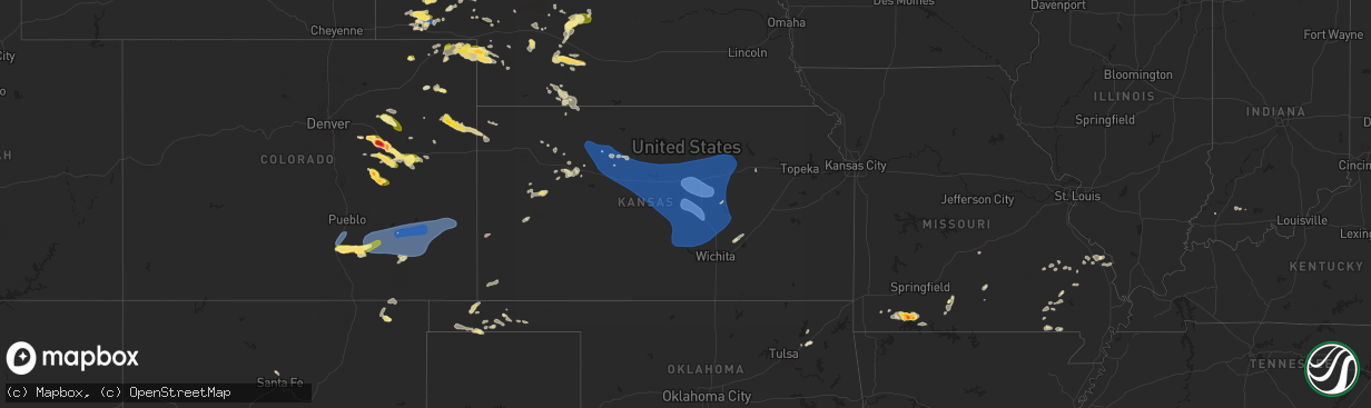
Hail Map in Kansas on July 3, 2024
The weather event in Kansas on July 3, 2024 includes Hail, Wind, and Tornado maps. 16 states and 364 cities were impacted and suffered possible damage. The total estimated number of properties impacted is 0.
Want more than just the map?
Turn this storm into a full workflow.
- Owner + property data so you know who to knock
- OnDemand branded weather history reports to win the "did we even have hail?" argument
- RoofTrace estimate so reps stop guessing numbers at the door
Bought this map? Upgrade within 7 days and we'll credit the $230. (10-15 min setup call)
Hail
Wind
Tornado
0
Estimated number of impacted properties by a 1.00" hail or larger0
Estimated number of impacted properties by a 1.75" hail or larger0
Estimated number of impacted properties by a 2.50" hail or largerStorm reports in Kansas
Kansas
| Date | Description |
|---|---|
| 07/03/20242:00 AM CDT | A local report indicates 59 MPH wind near 2 NE Maize |
| 07/03/20241:59 AM CDT | A local report indicates 60 MPH wind near Sedgwick |
| 07/03/20241:42 AM CDT | Large tree uprooted. |
| 07/03/20241:25 AM CDT | A local report indicates 59 MPH wind near 1 SW Hillsboro |
| 07/03/20241:15 AM CDT | A local report indicates 58 MPH wind near 3 E Hutchinson |
| 07/03/20241:13 AM CDT | A local report indicates 63 MPH wind near 4 S Durham |
| 07/03/20241:09 AM CDT | A local report indicates 58 MPH wind near 6 N Moundridge |
| 07/03/20241:09 AM CDT | A local report indicates 72 MPH wind near 1 W Canton |
| 07/03/20241:09 AM CDT | A local report indicates 67 MPH wind near 5 ESE Partridge |
| 07/03/20241:05 AM CDT | A local report indicates 76 MPH wind near 1 S Mcpherson |
| 07/03/20241:04 AM CDT | A local report indicates 58 MPH wind near 1 W Canton |
| 07/03/20241:00 AM CDT | A local report indicates 59 MPH wind near 1 NE Inman |
| 07/03/202412:58 AM CDT | Delayed report of tree limbs 4 inches in diameter blown down and a dumpster was blown over onto a train track. Power is out for part of the area. |
| 07/03/202412:57 AM CDT | Awos station kk78 abilene. |
| 07/03/202412:57 AM CDT | A local report indicates 60 MPH wind near 6 ESE Inman |
| 07/03/202412:55 AM CDT | A local report indicates 62 MPH wind near 2 SW Mcpherson |
| 07/03/202412:52 AM CDT | A local report indicates 69 MPH wind near Lindsborg |
| 07/03/202412:51 AM CDT | A local report indicates 75 MPH wind near 3 E Mcpherson |
| 07/03/202412:43 AM CDT | 4 to 5 inch diameter limbs also reported down. |
| 07/03/202412:42 AM CDT | A local report indicates 58 MPH wind near 5 SE Lyons |
| 07/03/202412:38 AM CDT | Asos station ksln salina regional airport. |
| 07/03/202412:35 AM CDT | A local report indicates 61 MPH wind near 2 W Little River |
| 07/03/202412:33 AM CDT | Asos station ksln salina regional airport. |
| 07/03/202412:33 AM CDT | A local report indicates 70 MPH wind near 8 WNW Marquette |
| 07/03/202412:27 AM CDT | Estimated 55-65mph wind gusts. |
| 07/03/202412:14 AM CDT | A local report indicates 73 MPH wind near 6 ENE Kanopolis |
| 07/03/202412:08 AM CDT | Also reported 0.85 inches of rain in 15 minutes. |
| 07/03/202412:05 AM CDT | Report of a house with part of the roof blown off about 5 miles northeast of ellsworth. Also... Tree limbs down in the town of ellsworth. Delayed report. Report relayed |
| 07/03/202412:00 AM CDT | Also reported an 8 inch diameter limb down. |
| 07/02/202411:58 PM CDT | A local report indicates 70 MPH wind near 3 SE Sylvan Grove |
| 07/02/202411:51 PM CDT | A local report indicates 60 MPH wind near 4 ESE Wilson |
| 07/02/202411:45 PM CDT | *** 1 fatal... 3 inj *** campers blown over from high winds at lake wilson. Updated information from russell county sheriff press release. |
| 07/02/202411:45 PM CDT | Report of multiple campers blown over at wilson lake. |
| 07/02/202411:34 PM CDT | A local report indicates 60 MPH wind near 3 NNE Bunker Hill |
| 07/02/202411:33 PM CDT | A local report indicates 70 MPH wind near Russell Airport |
| 07/02/202411:32 PM CDT | A local report indicates 68 MPH wind near Russell |
| 07/02/202411:01 PM CDT | Awos station khys hays regional airport awos site. |
| 07/02/202410:35 PM CDT | The asos in hill city |
| 07/02/202410:24 PM CDT | The asos in hill city |
| 07/02/202410:22 PM CDT | The asos in hill city |
| 07/02/20249:30 PM CDT | Many three and a half inch diameter green tree limbs blown down. Estimated time of report from radar. |
| 07/02/20249:14 PM CDT | Pws-kksselde4 wuunderground station. |
All States Impacted by Hail Map on July 3, 2024
Cities Impacted by Hail Map on July 3, 2024
- Adair, IA
- Exira, IA
- Anita, IA
- Hay Springs, NE
- Rushville, NE
- Pine Ridge, SD
- Wounded Knee, SD
- Batesland, SD
- Martin, SD
- Audubon, IA
- Merriman, NE
- Tuthill, SD
- Kyle, SD
- Wanblee, SD
- Angora, NE
- Cody, NE
- Dix, NE
- Bridgeport, NE
- Valentine, NE
- Oshkosh, NE
- Potter, NE
- Fort Leonard Wood, MO
- Waynesville, MO
- Thedford, NE
- Broadwater, NE
- Porcupine, SD
- Harrisburg, NE
- Lakeside, NE
- Ellsworth, NE
- Dalton, NE
- Allen, SD
- Gurley, NE
- Shepherd, MT
- Hyannis, NE
- Bingham, NE
- Sidney, NE
- Oelrichs, SD
- Laurel, MT
- Park City, MT
- Sterling, CO
- Worden, MT
- Alliance, NE
- Johnstown, NE
- Whitman, NE
- Lewellen, NE
- Edgemont, SD
- Custer, SD
- Lisco, NE
- Saint Francis, SD
- Ashby, NE
- Mullen, NE
- Wood Lake, NE
- Arthur, NE
- Willow Springs, MO
- Winslow, IN
- Upton, WY
- Moorcroft, WY
- Sundance, WY
- Ironton, MO
- Osage, WY
- Fleming, CO
- Haxtun, CO
- Newcastle, WY
- Jasper, IN
- Otwell, IN
- Lesterville, MO
- Rye, CO
- Bennett, CO
- Fredericktown, MO
- Annapolis, MO
- Arcadia, MO
- Walsenburg, CO
- Fort Myers, FL
- Deer Trail, CO
- Lodgepole, NE
- Velpen, IN
- Cabool, MO
- Cascade, MT
- Hill City, SD
- Des Moines, NM
- Sedgwick, CO
- Woodrow, CO
- Solo, MO
- Elk Creek, MO
- Folsom, NM
- Cape Coral, FL
- Perryville, MO
- Ovid, CO
- Pueblo, CO
- Fort Morgan, CO
- Byers, CO
- Crook, CO
- Iliff, CO
- Akron, CO
- Otis, CO
- Patton, MO
- Houston, MO
- Julesburg, CO
- Model, CO
- Fowler, CO
- Lake Park, GA
- Marquand, MO
- Sedgewickville, MO
- Greenville, MO
- Agate, CO
- Kim, CO
- Uniontown, MO
- Frohna, MO
- Jackson, MO
- Oak Ridge, MO
- Altenburg, MO
- Valdosta, GA
- Sutherland, NE
- Lemoyne, NE
- Glenallen, MO
- Keystone, SD
- Hermosa, SD
- Ogallala, NE
- Micanopy, FL
- Hawthorne, FL
- Williamsville, MO
- Keystone, NE
- Mill Spring, MO
- Curtis, NE
- Rapid City, SD
- Fairburn, SD
- Ramah, CO
- Yuma, CO
- Ainsworth, NE
- Maxwell, NE
- Moorefield, NE
- Simla, CO
- Genoa, CO
- Farnam, NE
- Joes, CO
- Limon, CO
- Wolf Lake, IL
- Doniphan, MO
- Santa Fe, NM
- Stapleton, NE
- Venango, NE
- Patterson, MO
- Brady, NE
- Ellsinore, MO
- Rocky Ford, CO
- Hershey, NE
- North Platte, NE
- Swink, CO
- La Junta, CO
- Trinidad, CO
- Las Animas, CO
- Alto Pass, IL
- Kirk, CO
- Gothenburg, NE
- Amherst, CO
- Grandin, MO
- Dickens, NE
- Claremore, OK
- Cobden, IL
- Matheson, CO
- Manzanola, CO
- Cheraw, CO
- Champion, NE
- Imperial, NE
- Eustis, NE
- Bassett, NE
- Idalia, CO
- Arnold, NE
- Scenic, SD
- Elsie, NE
- Makanda, IL
- Holyoke, CO
- Grant, NE
- Flagler, CO
- Callaway, NE
- Broken Bow, NE
- Calhan, CO
- Bradleyville, MO
- Ava, MO
- Seibert, CO
- Hugo, CO
- Rush, CO
- Merna, NE
- Arriba, CO
- Pryor, OK
- Poplar Bluff, MO
- Fairview, MO
- Belknap, IL
- Elwood, NE
- Lamar, CO
- Hasty, CO
- McClave, CO
- Wiley, CO
- Holly, CO
- Sugar City, CO
- Kanorado, KS
- Saint Francis, KS
- Burlington, CO
- Francisco, IN
- Princeton, IN
- Yoder, CO
- Keyes, OK
- Dalhart, TX
- Purdy, MO
- Goodland, KS
- Wauneta, NE
- Monett, MO
- Cassville, MO
- Goodwell, OK
- Richfield, KS
- Aurora, MO
- Verona, MO
- Syracuse, KS
- Bird City, KS
- Cape Fair, MO
- Galena, MO
- Chelsea, OK
- Shell Knob, MO
- Oxly, MO
- Stockville, NE
- Reeds Spring, MO
- Naylor, MO
- Lexington, NE
- Neelyville, MO
- McCook, NE
- Blue Eye, MO
- Branson, MO
- Harrison, NE
- Indianola, NE
- Hollister, MO
- Conchas Dam, NM
- Deerfield, KS
- Crawford, NE
- Marienthal, KS
- Holcomb, KS
- Rexford, KS
- Whitney, NE
- Danbury, NE
- Oberlin, KS
- Lebanon, NE
- Bartley, NE
- Wilsonville, NE
- Scott City, KS
- Selden, KS
- Chadron, NE
- Hoxie, KS
- Oakley, KS
- Norcatur, KS
- Winona, KS
- Healy, KS
- Norton, KS
- Gove, KS
- Quinter, KS
- Park, KS
- Grainfield, KS
- Collyer, KS
- Gordon, NE
- Wakeeney, KS
- Texhoma, OK
- Guymon, OK
- Palco, KS
- Plainville, KS
- Stratford, TX
- Natoma, KS
- Ellis, KS
- Paradise, KS
- Hemingford, NE
- Hardesty, OK
- Bayard, NE
- El Dorado, KS
- Potwin, KS
- Burns, KS
- Durham, KS
- Junction City, KS
- Alta Vista, KS
- Thornfield, MO
- Kirbyville, MO
- Bennington, KS
- Damar, KS
- Sedgwick, KS
- Burrton, KS
- Lorraine, KS
- Salina, KS
- Inman, KS
- Falun, KS
- Minneapolis, KS
- Lincoln, KS
- Sterling, KS
- Abilene, KS
- Hutchinson, KS
- North Newton, KS
- Windom, KS
- Hesston, KS
- Talmage, KS
- Chase, KS
- Wilson, KS
- Peabody, KS
- Claflin, KS
- Solomon, KS
- Waldo, KS
- Partridge, KS
- Walton, KS
- Ellinwood, KS
- Dorrance, KS
- Chapman, KS
- Canton, KS
- Lindsborg, KS
- Little River, KS
- Bunker Hill, KS
- South Hutchinson, KS
- Tescott, KS
- Gorham, KS
- Abbyville, KS
- Enterprise, KS
- Tampa, KS
- Catharine, KS
- Walker, KS
- Buhler, KS
- Roxbury, KS
- Nickerson, KS
- Raymond, KS
- Newton, KS
- Barnard, KS
- Pretty Prairie, KS
- Assaria, KS
- Russell, KS
- Gypsum, KS
- Goessel, KS
- Milford, KS
- Marquette, KS
- Hays, KS
- Mount Hope, KS
- Geneseo, KS
- Galva, KS
- Lehigh, KS
- Arlington, KS
- Hill City, KS
- Bogue, KS
- Beverly, KS
- Hillsboro, KS
- Sylvan Grove, KS
- Penokee, KS
- Hope, KS
- Mcpherson, KS
- New Cambria, KS
- Brookville, KS
- Halstead, KS
- Bushton, KS
- Ellsworth, KS
- Lyons, KS
- Holyrood, KS
- Hoisington, KS
- Clay Center, KS
- Victoria, KS
- Haven, KS
- Kanopolis, KS
- Lucas, KS
- Luray, KS
- Marion, KS
- Longford, KS
- Wakefield, KS
- Moundridge, KS
- Stockton, KS
- Overton, NE


