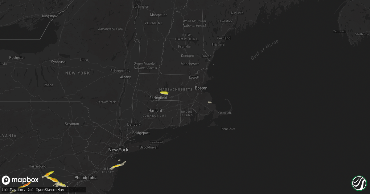
Hail Map in Massachusetts on July 2, 2022
Get this storm
July 2 map
$229
one time, instant access
Download today. No call, no setup
Keep the $229
Bought the map and want the full workflow? Apply the entire $229 to a subscription within 7 days. None of it is wasted.
Every map, not just this one
This buys you this map. Subscription and you get every map we run, in the markets you choose from a few cities to whole states to nationwide. Plus real-time alerts the moment a storm fires.
Contact data
Name, contact info, occupancy, even credit band for addresses in the footprint. You go from where it hit to who to call.
Become the source they trust
Unlimited branding weather history reports on demand. You already have the documented answer ready for the property owner, and you are the one who showed up with it.
Property data and RoofTrace estimates
Pull up any address you have got, its value and the exact code rules for that jurisdiction, straight from One Click Code. Then RoofTrace estimates the squares, pitch, and roof value, priced the way you price.
Storm reports in Massachusetts
Massachusetts
| Date | Description |
|---|---|
| 07/02/20225:10 PM CDT | In brookfield... A tree was down on webber road and schoolhouse cross road. Report relayed by amateur radio. |
| 07/02/20225:10 PM CDT | In natick... Wires were down on high street extension. Tree branches were down on eliot street. |
| 07/02/20225:00 PM CDT | In ware... A large limb was down on wires... Per police. Report relayed by amateur radio. |
| 07/02/20224:58 PM CDT | In belchertown... A large tree was down... Blocking rt. 21 near the ludlow line... Per police. Also... A large tree and power lines were down on north washington st.... |
| 07/02/20224:58 PM CDT | In belchertown... A large tree was down... Blocking rt. 21 near the ludlow line. Report relayed by amateur radio. |
| 07/02/20224:57 PM CDT | In warren... A tree was down on santos rd. |
| 07/02/20224:56 PM CDT | In palmer... Multiple trees down on center st. Large tree down on emery st. |
| 07/02/20224:52 PM CDT | Tree down on power lines on state st. Report relayed by amateur radio. |
| 07/02/20224:32 PM CDT | In granby... Tree down on east st.... Tree down on state st.... Multiple trees down on south st.... And tree down on route 202 at kendall st. |
| 07/02/20224:32 PM CDT | Tree down on east st.. Tree down on state st. Multiple trees down on south st. Tree down on route 202 at kendall st. |
| 07/02/20224:32 PM CDT | Tree down on east street in granby. |
| 07/02/20227:29 AM CDT | At 1228 AM EDT, a severe thunderstorm was located over Cheshire, or 9 miles northeast of Pittsfield, moving northeast at 40 mph. HAZARD...60 mph wind gusts. SOURCE...Radar indicated. IMPACT...Expect damage to roofs, siding, and trees. Locations impacted include... Adams, Cheshire, Florida, Savoy, East Windsor, Berkshire, Dalton, Lanesborough, Hinsdale, Windsor, Peru, Soldiers Memorial Field, Cheshire Harbor, Arnoldville, Town Crest Village, Maple Grove, The Boulders, Bowens Corners, Farnams and Rusek Whipple Square. |
| 07/02/202212:58 AM CDT | At 558 PM EDT, a severe thunderstorm was located over Warren, or 18 miles southeast of Amherst, moving east at 25 mph. HAZARD...60 mph wind gusts and penny size hail. SOURCE...Radar indicated. IMPACT...Expect damage to trees and power lines. Locations impacted include... Worcester, Holden, Auburn, Oxford, Charlton, Palmer, Spencer, Dudley, Leicester, Ware, Sturbridge, Warren, Paxton, North Brookfield, West Brookfield, Brimfield, Brookfield, East Brookfield and New Braintree. |
| 07/02/202212:52 AM CDT | At 552 PM EDT, a severe thunderstorm was located over Southborough, or near Framingham, moving east at 25 mph. HAZARD...60 mph wind gusts and penny size hail. SOURCE...Radar indicated. IMPACT...Expect damage to trees and power lines. Locations impacted include... Boston, Cambridge, Newton, Framingham, Waltham, Brookline, Marlborough, Natick, Watertown, Needham, Norwood, Wellesley, Dedham, Walpole, Canton, Westborough, Sudbury, Sharon, Ashland and Hopkinton. |
| 07/02/202212:27 AM CDT | At 527 PM EDT, a severe thunderstorm was located over Granby, or near Chicopee, moving east at 25 mph. HAZARD...60 mph wind gusts and quarter size hail. SOURCE...Radar indicated. IMPACT...Expect wind damage to trees and power lines. Minor hail damage to vehicles is possible. Locations impacted include... Amherst, Ludlow, South Hadley, Belchertown, Palmer, Ware, Granby, Warren, West Brookfield, Brimfield, Hardwick, New Braintree and New Salem. |
| 07/01/202211:34 PM CDT | At 434 PM EDT, a severe thunderstorm was located over Becket, or 13 miles southeast of Pittsfield, moving east at 20 mph. HAZARD...60 mph wind gusts and quarter size hail. SOURCE...Radar indicated. IMPACT...Expect wind damage to trees and power lines. Minor hail damage to vehicles is possible. Locations impacted include... Southampton, Williamsburg, Huntington, Westhampton, Chester, Chesterfield, Worthington, Goshen and Middlefield. |
| 07/01/202211:31 PM CDT | At 430 AM EDT, a severe thunderstorm was located over Scituate, or near Marshfield, moving east at 55 mph. HAZARD...60 mph wind gusts and quarter size hail. SOURCE...Radar indicated. IMPACT...Expect wind damage to trees and power lines. Minor hail damage to vehicles is possible. Locations impacted include... Marshfield, Hingham, Scituate, Hanover, Norwell, Hull and Cohasset. |
All States Impacted by Hail Map on July 2, 2022
Cities Impacted by Hail Map on July 2, 2022
- Ellsworth, ME
- Hancock, ME
- Wasta, SD
- Howes, SD
- Frazer, MT
- Peerless, MT
- Larslan, MT
- Wolf Point, MT
- Whitetail, MT
- Sturgis, SD
- Powers Lake, ND
- Stanley, ND
- Fort Pierre, SD
- Brockton, MT
- Decker, MT
- Sheridan, WY
- Waco, KY
- Richmond, KY
- Del Rio, TX
- Cartwright, ND
- Woodburn, KY
- Franklin, KY
- Mulvane, KS
- Clyde, NC
- Wall, SD
- Milesville, SD
- Midland, SD
- Marion, KY
- Fairview, OK
- Hepler, KS
- Uniontown, KS
- Redfield, KS
- Rocksprings, TX
- Granby, MA
- Ludlow, MA
- Bondsville, MA
- West Warren, MA
- Belchertown, MA
- Palmer, MA
- Thorndike, MA
- Ware, MA
- Mcminnville, TN
- Morrison, TN
- Augusta, KS
- Andover, KS
- Rhame, ND
- Ludlow, SD
- Prairie City, SD
- Bison, SD
- Meadow, SD
- Buffalo, SD
- Faith, SD
- Camp Crook, SD
- Mud Butte, SD
- Reva, SD
- Richland, MT
- Huron, SD
- Virgil, SD
- Wolsey, SD
- Alpena, SD
- Glen Rose, TX
- Bowman, ND
- Amidon, ND
- Sentinel Butte, ND
- Reeder, ND
- Hettinger, ND
- Scranton, ND
- Ryder, ND
- Reserve, MT
- Flaxville, MT
- Scobey, MT
- Roundhill, KY
- Brownsville, KY
- Morgantown, KY
- Caneyville, KY
- Cedar Vale, KS
- Adams, OR
- Norwich, KS
- Milton, KS
- Beattyville, KY
- Jackson, KY
- Tyndall, SD
- Avon, SD
- Middletown, MD
- Jefferson, MD
- Heppner, OR
- Honaker, VA
- Spurlockville, WV
- Uvalde, TX
- Canadian, TX
- Chester, OK
- Enid, OK
- Waukomis, OK
- Elkton, MD
- Orrtanna, PA
- Makoti, ND
- El Dorado, KS
- Welch, WV
- Herndon, WV
- Northfork, WV
- Clayton, NM
- Garrison, ND
- Roseglen, ND
- Wibaux, MT
- Broadview, MT
- Ryegate, MT
- Rapelje, MT
- Lynchburg, VA
- Rock Island, TN
- Roanoke, VA
- Burkesville, KY
- Lambert, MT
- Poplar, MT
- Fairview, MT
- Philip, SD
- Spivey, KS
- Harper, KS
- Williamson, WV
- Delbarton, WV
- Lancaster, KY
- Knippa, TX
- Stonefort, IL
- Creal Springs, IL
- New Burnside, IL
- Ozark, IL
- Concord, VA
- Madison Heights, VA
- Spout Spring, VA
- Gaithersburg, MD
- Fredericktown, MO
- Farmington, MO
- Asbury Park, NJ
- Eatontown, NJ
- Deal, NJ
- Howell, NJ
- West Long Branch, NJ
- Freehold, NJ
- Farmingdale, NJ
- Long Branch, NJ
- Oakhurst, NJ
- Neptune, NJ
- Colts Neck, NJ
- Irvine, KY
- Cohagen, MT
- Prairie City, OR
- Pilot Rock, OR
- Pendleton, OR
- Long Creek, OR
- Monument, OR
- La Grande, OR
- Summerville, OR
- Statesville, NC
- Opheim, MT
- Stoddard, WI
- Brownsville, MN
- Chaseburg, WI
- Hokah, MN
- La Crosse, WI
- Brackettville, TX
- New Underwood, SD
- Enning, SD
- Grenola, KS
- Cambridge, KS
- Latham, KS
- Jordan, MT
- Plaza, ND
- Parshall, ND
- White River, SD
- Murdo, SD
- Lemmon, SD
- Springfield, SD
- Vega, TX
- Clothier, WV
- Yolyn, WV
- Turtle Creek, WV
- Jeffrey, WV
- Hewett, WV
- Danville, WV
- Chapmanville, WV
- Alkol, WV
- Rapid City, SD
- Kadoka, SD
- De Smet, SD
- Erwin, SD
- Dalhart, TX
- Dryden, TX
- Manchester, KY
- Balko, OK
- Bend, OR
- Grassy Butte, ND
- Elgin, OR
- Spray, OR
- Fossil, OR
- Carrizo Springs, TX
- Asherton, TX
- Jetson, KY
- Pecks Mill, WV
- Lake, WV
- Martinsburg, WV
- Shepherdstown, WV
- Providence, KY
- Viola, KS
- Goddard, KS
- Clearwater, KS
- Fredonia, KY
- Cleburne, TX
- Joshua, TX
- Alvarado, TX
- Keene, TX
- Alexander, ND
- Sugar City, CO
- Rose Hill, KS
- Campton, KY
- Vancleve, KY
- Dawson Springs, KY
- Madisonville, KY
- Hazel Green, KY
- Mize, KY
- Cannel City, KY
- West Liberty, KY
- Salyersville, KY
- Boss, MO
- Shelby, MT
- Circle, MT
- Fort Peck, MT
- Haines, OR
- Ashland, OR
- Eagle Point, OR
- Newcastle, WY
- Winston Salem, NC
- Long Valley, SD
- Paint Rock, TX
- Sturgis, KY
- Perryton, TX
- Cut Bank, MT
- Belvidere, SD
- Gilchrist, OR
- Axton, VA
- Cheyenne, OK
- Scotland, SD
- Tripp, SD
- Okaton, SD
- Raymond, MT
- Driggs, ID
- Terry, MT
- Lindsay, MT
- Glendive, MT
- Highlands, NJ
- Fountain, CO
- Bevinsville, KY
- Topmost, KY
- Weeksbury, KY
- Kite, KY
- Beaver, KY
- Hi Hat, KY
- McDowell, KY
- Bypro, KY
- Wheelwright, KY
- Melvin, KY
- Wrightsville, PA
- East Petersburg, PA
- Rising Sun, MD
- Drumore, PA
- Landisville, PA
- Conestoga, PA
- York, PA
- Kirkwood, PA
- Red Lion, PA
- Mountville, PA
- Nottingham, PA
- Landenberg, PA
- North East, MD
- Oxford, PA
- Columbia, PA
- Delta, PA
- Holtwood, PA
- Lincoln University, PA
- Felton, PA
- New Providence, PA
- Airville, PA
- Peach Bottom, PA
- Mount Joy, PA
- Windsor, PA
- Pequea, PA
- Washington Boro, PA
- Quarryville, PA
- Marietta, PA
- Manheim, PA
- Conowingo, MD
- Brogue, PA
- Millersville, PA
- Lancaster, PA
- Lititz, PA
- Rockville, MD
- Great Falls, VA
- Potomac, MD
- Corbin, KY
- Sonora, TX
- Hagerstown, MD
- Ozona, TX
- Sabillasville, MD
- Gettysburg, PA
- Emmitsburg, MD
- Thurmont, MD
- Smithsburg, MD
- Cascade, MD
- Littlestown, PA
- Fairfield, PA
- Somerset, TX
- Poteet, TX
- Texhoma, OK
- Stratford, TX
- Oxford, GA
- Covington, GA
- Brockway, MT
- Wellington, KS
- Belle Plaine, KS
- Booneville, KY
- Talent, OR
- Medford, OR
- Amarillo, TX
- Seiling, OK
- Oakwood, OK
- Canton, OK
- Drakesboro, KY
- Rochester, KY
- Beaver Dam, KY
- Belton, KY
- Eureka, KS
- Nottingham, MD
- Glen Arm, MD
- Parkville, MD
- Perry Hall, MD
- Pleasanton, TX
- Salem, MO
- Sabinal, TX
- Concan, TX
- Daniel, WY
- Frederick, MD
- Browder, KY
- Beechmont, KY
- Beech Creek, KY
- Spearman, TX
- La Pryor, TX
- Kiowa, KS
- Alva, OK
- Burlington, OK
- Meally, KY
- Wittensville, KY
- Paintsville, KY
- Williamsport, KY
- Staffordsville, KY
- Van Lear, KY
- Boons Camp, KY
- Sitka, KY
- Thelma, KY
- New Castle, DE
- Bear, DE
- Newark, DE
- Pampa, TX
- Comstock, TX
- Weston, CO
- Arkansas City, KS
- Crystal City, TX
- Kingston, MA
- Plymouth, MA
- Plympton, MA
- Welch, OK
- Hooker, OK
- Springfield, CO
- Boise City, OK
- Felt, OK
- West Grove, PA
- Boonsboro, MD
- Fairplay, MD
- Sharpsburg, MD
- Williamsport, MD
- Mayfield, KS
- Clay, WV
- Summersville, WV
- Presho, SD
- Warren, MA
- Brimfield, MA
- Onida, SD
- La Pine, OR
- Coon Valley, WI
- Caledonia, MN
- Hagerhill, KY
- Debord, KY
- Flatgap, KY
- Pueblo, CO
- Kaylor, SD
- Niobrara, NE
- Meacham, OR
- Jacksonville, OR
- Phoenix, OR
- Willow Street, PA
- Oceanport, NJ
- Fort Monmouth, NJ
- Millville, NJ
- Edgemont, SD
- Hot Springs, SD
- Hill City, SD
- Oral, SD
- Pine Ridge, SD
- Smithwick, SD
- Panhandle, TX
- Idaho Falls, ID
- Dubois, ID
- Monteview, ID
- Saint Anthony, ID
- Terreton, ID
- Hamer, ID
- Blackfoot, ID
- Spencer, ID
- Moore, ID
- Arco, ID
- Plentywood, MT
- Redstone, MT
- Culbertson, MT
- Sidney, MT
- Kevin, MT
- Columbus, ND
- Noonan, ND
- Lignite, ND
- Crosby, ND
- Golva, ND
- Beach, ND
- New England, ND
- Center, ND
- Stanton, ND
- Washburn, ND
- Underwood, ND
- Hazen, ND
- Bismarck, ND
- Mandan, ND
- New Salem, ND
- Glen Ullin, ND
- Beulah, ND


