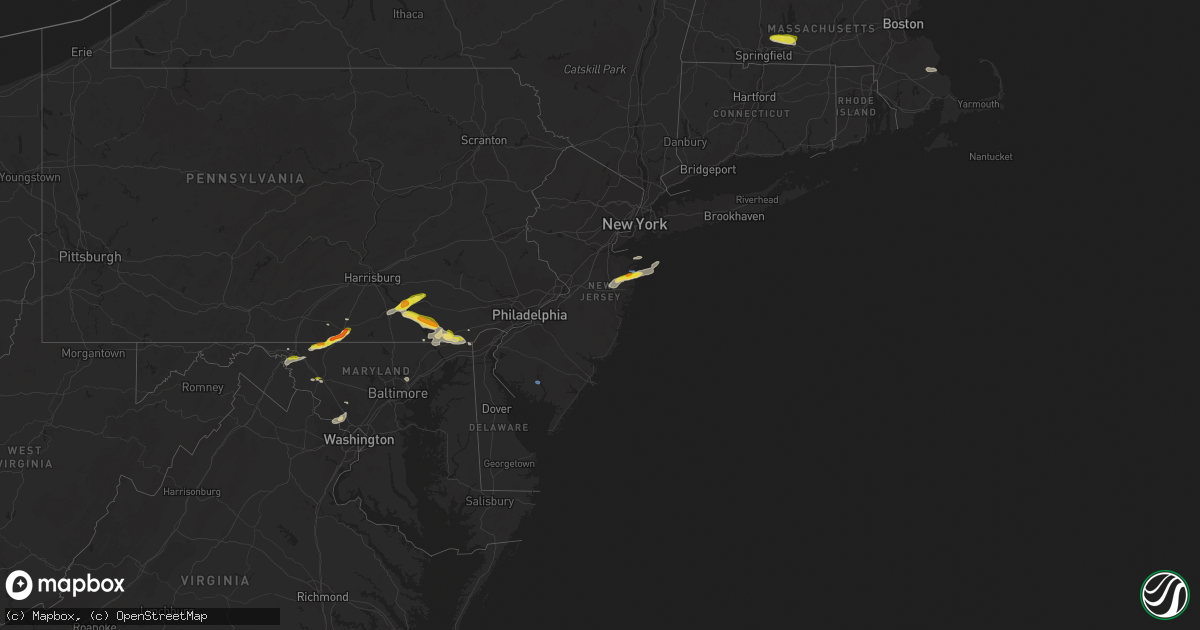
Hail Map in New Jersey on July 2, 2022
Get this storm
July 2 map
$229
one time, instant access
Download today. No call, no setup
Keep the $229
Bought the map and want the full workflow? Apply the entire $229 to a subscription within 7 days. None of it is wasted.
Every map, not just this one
This buys you this map. Subscription and you get every map we run, in the markets you choose from a few cities to whole states to nationwide. Plus real-time alerts the moment a storm fires.
Contact data
Name, contact info, occupancy, even credit band for addresses in the footprint. You go from where it hit to who to call.
Become the source they trust
Unlimited branding weather history reports on demand. You already have the documented answer ready for the property owner, and you are the one who showed up with it.
Property data and RoofTrace estimates
Pull up any address you have got, its value and the exact code rules for that jurisdiction, straight from One Click Code. Then RoofTrace estimates the squares, pitch, and roof value, priced the way you price.
Storm reports in New Jersey
New Jersey
| Date | Description |
|---|---|
| 07/02/20225:26 PM CDT | Pictures on social media of large trees downed in a backyard. Time estimated via radar. |
| 07/02/20225:21 PM CDT | Multiple trees down on brookdale avenue. Time estimated via radar. |
| 07/02/20225:21 PM CDT | Picture via social media. Time estimated via radar. |
| 07/02/20225:20 PM CDT | Trees down on wires. Time estimated via radar. |
| 07/02/20225:20 PM CDT | Picture via social media of ping pong ball sized hail. Time estimated via radar. |
| 07/02/20225:17 PM CDT | Quarter sized hail report by trained spotter. Time estimated via radar. |
| 07/02/20227:53 AM CDT | At 1252 AM EDT, a severe thunderstorm was located near Middletown, moving northeast at 35 mph. HAZARD...60 mph wind gusts and quarter size hail. SOURCE...Radar indicated. IMPACT...Minor hail damage to vehicles is possible. Expect wind damage to trees and power lines. This severe thunderstorm will be near... Goshen around 105 AM EDT. Chester around 110 AM EDT. Montgomery around 125 AM EDT. Walden around 135 AM EDT. Newburgh and New Windsor around 145 AM EDT. |
| 07/02/20223:43 AM CDT | At 843 PM EDT, a severe thunderstorm was located 17 miles southeast of Longport, or 18 miles southeast of Ocean City, moving east at 30 mph. HAZARD...60 mph wind gusts. SOURCE...Automated Surface Observing System. IMPACT...Damage to roofs, siding, trees, and power lines is possible. Locations impacted include... Millville, Ocean City, Cumberland, Somers Point, Laurel Lake, Woodbine, Sea Isle City, Estell Manor, Avalon, Corbin City, Leesburg, Beesleys Point, Seaville, Dennisville, Bricksboro, Strathmere, Eldora, Mauricetown, Belleplain Forest and Port Norris.This includes Garden State Parkway between mile markers 12 and 28. |
| 07/02/20221:05 AM CDT | At 605 PM EDT, a severe thunderstorm was located over Collingwood Park, or 8 miles west of Asbury Park, moving northeast at 35 mph. HAZARD...60 mph wind gusts and quarter size hail. SOURCE...Radar indicated. IMPACT...Minor damage to vehicles is possible. Wind damage to roofs, siding, trees, and power lines is possible. Locations impacted include... Long Branch, Asbury Park, Howell, Tinton Falls, Red Bank, Highlands, Farmingdale, East Freehold, Elberon, Collingwood Park, Lincroft, Navesink, Eatontown, Freehold, West Long Branch, Rumson, Little Silver, Oceanport, Shrewsbury and Interlaken.This includes Garden State Parkway between mile markers 101 and 111. |
| 07/02/202212:54 AM CDT | At 554 PM EDT, a severe thunderstorm was located over Bear, or near Newark, moving southeast at 15 mph. HAZARD...60 mph wind gusts and quarter size hail. SOURCE...Radar indicated. IMPACT...Minor damage to vehicles is possible. Wind damage to roofs, siding, trees, and power lines is possible. Locations impacted include... Pennsville, New Castle, Salem, Alloway, Quinton, Delaware City, Saint Georges, Stanton, Bear, Hancocks Bridge, Port Penn, Wilmington Manor, Hope Creek, Glasgow and Brookside.This includes Interstate 95 in Delaware between mile markers 3 and10. |
| 07/02/202212:34 AM CDT | At 534 PM EDT, a severe thunderstorm was located over Cassville, or 14 miles northwest of Toms River, moving east at 25 mph. HAZARD...60 mph wind gusts and quarter size hail. SOURCE...Radar indicated. IMPACT...Minor damage to vehicles is possible. Wind damage to roofs, siding, trees, and power lines is possible. Locations impacted include... Toms River, Long Branch, Asbury Park, Lakewood, Jackson, Howell, Tinton Falls, Manasquan, Point Pleasant Beach, Lakehurst, Farmingdale, Mantoloking, Allenwood, Six Flags Theme Park, West Freehold, Cassville, Adelphia, Clarksburg, Vista Center and Elberon.This includes the following highways... Interstate 195 in New Jersey between mile markers 12 and 34. Garden State Parkway between mile markers 88 and 106. |
| 07/01/20227:36 PM CDT | Kmiv gusted to 58 mph. |
All States Impacted by Hail Map on July 2, 2022
Cities Impacted by Hail Map on July 2, 2022
- Ellsworth, ME
- Hancock, ME
- Wasta, SD
- Howes, SD
- Frazer, MT
- Peerless, MT
- Larslan, MT
- Wolf Point, MT
- Whitetail, MT
- Sturgis, SD
- Powers Lake, ND
- Stanley, ND
- Fort Pierre, SD
- Brockton, MT
- Decker, MT
- Sheridan, WY
- Waco, KY
- Richmond, KY
- Del Rio, TX
- Cartwright, ND
- Woodburn, KY
- Franklin, KY
- Mulvane, KS
- Clyde, NC
- Wall, SD
- Milesville, SD
- Midland, SD
- Marion, KY
- Fairview, OK
- Hepler, KS
- Uniontown, KS
- Redfield, KS
- Rocksprings, TX
- Granby, MA
- Ludlow, MA
- Bondsville, MA
- West Warren, MA
- Belchertown, MA
- Palmer, MA
- Thorndike, MA
- Ware, MA
- Mcminnville, TN
- Morrison, TN
- Augusta, KS
- Andover, KS
- Rhame, ND
- Ludlow, SD
- Prairie City, SD
- Bison, SD
- Meadow, SD
- Buffalo, SD
- Faith, SD
- Camp Crook, SD
- Mud Butte, SD
- Reva, SD
- Richland, MT
- Huron, SD
- Virgil, SD
- Wolsey, SD
- Alpena, SD
- Glen Rose, TX
- Bowman, ND
- Amidon, ND
- Sentinel Butte, ND
- Reeder, ND
- Hettinger, ND
- Scranton, ND
- Ryder, ND
- Reserve, MT
- Flaxville, MT
- Scobey, MT
- Roundhill, KY
- Brownsville, KY
- Morgantown, KY
- Caneyville, KY
- Cedar Vale, KS
- Adams, OR
- Norwich, KS
- Milton, KS
- Beattyville, KY
- Jackson, KY
- Tyndall, SD
- Avon, SD
- Middletown, MD
- Jefferson, MD
- Heppner, OR
- Honaker, VA
- Spurlockville, WV
- Uvalde, TX
- Canadian, TX
- Chester, OK
- Enid, OK
- Waukomis, OK
- Elkton, MD
- Orrtanna, PA
- Makoti, ND
- El Dorado, KS
- Welch, WV
- Herndon, WV
- Northfork, WV
- Clayton, NM
- Garrison, ND
- Roseglen, ND
- Wibaux, MT
- Broadview, MT
- Ryegate, MT
- Rapelje, MT
- Lynchburg, VA
- Rock Island, TN
- Roanoke, VA
- Burkesville, KY
- Lambert, MT
- Poplar, MT
- Fairview, MT
- Philip, SD
- Spivey, KS
- Harper, KS
- Williamson, WV
- Delbarton, WV
- Lancaster, KY
- Knippa, TX
- Stonefort, IL
- Creal Springs, IL
- New Burnside, IL
- Ozark, IL
- Concord, VA
- Madison Heights, VA
- Spout Spring, VA
- Gaithersburg, MD
- Fredericktown, MO
- Farmington, MO
- Asbury Park, NJ
- Eatontown, NJ
- Deal, NJ
- Howell, NJ
- West Long Branch, NJ
- Freehold, NJ
- Farmingdale, NJ
- Long Branch, NJ
- Oakhurst, NJ
- Neptune, NJ
- Colts Neck, NJ
- Irvine, KY
- Cohagen, MT
- Prairie City, OR
- Pilot Rock, OR
- Pendleton, OR
- Long Creek, OR
- Monument, OR
- La Grande, OR
- Summerville, OR
- Statesville, NC
- Opheim, MT
- Stoddard, WI
- Brownsville, MN
- Chaseburg, WI
- Hokah, MN
- La Crosse, WI
- Brackettville, TX
- New Underwood, SD
- Enning, SD
- Grenola, KS
- Cambridge, KS
- Latham, KS
- Jordan, MT
- Plaza, ND
- Parshall, ND
- White River, SD
- Murdo, SD
- Lemmon, SD
- Springfield, SD
- Vega, TX
- Clothier, WV
- Yolyn, WV
- Turtle Creek, WV
- Jeffrey, WV
- Hewett, WV
- Danville, WV
- Chapmanville, WV
- Alkol, WV
- Rapid City, SD
- Kadoka, SD
- De Smet, SD
- Erwin, SD
- Dalhart, TX
- Dryden, TX
- Manchester, KY
- Balko, OK
- Bend, OR
- Grassy Butte, ND
- Elgin, OR
- Spray, OR
- Fossil, OR
- Carrizo Springs, TX
- Asherton, TX
- Jetson, KY
- Pecks Mill, WV
- Lake, WV
- Martinsburg, WV
- Shepherdstown, WV
- Providence, KY
- Viola, KS
- Goddard, KS
- Clearwater, KS
- Fredonia, KY
- Cleburne, TX
- Joshua, TX
- Alvarado, TX
- Keene, TX
- Alexander, ND
- Sugar City, CO
- Rose Hill, KS
- Campton, KY
- Vancleve, KY
- Dawson Springs, KY
- Madisonville, KY
- Hazel Green, KY
- Mize, KY
- Cannel City, KY
- West Liberty, KY
- Salyersville, KY
- Boss, MO
- Shelby, MT
- Circle, MT
- Fort Peck, MT
- Haines, OR
- Ashland, OR
- Eagle Point, OR
- Newcastle, WY
- Winston Salem, NC
- Long Valley, SD
- Paint Rock, TX
- Sturgis, KY
- Perryton, TX
- Cut Bank, MT
- Belvidere, SD
- Gilchrist, OR
- Axton, VA
- Cheyenne, OK
- Scotland, SD
- Tripp, SD
- Okaton, SD
- Raymond, MT
- Driggs, ID
- Terry, MT
- Lindsay, MT
- Glendive, MT
- Highlands, NJ
- Fountain, CO
- Bevinsville, KY
- Topmost, KY
- Weeksbury, KY
- Kite, KY
- Beaver, KY
- Hi Hat, KY
- McDowell, KY
- Bypro, KY
- Wheelwright, KY
- Melvin, KY
- Wrightsville, PA
- East Petersburg, PA
- Rising Sun, MD
- Drumore, PA
- Landisville, PA
- Conestoga, PA
- York, PA
- Kirkwood, PA
- Red Lion, PA
- Mountville, PA
- Nottingham, PA
- Landenberg, PA
- North East, MD
- Oxford, PA
- Columbia, PA
- Delta, PA
- Holtwood, PA
- Lincoln University, PA
- Felton, PA
- New Providence, PA
- Airville, PA
- Peach Bottom, PA
- Mount Joy, PA
- Windsor, PA
- Pequea, PA
- Washington Boro, PA
- Quarryville, PA
- Marietta, PA
- Manheim, PA
- Conowingo, MD
- Brogue, PA
- Millersville, PA
- Lancaster, PA
- Lititz, PA
- Rockville, MD
- Great Falls, VA
- Potomac, MD
- Corbin, KY
- Sonora, TX
- Hagerstown, MD
- Ozona, TX
- Sabillasville, MD
- Gettysburg, PA
- Emmitsburg, MD
- Thurmont, MD
- Smithsburg, MD
- Cascade, MD
- Littlestown, PA
- Fairfield, PA
- Somerset, TX
- Poteet, TX
- Texhoma, OK
- Stratford, TX
- Oxford, GA
- Covington, GA
- Brockway, MT
- Wellington, KS
- Belle Plaine, KS
- Booneville, KY
- Talent, OR
- Medford, OR
- Amarillo, TX
- Seiling, OK
- Oakwood, OK
- Canton, OK
- Drakesboro, KY
- Rochester, KY
- Beaver Dam, KY
- Belton, KY
- Eureka, KS
- Nottingham, MD
- Glen Arm, MD
- Parkville, MD
- Perry Hall, MD
- Pleasanton, TX
- Salem, MO
- Sabinal, TX
- Concan, TX
- Daniel, WY
- Frederick, MD
- Browder, KY
- Beechmont, KY
- Beech Creek, KY
- Spearman, TX
- La Pryor, TX
- Kiowa, KS
- Alva, OK
- Burlington, OK
- Meally, KY
- Wittensville, KY
- Paintsville, KY
- Williamsport, KY
- Staffordsville, KY
- Van Lear, KY
- Boons Camp, KY
- Sitka, KY
- Thelma, KY
- New Castle, DE
- Bear, DE
- Newark, DE
- Pampa, TX
- Comstock, TX
- Weston, CO
- Arkansas City, KS
- Crystal City, TX
- Kingston, MA
- Plymouth, MA
- Plympton, MA
- Welch, OK
- Hooker, OK
- Springfield, CO
- Boise City, OK
- Felt, OK
- West Grove, PA
- Boonsboro, MD
- Fairplay, MD
- Sharpsburg, MD
- Williamsport, MD
- Mayfield, KS
- Clay, WV
- Summersville, WV
- Presho, SD
- Warren, MA
- Brimfield, MA
- Onida, SD
- La Pine, OR
- Coon Valley, WI
- Caledonia, MN
- Hagerhill, KY
- Debord, KY
- Flatgap, KY
- Pueblo, CO
- Kaylor, SD
- Niobrara, NE
- Meacham, OR
- Jacksonville, OR
- Phoenix, OR
- Willow Street, PA
- Oceanport, NJ
- Fort Monmouth, NJ
- Millville, NJ
- Edgemont, SD
- Hot Springs, SD
- Hill City, SD
- Oral, SD
- Pine Ridge, SD
- Smithwick, SD
- Panhandle, TX
- Idaho Falls, ID
- Dubois, ID
- Monteview, ID
- Saint Anthony, ID
- Terreton, ID
- Hamer, ID
- Blackfoot, ID
- Spencer, ID
- Moore, ID
- Arco, ID
- Plentywood, MT
- Redstone, MT
- Culbertson, MT
- Sidney, MT
- Kevin, MT
- Columbus, ND
- Noonan, ND
- Lignite, ND
- Crosby, ND
- Golva, ND
- Beach, ND
- New England, ND
- Center, ND
- Stanton, ND
- Washburn, ND
- Underwood, ND
- Hazen, ND
- Bismarck, ND
- Mandan, ND
- New Salem, ND
- Glen Ullin, ND
- Beulah, ND


