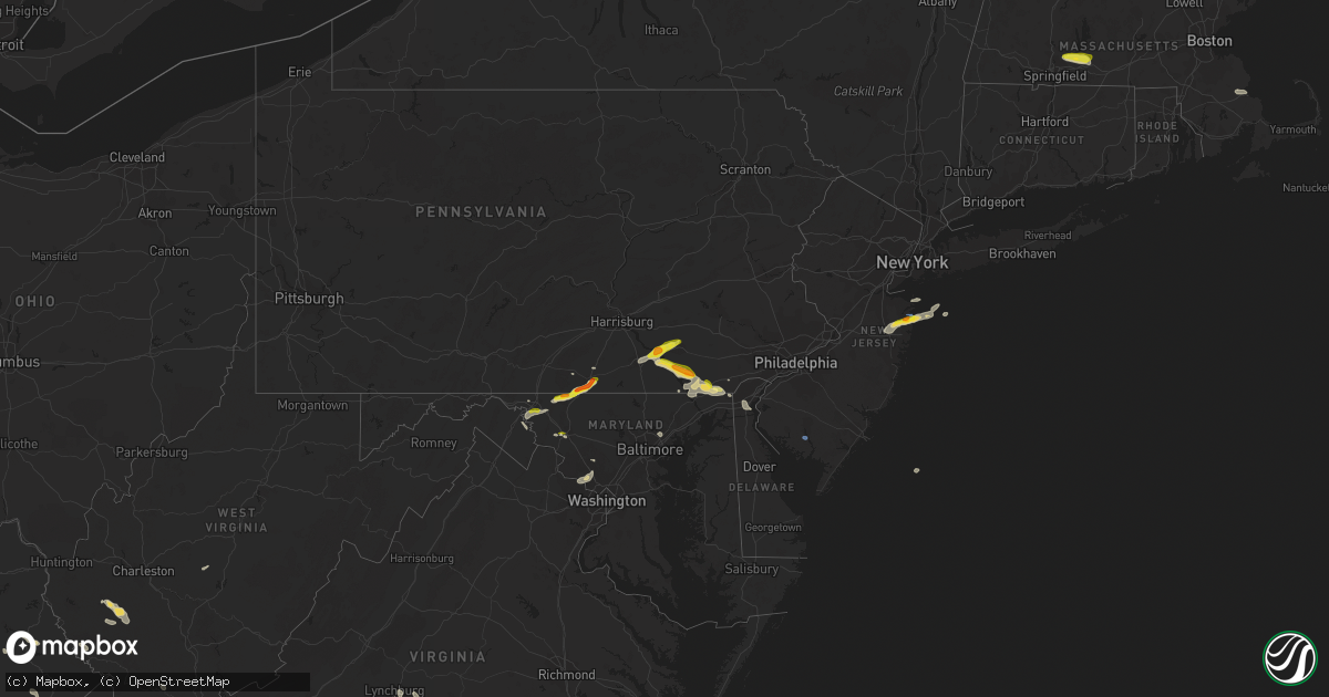
Hail Map on July 2, 2022
Get this storm
July 2 map
$229
one time, instant access
Download today. No call, no setup
Keep the $229
Bought the map and want the full workflow? Apply the entire $229 to a subscription within 7 days. None of it is wasted.
Every map, not just this one
This buys you this map. Subscription and you get every map we run, in the markets you choose from a few cities to whole states to nationwide. Plus real-time alerts the moment a storm fires.
Contact data
Name, contact info, occupancy, even credit band for addresses in the footprint. You go from where it hit to who to call.
Become the source they trust
Unlimited branding weather history reports on demand. You already have the documented answer ready for the property owner, and you are the one who showed up with it.
Property data and RoofTrace estimates
Pull up any address you have got, its value and the exact code rules for that jurisdiction, straight from One Click Code. Then RoofTrace estimates the squares, pitch, and roof value, priced the way you price.
States Impacted by Hail Map on July 2, 2022
Storm reports
Pennsylvania
| Date | Description |
|---|---|
| 07/02/20225:34 PM CDT | Trees fell onto a house... Pulling the power lines down and causing a propane tank to leak. |
| 07/02/20225:31 PM CDT | Trees and wires down along northridge drive. |
| 07/02/20225:31 PM CDT | Quarter sized hail in salunga landisville. |
| 07/02/20225:24 PM CDT | Trees down on a church on iron bridge rd near kinderhook rd. Tree down on a shed and a truck. |
| 07/02/20225:18 PM CDT | Report from mping: quarter |
| 07/02/20225:15 PM CDT | A local report indicates 1.00 inch wind near WRIGHTSVILLE |
| 07/02/20225:15 PM CDT | Trees and wires down along east front street. |
| 07/02/20225:15 PM CDT | Trees blown on to seven houses in wrightsville. No injuries. |
| 07/02/20224:05 PM CDT | Report from mping: quarter |
| 07/02/20223:51 PM CDT | Trees down on wires along route 134. |
| 07/02/20223:50 PM CDT | Trees down on wires along knight road. |
| 07/02/20223:50 PM CDT | Partial to total removal of roofs on two barns and collapse of an outbuilding on the 700 block of solomon rd. |
| 07/02/20223:36 PM CDT | Trees down on wires on boyle road near middle creek road. |
| 07/02/20223:35 PM CDT | Nickel to quarter size hail just north of the md line on boyle rd. |
| 07/02/20223:20 PM CDT | Multiple trees down along route 1 near oxford. Time estimated via radar. |
| 07/02/20223:16 PM CDT | Trees downed on wires. Time estimated via radar. |
| 07/02/20222:43 PM CDT | Quarter to ping pong ball size hail in east drumore twp. |
| 07/02/20222:40 PM CDT | Trees down on wires. |
| 07/02/20227:43 AM CDT | At 1243 AM EDT, severe thunderstorms were located along a line extending from Muncy Valley to Biggertown to Lairdsville to Hughesville, moving east at 25 mph. HAZARD...60 mph wind gusts and penny size hail. SOURCE...Radar indicated. IMPACT...Expect damage to roofs, siding, and trees. Locations impacted include... Jamison City, Waller, Biggertown, Lairdsville, Ricketts Glen State Park, Central, Muncy Valley and Benton. |
| 07/02/20227:25 AM CDT | At 1225 AM EDT, a severe thunderstorm was located over Mackeyville, moving east at 30 mph. HAZARD...60 mph wind gusts. SOURCE...Radar indicated. IMPACT...Expect damage to roofs, siding, and trees. Locations impacted include... Williamsport, Lock Haven, Mifflinburg, Carroll, Woodward, Lamar, Mill Hall, Dunnstown, Flemington, Duboistown, Castanea and Millheim.For those driving on Interstate 80, this includes areas between theBellefonte and Lewisburg-Williamsport exits, specifically from milemarkers 170 to 201.This includes Interstate 180 near mile marker 29. |
| 07/02/20227:05 AM CDT | At 1204 AM EDT, a severe thunderstorm was located over Milesburg, moving east at 40 mph. HAZARD...60 mph wind gusts. SOURCE...Radar indicated. IMPACT...Expect damage to roofs, siding, and trees. Locations impacted include... Bellefonte, Pleasant Gap, Zion, Centre Hall, Milesburg, Blanchard, Spring Mills, Madisonburg, Julian, Bald Eagle State Park, Howard and Beech Creek.For those driving on Interstate 80, this includes areas between theSnow Shoe and Lamar exits, specifically from mile markers 150 to 170.This includes Interstate 99 from mile markers 75 to 85. |
| 07/02/20221:09 AM CDT | At 609 PM EDT, a severe thunderstorm was located over Hallam, moving east at 30 mph. HAZARD...60 mph wind gusts and quarter size hail. SOURCE...Radar indicated. IMPACT...Hail damage to vehicles is expected. Expect wind damage to roofs, siding, and trees. Locations impacted include... Lancaster, Ephrata, Columbia, Lititz, Millersville, Willow Street, Mount Joy, New Holland, East Petersburg, Akron, Leola and Stonybrook-Wilshire.This includes The Pennsylvania Turnpike from mile markers 289 to 295. |
| 07/01/202211:33 PM CDT | At 432 PM EDT, a severe thunderstorm was located over Emmitsburg, moving northeast at 25 mph. HAZARD...60 mph wind gusts and quarter size hail. SOURCE...Radar indicated. IMPACT...Hail damage to vehicles is expected. Expect wind damage to roofs, siding, and trees. Locations impacted include... Hanover, Gettysburg, Hampton, Littlestown, Carroll Valley, McSherrystown, Bonneauville, New Oxford, East Berlin, Lake Heritage, Orrtanna and Abbottstown. |
| 07/01/202210:07 PM CDT | At 306 PM EDT, a severe thunderstorm was located over Safe Harbor, moving east at 25 mph. HAZARD...60 mph wind gusts and quarter size hail. SOURCE...Radar indicated. IMPACT...Hail damage to vehicles is expected. Expect wind damage to roofs, siding, and trees. Locations impacted include... Lancaster, Columbia, Millersville, Willow Street, Paradise, Strasburg, Mountville, Quarryville, Gap, Brogue, Smithville and Shenks Ferry. |
Wyoming
| Date | Description |
|---|---|
| 07/02/20225:08 PM CDT | Asos station krks rock springs airport. |
| 07/01/20229:48 PM CDT | Asos station krks rock springs airport. |
West Virginia
| Date | Description |
|---|---|
| 07/02/20224:10 PM CDT | Large tree branches down in bedington. |
| 07/02/20223:15 PM CDT | Corrects time of previous tstm wnd dmg report from 8 s madison. Trees reported down on route 17 near county line. Time estimated from radar. |
| 07/02/20223:08 PM CDT | Trees reported down on route 17 near county line. Time estimated from radar. |
| 07/02/20223:05 PM CDT | Trees down on meadow fork road. Time estimated from radar. |
| 07/02/20222:57 PM CDT | Trees down on six mile road. Time estimated from radar. |
| 07/02/202212:46 PM CDT | A few trees down. Time estimated from radar. |
| 07/02/202212:06 PM CDT | 2 trees down. Time estimated from radar. |
| 07/02/202212:32 AM CDT | At 532 PM EDT, a severe thunderstorm was located over Shepherdstown, moving southeast at 25 mph. HAZARD...60 mph wind gusts and quarter size hail. SOURCE...Radar indicated. IMPACT...Damaging winds will cause some trees and large branches to fall. This could injure those outdoors, as well as damage homes and vehicles. Roadways may become blocked by downed trees. Localized power outages are possible. Unsecured light objects may become projectiles. Locations impacted include... Shepherdstown, Brunswick, Braddock Heights, Jefferson, Keedysville, Sharpsburg, Rosemont, Rohrersville, Burkittsville, Gapland, Brownsville, Antietam, Arnoldtown, Moler Crossroads, Knoxville, Petersville and Middletown In Frederick Md. |
| 07/01/202211:45 PM CDT | At 444 PM EDT, a cluster of severe thunderstorms was located near Bald Knob, or 15 miles east of Logan, moving southeast at 35 mph. HAZARD...60 mph wind gusts and quarter size hail. SOURCE...Radar indicated. IMPACT...Hail damage to vehicles is expected. Expect wind damage to roofs, siding, and trees. Locations impacted include... Logan, Chief Logan State, Van, Amherstdale-Robinette, Mount Gay-Shamrock, Wharton, Bald Knob, Holden, Whitesville, West Logan, Mitchell Heights, Mount Gay, Verdunville, Naoma, Switzer, Arnett, Stickney, Blair, Amherstdale-Robine and Sharples.This includes Route 119 between mile markers 23 and 29, and betweenmile markers 41 and 46. |
| 07/01/202211:11 PM CDT | At 408 PM EDT, a severe thunderstorm was located over Van, or 8 miles southeast of Madison, moving southeast at 35 mph. HAZARD...60 mph wind gusts and quarter size hail. SOURCE...Radar indicated. IMPACT...Hail damage to vehicles is expected. Expect wind damage to roofs, siding, and trees. Locations impacted include... Logan, Chief Logan State, Van, Wharton, Bald Knob, Amherstdale-Robinette, Mount Gay-Shamrock, West Logan, Mitchell Heights, Naoma, Arnett, Stickney, Blair, Sharples, Jeffrey, Prenter and Amherstdale-Robine.This includes Route 119 near mile marker 33, and between mile markers41 and 45. |
| 07/01/202210:40 PM CDT | At 339 PM EDT, a severe thunderstorm was located near Madison, moving southeast at 20 mph. HAZARD...60 mph wind gusts and quarter size hail. SOURCE...Radar indicated. IMPACT...Hail damage to vehicles is expected. Expect wind damage to roofs, siding, and trees. Locations impacted include... Madison, Danville, Foster, Turtle Creek, Mud and Jeffrey. This includes Route 119 between mile markers 40 and 55. |
Wisconsin
| Date | Description |
|---|---|
| 07/01/20229:18 PM CDT | At 218 PM CDT, a severe thunderstorm was located near Stoddard, or 8 miles southeast of La Crosse, moving east at 40 mph. HAZARD...Quarter size hail. SOURCE...Radar indicated. IMPACT...Damage to vehicles is expected. This severe thunderstorm will be near... Coon Valley around 225 PM CDT. Westby around 240 PM CDT. Cashton around 245 PM CDT.Other locations impacted by this severe thunderstorm include Mount LaCrosse, County Roads G And H, Brinkman Ridge, Jersey Valley CountyPark, St Marys, Portland and South Side Of La Crosse. |
Oregon
| Date | Description |
|---|---|
| 07/02/20225:05 PM CDT | Indian lake campground. Time estimated from radar. Social media report. |
| 07/02/20222:49 AM CDT | At 748 PM PDT, a severe thunderstorm was located near Hilgard, or 12 miles west of La Grande, moving northeast at 30 mph. HAZARD...60 mph wind gusts and quarter size hail. SOURCE...Radar indicated. IMPACT...Hail damage to vehicles is expected. Expect wind damage to roofs, siding, and trees. Locations impacted include... La Grande, Elgin, Island City, Imbler, Summerville, Kamela, Hilgard and Starkey. |
| 07/02/20222:34 AM CDT | At 733 PM PDT, a severe thunderstorm was located 11 miles south of Rieth, or 12 miles southwest of Pendleton, moving northeast at 30 mph. HAZARD...70 mph wind gusts and half dollar size hail. SOURCE...Radar indicated. IMPACT...Hail damage to vehicles is expected. Expect considerable tree damage. Wind damage is also likely to mobile homes, roofs, and outbuildings. Locations impacted include... Pendleton, Athena, Adams, Helix, Holdman, Rieth, Mission and northwestern Umatilla Reservation. |
| 07/02/20222:22 AM CDT | At 722 PM PDT, a severe thunderstorm was located near Medford, moving north at 20 mph. HAZARD...Quarter size hail. SOURCE...Radar indicated. IMPACT...Damage to vehicles is expected. Locations impacted include... Medford, Central Point, Eagle Point, Lower Table Rock Trailhead, Touvelle State Park, Agate Reservoir, Roxy Ann Peak, White City, Upper Table Rock Trailhead and Phoenix. |
| 07/02/20222:10 AM CDT | At 708 PM PDT, a severe thunderstorm was located near Dale, or 38 miles southwest of Meacham, moving northeast at 20 mph. HAZARD...60 mph wind gusts and half dollar size hail. SOURCE...Radar indicated. IMPACT...Hail damage to vehicles is expected. Expect wind damage to roofs, siding, and trees. Locations impacted include... Lehman Hot Springs and Starkey. |
| 07/02/20222:00 AM CDT | At 700 PM PDT, a severe thunderstorm was located 12 miles northwest of Ukiah, or 23 miles east of Heppner, moving northeast at 20 mph. HAZARD...60 mph wind gusts and quarter size hail. SOURCE...Radar indicated. IMPACT...Hail damage to vehicles is expected. Expect wind damage to roofs, siding, and trees. Locations impacted include... Southwestern Umatilla Reservation. |
| 07/02/20221:18 AM CDT | At 618 PM PDT, a severe thunderstorm was located near Ritter, or 32 miles northwest of John Day, moving northeast at 35 mph. HAZARD...60 mph wind gusts and half dollar size hail. SOURCE...Radar indicated. IMPACT...Hail damage to vehicles is expected. Expect wind damage to roofs, siding, and trees. Locations impacted include... Lehman Hot Springs, Dale and Ritter. |
| 07/02/20221:01 AM CDT | At 559 PM PDT, a severe thunderstorm was located 7 miles east of Roxy Ann Peak, or 9 miles north of Ashland, moving north at 15 mph. HAZARD...Quarter size hail. SOURCE...Radar indicated. IMPACT...Damage to vehicles is expected. This severe thunderstorm will remain over mainly rural areas of central Jackson County. |
| 07/02/20221:00 AM CDT | At 559 PM PDT, a severe thunderstorm was located 10 miles southeast of Hardman, or 18 miles south of Heppner, moving northeast at 25 mph. HAZARD...60 mph wind gusts and half dollar size hail. SOURCE...Radar indicated. IMPACT...Hail damage to vehicles is expected. Expect wind damage to roofs, siding, and trees. Locations impacted include... Ukiah. |
| 07/01/202210:41 PM CDT | Destroyed garden. Dents in car. Time estimated from radar. Social media report. |
| 07/01/202210:40 PM CDT | A local report indicates 1.75 inch wind near SUMMERVILLE |
| 07/01/202210:15 PM CDT | At 315 PM PDT, a severe thunderstorm was located near Umatilla Reservation, or near Meacham, moving north at 25 mph. HAZARD...60 mph wind gusts and half dollar size hail. SOURCE...Radar indicated. IMPACT...Hail damage to vehicles is expected. Expect wind damage to roofs, siding, and trees. Locations impacted include... Pendleton, Meacham, Thorn Hollow, Kamela, Cayuse, Umatilla Reservation, Bingham Springs, Mission and Gibbon. |
| 07/01/202210:08 PM CDT | Greg roberts reported a tree blown down at the entrance to bear creek park in medford. It was 8-10 inches in diameter. |
| 07/01/20229:40 PM CDT | Power outages. |
| 07/01/20229:35 PM CDT | At 235 PM PDT, a severe thunderstorm was located over Haines, or 8 miles southwest of North Powder, moving northeast at 15 mph. HAZARD...Quarter size hail. Winds 40 mph or greater. SOURCE...Radar indicated. IMPACT...Damage to vehicles is expected. Locations impacted include... North Powder, Haines and Thief Valley Reservoir. |
| 07/01/20229:26 PM CDT | At 226 PM PDT, a severe thunderstorm was located over Starkey, or 19 miles southwest of La Grande, moving north at 30 mph. HAZARD...60 mph wind gusts and half dollar size hail. SOURCE...Radar indicated. IMPACT...Hail damage to vehicles is expected. Expect wind damage to roofs, siding, and trees. Locations impacted include... La Grande, Hilgard, Lehman Hot Springs, Starkey, Kamela and southern Umatilla Reservation. |
| 07/01/20229:01 PM CDT | A local report indicates 1.00 inch wind near 1 E DALE |
| 07/01/20229:00 PM CDT | Ping pong ball size hail near drift fence camp ground. |
| 07/01/20228:25 PM CDT | Social media report |
| 07/01/20227:45 PM CDT | Social media report. |
| 07/01/20227:45 PM CDT | Power outages affecting ten thousand. Franklin underpass flooding. |
| 07/01/20227:20 PM CDT | Time estimated from radar. |
Maine
| Date | Description |
|---|---|
| 07/02/20223:27 PM CDT | Photo showing hail of at least quarter size. Time estimated from radar. |
| 07/01/202211:25 PM CDT | At 425 PM EDT, a severe thunderstorm was located 8 miles southeast of Ellsworth, moving east at 30 mph. HAZARD...60 mph wind gusts and quarter size hail. SOURCE...Radar indicated. IMPACT...Minor hail damage to vehicles is possible. Expect wind damage to trees and power lines. Locations impacted include... Ellsworth, Bar Harbor, Cherryfield, Steuben, Millbridge, Hancock, Franklin, Gouldsboro, Lamoine, Trenton, Surry, Addison, Sullivan, Winter Harbor, Waltham and Sorrento. |
| 07/01/202210:41 PM CDT | At 341 PM EDT, a severe thunderstorm was located over Bucksport, moving east at 45 mph. HAZARD...60 mph wind gusts and quarter size hail. SOURCE...Radar indicated. IMPACT...Minor hail damage to vehicles is possible. Expect wind damage to trees and power lines. Locations impacted include... Ellsworth, Bucksport, Blue Hill, Cherryfield, Brewer, Dedham, Steuben, Verona Island, Deblois, Penobscot Township, Hancock, Franklin, Orrington, Holden, Orland, Eddington, Gouldsboro, Lamoine, Trenton and Surry. |
Georgia
| Date | Description |
|---|---|
| 07/02/20226:20 PM CDT | Tree down at hagood cir ne and roswell st ne |
| 07/02/20222:44 PM CDT | 5 trees down along jim wallace ln with some across roadway. |
| 07/02/20223:03 AM CDT | At 803 PM EDT, a severe thunderstorm was located over Lowery, or 10 miles west of Soperton, moving east at 10 mph. HAZARD...60 mph wind gusts. SOURCE...Radar indicated. IMPACT...Expect damage to roofs, siding, and trees. Locations impacted include... Soperton, Orland, Rockledge, Lowery, Barnhill and Lothair. |
| 07/02/20222:01 AM CDT | At 701 PM EDT, a severe thunderstorm was located over White Water Park, or near Marietta, and is nearly stationary. HAZARD...60 mph wind gusts. SOURCE...Radar indicated. IMPACT...Expect damage to roofs, siding, and trees. Locations impacted include... Marietta, Smyrna, Fair Oaks, Mount Bethel, White Water Park, Sandy Plains and Dobbins Air Reserve Base. |
| 07/01/20227:12 PM CDT | 3 trees down at baker church rd and jj club rd |
| 07/01/20227:00 PM CDT | 3 trees down at baker church rd and jj club rd |
Connecticut
| Date | Description |
|---|---|
| 07/02/20224:30 PM CDT | Two trees downed near litchfield |
| 07/02/202212:39 AM CDT | At 536 PM EDT, a severe thunderstorm was located near Thomaston, or 9 miles northwest of Wolcott, moving southeast at 40 mph. HAZARD...60 mph wind gusts and nickel size hail. SOURCE...Radar indicated. IMPACT...Expect damage to trees and power lines. Locations impacted include... New Britain, Bristol, Southington, Berlin and Plainville. |
| 07/01/202210:21 PM CDT | At 321 AM EDT, a severe thunderstorm was located over Mansfield, moving northeast at 55 mph. HAZARD...60 mph wind gusts and quarter size hail. SOURCE...Radar indicated. IMPACT...Expect wind damage to trees and power lines. Minor hail damage to vehicles is possible. Locations impacted include... Providence, Cranston, Pawtucket, East Providence, Woonsocket, Cumberland, North Providence, Johnston, North Attleborough, Mansfield, Windham, Plainfield, Attleboro, Smithfield, Lincoln, Central Falls, Grafton, Willimantic, Killingly and Webster. |
Florida
| Date | Description |
|---|---|
| 07/02/20221:34 AM CDT | At 634 PM EDT, a severe thunderstorm was located over Fargo, moving southeast at 10 mph. HAZARD...60 mph wind gusts. SOURCE...Radar indicated. IMPACT...Expect damage to roofs, siding, and trees. Locations impacted include... Fargo. |
South Dakota
| Date | Description |
|---|---|
| 07/02/20224:40 PM CDT | A local report indicates 1.00 inch wind near 3 WNW DWTN RAPID CITY |
| 07/02/20224:35 PM CDT | A local report indicates 1.00 inch wind near 2 WNW DWTN RAPID CITY |
| 07/02/20225:42 AM CDT | At 1042 PM MDT, a severe thunderstorm was located 11 miles east of Maurine, or 17 miles west of Faith, moving southeast at 25 mph. HAZARD...70 mph wind gusts and half dollar size hail. SOURCE...Radar indicated. IMPACT...Hail damage to vehicles is expected. Expect considerable tree damage. Wind damage is also likely to mobile homes, roofs, and outbuildings. Locations impacted include... Faith and Durkee Lake. |
| 07/02/20224:41 AM CDT | At 941 PM MDT, a severe thunderstorm was located 6 miles southwest of Date, or 40 miles northwest of Faith, moving southeast at 35 mph. HAZARD...60 mph wind gusts and quarter size hail. SOURCE...Radar indicated. IMPACT...Hail damage to vehicles is expected. Expect wind damage to roofs, siding, and trees. This severe thunderstorm will be near... Date around 945 PM MDT. |
| 07/02/20223:54 AM CDT | At 854 PM MDT, a severe thunderstorm was located near Scenic, or 38 miles southeast of Rapid City, moving east at 40 mph. HAZARD...60 mph wind gusts and quarter size hail. SOURCE...Radar indicated. IMPACT...Hail damage to vehicles is expected. Expect wind damage to roofs, siding, and trees. Locations impacted include... northeastern Badlands National Park, Pinnacles Ranger Station, Quinn, Delta 9 Missile Silo, Delta 1 Launch Facility, Cactus Flat, Minuteman Missile Visitors Center and Cottonwood.This includes Interstate 90 in South Dakota between Mile Markers 103and 138. |
| 07/02/20223:46 AM CDT | At 845 PM MDT, a severe thunderstorm was located 7 miles northwest of Slim Buttes, or 13 miles east of Buffalo, moving southeast at 30 mph. HAZARD...60 mph wind gusts and quarter size hail. SOURCE...Radar indicated. IMPACT...Hail damage to vehicles is expected. Expect wind damage to roofs, siding, and trees. This severe thunderstorm will be near... Reva around 900 PM MDT.Other locations in the path of this severe thunderstorm includeSorum. |
| 07/02/20223:39 AM CDT | At 839 PM MDT, a severe thunderstorm was located 7 miles east of Reeder, or 12 miles northwest of Hettinger, moving southeast at 50 mph. HAZARD...70 mph wind gusts and half dollar size hail. SOURCE...Radar indicated. IMPACT...Hail damage to vehicles is expected. Expect considerable tree damage. Wind damage is also likely to mobile homes, roofs, and outbuildings. This severe thunderstorm will be near... Hettinger around 855 PM MDT.Other locations in the path of this severe thunderstorm includeHaynes and White Butte. |
| 07/02/20223:12 AM CDT | At 811 PM CDT, a severe thunderstorm was located near Santee, or 7 miles south of Tyndall, moving south at 20 mph. HAZARD...60 mph wind gusts and half dollar size hail. SOURCE...Radar indicated. IMPACT...Hail damage to vehicles is expected. Expect wind damage to roofs, siding, and trees. This severe thunderstorm will be near... Santee around 820 PM CDT. |
| 07/02/20223:07 AM CDT | At 807 PM CDT, a severe thunderstorm was located near Tyndall, moving south at 25 mph. HAZARD...60 mph wind gusts and half dollar size hail. SOURCE...Radar indicated. IMPACT...Hail damage to vehicles is expected. Expect wind damage to roofs, siding, and trees. Locations impacted include... Springfield. |
| 07/02/20222:41 AM CDT | At 741 PM CDT, a severe thunderstorm was located near Tyndall, moving south at 15 mph. HAZARD...60 mph wind gusts and half dollar size hail. SOURCE...Radar indicated. IMPACT...Hail damage to vehicles is expected. Expect wind damage to roofs, siding, and trees. This severe thunderstorm will be near... Tyndall around 800 PM CDT.Other locations in the path of this severe thunderstorm includeTabor. |
| 07/02/20222:11 AM CDT | At 710 PM CDT, a severe thunderstorm was located over Kaylor, or 11 miles north of Tyndall, moving southeast at 15 mph. HAZARD...60 mph wind gusts and quarter size hail. SOURCE...Radar indicated. IMPACT...Hail damage to vehicles is expected. Expect wind damage to roofs, siding, and trees. This severe thunderstorm will be near... Scotland around 725 PM CDT.Other locations in the path of this severe thunderstorm includeTyndall. |
| 07/02/20221:35 AM CDT | At 635 PM MDT, severe thunderstorms were located along a line extending from 7 miles west of Newcastle to 8 miles northwest of Dewey to 7 miles west of Mule Creek Junction, moving east at 35 mph. HAZARD...60 mph wind gusts and quarter size hail. SOURCE...Radar indicated. IMPACT...Hail damage to vehicles is expected. Expect wind damage to roofs, siding, and trees. Severe thunderstorms will be near... Dewey and Elk Mountain Lookout around 645 PM MDT.Other locations in the path of these severe thunderstorms includeBurdock and Argyle. |
| 07/02/20221:21 AM CDT | At 620 PM MDT, a severe thunderstorm was located 7 miles south of Upton, or 22 miles northwest of Newcastle, moving northeast at 55 mph. HAZARD...60 mph wind gusts. SOURCE...Radar indicated. IMPACT...Expect damage to roofs, siding, and trees. This severe thunderstorm will be near... Osage around 630 PM MDT.Other locations in the path of this severe thunderstorm includeBuckhorn, Four Corners, Mallo Camp, O'Neil Pass, Crooks Tower, BlackFox Campground, Cheyenne Crossing, Terry Peak, Lead, Deadwood andCentral City.This includes Interstate 90 in South Dakota between Mile Markers 8and 15. |
| 07/02/20221:13 AM CDT | Personal weather station. |
| 07/02/20221:05 AM CDT | Asos station kpir pierre muni ap. |
| 07/02/20221:03 AM CDT | Uprooted tree... Relayed via social media with a photo. Time estimated from radar. |
| 07/02/202212:58 AM CDT | Asos station kpir pierre muni ap. |
| 07/01/202211:03 PM CDT | A local report indicates 62 MPH wind near 4 E CACTUS FLAT |
| 07/01/202210:39 PM CDT | At 339 PM MDT, a severe thunderstorm was located over Rapid City, moving east at 15 mph. HAZARD...60 mph wind gusts and quarter size hail. SOURCE...Radar indicated. IMPACT...Hail damage to vehicles is expected. Expect wind damage to roofs, siding, and trees. This severe thunderstorm will be near... Rapid City around 345 PM MDT. Rapid Valley around 355 PM MDT.Other locations in the path of this severe thunderstorm includesoutheastern Ellsworth Air Force Base, Hart Ranch, southern BoxElder, Black Gap, Rapid City Airport and Caputa.This includes Interstate 90 in South Dakota between Mile Markers 54and 74. |
| 07/01/202210:15 PM CDT | A local report indicates 70 MPH wind near 4 SSW REVA |
| 07/01/202210:15 PM CDT | A local report indicates 1.00 inch wind near 4 SSW REVA |
| 07/01/20229:27 PM CDT | A local report indicates 61 MPH wind near 12 E OELRICHS |
| 07/01/20229:20 PM CDT | A local report indicates 70 MPH wind near 8 E SMITHWICK |
| 07/01/20228:35 PM CDT | A local report indicates 1.00 inch wind near 2 NW SPRINGFIELD |
| 07/01/20228:29 PM CDT | A local report indicates 67 MPH wind near 11 W HOT SPRINGS |
| 07/01/20228:24 PM CDT | A local report indicates 60 MPH wind near 11 W HOT SPRINGS |
| 07/01/20227:18 PM CDT | A local report indicates 1.25 inch wind near 6 SE TRIPP |
Colorado
| Date | Description |
|---|---|
| 07/02/20225:21 PM CDT | A local report indicates 65 MPH wind near 1 N PINON |
| 07/02/20225:14 PM CDT | A local report indicates 60 MPH wind near 4 WSW PINON |
| 07/02/20224:37 AM CDT | At 937 PM MDT, a severe thunderstorm was located near Cheraw, or 12 miles north of La Junta, moving northwest at 15 mph. HAZARD...60 mph wind gusts and half dollar size hail. SOURCE...Radar indicated. IMPACT...Hail damage to vehicles is expected. Expect wind damage to roofs, siding, and trees. Locations impacted include... Sugar City. |
| 07/02/20223:12 AM CDT | At 811 PM MDT, a severe thunderstorm was located 12 miles north of Pritchett, or 13 miles northwest of Springfield, moving west at 10 mph. HAZARD...60 mph wind gusts and quarter size hail. SOURCE...Radar indicated. IMPACT...Hail damage to vehicles is expected. Expect wind damage to roofs, siding, and trees. This severe thunderstorm will remain over mainly rural areas of northwestern Baca and southeastern Bent Counties. |
| 07/01/202210:58 PM CDT | At 357 PM MDT, a severe thunderstorm was located near Pinon, or 15 miles north of Pueblo, moving south at 10 mph. HAZARD...60 mph wind gusts and nickel size hail. SOURCE...Radar indicated. IMPACT...Expect damage to roofs, siding, and trees. Locations impacted include... Northern Pueblo, Pinon and Pueblo West. |
North Carolina
| Date | Description |
|---|---|
| 07/02/20226:39 PM CDT | Several trees down along us 601 heading north towards mt airy. |
| 07/02/20223:34 AM CDT | At 834 PM EDT, a severe thunderstorm was located 7 miles northeast of Statesville, moving southeast at 10 mph. HAZARD...60 mph wind gusts and quarter size hail. SOURCE...Radar indicated. IMPACT...Minor hail damage to vehicles is expected. Expect wind damage to trees and power lines. Locations impacted include... Statesville, Cooleemee, Turnersburg, Cool Springs, Cleveland and Olin. |
| 07/02/20223:20 AM CDT | At 819 PM EDT, a severe thunderstorm was located over Winston-Salem, drifting southeast at 10 mph. HAZARD...60 mph wind gusts. SOURCE...Radar indicated. IMPACT...Expect damage to roofs, siding, and trees. Locations impacted include... Winston-Salem, Kernersville, Lewisville, Walkertown, Rural Hall, Pfafftown, Stanleyville and Sedge Garden. |
| 07/02/20222:28 AM CDT | At 727 PM EDT, severe thunderstorms were located along a line extending from near White Plains to near Dockery, moving southeast at 15 mph. HAZARD...60 mph wind gusts and quarter size hail. SOURCE...Radar indicated. IMPACT...Hail damage to vehicles is expected. Expect wind damage to roofs, siding, and trees. Locations impacted include... Mount Airy... Elkin... Fairview... Flat Rock... Yadkinville... Jonesville... and Dobson. |
| 07/02/202212:46 AM CDT | At 546 PM EDT, a severe thunderstorm was located 6 miles northeast of Waynesville, or near Clyde, moving south at 10 mph. HAZARD...60 mph wind gusts and quarter size hail. SOURCE...Radar indicated. IMPACT...Minor hail damage to vehicles is expected. Expect wind damage to trees and power lines. Locations impacted include... Waynesville, Canton, Lake Junaluska, Clyde, Cove Creek, Cruso, Sunburst, B.R. Parkway-Balsam Gap To Black Balsam Area and Maggie Valley. |
| 07/01/20228:11 PM CDT | Multiple trees were reported down on hwy 421. |
| 07/01/20227:45 PM CDT | Tree down in roadway on providence church road and rideout way. |
Delaware
| Date | Description |
|---|---|
| 07/02/20225:23 AM CDT | At 1023 PM EDT, a severe thunderstorm was located over Starr, or near Centerville, moving east at 30 mph. HAZARD...60 mph wind gusts. SOURCE...Radar indicated. IMPACT...Damage to roofs, siding, trees, and power lines is possible. Locations impacted include... Centerville, Milford, Denton, Centreville, Harrington, Greensboro, Oakland, Ridgely, Ellendale, Bowers, Goldsboro, Queen Anne, Viola, Starr, Jumptown, Sandtown, Andrewsville, Wye Mills, Big Stone Beach and Carville. |
| 07/02/20224:13 AM CDT | At 913 PM EDT, a severe thunderstorm was located near Cecilton, or 11 miles west of Middletown, moving southeast at 15 mph. HAZARD...60 mph wind gusts and quarter size hail. SOURCE...Radar indicated. IMPACT...Damaging winds will cause some trees and large branches to fall. This could injure those outdoors, as well as damage homes and vehicles. Roadways may become blocked by downed trees. Localized power outages are possible. Unsecured light objects may become projectiles. Locations impacted include... Cecilton, Warwick, Bohemias Mills and Cayots. |
| 07/01/202211:19 PM CDT | At 418 PM EDT, a severe thunderstorm was located over Lombard, or 11 miles west of Newark, moving southeast at 40 mph. HAZARD...60 mph wind gusts and quarter size hail. SOURCE...Radar indicated. IMPACT...Damaging winds will cause some trees and large branches to fall. This could injure those outdoors, as well as damage homes and vehicles. Roadways may become blocked by downed trees. Localized power outages are possible. Unsecured light objects may become projectiles. Locations impacted include... Elkton, Calvert, Zion, Blake, Barksdale, Lombard, Andora, Brantwood, Pleasant Hill, Cherry Hill, Fair Hill, Glen Westover, Appleton and Glasgow. |
Maryland
| Date | Description |
|---|---|
| 07/02/20226:50 PM CDT | A tree was down along md 108 between mink hollow road and new hampshire avenue. |
| 07/02/20226:50 PM CDT | Trees blew down along md-108 ashton road between mink hollow road and md-650 new hampshire avenue. |
| 07/02/20226:38 PM CDT | Trees blew down along shady grove road near oakmont avenue. |
| 07/02/20226:36 PM CDT | Trees were down along shady grove road and oakmont avenue. |
| 07/02/20226:34 PM CDT | A tree blew down in the intersection of glen rd and falls rd. |
| 07/02/20226:32 PM CDT | Trees were down along md-927 at interstate 270. |
| 07/02/20226:20 PM CDT | Wires blew down into the road near falls rd and kersey ln. |
| 07/02/20226:20 PM CDT | A tree blew down onto a residence near the intersection of starlight court and royal oak court. Trees blew down near the intersection of wooten parkway and md-189 falls |
| 07/02/20226:19 PM CDT | Report of wires down with a transformer fire near the 300 block of mannakee st. |
| 07/02/20226:17 PM CDT | A tree blew down onto a residence near starlight ct and royal oak ct. |
| 07/02/20226:17 PM CDT | Damage at intersection of coldstream dr & prestwick road. Tree on house and cars damaged in driveway. |
| 07/02/20226:17 PM CDT | Trees blew down near wooten parkway and falls rd blocking some lanes. |
| 07/02/20226:15 PM CDT | A tree and wires blew down near the 11900 block of harmony lane off of victory lane. Multiple trees blew down at the intersection of coldstream drive and prestwick road |
| 07/02/20226:15 PM CDT | A tree and wires blew down near the 11900 block of harmony ln off of victory ln. |
| 07/02/20224:53 PM CDT | Trees blew down in the 3400 block of bussard road. |
| 07/02/20224:53 PM CDT | A tree blew down near the 3430 block of bussard rd. |
| 07/02/20224:52 PM CDT | Lines were reported down near the 3640 block of harpers ferry rd. |
| 07/02/20224:47 PM CDT | Tree reported down on the on ramp of i-70 near rt. 144 |
| 07/02/20224:34 PM CDT | Trees and wires blew down in the 17100 block of snyders landing road. Wires blew down in the 3600 block of harpers ferry road. |
| 07/02/20224:34 PM CDT | A tree blew down with wires near the 17140 block of snyders landing rd. |
| 07/02/20223:31 PM CDT | Trees blew down onto wires near the intersection of mountain view road and md-140 waynesboro pike. |
| 07/02/20223:28 PM CDT | A tree blew down on wires near mountain view rd and waynesboro pike |
| 07/02/20223:20 PM CDT | A tree blew down bringing down a power pole and lines near sunshine trail and harbaugh valley rd. |
| 07/02/20223:18 PM CDT | A tree blew down bringing down a power pole and lines near sunshine trail and harbaugh valley rd. Trees and wires blew down in the 7500 block of friends creek road. |
| 07/02/20223:05 PM CDT | Wires down in the 13000 block of kretsinger road. |
| 07/02/20222:53 PM CDT | A tree blew down and downed wires near the 2020 block of day rd. |
| 07/02/20222:50 PM CDT | Several trees and wires blew down around funkstown. A tree and wires blew down on bear creek drive. A tree blew down onto wires in the 2000 block of day road. |
| 07/02/20222:47 PM CDT | A tree and wires blew down on bear creek dr. |
| 07/02/20224:14 AM CDT | At 914 PM EDT, severe thunderstorms were located along a line extending from near Perryman to 6 miles east of Millers Island, moving east at 30 mph. HAZARD...60 mph wind gusts. SOURCE...Radar indicated. IMPACT...Damage to roofs, siding, trees, and power lines is possible. Locations impacted include... Chestertown, Millington, Sudlersville, Betterton, Newtown, Sassafras, Morgnec, Massey, Crumpton, Kennedyville, Galena and Kingstown. |
| 07/02/20222:33 AM CDT | At 732 PM EDT, a severe thunderstorm was located over Redland, or over Rockville, moving northeast at 15 mph. HAZARD...60 mph wind gusts and quarter size hail. SOURCE...Public reported multiple trees down in Potomac Maryland. IMPACT...Damaging winds will cause some trees and large branches to fall. This could injure those outdoors, as well as damage homes and vehicles. Roadways may become blocked by downed trees. Localized power outages are possible. Unsecured light objects may become projectiles. Locations impacted include... Rockville, Gaithersburg, Olney, Aspen Hill, Redland, Derwood, Washington Grove, Brookeville, Sandy Spring, Ashton and Brinklow. |
| 07/02/202212:36 AM CDT | At 536 PM EDT, a severe thunderstorm was located over Harry Grove Stadium, moving east at 15 mph. HAZARD...60 mph wind gusts and quarter size hail. SOURCE...Radar indicated. IMPACT...Damaging winds will cause some trees and large branches to fall. This could injure those outdoors, as well as damage homes and vehicles. Roadways may become blocked by downed trees. Localized power outages are possible. Unsecured light objects may become projectiles. Locations impacted include... Frederick, Harry Grove Stadium, Ballenger Creek, Braddock Heights, New Market, Clover Hill, Linganore-Bartonsville, Discovery-Spring Garden, Monrovia, Ijamsville, Mount Pleasant and Clifton. |
| 07/02/202212:20 AM CDT | A few trees... Branches and wires blew down in the hyattsville/bladensburg area. |
| 07/01/202211:48 PM CDT | At 448 PM EDT, a severe thunderstorm was located over Oxford, or 12 miles northwest of Newark, moving east at 15 mph. HAZARD...60 mph wind gusts and quarter size hail. SOURCE...Radar indicated. IMPACT...Minor damage to vehicles is possible. Wind damage to roofs, siding, trees, and power lines is possible. Locations impacted include... Oxford, West Grove, Mount Vernon, Kemblesville, Landenberg, North Star, Avondale and Toughkenamon. |
| 07/01/202211:20 PM CDT | At 420 PM EDT, a severe thunderstorm was located near Carroll Valley, or near Thurmont, moving east at 20 mph. HAZARD...60 mph wind gusts and quarter size hail. SOURCE...Radar indicated. IMPACT...Damaging winds will cause some trees and large branches to fall. This could injure those outdoors, as well as damage homes and vehicles. Roadways may become blocked by downed trees. Localized power outages are possible. Unsecured light objects may become projectiles. Locations impacted include... Emmitsburg and Sabillasville. |
| 07/01/202211:15 PM CDT | At 415 PM EDT, a severe thunderstorm was located near Rouzerville, or near Thurmont, moving east at 20 mph. HAZARD...60 mph wind gusts and quarter size hail. SOURCE...Radar indicated. IMPACT...Damaging winds will cause some trees and large branches to fall. This could injure those outdoors, as well as damage homes and vehicles. Roadways may become blocked by downed trees. Localized power outages are possible. Unsecured light objects may become projectiles. Locations impacted include... Emmitsburg, Sabillasville, Fort Ritchie, Highfield and Cascade. |
| 07/01/202210:45 PM CDT | At 345 PM EDT, a severe thunderstorm was located near Quarryville, or 10 miles south of Willow Street, moving southeast at 25 mph. HAZARD...Ping pong ball size hail and 60 mph wind gusts. SOURCE...Radar indicated. IMPACT...People and animals outdoors will be injured. Expect hail damage to roofs, siding, windows, and vehicles. Wind damage to roofs, siding, trees, and power lines is possible. Locations impacted include... Oxford, West Grove, Homeville, Glen Roy, Mount Vernon, Kemblesville, Landenberg, North Star and Avondale. |
| 07/01/202210:43 PM CDT | At 343 PM EDT, a severe thunderstorm was located over Saint James, or near Municipal Stadium, moving east at 30 mph. HAZARD...60 mph wind gusts and quarter size hail. SOURCE...Radar indicated. IMPACT...Damaging winds will cause some trees and large branches to fall. This could injure those outdoors, as well as damage homes and vehicles. Roadways may become blocked by downed trees. Localized power outages are possible. Unsecured light objects may become projectiles. Locations impacted include... Hagerstown, Robinwood, Boonsboro, Smithsburg, Mount Aetna, Mount Lena, San Mar, Wolfsville, Saint James, Halfway, Myersville, Cavetown, Funkstown, Fairplay, Fort Ritchie, Chewsville, Pleasant Walk and Bridgeport. |
| 07/01/202210:42 PM CDT | At 341 PM EDT, a severe thunderstorm was located over Quarryville, moving southeast at 20 mph. HAZARD...60 mph wind gusts and half dollar size hail. SOURCE...Radar indicated. IMPACT...Hail damage to vehicles is expected. Expect wind damage to roofs, siding, and trees. Locations impacted include... Quarryville, Wakefield, Holtwood, Smithville, Kirkwood, Little Britain, Buck, Peach Bottom and Rawlinsville. |
| 07/01/202210:32 PM CDT | At 332 AM EDT, a severe thunderstorm was located near Grantsville, or near Bittinger, moving east at 35 mph. HAZARD...60 mph wind gusts. SOURCE...Radar indicated. IMPACT...Damaging winds will cause some trees and large branches to fall. This could injure those outdoors, as well as damage homes and vehicles. Roadways may become blocked by downed trees. Localized power outages are possible. Unsecured light objects may become projectiles. Locations impacted include... Bittinger, Grantsville, Friendsville, Accident, Merrill, Selbysport, New Germany, Piney Grove, Keysers Ridge, Jennings and Mineral Spring. |
| 07/01/202210:11 PM CDT | A tree was down along route 198 between good hope road and old columbia pike. |
| 07/01/20228:20 PM CDT | Multiple trees blew down around cherry grove road and stoney battery road. |
| 07/01/20228:16 PM CDT | Trees down around cherry grove road & stoney battery road. |
| 07/01/20227:59 PM CDT | Trees were down along macarthur boulevard and sangamore road. |
| 07/01/20227:49 PM CDT | Trees were down along md-650 and md-320. |
New Jersey
| Date | Description |
|---|---|
| 07/02/20225:26 PM CDT | Pictures on social media of large trees downed in a backyard. Time estimated via radar. |
| 07/02/20225:21 PM CDT | Picture via social media. Time estimated via radar. |
| 07/02/20225:21 PM CDT | Multiple trees down on brookdale avenue. Time estimated via radar. |
| 07/02/20225:20 PM CDT | Trees down on wires. Time estimated via radar. |
| 07/02/20225:20 PM CDT | Picture via social media of ping pong ball sized hail. Time estimated via radar. |
| 07/02/20225:17 PM CDT | Quarter sized hail report by trained spotter. Time estimated via radar. |
| 07/02/20227:53 AM CDT | At 1252 AM EDT, a severe thunderstorm was located near Middletown, moving northeast at 35 mph. HAZARD...60 mph wind gusts and quarter size hail. SOURCE...Radar indicated. IMPACT...Minor hail damage to vehicles is possible. Expect wind damage to trees and power lines. This severe thunderstorm will be near... Goshen around 105 AM EDT. Chester around 110 AM EDT. Montgomery around 125 AM EDT. Walden around 135 AM EDT. Newburgh and New Windsor around 145 AM EDT. |
| 07/02/20223:43 AM CDT | At 843 PM EDT, a severe thunderstorm was located 17 miles southeast of Longport, or 18 miles southeast of Ocean City, moving east at 30 mph. HAZARD...60 mph wind gusts. SOURCE...Automated Surface Observing System. IMPACT...Damage to roofs, siding, trees, and power lines is possible. Locations impacted include... Millville, Ocean City, Cumberland, Somers Point, Laurel Lake, Woodbine, Sea Isle City, Estell Manor, Avalon, Corbin City, Leesburg, Beesleys Point, Seaville, Dennisville, Bricksboro, Strathmere, Eldora, Mauricetown, Belleplain Forest and Port Norris.This includes Garden State Parkway between mile markers 12 and 28. |
| 07/02/20221:05 AM CDT | At 605 PM EDT, a severe thunderstorm was located over Collingwood Park, or 8 miles west of Asbury Park, moving northeast at 35 mph. HAZARD...60 mph wind gusts and quarter size hail. SOURCE...Radar indicated. IMPACT...Minor damage to vehicles is possible. Wind damage to roofs, siding, trees, and power lines is possible. Locations impacted include... Long Branch, Asbury Park, Howell, Tinton Falls, Red Bank, Highlands, Farmingdale, East Freehold, Elberon, Collingwood Park, Lincroft, Navesink, Eatontown, Freehold, West Long Branch, Rumson, Little Silver, Oceanport, Shrewsbury and Interlaken.This includes Garden State Parkway between mile markers 101 and 111. |
| 07/02/202212:54 AM CDT | At 554 PM EDT, a severe thunderstorm was located over Bear, or near Newark, moving southeast at 15 mph. HAZARD...60 mph wind gusts and quarter size hail. SOURCE...Radar indicated. IMPACT...Minor damage to vehicles is possible. Wind damage to roofs, siding, trees, and power lines is possible. Locations impacted include... Pennsville, New Castle, Salem, Alloway, Quinton, Delaware City, Saint Georges, Stanton, Bear, Hancocks Bridge, Port Penn, Wilmington Manor, Hope Creek, Glasgow and Brookside.This includes Interstate 95 in Delaware between mile markers 3 and10. |
| 07/02/202212:34 AM CDT | At 534 PM EDT, a severe thunderstorm was located over Cassville, or 14 miles northwest of Toms River, moving east at 25 mph. HAZARD...60 mph wind gusts and quarter size hail. SOURCE...Radar indicated. IMPACT...Minor damage to vehicles is possible. Wind damage to roofs, siding, trees, and power lines is possible. Locations impacted include... Toms River, Long Branch, Asbury Park, Lakewood, Jackson, Howell, Tinton Falls, Manasquan, Point Pleasant Beach, Lakehurst, Farmingdale, Mantoloking, Allenwood, Six Flags Theme Park, West Freehold, Cassville, Adelphia, Clarksburg, Vista Center and Elberon.This includes the following highways... Interstate 195 in New Jersey between mile markers 12 and 34. Garden State Parkway between mile markers 88 and 106. |
| 07/01/20227:36 PM CDT | Kmiv gusted to 58 mph. |
North Dakota
| Date | Description |
|---|---|
| 07/02/20226:25 PM CDT | A local report indicates 72 MPH wind near 9 S NOONAN |
| 07/02/20226:24 PM CDT | Ndawn station ray 4n. 10 meter measured wind gust. |
| 07/02/20226:15 PM CDT | Small broken branches. |
| 07/02/20225:41 AM CDT | At 1040 PM CDT, severe thunderstorms were located along a line extending from 5 miles west of Wilton to 6 miles southwest of Lake Harmon to 6 miles west of Fish Creek Dam, moving east at 35 mph. HAZARD...60 mph wind gusts and nickel size hail. SOURCE...Radar indicated. IMPACT...Expect damage to roofs, siding, and trees. Severe thunderstorms will be near... Mandan, Wilton and Lake Harmon around 1050 PM CDT. Bismarck and Regan around 1110 PM CDT. Lincoln and Mcdowell Dam Recreation Area around 1115 PM CDT. St. Anthony around 1120 PM CDT. Menoken around 1125 PM CDT.Other locations impacted by these severe thunderstorms include DoubleDitch Indian Village, Sweet Briar Lake, Price, Mckenzie, Baldwin,Crown Butte Lake, Sanger, Fort Abraham Lincoln State Park, UniversityOf Mary and Arena. |
| 07/02/20225:09 AM CDT | At 1008 PM CDT, severe thunderstorms were located along a line extending from near Underwood to 8 miles northeast of Center to 9 miles northeast of Glen Ullin, moving southeast at 35 mph. HAZARD...60 mph wind gusts and quarter size hail. SOURCE...Radar indicated. IMPACT...Hail damage to vehicles is expected. Expect wind damage to roofs, siding, and trees. Severe thunderstorms will be near... Cross Ranch State Park around 1025 PM CDT. New Salem around 1030 PM CDT. Wilton around 1045 PM CDT. Fish Creek Dam around 1050 PM CDT.Other locations impacted by these severe thunderstorms include DoubleDitch Indian Village, Sweet Briar Lake, Price, New Johns Lake,Falkirk, Baldwin, Crown Butte Lake, Sanger, Hensler and Fort Clark. |
| 07/02/20224:08 AM CDT | At 907 PM CDT, severe thunderstorms were located along a line extending from near Douglas to 8 miles northwest of Hazen Bay Recreation Area to near Golden Valley, moving southeast at 30 mph. HAZARD...60 mph wind gusts and nickel size hail. SOURCE...Radar indicated. IMPACT...Expect damage to roofs, siding, and trees. Severe thunderstorms will be near... Hazen Bay Recreation Area around 920 PM CDT. Max around 925 PM CDT. Beulah, Garrison, Lake Sakakawea State Park and Fort Stevenson State Park around 930 PM CDT. Pick City around 935 PM CDT. Riverdale around 940 PM CDT. Stanton and Coleharbor around 950 PM CDT. Underwood around 1000 PM CDT. Hannover around 1005 PM CDT.Other locations impacted by these severe thunderstorms includeHensler, Dakota Waters Recreation Area, Emmet, Fort Clark, WhiteShield and Falkirk. |
| 07/02/20223:15 AM CDT | At 814 PM CDT/714 PM MDT/, severe thunderstorms were located along a line extending from near Plaza to 8 miles southwest of Parshall to 8 miles north of Mckenzie Bay Recreation Area, moving southeast at 35 mph. HAZARD...60 mph wind gusts and nickel size hail. SOURCE...Radar indicated. IMPACT...Expect damage to roofs, siding, and trees. Severe thunderstorms will be near... Plaza around 820 PM CDT. Mckenzie Bay Recreation Area around 825 PM CDT. Makoti around 830 PM CDT.Other locations in the path of these severe thunderstorms includeRyder, Roseglen, Indian Hills Recreation Area, Douglas, Beulah BayRecreation Area and Hazen Bay Recreation Area. |
| 07/02/20222:58 AM CDT | At 757 PM MDT, a severe thunderstorm was located 10 miles southeast of Amidon, moving southeast at 35 mph. HAZARD...Golf ball size hail and 70 mph wind gusts. SOURCE...Radar indicated. IMPACT...People and animals outdoors will be injured. Expect hail damage to roofs, siding, windows, and vehicles. Expect considerable tree damage. Wind damage is also likely to mobile homes, roofs, and outbuildings. Locations impacted include... Reeder. |
| 07/02/20222:19 AM CDT | At 717 PM MDT, a severe thunderstorm was located 10 miles west of Amidon, moving southeast at 45 mph. HAZARD...Golf ball size hail and 60 mph wind gusts. SOURCE...Radar indicated. IMPACT...People and animals outdoors will be injured. Expect hail damage to roofs, siding, windows, and vehicles. Expect wind damage to roofs, siding, and trees. This severe thunderstorm will be near... Amidon around 730 PM MDT. |
| 07/02/20222:16 AM CDT | At 716 PM MDT, a severe thunderstorm was located near Ladner, or 20 miles northwest of Buffalo, moving southeast at 20 mph. HAZARD...60 mph wind gusts and quarter size hail. SOURCE...Radar indicated. IMPACT...Hail damage to vehicles is expected. Expect wind damage to roofs, siding, and trees. This severe thunderstorm will be near... Ladner and Table Mountain around 725 PM MDT.Other locations in the path of this severe thunderstorm include SouthCave Hills. |
| 07/02/20221:49 AM CDT | At 649 PM MDT, a severe thunderstorm was located near Golva, or 14 miles south of Beach, moving southeast at 25 mph. HAZARD...60 mph wind gusts and quarter size hail. SOURCE...Radar indicated. IMPACT...Hail damage to vehicles is expected. Expect wind damage to roofs, siding, and trees. This severe thunderstorm will remain over mainly rural areas of southern Golden Valley, southwestern Billings and northwestern Slope Counties, including the following locations... Alpha and Three V Crossing. |
| 07/02/20221:45 AM CDT | At 644 PM CDT, severe thunderstorms were located along a line extending from Lignite to 13 miles northeast of Battleview to 4 miles southeast of Powers Lake, moving southeast at 35 mph. HAZARD...70 mph wind gusts. SOURCE...Public. IMPACT...Expect considerable tree damage. Damage is likely to mobile homes, roofs, and outbuildings. Severe thunderstorms will be near... Flaxton and Lostwood around 700 PM CDT.Other locations in the path of these severe thunderstorms includeBowbells, Palermo, Kenmare and Blaisdell. |
| 07/02/20221:34 AM CDT | At 634 PM CDT, severe thunderstorms were located along a line extending from near Battleview to 5 miles east of Epping to near Williston, moving east at 35 mph. HAZARD...60 mph wind gusts and penny size hail. SOURCE...Radar indicated. IMPACT...Expect damage to roofs, siding, and trees. Severe thunderstorms will be near... Powers Lake and Battleview around 640 PM CDT.Other locations in the path of these severe thunderstorms includeLostwood, Stanley and Palermo. |
| 07/02/20221:19 AM CDT | At 619 PM MDT, a severe thunderstorm was located over Beach, moving east at 15 mph. HAZARD...60 mph wind gusts and quarter size hail. SOURCE...Radar indicated. IMPACT...Hail damage to vehicles is expected. Expect wind damage to roofs, siding, and trees. This severe thunderstorm will be near... Beach around 625 PM MDT.Other locations in the path of this severe thunderstorm includeSentinel Butte. |
| 07/02/20221:00 AM CDT | At 600 PM CDT, a severe thunderstorm was located near Noonan, or 13 miles southeast of Crosby, moving east at 35 mph. HAZARD...60 mph wind gusts and nickel size hail. SOURCE...Radar indicated. IMPACT...Expect damage to roofs, siding, and trees. This severe thunderstorm will remain over mainly rural areas of Burke and northeastern Divide Counties, including the following locations... Larson and Northgate. |
| 07/02/202212:12 AM CDT | At 511 PM MDT, a severe thunderstorm was located 16 miles north of Lambert, or 16 miles south of Culbertson, moving east at 30 mph. HAZARD...60 mph wind gusts and quarter size hail. SOURCE...Radar indicated. IMPACT...Hail damage to vehicles is expected. Expect wind damage to roofs, siding, and trees. Locations impacted include... Sidney, Fairview, East Fairview and Wooley. |
| 07/01/202210:23 PM CDT | Measured wind gust from personal weather station. |
| 07/01/20229:51 PM CDT | A local report indicates 60 MPH wind near RIVERDALE |
| 07/01/20229:39 PM CDT | Measured wind gust from personal weather station. |
| 07/01/20229:37 PM CDT | Measured on car roof anemometer. Report from off duty nws employee. Some blowing dust observed as well. |
| 07/01/20229:30 PM CDT | Relayed through social media. Wind speed estimated... With hail a little smaller than a marble. |
| 07/01/20229:25 PM CDT | Pea sized hail. |
| 07/01/20229:09 PM CDT | Mafb personnel. |
| 07/01/20228:40 PM CDT | Penny to nickel size hail. Reported by minot air force base personnel. |
| 07/01/20228:38 PM CDT | Corrects time of previous lsr. |
| 07/01/20228:38 PM CDT | A local report indicates 70 MPH wind near PLAZA |
| 07/01/20228:28 PM CDT | Sand creek raws site. Time estimated from radar. |
| 07/01/20228:07 PM CDT | Us air force weather station 4.3 wnw parshall. |
| 07/01/20227:47 PM CDT | Ndawn station beach 9s. 10 meter measured wind gust. |
| 07/01/20227:30 PM CDT | Dime sized hail. |
Massachusetts
| Date | Description |
|---|---|
| 07/02/20225:10 PM CDT | In natick... Wires were down on high street extension. Tree branches were down on eliot street. |
| 07/02/20225:10 PM CDT | In brookfield... A tree was down on webber road and schoolhouse cross road. Report relayed by amateur radio. |
| 07/02/20225:00 PM CDT | In ware... A large limb was down on wires... Per police. Report relayed by amateur radio. |
| 07/02/20224:58 PM CDT | In belchertown... A large tree was down... Blocking rt. 21 near the ludlow line... Per police. Also... A large tree and power lines were down on north washington st.... |
| 07/02/20224:58 PM CDT | In belchertown... A large tree was down... Blocking rt. 21 near the ludlow line. Report relayed by amateur radio. |
| 07/02/20224:57 PM CDT | In warren... A tree was down on santos rd. |
| 07/02/20224:56 PM CDT | In palmer... Multiple trees down on center st. Large tree down on emery st. |
| 07/02/20224:52 PM CDT | Tree down on power lines on state st. Report relayed by amateur radio. |
| 07/02/20224:32 PM CDT | Tree down on east street in granby. |
| 07/02/20224:32 PM CDT | Tree down on east st.. Tree down on state st. Multiple trees down on south st. Tree down on route 202 at kendall st. |
| 07/02/20224:32 PM CDT | In granby... Tree down on east st.... Tree down on state st.... Multiple trees down on south st.... And tree down on route 202 at kendall st. |
| 07/02/20227:29 AM CDT | At 1228 AM EDT, a severe thunderstorm was located over Cheshire, or 9 miles northeast of Pittsfield, moving northeast at 40 mph. HAZARD...60 mph wind gusts. SOURCE...Radar indicated. IMPACT...Expect damage to roofs, siding, and trees. Locations impacted include... Adams, Cheshire, Florida, Savoy, East Windsor, Berkshire, Dalton, Lanesborough, Hinsdale, Windsor, Peru, Soldiers Memorial Field, Cheshire Harbor, Arnoldville, Town Crest Village, Maple Grove, The Boulders, Bowens Corners, Farnams and Rusek Whipple Square. |
| 07/02/202212:58 AM CDT | At 558 PM EDT, a severe thunderstorm was located over Warren, or 18 miles southeast of Amherst, moving east at 25 mph. HAZARD...60 mph wind gusts and penny size hail. SOURCE...Radar indicated. IMPACT...Expect damage to trees and power lines. Locations impacted include... Worcester, Holden, Auburn, Oxford, Charlton, Palmer, Spencer, Dudley, Leicester, Ware, Sturbridge, Warren, Paxton, North Brookfield, West Brookfield, Brimfield, Brookfield, East Brookfield and New Braintree. |
| 07/02/202212:52 AM CDT | At 552 PM EDT, a severe thunderstorm was located over Southborough, or near Framingham, moving east at 25 mph. HAZARD...60 mph wind gusts and penny size hail. SOURCE...Radar indicated. IMPACT...Expect damage to trees and power lines. Locations impacted include... Boston, Cambridge, Newton, Framingham, Waltham, Brookline, Marlborough, Natick, Watertown, Needham, Norwood, Wellesley, Dedham, Walpole, Canton, Westborough, Sudbury, Sharon, Ashland and Hopkinton. |
| 07/02/202212:27 AM CDT | At 527 PM EDT, a severe thunderstorm was located over Granby, or near Chicopee, moving east at 25 mph. HAZARD...60 mph wind gusts and quarter size hail. SOURCE...Radar indicated. IMPACT...Expect wind damage to trees and power lines. Minor hail damage to vehicles is possible. Locations impacted include... Amherst, Ludlow, South Hadley, Belchertown, Palmer, Ware, Granby, Warren, West Brookfield, Brimfield, Hardwick, New Braintree and New Salem. |
| 07/01/202211:34 PM CDT | At 434 PM EDT, a severe thunderstorm was located over Becket, or 13 miles southeast of Pittsfield, moving east at 20 mph. HAZARD...60 mph wind gusts and quarter size hail. SOURCE...Radar indicated. IMPACT...Expect wind damage to trees and power lines. Minor hail damage to vehicles is possible. Locations impacted include... Southampton, Williamsburg, Huntington, Westhampton, Chester, Chesterfield, Worthington, Goshen and Middlefield. |
| 07/01/202211:31 PM CDT | At 430 AM EDT, a severe thunderstorm was located over Scituate, or near Marshfield, moving east at 55 mph. HAZARD...60 mph wind gusts and quarter size hail. SOURCE...Radar indicated. IMPACT...Expect wind damage to trees and power lines. Minor hail damage to vehicles is possible. Locations impacted include... Marshfield, Hingham, Scituate, Hanover, Norwell, Hull and Cohasset. |
Kentucky
| Date | Description |
|---|---|
| 07/02/20224:38 PM CDT | A tree was blown onto rochester road. |
| 07/02/20223:57 PM CDT | Large tree limbs down in the road on washington avenue. Time estimated from radar. |
| 07/02/20223:27 PM CDT | Estimated 40 to 60 mph near deaconess hospital. Heavy rain also reported. |
| 07/02/20223:25 PM CDT | One tree and several large limbs blown down across state route 365... About 4 miles from u.s. Highway 60 in the northeast part of crittenden county. |
| 07/02/20223:10 PM CDT | Estimated 60+ mph winds near clay... Ky. |
| 07/01/202211:49 PM CDT | At 449 PM EDT, a severe thunderstorm was located over Guerrant, or 8 miles southwest of Jackson, moving east at 30 mph. HAZARD...60 mph wind gusts and penny size hail. SOURCE...Radar indicated. IMPACT...Expect damage to roofs, siding, and trees. This severe thunderstorm will be near... Sebastian's Branch around 455 PM EDT. Curt around 500 PM EDT. Howard Creek around 505 PM EDT.Other locations in the path of this severe thunderstorm include LostCreek, Watts and Hardshell. |
| 07/01/202211:30 PM CDT | At 429 PM CDT, a severe thunderstorm was located 8 miles west of Morgantown, moving northeast at 10 mph. HAZARD...60 mph wind gusts and quarter size hail. SOURCE...Radar indicated. IMPACT...Hail damage to vehicles is expected. Expect wind damage to roofs, siding, and trees. This severe thunderstorm will remain over mainly rural areas of northwestern Butler County, including the following locations... Mining City, Logansport and Provo. |
| 07/01/202210:35 PM CDT | At 335 PM EDT, a severe thunderstorm was located over Melvin, or 12 miles southwest of Pikeville, moving northeast at 20 mph. HAZARD...60 mph wind gusts and quarter size hail. SOURCE...Radar indicated. IMPACT...Hail damage to vehicles is expected. Expect wind damage to roofs, siding, and trees. This severe thunderstorm will be near... Beaver around 345 PM EDT. Craynor around 350 PM EDT. Galveston around 355 PM EDT.Other locations in the path of this severe thunderstorm includeOsborn. |
| 07/01/202210:27 PM CDT | At 327 PM CDT, a severe thunderstorm was located over Earlington, or near Madisonville, moving east at 20 mph. HAZARD...60 mph wind gusts and nickel size hail. SOURCE...Radar indicated. IMPACT...Expect damage to roofs, siding, and trees. This severe thunderstorm will be near... Earlington around 330 PM CDT. Madisonville and Mortons Gap around 335 PM CDT.This includes the following highways... Interstate 69 in Kentucky between Mile Markers 95 and 122. Western Kentucky Parkway between Mile Markers 39 and 43. Pennyrile Parkway between Mile Markers 32 and 34. |
| 07/01/202210:02 PM CDT | At 301 PM CDT, a severe thunderstorm was located near Clay, or 7 miles west of Providence, moving northeast at 10 mph. HAZARD...60 mph wind gusts and penny size hail. SOURCE...Radar indicated. IMPACT...Expect damage to roofs, siding, and trees. This severe thunderstorm will be near... Providence around 310 PM CDT. Clay around 320 PM CDT. |
Missouri
| Date | Description |
|---|---|
| 07/02/202212:50 PM CDT | Trees down on the north side of fredericktown. |
| 07/02/20227:49 AM CDT | At 1249 PM CDT, a severe thunderstorm was located near Fredericktown, moving east at 10 mph. HAZARD...60 mph wind gusts and nickel size hail. SOURCE...Radar indicated. IMPACT...Expect damage to roofs, siding, and trees. This severe thunderstorm will be near... Fredericktown around 105 PM CDT.Other locations in the path of this severe thunderstorm includeJunction City and Cobalt. |
Idaho
| Date | Description |
|---|---|
| 07/02/20226:55 PM CDT | Noaa arl frd mesonet - hamer. |
| 07/02/20226:55 PM CDT | Noaa arl frd mesonet - hamer |
| 07/02/20226:15 PM CDT | Noaa arl frd mesonet - materials fuel complex. |
| 07/02/20226:15 PM CDT | Noaa arl frd mesonet - rover |
| 07/02/20226:15 PM CDT | Idaho transportationdept - telegraph hill. |
| 07/02/20226:15 PM CDT | Noaa arl frd mesonet - rover. |
| 07/02/20226:15 PM CDT | Idaho transportationdept - telegraph hill |
| 07/02/20226:15 PM CDT | Noaa arl frd mesonet - materials fuel complex |
| 07/02/20226:10 PM CDT | A local report indicates 1.00 inch wind near 2 NE AMMON |
| 07/02/20226:10 PM CDT | A local report indicates 59 MPH wind near 3 NNW IDAHO FALLS |
| 07/02/20226:05 PM CDT | Noaa arl frd mesonet - inl intec / grid 3 |
| 07/02/20225:55 PM CDT | Mesonet station tra inl reactor tech complex. |
| 07/02/20225:45 PM CDT | Corrects previous non-tstm wnd gst report from 11 wsw atomic city. Mesonet station sum big southern butte. |
| 07/02/20224:55 PM CDT | Noaa arl frd mesonet. |
| 07/02/20224:55 PM CDT | Noaa arl frd mesonet |
| 07/02/20224:45 PM CDT | Arl-frd mesoent. Continued with 54mph gust at 350pm |
| 07/02/20224:45 PM CDT | Arl-frd mesoent. Continued with 54mph gust at 350pm. |
| 07/02/20222:03 AM CDT | At 702 PM MDT, a severe thunderstorm was located just southwest of Alta, moving northeast at 25 mph. HAZARD...60 mph wind gusts and penny size hail. SOURCE...Radar indicated. IMPACT...Expect damage to roofs, siding, and trees. This severe thunderstorm will be near... Alta around 705 PM MDT.Other locations in the path of this severe thunderstorm include MoranBay. |
| 07/02/20221:57 AM CDT | At 657 PM MDT, a severe thunderstorm was located near Victor, or near Driggs, moving north at 40 mph. HAZARD...60 mph wind gusts and quarter size hail. SOURCE...Radar indicated. IMPACT...Hail damage to vehicles is expected. Expect wind damage to roofs, siding, and trees. Locations impacted include... Driggs, Felt, Victor and Tetonia. |
| 07/02/202212:07 AM CDT | At 506 PM MDT, severe thunderstorms were located along a line extending from 9 miles southeast of Northwest Inl to near Southeast Inl to 9 miles south of Southwest Inl, moving northeast at 25 mph. HAZARD...60 mph wind gusts and penny size hail. SOURCE...Radar indicated. IMPACT...Expect damage to roofs, siding, and trees. Locations impacted include... Terreton, Mud Lake, Northwest Inl, Central Inl, Southeast Inl, Southwest Inl, Howe and Big Southern Butte. |
| 07/01/202211:54 PM CDT | At 453 PM MDT, severe thunderstorms were located along a line extending from near Atomic City to 6 miles north of Moreland to Fort Hall Eagle Lodge, moving northeast at 30 mph. HAZARD...60 mph wind gusts and penny size hail. SOURCE...Radar indicated. IMPACT...Expect damage to roofs, siding, and trees. Locations impacted include... Idaho Falls, Blackfoot, Rigby, Ririe Reservoir, Lorenzo, Goshen, Ammon, Shelley, Iona, Ucon, Menan, Ririe, Roberts, Firth, Lewisville, Atomic City, Rose, Fort Hall Eagle Lodge, Fort Hall Lincoln Creek Lodge and Taber. |
| 07/01/202211:39 PM CDT | At 438 PM MDT, severe thunderstorms were located along a line extending from 10 miles northwest of Southeast Inl to Central Inl to 14 miles southeast of Craters Of The Moon, moving northeast at 25 mph. HAZARD...60 mph wind gusts and penny size hail. SOURCE...Radar indicated. IMPACT...Expect damage to roofs, siding, and trees. Locations impacted include... Central Inl, Southeast Inl, Southwest Inl and Big Southern Butte. |
| 07/01/202211:27 PM CDT | At 427 PM MDT, severe thunderstorms were located along a line extending from near Rose to 21 miles northwest of Aberdeen, moving east at 30 mph. HAZARD...60 mph wind gusts. SOURCE...Radar indicated. IMPACT...Expect damage to roofs, siding, and trees. Locations impacted include... Blackfoot, Springfield, Rockford, Moreland, Rose, Fort Hall Eagle Lodge, Pingree, Taber and Groveland. |
| 07/01/202211:00 PM CDT | At 400 PM MDT, severe thunderstorms were located along a line extending from near Rockford to 21 miles west of Aberdeen, moving northeast at 30 mph. HAZARD...60 mph wind gusts. SOURCE...Radar indicated. IMPACT...Expect damage to roofs, siding, and trees. Locations impacted include... Blackfoot, Springfield, Rockford, Moreland, Rose, Pingree, Taber, Groveland, Coxs Well Airport and Bear Trap Airport. |
| 07/01/202210:58 PM CDT | At 357 PM MDT, a severe thunderstorm was located over Monteview, or 10 miles northwest of Terreton, moving east at 30 mph. HAZARD...60 mph wind gusts. SOURCE...Radar indicated. IMPACT...Expect damage to roofs, siding, and trees. Locations impacted include... Dubois, Hamer and Monteview. |
| 07/01/20227:00 PM CDT | Idaho transportation dept mesonet |
| 07/01/20227:00 PM CDT | Idaho transportation dept mesonet. |
Virginia
| Date | Description |
|---|---|
| 07/02/20226:00 PM CDT | Large tree down along centerville road axton. |
| 07/02/20225:52 PM CDT | Tree down near intersection of dees road and sandy river road. |
| 07/02/20225:44 PM CDT | Tree down on chatham road. Time estimated from radar. |
| 07/02/20224:05 PM CDT | Thunderstorm winds blew a tree down at the intersection of franklin pike and the blue ridge parkway. Time estimated via radar. |
| 07/02/20224:00 PM CDT | Thunderstorm winds blew a tree down in the 1900 block of floyd highway north. Time estimated via radar. |
| 07/02/20223:30 PM CDT | Numerous trees down. |
| 07/02/20223:05 PM CDT | Several trees down on edon drive. |
| 07/02/20222:43 PM CDT | Tree down on oakville road between appomattox and oakville. |
| 07/02/20222:40 PM CDT | Tree down on spanish oaks rd. |
| 07/02/20222:27 PM CDT | Report from mping: 1-inch tree limbs broken; shingles blown off. |
| 07/02/20222:27 PM CDT | Tree down. |
| 07/02/20222:07 PM CDT | Two trees blew down near the intersection of va-635 miller school road and samuel miller loop. |
| 07/02/20221:58 PM CDT | Two trees blew down near miller school rd and samuel miller loop. |
| 07/02/20221:45 PM CDT | A tree blew down near the 1460 block of piedmont rd. |
| 07/02/20221:29 PM CDT | Tree damage was reported near gladstone... Including in the 1400 block of piedmont road. |
| 07/02/20222:05 AM CDT | At 705 PM EDT, a severe thunderstorm was located near Great Falls, or near Lowes Island, moving east at 10 mph. HAZARD...60 mph wind gusts and quarter size hail. SOURCE...Radar indicated. IMPACT...Damaging winds will cause some trees and large branches to fall. This could injure those outdoors, as well as damage homes and vehicles. Roadways may become blocked by downed trees. Localized power outages are possible. Unsecured light objects may become projectiles. Locations impacted include... Rockville, Bethesda, Gaithersburg, Olney, Aspen Hill, Potomac, North Bethesda, North Potomac, Redland, Great Falls, Chevy Chase, North Kensington, South Kensington, Wheaton-Glenmont, Wheaton, Darnestown, Derwood, Chevy Chase Village, Garrett Park and Chevy Chase View. |
| 07/02/20221:16 AM CDT | At 616 PM EDT, a severe thunderstorm was located over Axton, moving southeast at 5 mph. HAZARD...60 mph wind gusts and quarter size hail. SOURCE...Radar indicated. IMPACT...Hail damage to vehicles is expected. Expect wind damage to roofs, siding, and trees. Locations impacted include... Axton... Leatherwood... Swansonville... Aiken Summit... Sandy River... Laurel Park... and Chatmoss. |
| 07/01/202211:49 PM CDT | At 449 PM EDT, severe thunderstorms were located along a line extending from near Ferrum to near Terrys Fork to near Dugspur, moving south at 5 mph. HAZARD...60 mph wind gusts and quarter size hail. SOURCE...Radar indicated. IMPACT...Hail damage to vehicles is expected. Expect wind damage to roofs, siding, and trees. Locations impacted include... Floyd... Indian Valley... Ferrum... Willis... Dugspur... Endicott... and Alum Ridge. |
| 07/01/202211:16 PM CDT | At 415 PM EDT, severe thunderstorms were located along a line extending from near Evergreen to Evington, moving south at 10 mph. HAZARD...60 mph wind gusts and quarter size hail. SOURCE...Radar indicated. IMPACT...Hail damage to vehicles is expected. Expect wind damage to roofs, siding, and trees. Locations impacted include... Altavista... Hurt... Brookneal... Phenix... Red House... Rustburg... and Evington. |
| 07/01/202210:39 PM CDT | At 338 PM EDT, a severe thunderstorm was located over Cave Spring, or over Roanoke, moving east at 15 mph. HAZARD...60 mph wind gusts and quarter size hail. SOURCE...Radar indicated. IMPACT...Hail damage to vehicles is expected. Expect wind damage to roofs, siding, and trees. Locations impacted include... Roanoke... Salem... Vinton... Boones Mill... Stewartsville... Bent Mountain... and Burnt Chimney.This includes The following Locations The Salem Fairgrounds andRoanoke Regional Airport. |
| 07/01/202210:21 PM CDT | At 320 PM EDT, severe thunderstorms were located along a line extending from near Buckingham to Stonewall to near Coleman Falls, moving east at 20 mph. HAZARD...60 mph wind gusts and quarter size hail. SOURCE...Radar indicated. IMPACT...Hail damage to vehicles is expected. Expect wind damage to roofs, siding, and trees. Locations impacted include... Lynchburg... Buckingham... Appomattox... Dillwyn... Bent Creek... Concord... and Rustburg.This includes The following Locations Liberty University andLynchburg Airport. |
| 07/01/20229:56 PM CDT | At 256 PM EDT, a severe thunderstorm was located near Crozet, or 10 miles east of Waynesboro, moving east at 10 mph. HAZARD...60 mph wind gusts and quarter size hail. SOURCE...Radar indicated. IMPACT...Damaging winds will cause some trees and large branches to fall. This could injure those outdoors, as well as damage homes and vehicles. Roadways may become blocked by downed trees. Localized power outages are possible. Unsecured light objects may become projectiles. Locations impacted include... Crozet, Yancey Mills, Greenwood, North Garden and Batesville. |
| 07/01/20229:40 PM CDT | At 239 PM EDT, a severe thunderstorm was located over Ellison, or near Pipestem, moving southeast at 15 mph. HAZARD...60 mph wind gusts and quarter size hail. SOURCE...Radar indicated. IMPACT...Hail damage to vehicles is expected. Expect wind damage to roofs, siding, and trees. Locations impacted include... Hinton... Athens... Pipestem... Camp Creek... Red Sulphur Spring... Camp Creek State Park... and Buck. |
| 07/01/20229:27 PM CDT | At 226 PM EDT, a severe thunderstorm was located near New Glasgow, or near Clifford, moving southeast at 15 mph. HAZARD...60 mph wind gusts and quarter size hail. SOURCE...Radar indicated. IMPACT...Damaging winds will cause some trees and large branches to fall. This could injure those outdoors, as well as damage homes and vehicles. Roadways may become blocked by downed trees. Localized power outages are possible. Unsecured light objects may become projectiles. Locations impacted include... Arrington, Norwood, Five Forks, Tye River, Wingina, Gladstone, Roseland, Buffalo Springs and Piney River. |
| 07/01/20228:50 PM CDT | Tree blocking two lanes. |
| 07/01/20228:47 PM CDT | At 147 PM EDT, a severe thunderstorm was located near New Glasgow, or near Clifford, moving south at 10 mph. HAZARD...60 mph wind gusts and quarter size hail. SOURCE...Radar indicated. IMPACT...Damaging winds will cause some trees and large branches to fall. This could injure those outdoors, as well as damage homes and vehicles. Roadways may become blocked by downed trees. Localized power outages are possible. Unsecured light objects may become projectiles. Locations impacted include... Arrington, Gladstone, Buffalo Springs, Five Forks, Tye River and Allens Creek. |
| 07/01/20228:25 PM CDT | At 124 PM EDT, a severe thunderstorm was located near Maxwelton, or near Lewisburg, moving east at 20 mph. HAZARD...60 mph wind gusts and quarter size hail. SOURCE...Radar indicated. IMPACT...Hail damage to vehicles is expected. Expect wind damage to roofs, siding, and trees. Locations impacted include... Lewisburg... White Sulphur Springs... Ronceverte... Asbury... Greenbrier River Trail... Lewisburg Airport... and Alvon.This includes The following Location The West Virginia StateFairgrounds. |
| 07/01/20228:14 PM CDT | Large trees were blown down along george washington parkway at spout run parkway... Some up to 4 feet in diameter and up to 50 feet tall. Several trees blew down near t |
| 07/01/20228:14 PM CDT | Large trees were down along the george washington parkway at spout run parkway. |
| 07/01/20228:14 PM CDT | Large trees were down along the george washington parkway at spout run parkway... Some up to 4 feet in diameter and up to 50 feet tall. Several trees blew down near the |
| 07/01/20227:57 PM CDT | Several trees blew down and lawn furniture was lofted near mclean near i-495 capital beltway and va-193 georgetown pike. |
Washington
| Date | Description |
|---|---|
| 07/02/20223:36 AM CDT | At 834 PM PDT, a severe thunderstorm was located near Summerville, or 9 miles north of La Grande, moving northeast at 30 mph. HAZARD...Two inch hail and 70 mph wind gusts. SOURCE...Radar indicated. IMPACT...People and animals outdoors will be injured. Expect hail damage to roofs, siding, windows, and vehicles. Expect considerable tree damage. Wind damage is also likely to mobile homes, roofs, and outbuildings. Locations impacted include... La Grande, Elgin, Imbler, Summerville, and Minam. |
Nebraska
| Date | Description |
|---|---|
| 07/02/20222:38 AM CDT | At 738 PM MDT, severe thunderstorms were located along a line extending from 3 miles north of Cottonwood Springs Dam to 4 miles south of Cascade Falls to 7 miles northwest of Montrose, moving east at 40 mph. Automated observations recently recorded wind gusts over 60 mph at Minnekahta Junction. HAZARD...60 mph wind gusts. SOURCE...Automated observations. IMPACT...Expect damage to roofs, siding, and trees. Severe thunderstorms will be near... Hot Springs, Angostura Reservoir, Cold Brook Reservoir, southern Wind Cave National Park and Cottonwood Springs Dam around 745 PM MDT. Maverick Junction around 750 PM MDT.Other locations in the path of these severe thunderstorms includeOral, Buffalo Gap, Oelrichs, Smithwick, Hay Canyon Butte, PrairieWinds Casino, Intersection of Red Shirt and Cuny Table Roads, RedShirt Table Overlook, Oglala, Dry Wood Housing, Loneman and SlimButte. |
Montana
| Date | Description |
|---|---|
| 07/02/20226:00 PM CDT | Gw2498 badger creek site reported a wind of ne42g60 at 1700. |
| 07/02/20225:47 PM CDT | Boards taken off of fence. |
| 07/02/20225:20 PM CDT | Small branches broken off of trees. |
| 07/02/20225:20 PM CDT | Quarter sized hail covering entire ground. |
| 07/02/20224:14 AM CDT | At 914 PM MDT, a severe thunderstorm was located near Shelby, moving east at 25 mph. HAZARD...60 mph wind gusts and quarter size hail. SOURCE...Radar indicated. IMPACT...Hail damage to vehicles is expected. Expect wind damage to roofs, siding, and trees. Locations impacted include... Shelby, Devon, Dunkirk and Galata. |
| 07/02/20223:25 AM CDT | At 825 PM MDT, severe thunderstorms were located along a line extending from 7 miles west of Power to 14 miles southwest of Belt, moving northeast at 50 mph. HAZARD...60 mph wind gusts. SOURCE...Radar indicated. IMPACT...Expect damage to roofs, siding, and trees. Locations impacted include... Great Falls, Belt, Black Eagle, The Knees, Highwood, Power, Carter, Floweree, Portage, Eden, Malmstrom Afb, Stockett, Tracy, Vaughn, First Peoples Buffalo Jump State Park, Centerville, Sun River, Armington, Ulm and Sand Coulee. |
| 07/02/20221:59 AM CDT | At 658 PM MDT, a severe thunderstorm was located 17 miles northeast of North Browning, or 26 miles northwest of Cut Bank, moving southeast at 20 mph. HAZARD...60 mph wind gusts and quarter size hail. SOURCE...Radar indicated. IMPACT...Hail damage to vehicles is expected. Expect wind damage to roofs, siding, and trees. This severe thunderstorm will remain over mainly rural areas of northeastern Glacier County. |
| 07/02/20221:28 AM CDT | At 628 PM MDT, a severe thunderstorm was located 18 miles north of North Browning, or 31 miles northwest of Cut Bank, moving southeast at 20 mph. HAZARD...60 mph wind gusts and quarter size hail. SOURCE...Radar indicated. IMPACT...Hail damage to vehicles is expected. Expect wind damage to roofs, siding, and trees. This severe thunderstorm will remain over mainly rural areas of northeastern Glacier County. |
| 07/02/20221:16 AM CDT | At 615 PM MDT, a severe thunderstorm was located near Beach, moving east at 15 mph. HAZARD...60 mph wind gusts and quarter size hail. SOURCE...Trained weather spotters. IMPACT...Hail damage to vehicles is expected. Expect wind damage to roofs, siding, and trees. Locations impacted include... Wibaux and Yates. |
| 07/02/202212:29 AM CDT | At 529 PM MDT, severe thunderstorms were located along a line extending from near Arco to Mud Lake to 8 miles east of Ririe, moving north at 50 mph. HAZARD...70 mph wind gusts and penny size hail. SOURCE...Radar indicated. IMPACT...Expect considerable tree damage. Damage is likely to mobile homes, roofs, and outbuildings. Locations impacted include... Northern Idaho Falls, Rexburg, Rigby, Ashton, Arco, Dubois, Ririe Reservoir, Terreton, Marysville, Lorenzo, Ammon, Iona, Sugar City, Ucon, Menan, Teton, Ririe, Roberts, Lewisville and Mud Lake. |
| 07/01/202211:26 PM CDT | At 426 PM MDT, a severe thunderstorm was located 18 miles southeast of Brockway, or 22 miles northwest of Terry, moving east at 20 mph. HAZARD...60 mph wind gusts and quarter size hail. SOURCE...Radar indicated. IMPACT...Hail damage to vehicles is expected. Expect wind damage to roofs, siding, and trees. Locations impacted include... Fallon and Marsh. |
| 07/01/202210:48 PM CDT | At 347 PM MDT, a severe thunderstorm was located 8 miles north of Lustre, or 29 miles southwest of Scobey, moving east at 25 mph. HAZARD...60 mph wind gusts and quarter size hail. SOURCE...Radar indicated. IMPACT...Hail damage to vehicles is expected. Expect wind damage to roofs, siding, and trees. Locations impacted include... Bredette, Lustre and Volt. |
| 07/01/202210:40 PM CDT | At 339 PM MDT, a severe thunderstorm was located 16 miles south of Archer, or 20 miles southwest of Plentywood, moving east at 20 mph. HAZARD...60 mph wind gusts and quarter size hail. SOURCE...Radar indicated. IMPACT...Hail damage to vehicles is expected. Expect wind damage to roofs, siding, and trees. Locations impacted include... Medicine Lake, Froid and Homestead. |
| 07/01/202210:34 PM CDT | At 334 PM MDT, a severe thunderstorm was located near Brockway, or 16 miles southwest of Circle, moving east at 25 mph. HAZARD...60 mph wind gusts and quarter size hail. SOURCE...Radar indicated. IMPACT...Hail damage to vehicles is expected. Expect wind damage to roofs, siding, and trees. This severe thunderstorm will remain over mainly rural areas of southeastern McCone, north central Prairie and west central Dawson Counties. |
| 07/01/20229:45 PM CDT | At 245 PM MDT, a severe thunderstorm was located near Port Of Raymond, or 19 miles north of Plentywood, moving southeast at 15 mph. HAZARD...Quarter size hail. SOURCE...Radar indicated. IMPACT...Damage to vehicles is expected. Locations impacted include... Port Of Raymond, Comertown and Dooley. |
| 07/01/20229:44 PM CDT | At 243 PM MDT, a severe thunderstorm was located near Flowing Wells Rest Area, or 27 miles west of Circle, moving east at 15 mph. HAZARD...60 mph wind gusts and quarter size hail. SOURCE...Radar indicated. IMPACT...Hail damage to vehicles is expected. Expect wind damage to roofs, siding, and trees. Locations impacted include... Brockway, Flowing Wells Rest Area, Van Norman and Watkins. |
| 07/01/20227:30 PM CDT | Quarter sized hail. |
| 07/01/20227:18 PM CDT | A local report indicates 1.00 inch wind near 4 SE YATES |
| 07/01/20227:10 PM CDT | Lots of quarter sized hail. |
| 07/01/20227:00 PM CDT | Corrects previous hail report from 2 s wibaux. Quarter sized hail. Report corrected to show the correct time. |
Kansas
| Date | Description |
|---|---|
| 07/02/20227:58 AM CDT | At 1258 AM CDT, a severe thunderstorm was located near Kanopolis, moving northeast at 10 mph. HAZARD...60 mph wind gusts and half dollar size hail. SOURCE...Radar indicated. IMPACT...Hail damage to vehicles is expected. Expect wind damage to roofs, siding, and trees. Locations impacted include... Kanopolis, Kanopolis Lake and Kanopolis State Park. |
| 07/02/20222:50 AM CDT | At 750 PM CDT, a severe thunderstorm was located near Wellington, moving northeast at 15 mph. HAZARD...60 mph wind gusts and quarter size hail. SOURCE...Radar indicated. IMPACT...Hail damage to vehicles is expected. Expect wind damage to roofs, siding, and trees. Locations impacted include... Wellington, Belle Plaine, Oxford, Wellington Airport and Riverdale.This includes Interstate 35 between Mile Markers 18 and 33. |
| 07/02/20221:36 AM CDT | At 636 PM CDT, a severe thunderstorm was located near Viola, or 7 miles west of Clearwater, moving southeast at 10 mph. HAZARD...60 mph wind gusts and quarter size hail. SOURCE...Radar indicated. IMPACT...Hail damage to vehicles is expected. Expect wind damage to roofs, siding, and trees. Locations impacted include... Clearwater, Viola and Lake Afton. |
Illinois
| Date | Description |
|---|---|
| 07/01/202210:21 PM CDT | At 321 PM CDT, a severe thunderstorm was located 7 miles northeast of Marion, moving east at 20 mph. HAZARD...60 mph wind gusts and penny size hail. SOURCE...Radar indicated. IMPACT...Expect damage to roofs, siding, and trees. This severe thunderstorm will remain over mainly rural areas of northeastern Crittenden County. |
Oklahoma
| Date | Description |
|---|---|
| 07/02/20225:02 PM CDT | A local report indicates 1.00 inch wind near 2 N NORTH ENID |
| 07/02/20222:28 AM CDT | At 727 PM CDT, a severe thunderstorm was located 5 miles southwest of Boise City, moving northeast at 15 mph. HAZARD...60 mph wind gusts and quarter size hail. SOURCE...Radar indicated. IMPACT...Minor damage to roofs, siding, and trees is possible. Hail damage to vehicles is expected. Locations impacted include... Boise City and Keyes. |
| 07/01/202211:59 PM CDT | At 458 PM CDT, a severe thunderstorm was located 4 miles north of Enid, moving northeast at 15 mph. HAZARD...60 mph wind gusts and quarter size hail. SOURCE...Radar indicated. IMPACT...Hail damage to vehicles is expected. Expect wind damage to roofs, siding, and trees. Locations impacted include... Enid, Kremlin, Breckenridge, Hunter and North Enid. |
Texas
| Date | Description |
|---|---|
| 07/02/20226:08 PM CDT | A local report indicates 66 MPH wind near 3 SW DALHART |
| 07/02/20225:25 PM CDT | Social media photos of tree damage near cleburne. Multiple large trees snapped and/or blown over. Time estimated from radar. |
| 07/02/20224:12 PM CDT | A local report indicates 66 MPH wind near 6 ENE AMARILLO |
| 07/02/20223:42 AM CDT | At 842 PM CDT, a severe thunderstorm was located 8 miles southeast of Griggs, or 11 miles north of Stratford, moving northeast at 15 mph. HAZARD...60 mph wind gusts and quarter size hail. SOURCE...Radar indicated. IMPACT...Minor damage to roofs, siding, and trees is possible. Hail damage to vehicles is expected. Locations impacted include... Texhoma. |
| 07/02/20221:49 AM CDT | At 649 PM CDT, a severe thunderstorm was located 5 miles southeast of Wheeless, or 18 miles west of Boise City, moving northeast at 25 mph. HAZARD...60 mph wind gusts and quarter size hail. SOURCE...Radar indicated. IMPACT...Minor damage to roofs, siding, and trees is possible. Hail damage to vehicles is expected. Locations impacted include... Kenton, Wheeless, Black Mesa Park and Felt. |
New York
| Date | Description |
|---|---|
| 07/02/20221:26 AM CDT | At 626 PM EDT, a severe thunderstorm was located over Long Branch, moving northeast at 35 mph. HAZARD...Ping pong ball size hail and 60 mph wind gusts. SOURCE...Radar indicated. IMPACT...People and animals outdoors will be injured. Expect hail damage to roofs, siding, windows, and vehicles. Wind damage to roofs, siding, trees, and power lines is possible. Locations impacted include... Long Branch, Tinton Falls, Red Bank, Elberon, Lincroft, Eatontown, West Long Branch, Rumson, Little Silver, Oceanport, Shrewsbury, Interlaken, Deal, Allenhurst, Wanamassa and Oakhurst.This includes Garden State Parkway between mile markers 103 and 109. |
| 07/02/20221:00 AM CDT | At 559 PM EDT, a severe thunderstorm was located near Pawling, moving east at 35 mph. HAZARD...60 mph wind gusts and quarter size hail. SOURCE...Radar indicated. IMPACT...Minor hail damage to vehicles is possible. Expect wind damage to trees and power lines. This severe thunderstorm will be near... New Fairfield around 605 PM EDT. Danbury and Brookfield around 615 PM EDT. Newtown and Bethel around 620 PM EDT. Redding around 625 PM EDT. Monroe around 635 PM EDT. Shelton and Trumbull around 640 PM EDT. Seymour and Derby around 645 PM EDT. Milford and Stratford around 650 PM EDT. Orange around 655 PM EDT. New Haven around 700 PM EDT. |
| 07/02/202212:07 AM CDT | At 506 PM EDT, a severe thunderstorm was located near Amenia, or 16 miles north of Sherman, moving east at 30 mph. HAZARD...60 mph wind gusts and penny size hail. SOURCE...Radar indicated. IMPACT...Expect damage to roofs, siding, and trees. Locations impacted include... Torrington, New Hartford, Amenia, Sharon, Litchfield, Northwest Harwinton, Terryville, Cornwall Bridge, New Hartford Center, Dover Plains, Harwinton, Goshen, Warren, Cornwall, Bantam, West Torrington, Torringford, Haight Vineyard, Pequabuck and Kelly Corner. |
| 07/01/202210:46 PM CDT | At 346 PM EDT, a severe thunderstorm was located over Swan Lake, or over Liberty, moving east at 40 mph. HAZARD...60 mph wind gusts and penny size hail. SOURCE...Radar indicated. IMPACT...Expect damage to roofs, siding, and trees. Locations impacted include... Fallsburg, Liberty, Neversink, South Fallsburg, Woodridge, Phillipsport, White Sulphur Springs, Swan Lake, Harris and Loch Sheldrake. |
| 07/01/202210:17 PM CDT | At 316 PM EDT, a severe thunderstorm was located over Calverton, or near Riverhead, moving east at 15 mph. HAZARD...60 mph wind gusts and quarter size hail. SOURCE...Radar indicated. IMPACT...Minor hail damage to vehicles is possible. Expect wind damage to trees and power lines. Locations impacted include... Riverhead, Calverton, Hampton Bays, East Quogue, Flanders, Aquebogue, Jamesport and Laurel. |
Cities Impacted by Hail Map on July 2, 2022
- Ellsworth, ME
- Hancock, ME
- Wasta, SD
- Howes, SD
- Frazer, MT
- Peerless, MT
- Larslan, MT
- Wolf Point, MT
- Whitetail, MT
- Sturgis, SD
- Powers Lake, ND
- Stanley, ND
- Fort Pierre, SD
- Brockton, MT
- Decker, MT
- Sheridan, WY
- Waco, KY
- Richmond, KY
- Del Rio, TX
- Cartwright, ND
- Woodburn, KY
- Franklin, KY
- Mulvane, KS
- Clyde, NC
- Wall, SD
- Milesville, SD
- Midland, SD
- Marion, KY
- Fairview, OK
- Hepler, KS
- Uniontown, KS
- Redfield, KS
- Rocksprings, TX
- Granby, MA
- Ludlow, MA
- Bondsville, MA
- West Warren, MA
- Belchertown, MA
- Palmer, MA
- Thorndike, MA
- Ware, MA
- Mcminnville, TN
- Morrison, TN
- Augusta, KS
- Andover, KS
- Rhame, ND
- Ludlow, SD
- Prairie City, SD
- Bison, SD
- Meadow, SD
- Buffalo, SD
- Faith, SD
- Camp Crook, SD
- Mud Butte, SD
- Reva, SD
- Richland, MT
- Huron, SD
- Virgil, SD
- Wolsey, SD
- Alpena, SD
- Glen Rose, TX
- Bowman, ND
- Amidon, ND
- Sentinel Butte, ND
- Reeder, ND
- Hettinger, ND
- Scranton, ND
- Ryder, ND
- Reserve, MT
- Flaxville, MT
- Scobey, MT
- Roundhill, KY
- Brownsville, KY
- Morgantown, KY
- Caneyville, KY
- Cedar Vale, KS
- Adams, OR
- Norwich, KS
- Milton, KS
- Beattyville, KY
- Jackson, KY
- Tyndall, SD
- Avon, SD
- Middletown, MD
- Jefferson, MD
- Heppner, OR
- Honaker, VA
- Spurlockville, WV
- Uvalde, TX
- Canadian, TX
- Chester, OK
- Enid, OK
- Waukomis, OK
- Elkton, MD
- Orrtanna, PA
- Makoti, ND
- El Dorado, KS
- Welch, WV
- Herndon, WV
- Northfork, WV
- Clayton, NM
- Garrison, ND
- Roseglen, ND
- Wibaux, MT
- Broadview, MT
- Ryegate, MT
- Rapelje, MT
- Lynchburg, VA
- Rock Island, TN
- Roanoke, VA
- Burkesville, KY
- Lambert, MT
- Poplar, MT
- Fairview, MT
- Philip, SD
- Spivey, KS
- Harper, KS
- Williamson, WV
- Delbarton, WV
- Lancaster, KY
- Knippa, TX
- Stonefort, IL
- Creal Springs, IL
- New Burnside, IL
- Ozark, IL
- Concord, VA
- Madison Heights, VA
- Spout Spring, VA
- Gaithersburg, MD
- Fredericktown, MO
- Farmington, MO
- Asbury Park, NJ
- Eatontown, NJ
- Deal, NJ
- Howell, NJ
- West Long Branch, NJ
- Freehold, NJ
- Farmingdale, NJ
- Long Branch, NJ
- Oakhurst, NJ
- Neptune, NJ
- Colts Neck, NJ
- Irvine, KY
- Cohagen, MT
- Prairie City, OR
- Pilot Rock, OR
- Pendleton, OR
- Long Creek, OR
- Monument, OR
- La Grande, OR
- Summerville, OR
- Statesville, NC
- Opheim, MT
- Stoddard, WI
- Brownsville, MN
- Chaseburg, WI
- Hokah, MN
- La Crosse, WI
- Brackettville, TX
- New Underwood, SD
- Enning, SD
- Grenola, KS
- Cambridge, KS
- Latham, KS
- Jordan, MT
- Plaza, ND
- Parshall, ND
- White River, SD
- Murdo, SD
- Lemmon, SD
- Springfield, SD
- Vega, TX
- Clothier, WV
- Yolyn, WV
- Turtle Creek, WV
- Jeffrey, WV
- Hewett, WV
- Danville, WV
- Chapmanville, WV
- Alkol, WV
- Rapid City, SD
- Kadoka, SD
- De Smet, SD
- Erwin, SD
- Dalhart, TX
- Dryden, TX
- Manchester, KY
- Balko, OK
- Bend, OR
- Grassy Butte, ND
- Elgin, OR
- Spray, OR
- Fossil, OR
- Carrizo Springs, TX
- Asherton, TX
- Jetson, KY
- Pecks Mill, WV
- Lake, WV
- Martinsburg, WV
- Shepherdstown, WV
- Providence, KY
- Viola, KS
- Goddard, KS
- Clearwater, KS
- Fredonia, KY
- Cleburne, TX
- Joshua, TX
- Alvarado, TX
- Keene, TX
- Alexander, ND
- Sugar City, CO
- Rose Hill, KS
- Campton, KY
- Vancleve, KY
- Dawson Springs, KY
- Madisonville, KY
- Hazel Green, KY
- Mize, KY
- Cannel City, KY
- West Liberty, KY
- Salyersville, KY
- Boss, MO
- Shelby, MT
- Circle, MT
- Fort Peck, MT
- Haines, OR
- Ashland, OR
- Eagle Point, OR
- Newcastle, WY
- Winston Salem, NC
- Long Valley, SD
- Paint Rock, TX
- Sturgis, KY
- Perryton, TX
- Cut Bank, MT
- Belvidere, SD
- Gilchrist, OR
- Axton, VA
- Cheyenne, OK
- Scotland, SD
- Tripp, SD
- Okaton, SD
- Raymond, MT
- Driggs, ID
- Terry, MT
- Lindsay, MT
- Glendive, MT
- Highlands, NJ
- Fountain, CO
- Bevinsville, KY
- Topmost, KY
- Weeksbury, KY
- Kite, KY
- Beaver, KY
- Hi Hat, KY
- McDowell, KY
- Bypro, KY
- Wheelwright, KY
- Melvin, KY
- Wrightsville, PA
- East Petersburg, PA
- Rising Sun, MD
- Drumore, PA
- Landisville, PA
- Conestoga, PA
- York, PA
- Kirkwood, PA
- Red Lion, PA
- Mountville, PA
- Nottingham, PA
- Landenberg, PA
- North East, MD
- Oxford, PA
- Columbia, PA
- Delta, PA
- Holtwood, PA
- Lincoln University, PA
- Felton, PA
- New Providence, PA
- Airville, PA
- Peach Bottom, PA
- Mount Joy, PA
- Windsor, PA
- Pequea, PA
- Washington Boro, PA
- Quarryville, PA
- Marietta, PA
- Manheim, PA
- Conowingo, MD
- Brogue, PA
- Millersville, PA
- Lancaster, PA
- Lititz, PA
- Rockville, MD
- Great Falls, VA
- Potomac, MD
- Corbin, KY
- Sonora, TX
- Hagerstown, MD
- Ozona, TX
- Sabillasville, MD
- Gettysburg, PA
- Emmitsburg, MD
- Thurmont, MD
- Smithsburg, MD
- Cascade, MD
- Littlestown, PA
- Fairfield, PA
- Somerset, TX
- Poteet, TX
- Texhoma, OK
- Stratford, TX
- Oxford, GA
- Covington, GA
- Brockway, MT
- Wellington, KS
- Belle Plaine, KS
- Booneville, KY
- Talent, OR
- Medford, OR
- Amarillo, TX
- Seiling, OK
- Oakwood, OK
- Canton, OK
- Drakesboro, KY
- Rochester, KY
- Beaver Dam, KY
- Belton, KY
- Eureka, KS
- Nottingham, MD
- Glen Arm, MD
- Parkville, MD
- Perry Hall, MD
- Pleasanton, TX
- Salem, MO
- Sabinal, TX
- Concan, TX
- Daniel, WY
- Frederick, MD
- Browder, KY
- Beechmont, KY
- Beech Creek, KY
- Spearman, TX
- La Pryor, TX
- Kiowa, KS
- Alva, OK
- Burlington, OK
- Meally, KY
- Wittensville, KY
- Paintsville, KY
- Williamsport, KY
- Staffordsville, KY
- Van Lear, KY
- Boons Camp, KY
- Sitka, KY
- Thelma, KY
- New Castle, DE
- Bear, DE
- Newark, DE
- Pampa, TX
- Comstock, TX
- Weston, CO
- Arkansas City, KS
- Crystal City, TX
- Kingston, MA
- Plymouth, MA
- Plympton, MA
- Welch, OK
- Hooker, OK
- Springfield, CO
- Boise City, OK
- Felt, OK
- West Grove, PA
- Boonsboro, MD
- Fairplay, MD
- Sharpsburg, MD
- Williamsport, MD
- Mayfield, KS
- Clay, WV
- Summersville, WV
- Presho, SD
- Warren, MA
- Brimfield, MA
- Onida, SD
- La Pine, OR
- Coon Valley, WI
- Caledonia, MN
- Hagerhill, KY
- Debord, KY
- Flatgap, KY
- Pueblo, CO
- Kaylor, SD
- Niobrara, NE
- Meacham, OR
- Jacksonville, OR
- Phoenix, OR
- Willow Street, PA
- Oceanport, NJ
- Fort Monmouth, NJ
- Millville, NJ
- Edgemont, SD
- Hot Springs, SD
- Hill City, SD
- Oral, SD
- Pine Ridge, SD
- Smithwick, SD
- Panhandle, TX
- Idaho Falls, ID
- Dubois, ID
- Monteview, ID
- Saint Anthony, ID
- Terreton, ID
- Hamer, ID
- Blackfoot, ID
- Spencer, ID
- Moore, ID
- Arco, ID
- Plentywood, MT
- Redstone, MT
- Culbertson, MT
- Sidney, MT
- Kevin, MT
- Columbus, ND
- Noonan, ND
- Lignite, ND
- Crosby, ND
- Golva, ND
- Beach, ND
- New England, ND
- Center, ND
- Stanton, ND
- Washburn, ND
- Underwood, ND
- Hazen, ND
- Bismarck, ND
- Mandan, ND
- New Salem, ND
- Glen Ullin, ND
- Beulah, ND