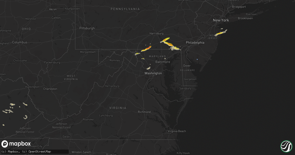
Hail Map in Maryland on July 2, 2022
Get this storm
July 2 map
$229
one time, instant access
Download today. No call, no setup
Keep the $229
Bought the map and want the full workflow? Apply the entire $229 to a subscription within 7 days. None of it is wasted.
Every map, not just this one
This buys you this map. Subscription and you get every map we run, in the markets you choose from a few cities to whole states to nationwide. Plus real-time alerts the moment a storm fires.
Contact data
Name, contact info, occupancy, even credit band for addresses in the footprint. You go from where it hit to who to call.
Become the source they trust
Unlimited branding weather history reports on demand. You already have the documented answer ready for the property owner, and you are the one who showed up with it.
Property data and RoofTrace estimates
Pull up any address you have got, its value and the exact code rules for that jurisdiction, straight from One Click Code. Then RoofTrace estimates the squares, pitch, and roof value, priced the way you price.
Storm reports in Maryland
Maryland
| Date | Description |
|---|---|
| 07/02/20226:50 PM CDT | A tree was down along md 108 between mink hollow road and new hampshire avenue. |
| 07/02/20226:50 PM CDT | Trees blew down along md-108 ashton road between mink hollow road and md-650 new hampshire avenue. |
| 07/02/20226:38 PM CDT | Trees blew down along shady grove road near oakmont avenue. |
| 07/02/20226:36 PM CDT | Trees were down along shady grove road and oakmont avenue. |
| 07/02/20226:34 PM CDT | A tree blew down in the intersection of glen rd and falls rd. |
| 07/02/20226:32 PM CDT | Trees were down along md-927 at interstate 270. |
| 07/02/20226:20 PM CDT | A tree blew down onto a residence near the intersection of starlight court and royal oak court. Trees blew down near the intersection of wooten parkway and md-189 falls |
| 07/02/20226:20 PM CDT | Wires blew down into the road near falls rd and kersey ln. |
| 07/02/20226:19 PM CDT | Report of wires down with a transformer fire near the 300 block of mannakee st. |
| 07/02/20226:17 PM CDT | A tree blew down onto a residence near starlight ct and royal oak ct. |
| 07/02/20226:17 PM CDT | Damage at intersection of coldstream dr & prestwick road. Tree on house and cars damaged in driveway. |
| 07/02/20226:17 PM CDT | Trees blew down near wooten parkway and falls rd blocking some lanes. |
| 07/02/20226:15 PM CDT | A tree and wires blew down near the 11900 block of harmony lane off of victory lane. Multiple trees blew down at the intersection of coldstream drive and prestwick road |
| 07/02/20226:15 PM CDT | A tree and wires blew down near the 11900 block of harmony ln off of victory ln. |
| 07/02/20224:53 PM CDT | A tree blew down near the 3430 block of bussard rd. |
| 07/02/20224:53 PM CDT | Trees blew down in the 3400 block of bussard road. |
| 07/02/20224:52 PM CDT | Lines were reported down near the 3640 block of harpers ferry rd. |
| 07/02/20224:47 PM CDT | Tree reported down on the on ramp of i-70 near rt. 144 |
| 07/02/20224:34 PM CDT | Trees and wires blew down in the 17100 block of snyders landing road. Wires blew down in the 3600 block of harpers ferry road. |
| 07/02/20224:34 PM CDT | A tree blew down with wires near the 17140 block of snyders landing rd. |
| 07/02/20223:31 PM CDT | Trees blew down onto wires near the intersection of mountain view road and md-140 waynesboro pike. |
| 07/02/20223:28 PM CDT | A tree blew down on wires near mountain view rd and waynesboro pike |
| 07/02/20223:20 PM CDT | A tree blew down bringing down a power pole and lines near sunshine trail and harbaugh valley rd. |
| 07/02/20223:18 PM CDT | A tree blew down bringing down a power pole and lines near sunshine trail and harbaugh valley rd. Trees and wires blew down in the 7500 block of friends creek road. |
| 07/02/20223:05 PM CDT | Wires down in the 13000 block of kretsinger road. |
| 07/02/20222:53 PM CDT | A tree blew down and downed wires near the 2020 block of day rd. |
| 07/02/20222:50 PM CDT | Several trees and wires blew down around funkstown. A tree and wires blew down on bear creek drive. A tree blew down onto wires in the 2000 block of day road. |
| 07/02/20222:47 PM CDT | A tree and wires blew down on bear creek dr. |
| 07/02/20224:14 AM CDT | At 914 PM EDT, severe thunderstorms were located along a line extending from near Perryman to 6 miles east of Millers Island, moving east at 30 mph. HAZARD...60 mph wind gusts. SOURCE...Radar indicated. IMPACT...Damage to roofs, siding, trees, and power lines is possible. Locations impacted include... Chestertown, Millington, Sudlersville, Betterton, Newtown, Sassafras, Morgnec, Massey, Crumpton, Kennedyville, Galena and Kingstown. |
| 07/02/20222:33 AM CDT | At 732 PM EDT, a severe thunderstorm was located over Redland, or over Rockville, moving northeast at 15 mph. HAZARD...60 mph wind gusts and quarter size hail. SOURCE...Public reported multiple trees down in Potomac Maryland. IMPACT...Damaging winds will cause some trees and large branches to fall. This could injure those outdoors, as well as damage homes and vehicles. Roadways may become blocked by downed trees. Localized power outages are possible. Unsecured light objects may become projectiles. Locations impacted include... Rockville, Gaithersburg, Olney, Aspen Hill, Redland, Derwood, Washington Grove, Brookeville, Sandy Spring, Ashton and Brinklow. |
| 07/02/202212:36 AM CDT | At 536 PM EDT, a severe thunderstorm was located over Harry Grove Stadium, moving east at 15 mph. HAZARD...60 mph wind gusts and quarter size hail. SOURCE...Radar indicated. IMPACT...Damaging winds will cause some trees and large branches to fall. This could injure those outdoors, as well as damage homes and vehicles. Roadways may become blocked by downed trees. Localized power outages are possible. Unsecured light objects may become projectiles. Locations impacted include... Frederick, Harry Grove Stadium, Ballenger Creek, Braddock Heights, New Market, Clover Hill, Linganore-Bartonsville, Discovery-Spring Garden, Monrovia, Ijamsville, Mount Pleasant and Clifton. |
| 07/02/202212:20 AM CDT | A few trees... Branches and wires blew down in the hyattsville/bladensburg area. |
| 07/01/202211:48 PM CDT | At 448 PM EDT, a severe thunderstorm was located over Oxford, or 12 miles northwest of Newark, moving east at 15 mph. HAZARD...60 mph wind gusts and quarter size hail. SOURCE...Radar indicated. IMPACT...Minor damage to vehicles is possible. Wind damage to roofs, siding, trees, and power lines is possible. Locations impacted include... Oxford, West Grove, Mount Vernon, Kemblesville, Landenberg, North Star, Avondale and Toughkenamon. |
| 07/01/202211:20 PM CDT | At 420 PM EDT, a severe thunderstorm was located near Carroll Valley, or near Thurmont, moving east at 20 mph. HAZARD...60 mph wind gusts and quarter size hail. SOURCE...Radar indicated. IMPACT...Damaging winds will cause some trees and large branches to fall. This could injure those outdoors, as well as damage homes and vehicles. Roadways may become blocked by downed trees. Localized power outages are possible. Unsecured light objects may become projectiles. Locations impacted include... Emmitsburg and Sabillasville. |
| 07/01/202211:15 PM CDT | At 415 PM EDT, a severe thunderstorm was located near Rouzerville, or near Thurmont, moving east at 20 mph. HAZARD...60 mph wind gusts and quarter size hail. SOURCE...Radar indicated. IMPACT...Damaging winds will cause some trees and large branches to fall. This could injure those outdoors, as well as damage homes and vehicles. Roadways may become blocked by downed trees. Localized power outages are possible. Unsecured light objects may become projectiles. Locations impacted include... Emmitsburg, Sabillasville, Fort Ritchie, Highfield and Cascade. |
| 07/01/202210:45 PM CDT | At 345 PM EDT, a severe thunderstorm was located near Quarryville, or 10 miles south of Willow Street, moving southeast at 25 mph. HAZARD...Ping pong ball size hail and 60 mph wind gusts. SOURCE...Radar indicated. IMPACT...People and animals outdoors will be injured. Expect hail damage to roofs, siding, windows, and vehicles. Wind damage to roofs, siding, trees, and power lines is possible. Locations impacted include... Oxford, West Grove, Homeville, Glen Roy, Mount Vernon, Kemblesville, Landenberg, North Star and Avondale. |
| 07/01/202210:43 PM CDT | At 343 PM EDT, a severe thunderstorm was located over Saint James, or near Municipal Stadium, moving east at 30 mph. HAZARD...60 mph wind gusts and quarter size hail. SOURCE...Radar indicated. IMPACT...Damaging winds will cause some trees and large branches to fall. This could injure those outdoors, as well as damage homes and vehicles. Roadways may become blocked by downed trees. Localized power outages are possible. Unsecured light objects may become projectiles. Locations impacted include... Hagerstown, Robinwood, Boonsboro, Smithsburg, Mount Aetna, Mount Lena, San Mar, Wolfsville, Saint James, Halfway, Myersville, Cavetown, Funkstown, Fairplay, Fort Ritchie, Chewsville, Pleasant Walk and Bridgeport. |
| 07/01/202210:42 PM CDT | At 341 PM EDT, a severe thunderstorm was located over Quarryville, moving southeast at 20 mph. HAZARD...60 mph wind gusts and half dollar size hail. SOURCE...Radar indicated. IMPACT...Hail damage to vehicles is expected. Expect wind damage to roofs, siding, and trees. Locations impacted include... Quarryville, Wakefield, Holtwood, Smithville, Kirkwood, Little Britain, Buck, Peach Bottom and Rawlinsville. |
| 07/01/202210:32 PM CDT | At 332 AM EDT, a severe thunderstorm was located near Grantsville, or near Bittinger, moving east at 35 mph. HAZARD...60 mph wind gusts. SOURCE...Radar indicated. IMPACT...Damaging winds will cause some trees and large branches to fall. This could injure those outdoors, as well as damage homes and vehicles. Roadways may become blocked by downed trees. Localized power outages are possible. Unsecured light objects may become projectiles. Locations impacted include... Bittinger, Grantsville, Friendsville, Accident, Merrill, Selbysport, New Germany, Piney Grove, Keysers Ridge, Jennings and Mineral Spring. |
| 07/01/202210:11 PM CDT | A tree was down along route 198 between good hope road and old columbia pike. |
| 07/01/20228:20 PM CDT | Multiple trees blew down around cherry grove road and stoney battery road. |
| 07/01/20228:16 PM CDT | Trees down around cherry grove road & stoney battery road. |
| 07/01/20227:59 PM CDT | Trees were down along macarthur boulevard and sangamore road. |
| 07/01/20227:49 PM CDT | Trees were down along md-650 and md-320. |
All States Impacted by Hail Map on July 2, 2022
Cities Impacted by Hail Map on July 2, 2022
- Ellsworth, ME
- Hancock, ME
- Wasta, SD
- Howes, SD
- Frazer, MT
- Peerless, MT
- Larslan, MT
- Wolf Point, MT
- Whitetail, MT
- Sturgis, SD
- Powers Lake, ND
- Stanley, ND
- Fort Pierre, SD
- Brockton, MT
- Decker, MT
- Sheridan, WY
- Waco, KY
- Richmond, KY
- Del Rio, TX
- Cartwright, ND
- Woodburn, KY
- Franklin, KY
- Mulvane, KS
- Clyde, NC
- Wall, SD
- Milesville, SD
- Midland, SD
- Marion, KY
- Fairview, OK
- Hepler, KS
- Uniontown, KS
- Redfield, KS
- Rocksprings, TX
- Granby, MA
- Ludlow, MA
- Bondsville, MA
- West Warren, MA
- Belchertown, MA
- Palmer, MA
- Thorndike, MA
- Ware, MA
- Mcminnville, TN
- Morrison, TN
- Augusta, KS
- Andover, KS
- Rhame, ND
- Ludlow, SD
- Prairie City, SD
- Bison, SD
- Meadow, SD
- Buffalo, SD
- Faith, SD
- Camp Crook, SD
- Mud Butte, SD
- Reva, SD
- Richland, MT
- Huron, SD
- Virgil, SD
- Wolsey, SD
- Alpena, SD
- Glen Rose, TX
- Bowman, ND
- Amidon, ND
- Sentinel Butte, ND
- Reeder, ND
- Hettinger, ND
- Scranton, ND
- Ryder, ND
- Reserve, MT
- Flaxville, MT
- Scobey, MT
- Roundhill, KY
- Brownsville, KY
- Morgantown, KY
- Caneyville, KY
- Cedar Vale, KS
- Adams, OR
- Norwich, KS
- Milton, KS
- Beattyville, KY
- Jackson, KY
- Tyndall, SD
- Avon, SD
- Middletown, MD
- Jefferson, MD
- Heppner, OR
- Honaker, VA
- Spurlockville, WV
- Uvalde, TX
- Canadian, TX
- Chester, OK
- Enid, OK
- Waukomis, OK
- Elkton, MD
- Orrtanna, PA
- Makoti, ND
- El Dorado, KS
- Welch, WV
- Herndon, WV
- Northfork, WV
- Clayton, NM
- Garrison, ND
- Roseglen, ND
- Wibaux, MT
- Broadview, MT
- Ryegate, MT
- Rapelje, MT
- Lynchburg, VA
- Rock Island, TN
- Roanoke, VA
- Burkesville, KY
- Lambert, MT
- Poplar, MT
- Fairview, MT
- Philip, SD
- Spivey, KS
- Harper, KS
- Williamson, WV
- Delbarton, WV
- Lancaster, KY
- Knippa, TX
- Stonefort, IL
- Creal Springs, IL
- New Burnside, IL
- Ozark, IL
- Concord, VA
- Madison Heights, VA
- Spout Spring, VA
- Gaithersburg, MD
- Fredericktown, MO
- Farmington, MO
- Asbury Park, NJ
- Eatontown, NJ
- Deal, NJ
- Howell, NJ
- West Long Branch, NJ
- Freehold, NJ
- Farmingdale, NJ
- Long Branch, NJ
- Oakhurst, NJ
- Neptune, NJ
- Colts Neck, NJ
- Irvine, KY
- Cohagen, MT
- Prairie City, OR
- Pilot Rock, OR
- Pendleton, OR
- Long Creek, OR
- Monument, OR
- La Grande, OR
- Summerville, OR
- Statesville, NC
- Opheim, MT
- Stoddard, WI
- Brownsville, MN
- Chaseburg, WI
- Hokah, MN
- La Crosse, WI
- Brackettville, TX
- New Underwood, SD
- Enning, SD
- Grenola, KS
- Cambridge, KS
- Latham, KS
- Jordan, MT
- Plaza, ND
- Parshall, ND
- White River, SD
- Murdo, SD
- Lemmon, SD
- Springfield, SD
- Vega, TX
- Clothier, WV
- Yolyn, WV
- Turtle Creek, WV
- Jeffrey, WV
- Hewett, WV
- Danville, WV
- Chapmanville, WV
- Alkol, WV
- Rapid City, SD
- Kadoka, SD
- De Smet, SD
- Erwin, SD
- Dalhart, TX
- Dryden, TX
- Manchester, KY
- Balko, OK
- Bend, OR
- Grassy Butte, ND
- Elgin, OR
- Spray, OR
- Fossil, OR
- Carrizo Springs, TX
- Asherton, TX
- Jetson, KY
- Pecks Mill, WV
- Lake, WV
- Martinsburg, WV
- Shepherdstown, WV
- Providence, KY
- Viola, KS
- Goddard, KS
- Clearwater, KS
- Fredonia, KY
- Cleburne, TX
- Joshua, TX
- Alvarado, TX
- Keene, TX
- Alexander, ND
- Sugar City, CO
- Rose Hill, KS
- Campton, KY
- Vancleve, KY
- Dawson Springs, KY
- Madisonville, KY
- Hazel Green, KY
- Mize, KY
- Cannel City, KY
- West Liberty, KY
- Salyersville, KY
- Boss, MO
- Shelby, MT
- Circle, MT
- Fort Peck, MT
- Haines, OR
- Ashland, OR
- Eagle Point, OR
- Newcastle, WY
- Winston Salem, NC
- Long Valley, SD
- Paint Rock, TX
- Sturgis, KY
- Perryton, TX
- Cut Bank, MT
- Belvidere, SD
- Gilchrist, OR
- Axton, VA
- Cheyenne, OK
- Scotland, SD
- Tripp, SD
- Okaton, SD
- Raymond, MT
- Driggs, ID
- Terry, MT
- Lindsay, MT
- Glendive, MT
- Highlands, NJ
- Fountain, CO
- Bevinsville, KY
- Topmost, KY
- Weeksbury, KY
- Kite, KY
- Beaver, KY
- Hi Hat, KY
- McDowell, KY
- Bypro, KY
- Wheelwright, KY
- Melvin, KY
- Wrightsville, PA
- East Petersburg, PA
- Rising Sun, MD
- Drumore, PA
- Landisville, PA
- Conestoga, PA
- York, PA
- Kirkwood, PA
- Red Lion, PA
- Mountville, PA
- Nottingham, PA
- Landenberg, PA
- North East, MD
- Oxford, PA
- Columbia, PA
- Delta, PA
- Holtwood, PA
- Lincoln University, PA
- Felton, PA
- New Providence, PA
- Airville, PA
- Peach Bottom, PA
- Mount Joy, PA
- Windsor, PA
- Pequea, PA
- Washington Boro, PA
- Quarryville, PA
- Marietta, PA
- Manheim, PA
- Conowingo, MD
- Brogue, PA
- Millersville, PA
- Lancaster, PA
- Lititz, PA
- Rockville, MD
- Great Falls, VA
- Potomac, MD
- Corbin, KY
- Sonora, TX
- Hagerstown, MD
- Ozona, TX
- Sabillasville, MD
- Gettysburg, PA
- Emmitsburg, MD
- Thurmont, MD
- Smithsburg, MD
- Cascade, MD
- Littlestown, PA
- Fairfield, PA
- Somerset, TX
- Poteet, TX
- Texhoma, OK
- Stratford, TX
- Oxford, GA
- Covington, GA
- Brockway, MT
- Wellington, KS
- Belle Plaine, KS
- Booneville, KY
- Talent, OR
- Medford, OR
- Amarillo, TX
- Seiling, OK
- Oakwood, OK
- Canton, OK
- Drakesboro, KY
- Rochester, KY
- Beaver Dam, KY
- Belton, KY
- Eureka, KS
- Nottingham, MD
- Glen Arm, MD
- Parkville, MD
- Perry Hall, MD
- Pleasanton, TX
- Salem, MO
- Sabinal, TX
- Concan, TX
- Daniel, WY
- Frederick, MD
- Browder, KY
- Beechmont, KY
- Beech Creek, KY
- Spearman, TX
- La Pryor, TX
- Kiowa, KS
- Alva, OK
- Burlington, OK
- Meally, KY
- Wittensville, KY
- Paintsville, KY
- Williamsport, KY
- Staffordsville, KY
- Van Lear, KY
- Boons Camp, KY
- Sitka, KY
- Thelma, KY
- New Castle, DE
- Bear, DE
- Newark, DE
- Pampa, TX
- Comstock, TX
- Weston, CO
- Arkansas City, KS
- Crystal City, TX
- Kingston, MA
- Plymouth, MA
- Plympton, MA
- Welch, OK
- Hooker, OK
- Springfield, CO
- Boise City, OK
- Felt, OK
- West Grove, PA
- Boonsboro, MD
- Fairplay, MD
- Sharpsburg, MD
- Williamsport, MD
- Mayfield, KS
- Clay, WV
- Summersville, WV
- Presho, SD
- Warren, MA
- Brimfield, MA
- Onida, SD
- La Pine, OR
- Coon Valley, WI
- Caledonia, MN
- Hagerhill, KY
- Debord, KY
- Flatgap, KY
- Pueblo, CO
- Kaylor, SD
- Niobrara, NE
- Meacham, OR
- Jacksonville, OR
- Phoenix, OR
- Willow Street, PA
- Oceanport, NJ
- Fort Monmouth, NJ
- Millville, NJ
- Edgemont, SD
- Hot Springs, SD
- Hill City, SD
- Oral, SD
- Pine Ridge, SD
- Smithwick, SD
- Panhandle, TX
- Idaho Falls, ID
- Dubois, ID
- Monteview, ID
- Saint Anthony, ID
- Terreton, ID
- Hamer, ID
- Blackfoot, ID
- Spencer, ID
- Moore, ID
- Arco, ID
- Plentywood, MT
- Redstone, MT
- Culbertson, MT
- Sidney, MT
- Kevin, MT
- Columbus, ND
- Noonan, ND
- Lignite, ND
- Crosby, ND
- Golva, ND
- Beach, ND
- New England, ND
- Center, ND
- Stanton, ND
- Washburn, ND
- Underwood, ND
- Hazen, ND
- Bismarck, ND
- Mandan, ND
- New Salem, ND
- Glen Ullin, ND
- Beulah, ND


