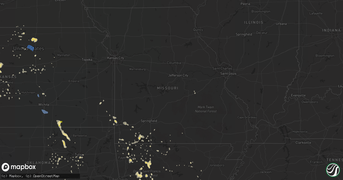
Hail Map in Missouri on July 2, 2020
Get this storm
July 2 map
$229
one time, instant access
Download today. No call, no setup
Keep the $229
Bought the map and want the full workflow? Apply the entire $229 to a subscription within 7 days. None of it is wasted.
Every map, not just this one
This buys you this map. Subscription and you get every map we run, in the markets you choose from a few cities to whole states to nationwide. Plus real-time alerts the moment a storm fires.
Contact data
Name, contact info, occupancy, even credit band for addresses in the footprint. You go from where it hit to who to call.
Become the source they trust
Unlimited branding weather history reports on demand. You already have the documented answer ready for the property owner, and you are the one who showed up with it.
Property data and RoofTrace estimates
Pull up any address you have got, its value and the exact code rules for that jurisdiction, straight from One Click Code. Then RoofTrace estimates the squares, pitch, and roof value, priced the way you price.
Storm reports in Missouri
Missouri
| Date | Description |
|---|---|
| 07/02/20206:11 PM CDT | Tree debris blocking joe bald park rd. |
| 07/02/20205:43 PM CDT | Several 3 to 5 inch trees blown down just south of anderson on old highway 71. |
| 07/02/20205:05 PM CDT | Tree over the road at county lane 90 and blackberry road. |
| 07/02/20204:45 PM CDT | 4 inch tree blown down just east of northpark mall. |
| 07/02/20204:40 PM CDT | Initial report of approx 15 power poles down. Near belview on newman rod... Near northpark apartments. Several cars involved with the power lines also. |
| 07/02/202012:36 AM CDT | At 535 PM CDT, a severe thunderstorm was located near Pineville, moving southeast at 15 mph. HAZARD...60 mph wind gusts and quarter size hail. SOURCE...Radar indicated. IMPACT...Hail damage to vehicles is expected. Expect wind damage to roofs, siding, and trees. Locations impacted include... Big Sugar Creek State Park... Anderson... Seligman... Pineville... Washburn... Lanagan... Powell... This includes Interstate 49 between mile markers 1 and 12. |
| 07/01/202011:59 PM CDT | At 459 PM CDT, severe thunderstorms were located along a line extending from 8 miles east of Sarcoxie to near Shoal Creek Drive to near Baxter Springs, moving south at 20 mph. HAZARD...60 mph wind gusts and quarter size hail. SOURCE...Radar indicated. IMPACT...Hail damage to vehicles is expected. Expect wind damage to roofs, siding, and trees. Locations impacted include... Joplin... Carthage... Neosho... Webb City... Monett... Carl Junction... Baxter Springs... Galena... Oronogo... Seneca... Granby... Carterville... Duquesne... Sarcoxie... Pierce City... Duenweg... Diamond... Loma Linda... Airport Drive... Leawood...This includes the following highways... Interstate 44 between mile markers 0 and 41. Interstate 49 between mile markers 16 and 45. |
All States Impacted by Hail Map on July 2, 2020
Cities Impacted by Hail Map on July 2, 2020
- Monett, MO
- Burlington, CO
- Valentine, NE
- Alpena, AR
- Little Rock, AR
- Coldwater, MS
- Medway, ME
- Hays, KS
- Lake Village, AR
- Presho, SD
- Vivian, SD
- Scott City, KS
- Arapahoe, CO
- Sheridan Lake, CO
- Richardton, ND
- Mud Butte, SD
- Faith, SD
- Wray, CO
- Wilmar, AR
- Lansford, ND
- Glenburn, ND
- Stark, KS
- Savonburg, KS
- Dover, AR
- Rocklake, ND
- Rolla, ND
- Hansboro, ND
- Dunn Center, ND
- Taylor, ND
- Halliday, ND
- Rapid City, SD
- St John, KS
- Dodd City, TX
- Windom, TX
- Bayard, NE
- Panhandle, TX
- Gurley, NE
- Peetz, CO
- Sidney, NE
- Deer, AR
- Parshall, ND
- Roseglen, ND
- Belleville, KS
- Scandia, KS
- Concordia, KS
- Jamestown, KS
- Kilgore, NE
- Nenzel, NE
- Oakley, KS
- Hanston, KS
- Kinsley, KS
- Saint James, MO
- Chandler, OK
- Perryville, AR
- Fort Worth, TX
- Gregory, SD
- Bethune, CO
- Carl Junction, MO
- Joplin, MO
- Webb City, MO
- Monticello, AR
- Grady, AR
- Fairfax, OK
- Pierce City, MO
- Hill City, SD
- Keystone, SD
- Goodland, KS
- Clarksville, AR
- Lamar, AR
- Prairie City, SD
- Cope, CO
- Anton, CO
- Buena Vista, GA
- Union Center, SD
- Newell, SD
- Bird City, KS
- Saint Francis, KS
- Benkelman, NE
- Gladstone, ND
- Hemingford, NE
- Lamar, CO
- Wiley, CO
- Hasty, CO
- McClave, CO
- Harvey, ND
- Chaseley, ND
- Bowdon, ND
- Burr Oak, KS
- Tupelo, OK
- De Witt, AR
- Greenville, MS
- Leland, MS
- Bentonia, MS
- Newcastle, WY
- Hermosa, SD
- Oberon, ND
- Springdale, AR
- Oral, SD
- Pine Ridge, SD
- Champion, NE
- Carpio, ND
- Salina, KS
- Alexander, AR
- Mabelvale, AR
- Bauxite, AR
- Howes, SD
- Pierre, SD
- Blunt, SD
- Guide Rock, NE
- Searcy, AR
- Hugo, OK
- Rison, AR
- Lake Wales, FL
- Atwood, KS
- Selden, KS
- Hoxie, KS
- Rexford, KS
- Lexington, MS
- Cruger, MS
- Sturgis, SD
- Mulberry, AR
- Ryan, OK
- Crawford, NE
- Dumas, AR
- Healy, KS
- Grinnell, KS
- Ogallala, NE
- Paxton, NE
- Keystone, NE
- Harrison, AR
- Rolette, ND
- Rugby, ND
- White Owl, SD
- Whitman, NE
- Max, NE
- Lincoln, KS
- Sylvan Grove, KS
- Drumright, OK
- Dresden, KS
- Yale, OK
- Regent, ND
- Hettinger, ND
- Colby, KS
- Garden City, KS
- Leslie, AR
- Dickinson, ND
- New England, ND
- Amidon, ND
- Midland, SD
- Draper, SD
- Fort Pierre, SD
- Okaton, SD
- Murdo, SD
- Hayes, SD
- Satanta, KS
- Berthold, ND
- Lindsborg, KS
- Assaria, KS
- Reva, SD
- Edson, KS
- Utica, KS
- Hominy, OK
- Vale, SD
- Madison, ME
- Sarah, MS
- Crenshaw, MS
- Indianola, MS
- Hollandale, MS
- Inverness, MS
- Stratton, CO
- Cody, NE
- Tuthill, SD
- Saint Francis, SD
- Aladdin, WY
- Marsland, NE
- Rogers, AR
- Yazoo City, MS
- Glenpool, OK
- Phillips, WI
- Lebanon, NE
- Shaw, MS
- Doddsville, MS
- Kensal, ND
- Booneville, AR
- Ponca, AR
- Garfield, KS
- Belpre, KS
- Larned, KS
- Guymon, OK
- Chamberlain, SD
- England, AR
- Pine Bluff, AR
- Cherry Creek, SD
- Philip, SD
- Milesville, SD
- Miller, SD
- Lakin, KS
- Belzoni, MS
- Crookston, NE
- Shell Knob, MO
- Washburn, ND
- Hayes Center, NE
- Mountain View, AR
- Magazine, AR
- Thedford, NE
- Pawhuska, OK
- Shidler, OK
- Burbank, OK
- Granada, CO
- Berryville, AR
- Hudson, KS
- Maple City, KS
- Dexter, KS
- Herndon, KS
- Hernando, MS
- Lyon, MS
- Clarksdale, MS
- Silver City, MS
- Hudson, ME
- Spencer, NE
- Oneill, NE
- Waxahachie, TX
- Cedar Hill, TX
- Midlothian, TX
- McIntosh, SD
- McLaughlin, SD
- Kanorado, KS
- Victoria, KS
- Walker, KS
- Gorham, KS
- Wood, SD
- Tulsa, OK
- Sapulpa, OK
- Sand Springs, OK
- Belleville, AR
- Danville, AR
- Plaza, ND
- Ryder, ND
- Killdeer, ND
- Green Forest, AR
- Abilene, KS
- Solomon, KS
- Minter City, MS
- Charleston, MS
- Akron, CO
- Bolton, MS
- Wasta, SD
- Enning, SD
- Winner, SD
- Hamill, SD
- Wauneta, NE
- Stratton, NE
- Oxford, MS
- Water Valley, MS
- Tutwiler, MS
- Imperial, NE
- Enders, NE
- Superior, NE
- Dundee, MS
- Sledge, MS
- Isola, MS
- Mankato, KS
- Yellville, AR
- Caputa, SD
- Holdenville, OK
- Wetumka, OK
- Parthenon, AR
- Woodworth, ND
- Sheridan, AR
- Warren, AR
- Elkhart, KS
- Jenks, OK
- Pittsboro, MS
- Tillar, AR
- Perth, ND
- Vernon, CO
- Weskan, KS
- Parks, NE
- Sterling, CO
- Kress, TX
- Red Oak, TX
- Otis, KS
- Pfeifer, KS
- Russell, KS
- Jetmore, KS
- Ellis, KS
- Scenic, SD
- New Salem, ND
- Dighton, KS
- Milburn, OK
- Kenefic, OK
- Brewster, KS
- Eagle Butte, SD
- Dupree, SD
- Lantry, SD
- Gove, KS
- Aurora, MO
- Reeds Spring, MO
- Brinkley, AR
- Hamburg, AR
- Pittsburg, KS
- Asbury, MO
- Coleharbor, ND
- Milo, ME
- Seligman, MO
- Garfield, AR
- Eagle Rock, MO
- Keller, TX
- Elkins, AR
- Fayetteville, AR
- Weleetka, OK
- Bassett, NE
- Bridgeport, NE
- Angora, NE
- Batesville, AR
- Portales, NM
- Wessington Springs, SD
- Gypsum, KS
- Cape Fair, MO
- Beeler, KS
- Sterling, KS
- Omaha, AR
- Mounds, OK
- Pritchett, CO
- Okemah, OK
- Seminole, OK
- Sarcoxie, MO
- Selfridge, ND
- Mayersville, MS
- Carrington, ND
- Brownell, KS
- McCracken, KS
- Burdett, KS
- Cherokee, KS
- Weir, KS
- Cushing, OK
- Poteau, OK
- Meadow, SD
- Joes, CO
- Vona, CO
- Kirk, CO
- Senatobia, MS
- Coahoma, MS
- Gordon, NE
- Columbus, KS
- Hollister, MO
- Bisbee, ND
- Knox, ND
- Hugoton, KS
- Moscow, KS
- Glencoe, OK
- Sarles, ND
- Lefor, ND
- Kinta, OK
- Park, KS
- Quinter, KS
- Wisner, LA
- Morland, KS
- Denhoff, ND
- Goodrich, ND
- Merigold, MS
- Ruleville, MS
- Cleveland, MS
- Ferriday, LA
- Dardanelle, AR
- Sahuarita, AZ
- Hazen, ND
- Stanton, ND
- Culbertson, NE
- Carthage, MO
- Reeds, MO
- Bixby, OK
- Stuart, NE
- Lenora, KS
- Stillwater, OK
- Mccurtain, OK
- Great Bend, KS
- Jefferson, AR
- Penokee, KS
- Hill City, KS
- Huntsville, AR
- Harmony, ME
- Hunter, KS
- Belcourt, ND
- Curtis, NE
- Snow Lake, AR
- Watson, AR
- Merriman, NE
- Lodgepole, SD
- Hagarville, AR
- Altus, AR
- Ozark, AR
- Hartman, AR
- Houlton, ME
- Cassville, MO
- Carson, ND
- Uniontown, KS
- Golden, MO
- Bisbee, AZ
- Tombstone, AZ
- Thorndike, ME
- Troy, ME
- Harrison, NE
- Oark, AR
- Redfield, AR
- Madrid, NE
- Galena, MO
- Potter, NE
- Portis, KS
- Oronogo, MO
- Paris, AR
- Claude, TX
- Troy, NY
- Dalton, NE
- Eustis, NE
- Lowell, AR
- Stafford, KS
- Lewis, KS
- Macksville, KS
- Branson, MO
- Okmulgee, OK
- Gann Valley, SD
- Downs, KS
- Long Pine, NE
- Dustin, OK
- Belvidere, SD
- Winona, KS
- Monument, KS
- Marienthal, KS
- Holly, CO
- Ruso, ND
- Benedict, ND
- Grant, NE
- Bingham, ME
- Ralston, OK
- Buffalo, SD
- Duncan, MS
- Anderson, MO
- Pineville, MO
- Bristow, OK
- Valley Springs, AR
- Lampe, MO
- Anson, ME
- Newton, KS
- Mylo, ND
- Fairfield, ME
- Gainesville, MO
- Wing, ND
- Galena, KS
- Ponca City, OK
- Martin, SD
- Stuart, FL
- Indiantown, FL
- Osborne, KS
- Cuba, MO
- Pawnee, OK
- Benton, AR
- Ellinwood, KS
- Portland, AR
- Waterford, NY
- Mechanicville, NY
- Beloit, KS
- Tribune, KS
- Elgin, ND
- Ulysses, KS
- Sublette, KS
- Kingsland, AR
- Bearden, AR
- Sherman, ME
- Eureka Springs, AR
- Plainview, AR
- Humphrey, AR
- Louise, MS
- Anguilla, MS
- Wall, SD
- Marietta, OK
- Waterville, ME
- Chapman, KS
- Saint Bernard, LA
- Helena, AR
- Drew, MS
- Scranton, AR
- Turtle Lake, ND
- Ripley, OK
- Beggs, OK
- Pea Ridge, AR
- Oviedo, FL
- Orlando, FL
- Minneapolis, KS
- Grapevine, AR
- Island Falls, ME
- Wasola, MO
- Glen Allan, MS
- Chatham, MS
- McCook, NE
- Maywood, NE
- Mansfield, TX
- Girard, KS
- Maypearl, TX
- Venus, TX
- Napoleon, ND
- Lamar, OK
- Barnard, KS
- Jasper, AR
- Perkins, OK
- Coalgate, OK
- Athens, ME
- Sundance, WY
- Marble Falls, AR
- Marks, MS
- Shelby, MS
- Mound Bayou, MS
- Hindsville, AR
- Tryon, OK
- Brookston, TX
- Moundridge, KS
- Ransom, KS
- Miami, OK
- Kingston, AR
- Roxton, TX
- Milford, KS
- Bradford, AR
- Saint Lawrence, SD
- Johnson, KS
- Chadwick, MO
- Almont, ND
- Hurdsfield, ND
- Makoti, ND
- Plainville, KS
- Langdon, ND
- Barnsdall, OK
- White Hall, AR
- Ivan, AR
- Pingree, ND
- Pleasant Grove, AR
- Ennis, TX
- Hensley, AR
- Prosper, TX
- Oberlin, KS
- Red Rock, OK
- Como, MS
- North Anson, ME
- Chestnutridge, MO
- Walnut Shade, MO
- Hanna, OK
- Brookville, KS
- New Underwood, SD
- Newport, AR
- Verona, MO
- Purdy, MO
- Esbon, KS
- Augusta, AR
- Fort Lauderdale, FL
- Fordyce, AR
- Gould, AR
- Sicily Island, LA
- Flippin, AR
- Compton, AR
- Waldron, AR
- Wapanucka, OK
- Pickens, AR
- Bartley, NE
- Indianola, NE
- Hermleigh, TX
- Holyrood, KS
- Claflin, KS
- Freistatt, MO
- Gunnison, MS
- Fairfax, SD
- Butte, NE
- Washburn, MO
- Banks, AR
- Whitney, NE
- Clinton, AR
- Cooper, TX
- Gentry, AR
- Cave City, AR
- Trenton, NE
- Regan, ND
- Red Oak, OK
- Ethel, AR
- Canton, MS
- Heavener, OK
- Howe, OK
- Lancaster, TX
- Noel, MO
- Tolley, ND
- Gravette, AR
- Tucker, AR
- Black Hawk, SD
- Mercer, ND
- Natoma, KS
- Bogalusa, LA
- Woodbine, KS
- Burden, KS
- Winfield, KS
- Tipton, KS
- Pomona, MO
- Wesley, AR
- Sherrill, AR
- Sumner, TX
- Piedmont, SD
- Reliance, SD
- Broken Arrow, OK
- Coal Hill, AR
- Ellsworth, KS
- Dallas, TX
- Duncanville, TX
- Deadwood, SD
- Muenster, TX
- Solon, ME
- Allen, OK
- Protem, MO
- Silverton, TX
- Oacoma, SD
- New Edinburg, AR
- Gassville, AR
- Mission, SD
- Moro, AR
- Sylvia, KS
- Kanopolis, KS
- Erie, KS
- Agra, OK
- Benedicta, ME
- Kiefer, OK
- Abbyville, KS
- Plevna, KS
- Mount Vernon, AR
- Lebanon, KS
- Subiaco, AR
- Keldron, SD
- Holly Grove, AR
- Muleshoe, TX
- Havana, AR
- New Blaine, AR
- Oak Grove, LA
- Arlington, KS
- Turon, KS
- Magee, MS
- Mount Olive, MS
- Palmer, TX
- Ferris, TX
- New Braintree, MA
- Barre, MA
- Oakham, MA
- Jennings, KS
- Gem, KS
- Logan, KS
- Norcatur, KS
- Clayton, KS
- Levant, KS
- Norton, KS
- Long Island, KS
- Prairie View, KS
- Almena, KS
- Delphos, KS
- Glasco, KS
- Halstead, KS
- Sedgwick, KS
- Haysville, KS
- Belle Plaine, KS
- Mulvane, KS
- Derby, KS
- Peck, KS
- Dodge, ND
- Max, ND
- Minot Afb, ND
- Westhope, ND
- Burlington, ND
- Maxbass, ND
- Minot, ND
- Lincoln, MA
- Waltham, MA
- Weston, MA
- Custer, SD


