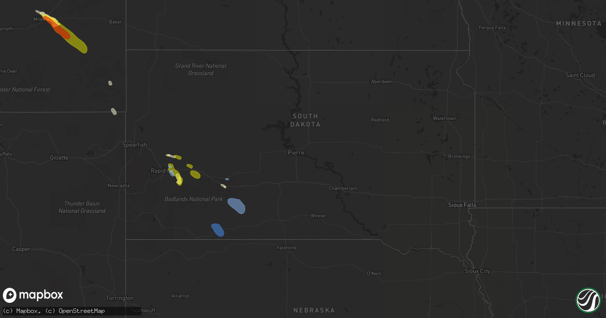
Hail Map in South Dakota on July 1, 2022
Get this storm
July 1 map
$229
one time, instant access
Download today. No call, no setup
Keep the $229
Bought the map and want the full workflow? Apply the entire $229 to a subscription within 7 days. None of it is wasted.
Every map, not just this one
This buys you this map. Subscription and you get every map we run, in the markets you choose from a few cities to whole states to nationwide. Plus real-time alerts the moment a storm fires.
Contact data
Name, contact info, occupancy, even credit band for addresses in the footprint. You go from where it hit to who to call.
Become the source they trust
Unlimited branding weather history reports on demand. You already have the documented answer ready for the property owner, and you are the one who showed up with it.
Property data and RoofTrace estimates
Pull up any address you have got, its value and the exact code rules for that jurisdiction, straight from One Click Code. Then RoofTrace estimates the squares, pitch, and roof value, priced the way you price.
Storm reports in South Dakota
South Dakota
| Date | Description |
|---|---|
| 07/01/20226:20 PM CDT | A local report indicates 60 MPH wind near 2 SE FARMINGDALE |
| 07/01/20225:55 PM CDT | A local report indicates 62 MPH wind near RAPID CITY ARPT |
| 07/01/20225:20 PM CDT | A local report indicates 71 MPH wind near ELLSWORTH AFB |
| 07/01/20224:45 PM CDT | Pea sized hail |
| 07/01/20224:30 AM CDT | At 930 PM CDT/830 PM MDT/, a severe thunderstorm was located near Cody, or 32 miles southeast of Martin, moving east at 35 mph. HAZARD...60 mph wind gusts and penny size hail. SOURCE...Radar indicated. IMPACT...Expect damage to roofs, siding, and trees. Locations impacted include... Valentine, Cody, Kilgore, Nenzel, Merritt Reservoir, Crookston, Steer Creek Campground, Cody Lake, Anderson Bridge State Wildlife Management Area, Smith Falls State Park, Schlagel Creek State Wildlife Management Area, Highway 97 crossing the Niobrara River, Big Alkali Lake State Wildlife Management Area and Sparks.This includes the following highways... Highway 20 between mile markers 156 and 217. Highway 97 between mile markers 114 and 141. Highway 83 between mile markers 189 and 222. Highway 12 between mile markers 1 and 17. |
| 07/01/20223:52 AM CDT | At 851 PM CDT/751 PM MDT/, severe thunderstorms were located along a line extending from near Vetal to 19 miles southeast of Gordon to Alliance, moving southeast at 30 mph. HAZARD...60 mph wind gusts and penny size hail. SOURCE...Radar indicated. IMPACT...Expect damage to roofs, siding, and trees. Locations impacted include... Ellsworth, Cody, Merriman, Kilgore, Nenzel, Medicine Lake, Antioch, Eli, Big Hill, Dipping Vat Meadow, Billys Lake, Irwin, Rock Hill, Miles Lake, Wickson Lake, Diamond Lake, Herman Lake, Indian Hill and Krause Lake.This includes the following highways... Highway 20 between mile markers 112 and 183. Highway 250 between mile markers 1 and 30. Highway 2 between mile markers 96 and 125. Highway 61 between mile markers 175 and 231. |
| 07/01/20222:36 AM CDT | At 735 PM MDT/835 PM CDT/, severe thunderstorms were located along a line extending from 7 miles west of Westover to 7 miles southeast of Lacreek Wildlife Refuge, moving east at 25 mph. HAZARD...60 mph wind gusts. SOURCE...Radar indicated. At 721 PM, a 61 mph gust was reported at Wanblee. IMPACT...Expect damage to roofs, siding, and trees. Locations impacted include... Spring Creek.This includes Interstate 90 in South Dakota between Mile Markers 164and 170. |
| 07/01/202212:08 AM CDT | At 508 PM MDT, a severe thunderstorm was located over Farmingdale, or 16 miles east of Rapid City, moving southeast at 15 mph. HAZARD...60 mph wind gusts and quarter size hail. SOURCE...Radar indicated. IMPACT...Hail damage to vehicles is expected. Expect wind damage to roofs, siding, and trees. This severe thunderstorm will be near... Railroad Buttes around 535 PM MDT. Folsom around 540 PM MDT.This includes Interstate 90 in South Dakota between Mile Markers 73and 77. |
| 06/30/202211:32 PM CDT | At 432 PM MDT, a severe thunderstorm was located over southern Box Elder, or 8 miles northeast of Rapid City, moving southeast at 10 mph. HAZARD...60 mph wind gusts and quarter size hail. SOURCE...Radar indicated. IMPACT...Hail damage to vehicles is expected. Expect wind damage to roofs, siding, and trees. Locations impacted include... Rapid City Airport and Caputa.This includes Interstate 90 in South Dakota between Mile Markers 62and 75. |
| 06/30/202211:30 PM CDT | At 429 PM MDT, a severe thunderstorm was located 8 miles southwest of Elk Mountain Lookout, or 14 miles south of Newcastle, moving east at 35 mph. HAZARD...60 mph wind gusts and quarter size hail. SOURCE...Radar indicated. IMPACT...Hail damage to vehicles is expected. Expect wind damage to roofs, siding, and trees. This severe thunderstorm will be near... Dewey around 445 PM MDT.Other locations in the path of this severe thunderstorm includePringle, Argyle, Cottonwood Springs Dam and southwestern Wind CaveNational Park. |
| 06/30/202210:16 PM CDT | At 316 PM MDT, a severe thunderstorm was located 5 miles northwest of Viewfield, or 21 miles northeast of Rapid City, moving east at 20 mph. HAZARD...60 mph wind gusts and half dollar size hail. SOURCE...Radar indicated. IMPACT...Hail damage to vehicles is expected. Expect wind damage to roofs, siding, and trees. This severe thunderstorm will be near... Viewfield around 335 PM MDT.Other locations in the path of this severe thunderstorm includeCurlew Lake.This includes Interstate 90 in South Dakota between Mile Markers 82and 87. |
| 06/30/20228:59 PM CDT | 50-60 mph wind gusts at onset of storm. One tree branch down. |
| 06/30/20228:21 PM CDT | A local report indicates 61 MPH wind near 7 E WANBLEE |
| 06/30/20228:04 PM CDT | Time estimated from radar |
| 06/30/20227:15 PM CDT | A local report indicates 61 MPH wind near 2 E COTTONWOOD |
All States Impacted by Hail Map on July 1, 2022
Cities Impacted by Hail Map on July 1, 2022
- Moosic, PA
- Kingston, PA
- Duryea, PA
- Wilkes Barre, PA
- Pittston, PA
- Luzerne, PA
- Glenrock, WY
- Douglas, WY
- Upton, WY
- Ellsworth, NE
- Aladdin, WY
- Hulett, WY
- Reading, PA
- Reinholds, PA
- Mohnton, PA
- Tippecanoe, OH
- Freeport, OH
- Hanston, KS
- Larned, KS
- Ashburn, VA
- Spring Mills, PA
- Centre Hall, PA
- Athens, OH
- Smithfield, OH
- Mingo Junction, OH
- Dillonvale, OH
- Rayland, OH
- Steubenville, OH
- Scottown, OH
- Proctorville, OH
- Chesapeake, OH
- Encino, TX
- Crook, CO
- Hebbronville, TX
- Realitos, TX
- Concepcion, TX
- Wilson, KS
- Ellsworth, KS
- Kinzers, PA
- Gordonville, PA
- Coatesville, PA
- Leola, PA
- Ephrata, PA
- Lititz, PA
- Honey Brook, PA
- Bird In Hand, PA
- Ronks, PA
- Lancaster, PA
- Gap, PA
- Narvon, PA
- New Holland, PA
- Brownstown, PA
- Logan, OH
- Bremen, OH
- New Straitsville, OH
- Salina, KS
- Stoneboro, PA
- Washington Boro, PA
- Tionesta, PA
- Okeana, OH
- Hamilton, OH
- Oxford, OH
- Tyrone, PA
- Forksville, PA
- New Albany, PA
- Lance Creek, WY
- Myerstown, PA
- Bethel, PA
- Fredericksburg, PA
- Wheatland, WY
- Guernsey, WY
- Montezuma, KS
- Kadoka, SD
- Interior, SD
- Portage, PA
- Newmanstown, PA
- Kirksville, MO
- Sylvan Grove, KS
- Weston, CO
- Marsland, NE
- Hemingford, NE
- Kingsville, TX
- Dayton, OH
- Chillicothe, OH
- Port Charlotte, FL
- Uhrichsville, OH
- Cadiz, OH
- Scio, OH
- Gore, VA
- Onaga, KS
- Riley, KS
- Saint George, KS
- Manhattan, KS
- Milford, KS
- Olsburg, KS
- Westmoreland, KS
- Ulysses, KS
- Sublette, KS
- Satanta, KS
- Clearville, PA
- Brackney, PA
- Vestal, NY
- New Underwood, SD
- Caputa, SD
- Gillette, WY
- Kaycee, WY
- Liberty, PA
- Canton, PA
- Shunk, PA
- Narrowsburg, NY
- Beach Lake, PA
- Cochecton, NY
- Damascus, PA
- Milanville, PA
- Lake Huntington, NY
- Sturgis, SD
- Sundance, WY
- Bernville, PA
- Strausstown, PA
- Newcastle, WY
- Freeland, MD
- Reisterstown, MD
- Hampstead, MD
- Sparks Glencoe, MD
- Manchester, MD
- Parkton, MD
- Upperco, MD
- Alzada, MT
- Willow Street, PA
- New Providence, PA
- Strasburg, PA
- Haxtun, CO
- Las Vegas, NM
- Rociada, NM
- Flagstaff, AZ
- McDonough, NY
- Oxford, NY
- White Sulphur Springs, WV
- Sterling, VA
- Miles City, MT
- Volborg, MT
- Kinsey, MT
- Ismay, MT
- Willow Wood, OH
- Glendo, WY
- Hartville, WY
- Orange Grove, TX
- Alice, TX
- New Lexington, OH
- Corning, OH
- Shawnee, OH
- Hollidaysburg, PA
- Kirkwood, PA
- Quarryville, PA
- Loogootee, IN
- Whitetail, MT
- Redstone, MT
- Reserve, MT
- Flaxville, MT
- Plentywood, MT
- Ellicott City, MD
- Marriottsville, MD
- Sykesville, MD
- West Friendship, MD
- Duchesne, UT
- Shoals, IN
- Mitchell, IN
- Laurel, MT
- Alexandria, PA
- Petersburg, PA
- Pennsylvania Furnace, PA
- Warriors Mark, PA
- Spruce Creek, PA
- Van Buren, ME
- Grand Isle, ME
- St John, KS
- Pawnee Rock, KS
- Delta, PA
- Street, MD
- Conowingo, MD
- Peach Bottom, PA
- Drumore, PA
- Whiteford, MD
- Darlington, MD
- Needmore, PA
- Breezewood, PA
- Crystal Spring, PA
- Warfordsburg, PA
- Rushville, IN
- Aguilar, CO
- Assaria, KS
- Grove City, PA
- Kennerdell, PA
- Polk, PA
- Jackson Center, PA
- Maysville, KY
- Denver, PA
- Stevens, PA
- Lebanon, PA
- Cooksville, MD
- Glenwood, MD
- Woodbine, MD
- Molt, MT
- Friendsville, PA
- Binghamton, NY
- Claremont, IL
- Oblong, IL
- Willow Hill, IL
- Sumner, IL
- West Liberty, IL
- Cottonwood Falls, KS
- Matfield Green, KS
- Marion, KS
- Lincolnville, KS
- Elmdale, KS
- Strong City, KS
- Cedar Point, KS
- Walsenburg, CO
- Tucson, AZ
- Branson, CO
- Robinson, IL
- Stoy, IL
- Newnan, GA
- Glenford, OH
- Thornville, OH
- Gerrardstown, WV
- Hedgesville, WV
- Halstead, KS
- Moundridge, KS
- Owanka, SD
- Hesston, KS
- Inman, KS
- Newton, KS
- Mcpherson, KS
- Burrton, KS
- Buhler, KS
- Tribune, KS
- Leoti, KS
- Trinidad, CO
- Trinchera, CO
- Malta, OH
- Kanopolis, KS
- Brookville, KS
- Franklin, GA
- Lagrange, GA
- Meadow Bridge, WV
- Heath, OH
- Hopewell, OH
- Mount Perry, OH
- Miamisburg, OH
- Berkeley Springs, WV
- Winchester, VA
- Glengary, WV
- Cross Junction, VA
- Olney, IL
- Newton, IL
- Sainte Marie, IL
- Dundas, IL
- Dayton, VA
- Bridgewater, VA
- Pomeroy, OH
- Long Bottom, OH
- Saint Mary, MO
- Perryville, MO
- Somerset, OH
- Whitney Point, NY
- Lisle, NY
- Catlettsburg, KY
- Ellsworth Afb, SD
- Rapid City, SD
- Box Elder, SD
- Lorraine, KS
- Mount Lemmon, AZ
- Falfurrias, TX
- Glenwood, IN
- Fort Riley, KS
- Louisa, KY
- Prichard, WV
- Beatrice, AL
- Hutchinson, KS
- Valley Center, KS
- Sedgwick, KS
- Belle Fourche, SD
- Frenchville, ME
- High View, WV
- Yellow Spring, WV
- Keyes, OK
- Crooksville, OH
- Riviera, TX
- Premont, TX
- Wall, SD
- Wasta, SD
- Great Bend, KS
- Kimbolton, OH
- Vernal, UT
- Baltimore, OH
- San Diego, TX
- Gallipolis Ferry, WV
- Kingston, TN
- Ravenswood, WV
- Solomon, KS
- New Cambria, KS
- New Lebanon, OH
- Germantown, OH
- Minford, OH
- Lucasville, OH
- Buchtel, OH
- Union Furnace, OH
- Haydenville, OH
- Nelsonville, OH
- Walton, KS
- Zanesville, OH
- Fremont, OH
- Helena, OH
- Wanblee, SD
- Long Valley, SD
- Porcupine, SD
- Martin, SD
- Allen, SD
- Batesland, SD
- Billings, MT
- Piedmont, SD
- Old Forge, PA
- Callicoon, NY
- Honesdale, PA
- Kenoza Lake, NY


