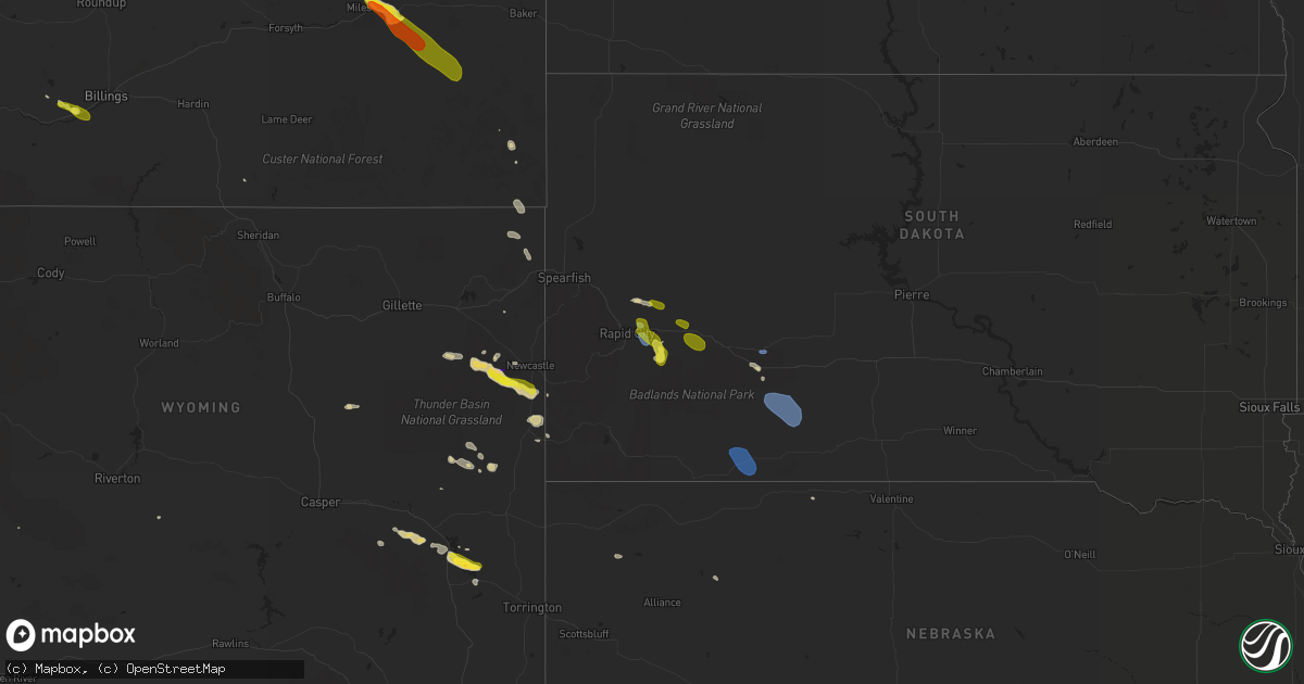
Hail Map on July 1, 2022
Get this storm
July 1 map
$229
one time, instant access
Download today. No call, no setup
Keep the $229
Bought the map and want the full workflow? Apply the entire $229 to a subscription within 7 days. None of it is wasted.
Every map, not just this one
This buys you this map. Subscription and you get every map we run, in the markets you choose from a few cities to whole states to nationwide. Plus real-time alerts the moment a storm fires.
Contact data
Name, contact info, occupancy, even credit band for addresses in the footprint. You go from where it hit to who to call.
Become the source they trust
Unlimited branding weather history reports on demand. You already have the documented answer ready for the property owner, and you are the one who showed up with it.
Property data and RoofTrace estimates
Pull up any address you have got, its value and the exact code rules for that jurisdiction, straight from One Click Code. Then RoofTrace estimates the squares, pitch, and roof value, priced the way you price.
States Impacted by Hail Map on July 1, 2022
Storm reports
Kansas
| Date | Description |
|---|---|
| 07/01/20226:26 PM CDT | A local report indicates 1.25 inch wind near 4 N KEATS |
| 07/01/20226:22 PM CDT | Personal weather station measured gust. |
| 07/01/20226:21 PM CDT | Mostly nickel size but a few larger ones. Time estimated from radar. |
| 07/01/20225:56 PM CDT | A local report indicates 60 MPH wind near 2 W NEWTON |
| 07/01/20225:10 PM CDT | A local report indicates 1.75 inch wind near 4 W HESSTON |
| 07/01/20225:08 PM CDT | A local report indicates 1.75 inch wind near 4 S MOUNDRIDGE |
| 07/01/20221:32 AM CDT | At 632 PM CDT, a severe thunderstorm was located near Tuttle Creek Lake, moving northeast at 20 mph. HAZARD...60 mph wind gusts and half dollar size hail. SOURCE...Trained weather spotters. IMPACT...Hail damage to vehicles is expected. Expect wind damage to roofs, siding, and trees. Locations impacted include... Olsburg and Tuttle Creek Lake. |
| 07/01/20221:10 AM CDT | At 609 PM CDT, a severe thunderstorm was located 5 miles south of Riley, moving northeast at 20 mph. HAZARD...Half dollar size hail. SOURCE...Radar indicated. IMPACT...Damage to vehicles is expected. Locations impacted include... Northern Manhattan, Riley, Tuttle Creek Lake and Keats. |
| 07/01/202212:32 AM CDT | At 532 PM CDT, a severe thunderstorm was located over North Newton, moving east at 20 mph. HAZARD...60 mph wind gusts and quarter size hail. SOURCE...Radar indicated. IMPACT...Hail damage to vehicles is expected. Expect wind damage to roofs, siding, and trees. Locations impacted include... Newton, Hesston, Halstead, North Newton, Sedgwick, Whitewater, Walton and Newton Airport.This includes Interstate 135 between Mile Markers 23 and 42. |
| 07/01/202212:06 AM CDT | At 506 PM CDT, a severe thunderstorm was located near Hesston, moving east at 5 mph. HAZARD...60 mph wind gusts and half dollar size hail. SOURCE...Radar indicated. IMPACT...Hail damage to vehicles is expected. Expect wind damage to roofs, siding, and trees. Locations impacted include... Newton, Hesston, North Newton and Moundridge. This includes Interstate 135 between Mile Markers 35 and 46. |
| 06/30/202211:16 PM CDT | At 416 PM CDT, a severe thunderstorm was located 10 miles south of Burdick, or 13 miles northeast of Marion, moving east at 15 mph. HAZARD...60 mph wind gusts and nickel size hail. SOURCE...Radar indicated. IMPACT...Expect damage to roofs, siding, and trees. Locations impacted include... Elmdale, Hymer, Tallgrass Prairie and Tallgrass Prairie Preserve. |
South Dakota
| Date | Description |
|---|---|
| 07/01/20226:20 PM CDT | A local report indicates 60 MPH wind near 2 SE FARMINGDALE |
| 07/01/20225:55 PM CDT | A local report indicates 62 MPH wind near RAPID CITY ARPT |
| 07/01/20225:20 PM CDT | A local report indicates 71 MPH wind near ELLSWORTH AFB |
| 07/01/20224:45 PM CDT | Pea sized hail |
| 07/01/20224:30 AM CDT | At 930 PM CDT/830 PM MDT/, a severe thunderstorm was located near Cody, or 32 miles southeast of Martin, moving east at 35 mph. HAZARD...60 mph wind gusts and penny size hail. SOURCE...Radar indicated. IMPACT...Expect damage to roofs, siding, and trees. Locations impacted include... Valentine, Cody, Kilgore, Nenzel, Merritt Reservoir, Crookston, Steer Creek Campground, Cody Lake, Anderson Bridge State Wildlife Management Area, Smith Falls State Park, Schlagel Creek State Wildlife Management Area, Highway 97 crossing the Niobrara River, Big Alkali Lake State Wildlife Management Area and Sparks.This includes the following highways... Highway 20 between mile markers 156 and 217. Highway 97 between mile markers 114 and 141. Highway 83 between mile markers 189 and 222. Highway 12 between mile markers 1 and 17. |
| 07/01/20223:52 AM CDT | At 851 PM CDT/751 PM MDT/, severe thunderstorms were located along a line extending from near Vetal to 19 miles southeast of Gordon to Alliance, moving southeast at 30 mph. HAZARD...60 mph wind gusts and penny size hail. SOURCE...Radar indicated. IMPACT...Expect damage to roofs, siding, and trees. Locations impacted include... Ellsworth, Cody, Merriman, Kilgore, Nenzel, Medicine Lake, Antioch, Eli, Big Hill, Dipping Vat Meadow, Billys Lake, Irwin, Rock Hill, Miles Lake, Wickson Lake, Diamond Lake, Herman Lake, Indian Hill and Krause Lake.This includes the following highways... Highway 20 between mile markers 112 and 183. Highway 250 between mile markers 1 and 30. Highway 2 between mile markers 96 and 125. Highway 61 between mile markers 175 and 231. |
| 07/01/20222:36 AM CDT | At 735 PM MDT/835 PM CDT/, severe thunderstorms were located along a line extending from 7 miles west of Westover to 7 miles southeast of Lacreek Wildlife Refuge, moving east at 25 mph. HAZARD...60 mph wind gusts. SOURCE...Radar indicated. At 721 PM, a 61 mph gust was reported at Wanblee. IMPACT...Expect damage to roofs, siding, and trees. Locations impacted include... Spring Creek.This includes Interstate 90 in South Dakota between Mile Markers 164and 170. |
| 07/01/202212:08 AM CDT | At 508 PM MDT, a severe thunderstorm was located over Farmingdale, or 16 miles east of Rapid City, moving southeast at 15 mph. HAZARD...60 mph wind gusts and quarter size hail. SOURCE...Radar indicated. IMPACT...Hail damage to vehicles is expected. Expect wind damage to roofs, siding, and trees. This severe thunderstorm will be near... Railroad Buttes around 535 PM MDT. Folsom around 540 PM MDT.This includes Interstate 90 in South Dakota between Mile Markers 73and 77. |
| 06/30/202211:32 PM CDT | At 432 PM MDT, a severe thunderstorm was located over southern Box Elder, or 8 miles northeast of Rapid City, moving southeast at 10 mph. HAZARD...60 mph wind gusts and quarter size hail. SOURCE...Radar indicated. IMPACT...Hail damage to vehicles is expected. Expect wind damage to roofs, siding, and trees. Locations impacted include... Rapid City Airport and Caputa.This includes Interstate 90 in South Dakota between Mile Markers 62and 75. |
| 06/30/202211:30 PM CDT | At 429 PM MDT, a severe thunderstorm was located 8 miles southwest of Elk Mountain Lookout, or 14 miles south of Newcastle, moving east at 35 mph. HAZARD...60 mph wind gusts and quarter size hail. SOURCE...Radar indicated. IMPACT...Hail damage to vehicles is expected. Expect wind damage to roofs, siding, and trees. This severe thunderstorm will be near... Dewey around 445 PM MDT.Other locations in the path of this severe thunderstorm includePringle, Argyle, Cottonwood Springs Dam and southwestern Wind CaveNational Park. |
| 06/30/202210:16 PM CDT | At 316 PM MDT, a severe thunderstorm was located 5 miles northwest of Viewfield, or 21 miles northeast of Rapid City, moving east at 20 mph. HAZARD...60 mph wind gusts and half dollar size hail. SOURCE...Radar indicated. IMPACT...Hail damage to vehicles is expected. Expect wind damage to roofs, siding, and trees. This severe thunderstorm will be near... Viewfield around 335 PM MDT.Other locations in the path of this severe thunderstorm includeCurlew Lake.This includes Interstate 90 in South Dakota between Mile Markers 82and 87. |
| 06/30/20228:59 PM CDT | 50-60 mph wind gusts at onset of storm. One tree branch down. |
| 06/30/20228:21 PM CDT | A local report indicates 61 MPH wind near 7 E WANBLEE |
| 06/30/20228:04 PM CDT | Time estimated from radar |
| 06/30/20227:15 PM CDT | A local report indicates 61 MPH wind near 2 E COTTONWOOD |
Ohio
| Date | Description |
|---|---|
| 07/01/20225:15 PM CDT | Mesonet station at866 fremont. |
| 07/01/20225:04 PM CDT | Measured on personal weather station. |
| 07/01/20225:01 PM CDT | A tractor-trailer was blown over by thunderstorm winds. Businesses also had damage to signs. |
| 07/01/20225:01 PM CDT | *** 1 inj *** corrects previous tstm wnd dmg report from 1 nnw fremont. Three buildings with metal siding damaged at county fairground. Large metal door blown in and ha |
| 07/01/20225:01 PM CDT | Large metal door of structure blown in. Time estimated via radar. |
| 07/01/20225:00 PM CDT | Corrects previous tstm wnd dmg report from 1 w fremont. Numerous trees down in fremont. Four trees fell on homes and at least one on a car. Several communities without |
| 07/01/20225:00 PM CDT | Reports of numerous trees down in fremont. |
| 07/01/20224:58 PM CDT | Tree down on house. Time estimated via radar. |
| 07/01/20223:33 PM CDT | A local report indicates 1.25 inch wind near 3 SSE SOMERSET |
| 07/01/20223:00 PM CDT | Several small trees down near the silver memorial bridge. |
| 07/01/20226:56 AM CDT | At 1156 PM EDT, a severe thunderstorm was located near Shawnee, moving east at 25 mph. HAZARD...60 mph wind gusts and quarter size hail. SOURCE...Radar indicated. IMPACT...Hail damage to vehicles is expected. Expect wind damage to roofs, siding, and trees. Locations impacted include... McConnelsville, Shawnee, Malta, Corning, Hemlock, Rendville and Eagleport. |
| 07/01/20223:04 AM CDT | At 804 PM EDT, severe thunderstorms were located along a line extending from 6 miles south of Ravenna to near Green, moving southeast at 25 mph. HAZARD...60 mph wind gusts and penny size hail. SOURCE...Radar indicated. IMPACT...Expect damage to trees and power lines. Locations impacted include... Akron, Canton, Ravenna, Massillon, Green, Alliance, Tallmadge, North Canton, Louisville, Sebring, Mogadore, Minerva, Hartville, Navarre, Waynesburg, East Sparta, New Franklin, Brimfield, Canal Fulton and Randolph. |
| 07/01/20221:00 AM CDT | At 559 PM EDT, severe thunderstorms were located along a line extending from 6 miles northeast of Genoa to near Gibsonburg to near Fremont, moving east at 35 mph. HAZARD...60 mph wind gusts. SOURCE...Radar indicated. IMPACT...Expect damage to trees and power lines. Locations impacted include... Sandusky, Fremont, Port Clinton, Kelleys Island, Put-In-Bay, Bellevue, Clyde, Oak Harbor, Gibsonburg, Genoa, Woodville, Elmore, Green Springs, Northern Milan, Castalia, Ballville, Catawba Island, Marblehead, Bay View and Lindsey. |
| 06/30/20227:19 PM CDT | Trees down on route 183 in lexington township. Time estimated via radar. |
| 06/30/20227:17 PM CDT | Tree down on road in plain township. |
Colorado
| Date | Description |
|---|---|
| 07/01/20223:10 PM CDT | Report of golfball size hail in gulnare with severe thunderstorm. Also... 1 inch of hail accumulation reported. |
| 07/01/20222:49 AM CDT | At 749 PM MDT, a severe thunderstorm was located 12 miles southeast of Cheyenne Wells, moving northeast at 15 mph. HAZARD...60 mph wind gusts and nickel size hail. SOURCE...Radar indicated. IMPACT...Expect damage to roofs, siding, and trees. This severe thunderstorm will remain over mainly rural areas of southeastern Cheyenne County in east central Colorado. |
| 06/30/20229:03 PM CDT | At 202 PM MDT, a severe thunderstorm was located over Gulnare, or 18 miles northwest of Trinidad, moving southeast at 10 mph. HAZARD...60 mph wind gusts and quarter size hail. SOURCE...Radar indicated. IMPACT...Hail damage to vehicles is expected. Expect wind damage to roofs, siding, and trees. Locations impacted include... Gulnare. |
| 06/30/20228:17 PM CDT | At 117 PM MDT, a severe thunderstorm was located near Capulin, or 24 miles southwest of Alamosa, moving east at 10 mph. Other strong thunderstorms were developing farther east, from the Romeo to Conejos areas, and could become severe. HAZARD...60 mph wind gusts and quarter size hail. SOURCE...Radar indicated. IMPACT...Hail damage to vehicles is expected. Expect wind damage to roofs, siding, and trees. Locations impacted include... Manassa, Antonito, Romeo, Conejos and Ortiz. This also includes U.S. Highway 285. |
Massachusetts
| Date | Description |
|---|---|
| 07/01/20226:54 AM CDT | At 1154 PM EDT, a severe thunderstorm was located near Chatham, moving east at 40 mph. HAZARD...60 mph wind gusts. SOURCE...Radar indicated. IMPACT...Expect damage to roofs, siding, and trees. Locations impacted include... Pittsfield, Chatham, Adams, Lenox, Cheshire, New Lebanon, Austerlitz, Florida, Hancock, Savoy, Berkshire, Dalton, Lanesborough, Hinsdale, Canaan, Richmond, West Stockbridge, Windsor, Peru and East Nassau. |
Indiana
| Date | Description |
|---|---|
| 07/01/20226:50 PM CDT | Multiple trees snapped or uprooted at rush county fairgrounds. Also flying debris as tents were blown down and tables blown over. Additionally a communication tower was |
| 07/01/20222:44 PM CDT | A local report indicates 58 MPH wind near 2 NNE LANDESS |
| 07/01/20223:25 AM CDT | At 824 PM CDT, severe thunderstorms were located along a line extending from near Palestine to Robinson to Willow Hill, moving east-southeast at 15 mph. HAZARD...60 mph wind gusts and quarter size hail. SOURCE...Radar indicated. IMPACT...Hail damage to vehicles is expected. Expect wind damage to roofs, siding, and trees. Severe thunderstorms will be near... Hutsonville around 830 PM CDT. Robinson around 835 PM CDT.Other locations in the path of these severe thunderstorms includeFlat Rock, Palestine, Hardinville and New Hebron. |
Michigan
| Date | Description |
|---|---|
| 07/01/20225:05 PM CDT | One large tree downed with other large limbs broken. |
Arizona
| Date | Description |
|---|---|
| 07/01/20225:45 PM CDT | Tree down on the left lane heading north bound. |
| 07/01/20225:30 PM CDT | Social media report received of multiple trees down at la encantada off e skyline drive. Time estimated by radar. |
| 07/01/20227:09 AM CDT | At 1209 PM MST/109 PM MDT/, a severe thunderstorm was located 10 miles north of Angell, or 22 miles northeast of Flagstaff, moving northeast at 10 mph. HAZARD...60 mph wind gusts and quarter size hail. SOURCE...Radar indicated. IMPACT...Hail damage to vehicles is expected. Expect wind damage to roofs, siding, and trees. This severe thunderstorm will remain over mainly rural areas of Coconino County. |
| 06/30/202210:37 PM CDT | At 337 PM MST, a severe thunderstorm was located over Davis-Monthan Air Force Base, moving north at 10 mph. HAZARD...60 mph wind gusts and quarter size hail. SOURCE...Radar indicated. IMPACT...Hail damage to vehicles is expected. Expect wind damage to roofs, siding, and trees. Locations impacted include... Tucson, Davis-Monthan Air Force Base, Tanque Verde, Vail, South Tucson, Catalina Foothills, Corona De Tucson, Tucson International Airport and Rita Ranch. |
| 06/30/202210:09 PM CDT | At 308 PM MST, a severe thunderstorm was located over Casas Adobes, or near Oro Valley, and is nearly stationary. HAZARD...60 mph wind gusts and penny size hail. SOURCE...Radar indicated. IMPACT...Expect damage to roofs, siding, and trees. Locations impacted include... Tucson, Oro Valley, Marana, Casas Adobes, Flowing Wells, Tortolita, Catalina Foothills and Catalina State Park. |
New York
| Date | Description |
|---|---|
| 07/01/20226:55 PM CDT | Multiple reports of trees and wires down in preston. |
| 07/01/20225:53 PM CDT | Trees down in bethel. |
| 07/01/20225:50 PM CDT | Trees down in the town of delaware. |
| 07/01/20225:14 AM CDT | At 1014 PM EDT, severe thunderstorms were located along a line extending from near Greater Binghamton Airport to near Tioga Center, moving east at 25 mph. HAZARD...60 mph wind gusts and quarter size hail. SOURCE...Radar indicated. IMPACT...Hail damage to vehicles is expected. Expect wind damage to roofs, siding, and trees. Locations impacted include... Binghamton, Johnson City, Endicott, Maine, Owego, Port Dickinson, Newark Valley, Greater Binghamton Airport, Chenango Forks and West Corners. |
| 07/01/20224:16 AM CDT | At 916 PM EDT, a severe thunderstorm was located near Hagaman, or near Amsterdam, moving east at 40 mph. HAZARD...60 mph wind gusts and quarter size hail. SOURCE...Radar indicated. IMPACT...Hail damage to vehicles is expected. Expect wind damage to roofs, siding, and trees. Locations impacted include... Amsterdam, Glenville, Ballston Spa, Broadalbin, Hagaman, Mayfield, Fort Johnson, Galway, North Ballston Spa, Rock City Falls, Mount Pleasant, Charlton, Perth, Parkis Mills, West Perth, Munsonville, Shaw Corners, Barkersville, West Milton and Glenwild. |
| 07/01/20223:45 AM CDT | At 845 PM EDT, severe thunderstorms were located along a line extending from near Cherry Valley to near Cooperstown Junction, moving east at 40 mph. HAZARD...60 mph wind gusts and quarter size hail. SOURCE...Radar indicated. IMPACT...Hail damage to vehicles is expected. Expect wind damage to roofs, siding, and trees. Locations impacted include... Worcester, Middlefield, Maryland, Cooperstown, Westville, Westford, Cherry Valley, Milford, Bowerstown and Elk Creek. |
| 07/01/20223:10 AM CDT | At 810 PM EDT, a severe thunderstorm was located over Whitney Point, or 8 miles southeast of Marathon, moving east at 25 mph. HAZARD...60 mph wind gusts and quarter size hail. SOURCE...Radar indicated. IMPACT...Hail damage to vehicles is expected. Expect wind damage to roofs, siding, and trees. Locations impacted include... Coventry, Greene, Oxford, Whitney Point, Lisle, Brisben, Smithville Flats, Nineveh, South Oxford and Smithville Center. |
| 07/01/20223:08 AM CDT | At 808 PM EDT, a severe thunderstorm was located over Norwich, moving east at 30 mph. HAZARD...60 mph wind gusts and quarter size hail. SOURCE...Radar indicated. IMPACT...Hail damage to vehicles is expected. Expect wind damage to roofs, siding, and trees. Locations impacted include... Oneonta, Norwich, Edmeston, North Norwich, Oxford, Pittsfield, New Lisbon, Preston, New Berlin and Otego. |
| 07/01/20223:04 AM CDT | At 804 PM EDT, a severe thunderstorm was located near Edmeston, or 13 miles west of Cooperstown, moving east at 30 mph. HAZARD...60 mph wind gusts and quarter size hail. SOURCE...Radar indicated. IMPACT...Hail damage to vehicles is expected. Expect wind damage to roofs, siding, and trees. Locations impacted include... Worcester, Middlefield, Hartwick, Maryland, Cooperstown, Edmeston, Westville, Pittsfield, Springfield and Richfield Springs. |
| 07/01/202212:42 AM CDT | At 542 PM EDT, a severe thunderstorm was located over Coney Island, moving northeast at 30 mph. HAZARD...60 mph wind gusts and penny size hail. SOURCE...Radar indicated. IMPACT...Expect damage to trees and power lines. This severe thunderstorm will be near... Sheepshead Bay around 545 PM EDT. Flatbush around 550 PM EDT. Canarsie around 555 PM EDT. Rockaway Beach and Howard Beach around 600 PM EDT. Kennedy Airport around 605 PM EDT. Jamaica and Long Beach around 610 PM EDT. Valley Stream and Lynbrook around 615 PM EDT. Garden City and Baldwin around 620 PM EDT. Freeport and Mineola around 625 PM EDT. Levittown and Massapequa around 630 PM EDT. |
| 06/30/20229:29 PM CDT | Large tree down blocking farm to market road. |
| 06/30/20229:15 PM CDT | Multiple reports of trees down in the town of maine. |
| 06/30/20228:52 PM CDT | Tree downed across county road 68 |
| 06/30/20228:51 PM CDT | Tree and power lines downed on louden road at edie road |
| 06/30/20228:51 PM CDT | Tree downed at the corner of magnolia drive and azalea drive |
| 06/30/20228:50 PM CDT | Tree and power lines downed across ingersoll road at lilac lane |
| 06/30/20228:50 PM CDT | Tree downed across the roadway at the intersection of rose terrace and louden road |
| 06/30/20228:49 PM CDT | Tree amd power lines downed on louden road between morris road and ingersoll road |
| 06/30/20228:49 PM CDT | Tree and power lines downed at 314 louden road |
| 06/30/20228:45 PM CDT | Tree downed across smith bridge road |
| 06/30/20228:42 PM CDT | Tree downed on a trailer at brookview mobile home park |
| 06/30/20228:39 PM CDT | Tree downed on a house on lawrence street |
| 06/30/20228:28 PM CDT | Multiple trees and large branches down in the vicinity of west hill road in vestal center. |
| 06/30/20228:16 PM CDT | Tree down near church street and northern boulevard in hagaman. |
| 06/30/20228:14 PM CDT | Tree downed at the corner of regina lane and bylina lane |
| 06/30/20228:12 PM CDT | Multiple trees and powerlines down throughout amsterdam |
| 06/30/20228:12 PM CDT | Trees and powerlines downed on mesacosa road |
| 06/30/20228:10 PM CDT | Trees and wires down. |
| 06/30/20228:10 PM CDT | Multiple reports of trees and wires down in bainbridge. |
| 06/30/20228:10 PM CDT | Trees and wires down in unadilla. |
| 06/30/20228:08 PM CDT | Multiple large tree limbs down in fort johnson. Time estimated from radar. |
| 06/30/20228:08 PM CDT | Erie canal bike trail impassable between amsterdam and fort hunter due to many downed trees |
| 06/30/20228:00 PM CDT | Tree down along mohawk drive near fonda. |
| 06/30/20227:52 PM CDT | Multiple reports of trees and wires down in guilford. |
| 06/30/20227:33 PM CDT | Multiple reports of trees and wires down in gilbertsville. |
| 06/30/20227:29 PM CDT | Trees and wires down in morris. |
| 06/30/20227:25 PM CDT | Multiple reports of trees and wires down in oxford. |
| 06/30/20227:15 PM CDT | Trees and wires down on route 206 between whitney point and triangle. |
| 06/30/20227:15 PM CDT | Tree and power lines down on ticknor brook road. |
| 06/30/20227:12 PM CDT | Tree down on a house on hyde street. |
| 06/30/20227:10 PM CDT | Corrects previous tstm wnd dmg report from richfield springs. Trees and wires down. |
Georgia
| Date | Description |
|---|---|
| 07/01/20222:02 PM CDT | Powerpole down on hamilton drive near west point road |
| 07/01/20222:02 PM CDT | Powerline down on hamilton drive near west point road |
| 07/01/20222:00 PM CDT | Powerlines down near willis rd and bob smith rd |
| 07/01/20221:43 PM CDT | Multiple trees down along forest road between foxcroft ct and stonehaven dr. |
| 07/01/20221:43 PM CDT | Powerlines down near main st and east st. |
| 07/01/20221:38 PM CDT | Large tree fell on i-85 southbound bocking most of the freeway. |
| 07/01/20221:38 PM CDT | Tree down on jefferson street west of anthony drive. |
| 07/01/20221:23 PM CDT | 1 tree down across road at mountville hogansville road and camp viola road |
| 06/30/202210:29 PM CDT | At 328 PM EDT, a severe thunderstorm was located near Glenn, or 9 miles northwest of LaGrange, moving east at 10 mph. HAZARD...60 mph wind gusts. SOURCE...Radar indicated. IMPACT...Expect damage to roofs, siding, and trees. Locations impacted include... LaGrange, Corinth, Waresville, Harrisonville, Hillcrest, Wares Crossroads, Glenn and Abbottsford. |
| 06/30/20229:29 PM CDT | At 228 PM EDT, a severe thunderstorm was located over Arnco-Sargent, or near Newnan, moving east at 25 mph. HAZARD...60 mph wind gusts. SOURCE...Radar indicated. IMPACT...Expect damage to roofs, siding, and trees. Locations impacted include... Newnan, Peachtree City, Senoia, Whitesburg, Moreland, Sharpsburg, Turin, Haralson, East Newnan, Plant Yates, Arnco-Sargent, Dunaway Gardens, Thomas Crossroads, Madras and Roscoe. |
Montana
| Date | Description |
|---|---|
| 07/01/20224:13 AM CDT | At 913 PM MDT, a severe thunderstorm was located over Laurel, or 14 miles southwest of Billings, moving southeast at 25 mph. HAZARD...60 mph wind gusts and quarter size hail. SOURCE...Radar indicated. IMPACT...Hail damage to vehicles is expected. Expect wind damage to roofs, siding, and trees. Locations impacted include... Billings, Laurel, Lockwood, Huntley, Billings Heights, Billings West End, Pryor and Park City. |
| 07/01/20223:19 AM CDT | At 818 PM MDT, a severe thunderstorm was located near Redstone, or 19 miles west of Plentywood, moving southeast at 30 mph. HAZARD...Ping pong ball size hail and 60 mph wind gusts. SOURCE...Trained weather spotters. IMPACT...People and animals outdoors will be injured. Expect hail damage to roofs, siding, windows, and vehicles. Expect wind damage to roofs, siding, and trees. Locations impacted include... Medicine Lake and Reserve. |
| 07/01/20222:28 AM CDT | At 728 PM MDT, a severe thunderstorm was located near Whitetail, or 13 miles northeast of Scobey, moving southeast at 25 mph. HAZARD...60 mph wind gusts and quarter size hail. SOURCE...Radar indicated. IMPACT...Hail damage to vehicles is expected. Expect wind damage to roofs, siding, and trees. Locations impacted include... Flaxville, Redstone, Archer, Port Of Whitetail, Whitetail, Daleview and Navajo. |
| 07/01/20222:23 AM CDT | At 723 PM MDT, a severe thunderstorm was located 24 miles west of Ekalaka, moving southeast at 30 mph. HAZARD...60 mph wind gusts and half dollar size hail. SOURCE...Radar indicated. IMPACT...Hail damage to vehicles is expected. Expect wind damage to roofs, siding, and trees. Locations impacted include... Powderville.This replaces the warning previously in effect for this area. |
| 07/01/20221:27 AM CDT | At 627 PM MDT, a severe thunderstorm was located 19 miles southeast of Miles City, moving southeast at 30 mph. HAZARD...60 mph wind gusts and quarter size hail. SOURCE...Radar indicated. IMPACT...Hail damage to vehicles is expected. Expect wind damage to roofs, siding, and trees. Locations impacted include... Mizpah. |
| 07/01/202212:54 AM CDT | At 553 PM MDT, a severe thunderstorm was located near Miles City, moving southeast at 30 mph. HAZARD...60 mph wind gusts and quarter size hail. SOURCE...Radar indicated. IMPACT...Hail damage to vehicles is expected. Expect wind damage to roofs, siding, and trees. Locations impacted include... Miles City, Strawberry Hill Recreation Area and Matthews Recreation Area. |
| 06/30/202210:18 PM CDT | A local report indicates 1.00 inch wind near 1 NNE LAUREL |
| 06/30/202210:17 PM CDT | A local report indicates 1.00 inch wind near LAUREL |
| 06/30/20229:31 PM CDT | Quarter sized hail and heavy rain. |
| 06/30/20228:44 PM CDT | Ping pong ball sized hail. |
| 06/30/20228:44 PM CDT | Half dollar sized hail and heavy rain. |
Maryland
| Date | Description |
|---|---|
| 07/01/20222:48 PM CDT | A tree blew down near the 710 block of priestford rd. |
| 07/01/20222:45 PM CDT | Tree damage was reported around darlington. Trees blew down near the intersection of md-623 castleton road and us-1 conowingo road. Trees and wires blew down near the i |
| 07/01/20222:44 PM CDT | A tree blew down near castleton rd and conowingo rd. |
| 07/01/20222:08 PM CDT | Trees blew down off of folly quarter road near carroll mill road. |
| 07/01/20222:06 PM CDT | Tree down off of folly quarter road near carroll mill road. |
| 07/01/20222:02 PM CDT | Tree down blocking 20000 blk of west liberty rd |
| 07/01/20222:02 PM CDT | Tree damage was reported near bentley springs... Including in the 20000 block of west liberty road. |
| 07/01/20222:02 PM CDT | Tree down blocking 20000 blk of west liberty rd |
| 07/01/20221:50 PM CDT | Tree down on butler rd |
| 07/01/20221:28 PM CDT | 2 trees down. |
| 07/01/20221:28 PM CDT | Two trees blew down near the intersection of north gorsuch road and leisters church road. |
| 07/01/20221:24 PM CDT | Tree branch on wires |
| 07/01/20221:18 PM CDT | Tree on wires |
| 07/01/20221:18 PM CDT | Trees blew down onto wires on wyndwood terrace. |
| 07/01/20221:18 PM CDT | Tree damage was reported near westminster. Trees blew down onto wires on wyndwood terrace. A large tree limb blew down onto wires near the intersection of rinehart road |
| 07/01/20221:11 PM CDT | Tree down on wires. |
| 07/01/20221:11 PM CDT | Trees blew down onto wires near the intersection of pipe creek road and stem road. |
| 07/01/202212:53 PM CDT | A large tree limb fell and brought down power lines near the 30 block of east 2nd street. |
| 07/01/202212:52 PM CDT | A large tree limb fell and brought down power lines near old annapolis rd and bridle path ln. |
| 07/01/202212:50 PM CDT | Tree down near route 15 & mountville road |
| 07/01/202212:43 PM CDT | Tree damage was reported near and north of frederick. Several trees blew down on ford road. A tree blew down near the intersection of us-15 and mountville road. A large |
| 07/01/202212:43 PM CDT | Trees down on ford road. |
| 07/01/202212:43 PM CDT | Several trees blew down on ford road. |
| 07/01/20227:58 AM CDT | At 1257 PM EDT, a severe thunderstorm was located near Kearneysville, or near Shepherdstown, moving east at 30 mph. HAZARD...60 mph wind gusts and quarter size hail. SOURCE...Radar indicated. IMPACT...Damaging winds will cause some trees and large branches to fall. This could injure those outdoors, as well as damage homes and vehicles. Roadways may become blocked by downed trees. Localized power outages are possible. Unsecured light objects may become projectiles. Locations impacted include... Shepherdstown, Brunswick, Ranson, Boonsboro, Braddock Heights, Mount Lena, Harpers Ferry, Kearneysville, Jefferson, Myersville, Keedysville, Sharpsburg, Shenandoah Junction, Fairplay, Rosemont, Rohrersville, Burkittsville, Gapland, Brownsville and Antietam. |
| 06/30/202210:44 PM CDT | At 344 PM EDT, a severe thunderstorm was located over Rock Springs, or 13 miles north of Havre De Grace, moving east at 30 mph. HAZARD...60 mph wind gusts and quarter size hail. SOURCE...Radar indicated. IMPACT...Minor damage to vehicles is possible. Wind damage to roofs, siding, trees, and power lines is possible. Locations impacted include... Newark, Oxford, West Grove, Homeville, Glen Roy, North Star, Landenberg, Mount Vernon, Kemblesville, Pike Creek, Hockessin, Avondale, Toughkenamon and Brookside.This includes Interstate 95 in Delaware near mile marker 5. |
| 06/30/202210:42 PM CDT | At 341 PM EDT, a severe thunderstorm was located over Conowingo, or 9 miles northwest of Havre De Grace, moving east at 40 mph. HAZARD...60 mph wind gusts and quarter size hail. SOURCE...Radar indicated. IMPACT...Damaging winds will cause some trees and large branches to fall. This could injure those outdoors, as well as damage homes and vehicles. Roadways may become blocked by downed trees. Localized power outages are possible. Unsecured light objects may become projectiles. Locations impacted include... Calvert, North East, Rising Sun, Zion, Richardsmere, Woodlawn, West Nottingham, Octoraro, Conowingo, Rock Springs, Bay View, Farmington, Port Deposit, Darlington, Scarboro and Whiteford. |
| 06/30/20229:57 PM CDT | At 257 PM EDT, a severe thunderstorm was located over Stewartstown, moving east at 35 mph. HAZARD...60 mph wind gusts and quarter size hail. SOURCE...Radar indicated. IMPACT...Hail damage to vehicles is expected. Expect wind damage to roofs, siding, and trees. This severe thunderstorm will be near... Stewartstown and Cross Roads around 300 PM EDT. Delta, Sunnyburn and Holtwood around 320 PM EDT. Wakefield and Quarryville around 340 PM EDT.Other locations impacted by this severe thunderstorm include FawnGrove, Buck, Peach Bottom, Little Britain and Airville.This includes Interstate 83 from mile markers 0 to 4. |
| 06/30/20229:57 PM CDT | At 257 PM EDT, a severe thunderstorm was located over Sykesville, or 10 miles northwest of Historic Ellicott City, moving east at 30 mph. HAZARD...60 mph wind gusts and quarter size hail. SOURCE...Radar indicated. IMPACT...Damaging winds will cause some trees and large branches to fall. This could injure those outdoors, as well as damage homes and vehicles. Roadways may become blocked by downed trees. Localized power outages are possible. Unsecured light objects may become projectiles. Locations impacted include... Pikesville, Historic Ellicott City, Ellicott City, Catonsville, Woodlawn, Randallstown, Owings Mills, Eldersburg, Milford Mill, Reisterstown, Lochearn, Sykesville, Oakland, Garrison, Henryton, West Friendship, Woodstock, Gaither, Granite and Mcdonogh. |
| 06/30/20229:33 PM CDT | At 233 PM EDT, a severe thunderstorm was located over Hampstead, or near Westminster, moving northeast at 35 mph. HAZARD...60 mph wind gusts and quarter size hail. SOURCE...Radar indicated. IMPACT...Damaging winds will cause some trees and large branches to fall. This could injure those outdoors, as well as damage homes and vehicles. Roadways may become blocked by downed trees. Localized power outages are possible. Unsecured light objects may become projectiles. Locations impacted include... Westminster, Hampstead, Manchester, Carrollton, Upperco, Freeland, Lineboro, Boring, Bentley Springs, Patapsco, Reese, Parkton, Hereford, Millers, Greenmount, Butler and Maryland Line. |
| 06/30/20229:26 PM CDT | At 226 PM EDT, a severe thunderstorm was located over Green Valley, or near Damascus, moving east at 40 mph. HAZARD...60 mph wind gusts and quarter size hail. SOURCE...Radar indicated. IMPACT...Damaging winds will cause some trees and large branches to fall. This could injure those outdoors, as well as damage homes and vehicles. Roadways may become blocked by downed trees. Localized power outages are possible. Unsecured light objects may become projectiles. Locations impacted include... Damascus, Ballenger Creek, Mount Airy, New Market, Green Valley, Linganore-Bartonsville, Clarksburg, Monrovia, Ijamsville, Lisbon, Watersville, Poplar Springs, Roxbury Mills and Woodbine. |
| 06/30/20229:11 PM CDT | At 211 PM EDT, a severe thunderstorm was located near Taneytown, or near Westminster, moving east at 25 mph. HAZARD...60 mph wind gusts and quarter size hail. SOURCE...Radar indicated. IMPACT...Damaging winds will cause some trees and large branches to fall. This could injure those outdoors, as well as damage homes and vehicles. Roadways may become blocked by downed trees. Localized power outages are possible. Unsecured light objects may become projectiles. Locations impacted include... Westminster, Taneytown, New Windsor, Union Bridge, Carrollton, Linwood, Patapsco, Reese, Uniontown, Wagners Mill, Marston, Keymar and Unionville. |
| 06/30/20228:33 PM CDT | At 133 PM EDT, a severe thunderstorm was located near Boonsboro, or 9 miles west of Frederick, moving east at 25 mph. HAZARD...60 mph wind gusts and quarter size hail. SOURCE...Radar indicated. IMPACT...Damaging winds will cause some trees and large branches to fall. This could injure those outdoors, as well as damage homes and vehicles. Roadways may become blocked by downed trees. Localized power outages are possible. Unsecured light objects may become projectiles. Locations impacted include... Frederick, Harry Grove Stadium, Ballenger Creek, Walkersville, Braddock Heights, New Market, Discovery-Spring Garden, Clover Hill, Linganore-Bartonsville, Jefferson, Woodsboro, Buckeystown, Libertytown, Monrovia, Ijamsville, Bloomfield, Mount Pleasant, Clifton, Utica and Middletown In Frederick Md. |
Vermont
| Date | Description |
|---|---|
| 07/01/20224:36 AM CDT | At 935 PM EDT, a severe thunderstorm was located over Rock City Falls, or near Saratoga Springs, moving east at 40 mph. HAZARD...60 mph wind gusts. SOURCE...Radar indicated. IMPACT...Expect damage to roofs, siding, and trees. Locations impacted include... Saratoga Springs, Glens Falls, Hudson Falls, Arlington, Salem, Ballston Spa, Fort Edward, Corinth, Hartford, Cambridge, Greenwich, Rock City Falls, Glens Falls North, North Ballston Spa, West Glens Falls, Kings, Mount Pleasant, Gates, Wilton and Malta. |
Utah
| Date | Description |
|---|---|
| 07/01/20225:20 PM CDT | Measured from i-80 at milepost 107 udot rwis sensor. |
Oklahoma
| Date | Description |
|---|---|
| 07/01/20223:48 AM CDT | At 848 PM CDT, a severe thunderstorm was located 11 miles southeast of Boise City, moving east at 10 mph. HAZARD...60 mph wind gusts and quarter size hail. SOURCE...Radar indicated. IMPACT...Minor damage to roofs, siding, and trees is possible. Hail damage to vehicles is expected. Locations impacted include... Griggs. |
Connecticut
| Date | Description |
|---|---|
| 07/01/20222:45 AM CDT | Tree and wires down on cherry hill rd. |
Texas
| Date | Description |
|---|---|
| 07/01/20221:32 AM CDT | At 632 PM CDT, severe thunderstorms were located along a line extending from near Banquete to near Bishop to Ricardo, moving east at 20 mph. HAZARD...60 mph wind gusts. SOURCE...Radar indicated. IMPACT...Expect damage to roofs, siding, and trees. Locations impacted include... Kingsville, Alice, Robstown, Driscoll, Bishop, Ricardo, Banquete, Ben Bolt, Alice Acres, Kingsville Naval Air Station, Agua Dulce, Petronila and North San Pedro.This includes the following highways... US Highway 281 between mile markers 676 and 684. US Highway 77 between mile markers 672 and 698. |
| 07/01/202212:59 AM CDT | At 559 PM CDT, severe thunderstorms were located along a line extending from 6 miles south of Alfred to near Bishop to near Ricardo, moving east at 30 mph. HAZARD...60 mph wind gusts and penny size hail. SOURCE...Radar indicated. IMPACT...Expect damage to roofs, siding, and trees. Locations impacted include... Kingsville, Alice, Robstown, Driscoll, Bishop, Ben Bolt, Palito Blanco, Alice Acres, Banquete, Kingsville Naval Air Station, Agua Dulce and Petronila.This includes the following highways... US Highway 281 between mile markers 676 and 696. US Highway 77 between mile markers 672 and 698. |
Florida
| Date | Description |
|---|---|
| 07/01/20221:24 AM CDT | At 624 PM EDT, a severe thunderstorm was located near Florida A And M, or near Tallahassee, moving east at 25 mph. HAZARD...60 mph wind gusts. SOURCE...Radar indicated. IMPACT...Expect damage to roofs, siding, and trees. Locations impacted include... Woodville, Tallahassee, Florida A And M, Florida State University, Doak Campbell Stadium, Lake Bradford, Ralford Greenway, Leon Sinks, Gaither Community Center, Lake Munson, Tallahassee Memorial Hosp, Eight Mile Pond, Chaires, Tallahassee Regional A/P, State Capital Complex, Governors Square Mall, Natural Bridge, Springsax Park, Belair and Apalachee Regional Park. |
| 07/01/202212:06 AM CDT | At 506 PM EDT, a severe thunderstorm was located near Lake George, or 7 miles northwest of Pierson, moving northeast at 15 mph. HAZARD...60 mph wind gusts. SOURCE...Radar indicated. IMPACT...Expect damage to roofs, siding, and trees. Locations impacted include... Crescent City and Andalusia. |
| 06/30/202211:37 PM CDT | At 436 PM EDT, a severe thunderstorm was located near Olustee, or 10 miles east of Lake City, moving east at 15 mph. HAZARD...60 mph wind gusts. SOURCE...Radar indicated. IMPACT...Expect damage to roofs, siding, and trees. Locations impacted include... Sanderson and Olustee. |
Illinois
| Date | Description |
|---|---|
| 06/30/20229:00 PM CDT | Trees and powerlines blown down over parts of oblong. 24 to 26 inch tree uprooted at 601 e kentucky st. 12 to 14 inch tree limbs down at 501 e kentucky st. Tree blown o |
Pennsylvania
| Date | Description |
|---|---|
| 07/01/20224:46 PM CDT | Multiple trees down. Time estimated via radar. |
| 07/01/20224:45 PM CDT | Tree down on a house on amelia road. |
| 07/01/20224:37 PM CDT | A local report indicates 1.00 inch wind near OLD FORGE |
| 07/01/20224:37 PM CDT | A local report indicates 1.00 inch wind near AVOCA |
| 07/01/20223:45 PM CDT | Trees down on wires along pine creek drive. |
| 07/01/20223:24 PM CDT | Moderate-sized tree branches and limbs down along good hope road between route 896 and flint hill road. Time estimated via radar. |
| 07/01/20222:40 PM CDT | Trees down on wires. |
| 07/01/20222:12 PM CDT | Trees down on wires near green springs road. |
| 07/01/20222:10 PM CDT | Trees down on wires along route 472. |
| 07/01/20222:02 PM CDT | Trees down on wires across barrens road. |
| 07/01/20221:53 PM CDT | Numerous trees and wires down in the manor ridge area. |
| 07/01/20221:41 PM CDT | Trees down on wires at the intersection of compass road and hill road. Time estimated via radar. |
| 07/01/20221:20 PM CDT | Several medium size limbs and 1 medium size tree down. |
| 07/01/20221:18 PM CDT | Trees down on wires. |
| 07/01/20221:15 PM CDT | Tree toppled on wires on charles street. |
| 07/01/20221:10 PM CDT | Picture via social media with an estimated size given. Time estimated via radar. |
| 07/01/20221:09 PM CDT | Multiple trees/wires down reported in reading/wyomissing/spring twp area via em. Time estimated via radar. |
| 07/01/20221:08 PM CDT | 1 inch hail reported in west wyomissing/spring township. Time estimated via radar. |
| 07/01/20221:07 PM CDT | Ppl outage center reports trees down on wires in this neighborhood. Time estimated via radar. |
| 07/01/20221:06 PM CDT | Time estimated via radar. |
| 07/01/20221:06 PM CDT | Report from trained spotter of pea to quarter sized hail. Time estimated via radar. |
| 07/01/20221:00 PM CDT | One tree snapped with a large limb landing on the roof of a house on the 2600 block of stoverstown rd. |
| 07/01/202212:55 PM CDT | Tree damage intersection of pa-45 and pa-350 via social media. |
| 07/01/202212:53 PM CDT | Trees and wires down in franklin twp near warriors mark. |
| 07/01/202212:30 PM CDT | Trees down in tyrone twp. |
| 07/01/202212:26 PM CDT | Trees and wires down on bellmeade drive. |
| 07/01/202212:21 PM CDT | Several trees down along kettle road. Power poles snapped near blackie lane. |
| 07/01/202212:15 PM CDT | Trees down in allegheny twp/sugar run rd. |
| 07/01/202212:06 PM CDT | Multiple trees and wires down along old route 22. |
| 07/01/20226:18 AM CDT | At 1118 PM EDT, a severe thunderstorm was located near Jeffries, moving east at 40 mph. HAZARD...60 mph wind gusts. SOURCE...Radar indicated. IMPACT...Expect damage to roofs, siding, and trees. Locations impacted include... Philipsburg, Curwensville, Osceola Mills, Chester Hill, Houtzdale, Jeffries, Morrisdale, Irvona, West Decatur, Coalport, Ramey and Brisbin. |
| 07/01/20225:05 AM CDT | At 1005 PM EDT, severe thunderstorms were located along a line extending from near Vestal Center to Brackney, moving east at 20 mph. HAZARD...60 mph wind gusts and quarter size hail. SOURCE...Radar indicated. IMPACT...Hail damage to vehicles is expected. Expect wind damage to roofs, siding, and trees. Locations impacted include... Kirkwood, Conklin, Great Bend and Brackney. |
| 07/01/20224:27 AM CDT | At 927 PM EDT, a severe thunderstorm was located over Vestal Center, or near Binghamton, moving east at 30 mph. HAZARD...60 mph wind gusts and quarter size hail. SOURCE...Radar indicated. IMPACT...Hail damage to vehicles is expected. Expect wind damage to roofs, siding, and trees. Locations impacted include... Binghamton, Kirkwood, Conklin, Susquehanna, Susquehanna Depot, Hallstead, Windsor, New Milford, Great Bend and Lanesboro. |
| 07/01/20224:20 AM CDT | At 919 PM EDT, severe thunderstorms were located along a line extending from Stamford to near Sanford, moving southeast at 30 mph. HAZARD...60 mph wind gusts and quarter size hail. SOURCE...Radar indicated. IMPACT...Hail damage to vehicles is expected. Expect wind damage to roofs, siding, and trees. Locations impacted include... Rockland, Oneonta, Sidney, Walton, Delhi, Davenport, Roxbury, Sanford, Colchester and Maryland. |
| 07/01/20223:50 AM CDT | At 849 PM EDT, severe thunderstorms were located along a line extending from Colliersville to near Bainbridge, moving southeast at 25 mph. HAZARD...60 mph wind gusts and quarter size hail. SOURCE...Radar indicated. IMPACT...Hail damage to vehicles is expected. Expect wind damage to roofs, siding, and trees. Locations impacted include... Oneonta, Sidney, Walton, Delhi, Davenport, Guilford, Sanford, Colchester, Maryland and Kortright. |
| 07/01/20223:48 AM CDT | At 848 PM EDT, a severe thunderstorm was located near Shunk, or 9 miles southeast of Canton, moving east at 15 mph. HAZARD...60 mph wind gusts and quarter size hail. SOURCE...Radar indicated. IMPACT...Hail damage to vehicles is expected. Expect wind damage to roofs, siding, and trees. Locations impacted include... Canton, West Franklin, Wilmot, Hollenback, Wyalusing, Monroe, New Albany, Overton, Monroeton and Sugar Run. |
| 07/01/20221:50 AM CDT | At 650 PM EDT, a severe thunderstorm was located over Fosterdale, or 12 miles southwest of Liberty, moving northeast at 35 mph. HAZARD...60 mph wind gusts and half dollar size hail. SOURCE...Radar indicated. IMPACT...Hail damage to vehicles is expected. Expect wind damage to roofs, siding, and trees. Locations impacted include... Liberty, Bethel, Neversink, South Fallsburg, Cochecton, Jeffersonville, Parksville, Swan Lake, Loch Sheldrake and Hurleyville. |
| 07/01/202212:39 AM CDT | At 539 PM EDT, a severe thunderstorm was located over Moosic, or over Scranton, moving northeast at 30 mph. HAZARD...60 mph wind gusts and quarter size hail. SOURCE...Radar indicated. IMPACT...Hail damage to vehicles is expected. Expect wind damage to roofs, siding, and trees. Locations impacted include... Scranton, Dunmore, Carbondale, Old Forge, Archbald, Blakely, Taylor, Dickson City, Moosic and Olyphant. |
| 07/01/202212:37 AM CDT | At 537 PM EDT, a severe thunderstorm was located over Locust Grove, moving east at 30 mph. HAZARD...60 mph wind gusts and quarter size hail. SOURCE...Radar indicated. IMPACT...Hail damage to vehicles is expected. Expect wind damage to roofs, siding, and trees. This severe thunderstorm will be near... Locust Grove and Crystal Springs around 550 PM EDT. Needmore around 600 PM EDT. McConnellsburg, Harrisonville and Big Cove Tannery around 610 PM EDT.This includes the following Interstates... Interstate 70 from mile markers 149 to 166. The Pennsylvania Turnpike from mile markers 175 to 182. |
| 06/30/202211:56 PM CDT | At 456 PM EDT, a severe thunderstorm was located near Strausstown, or near Schuylkill Haven, moving east at 20 mph. HAZARD...60 mph wind gusts and quarter size hail. SOURCE...Radar indicated. IMPACT...Minor damage to vehicles is possible. Wind damage to roofs, siding, trees, and power lines is possible. Locations impacted include... Kutztown, Hamburg, Fleetwood, Leesport, Shoemakersville, Bernville, Strausstown, Lenhartsville, Fairview Hgts and Centerport.This includes Interstate 78 in Pennsylvania between mile markers 19and 41. |
| 06/30/202211:52 PM CDT | Trees and wires down along route 654. |
| 06/30/202211:47 PM CDT | Trees and wires down along route 118. |
| 06/30/202211:26 PM CDT | At 426 PM EDT, a severe thunderstorm was located over Friedensburg, moving northeast at 30 mph. HAZARD...60 mph wind gusts and quarter size hail. SOURCE...Radar indicated. IMPACT...Hail damage to vehicles is expected. Expect wind damage to roofs, siding, and trees. Locations impacted include... Pottsville, Tamaqua, Schuylkill Haven, St. Clair, Orwigsburg, Port Carbon, Hometown, Tuscarora, New Philadelphia, Friedensburg, Grier City-Park Crest and Renningers. |
| 06/30/202211:15 PM CDT | Tree down across road on the 1800 block of axemann rd. |
| 06/30/202210:43 PM CDT | Pa 350 closed near blue rock ln in taylor twp due to downed trees and powerlines. |
| 06/30/202210:38 PM CDT | At 338 PM EDT, a severe thunderstorm was located over Strausstown, or 8 miles south of Schuylkill Haven, moving northeast at 25 mph. HAZARD...60 mph wind gusts and quarter size hail. SOURCE...Radar indicated. IMPACT...Minor damage to vehicles is possible. Wind damage to roofs, siding, trees, and power lines is possible. Locations impacted include... Hamburg and Strausstown. This includes Interstate 78 in Pennsylvania between mile markers 17and 33. |
| 06/30/202210:22 PM CDT | Pa 36 closed near pine run rd due to downed trees and wires. |
| 06/30/20229:42 PM CDT | At 241 PM EDT, a severe thunderstorm was located over New Oxford, moving northeast at 25 mph. HAZARD...60 mph wind gusts and quarter size hail. SOURCE...Radar indicated. IMPACT...Hail damage to vehicles is expected. Expect wind damage to roofs, siding, and trees. This severe thunderstorm will be near... Hampton around 250 PM EDT. East Berlin and Lake Meade around 300 PM EDT. York Airport and Spring Grove around 310 PM EDT. Weigelstown, Dover and Shiloh around 320 PM EDT. York, Emigsville and Manchester around 330 PM EDT.Other locations impacted by this severe thunderstorm include YorkHaven, Heidlersburg, Abbottstown, New Salem and Lewisberry.This includes Interstate 83 from mile markers 15 to 34. |
| 06/30/20229:26 PM CDT | At 226 PM EDT, a severe thunderstorm was located over Centre Hall, moving east at 40 mph. HAZARD...60 mph wind gusts and quarter size hail. SOURCE...Radar indicated. IMPACT...Hail damage to vehicles is expected. Expect wind damage to roofs, siding, and trees. This severe thunderstorm will be near... Potters Mills around 230 PM EDT. Spring Mills, Poe Valley State Park and Madisonburg around 240 PM EDT. Millheim, Aaronsburg and Coburn around 250 PM EDT. Woodward and Weikert around 300 PM EDT. Mifflinburg, R.B. Winter State Park and Laurelton Center around 310 PM EDT.Other locations impacted by this severe thunderstorm includeLoganton, Hartleton, McCall Dam State Park, Tussey Mountain Ski Areaand Pennsylvania Military Museum.For those driving on Interstate 80, this includes areas between theLock Haven and Mile Run exits, specifically from mile markers 183 to196.This includes Interstate 99 from mile markers 77 to 82. |
| 06/30/20229:18 PM CDT | At 218 PM EDT, a severe thunderstorm was located near New Holland, moving east at 15 mph. HAZARD...Ping pong ball size hail and 60 mph wind gusts. SOURCE...Radar indicated. IMPACT...People and animals outdoors will be injured. Expect hail damage to roofs, siding, windows, and vehicles. Wind damage to roofs, siding, trees, and power lines is possible. Locations impacted include... Coatesville, Parkesburg, Honey Brook, Elverson, New Morgan, Atglen, South Coatesville and Modena.This includes the following highways... Pennsylvania Turnpike between mile markers 296 and 304. Interstate 176 in Pennsylvania between mile markers 1 and 2. |
| 06/30/20229:15 PM CDT | Trees down along route 85 near kittanning |
| 06/30/20229:07 PM CDT | At 207 PM EDT, a severe thunderstorm was located over New Holland, moving east at 25 mph. HAZARD...60 mph wind gusts and quarter size hail. SOURCE...Radar indicated. IMPACT...Hail damage to vehicles is expected. Expect wind damage to roofs, siding, and trees. This severe thunderstorm will be near... Churchtown and Gap around 220 PM EDT.Other locations impacted by this severe thunderstorm includeGoodville, Intercourse, Christiana, Gordonville and White Horse.This includes The Pennsylvania Turnpike from mile markers 293 to 295. |
| 06/30/20229:04 PM CDT | At 203 PM EDT, a severe thunderstorm was located over Sinking Spring, or near Reading, moving northeast at 30 mph. HAZARD...60 mph wind gusts and quarter size hail. SOURCE...Radar indicated. IMPACT...Minor damage to vehicles is possible. Wind damage to roofs, siding, trees, and power lines is possible. Locations impacted include... Reading, Wyomissing, Birdsboro, Kutztown, Fleetwood, Sinking Spring, Laureldale, Wernersville, Topton, Leesport, Bally, Bechtelsville, Lyons, Spring Ridge, Shillington, West Reading, Boyertown, Mount Penn, Mohnton and Kenhorst.This includes the following highways... Interstate 78 in Pennsylvania between mile markers 44 and 45. Interstate 176 in Pennsylvania between mile markers 6 and 11. |
| 06/30/20228:53 PM CDT | At 153 PM EDT, a severe thunderstorm was located over Franklinville, moving northeast at 30 mph. HAZARD...60 mph wind gusts and quarter size hail. SOURCE...Radar indicated. IMPACT...Hail damage to vehicles is expected. Expect wind damage to roofs, siding, and trees. This severe thunderstorm will be near... Rock Springs, Ramblewood and Stormstown around 210 PM EDT. State College, Pine Grove Mills and Whipple Dam State Park around 220 PM EDT. Boalsburg, Lemont and Houserville around 230 PM EDT. Centre Hall, Potters Mills and Seven Mountains around 240 PM EDT.Other locations impacted by this severe thunderstorm includePetersburg, Barrville, Alexandria, Tussey Mountain Ski Area andPennsylvania State University.This includes Interstate 99 from mile markers 69 to 83. |
| 06/30/20228:26 PM CDT | At 126 PM EDT, a severe thunderstorm was located over Canoe Creek State Park, moving northeast at 35 mph. HAZARD...60 mph wind gusts and quarter size hail. SOURCE...Radar indicated. IMPACT...Hail damage to vehicles is expected. Expect wind damage to roofs, siding, and trees. This severe thunderstorm will be near... Williamsburg and Sinking Valley around 130 PM EDT. Spruce Creek and Birmingham around 140 PM EDT. Huntingdon and Franklinville around 150 PM EDT. Whipple Dam State Park and Mcalevys Fort around 200 PM EDT.Other locations impacted by this severe thunderstorm includePetersburg, Alexandria, McConnellstown, Juniata College and PennState Altoona.This includes Interstate 99 from mile markers 33 to 40. |
| 06/30/20228:10 PM CDT | Trees and wires down in terry township along route 187. |
| 06/30/20228:10 PM CDT | Trees and wires down on homets ferry road in wyalusing township. |
| 06/30/20228:04 PM CDT | Widespread trees down between blossburg and ogdensburg along ogdensburg road. |
| 06/30/20228:03 PM CDT | At 103 PM EDT, a severe thunderstorm was located over Lilly, moving east at 40 mph. HAZARD...60 mph wind gusts and quarter size hail. SOURCE...Radar indicated. IMPACT...Hail damage to vehicles is expected. Expect wind damage to roofs, siding, and trees. This severe thunderstorm will be near... Claysburg around 110 PM EDT. Hollidaysburg, Roaring Spring and Duncansville around 120 PM EDT. Royer, Entriken and Williamsburg around 130 PM EDT. Trough Creek State Park and Raystown Dam around 140 PM EDT.Other locations impacted by this severe thunderstorm includeCassville, Cassandra, Marklesburg, Mapleton and McConnellstown.This includes Interstate 99 from mile markers 16 to 32. |
| 06/30/20227:52 PM CDT | Multiple trees and wires down in canton township near route 414. |
Wyoming
| Date | Description |
|---|---|
| 07/01/20225:58 PM CDT | Guernsey awos. |
| 07/01/20225:40 PM CDT | Three inch tree limbs broken off numerous trees on property. |
| 07/01/20225:20 PM CDT | Pea sized or slightly bigger hail |
| 06/30/202211:31 PM CDT | At 431 PM MDT, a severe thunderstorm was located near Two Moon Campground, or 24 miles north of Wheatland, moving east at 20 mph. HAZARD...60 mph wind gusts and half dollar size hail. SOURCE...Radar indicated. IMPACT...Hail damage to vehicles is expected. Expect wind damage to roofs, siding, and trees. Locations impacted include... Guernsey, Guernsey Campground, Fort Laramie National Historic Site and Hartville. |
| 06/30/202210:42 PM CDT | At 341 PM MDT, a severe thunderstorm was located 10 miles northeast of Clareton, or 18 miles west of Newcastle, moving east at 30 mph. HAZARD...60 mph wind gusts and half dollar size hail. SOURCE...Radar indicated. IMPACT...Hail damage to vehicles is expected. Expect wind damage to roofs, siding, and trees. Locations impacted include... Newcastle. |
| 06/30/20228:18 PM CDT | 55-60 mph wind gust. |
West Virginia
| Date | Description |
|---|---|
| 07/01/20225:25 PM CDT | Trees down along montague drive. |
| 07/01/20225:25 PM CDT | Corrects previous tstm wnd dmg report from 1 nne white sulphur springs. Trees down along montague drive. |
| 07/01/20225:11 PM CDT | Trees down along big draft road. |
| 07/01/20224:50 PM CDT | Tree damage was reported near petersburg... Including near the intersection of cr-220/2 johnson run road near airport road. |
| 07/01/20224:50 PM CDT | Tree down on johnson run rd near airport rd |
| 07/01/20224:09 PM CDT | Several reports of large trees down on the northside of parkersburg from social media. Time estimated from radar. |
| 07/01/20223:15 PM CDT | Tree down... Power is out. |
| 07/01/20221:52 PM CDT | Tree and branches down in capon lake near capon springs road. |
| 07/01/20221:52 PM CDT | Tree damage was reported near capon springs... Including trees and large tree limbs that blew down along cr-16 capon springs road. |
| 07/01/20221:46 PM CDT | Tree down near sector on south branch river road. |
| 07/01/20221:22 PM CDT | Branches and wires down near old jersey mountain run near jersey mountain road. |
| 07/01/202212:10 PM CDT | A tree blew down near the 6100 block of bakerton rd. |
| 07/01/202212:10 PM CDT | Tree damage was reported in moler crossroads... Including in the 6100 block of cr-28 bakerton road. |
| 07/01/202211:45 AM CDT | A wind gust of 56 knots |
| 07/01/202211:42 AM CDT | Tree down in the 100 block of lost road. |
| 07/01/202211:42 AM CDT | Tree damage was reported near martinsburg... Including in the 100 block of cr-13/1 lost road. |
| 07/01/202211:40 AM CDT | Multiple trees and branches down on lewill lane. Structural damage to a house due to a tree falling on the house. |
| 07/01/202211:40 AM CDT | Tree damage was reported in inwood... Including in the 4300 block of wv-51 gerrardstown road. |
| 07/01/202211:40 AM CDT | Multiple trees and large tree limbs blew down on lewill lane. Structural damage to a house was reported due to a tree falling on the house. |
| 07/01/202211:38 AM CDT | Tree down in the 4300 block of garrardstown road. |
| 07/01/202211:32 AM CDT | Tree down near intersection of back creek valley rd and ethel ln |
| 07/01/202211:32 AM CDT | Tree damage was reported near glengary... Including near the intersection of cr-7 back creek valley road and ethel lane. |
| 07/01/202210:21 AM CDT | Tree damage was reported near sector on cr-8 south branch river road. |
| 07/01/202210:14 AM CDT | Tree down on hickory hill road near deer lane. |
| 07/01/202210:14 AM CDT | Tree damage was reported south of purgitsville... Including on hickory hill road near deer lane. |
| 07/01/202210:08 AM CDT | Tree damage was reported west of purgitsville... Including on cr-2/1 mountain view road near haggerty lane. |
| 07/01/202210:07 AM CDT | Tree down on mountain view road near haggerty lane. |
| 07/01/20227:26 AM CDT | At 1225 PM EDT, a severe thunderstorm was located near Greenwood, moving east at 15 mph. HAZARD...60 mph wind gusts and quarter size hail. SOURCE...Radar indicated. IMPACT...Damaging winds will cause some trees and large branches to fall. This could injure those outdoors, as well as damage homes and vehicles. Roadways may become blocked by downed trees. Localized power outages are possible. Unsecured light objects may become projectiles. Locations impacted include... Martinsburg, Inwood, Berkeley, Glengary, Shanghai, Arden, Gerrardstown, Vanville, Valley High and Martinsburg Airport. |
| 07/01/20226:56 AM CDT | At 1156 AM EDT, a severe thunderstorm was located 11 miles southwest of Greenwood, moving east at 20 mph. HAZARD...60 mph wind gusts and quarter size hail. SOURCE...Radar indicated. IMPACT...Damaging winds will cause some trees and large branches to fall. This could injure those outdoors, as well as damage homes and vehicles. Roadways may become blocked by downed trees. Localized power outages are possible. Unsecured light objects may become projectiles. Locations impacted include... Inwood, Brucetown, Gainesboro, Cedar Grove, Clear Brook, Ridgeway, Bunker Hill, Stephenson, Wadesville, Cross Junction, Cedar Hill, Gore and Whitacre. |
| 07/01/20226:08 AM CDT | At 1108 AM EDT, a severe thunderstorm was located 11 miles southwest of Romney, moving east at 30 mph. HAZARD...60 mph wind gusts and quarter size hail. SOURCE...Radar indicated. IMPACT...Damaging winds will cause some trees and large branches to fall. This could injure those outdoors, as well as damage homes and vehicles. Roadways may become blocked by downed trees. Localized power outages are possible. Unsecured light objects may become projectiles. Locations impacted include... Romney, Augusta, Yellow Spring, Shanks, Delray, Purgitsville, Frenchburg, Kirby, Junction, Slanesville and Capon Springs. |
| 07/01/20222:52 AM CDT | At 752 PM EDT, a severe thunderstorm was located over Bluefield, moving northeast at 15 mph. HAZARD...Quarter size hail. SOURCE...Radar indicated. IMPACT...Damage to vehicles is expected. Locations impacted include... Bluefield... Rocky Gap... Ceres... Clear Fork... Sandlick... and Kegley.This includes The following Location Mercer County Airport. |
| 07/01/202212:38 AM CDT | At 538 PM EDT, a severe thunderstorm was located over Petersburg, moving northeast at 20 mph. HAZARD...60 mph wind gusts and quarter size hail. SOURCE...Radar indicated. IMPACT...Damaging winds will cause some trees and large branches to fall. This could injure those outdoors, as well as damage homes and vehicles. Roadways may become blocked by downed trees. Localized power outages are possible. Unsecured light objects may become projectiles. Locations impacted include... Moorefield, Petersburg, Bean Settlement, Welton, Arthur, Seymourville, Rig, Masonville, Cabins, Lost River, Dorcas, Fisher and Baker. |
| 06/30/202211:30 PM CDT | At 430 PM EDT, a severe thunderstorm was located over Bluemont, or 8 miles south of Charles Town, moving east at 25 mph. HAZARD...60 mph wind gusts and quarter size hail. SOURCE...Radar indicated. IMPACT...Damaging winds will cause some trees and large branches to fall. This could injure those outdoors, as well as damage homes and vehicles. Roadways may become blocked by downed trees. Localized power outages are possible. Unsecured light objects may become projectiles. Locations impacted include... Purcellville, Round Hill, Bluemont, Hamilton, Hillsboro, Wickliffe, Paeonian Springs, Waterford, Philomont, Lincoln and Hughesville. |
| 06/30/202210:44 PM CDT | At 343 PM EDT, a severe thunderstorm was located near Winchester, moving northeast at 30 mph. HAZARD...60 mph wind gusts and quarter size hail. SOURCE...Radar indicated. IMPACT...Damaging winds will cause some trees and large branches to fall. This could injure those outdoors, as well as damage homes and vehicles. Roadways may become blocked by downed trees. Localized power outages are possible. Unsecured light objects may become projectiles. Locations impacted include... Winchester, Millwood Pike, Berryville, Stephens City, Middleway, Brucetown, Greenwood, High View Manor, Gainesboro, Cedar Grove, Gaylord, Clear Brook, Ridgeway, Briggs, Stephenson, Wickliffe, Wadesville, Summit Point, Cedar Hill and Albin. |
| 06/30/20229:46 PM CDT | At 246 PM EDT, a severe thunderstorm was located 8 miles south of Romney, moving east at 30 mph. HAZARD...60 mph wind gusts and quarter size hail. SOURCE...Radar indicated. IMPACT...Damaging winds will cause some trees and large branches to fall. This could injure those outdoors, as well as damage homes and vehicles. Roadways may become blocked by downed trees. Localized power outages are possible. Unsecured light objects may become projectiles. Locations impacted include... Augusta, Shanks, Delray, Purgitsville, Frenchburg, Kirby and Mcneill. |
| 06/30/20229:31 PM CDT | At 230 PM EDT, a severe thunderstorm was located near Mathias, or 7 miles east of Rough Run, moving east at 30 mph. HAZARD...60 mph wind gusts and quarter size hail. SOURCE...Radar indicated. IMPACT...Damaging winds will cause some trees and large branches to fall. This could injure those outdoors, as well as damage homes and vehicles. Roadways may become blocked by downed trees. Localized power outages are possible. Unsecured light objects may become projectiles. Locations impacted include... Mathias, Lost City, Lost River and Brake. |
| 06/30/20229:21 PM CDT | At 220 PM EDT, a severe thunderstorm was located 8 miles northwest of Moorefield, moving east at 40 mph. HAZARD...60 mph wind gusts and quarter size hail. SOURCE...Radar indicated. IMPACT...Damaging winds will cause some trees and large branches to fall. This could injure those outdoors, as well as damage homes and vehicles. Roadways may become blocked by downed trees. Localized power outages are possible. Unsecured light objects may become projectiles. Locations impacted include... Moorefield, Mcneill, Maysville, Old Fields, Arthur, Medley, Kline Gap, Williamsport, Scherr, Seymourville and Lahmansville. |
| 06/30/20229:09 PM CDT | At 208 PM EDT, a severe thunderstorm was located near Romney, moving east at 5 mph. HAZARD...60 mph wind gusts and quarter size hail. SOURCE...Radar indicated. IMPACT...Damaging winds will cause some trees and large branches to fall. This could injure those outdoors, as well as damage homes and vehicles. Roadways may become blocked by downed trees. Localized power outages are possible. Unsecured light objects may become projectiles. Locations impacted include... Romney, Springfield, Reeses Mill, Points, Three Churches, Levels, Headsville, Higginsville, Junction, Wapocomo and Slanesville. |
Virginia
| Date | Description |
|---|---|
| 07/01/20226:55 PM CDT | Tree down on tazewell avenue. |
| 07/01/20226:54 PM CDT | Tree down on edgewood road. |
| 07/01/20226:20 PM CDT | A few trees blew down and a swing set was overturned in a neighborhood near monterey. |
| 07/01/20225:41 PM CDT | Several large trees blown down across cumberland gap road just south of the huffman area. One tree fell on a utility line and snapped a utility pole. Time estimated fro |
| 07/01/20224:55 PM CDT | Several large tree limbs blew down near the intersection of va-625 ashburn farm parkway and crossroads drive/windmill drive. |
| 07/01/20224:19 PM CDT | Trees blew down near the intersection of us-15 james madison highway and va-686 ingram drive. |
| 07/01/20223:54 PM CDT | A tree blew down near the 1500 block of browntown rd. |
| 07/01/20222:56 PM CDT | A tree blew down near the 10000 block of waggy's creek rd. |
| 07/01/20222:56 PM CDT | A tree blew down near the 10000 block of waggy's creek rd. |
| 07/01/20222:44 PM CDT | Multiple large tree limbs... Trees and wires blew down on east side of the city of winchester. |
| 07/01/20222:38 PM CDT | Wires and tree branches down on east side of winchester. |
| 07/01/20221:45 PM CDT | Quarter size hail was reported near sangerville. |
| 07/01/20221:42 PM CDT | Trees blew down between rawley springs and briery branch. Trees blew down in the 10000 block of va-702 waggy's creek road. |
| 07/01/20221:42 PM CDT | Trees down between rawley springs and briery branch. |
| 07/01/20221:42 PM CDT | Trees blew down between rawley springs and briery branch. |
| 07/01/202211:08 AM CDT | Tree damage was reported in cross junction... Including on lakeview drive near lake holiday. |
| 07/01/202211:04 AM CDT | Tree down on lakeview drive near lake holiday. |
| 07/01/20222:49 AM CDT | At 749 PM EDT, a severe thunderstorm was located over Woodstock, moving northeast at 20 mph. HAZARD...60 mph wind gusts and quarter size hail. SOURCE...Radar indicated. IMPACT...Damaging winds will cause some trees and large branches to fall. This could injure those outdoors, as well as damage homes and vehicles. Roadways may become blocked by downed trees. Localized power outages are possible. Unsecured light objects may become projectiles. Locations impacted include... Front Royal, Strasburg, Woodstock, Stephens City, Middletown, Edinburg, Maurertown, Toms Brook, Fort Valley, Seven Fountains, Dilbeck, Harmony, Alonzaville, Riverton, Reliance, Karo, Fishers Hill, Cedarville, Clary and Buckton. |
| 07/01/20221:23 AM CDT | At 622 PM EDT, a severe thunderstorm was located near White Sulphur Springs, and is nearly stationary. Another severe storm was located 2 miles south of Neola. HAZARD...60 mph wind gusts and quarter size hail. SOURCE...Radar indicated. IMPACT...Hail damage to vehicles is expected. Expect wind damage to roofs, siding, and trees. Locations impacted include... White Sulphur Springs... Neola... and Alvon. |
| 07/01/202212:16 AM CDT | At 515 PM EDT, a severe thunderstorm was located near Haymarket, or 8 miles southwest of South Riding, moving northeast at 20 mph. HAZARD...60 mph wind gusts. SOURCE...Radar indicated. IMPACT...Damaging winds will cause some trees and large branches to fall. This could injure those outdoors, as well as damage homes and vehicles. Roadways may become blocked by downed trees. Localized power outages are possible. Unsecured light objects may become projectiles. Locations impacted include... South Riding, Broadlands, Brambleton, Dulles International Airport, Linton Hall, Haymarket, Arcola, Gainesville, Catharpin and Woolsey. |
| 07/01/202212:07 AM CDT | At 507 PM EDT, a severe thunderstorm was located over Middleburg, or 13 miles west of Brambleton, moving east at 40 mph. HAZARD...60 mph wind gusts and quarter size hail. SOURCE...Radar indicated. IMPACT...Damaging winds will cause some trees and large branches to fall. This could injure those outdoors, as well as damage homes and vehicles. Roadways may become blocked by downed trees. Localized power outages are possible. Unsecured light objects may become projectiles. Locations impacted include... Middleburg, Oatlands, Saint Louis, Gleedsville, Aldie, Upperville, Philomont and Rectortown. |
| 07/01/202212:00 AM CDT | At 459 PM EDT, a severe thunderstorm was located near Front Royal, moving northeast at 25 mph. HAZARD...60 mph wind gusts. SOURCE...Radar indicated. IMPACT...Damaging winds will cause some trees and large branches to fall. This could injure those outdoors, as well as damage homes and vehicles. Roadways may become blocked by downed trees. Localized power outages are possible. Unsecured light objects may become projectiles. Locations impacted include... Front Royal, Strasburg, Middletown, Fort Valley, White Post, Nineveh, Riverton, Reliance, Armel, Bethel, Cedarville and Buckton. |
| 06/30/202210:47 PM CDT | At 347 PM EDT, a severe thunderstorm was located near Upper Tract, or 9 miles southwest of Rough Run, moving east at 40 mph. HAZARD...60 mph wind gusts and quarter size hail. SOURCE...Radar indicated. IMPACT...Damaging winds will cause some trees and large branches to fall. This could injure those outdoors, as well as damage homes and vehicles. Roadways may become blocked by downed trees. Localized power outages are possible. Unsecured light objects may become projectiles. Locations impacted include... Upper Tract, Bergton, Ruddle, Milam, Brushy Run, Deer Run, Brake and Criders. |
| 06/30/202210:45 PM CDT | At 344 PM EDT, a severe thunderstorm was located near Harrisonburg, moving east at 30 mph. HAZARD...60 mph wind gusts and quarter size hail. SOURCE...Radar indicated. IMPACT...Damaging winds will cause some trees and large branches to fall. This could injure those outdoors, as well as damage homes and vehicles. Roadways may become blocked by downed trees. Localized power outages are possible. Unsecured light objects may become projectiles. Locations impacted include... Harrisonburg, Bridgewater, Shenandoah, Massanutten, Elkton, Mount Crawford, Penn Laird, Ingham, Pleasant Valley, Keezletown, Jollett, Mcgaheysville, Montevideo and Swift Run. |
| 06/30/202210:05 PM CDT | At 305 PM EDT, a severe thunderstorm was located 9 miles north of Star Tannery, or 13 miles west of Winchester, moving east at 40 mph. HAZARD...60 mph wind gusts and quarter size hail. SOURCE...Radar indicated. IMPACT...Damaging winds will cause some trees and large branches to fall. This could injure those outdoors, as well as damage homes and vehicles. Roadways may become blocked by downed trees. Localized power outages are possible. Unsecured light objects may become projectiles. Locations impacted include... Winchester, Millwood Pike, Capon Bridge, Yellow Spring, High View, High View Manor, Gainesboro, Wilde Acres, Cedar Grove, Stephenson, Cross Junction, Rock Enon Springs, Albin, Gore, Whitacre, Capon Springs, Timber Ridge and Lehew. |
| 06/30/20229:34 PM CDT | At 234 PM EDT, a severe thunderstorm was located near Wardensville, or 15 miles northwest of Strasburg, moving east at 30 mph. HAZARD...60 mph wind gusts and quarter size hail. SOURCE...Radar indicated. IMPACT...Damaging winds will cause some trees and large branches to fall. This could injure those outdoors, as well as damage homes and vehicles. Roadways may become blocked by downed trees. Localized power outages are possible. Unsecured light objects may become projectiles. Locations impacted include... Yellow Spring, High View, Delray, Wilde Acres, Rock Enon Springs, Capon Springs, Lehew and High View Manor. |
| 06/30/20229:27 PM CDT | At 227 PM EDT, a severe thunderstorm was located near Dale Enterprise, or 9 miles west of Harrisonburg, moving east at 40 mph. HAZARD...60 mph wind gusts and quarter size hail. SOURCE...Radar indicated. IMPACT...Damaging winds will cause some trees and large branches to fall. This could injure those outdoors, as well as damage homes and vehicles. Roadways may become blocked by downed trees. Localized power outages are possible. Unsecured light objects may become projectiles. Locations impacted include... Harrisonburg, Bridgewater, Broadway, Timberville, Massanutten, Dale Enterprise, Dayton, Pleasant Valley, Cherry Grove, Lacey Spring, Singers Glen, Rawley Springs, Linville, Montezuma, Clover Hill, Sangerville, Keezletown, Hinton and Sparkling Springs. |
Maine
| Date | Description |
|---|---|
| 07/01/20226:30 PM CDT | Canopy tent damaged in downtown houlton. Time estimated from radar. |
| 07/01/20224:34 PM CDT | Near sainte-anne-de-madawaska. Also estimated wind gust to 55 mph. |
| 07/01/20224:30 PM CDT | Canopy tent in power lines. Time estimated from radar. |
| 07/01/20224:11 PM CDT | A local report indicates 61 MPH wind near 3 N SAINT AGATHA |
| 07/01/20221:21 AM CDT | At 620 PM EDT, a severe thunderstorm was located 8 miles north of Shin Pond, or 16 miles north of Patten, moving east at 40 mph. HAZARD...60 mph wind gusts and penny size hail. SOURCE...Radar indicated. IMPACT...Expect damage to trees and power lines. Locations impacted include... Smyrna, Dudley Township, Smyrna Mills, Oakfield, New Limerick, Ludlow, Merrill, Dyer Brook, Hersey, Dudley, Webbertown, Saint Croix and Moro Plantation. |
| 07/01/202212:27 AM CDT | At 527 PM EDT, a severe thunderstorm was located near Lille, or near Madawaska, moving east at 30 mph. HAZARD...60 mph wind gusts and quarter size hail. SOURCE...Radar indicated. IMPACT...Minor hail damage to vehicles is possible. Expect wind damage to trees and power lines. Locations impacted include... Madawaska, Van Buren, Lille and Grand Isle. |
| 06/30/20227:00 PM CDT | Tree down on property. Time estimated from radar. |
Nebraska
| Date | Description |
|---|---|
| 06/30/202211:26 PM CDT | At 425 PM MDT, a severe thunderstorm was located 8 miles northeast of Lance Creek, or 23 miles north of Lusk, moving east at 25 mph. HAZARD...60 mph wind gusts and quarter size hail. SOURCE...Radar indicated. IMPACT...Hail damage to vehicles is expected. Expect wind damage to roofs, siding, and trees. Locations impacted include... Redbird and Lance Creek. |
Rhode Island
| Date | Description |
|---|---|
| 07/01/20223:04 AM CDT | Tree down blocking road between twin river road and breakneck hill road. |
South Carolina
| Date | Description |
|---|---|
| 07/01/20221:34 AM CDT | At 634 PM EDT, a severe thunderstorm was located near Hendersonville, or over Flat Rock, moving west at 15 mph. HAZARD...60 mph wind gusts and quarter size hail. SOURCE...Radar indicated. IMPACT...Minor hail damage to vehicles is expected. Expect wind damage to trees and power lines. Locations impacted include... Hendersonville, Flat Rock, Etowah, Laurel Park, Dupont State Forest, Valley Hill, Horse Shoe, Tuxedo, Crab Creek and Forge Mountain. |
Cities Impacted by Hail Map on July 1, 2022
- Moosic, PA
- Kingston, PA
- Duryea, PA
- Wilkes Barre, PA
- Pittston, PA
- Luzerne, PA
- Glenrock, WY
- Douglas, WY
- Upton, WY
- Ellsworth, NE
- Aladdin, WY
- Hulett, WY
- Reading, PA
- Reinholds, PA
- Mohnton, PA
- Tippecanoe, OH
- Freeport, OH
- Hanston, KS
- Larned, KS
- Ashburn, VA
- Spring Mills, PA
- Centre Hall, PA
- Athens, OH
- Smithfield, OH
- Mingo Junction, OH
- Dillonvale, OH
- Rayland, OH
- Steubenville, OH
- Scottown, OH
- Proctorville, OH
- Chesapeake, OH
- Encino, TX
- Crook, CO
- Hebbronville, TX
- Realitos, TX
- Concepcion, TX
- Wilson, KS
- Ellsworth, KS
- Kinzers, PA
- Gordonville, PA
- Coatesville, PA
- Leola, PA
- Ephrata, PA
- Lititz, PA
- Honey Brook, PA
- Bird In Hand, PA
- Ronks, PA
- Lancaster, PA
- Gap, PA
- Narvon, PA
- New Holland, PA
- Brownstown, PA
- Logan, OH
- Bremen, OH
- New Straitsville, OH
- Salina, KS
- Stoneboro, PA
- Washington Boro, PA
- Tionesta, PA
- Okeana, OH
- Hamilton, OH
- Oxford, OH
- Tyrone, PA
- Forksville, PA
- New Albany, PA
- Lance Creek, WY
- Myerstown, PA
- Bethel, PA
- Fredericksburg, PA
- Wheatland, WY
- Guernsey, WY
- Montezuma, KS
- Kadoka, SD
- Interior, SD
- Portage, PA
- Newmanstown, PA
- Kirksville, MO
- Sylvan Grove, KS
- Weston, CO
- Marsland, NE
- Hemingford, NE
- Kingsville, TX
- Dayton, OH
- Chillicothe, OH
- Port Charlotte, FL
- Uhrichsville, OH
- Cadiz, OH
- Scio, OH
- Gore, VA
- Onaga, KS
- Riley, KS
- Saint George, KS
- Manhattan, KS
- Milford, KS
- Olsburg, KS
- Westmoreland, KS
- Ulysses, KS
- Sublette, KS
- Satanta, KS
- Clearville, PA
- Brackney, PA
- Vestal, NY
- New Underwood, SD
- Caputa, SD
- Gillette, WY
- Kaycee, WY
- Liberty, PA
- Canton, PA
- Shunk, PA
- Narrowsburg, NY
- Beach Lake, PA
- Cochecton, NY
- Damascus, PA
- Milanville, PA
- Lake Huntington, NY
- Sturgis, SD
- Sundance, WY
- Bernville, PA
- Strausstown, PA
- Newcastle, WY
- Freeland, MD
- Reisterstown, MD
- Hampstead, MD
- Sparks Glencoe, MD
- Manchester, MD
- Parkton, MD
- Upperco, MD
- Alzada, MT
- Willow Street, PA
- New Providence, PA
- Strasburg, PA
- Haxtun, CO
- Las Vegas, NM
- Rociada, NM
- Flagstaff, AZ
- McDonough, NY
- Oxford, NY
- White Sulphur Springs, WV
- Sterling, VA
- Miles City, MT
- Volborg, MT
- Kinsey, MT
- Ismay, MT
- Willow Wood, OH
- Glendo, WY
- Hartville, WY
- Orange Grove, TX
- Alice, TX
- New Lexington, OH
- Corning, OH
- Shawnee, OH
- Hollidaysburg, PA
- Kirkwood, PA
- Quarryville, PA
- Loogootee, IN
- Whitetail, MT
- Redstone, MT
- Reserve, MT
- Flaxville, MT
- Plentywood, MT
- Ellicott City, MD
- Marriottsville, MD
- Sykesville, MD
- West Friendship, MD
- Duchesne, UT
- Shoals, IN
- Mitchell, IN
- Laurel, MT
- Alexandria, PA
- Petersburg, PA
- Pennsylvania Furnace, PA
- Warriors Mark, PA
- Spruce Creek, PA
- Van Buren, ME
- Grand Isle, ME
- St John, KS
- Pawnee Rock, KS
- Delta, PA
- Street, MD
- Conowingo, MD
- Peach Bottom, PA
- Drumore, PA
- Whiteford, MD
- Darlington, MD
- Needmore, PA
- Breezewood, PA
- Crystal Spring, PA
- Warfordsburg, PA
- Rushville, IN
- Aguilar, CO
- Assaria, KS
- Grove City, PA
- Kennerdell, PA
- Polk, PA
- Jackson Center, PA
- Maysville, KY
- Denver, PA
- Stevens, PA
- Lebanon, PA
- Cooksville, MD
- Glenwood, MD
- Woodbine, MD
- Molt, MT
- Friendsville, PA
- Binghamton, NY
- Claremont, IL
- Oblong, IL
- Willow Hill, IL
- Sumner, IL
- West Liberty, IL
- Cottonwood Falls, KS
- Matfield Green, KS
- Marion, KS
- Lincolnville, KS
- Elmdale, KS
- Strong City, KS
- Cedar Point, KS
- Walsenburg, CO
- Tucson, AZ
- Branson, CO
- Robinson, IL
- Stoy, IL
- Newnan, GA
- Glenford, OH
- Thornville, OH
- Gerrardstown, WV
- Hedgesville, WV
- Halstead, KS
- Moundridge, KS
- Owanka, SD
- Hesston, KS
- Inman, KS
- Newton, KS
- Mcpherson, KS
- Burrton, KS
- Buhler, KS
- Tribune, KS
- Leoti, KS
- Trinidad, CO
- Trinchera, CO
- Malta, OH
- Kanopolis, KS
- Brookville, KS
- Franklin, GA
- Lagrange, GA
- Meadow Bridge, WV
- Heath, OH
- Hopewell, OH
- Mount Perry, OH
- Miamisburg, OH
- Berkeley Springs, WV
- Winchester, VA
- Glengary, WV
- Cross Junction, VA
- Olney, IL
- Newton, IL
- Sainte Marie, IL
- Dundas, IL
- Dayton, VA
- Bridgewater, VA
- Pomeroy, OH
- Long Bottom, OH
- Saint Mary, MO
- Perryville, MO
- Somerset, OH
- Whitney Point, NY
- Lisle, NY
- Catlettsburg, KY
- Ellsworth Afb, SD
- Rapid City, SD
- Box Elder, SD
- Lorraine, KS
- Mount Lemmon, AZ
- Falfurrias, TX
- Glenwood, IN
- Fort Riley, KS
- Louisa, KY
- Prichard, WV
- Beatrice, AL
- Hutchinson, KS
- Valley Center, KS
- Sedgwick, KS
- Belle Fourche, SD
- Frenchville, ME
- High View, WV
- Yellow Spring, WV
- Keyes, OK
- Crooksville, OH
- Riviera, TX
- Premont, TX
- Wall, SD
- Wasta, SD
- Great Bend, KS
- Kimbolton, OH
- Vernal, UT
- Baltimore, OH
- San Diego, TX
- Gallipolis Ferry, WV
- Kingston, TN
- Ravenswood, WV
- Solomon, KS
- New Cambria, KS
- New Lebanon, OH
- Germantown, OH
- Minford, OH
- Lucasville, OH
- Buchtel, OH
- Union Furnace, OH
- Haydenville, OH
- Nelsonville, OH
- Walton, KS
- Zanesville, OH
- Fremont, OH
- Helena, OH
- Wanblee, SD
- Long Valley, SD
- Porcupine, SD
- Martin, SD
- Allen, SD
- Batesland, SD
- Billings, MT
- Piedmont, SD
- Old Forge, PA
- Callicoon, NY
- Honesdale, PA
- Kenoza Lake, NY