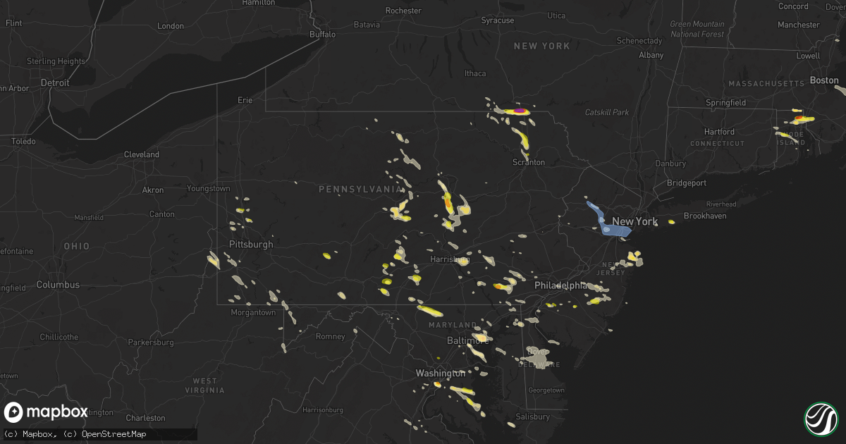
Hail Map in Pennsylvania on June 29, 2019
Get this storm
June 29 map
$229
one time, instant access
Download today. No call, no setup
Keep the $229
Bought the map and want the full workflow? Apply the entire $229 to a subscription within 7 days. None of it is wasted.
Every map, not just this one
This buys you this map. Subscription and you get every map we run, in the markets you choose from a few cities to whole states to nationwide. Plus real-time alerts the moment a storm fires.
Contact data
Name, contact info, occupancy, even credit band for addresses in the footprint. You go from where it hit to who to call.
Become the source they trust
Unlimited branding weather history reports on demand. You already have the documented answer ready for the property owner, and you are the one who showed up with it.
Property data and RoofTrace estimates
Pull up any address you have got, its value and the exact code rules for that jurisdiction, straight from One Click Code. Then RoofTrace estimates the squares, pitch, and roof value, priced the way you price.
Storm reports in Pennsylvania
Pennsylvania
| Date | Description |
|---|---|
| 06/29/20196:46 PM CDT | Trees down between stahlstown and ligonier |
| 06/29/20196:42 PM CDT | Multiple trees and powerlines down in heidelberg township. |
| 06/29/20196:05 PM CDT | Multiple trees down in pine grove township. |
| 06/29/20195:50 PM CDT | Numerous trees down |
| 06/29/20195:50 PM CDT | Numerous trees down |
| 06/29/20195:30 PM CDT | Multiple trees down in lower augusta township. |
| 06/29/20195:25 PM CDT | Trees and wires down |
| 06/29/20195:16 PM CDT | Multiple trees down in shamokin township. |
| 06/29/20194:40 PM CDT | 2 trees down on buildings |
| 06/29/20194:40 PM CDT | Multiple power poles down |
| 06/29/20194:35 PM CDT | Numerous trees down |
| 06/29/20194:25 PM CDT | Tree partially blocking state route 65 |
| 06/29/20194:21 PM CDT | Several trees down |
| 06/29/20194:20 PM CDT | Several trees down in walter panek park |
| 06/29/20194:20 PM CDT | Numerous trees down |
| 06/29/20194:20 PM CDT | Trees down |
| 06/29/20194:10 PM CDT | Numerous trees down |
| 06/29/20193:51 PM CDT | Tree and wires down near 618 fern street. Time estimated from radar. |
| 06/29/20193:51 PM CDT | Photo of a large tree down. Time estimated from radar. |
| 06/29/20193:48 PM CDT | Trees down. Time estimated from radar. |
| 06/29/20193:45 PM CDT | Trees and power lines down between washington and christian streets. Time estimated from radar. |
| 06/29/20193:43 PM CDT | Tree down near roosevelt street |
| 06/29/20193:43 PM CDT | Tree down on a truck and apartment. Time estimated from radar. |
| 06/29/20193:43 PM CDT | Mping report of tree limbs down and property damage from thunderstorm winds. Time estimated from radar. |
| 06/29/20193:40 PM CDT | Downed tree severely damaged an apartment building. Time estimated from radar. |
| 06/29/20193:32 PM CDT | Social media photos of several trees down in the northeast philadelphia area. Time estimated from radar. |
| 06/29/20193:30 PM CDT | Downed tree near the intersection of chancellor avenue and northwood avenue. Time estimated from radar. |
| 06/29/20193:30 PM CDT | Reports of downed trees in the area. Time estimated from radar. |
| 06/29/20193:28 PM CDT | A local report indicates 1.00 inch wind near 1 NE CLARKS SUMMIT |
| 06/29/20193:28 PM CDT | Large tree blown down blocking stahl road near welsh road. Time estimated from radar. |
| 06/29/20193:26 PM CDT | Downed tree on ashmead road near tookany creek parkway. Time estimated from radar. |
| 06/29/20193:26 PM CDT | Several trees down in this area. Time estimated from radar. |
| 06/29/20193:25 PM CDT | Trees down near the intersection of love road and state route 949. Time estimated from radar. |
| 06/29/20193:24 PM CDT | Downed tree on oak lane road near coventry road. Time estimated from radar. |
| 06/29/20193:22 PM CDT | Downed tree on tennis avenue near limekiln pike. Time estimated from radar. |
| 06/29/20193:22 PM CDT | Road sign blown over near the intersection of argyle road and wynnewood road. Time estimated from radar. |
| 06/29/20193:18 PM CDT | Downed tree and wires near the intersection of dove lake road and black rock road. Time estimated from radar. |
| 06/29/20193:18 PM CDT | Large limbs downed from the canopies of several oak and maple trees. Time estimated from radar. |
| 06/29/20193:18 PM CDT | Large tree down on conshohocken state road near waverly road. Time estimated from radar. |
| 06/29/20193:16 PM CDT | Downed tree at barren hill road and river road. Time estimated from radar. |
| 06/29/20193:16 PM CDT | Large trees down near stony lane. Time estimated from radar. |
| 06/29/20193:15 PM CDT | Power lines down |
| 06/29/20193:14 PM CDT | Downed tree blocking interstate 76 exit ramp to balligomingo road. Time estimated from radar. |
| 06/29/20193:14 PM CDT | Downed tree near the intersection of old eagle school road and valley road. Time estimated from radar. |
| 06/29/20193:14 PM CDT | Downed tree on state highway 352 near middletown road. All lanes closed. Time estimated from radar. |
| 06/29/20193:12 PM CDT | Downed tree near the intersection of upper gulph road and wentworth road. Time estimated from radar. |
| 06/29/20193:08 PM CDT | Downed tree near the intersection of oriole drive and chandler mill road. Time estimated from radar. |
| 06/29/20193:08 PM CDT | Downed tree near the intersection of valley road and swedesford road. Time estimated from radar. |
| 06/29/20193:08 PM CDT | Power lines down |
| 06/29/20193:08 PM CDT | Corrects previous tstm wnd dmg report from 1 wsw gradyville. Downed tree on gradyville road near valley road. All lanes closed. Time estimated from radar. |
| 06/29/20193:06 PM CDT | Downed tree on state highway 352 near valley road. All lanes closed. Time estimated from radar. |
| 06/29/20193:06 PM CDT | Reports of downed trees and limbs in several locations in and near west chester. Time estimated from social media reports and radar. |
| 06/29/20193:05 PM CDT | Tree down across roadway in benton township. Time estimated from radar. |
| 06/29/20193:05 PM CDT | Trees down. Time estimated from radar. |
| 06/29/20193:03 PM CDT | Large tree limbs downed. Time estimated from radar. |
| 06/29/20193:02 PM CDT | Downed tree near stellas way and level road. Time estimated from radar. |
| 06/29/20193:02 PM CDT | Downed tree blocking boot road near king road in west whiteland twp. Time estimated from radar. |
| 06/29/20192:58 PM CDT | Downed tree on stony run road near schuylkill road in east vincent twp. Time estimated from radar. |
| 06/29/20192:58 PM CDT | Downed tree in wires at the intersection of bethel church road and kolb road. Lane closures required. Time estimated from radar. |
| 06/29/20192:58 PM CDT | Downed tree near the intersection of woodland drive and santillo way. Time estimated from radar. |
| 06/29/20192:57 PM CDT | A local report indicates 1.00 inch wind near 2 SSW WEST LENOX |
| 06/29/20192:54 PM CDT | Downed tree blocking dorian mill road near robert dean drive. Time estimated from radar. |
| 06/29/20192:52 PM CDT | Photo shows a large tree down on a fence and power lines. Time estimated from radar. |
| 06/29/20192:51 PM CDT | Downed tree near the intersection of william salesbury drive and hickory drive. Time estimated from radar. |
| 06/29/20192:51 PM CDT | Corrects previous tstm wnd dmg report from coatesville. Photo of a large tree down. Time estimated from radar. |
| 06/29/20192:48 PM CDT | Tree down across roadway. |
| 06/29/20192:47 PM CDT | Downed tree near the intersection of strasburg road and youngsburg road. Time estimated from radar. |
| 06/29/20192:45 PM CDT | Several reports of downed trees and wires on freemansburg avenue. Time estimated from radar. |
| 06/29/20192:41 PM CDT | Downed tree blocking limestone road near highland road. Time estimated from radar. |
| 06/29/20192:39 PM CDT | Social media video footage of numerous trees down and property damage in the potter street and tioga street sections of allentown. Time estimated from radar. |
| 06/29/20192:39 PM CDT | Downed tree on jacksonville road near macada road. Time estimated from radar. |
| 06/29/20192:37 PM CDT | Tree down on harford road. Time estimated from radar. |
| 06/29/20192:37 PM CDT | Downed tree on gap newport pike near glen run road. Time estimated from radar. |
| 06/29/20192:35 PM CDT | Downed tree in wires at the intersection of chestnut street and kings highway. Lane closures in place. Time estimated from radar. |
| 06/29/20192:33 PM CDT | Time estimated from radar. |
| 06/29/20192:33 PM CDT | Downed tree blocking monacy road near manor road. Time estimated from radar. |
| 06/29/20192:32 PM CDT | Numerous trees and powerlines down in the area south of susquehanna st. A few roads blocked. Time estimated from radar. |
| 06/29/20192:31 PM CDT | Downed trees and power lines on and near fallowfield road. Time estimated from radar. |
| 06/29/20192:31 PM CDT | A local report indicates 1.00 inch wind near WAGONTOWN |
| 06/29/20192:29 PM CDT | Downed tree near the intersection of limestone road and old racetrack road. Time estimated from radar.. |
| 06/29/20192:29 PM CDT | Wires down along route 706. Time estimated from radar. |
| 06/29/20192:29 PM CDT | Downed tree at the intersection of christy court and white bear road. Time estimated from radar. |
| 06/29/20192:28 PM CDT | Wires down blocking entire roadway |
| 06/29/20192:26 PM CDT | Downed tree on cedar knoll road in west caln twp. Time estimated from radar. |
| 06/29/20192:26 PM CDT | Downed tree near the intersection of airport road and ash road. Time estimated from radar. |
| 06/29/20192:26 PM CDT | Downed tree blocking the roadway at the intersection of kings highway and ash road. Time estimated from radar. |
| 06/29/20192:24 PM CDT | Downed tree blocking the roadway at the intersection of sandy hill road and tyler drive. Time estimated from radar. |
| 06/29/20192:22 PM CDT | Downed tree on wires on welsh road in cumru twp. Time estimated from radar. |
| 06/29/20192:22 PM CDT | Downed tree onto a house on commonwealth blvd in kenhorst boro. Time estimated from radar. |
| 06/29/20192:21 PM CDT | Multiple reports of trees down in the area of intersection of warner road and chestnut ridge road. Time estimated from radar. |
| 06/29/20192:20 PM CDT | Multiple trees down in manheim twp. |
| 06/29/20192:20 PM CDT | Multiple trees down in east cocalico twp. |
| 06/29/20192:16 PM CDT | Downed tree on hoch road. Time estimated from radar. |
| 06/29/20192:08 PM CDT | Downed tree on gradyville road near valley road. All lanes closed. Time estimated from radar. |
| 06/29/20192:00 PM CDT | Several large trees down. |
| 06/29/20191:57 PM CDT | Trees and wires down |
| 06/29/20191:55 PM CDT | Trees and wires down |
| 06/29/20191:50 PM CDT | Multiple trees down on water street |
| 06/29/20191:44 PM CDT | Multiple trees down |
| 06/29/20191:15 PM CDT | Multiple trees down |
| 06/29/201912:50 PM CDT | Numerous trees down |
| 06/29/201912:35 PM CDT | Multiple trees down |
| 06/29/201912:25 PM CDT | Numerous trees down |
| 06/29/201912:22 PM CDT | Multiple trees and wires down |
| 06/29/201912:20 PM CDT | *** 20 inj *** over a dozen trees down. Multiple camping tents blown over... One large party tent knocked over. Numerous injuries reported... Most minor. |
| 06/29/201912:05 PM CDT | Numerous trees down |
| 06/29/201911:45 AM CDT | Multiple trees and wires down |
| 06/29/201911:38 AM CDT | Mix of dime and quarter size hail. |
| 06/29/201911:20 AM CDT | Numerous trres and wires down |
| 06/29/201911:20 AM CDT | Two trees down near rockview prison |
| 06/29/201911:17 AM CDT | Two trees down near prison |
| 06/29/201910:42 AM CDT | Trees down... Time estimated from radar |
| 06/29/20197:59 AM CDT | At 1258 PM EDT, a severe thunderstorm was located near Trough Creek State Park, moving southeast at 35 mph. HAZARD...60 mph wind gusts and quarter size hail. SOURCE...Radar indicated. IMPACT...Hail damage to vehicles is expected. Expect wind damage to trees, roofs, and siding. Locations impacted include... Chambersburg, Shippensburg, Guilford, Mount Union, Scotland, Newville, Rockhill Furnace, Raystown Dam, Willow Hill, Fannettsburg, Roxbury, Big Spring State Park, Doylesburg, Upper Strasburg, Trough Creek State Park, McConnellstown, Three Springs, Mapleton, Orbisonia and Saltillo.This includes the following Interstates... The Pennsylvania Turnpike from mile markers 184 to 215. Interstate 81 from mile markers 13 to 29. |
| 06/29/20197:45 AM CDT | At 1245 PM EDT, a severe thunderstorm was located near Reeds Gap State Park, moving east at 30 mph. HAZARD...60 mph wind gusts and quarter size hail. SOURCE...Radar indicated. IMPACT...Hail damage to vehicles is expected. Expect wind damage to trees, roofs, and siding. Locations impacted include... Burnham, Milroy, Yeagertown, Mcalisterville, McClure, Beaver Springs, Reedsville, Troxelville, Alfarata, Belltown, Weikert, Snyder-Middleswart State Park, Laurelton Center, Seven Mountains, Reeds Gap State Park, Beavertown, Hartleton, Wagner and Siglerville. |
| 06/29/20197:40 AM CDT | At 1240 PM EDT, a severe thunderstorm was located over Mars, or near Cranberry, moving southeast at 15 mph. HAZARD...Wind gusts to 60 mph and quarter-size hail. SOURCE...Radar. IMPACT...Minor hail damage to vehicles is possible. Expect wind damage to trees and power lines, resulting in some power outages. Locations impacted include... Cranberry... Seven Fields... Gibsonia... Sarver... Evans City... Mars... Saxonburg... Russellton... Nixon... Curtisville... Valencia... Connoquenessing... |
| 06/29/20197:28 AM CDT | At 1227 PM EDT, a severe thunderstorm was located near Renovo, moving southeast at 35 mph. HAZARD...60 mph wind gusts and quarter size hail. SOURCE...Radar indicated. IMPACT...Hail damage to vehicles is expected. Expect wind damage to trees, roofs, and siding. Locations impacted include... Renovo, Waterville, Hyner, Little Pine State Park and Cammal. |
| 06/29/20197:20 AM CDT | At 1220 PM EDT, a severe thunderstorm was located over Pleasant Gap, moving east at 35 mph. HAZARD...60 mph wind gusts and quarter size hail. SOURCE...Radar indicated. IMPACT...Hail damage to vehicles is expected. Expect wind damage to trees, roofs, and siding. Locations impacted include... State College, Bellefonte, Woodward, Boalsburg, Pleasant Gap, Lemont, Zion, Houserville, Centre Hall, Milesburg, Millheim, Aaronsburg, Rebersburg, Spring Mills, Coburn, Madisonburg, Potters Mills, Poe Valley State Park, Seven Mountains and Tussey Mountain Ski Area.For those driving on Interstate 80, this includes areas between theMilesburg and Lamar exits, specifically from mile markers 158 to 162.This includes Interstate 99 from mile markers 77 to 85. |
| 06/29/20197:07 AM CDT | At 1207 PM EDT, a severe thunderstorm was located near Zelienople, or 11 miles northeast of Beaver Falls, moving southeast at 20 mph. HAZARD...Wind gusts to 60 mph and quarter-size hail. SOURCE...Radar. IMPACT...Minor hail damage to vehicles is possible. Expect wind damage to trees and power lines, resulting in some power outages. Locations impacted include... Meridian... Zelienople... Evans City... Prospect... Harmony... Connoquenessing... Portersville... |
| 06/29/20196:38 AM CDT | At 1137 AM EDT, a severe thunderstorm was located near North Philipsburg, moving east at 35 mph. HAZARD...60 mph wind gusts and quarter size hail. SOURCE...Radar indicated. IMPACT...Hail damage to vehicles is expected. Expect wind damage to trees, roofs, and siding. Locations impacted include... Philipsburg, Lemont, Houserville, Milesburg, Chester Hill, Snow Shoe, North Philipsburg, Clarence, South Philipsburg, Moshannon, Julian, Black Moshannon State Park, Morrisdale, West Decatur, Grassflat, Kylertown, Wallaceton, Unionville and University Park Airport.For those driving on Interstate 80, this includes areas between theWoodland and Milesburg exits, specifically from mile markers 127 to155.This includes Interstate 99 near mile marker 67...and from milemarkers 73 to 76. |
| 06/29/20195:23 AM CDT | At 1023 PM EDT, a severe thunderstorm was located over Emmitsburg, moving east at 25 mph. HAZARD...60 mph wind gusts and quarter size hail. SOURCE...Radar indicated. IMPACT...Damaging winds will cause some trees and large branches to fall. This could injure those outdoors, as well as damage homes and vehicles. Roadways may become blocked by downed trees. Localized power outages are possible. Unsecured light objects may become projectiles. Locations impacted include... Westminster, Emmitsburg, Taneytown, New Windsor, Union Bridge, Harney, Linwood, Detour, Uniontown, Wagners Mill, Keysville, Marston and Keymar. |
| 06/29/20194:42 AM CDT | At 942 PM EDT, a severe thunderstorm was located near Triadelphia, moving southeast at 25 mph. HAZARD...Wind gusts to 60 mph and quarter-size hail. SOURCE...Radar. IMPACT...Minor hail damage to vehicles is possible. Expect wind damage to trees and power lines, resulting in some power outages. Locations impacted include... Moundsville... Glen Dale... Cameron... Rogersville... Aleppo... New Freeport... Glendale... Rocklick... Lone Oak... Glen Easton... Grand Vue Park... Dallas... |
| 06/29/20194:18 AM CDT | At 917 PM EDT, severe thunderstorms were located along a line extending from near Williamsport to near Greenwood, moving southeast at 25 mph. HAZARD...60 mph wind gusts. SOURCE...Radar indicated. IMPACT...Damaging winds will cause some trees and large branches to fall. This could injure those outdoors, as well as damage homes and vehicles. Roadways may become blocked by downed trees. Localized power outages are possible. Unsecured light objects may become projectiles. Locations impacted include... Hagerstown, Martinsburg, Charles Town, Shepherdstown, Hancock, Paw Paw, Municipal Stadium, Greenwood, Robinwood, Fountainhead-Orchard Hills, Ranson, Boonsboro, Smithsburg, Inwood, Paramount-Long Meadow, Wilson-Conococheague, Williamsport, Berkeley Springs, Mount Aetna and Mount Lena. |
| 06/29/20194:17 AM CDT | At 917 PM EDT, a severe thunderstorm was located 8 miles northwest of Jefferson Boro, or 8 miles north of Waynesburg, moving southeast at 30 mph. HAZARD...Wind gusts to 60 mph and quarter-size hail. SOURCE...Radar. IMPACT...Minor hail damage to vehicles is possible. Expect wind damage to trees and power lines, resulting in some power outages. Locations impacted include... Waynesburg... Masontown... Brownsville... Fredericktown-Millsboro... Fairdale... Jefferson Boro... Isabella... West Brownsville... Deemston... Bobtown... Republic... Nemacolin... |
| 06/29/20193:43 AM CDT | At 843 PM EDT, a severe thunderstorm was located over Lanesboro, or 10 miles southwest of Deposit, moving east at 30 mph. HAZARD...Half dollar size hail. SOURCE...Radar indicated. IMPACT...Damage to vehicles is expected. Locations impacted include... Susquehanna, Deposit, Susquehanna Depot, Hancock, Lanesboro, Starrucca, Hiawatha, Shehawken, Starlight and Starruca. |
| 06/29/20193:41 AM CDT | At 841 PM EDT, a severe thunderstorm was located near Wellsburg, moving southeast at 20 mph. HAZARD...Wind gusts to 60 mph and quarter-size hail. SOURCE...Radar. IMPACT...Minor hail damage to vehicles is possible. Expect wind damage to trees and power lines, resulting in some power outages. Locations impacted include... Washington... Canonsburg... Wellsburg... West Liberty... Avella... Valley Grove... Wolfdale... McGovern... Houston... Bethany... Claysville... Franklin... |
| 06/29/20193:16 AM CDT | At 815 PM EDT, a severe thunderstorm was located over Hooverson Heights, or near Avella, moving southeast at 25 mph. HAZARD...Wind gusts to 60 mph and quarter-size hail. SOURCE...Radar. IMPACT...Minor hail damage to vehicles is possible. Expect wind damage to trees and power lines, resulting in some power outages. Locations impacted include... Weirton... Avella... Wolfdale... Hooverson Heights... Franklin... Hickory... Taylorstown... West Middletown... Rockdale... Atlasburg... |
| 06/29/20193:00 AM CDT | At 800 PM EDT, a severe thunderstorm was located over McGovern, or over Canonsburg, moving southeast at 25 mph. HAZARD...Wind gusts to 60 mph and quarter-size hail. SOURCE...Radar. IMPACT...Minor hail damage to vehicles is possible. Expect wind damage to trees and power lines, resulting in some power outages. Locations impacted include... McMurray... Washington... Canonsburg... Monongahela... Wolfdale... McGovern... Bentleyville... East Washington... New Eagle... Wickerham Manor-Fisher... Baidland... Houston... |
| 06/29/20192:59 AM CDT | At 759 PM EDT, a severe thunderstorm was located over Follansbee, or over Steubenville, moving southeast at 30 mph. HAZARD...Wind gusts to 60 mph and quarter-size hail. SOURCE...Radar. IMPACT...Minor hail damage to vehicles is possible. Expect wind damage to trees and power lines, resulting in some power outages. Locations impacted include... Weirton... Steubenville... Avella... Mingo Junction... Follansbee... Hooverson Heights... Franklin... Atlasburg... Rockdale... Colliers... Langeloth... East Steubenville... |
| 06/29/20192:55 AM CDT | At 755 PM EDT, a severe thunderstorm was located over Little Meadows, or 7 miles south of Endicott, moving east at 25 mph. HAZARD...Quarter size hail. SOURCE...Radar indicated. IMPACT...Damage to vehicles is expected. Locations impacted include... Endicott, Susquehanna, Susquehanna Depot, Montrose, Harford, Hallstead, New Milford, Great Bend, Lanesboro and Little Meadows. |
| 06/29/20192:53 AM CDT | At 752 PM EDT, a severe thunderstorm was located near Ephrata, moving southeast at 40 mph. HAZARD...60 mph wind gusts and nickel size hail. SOURCE...Radar indicated. IMPACT...Expect damage to trees, roofs, and siding. Locations impacted include... Ephrata, Lititz, New Holland, Akron, Leola, Paradise, Denver, Reamstown, Rothsville, Gap, Adamstown, Brickerville, Terre Hill, Churchtown, Leacock, Bareville, Bowmansville, Reinholds, Intercourse and Christiana.This includes The Pennsylvania Turnpike from mile markers 273 to 295. |
| 06/29/20192:41 AM CDT | At 740 PM EDT, severe thunderstorms were located along a line extending from near Warren Center to near East Smithfield, moving southeast at 25 mph. HAZARD...60 mph wind gusts and quarter size hail. SOURCE...Radar indicated. IMPACT...Hail damage to vehicles is expected. Expect wind damage to roofs, siding, and trees. Locations impacted include... Rush, Athens, Towanda, Wysox, Sheshequin, Ulster, Orwell, North Towanda, Windham and Herrick. |
| 06/29/20191:45 AM CDT | At 644 PM EDT, severe thunderstorms were located along a line extending from Leck Kill to near Urban to Port Trevorton, moving southeast at 45 mph. HAZARD...60 mph wind gusts and penny size hail. SOURCE...Radar indicated. IMPACT...Expect damage to trees, roofs, and siding. Locations impacted include... Linglestown, Skyline View, Valley View, Millersburg, Pine Grove, Lykens, Tremont, Elizabethville, Williamstown, Tower City, Port Trevorton, Donaldson, Klingerstown, Harper Tavern, Leck Kill, Urban, Dehart Dam, Rebuck, Meiserville and Lickdale.This includes the following Interstates... Interstate 78 near mile marker 0. Interstate 81 from mile markers 76 to 109. |
| 06/29/20191:04 AM CDT | At 603 PM EDT, a severe thunderstorm was located over Winfield, moving southeast at 35 mph. HAZARD...60 mph wind gusts and penny size hail. SOURCE...Radar indicated. IMPACT...Expect damage to trees, roofs, and siding. Locations impacted include... Sunbury, Shamokin, Milton, Mount Carmel, Lewisburg, Selinsgrove, Danville, Northumberland, Kulpmont, Winfield, Elysburg, Fairview-Ferndale, Riverside, Trevorton, Shamokin Dam, Linntown, Marshallton, Hummels Wharf, Montandon and Kratzerville.For those driving on Interstate 80, this includes areas between theLimestoneville and Danville exits, specifically from mile markers 216to 222. |
| 06/29/201912:16 AM CDT | At 515 PM EDT, a severe thunderstorm was located over Aliquippa, moving southeast at 25 mph. HAZARD...Wind gusts to 60 mph and quarter-size hail. SOURCE...Radar. IMPACT...Minor hail damage to vehicles is possible. Expect wind damage to trees and power lines, resulting in some power outages. Locations impacted include... Ross Township... McCandless Township... Moon Township... Franklin Park... Aliquippa... Monaca... Hampton Township... Robinson Township... Economy... Kennedy Township... Ambridge... Wexford... |
| 06/29/201912:01 AM CDT | At 501 PM EDT, a severe thunderstorm was located near Curwensville, moving southeast at 35 mph. HAZARD...60 mph wind gusts and penny size hail. SOURCE...Radar indicated. IMPACT...Expect damage to trees, roofs, and siding. Locations impacted include... DuBois, Clearfield, Sandy, Philipsburg, Woodland, Curwensville, Hyde, Osceola Mills, Plymptonville, Rockton, Chester Hill, Houtzdale, Jeffries, S.B. Elliot State Park, Morrisdale, Irvona, West Decatur, Coalport, Ramey and Brisbin.For those driving on Interstate 80, this includes areas between theDubois and Snow Shoe exits, specifically from mile markers 97 to 138. |
| 06/28/201911:59 PM CDT | At 458 PM EDT, severe thunderstorms were located along a line extending from near Renovo to near Williamsport, moving southeast at 35 mph. HAZARD...60 mph wind gusts and penny size hail. SOURCE...Radar indicated. IMPACT...Expect damage to trees, roofs, and siding. Locations impacted include... Williamsport, Lock Haven, Milton, Montoursville, Jersey Shore, Carroll, Lamar, Muncy, Watsontown, Mill Hall, Montgomery, Avis, Dunnstown, Flemington, Renovo, Duboistown, Castanea, New Columbia, McElhattan and South Renovo.For those driving on Interstate 80, this includes areas between theBellefonte and Danville exits, specifically from mile markers 171 to217.This includes Interstate 180 from mile markers 1 to 29. |
| 06/28/201911:36 PM CDT | At 436 PM EDT, a severe thunderstorm was located over Scranton, moving southeast at 15 mph. HAZARD...Quarter size hail. SOURCE...Radar indicated. IMPACT...Damage to vehicles is expected. Locations impacted include... Scranton, Dunmore, Old Forge, Taylor, Moosic, Moscow, Lehigh, Gouldsboro, Yostville and Springbrook Corners. |
| 06/28/201911:28 PM CDT | At 427 PM EDT, severe thunderstorms were located along a line extending from Willow Grove to near Hancocks Bridge, moving southeast at 40 mph. HAZARD...70 mph wind gusts and quarter size hail. SOURCE...Radar indicated. IMPACT...Minor damage to vehicles is possible. Expect considerable tree damage. Wind damage is also likely to mobile homes, roofs, and outbuildings. Locations impacted include... Philadelphia, Trenton, Camden, Vineland, Millville, Bridgeton, Gloucester City, Cherry Hill, Bensalem, Evesham, Mount Laurel, Ewing, Chester, Willingboro, Deptford, Voorhees, Medford, West Deptford, Glassboro and Lindenwold. |
| 06/28/201911:17 PM CDT | At 417 PM EDT, a severe thunderstorm was located 8 miles west of Brookville, moving southeast at 20 mph. HAZARD...Wind gusts to 60 mph and quarter-size hail. SOURCE...Radar. IMPACT...Minor hail damage to vehicles is possible. Expect wind damage to trees and power lines, resulting in some power outages. Locations impacted include... Brookville... Summerville... Corsica... Worthville... |
| 06/28/201911:05 PM CDT | At 405 PM EDT, a severe thunderstorm was located over Leetonia, moving southeast at 45 mph. HAZARD...60 mph wind gusts and penny size hail. SOURCE...Radar indicated. IMPACT...Expect damage to trees, roofs, and siding. Locations impacted include... Williamsport, Montoursville, Morris, Blossburg, Duboistown, Arnot, Elimsport, Waterville, Leonard Harrison State Park, Ralston, Cedar Run, Cammal, Trout Run, Barbours, Little Pine State Park, Leetonia, Cogan Station, Collomsville, Ogdensburg and Slate Run.This includes Interstate 180 from mile markers 16 to 29. |
| 06/28/201911:04 PM CDT | At 404 PM EDT, severe thunderstorms were located along a line extending from Union Dale to Glenwood, moving southeast at 30 mph. HAZARD...Half dollar size hail. SOURCE...Radar indicated. IMPACT...Damage to vehicles is expected. Locations impacted include... Scranton, Dunmore, Carbondale, Archbald, Blakely, Dickson City, Olyphant, Clarks Summit, Jessup and Throop. |
| 06/28/201910:59 PM CDT | At 358 PM EDT, a severe thunderstorm was located near Slippery Rock, or 10 miles northwest of Butler, moving east at 20 mph. HAZARD...Wind gusts to 60 mph and quarter-size hail. SOURCE...Radar. IMPACT...Minor hail damage to vehicles is possible. Expect wind damage to trees and power lines, resulting in some power outages. Locations impacted include... Butler... Homeacre-Lyndora... Shanor-Northvue... East Butler... West Liberty... West Sunbury... Hooker... Moraine State Park... |
| 06/28/201910:56 PM CDT | At 355 PM EDT, severe thunderstorms were located along a line extending from near Roxburg to near Geryville, moving southeast at 25 mph. HAZARD...60 mph wind gusts and penny size hail. SOURCE...Radar indicated. IMPACT...Damage to roofs, siding, trees, and power lines is possible. Locations impacted include... Quakertown, Perkasie, Doylestown, Byram, Souderton, Bedminster, Washington, Chalfont, Tinicum, High Bridge, Clinton, Belvidere, Harmony, Oxford, Alpha, Dublin, Glen Gardner, Ferndale, Hampton and Frenchtown. |
| 06/28/201910:31 PM CDT | At 331 PM EDT, a severe thunderstorm was located over Greendell, or near Newton, moving southeast at 20 mph. HAZARD...60 mph wind gusts and quarter size hail. SOURCE...Radar indicated. IMPACT...Minor damage to vehicles is possible. Wind damage to roofs, siding, trees, and power lines is possible. Locations impacted include... Newton, Dover, Hopatcong, Hackettstown, Wharton, Rockaway, Blairstown, Mount Arlington, Stanhope, Netcong, Hope, Chester, Victory Gardens, Delaware Water Gap, Andover, Lake Mohawk, Greendell, Millbrook, Long Valley and Green Pond. |
| 06/28/201910:29 PM CDT | At 328 PM EDT, a severe thunderstorm was located near Westminster, moving southeast at 20 mph. HAZARD...60 mph wind gusts. SOURCE...Radar indicated. IMPACT...Damaging winds will cause some trees and large branches to fall. This could injure those outdoors, as well as damage homes and vehicles. Roadways may become blocked by downed trees. Localized power outages are possible. Unsecured light objects may become projectiles. Locations impacted include... Westminster, Eldersburg, Taneytown, Hampstead, Walkersville, Manchester, Sykesville, Oakland, Gamber, New Windsor, Woodsboro, Union Bridge, Libertytown, Finksburg, Carrollton, Winfield, New Midway, Louisville, Linwood and Uniontown. |
| 06/28/201910:24 PM CDT | At 324 PM EDT, a severe thunderstorm was located over Greenville, or near Wilmington, moving east at 20 mph. HAZARD...60 mph wind gusts and quarter size hail. SOURCE...Radar indicated. IMPACT...Minor damage to vehicles is possible. Wind damage to roofs, siding, trees, and power lines is possible. Locations impacted include... Wilmington, Chester, Pennsville, Carneys Point, Elsmere, Penns Grove, Newport, Arden, Greenville, Talleyville, Hockessin, Ashland, North Star, Chester Township, Pike Creek, Marcus Hook, Trainer, Bellefonte, Ardentown and Ardencroft. |
| 06/28/201910:12 PM CDT | At 312 PM EDT, severe thunderstorms were located along a line extending from near Brackney to near Le Raysville, moving southeast at 30 mph. HAZARD...Quarter size hail. SOURCE...Radar indicated. IMPACT...Damage to vehicles is expected. Locations impacted include... Rush, Jackson, Clifford, Forest City, Montrose, Dimock, Harford, Orwell, New Milford and Vandling. |
| 06/28/201910:09 PM CDT | At 309 PM EDT, severe thunderstorms were located along a line extending from near Honey Brook to near Cochranville, moving east at 30 mph. HAZARD...60 mph wind gusts and penny size hail. SOURCE...Radar indicated. IMPACT...Damage to roofs, siding, trees, and power lines is possible. Locations impacted include... Coatesville, Downingtown, Kennett Square, Parkesburg, West Grove, Honey Brook, Cochranville, Marshallton, Ladenberg, Lionville-Marchwood, Atglen, South Coatesville, Avondale, Modena, Thorndale and Toughkenamon. |
| 06/28/20199:46 PM CDT | At 246 PM EDT, a severe thunderstorm was located near Mercersburg, or near Greencastle, moving southeast at 20 mph. HAZARD...60 mph wind gusts and quarter size hail. SOURCE...Radar indicated. IMPACT...Damaging winds will cause some trees and large branches to fall. This could injure those outdoors, as well as damage homes and vehicles. Roadways may become blocked by downed trees. Localized power outages are possible. Unsecured light objects may become projectiles. Locations impacted include... Hagerstown, Thurmont, Emmitsburg, Robinwood, Taneytown, Fountainhead-Orchard Hills, Smithsburg, Paramount-Long Meadow, Mount Aetna, Long Meadow, Wolfsville, Maugansville, Cavetown, Leitersburg, Sabillasville, Fort Ritchie, Chewsville, Ringgold, Middleburg and Warrenton. |
| 06/28/20199:45 PM CDT | At 245 PM EDT, a severe thunderstorm was located over Campbelltown, moving east at 30 mph. HAZARD...60 mph wind gusts and quarter size hail. SOURCE...Radar indicated. IMPACT...Hail damage to vehicles is expected. Expect wind damage to trees, roofs, and siding. Locations impacted include... Lancaster, Lebanon, Hershey, Ephrata, Elizabethtown, Lititz, Middletown, Mount Joy, Palmyra, Manheim, Annville, Hummelstown, East Petersburg, Cornwall, Akron, Leola, Salunga-Landisville, Denver, Campbelltown and Reamstown.This includes The Pennsylvania Turnpike from mile markers 252 to 287. |
| 06/28/20199:27 PM CDT | At 226 PM EDT, severe thunderstorms were located along a line extending from Mechanicsville to Aristes to Pine Grove to Fort Indiantown Gap, moving east at 30 mph. HAZARD...60 mph wind gusts and quarter size hail. SOURCE...Radar indicated. IMPACT...Minor damage to vehicles is possible. Wind damage to roofs, siding, trees, and power lines is possible. Locations impacted include... Reading, Wyomissing, Hamburg, Fleetwood, Sinking Spring, Laureldale, Womelsdorf, Wernersville, Newmanstown, Leesport, Shoemakersville, Bernville, Strausstown, Lenhartsville, Fairview Hgts, Spring Ridge, Centerport, Wyomissing Hills, West Lawn and Whitfield. |
| 06/28/20199:01 PM CDT | At 200 PM EDT, a severe thunderstorm was located near Klingerstown, moving east at 35 mph. HAZARD...60 mph wind gusts and quarter size hail. SOURCE...Radar indicated. IMPACT...Hail damage to vehicles is expected. Expect wind damage to trees, roofs, and siding. Locations impacted include... Pottsville, Shamokin, Mount Carmel, Schuylkill Haven, Shenandoah, Minersville, Frackville, St. Clair, Kulpmont, Ashland, Elysburg, Pine Grove, Fairview-Ferndale, Port Carbon, Trevorton, Tremont, Catawissa, Girardville, Marshallton and Williamstown.This includes Interstate 81 from mile markers 97 to 128. |
| 06/28/20198:51 PM CDT | At 150 AM EDT, a severe thunderstorm was located 8 miles northwest of Andover, or 17 miles south of Ashtabula, moving east at 35 mph. HAZARD...60 mph wind gusts and penny size hail. SOURCE...Radar indicated. IMPACT...Expect damage to trees and power lines. Locations impacted include... Andover, Linesville, Pymatuning North, Pymatuning Central, Harmonsburg, Roaming Shores, Pierpont, Cherry Valley, Conneautville, Conneaut Lake, Rock Creek, Springboro, Hartstown and Conneaut Lakeshore. |
| 06/28/20198:32 PM CDT | Trees and power lines down |
| 06/28/20198:18 PM CDT | Wire poles blown down near 100 ridge church road. |
| 06/28/20198:10 PM CDT | At 110 PM EDT, severe thunderstorms were located along a line extending from near Mcalisterville to near Spruce Hill to Blacklog, moving east at 30 mph. HAZARD...60 mph wind gusts and quarter size hail. SOURCE...Radar indicated. IMPACT...Hail damage to vehicles is expected. Expect wind damage to trees, roofs, and siding. Locations impacted include... Marysville, Newport, Duncannon, Honey Grove, New Bloomfield, Mcalisterville, Spruce Hill, Richfield, Mexico, East Waterford, New Buffalo, Loysville, Ickesburg, Colonel Denning State Park, Blacklog, Perulack, Walnut, Shermansdale, Rockville and Liverpool. |
| 06/28/20198:06 PM CDT | Roof damage to a home. |
| 06/28/20198:00 PM CDT | Trees down on gashel road in donegal twp. |
| 06/28/20198:00 PM CDT | Roof blown off of house |
| 06/28/20197:44 PM CDT | Roof blown off house on dry ridge rd |
| 06/28/20197:23 PM CDT | Trees down at intersection of sugar run road and washington pike. |
| 06/28/20197:17 PM CDT | Trees down along fallen timber road. |
| 06/28/20197:15 PM CDT | Trees down at old 71 and brewer st |
| 06/28/20197:15 PM CDT | Trees down at linden hall golf course |
| 06/28/20197:14 PM CDT | Wire poles down near 238 meadowcroft road. |
| 06/28/20197:14 PM CDT | Trees down on 400 block of rankin rd |
| 06/28/20197:14 PM CDT | Trees down on washington pike |
| 06/28/20197:09 PM CDT | Trees and wires down blocking road |
| 06/28/20197:08 PM CDT | Trees down along redds mill road in fallowfield twp. |
All States Impacted by Hail Map on June 29, 2019
- Minnesota
- North Dakota
- New Jersey
- Oklahoma
- Texas
- Delaware
- Maryland
- Pennsylvania
- West Virginia
- Montana
- South Dakota
- Wisconsin
- New York
- Rhode Island
- Massachusetts
- Nebraska
- Illinois
- Virginia
- Ohio
- Wyoming
- Alabama
- Connecticut
- Florida
- Colorado
- Arkansas
- New Hampshire
- Georgia
- Mississippi
- Indiana
- Iowa
- Oregon
- Maine
- Kentucky
- Tennessee
- Louisiana
Cities Impacted by Hail Map on June 29, 2019
- Saint Vincent, MN
- Pembina, ND
- Lancaster, MN
- Sicklerville, NJ
- Blackwood, NJ
- Stringtown, OK
- Antlers, OK
- Daisy, OK
- Clayton, OK
- Lane, OK
- Atoka, OK
- Wolfe City, TX
- Dover, DE
- Middle River, MD
- Harmony, PA
- Fombell, PA
- Pasadena, MD
- Felton, MN
- Ponemah, MN
- Blackduck, MN
- Kelliher, MN
- Teague, TX
- Buffalo, TX
- Fairfield, TX
- Oakwood, TX
- Cummings, ND
- Mayville, ND
- Hillsboro, ND
- Portland, ND
- Richardton, ND
- Renovo, PA
- Beech Creek, PA
- Philadelphia, PA
- Waldorf, MD
- Grapeland, TX
- Houston, TX
- Pearland, TX
- Pennington, MN
- Deer River, MN
- Tenstrike, MN
- Marcell, MN
- Squaw Lake, MN
- Spring Lake, MN
- Max, MN
- Grand Rapids, MN
- Bemidji, MN
- Northome, MN
- Puposky, MN
- Talmoon, MN
- Bena, MN
- Bigfork, MN
- Hines, MN
- Cohasset, MN
- Bethany, WV
- Wellsburg, WV
- Belcamp, MD
- Bel Air, MD
- Aberdeen, MD
- Abingdon, MD
- Midlothian, TX
- Baytown, TX
- Plentywood, MT
- Webster, ND
- Coatesville, PA
- Parkesburg, PA
- Cammal, PA
- Elizabethville, PA
- Dalmatia, PA
- Mount Pleasant Mills, PA
- Port Trevorton, PA
- Liverpool, PA
- Martin, SD
- Allen, SD
- Decatur, TX
- Christiana, PA
- Strasburg, PA
- Ronks, PA
- Atglen, PA
- Paradise, PA
- Cochranville, PA
- Quarryville, PA
- Bruce, WI
- Weyerhaeuser, WI
- Conklin, NY
- Binghamton, NY
- Susquehanna, PA
- Brackney, PA
- Kirkwood, NY
- Hallstead, PA
- Windsor, NY
- Great Bend, PA
- Maddock, ND
- Lefor, ND
- Gunter, TX
- Howe, TX
- Sherman, TX
- Pawtucket, RI
- Johnston, RI
- Central Falls, RI
- Cumberland, RI
- North Attleboro, MA
- North Providence, RI
- Smithfield, RI
- Seekonk, MA
- Attleboro, MA
- Rehoboth, MA
- Providence, RI
- Lincoln, RI
- Snow, OK
- Winter, WI
- Ellsworth, NE
- Smyrna, DE
- Townsend, DE
- New Columbia, PA
- Watchung, NJ
- Plainfield, NJ
- Vincentown, NJ
- Manchester Township, NJ
- Glyndon, MN
- Webster, WI
- Salix, PA
- South Fork, PA
- Elton, PA
- Johnstown, PA
- Windber, PA
- Malden, IL
- Arlington, IL
- Spring Valley, IL
- Princeton, IL
- Cherry, IL
- Potter, NE
- Dalton, NE
- Gurley, NE
- Woodford, VA
- Fredericksburg, VA
- Crosby, ND
- Alamo, ND
- Crary, ND
- Starkweather, ND
- Devils Lake, ND
- Santa Fe, TX
- Alvin, TX
- Lansford, ND
- Maxbass, ND
- Redlake, MN
- Redby, MN
- Browns Mills, NJ
- Pemberton, NJ
- Nicholson, PA
- Kingsley, PA
- Factoryville, PA
- Fleetville, PA
- Dalton, PA
- Hop Bottom, PA
- Bellefonte, PA
- Centre Hall, PA
- State College, PA
- Kenmare, ND
- Ulster, PA
- Hammondsville, OH
- Carrollton, OH
- Kensington, OH
- Mechanicstown, OH
- Salineville, OH
- Victoria, TX
- Middle River, MN
- Gordon, NE
- Middletown, RI
- Brainerd, MN
- Lock Haven, PA
- Doylesburg, PA
- Blairs Mills, PA
- East Waterford, PA
- Blain, PA
- Mcville, ND
- Pekin, ND
- Massapequa Park, NY
- Farmingdale, NY
- Massapequa, NY
- Amityville, NY
- Lindenhurst, NY
- Copiague, NY
- Reading, PA
- Allenwood, PA
- Asbury Park, NJ
- West Long Branch, NJ
- Oakhurst, NJ
- Eatontown, NJ
- Exeland, WI
- Ojibwa, WI
- Radisson, WI
- Harrison, NE
- Lusk, WY
- Mercersburg, PA
- Towner, ND
- Rugby, ND
- Mott, ND
- Streetman, TX
- Goodridge, MN
- Corrigan, TX
- Diboll, TX
- Glenburn, ND
- Cooperstown, ND
- Finley, ND
- Hope, ND
- Waynesburg, OH
- Danville, IL
- Hoopeston, IL
- Rossville, IL
- Alvin, IL
- Bismarck, IL
- North Bend, PA
- Earleville, MD
- North East, MD
- Emory, TX
- La Grange, TX
- Giddings, TX
- Mylo, ND
- Flasher, ND
- Carson, ND
- Pingree, ND
- Danbury, WI
- Gordon, WI
- Carpenter, WY
- Watson, OK
- Powell, TX
- Kerens, TX
- Rice, TX
- Upperstrasburg, PA
- Fort Loudon, PA
- Bay City, TX
- Randolph, AL
- Penelope, TX
- Hubbard, TX
- Mertens, TX
- Frost, TX
- Malone, TX
- Laporte, MN
- Caney, OK
- Dallas, TX
- Hebron, ND
- New Leipzig, ND
- Canonsburg, PA
- Hainesport, NJ
- Mount Holly, NJ
- Lumberton, NJ
- Celeste, TX
- Farmersville, TX
- Milroy, PA
- Remer, MN
- Henning, IL
- Alexandria, VA
- Lewisburg, PA
- Canton, TX
- Bandera, TX
- Kutztown, PA
- Mertztown, PA
- Celina, TX
- Isle, MN
- Friendsville, PA
- Montrose, PA
- Ennis, TX
- Barry, TX
- Caddo Mills, TX
- Backus, MN
- Kilgore, NE
- Danville, PA
- Shrewsbury, NJ
- Long Branch, NJ
- Oceanport, NJ
- Red Bank, NJ
- Little Silver, NJ
- Deal, NJ
- Fort Monmouth, NJ
- Foster, RI
- Coventry, RI
- Greene, RI
- Saint Thomas, PA
- New Canaan, CT
- New Port Richey, FL
- Moundsville, WV
- Elgin, ND
- Colts Neck, NJ
- Monmouth Beach, NJ
- Rumson, NJ
- Bessemer, AL
- Oakman, AL
- Kemp, TX
- La Moille, IL
- Valley Stream, NY
- Lynbrook, NY
- West Hempstead, NY
- Malverne, NY
- Rockville Centre, NY
- Fleetwood, PA
- Shoemakersville, PA
- Willow City, ND
- Oxford, PA
- Elkton, MD
- Nottingham, PA
- Rising Sun, MD
- Warwick, MD
- Middletown, DE
- Chesapeake City, MD
- Winfield, PA
- Selinsgrove, PA
- Birchwood, WI
- Thief River Falls, MN
- Owego, NY
- Nichols, NY
- Jemison, AL
- Maplesville, AL
- Lawley, AL
- Brigantine, NJ
- Bottineau, ND
- Newburyport, MA
- Salisbury, MA
- Mifflintown, PA
- Atlanta, TX
- Cumby, TX
- Onarga, IL
- Gilman, IL
- Keller, TX
- Zahl, ND
- Grenora, ND
- Malvern, PA
- Monroeville, NJ
- Liverpool, TX
- Kearneysville, WV
- Kramer, ND
- Galeton, PA
- Nanticoke, MD
- Grampian, PA
- Freehold, NJ
- Jackson, NJ
- Curtis Bay, MD
- Newburg, ND
- Upham, ND
- Strasburg, CO
- Byers, CO
- Fort Washington, MD
- Shamokin, PA
- Sunbury, PA
- Paxinos, PA
- Courtenay, ND
- Spraggs, PA
- Waynesburg, PA
- Palestine, TX
- Trinity, TX
- Carr, CO
- Aliquippa, PA
- Taneytown, MD
- Keymar, MD
- Emily, MN
- Arley, AL
- Jasper, AL
- Gonvick, MN
- Hummelstown, PA
- Middletown, PA
- Harrisburg, PA
- Hershey, PA
- Elizabethtown, PA
- Clearbrook, MN
- Shermans Dale, PA
- New Bloomfield, PA
- Elliottsburg, PA
- Landisburg, PA
- Upper Marlboro, MD
- Bowie, MD
- Davidsonville, MD
- King George, VA
- Colbert, OK
- Hendrix, OK
- Calera, OK
- Durant, OK
- Huntsville, TX
- Knox, ND
- Leeds, ND
- Wolford, ND
- York, ND
- Spring Mills, PA
- Brooklyn, MD
- Greenville, TX
- Harrisburg, NE
- Palmyra, PA
- Montgomery, PA
- Ulysses, PA
- De Queen, AR
- Danforth, IL
- Kempton, IL
- Piper City, IL
- Merriman, NE
- Cody, NE
- Dayville, CT
- Danielson, CT
- Purdon, TX
- Dawson, TX
- Woonsocket, RI
- Sheyenne, ND
- Carrington, ND
- Lyme, NH
- East Rochester, OH
- Minerva, OH
- Paxton, IL
- Woodstown, NJ
- Swedesboro, NJ
- Mullica Hill, NJ
- Williamsport, MD
- Nashoba, OK
- Matagorda, TX
- Prince Frederick, MD
- Port Penn, DE
- New Castle, DE
- Longville, MN
- Marsland, NE
- Felton, DE
- Milford, DE
- Harrington, DE
- Frederica, DE
- New Rockford, ND
- Grygla, MN
- Cook, MN
- Mora, MN
- Rolette, ND
- Hawkinsville, GA
- Floodwood, MN
- Wright, MN
- Pine River, MN
- New Auburn, WI
- Chetek, WI
- Bokchito, OK
- Portal, ND
- Columbus, ND
- Noonan, ND
- Emmitsburg, MD
- Union Bridge, MD
- Westminster, MD
- Fessenden, ND
- Lititz, PA
- Valentine, NE
- Glady, WV
- Bowden, WV
- Venus, TX
- Lakota, ND
- Staten Island, NY
- Newfolden, MN
- Strandquist, MN
- Wimbledon, ND
- Tremont, MS
- Almont, ND
- Glen Ullin, ND
- Loganton, PA
- Mill Hall, PA
- Cohasset, MA
- Hull, MA
- Scituate, MA
- Morristown, IN
- Allentown, PA
- Lockesburg, AR
- Mizpah, MN
- Solway, MN
- Wirt, MN
- Bovey, MN
- Cass Lake, MN
- Jewett, TX
- Ganado, TX
- Rice Lake, WI
- Fairview, WV
- Wylie, TX
- Kerrville, TX
- Shevlin, MN
- Davenport, IA
- Walcott, IA
- Beulah, ND
- Dellroy, OH
- Brogue, PA
- Felton, PA
- Roseland, VA
- Tyro, VA
- Burnet, TX
- Jacobson, MN
- Lake Nebagamon, WI
- South Range, WI
- Poplar, WI
- Crookston, NE
- Amity, PA
- Clarksville, PA
- Prosperity, PA
- Jefferson, PA
- Washington, PA
- Marianna, PA
- Beach Haven, NJ
- Pasadena, TX
- Trego, WI
- Spooner, WI
- Dauphin, PA
- Halifax, PA
- Brownsville, PA
- East Millsboro, PA
- La Belle, PA
- Denbo, PA
- Woodway, TX
- Waco, TX
- Crawford, TX
- McGregor, TX
- Magnolia, DE
- Van Alstyne, TX
- Couderay, WI
- Hayward, WI
- Parsons, WV
- Stephen, MN
- Siren, WI
- Annawan, IL
- Pequot Lakes, MN
- Dwight, IL
- Locust Grove, OK
- Chouteau, OK
- Neptune, NJ
- Farmingdale, NJ
- Stevens, PA
- Newmanstown, PA
- Ephrata, PA
- Denver, PA
- Sisters, OR
- Tuthill, SD
- Shippensburg, PA
- Biglerville, PA
- Crosslake, MN
- La Porte, TX
- Seabrook, TX
- Lovelady, TX
- Springbrook, WI
- Gatzke, MN
- New Milford, PA
- Scio, OH
- Downingtown, PA
- Elverson, PA
- Morgantown, PA
- Glenmoore, PA
- Narvon, PA
- Honey Brook, PA
- Strathcona, MN
- Leonard, MN
- Brookston, MN
- Eustace, TX
- Bisbee, ND
- Fergus Falls, MN
- Perrysville, IN
- Georgetown, IL
- Cayuga, IN
- Justin, TX
- Haslet, TX
- Cullom, IL
- Callery, PA
- Evans City, PA
- Mars, PA
- Maud, TX
- Hooks, TX
- Cochran, GA
- Elm Mott, TX
- West, TX
- Clearville, PA
- Binford, ND
- Sutton, ND
- Glenfield, ND
- Cissna Park, IL
- Covington, IN
- Potomac, IL
- Rankin, IL
- Wellington, IL
- Williamsport, IN
- State Line, IN
- Lewisville, OH
- Summerfield, OH
- Bruceton Mills, WV
- Freeport, TX
- Morgantown, WV
- Dilliner, PA
- Maidsville, WV
- Mount Morris, PA
- Prosper, TX
- Anna, TX
- Crosby, MN
- Amsterdam, OH
- Lebanon, PA
- Chatsworth, NJ
- Barnegat, NJ
- Phoenixville, PA
- Chester Springs, PA
- Essex, MD
- Gunpowder, MD
- Rosedale, MD
- Minong, WI
- Merrifield, MN
- Glassboro, NJ
- Pitman, NJ
- Sewell, NJ
- Newport, NJ
- Elysburg, PA
- Vestal, NY
- Italy, TX
- Texarkana, TX
- Marietta, PA
- Mount Joy, PA
- Annapolis, MD
- Bowdoin, ME
- Litchfield, ME
- Sabattus, ME
- Elkins, WV
- Sabin, MN
- Hawley, MN
- Martinsburg, WV
- Inwood, WV
- Ranson, WV
- Charles Town, WV
- Shenandoah Junction, WV
- Parmelee, SD
- Manassas, VA
- Nashwauk, MN
- Hibbing, MN
- Grace City, ND
- Gibbon Glade, PA
- Farmington, PA
- Berkeley Springs, WV
- Mcgregor, MN
- Palisade, MN
- Williamstown, NJ
- Roseau, MN
- Plummer, MN
- Harwood, MD
- Edgewater, MD
- Nevada, TX
- Lusby, MD
- Hopkinsville, KY
- Manchester, NH
- Chester, NH
- Kingston, NH
- Auburn, NH
- Derry, NH
- Sandown, NH
- Londonderry, NH
- Danville, NH
- Cranberry Township, PA
- Baden, PA
- Freedom, PA
- Honey Grove, PA
- New Germantown, PA
- Newville, PA
- Oley, PA
- Petersburg, ND
- Davis, WV
- Eglon, WV
- Oakland, MD
- Cando, ND
- Neelyton, PA
- Dry Run, PA
- Cross Plains, TX
- Federal Dam, MN
- Finlayson, MN
- McGrath, MN
- Rome, PA
- Stillwater, PA
- Greencastle, PA
- Fairfield, PA
- Waynesboro, PA
- North Scituate, RI
- Chepachet, RI
- Millersville, PA
- Conestoga, PA
- Lancaster, PA
- Washington Boro, PA
- Candor, NY
- Saint Francis, SD
- Medford, NJ
- Casselton, ND
- Tamarack, MN
- Aurora, WV
- Terra Alta, WV
- Dornsife, PA
- Herndon, PA
- North Kingstown, RI
- Crane Hill, AL
- Boalsburg, PA
- Wilton, IA
- Moscow, IA
- Eagle Rock, VA
- Cove, AR
- Port Republic, MD
- Huntingtown, MD
- Oberon, ND
- Toulon, IL
- Galva, IL
- Badger, MN
- Norton, MA
- Greenville, RI
- Jamestown, ND
- Wellsville, OH
- Douglassville, TX
- Hull, TX
- Minnewaukan, ND
- Karlstad, MN
- Greenbush, MN
- Wrenshall, MN
- Barnum, MN
- Cloquet, MN
- Carlton, MN
- Joppa, MD
- Rushville, NE
- Covington, VA
- Memphis, TN
- Alto, TX
- Deerwood, MN
- Morristown, NJ
- Basking Ridge, NJ
- New Vernon, NJ
- Port Allegany, PA
- Malvern, OH
- Kitzmiller, MD
- Severn, MD
- Boonsboro, MD
- Corsicana, TX
- Burke, VA
- Fairfax Station, VA
- Springfield, VA
- Rappahannock Academy, VA
- Rock Island, IL
- Ambridge, PA
- Monaca, PA
- Sonora, KY
- Upton, KY
- Tolna, ND
- Park Rapids, MN
- Blooming Grove, TX
- Anamoose, ND
- Martin, ND
- Middleburg, PA
- Beavertown, PA
- Houston, PA
- Meadow Lands, PA
- Hickory, PA
- Trail, MN
- Gully, MN
- Valencia, PA
- Ohiopyle, PA
- Dunbar, PA
- Bynum, TX
- Pipe Creek, TX
- Mico, TX
- Saint Leonard, MD
- La Marque, TX
- Hitchcock, TX
- Texas City, TX
- Dickinson, TX
- Stone Lake, WI
- Anderson, TX
- Chesapeake Beach, MD
- Sunderland, MD
- Owings, MD
- Jermyn, PA
- Olyphant, PA
- Newton, NJ
- Andover, NJ
- Ironton, MN
- Aitkin, MN
- China Spring, TX
- Valley Mills, TX
- Stockton, IA
- Brandywine, MD
- Dunkirk, MD
- Holyoke, MN
- Conroe, TX
- Porter, TX
- Red Lake Falls, MN
- Blackstone, MA
- North Smithfield, RI
- Bellingham, MA
- Albright, WV
- Outing, MN
- Bagley, MN
- Swatara, MN
- Walker, MN
- Hill City, MN
- Galesburg, ND
- Clifford, ND
- Bedford, PA
- Pennsville, NJ
- Warren Center, PA
- Le Raysville, PA
- McVeytown, PA
- Lewistown, PA
- Meadowlands, MN
- Barnesville, MN
- Moorhead, MN
- Coudersport, PA
- Senecaville, OH
- Accident, MD
- Friendsville, MD
- McHenry, MD
- Swanton, MD
- Aquasco, MD
- Follansbee, WV
- Brilliant, OH
- Claysville, PA
- West Alexander, PA
- Mingo Junction, OH
- Steubenville, OH
- Colliers, WV
- Avella, PA
- Forreston, TX
- Waxahachie, TX
- Blue Grass, IA
- Bridgewater, NJ
- Bedminster, NJ
- Kerens, WV
- Montrose, WV
- Doddridge, AR
- Bivins, TX
- Rodessa, LA
- Jud, ND
- Kittery, ME
- Clarence, IA
- Tipton, IA
- Bennett, IA
- Shade Gap, PA
- Burnt Cabins, PA
- Orbisonia, PA
- Pontiac, IL
- Salem, NJ
- Bear, DE
- Red Oak, TX
- Monmouth, ME
- Greene, ME
- Burlington, WV
- Little Meadows, PA
- Apalachin, NY
- Cambridge, OH
- Dilworth, MN
- Williamsport, PA
- Alvarado, TX
- Crockett, TX
- West Branch, IA
- Ravenna, TX
- Coleman, TX
- Wickes, AR
- Gap, PA
- Willow River, MN
- Natural Dam, AR
- Chestertown, MD
- Coal Township, PA
- Northumberland, PA
- Milton, PA
- Millersburg, PA
- West Milton, PA
- Trevorton, PA
- Shamokin Dam, PA
- Holbrook, PA
- Lisbon, OH
- Hanoverton, OH
- Clinton, MD
- Bingham, NE
- Renfrew, PA
- Annville, PA
- League City, TX
- Denison, TX
- White Marsh, MD
- Nottingham, MD
- Niagara, ND
- Moatsville, WV
- Scurry, TX
- Cross Fork, PA
- Reserve, MT
- Succasunna, NJ
- Mine Hill, NJ
- Randolph, NJ
- Dover, NJ
- Stanhope, NJ
- Landing, NJ
- Mount Arlington, NJ
- Ledgewood, NJ
- Kenvil, NJ
- Jersey Mills, PA
- Waterville, PA
- Orrtanna, PA
- Gardners, PA
- Centreville, MD
- Church Hill, MD
- Howard, PA
- Madisonburg, PA
- Ladysmith, WI
- Burgettstown, PA
- Kemah, TX
- New Boston, TX
- Ashdown, AR
- Fort Worth, TX
- Grand Saline, TX
- Portersville, PA
- New Castle, PA
- Centerville, TX
- Wilmington, DE
- Esmond, ND
- Fincastle, VA
- Dudley, GA
- Forbes, MN
- Purgitsville, WV
- Cleveland, TX
- Stevensville, MD
- Saginaw, MN
- Alborn, MN
- Sandstone, MN
- Akeley, MN
- Wiggins, CO
- Granville, WV
- Willow Hill, PA
- Fannettsburg, PA
- Hackensack, MN
- Hope, RI
- Sterling, CT
- East Greenwich, RI
- West Warwick, RI
- Rio Medina, TX
- Mather, PA
- Fargo, ND
- Mapleton, ND
- West Fargo, ND
- Emington, IL
- Elkridge, MD
- Newark, DE
- Gatesville, TX
- Kinzers, PA
- Jacksonville, TX
- Slippery Rock, PA
- Warwick, ND
- Lancaster, TX
- Hutchins, TX
- Humble, TX
- Friendswood, TX
- Plainville, MA
- Commerce, TX
- Paw Paw, WV
- Bloomery, WV
- Talbotton, GA
- Plaza, ND
- Harvey, ND
- South Plainfield, NJ
- Dunellen, NJ
- Warren, NJ
- Piscataway, NJ
- Scotch Plains, NJ
- Rowlesburg, WV
- Jackson, PA
- Thompson, PA
- Keyser, WV
- Lexington, VA
- Glasgow, VA
- Natural Bridge, VA
- Kopperl, TX
- Center Point, TX
- Goldsboro, MD
- Henderson, MD
- Carrollton, TX
- The Colony, TX
- Blanchard, PA
- Wexford, PA
- Bradfordwoods, PA
- Butler, PA
- New Kensington, PA
- Newmarket, NH
- Durham, NH
- Outlook, MT
- Akron, OH
- Mount Wolf, PA
- Manchester, PA
- York, PA
- Andrews Air Force Base, MD
- Temple Hills, MD
- Suitland, MD
- Mckinney, TX
- Greenfield, IN
- Shelbyville, IN
- Fountaintown, IN
- Massena, NY
- Mitchell, OR
- Big Falls, MN
- Rusk, TX
- Chester, TX
- Glen Burnie, MD
- Tow, TX
- Glen Rose, TX
- Saint Hilaire, MN
- Parkville, MD
- Baltimore, MD
- Rockbridge Baths, VA
- Lampasas, TX
- Mchenry, ND
- Markleysburg, PA
- Woodbridge, VA
- Howell, NJ
- Belmar, NJ
- Tuscumbia, AL
- Beaver, PA
- Rochester, PA
- Mifflin, PA
- Sturgeon Lake, MN
- Gracey, KY
- Linden, TX
- Argyle, MN
- Easton, PA
- Bangor, PA
- Phillipsburg, NJ
- Paris, OH
- McDonald, PA
- Wheeling, WV
- Westport, PA
- Rocky Ridge, MD
- Thurmont, MD
- Selma, VA
- Effie, MN
- Gillham, AR
- Dunseith, ND
- Agate, ND
- Camden Wyoming, DE
- Clayton, DE
- Dover Afb, DE
- Hartly, DE
- Woodside, DE
- Marydel, MD
- Marydel, DE
- Viola, DE
- Cheswold, DE
- Scranton, PA
- Clarks Summit, PA
- Sugar Land, TX
- Drake, ND
- Donahue, IA
- Long Grove, IA
- Strattanville, PA
- Summerville, PA
- Spring Glen, PA
- Williamstown, PA
- Mountainburg, AR
- Cross Junction, VA
- McConnellsburg, PA
- Lawton, ND
- Hinckley, MN
- Kingsville, MD
- Perry Hall, MD
- Glen Arm, MD
- Upper Falls, MD
- Asbury, NJ
- Horatio, AR
- Haddonfield, NJ
- Oaklyn, NJ
- Audubon, NJ
- Collingswood, NJ
- Hopwood, PA
- Gaines, PA
- Portage, PA
- Hughesville, MD
- Mannington, WV
- Duncannon, PA
- Newport, PA
- Lincoln University, PA
- Landenberg, PA
- Three Springs, PA
- Silver Spring, MD
- Delaware City, DE
- Saint Georges, DE
- Bethpage, NY
- Exeter, NH
- East Kingston, NH
- Gladstone, ND
- Dickinson, ND
- Taylor, ND
- Mesquite, TX
- Carteret, NJ
- Middlesex, NJ
- Budd Lake, NJ
- Metuchen, NJ
- Gillette, NJ
- Rahway, NJ
- Elizabeth, NJ
- Colonia, NJ
- Millington, NJ
- Mendham, NJ
- Iselin, NJ
- Linden, NJ
- Fanwood, NJ
- Hopatcong, NJ
- Mountainside, NJ
- Westfield, NJ
- Avenel, NJ
- Clark, NJ
- Cranford, NJ
- Stirling, NJ
- Sewaren, NJ
- Garwood, NJ
- Flanders, NJ
- Denville, NJ
- Morris Plains, NJ
- Bayonne, NJ
- Edison, NJ
- Port Reading, NJ
- Fords, NJ
- Netcong, NJ
- Roselle, NJ
- Woodbridge, NJ
- Roselle Park, NJ
- Berkeley Heights, NJ
- Bernardsville, NJ
- Elizabethport, NJ
- Sidman, PA
- Chambersburg, PA
- Walnut Bottom, PA
- Pedricktown, NJ
- Berlin, NJ
- Arthur, ND
- Argusville, ND
- Harwood, ND
- Gardner, ND
- Georgetown, MN
- Grandin, ND
- Hunter, ND
- Amenia, ND
- Horace, ND
- Blanchard, ND


