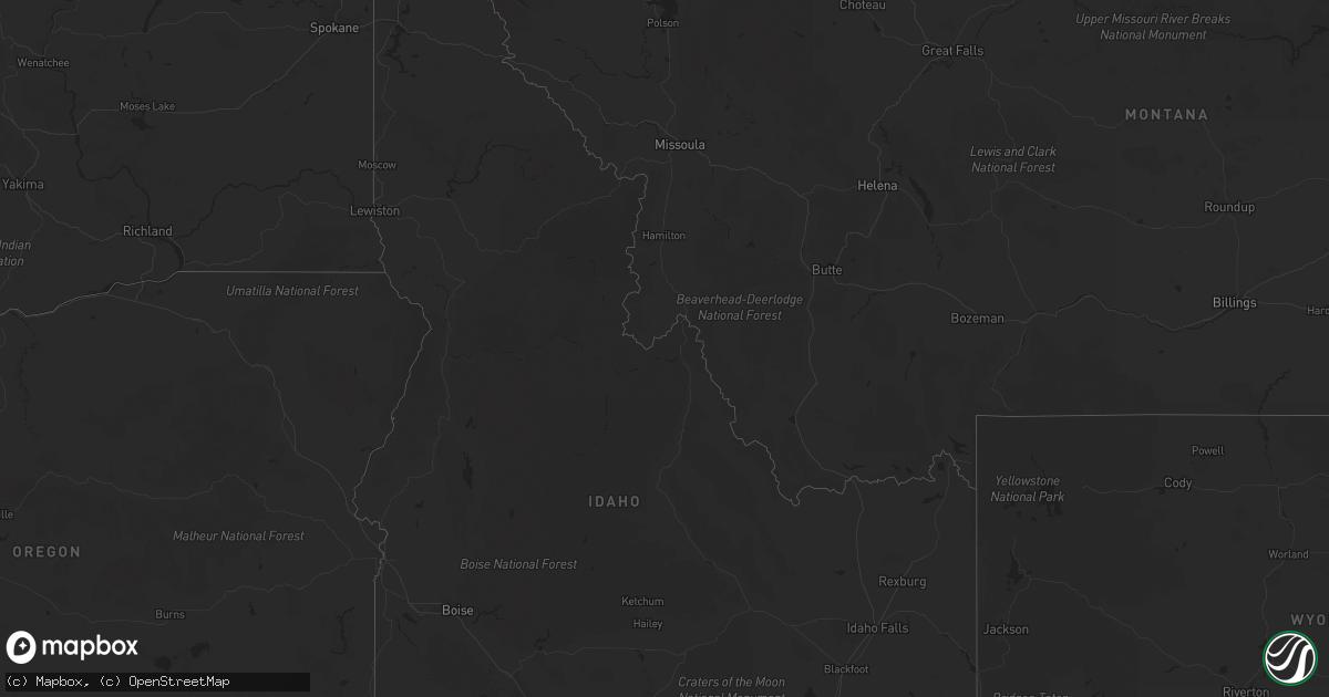
Hail Map in Idaho on June 22, 2021
Get this storm
June 22 map
$229
one time, instant access
Download today. No call, no setup
Keep the $229
Bought the map and want the full workflow? Apply the entire $229 to a subscription within 7 days. None of it is wasted.
Every map, not just this one
This buys you this map. Subscription and you get every map we run, in the markets you choose from a few cities to whole states to nationwide. Plus real-time alerts the moment a storm fires.
Contact data
Name, contact info, occupancy, even credit band for addresses in the footprint. You go from where it hit to who to call.
Become the source they trust
Unlimited branding weather history reports on demand. You already have the documented answer ready for the property owner, and you are the one who showed up with it.
Property data and RoofTrace estimates
Pull up any address you have got, its value and the exact code rules for that jurisdiction, straight from One Click Code. Then RoofTrace estimates the squares, pitch, and roof value, priced the way you price.
Storm reports in Idaho
Idaho
| Date | Description |
|---|---|
| 06/22/20211:40 AM CDT | At 639 PM MDT, severe thunderstorms were located along a line extending from near Freezeout Mountain to near Elephant Butte, moving northeast at 30 mph. HAZARD...60 mph wind gusts and penny size hail. SOURCE...Radar indicated. IMPACT...Expect damage to roofs, siding, and trees. Severe thunderstorms will be near... Homedale, Elephant Butte and Succor Creek Campground around 640 PM MDT. Marsing, Wilder and Givens Hot Springs around 650 PM MDT. Greenleaf, Notus, Lake Lowell and Huston around 700 PM MDT. Caldwell, Sand Hollow and Board Corral Mountain around 710 PM MDT. Nampa, Kuna, Double Mountain and Owyhee Dam around 720 PM MDT. |
| 06/21/202111:10 PM CDT | Ktwf. |
| 06/21/202110:57 PM CDT | Asos station kmyl mccall. |
| 06/21/20219:52 PM CDT | Mesonet station deai1 catfish. |
| 06/21/20219:49 PM CDT | A trained spotter reported multiple trees and powerlines down associated with a strong gust front - gusting to around 60 mph. |
| 06/21/20219:44 PM CDT | Mesonet station dehi1 deer haven. |
| 06/21/20219:37 PM CDT | Davis weather station. |
| 06/21/20219:28 PM CDT | Mesonet station tt289 crestline trail. |
| 06/21/20219:26 PM CDT | Davis weather station. Jacobus ranch. |
| 06/21/20219:18 PM CDT | Mesonet station ew2058 horseshoe bend. |
| 06/21/20219:14 PM CDT | Mesonet station tt677 hydromet test 1. |
| 06/21/20219:00 PM CDT | Tree broken in half due to thunderstorm outflow winds. Estimated 60 mph gust. |
| 06/21/20218:58 PM CDT | Asos station kboi boise. |
| 06/21/20218:48 PM CDT | Mesonet station tt682 raws 15 min tx 10 min avg. |
| 06/21/20218:41 PM CDT | 1-inch tree limbs broken; shingles blown off. |
| 06/21/20218:33 PM CDT | 1-inch tree limbs broken; shingles blown off. |
| 06/21/20218:30 PM CDT | Blue spruce tree 50 ft tall uprooted in thunderstorm outflow. |
| 06/21/20217:55 PM CDT | Mesonet station twbi1 twin buttes. |
All States Impacted by Hail Map on June 22, 2021
Cities Impacted by Hail Map on June 22, 2021
- Waukee, IA
- Grimes, IA
- Windsor Heights, IA
- Clive, IA
- Dallas Center, IA
- Urbandale, IA
- Bagley, IA
- Jefferson, IA
- Kahoka, MO
- Osceola, NE
- Shelby, NE
- Friend, NE
- Gresham, NE
- Genoa, NE
- Cordova, NE
- Saint Edward, NE
- Beaver Crossing, NE
- Monroe, NE
- Silver Creek, NE
- Exeter, NE
- Stromsburg, NE
- Columbus, NE
- Waco, NE
- Benedict, NE
- York, NE
- Urbana, IA
- Coggon, IA
- Walker, IA
- Central City, IA
- Center Point, IA
- Vinton, IA
- Mount Sterling, IA
- Lake City, IA
- Yale, IA
- Lanesboro, IA
- Scranton, IA
- Nemaha, IA
- Lohrville, IA
- Fonda, IA
- Lytton, IA
- Glidden, IA
- Rockwell City, IA
- Churdan, IA
- Auburn, IA
- Sac City, IA
- Clarkson, NE
- Howells, NE
- Tilden, NE
- Brunswick, NE
- Humphrey, NE
- Meadow Grove, NE
- Madison, NE
- Neligh, NE
- Lindsay, NE
- Cantril, IA
- Hedrick, IA
- Libertyville, IA
- Bonaparte, IA
- Ollie, IA
- Packwood, IA
- Farmington, IA
- Luray, MO
- Martinsburg, IA
- Keosauqua, IA
- Arbela, MO
- Birmingham, IA
- Sigourney, IA
- Douds, IA
- Hayesville, IA
- Batavia, IA
- Ottumwa, IA
- Fairfield, IA
- Selma, IA
- Eldon, IA
- Utica, NE
- Platte Center, NE
- McCool Junction, NE
- Newman Grove, NE
- Albion, NE
- Fullerton, NE
- Palmer, NE
- Central City, NE
- Petersburg, NE
- Cedar Rapids, NE
- Hampton, NE
- Clarks, NE
- Bradshaw, NE
- Marquette, NE
- Henderson, NE
- Polk, NE
- Hordville, NE
- Belgrade, NE
- Carlisle, IA
- Norwalk, IA
- Indianola, IA
- Des Moines, IA
- Fairmont, NE
- Pierce, NE
- Pierson, IA
- Correctionville, IA
- Remsen, IA
- Le Mars, IA
- Kingsley, IA
- Webster, IA
- North English, IA
- South English, IA
- Harper, IA
- Mount Auburn, IA
- Brandon, IA
- Alburnett, IA
- Oakdale, NE
- Clearwater, NE
- Battle Creek, NE
- Washta, IA
- Winnebago, NE
- Lacona, IA
- Ackworth, IA
- Milo, IA
- Rising City, NE
- Bellwood, NE
- David City, NE
- Fellsmere, FL
- East Bridgewater, MA
- Bridgewater, MA
- Johnston, IA
- West Des Moines, IA
- Gladbrook, IA
- Traer, IA
- Ewing, NE
- Ulysses, NE
- Surprise, NE
- Plainview, NE
- Chariton, IA
- Macy, NE
- Grenville, NM
- Orchard, NE
- Beaman, IA
- Minburn, IA
- Hanson, MA
- Halifax, MA
- Satellite Beach, FL
- Melbourne, FL
- Merritt Island, FL
- Patrick Afb, FL
- Reinbeck, IA
- Milligan, NE
- Ralston, IA
- Royal, NE
- Independence, IA
- Jesup, IA
- Carroll, IA
- Jamaica, IA
- Coon Rapids, IA
- Grand View, ID
- Jordan Valley, OR
- Rowley, IA
- La Porte City, IA
- Osmond, NE
- Norfolk, NE
- Sloan, IA
- Onawa, IA
- Wolbach, NE
- Beach Haven, NJ
- Grand Junction, IA
- Palm Bay, FL
- Early, IA
- Delta, IA
- What Cheer, IA
- Russell, IA
- Aurora, NE
- Grafton, NE
- Ryan, IA
- Cushing, IA
- Battle Creek, IA
- Holstein, IA
- Tobias, NE
- Duncan, NE
- Stockport, IA
- Milton, IA


