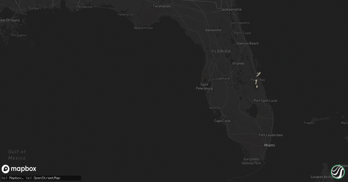
Hail Map in Florida on June 22, 2021
Get this storm
June 22 map
$229
one time, instant access
Download today. No call, no setup
Keep the $229
Bought the map and want the full workflow? Apply the entire $229 to a subscription within 7 days. None of it is wasted.
Every map, not just this one
This buys you this map. Subscription and you get every map we run, in the markets you choose from a few cities to whole states to nationwide. Plus real-time alerts the moment a storm fires.
Contact data
Name, contact info, occupancy, even credit band for addresses in the footprint. You go from where it hit to who to call.
Become the source they trust
Unlimited branding weather history reports on demand. You already have the documented answer ready for the property owner, and you are the one who showed up with it.
Property data and RoofTrace estimates
Pull up any address you have got, its value and the exact code rules for that jurisdiction, straight from One Click Code. Then RoofTrace estimates the squares, pitch, and roof value, priced the way you price.
Storm reports in Florida
Florida
| Date | Description |
|---|---|
| 06/22/20211:40 PM CDT | Small tree down over cr 310. Time of event estimated with radar. |
| 06/22/20211:25 PM CDT | Damage to small storage sheds near the 2100 block of state road 16 near st augustine. Time estimated from radar. |
| 06/22/20211:20 PM CDT | A tree fell onto a residence causing significant property damage. Time of damage estimated from radar imagery. |
| 06/22/202112:40 PM CDT | A large tree uprooted and fell on top of a house on west 69th street in jacksonville. No injuries. Time estimated by radar. |
| 06/22/202111:58 AM CDT | Trees down near old lawtey rd. Time of event estimated with radar. |
| 06/22/20217:22 AM CDT | At 1222 PM EDT, a severe thunderstorm was located over Lake Butler, moving east at 20 mph. HAZARD...60 mph wind gusts. SOURCE...Radar indicated. IMPACT...Expect damage to roofs, siding, and trees. Locations impacted include... Starke, Lake Butler, Raiford, Beasley, New River, Lawtey, Ellerbee and Johnstown. |
| 06/22/20212:16 AM CDT | At 716 AM EDT, a severe thunderstorm was located 19 miles south of Greensboro, or 20 miles southeast of Blountstown, moving east at 45 mph. HAZARD...60 mph wind gusts. SOURCE...Radar indicated. IMPACT...Expect damage to roofs, siding, and trees. Locations impacted include... Telogia, Lake Talquin, Bloxham, Brown House, Fort Braden and Clio. |
| 06/21/202111:09 PM CDT | At 408 PM EDT, a severe thunderstorm was located over Sanford, moving northeast at 15 mph. HAZARD...60 mph wind gusts and nickel size hail. SOURCE...Radar indicated. IMPACT...Expect damage to roofs, siding, and trees. Locations impacted include... Deltona, Sanford, Orange City, DeBary and Osteen. |
| 06/21/20218:46 PM CDT | At 146 PM EDT, a severe thunderstorm was located over Bardin, or near Palatka, moving east at 25 mph. HAZARD...60 mph wind gusts. SOURCE...Radar indicated. IMPACT...Expect damage to roofs, siding, and trees. Locations impacted include... Bostwick, Federal Point, Bardin and Carraway. |
All States Impacted by Hail Map on June 22, 2021
Cities Impacted by Hail Map on June 22, 2021
- Waukee, IA
- Grimes, IA
- Windsor Heights, IA
- Clive, IA
- Dallas Center, IA
- Urbandale, IA
- Bagley, IA
- Jefferson, IA
- Kahoka, MO
- Osceola, NE
- Shelby, NE
- Friend, NE
- Gresham, NE
- Genoa, NE
- Cordova, NE
- Saint Edward, NE
- Beaver Crossing, NE
- Monroe, NE
- Silver Creek, NE
- Exeter, NE
- Stromsburg, NE
- Columbus, NE
- Waco, NE
- Benedict, NE
- York, NE
- Urbana, IA
- Coggon, IA
- Walker, IA
- Central City, IA
- Center Point, IA
- Vinton, IA
- Mount Sterling, IA
- Lake City, IA
- Yale, IA
- Lanesboro, IA
- Scranton, IA
- Nemaha, IA
- Lohrville, IA
- Fonda, IA
- Lytton, IA
- Glidden, IA
- Rockwell City, IA
- Churdan, IA
- Auburn, IA
- Sac City, IA
- Clarkson, NE
- Howells, NE
- Tilden, NE
- Brunswick, NE
- Humphrey, NE
- Meadow Grove, NE
- Madison, NE
- Neligh, NE
- Lindsay, NE
- Cantril, IA
- Hedrick, IA
- Libertyville, IA
- Bonaparte, IA
- Ollie, IA
- Packwood, IA
- Farmington, IA
- Luray, MO
- Martinsburg, IA
- Keosauqua, IA
- Arbela, MO
- Birmingham, IA
- Sigourney, IA
- Douds, IA
- Hayesville, IA
- Batavia, IA
- Ottumwa, IA
- Fairfield, IA
- Selma, IA
- Eldon, IA
- Utica, NE
- Platte Center, NE
- McCool Junction, NE
- Newman Grove, NE
- Albion, NE
- Fullerton, NE
- Palmer, NE
- Central City, NE
- Petersburg, NE
- Cedar Rapids, NE
- Hampton, NE
- Clarks, NE
- Bradshaw, NE
- Marquette, NE
- Henderson, NE
- Polk, NE
- Hordville, NE
- Belgrade, NE
- Carlisle, IA
- Norwalk, IA
- Indianola, IA
- Des Moines, IA
- Fairmont, NE
- Pierce, NE
- Pierson, IA
- Correctionville, IA
- Remsen, IA
- Le Mars, IA
- Kingsley, IA
- Webster, IA
- North English, IA
- South English, IA
- Harper, IA
- Mount Auburn, IA
- Brandon, IA
- Alburnett, IA
- Oakdale, NE
- Clearwater, NE
- Battle Creek, NE
- Washta, IA
- Winnebago, NE
- Lacona, IA
- Ackworth, IA
- Milo, IA
- Rising City, NE
- Bellwood, NE
- David City, NE
- Fellsmere, FL
- East Bridgewater, MA
- Bridgewater, MA
- Johnston, IA
- West Des Moines, IA
- Gladbrook, IA
- Traer, IA
- Ewing, NE
- Ulysses, NE
- Surprise, NE
- Plainview, NE
- Chariton, IA
- Macy, NE
- Grenville, NM
- Orchard, NE
- Beaman, IA
- Minburn, IA
- Hanson, MA
- Halifax, MA
- Satellite Beach, FL
- Melbourne, FL
- Merritt Island, FL
- Patrick Afb, FL
- Reinbeck, IA
- Milligan, NE
- Ralston, IA
- Royal, NE
- Independence, IA
- Jesup, IA
- Carroll, IA
- Jamaica, IA
- Coon Rapids, IA
- Grand View, ID
- Jordan Valley, OR
- Rowley, IA
- La Porte City, IA
- Osmond, NE
- Norfolk, NE
- Sloan, IA
- Onawa, IA
- Wolbach, NE
- Beach Haven, NJ
- Grand Junction, IA
- Palm Bay, FL
- Early, IA
- Delta, IA
- What Cheer, IA
- Russell, IA
- Aurora, NE
- Grafton, NE
- Ryan, IA
- Cushing, IA
- Battle Creek, IA
- Holstein, IA
- Tobias, NE
- Duncan, NE
- Stockport, IA
- Milton, IA


