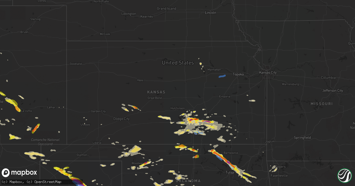
Hail Map in Kansas on June 18, 2019
Get this storm
June 18 map
$229
one time, instant access
Download today. No call, no setup
Keep the $229
Bought the map and want the full workflow? Apply the entire $229 to a subscription within 7 days. None of it is wasted.
Every map, not just this one
This buys you this map. Subscription and you get every map we run, in the markets you choose from a few cities to whole states to nationwide. Plus real-time alerts the moment a storm fires.
Contact data
Name, contact info, occupancy, even credit band for addresses in the footprint. You go from where it hit to who to call.
Become the source they trust
Unlimited branding weather history reports on demand. You already have the documented answer ready for the property owner, and you are the one who showed up with it.
Property data and RoofTrace estimates
Pull up any address you have got, its value and the exact code rules for that jurisdiction, straight from One Click Code. Then RoofTrace estimates the squares, pitch, and roof value, priced the way you price.
Storm reports in Kansas
Kansas
| Date | Description |
|---|---|
| 06/18/20196:15 PM CDT | Delayed report via facebook...estimated winds of 60+ mph and very heavy rain. |
| 06/18/20195:55 PM CDT | Up to ping pong ball size hail being reported east of leon. |
| 06/18/20195:50 PM CDT | Mping report of wind damage. |
| 06/18/20195:32 PM CDT | A local report indicates 1.00 inch wind near 2 SW LEON |
| 06/18/20195:28 PM CDT | Golf ball size hail and 40 mph winds sw of leon. |
| 06/18/20195:21 PM CDT | Estimated 60 to 70 mph wind gusts east of augusta. Semi truck blown over at this location as well. |
| 06/18/20195:20 PM CDT | Semi truck blown over on hwy 54 east of augusta. |
| 06/18/20195:14 PM CDT | . |
| 06/18/20194:46 PM CDT | Wind gusts estimated to be greater than 50 mph. Torrential rain and pea size hail occurred as well. |
| 06/18/20194:45 PM CDT | A local report indicates 60 MPH wind near 8 SSE JETMORE |
| 06/18/20194:29 PM CDT | A local report indicates 1.00 inch wind near 5 E DOWNTOWN WICHITA |
| 06/18/20194:24 PM CDT | Lots of golf ball reported at k96 and 21st. |
| 06/18/20194:18 PM CDT | A local report indicates 60 MPH wind near 4 SW HANSTON |
| 06/18/20194:17 PM CDT | Report relayed by family member of nws employee. |
| 06/18/20194:12 PM CDT | 29th and webb rd. |
| 06/18/20194:06 PM CDT | 29th and rock. |
| 06/18/20193:47 PM CDT | Mping report. |
| 06/18/20193:43 PM CDT | Near 21st and ridge. |
| 06/18/20193:41 PM CDT | A local report indicates 2.00 inch wind near 6 NNW WICHITA EISENHOWE |
| 06/18/20193:40 PM CDT | Near 21st and ridge. |
| 06/18/20193:35 PM CDT | Near maple and ridge. |
| 06/18/20193:25 PM CDT | A local report indicates 60 MPH wind near 4 NNW LEWIS |
| 06/18/20192:42 PM CDT | A local report indicates a tornado near 10 NNW KINSLEY |
| 06/18/20192:37 PM CDT | A local report indicates a tornado near 9 NW KINSLEY |
| 06/18/20192:25 PM CDT | Public reported very heavy rain and brief 60-70mph wind gust. |
| 06/18/20196:42 AM CDT | At 1141 PM CDT, severe thunderstorms were located along a line extending from 14 miles north of Alabaster Caverns State Park to 3 miles east of Freedom to 6 miles west of Waynoka, moving east at 50 mph. HAZARD...60 mph wind gusts and penny size hail. SOURCE...Radar indicated. IMPACT...Expect damage to roofs, siding, and trees. Locations impacted include... Alva, Waynoka, Freedom, Dacoma, Alabaster Caverns State Park, Avard, Capron, Hopeton and Camp Houston. |
| 06/18/20195:18 AM CDT | At 1018 PM CDT, severe thunderstorms were located along a line extending from 3 miles east of Meade to 3 miles west of Gate to 5 miles east of Perryton, moving east at 40 mph. HAZARD...70 mph wind gusts and nickel size hail. SOURCE...Radar indicated. IMPACT...Expect considerable tree damage. Damage is likely to mobile homes, roofs, and outbuildings. Locations impacted include... Laverne, Buffalo, May, Rosston, Selman and Catesby. |
| 06/18/20193:59 AM CDT | At 858 PM CDT, a severe thunderstorm was located 10 miles south of Ulysses, moving east at 40 mph. HAZARD...60 mph wind gusts and nickel size hail. SOURCE...Radar indicated. IMPACT...Expect damage to roofs, siding, and trees. Locations impacted include... Sublette, Satanta, Moscow, Ryus and Cave. |
| 06/18/20192:54 AM CDT | At 754 PM CDT, a severe thunderstorm was located over Sedan, moving east at 30 mph. HAZARD...60 mph wind gusts and quarter size hail. SOURCE...Radar indicated. IMPACT...Hail damage to vehicles is expected. Expect wind damage to roofs, siding, and trees. Locations impacted include... Caney, Sedan, Peru, Chautauqua, Havana, Elgin, Niotaze and Hale. |
| 06/18/20191:55 AM CDT | At 654 PM CDT, a severe thunderstorm was located near Burden, or 6 miles east of Winfield, moving east at 30 mph. HAZARD...60 mph wind gusts and quarter size hail. SOURCE...Radar indicated. IMPACT...Hail damage to vehicles is expected. Expect wind damage to roofs, siding, and trees. Locations impacted include... Winfield, Burden, Dexter, Atlanta, Cambridge, Winfield City Lake and Strother Field Airport. |
| 06/18/20191:19 AM CDT | At 618 PM CDT, a severe thunderstorm was located 6 miles northeast of Harper, moving northeast at 15 mph. HAZARD...60 mph wind gusts and half dollar size hail. SOURCE...Radar indicated. IMPACT...Hail damage to vehicles is expected. Expect wind damage to roofs, siding, and trees. Locations impacted include... Conway Springs, Argonia, Norwich, Viola and Runnymede. |
| 06/18/20191:13 AM CDT | At 612 PM CDT, a severe thunderstorm was located near Belle Plaine, moving east at 15 mph. HAZARD...60 mph wind gusts and quarter size hail. SOURCE...Radar indicated. IMPACT...Hail damage to vehicles is expected. Expect wind damage to roofs, siding, and trees. Locations impacted include... Winfield, Wellington, Mulvane, Belle Plaine, Oxford, Udall, Rock, Winfield City Lake, Riverdale, Strother Field Airport and Wellington Airport.This includes Interstate 35 between Mile Markers 18 and 31. |
| 06/18/20191:11 AM CDT | At 610 PM CDT, a severe thunderstorm was located 12 miles northeast of Latham, or 14 miles east of Leon, moving east at 20 mph. This extends the previous warning for 15 minutes. HAZARD...60 mph wind gusts and half dollar size hail. SOURCE...Radar indicated. IMPACT...Hail damage to vehicles is expected. Expect wind damage to roofs, siding, and trees. Locations impacted include... Latham and Beaumont. |
| 06/18/20191:06 AM CDT | At 606 PM CDT, a severe thunderstorm was located 7 miles northeast of Latham, or 12 miles east of Leon, moving east at 20 mph. HAZARD...Ping pong ball size hail and 60 mph wind gusts. SOURCE...Radar indicated. IMPACT...People and animals outdoors will be injured. Expect hail damage to roofs, siding, windows, and vehicles. Expect wind damage to roofs, siding, and trees. Locations impacted include... Howard, Moline, Longton, Severy, Fall River, Elk Falls, Climax, Fall River Lake, Piedmont, Fall River State Park and Beaumont. |
| 06/18/201912:21 AM CDT | At 521 PM CDT, a severe thunderstorm was located near Leon, moving east at 20 mph. HAZARD...Golf ball size hail and 70 mph wind gusts. SOURCE...Radar indicated. IMPACT...People and animals outdoors will be injured. Expect hail damage to roofs, siding, windows, and vehicles. Expect considerable tree damage. Wind damage is also likely to mobile homes, roofs, and outbuildings. Locations impacted include... Leon, Latham, Rosalia, El Dorado Airport and Beaumont. |
| 06/18/201912:14 AM CDT | At 514 PM CDT, a severe thunderstorm was located near Norwich, or 11 miles west of Conway Springs, moving east at 15 mph. HAZARD...60 mph wind gusts and quarter size hail. SOURCE...Radar indicated. IMPACT...Hail damage to vehicles is expected. Expect wind damage to roofs, siding, and trees. Locations impacted include... Clearwater, Conway Springs, Norwich, Viola and Riverdale. |
| 06/18/201912:11 AM CDT | At 510 PM CDT, a severe thunderstorm was located over Garden Plain, moving east at 30 mph. HAZARD...Ping pong ball size hail and 60 mph wind gusts. SOURCE...Radar indicated. IMPACT...People and animals outdoors will be injured. Expect hail damage to roofs, siding, windows, and vehicles. Expect wind damage to roofs, siding, and trees. Locations impacted include... Wichita, Derby, Haysville, Park City, Valley Center, Bel Aire, Goddard, Maize, Cheney, Garden Plain, Downtown Wichita, Kechi, Eastborough, West Wichita, Eisenhower National Airport, Mcconnell Air Force Base, South Wichita, Cheney Lake, Oaklawn and Lake Afton.This includes the following highways... Interstate 135 between Mile Markers 0 and 15. Interstate 35 between Mile Markers 37 and 47. |
| 06/18/201912:03 AM CDT | At 503 PM CDT, a severe thunderstorm was located over Andover, moving east at 20 mph. HAZARD...60 mph wind gusts and half dollar size hail. SOURCE...Radar indicated. IMPACT...Hail damage to vehicles is expected. Expect wind damage to roofs, siding, and trees. Locations impacted include... Wichita, Derby, Andover, Mulvane, Rose Hill, Eastborough, East Wichita, Mcconnell Air Force Base and Augusta Municipal Airport.This includes Interstate 35 between Mile Markers 45 and 59. |
| 06/17/201911:40 PM CDT | At 440 PM CDT, a severe thunderstorm was located near Jetmore, moving east at 15 mph. HAZARD...60 mph wind gusts and quarter size hail. SOURCE...Radar indicated. IMPACT...Hail damage to vehicles is expected. Expect wind damage to roofs, siding, and trees. Locations impacted include... Bellefont. |
| 06/17/201911:28 PM CDT | At 428 PM CDT, a severe thunderstorm was located 6 miles west of Renfrow, moving east at 15 mph. HAZARD...Two inch hail and 60 mph wind gusts. SOURCE...Radar indicated. IMPACT...People and animals outdoors will be injured. Expect hail damage to roofs, siding, windows, and vehicles. Expect wind damage to roofs, siding, and trees. Locations impacted include... Renfrow. |
| 06/17/201911:27 PM CDT | At 427 PM CDT, a severe thunderstorm was located over Eisenhower National Airport, or near Goddard, moving northeast at 35 mph. HAZARD...60 mph wind gusts and half dollar size hail. SOURCE...Radar indicated. IMPACT...Hail damage to vehicles is expected. Expect wind damage to roofs, siding, and trees. Locations impacted include... Wichita, Park City, Valley Center, Bel Aire, Goddard, Maize, Colwich, Downtown Wichita, Kechi, Eastborough, West Wichita, East Wichita, Eisenhower National Airport, Northeast Wichita, Mcconnell Air Force Base, Jabara Airport and Oaklawn.This includes the following highways... Interstate 135 between Mile Markers 1 and 22. Interstate 35 between Mile Markers 44 and 50. |
| 06/17/201911:25 PM CDT | At 425 PM CDT, a severe thunderstorm was located over Andover, moving east at 20 mph. HAZARD...Golf ball size hail and 60 mph wind gusts. SOURCE...Radar indicated. IMPACT...People and animals outdoors will be injured. Expect hail damage to roofs, siding, windows, and vehicles. Expect wind damage to roofs, siding, and trees. Locations impacted include... Wichita, El Dorado, Andover, Augusta, Bel Aire, Towanda, Benton, Northeast Wichita, Santa Fe Lake, Augusta Municipal Airport and Jabara Airport.This includes Interstate 35 between Mile Markers 50 and 75. |
| 06/17/201911:19 PM CDT | At 418 PM CDT, a severe thunderstorm was located near Potawatomi Reservation, moving northeast at 35 mph. HAZARD...60 mph wind gusts. SOURCE...Radar indicated. IMPACT...Expect damage to roofs, siding, and trees. Locations impacted include... Holton, Hoyt, Mayetta, Denison, Delia and Potawatomi Reservation. |
| 06/17/201911:13 PM CDT | At 413 PM CDT, a severe thunderstorm was located 7 miles west of Pretty Prairie, moving east at 25 mph. HAZARD...Ping pong ball size hail and 60 mph wind gusts. SOURCE...Radar indicated. IMPACT...People and animals outdoors will be injured. Expect hail damage to roofs, siding, windows, and vehicles. Expect wind damage to roofs, siding, and trees. Locations impacted include... Kingman, Cheney, Haven, Pretty Prairie, Waterloo, Cheney Lake, Mt Vernon, Kingman Airport and Cheney State Park. |
| 06/17/201910:50 PM CDT | At 350 PM CDT, a severe thunderstorm was located near Jetmore, moving east at 20 mph. HAZARD...60 mph wind gusts and nickel size hail. SOURCE...Radar indicated. IMPACT...Expect damage to roofs, siding, and trees. Locations impacted include... Gray, Jetmore and Hanston. |
| 06/17/201910:49 PM CDT | At 348 PM CDT, a severe thunderstorm was located near Wakita, moving northeast at 20 mph. Another severe thunderstorm is located northwest of Medford. HAZARD...Ping pong ball size hail and 60 mph wind gusts. SOURCE...Radar indicated. IMPACT...People and animals outdoors will be injured. Expect hail damage to roofs, siding, windows, and vehicles. Expect wind damage to roofs, siding, and trees. Locations impacted include... Medford, Wakita and Renfrow. |
| 06/17/201910:45 PM CDT | At 344 PM CDT, a severe thunderstorm was located 6 miles southeast of Newton, moving east at 20 mph. HAZARD...Two inch hail and 60 mph wind gusts. SOURCE...Radar indicated. IMPACT...People and animals outdoors will be injured. Expect hail damage to roofs, siding, windows, and vehicles. Expect wind damage to roofs, siding, and trees. Locations impacted include... Newton, Park City, Valley Center, Halstead, Sedgwick, Whitewater, Bentley, Potwin, Elbing, Burns and Newton Airport.This includes the following highways... Interstate 135 between Mile Markers 17 and 33. Interstate 35 near Mile Marker 80. |
| 06/17/201910:43 PM CDT | At 342 PM CDT, severe thunderstorms were located along a line extending from 3 miles southwest of St. Marys to near Eskridge, moving northeast at 25 mph. HAZARD...60 mph wind gusts. Wind gusts to 40 to 50 mph have been reported earlier with this storm. SOURCE...Radar indicated. IMPACT...Expect damage to roofs, siding, and trees. Locations impacted include... Topeka, Rossville, Eskridge, St. Marys, Dover, Silver Lake, Auburn, Hoyt, Maple Hill, Mayetta, Paxico, Belvue, Delia, Willard, Pauline and Keene.This includes the following highways... Interstate 70 between mile markers 334 and 355. Kansas Turnpike between mile markers 162 and 179. |
| 06/17/201910:36 PM CDT | At 336 PM CDT, a severe thunderstorm was located near West Wichita, or near Downtown Wichita, moving east at 20 mph. HAZARD...60 mph wind gusts and quarter size hail. SOURCE...Radar indicated. IMPACT...Hail damage to vehicles is expected. Expect wind damage to roofs, siding, and trees. Locations impacted include... Wichita, Andover, Augusta, Park City, Valley Center, Bel Aire, Maize, Towanda, Benton, Downtown Wichita, Kechi, Eastborough, West Wichita, East Wichita, Northeast Wichita, Santa Fe Lake, Augusta Municipal Airport and Jabara Airport.This includes the following highways... Interstate 135 between Mile Markers 6 and 17. Interstate 35 between Mile Markers 49 and 66. |
| 06/17/201910:10 PM CDT | At 309 PM CDT, severe thunderstorms were located along a line extending from 5 miles east of Tuttle Creek Lake to near Alma to 3 miles south of Volland, moving northeast at 35 mph. HAZARD...60 mph wind gusts and penny size hail. Winds of 40 to 50 mph have been reported earlier with this storm. SOURCE...Radar indicated. IMPACT...Expect damage to roofs, siding, and trees. Locations impacted include... Manhattan, Wamego, Alma, Westmoreland, Eskridge, Blaine, St. Marys, Onaga, St. George, McFarland, Paxico, Belvue, Emmett, Louisville, Wheaton, Keene and Volland.This includes Interstate 70 between mile markers 316 and 341. |
| 06/17/201910:09 PM CDT | At 309 PM CDT, a severe thunderstorm was located near Lewis, moving southeast at 25 mph. HAZARD...60 mph wind gusts and quarter size hail. SOURCE...Radar indicated. IMPACT...Hail damage to vehicles is expected. Expect wind damage to roofs, siding, and trees. Locations impacted include... Macksville, Lewis, Garfield, Belpre, Zook and Trousdale. |
| 06/17/20199:51 PM CDT | At 251 PM CDT, a severe thunderstorm was located near Preston, moving east at 20 mph. HAZARD...60 mph wind gusts and quarter size hail. SOURCE...Radar indicated. IMPACT...Hail damage to vehicles is expected. Expect wind damage to roofs, siding, and trees. Locations impacted include... Iuka, Preston and Neola. |
| 06/17/20199:49 PM CDT | At 249 PM CDT, a severe thunderstorm was located over Haven, moving northeast at 20 mph. HAZARD...60 mph wind gusts and quarter size hail. SOURCE...Radar indicated. IMPACT...Hail damage to vehicles is expected. Expect wind damage to roofs, siding, and trees. Locations impacted include... Valley Center, Maize, Halstead, Sedgwick, Haven, Burrton, Mount Hope and Bentley. |
| 06/17/20199:34 PM CDT | At 233 PM CDT, severe thunderstorms were located along a line extending from 3 miles northwest of Junction City to 7 miles northwest of Dwight to 4 miles northwest of Council Grove Lake, moving northeast at 35 mph. HAZARD...60 mph wind gusts. SOURCE...Radar indicated. IMPACT...Expect damage to roofs, siding, and trees. Locations impacted include... Manhattan, Wamego, Alma, Eskridge, Ogden, St. George, Alta Vista, Dwight, McFarland, Keats, Council Grove Lake and Volland.This includes Interstate 70 between mile markers 301 and 333. Very heavy rainfall is also occurring with these storms. |
| 06/17/20199:24 PM CDT | At 224 PM CDT, a severe thunderstorm was located near Gray, moving east at 15 mph. HAZARD...60 mph wind gusts and quarter size hail. SOURCE...Radar indicated. IMPACT...Hail damage to vehicles is expected. Expect wind damage to roofs, siding, and trees. Locations impacted include... Gray, Larned, Burdett, Garfield, Rozel, Sanford and Frizell. |
| 06/17/20199:15 PM CDT | At 214 PM CDT, severe thunderstorms were located along a line extending from 4 miles northeast of Talmage to 3 miles southeast of Herington, moving northeast at 25 mph. HAZARD...60 mph wind gusts. SOURCE...Radar indicated. IMPACT...Expect damage to roofs, siding, and trees. Locations impacted include... Junction City, Herington, Grandview Plaza, Chapman, White City, Milford, Dwight, Woodbine, Wilsey, Parkerville, Latimer, Milford Lake, Moonlight, Council Grove Lake and Burdick.This includes Interstate 70 between mile markers 280 and 305. Very heavy rainfall is also occurring with these storms. |
All States Impacted by Hail Map on June 18, 2019
Cities Impacted by Hail Map on June 18, 2019
- Joplin, MT
- Burden, KS
- Post, TX
- Eunice, NM
- Centerville, KS
- Garnett, KS
- Laverne, OK
- Woodward, OK
- Mooreland, OK
- Skellytown, TX
- Borger, TX
- Junction City, KS
- Felt, OK
- Telephone, TX
- Sharon, OK
- Chester, OK
- Wakita, OK
- Fairview, OK
- Erick, OK
- Tishomingo, OK
- Sanderson, TX
- Dryden, TX
- Richmond, KS
- Princeton, KS
- Elk City, KS
- Choctaw, OK
- Newalla, OK
- Mangum, OK
- Atlanta, KS
- Conway Springs, KS
- Courtland, VA
- Yale, VA
- Capron, VA
- Stony Creek, VA
- Gage, OK
- Shattuck, OK
- Okarche, OK
- Butler, OK
- Perryton, TX
- Longview, TX
- Manzanola, CO
- Rocky Ford, CO
- Manchester, OK
- Levelland, TX
- Littlefield, TX
- Anton, TX
- Pampa, TX
- Holly, CO
- Sublette, KS
- Ardmore, OK
- Ashton, ID
- Wellington, KS
- Turon, KS
- Chouteau, OK
- Locust Grove, OK
- Mclean, TX
- Wichita, KS
- Newcastle, TX
- Broken Arrow, OK
- Coweta, OK
- Texola, OK
- Willow, OK
- Sweetwater, OK
- Sayre, OK
- Udall, KS
- Winfield, KS
- Clarendon, TX
- Quail, TX
- Wellington, TX
- Shamrock, TX
- Deer Trail, CO
- Boise City, OK
- Grenville, NM
- Clayton, NM
- Abernathy, TX
- Pittsburg, TX
- Leesburg, TX
- Hamlin, TX
- McCaulley, TX
- Roby, TX
- Belt, MT
- Big Spring, TX
- Panhandle, TX
- Stinnett, TX
- Sunray, TX
- White Deer, TX
- Canon City, CO
- Lawton, OK
- Olney Springs, CO
- Boone, CO
- Fowler, CO
- Catoosa, OK
- Cordell, OK
- Corn, OK
- Colony, OK
- Stafford, KS
- Kingman, KS
- Arlington, KS
- Cunningham, KS
- Foss, OK
- Clinton, OK
- Latham, KS
- Cambridge, KS
- Gracemont, OK
- Havre, MT
- Balmorhea, TX
- Haven, KS
- Sulphur, OK
- Davis, OK
- Muleshoe, TX
- Aurora, CO
- Howard, KS
- Earth, TX
- Sudan, TX
- Medford, OK
- Canyon, TX
- Piedmont, OK
- Fargo, OK
- Fritch, TX
- Groom, TX
- Kevin, MT
- Shelby, MT
- Orange, VA
- Mineral, VA
- Dalhart, TX
- Holmdel, NJ
- Dayton, NJ
- Helmetta, NJ
- Spotswood, NJ
- Monroe Township, NJ
- East Brunswick, NJ
- Colts Neck, NJ
- Morganville, NJ
- Cranbury, NJ
- Monmouth Junction, NJ
- Marlboro, NJ
- Old Bridge, NJ
- Englishtown, NJ
- Bluff City, KS
- Calumet, OK
- Anson, TX
- Abilene, TX
- Saint Anthony, ID
- Rexburg, ID
- Snyder, TX
- Fluvanna, TX
- Crosbyton, TX
- Spur, TX
- Leon, KS
- Augusta, KS
- Hobbs, NM
- Lovington, NM
- Plains, KS
- Roaring Springs, TX
- Floydada, TX
- Hereford, TX
- Hallsville, TX
- Brusett, MT
- Jordan, MT
- Shidler, OK
- Kilgore, TX
- Argonia, KS
- Harper, KS
- Norwich, KS
- Konawa, OK
- Eureka, KS
- El Dorado, KS
- Lockney, TX
- Gretna, VA
- Nathalie, VA
- Java, VA
- Walsenburg, CO
- Elk City, OK
- Hammon, OK
- Canute, OK
- Collinsville, OK
- Skiatook, OK
- Sperry, OK
- Owasso, OK
- Lubbock, TX
- Shallowater, TX
- Wanette, OK
- Wapanucka, OK
- Coleman, OK
- Adrian, TX
- Cheney, KS
- Colorado Springs, CO
- Fountain, CO
- Detroit, TX
- Clarksville, TX
- Kim, CO
- Marathon, TX
- Coalgate, OK
- Clay Center, KS
- Cut Bank, MT
- Hennessey, OK
- Hulbert, OK
- Fort Gibson, OK
- Wagoner, OK
- Paris, TX
- Blossom, TX
- Coahoma, TX
- Bison, OK
- Hydro, OK
- Roswell, NM
- Tatum, TX
- Diana, TX
- Gilmer, TX
- Henderson, TX
- Harleton, TX
- Arapaho, OK
- Pueblo, CO
- Mount Pleasant, TX
- Talco, TX
- Petersburg, TX
- Ralls, TX
- Lorenzo, TX
- Two Dot, MT
- Miami, TX
- Idalou, TX
- Potwin, KS
- Slaton, TX
- Wilson, TX
- Hermleigh, TX
- Decatur, AR
- Woodford, VA
- Ruther Glen, VA
- Altamont, KS
- Carnegie, OK
- Fort Cobb, OK
- Branson, CO
- Picacho, NM
- Otter, MT
- Jetmore, KS
- Burrton, KS
- Halstead, KS
- Sedgwick, KS
- Stratford, TX
- Rose Hill, KS
- Douglass, KS
- Piedmont, KS
- Beulah, CO
- Rye, CO
- Holdenville, OK
- Hennepin, OK
- Tussy, OK
- Ratliff City, OK
- Duncan, OK
- Foster, OK
- Elmore City, OK
- Garden Plain, KS
- Seminole, TX
- Denver City, TX
- Wildorado, TX
- Marietta, OK
- Weatherford, OK
- Sedan, KS
- Cedar Vale, KS
- Mcconnell Afb, KS
- Trinchera, CO
- Trinidad, CO
- Barnsdall, OK
- Burbank, OK
- Pawhuska, OK
- Wynona, OK
- Model, CO
- Kingfisher, OK
- Watonga, OK
- Omega, OK
- Ira, TX
- Andover, KS
- Rock, KS
- Gate, OK
- Ada, OK
- Sasakwa, OK
- Valley Center, KS
- Rotan, TX
- Sweetwater, TX
- Westbrook, TX
- Colorado City, TX
- Sylvester, TX
- Loraine, TX
- Calhan, CO
- Cooper, TX
- Pecos, TX
- Pottsboro, TX
- Newton, KS
- Booker, TX
- Mount Hope, KS
- Alpine, TX
- Sanders, MT
- Clarksville, VA
- Cave Springs, AR
- Gentry, AR
- Springdale, AR
- Siloam Springs, AR
- Bentonville, AR
- Altus, OK
- Blair, OK
- Mountain View, OK
- Gotebo, OK
- Dumas, TX
- Deer Creek, OK
- Nardin, OK
- Blackwell, OK
- Inola, OK
- Hanston, KS
- Spearville, KS
- Vinson, OK
- Gould, OK
- Rush Springs, OK
- Nahunta, GA
- Belle Plaine, KS
- Partlow, VA
- Spotsylvania, VA
- Tahlequah, OK
- Tulsa, OK
- Kaw City, OK
- Claremore, OK
- Crescent, OK
- Wheeler, TX
- Aiken, SC
- Mount Vernon, TX
- Goddard, KS
- Hinton, OK
- Dimmitt, TX
- Nazareth, TX
- Walsh, CO
- Cashion, OK
- Edmond, OK
- Beaverdam, VA
- Louisa, VA
- Bumpass, VA
- Larned, KS
- Kinsley, KS
- Lanexa, VA
- Barhamsville, VA
- Mascot, VA
- West Point, VA
- Shacklefords, VA
- Mattaponi, VA
- Tonkawa, OK
- Billings, OK
- Parker, KS
- Havana, KS
- Paducah, TX
- Longton, KS
- Lexington, OK
- Brookneal, VA
- Randolph, VA
- Charlotte Court House, VA
- Lamesa, TX
- Ponca City, OK
- Red Rock, OK
- Sumner, TX
- Fort Davis, TX
- Tupelo, OK
- Union City, OK
- El Reno, OK
- Clearwater, KS
- Penhook, VA
- Rocky Mount, VA
- Norman, OK
- Maize, KS
- Chinook, MT
- Forsyth, MT
- Riverton, WY
- Espanola, NM
- Hernandez, NM
- Ohkay Owingeh, NM
- Kingston, OK
- Elgin, ND
- Avondale, CO
- Stratford, OK
- Burns, KS
- Minco, OK
- Shawnee, OK
- Byars, OK
- Wayne, OK
- Breckenridge, TX
- Colwich, KS
- Derby, KS
- Rosston, OK
- Great Falls, MT
- Dickens, TX
- Matador, TX
- Clover, VA
- Oklahoma City, OK
- Bethany, OK
- Sugar City, CO
- Cactus, TX
- Vici, OK
- Seiling, OK
- Roxton, TX
- Lake Creek, TX
- Andale, KS
- Ozona, TX
- Dacoma, OK
- Seminole, OK
- Geary, OK
- Brady, MT
- Buffalo, OK
- Meade, KS
- Cyril, OK
- Apache, OK
- New Leipzig, ND
- Plains, TX
- Mcadoo, TX
- Campbell, TX
- Danville, KS
- Dutton, MT
- Aline, OK
- Carmen, OK
- Crowell, TX
- Sherman, TX
- Fort Stockton, TX
- Tecumseh, OK
- Dover, OK
- Little Plymouth, VA
- Church View, VA
- Saluda, VA
- Thomas, OK
- Taloga, OK
- Grenola, KS
- Browns Summit, NC
- Reidsville, NC
- Beaumont, KS
- Murdock, KS
- Viola, KS
- Bentley, KS
- Moline, KS
- Oxford, KS
- Haysville, KS
- Mulvane, KS
- Peck, KS
- Milton, KS
- Big Sandy, TX
- Lookeba, OK
- Bennett, CO
- Oakwood, OK
- Fay, OK
- Okeene, OK
- Waukomis, OK
- Ames, OK
- Brookston, TX
- Arthur City, TX
- Albany, TX
- Las Animas, CO
- Kaufman, TX
- Wynnewood, OK
- Springer, OK
- Durant, OK
- Bokchito, OK
- Earlsboro, OK
- Claude, TX
- Freedom, OK
- Sulphur Bluff, TX
- Elgin, OK
- Fletcher, OK
- Fredonia, KS
- Black Eagle, MT
- Power, MT
- Sand Coulee, MT
- Saltillo, TX
- Cumby, TX
- Texline, TX
- Troy, NC
- New London, NC
- Denton, NC
- Asheboro, NC
- Scroggins, TX
- May, OK
- Pattonville, TX
- Deport, TX
- Neodesha, KS
- Marlow, OK
- Lindsay, OK
- Exmore, VA
- Dallas, TX
- Hutchins, TX
- Mannsville, OK
- Kenefic, OK
- Madill, OK
- Gladewater, TX
- Mountain Park, OK
- Tipton, OK
- Headrick, OK
- Indiahoma, OK
- Snyder, OK
- Chatham, VA
- Bennington, OK
- Lakin, KS
- Odonnell, TX
- Afton, TX
- Mutual, OK
- Anadarko, OK
- Galata, MT
- Fredericksburg, TX
- Binger, OK
- Granite, OK
- Lone Wolf, OK
- Calera, OK
- Mead, OK
- Millstone Township, NJ
- Caddo, OK
- Caney, OK
- Denison, TX
- Midlothian, TX
- Carthage, TX
- Long Branch, TX
- Dike, TX
- Honey Grove, TX
- Bogata, TX
- Fall River, KS
- Purcell, OK
- Cookville, TX
- Florissant, CO
- Independence, KS
- Hollis, OK
- Dewy Rose, GA
- Braman, OK
- Carter, OK
- Rocky, OK
- Hobart, OK
- Arnett, OK
- Pocasset, OK
- Atoka, OK
- Coldwater, KS
- Halifax, VA
- South Boston, VA
- Yukon, OK
- Grandview, TX
- Winona, TX
- Ulysses, KS
- Macomb, OK
- Sylvania, GA
- Conrad, MT
- Peru, KS
- Woodland, NC
- Ahoskie, NC
- Centerton, AR
- Gravette, AR
- Wyandotte, OK
- Windsor, SC
- Stockett, MT
- Follett, TX
- Ore City, TX
- Nassawadox, VA
- Okemah, OK
- Waynoka, OK
- Yoder, CO
- Seagraves, TX
- Ropesville, TX
- Lewis, KS
- Rich Square, NC
- Roxobel, NC
- Scotland Neck, NC
- Wakefield, KS
- Guthrie, OK
- Loving, TX
- Olney, TX
- Omaha, TX
- Freehold, NJ
- Sentinel, OK
- Lone Grove, OK
- Winfield, TX
- Meridian, OK
- Arcadia, OK
- Wolfforth, TX
- Brownfield, TX
- Luray, SC
- Terrell, TX
- Wills Point, TX
- Greenfield, OK
- Pritchett, CO
- Overbrook, OK
- Asher, OK
- Carter, MT
- Floweree, MT
- Newkirk, OK
- Cheyenne, OK
- Trappe, MD
- Hurlock, MD
- Federalsburg, MD
- Preston, MD
- Lincroft, NJ
- Colorado City, CO
- Ninnekah, OK
- Cement, OK
- Fort Sill, OK
- Medicine Park, OK
- Snow, OK
- Nashoba, OK
- Fittstown, OK
- Lamar, OK
- Stuart, OK
- Wardville, OK
- Stringtown, OK
- Clayton, OK
- Roff, OK
- Paoli, OK
- Allen, OK
- Wewoka, OK
- Pauls Valley, OK
- Maud, OK
- Pittsburg, OK
- Mcalester, OK
- Atwood, OK
- Fitzhugh, OK
- Calvin, OK
- Antlers, OK
- Daisy, OK
- Maysville, OK
- Kiowa, OK
- Centrahoma, OK
- Stonewall, OK
- Comanche, OK
- Noble, OK
- Elmer, OK
- Loveland, OK
- Roosevelt, OK
- Grandfield, OK
- Altus Afb, OK
- Duke, OK
- Devol, OK
- Davidson, OK
- Randlett, OK
- Burkburnett, TX
- Olustee, OK
- Wichita Falls, TX
- Temple, OK
- Frederick, OK
- Petrolia, TX
- Byers, TX
- Hollister, OK
- Alma, KS
- Paxico, KS
- Fieldton, TX
- Olton, TX
- Amherst, TX
- Hale Center, TX
- New Deal, TX
- Girard, TX
- Justiceburg, TX
- Seymour, TX
- Avinger, TX
- Lone Star, TX
- Elm Grove, LA
- Marshall, TX
- Haughton, LA
- Shreveport, LA
- Hughes Springs, TX
- Blanchard, LA
- Daingerfield, TX
- Mooringsport, LA
- Mansfield, LA
- Jefferson, TX
- Karnack, TX
- Barksdale Afb, LA
- Linden, TX
- Bossier City, LA
- Frierson, LA
- Vivian, LA
- Greenwood, LA
- White Oak, TX
- Hawkins, TX
- Waskom, TX
- Bridgeville, DE
- Seaford, DE
- Greenwood, DE
- Marfa, TX


