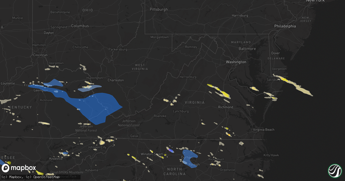
Hail Map in Virginia on June 17, 2022
Get this storm
June 17 map
$229
one time, instant access
Download today. No call, no setup
Keep the $229
Bought the map and want the full workflow? Apply the entire $229 to a subscription within 7 days. None of it is wasted.
Every map, not just this one
This buys you this map. Subscription and you get every map we run, in the markets you choose from a few cities to whole states to nationwide. Plus real-time alerts the moment a storm fires.
Contact data
Name, contact info, occupancy, even credit band for addresses in the footprint. You go from where it hit to who to call.
Become the source they trust
Unlimited branding weather history reports on demand. You already have the documented answer ready for the property owner, and you are the one who showed up with it.
Property data and RoofTrace estimates
Pull up any address you have got, its value and the exact code rules for that jurisdiction, straight from One Click Code. Then RoofTrace estimates the squares, pitch, and roof value, priced the way you price.
Storm reports in Virginia
Virginia
| Date | Description |
|---|---|
| 06/17/20226:55 PM CDT | Trees down on powerlines. |
| 06/17/20226:55 PM CDT | Large tree limb downed on to road along us-13 near exmore. Time radar estimated. |
| 06/17/20226:51 PM CDT | Trees down on powerlines. |
| 06/17/20226:47 PM CDT | Updates previous hail report from bloxom. Also... A few large tree limbs were downed into a garden at this location. Time radar estimated. |
| 06/17/20225:40 PM CDT | Trees downed along i-85 near mm 21. Time radar estimated. |
| 06/17/20225:25 PM CDT | Multiple trees uprooted along route 30 in king william. One tree fell through roof of house. |
| 06/17/20225:23 PM CDT | Ping pong ball size hail reported along us-58 12 miles east of emporia. |
| 06/17/20225:20 PM CDT | Shingles blown off roof of house in central garage. |
| 06/17/20225:15 PM CDT | Corrects previous tstm wnd dmg report from 1 ese nutbush. Trained spotter reports numerous large trees downed... Including a couple onto outbuildings near battes roads |
| 06/17/20225:15 PM CDT | Trees downed along us-460 east of burkesville... With numerous power outages in the area. Time radar estimated. |
| 06/17/20225:10 PM CDT | Large tree uprooted on tomlinson road in victoria. Time estimated from radar. |
| 06/17/20224:56 PM CDT | A couple of trees down in the area of massies mill... Va. |
| 06/17/20224:55 PM CDT | Tree down on gully tavern road in rice. |
| 06/17/20224:55 PM CDT | Several trees down across the county. |
| 06/17/20224:52 PM CDT | Tree down at new bethel road and dempsey road in meherrin. Time estimated from radar. |
| 06/17/20224:45 PM CDT | Tree down on ligontown road in cumberland. |
| 06/17/20224:45 PM CDT | Tree downed along i-95 at mile marker 104... With another leaning toward roadway/into traffic at mile marker 105. |
| 06/17/20224:44 PM CDT | Reports of multiple large trees uprooted in the ladysmith area near route 1. Also damage to outbuilding from fallen trees. |
| 06/17/20224:40 PM CDT | A couple outbuildings damaged with trees also uprooted at a farm along jericho road near ruther glen. Time is radar estimated. |
| 06/17/20224:39 PM CDT | Tree down on brickett road in farmville. |
| 06/17/20224:39 PM CDT | Tree down on five forks road in pamplin. |
| 06/17/20224:33 PM CDT | Tree down on prince edward highway in prospect. |
| 06/17/20224:26 PM CDT | Tree down on a house on old richmond road. |
| 06/17/20224:26 PM CDT | Tree down on power line on brook st. |
| 06/17/20224:20 PM CDT | One tree down on a powerline on moorefield bridge rd. |
| 06/17/20224:18 PM CDT | Tree down on stubbs bridge rd. Near the lake anna bridge. |
| 06/17/20224:17 PM CDT | Power lines down on stage rd in concord va. |
| 06/17/20224:17 PM CDT | Power lines and trees down in road on bear creek rd. |
| 06/17/20224:17 PM CDT | Power line down on pettigrew drive near concord va. |
| 06/17/20224:17 PM CDT | Power lines down near the farmers bank of appomattox on village hwy. |
| 06/17/20224:16 PM CDT | Tree down on buck creek road. |
| 06/17/20224:15 PM CDT | Trees downed at intersection of lew jones road and manson church road. Time radar estimated. |
| 06/17/20224:15 PM CDT | Tree down blocking spring grove road. |
| 06/17/20224:15 PM CDT | Tree down on spring grove road. |
| 06/17/20224:14 PM CDT | Tree down at the intersection of boggs dr. And stage coach rd. |
| 06/17/20224:13 PM CDT | A couple of trees down in the area of rockfish... Va. |
| 06/17/20224:11 PM CDT | Tree down... Blocking the road on stage rd. |
| 06/17/20224:08 PM CDT | Telephone pole down on stage road. |
| 06/17/20224:05 PM CDT | Tree down in road... Blocking one lane. Near intersection of robertsons ridge rd and sandy river rd. |
| 06/17/20224:05 PM CDT | Tree down in the 2200 block of piedmont rd. |
| 06/17/20224:05 PM CDT | Tree down at the intersection of creekview ln. Thomas nelson hwy. |
| 06/17/20224:05 PM CDT | Multiple trees down around the city of lynchburg. |
| 06/17/20224:05 PM CDT | Power line down on the concord turnpike. |
| 06/17/20224:04 PM CDT | Report from mping: 1-inch tree limbs broken; shingles blown off. |
| 06/17/20224:02 PM CDT | Tree down at the intersection of tye river rd. And boxwood farm rd. |
| 06/17/20224:01 PM CDT | Multiple reports of trees down between arringotn and colleen... Va. |
| 06/17/20224:00 PM CDT | 35 to 40 trees down around city of amherst reported by emergency manager. |
| 06/17/20224:00 PM CDT | Top of pine tree snapped off in city of lynchburg. |
| 06/17/20224:00 PM CDT | Tree down in the 1300 block of beech grove rd. |
| 06/17/20224:00 PM CDT | Updates previous tstm wnd dmg report from amherst. Around 60 trees down around amherst county... Including a tree on a home on highway 130. 6...000 customers without po |
| 06/17/20224:00 PM CDT | Large tree branch down. |
| 06/17/20223:58 PM CDT | Tree down in the 400 block of woodward rd. |
| 06/17/20223:56 PM CDT | Tree in middle of road. Near intersection of island ct and club house rd. |
| 06/17/20223:55 PM CDT | Power lines blew down near the 210 block of oak park rd. |
| 06/17/20223:54 PM CDT | Large trees down on sedgewick drive. One tree significantly damaged a house. |
| 06/17/20223:53 PM CDT | Tree down across road near intersection of kings mountain rd and daniels creek rd. |
| 06/17/20223:53 PM CDT | A tree blew down near n blue ridge turnpike and hebron ct. |
| 06/17/20223:53 PM CDT | Tree fell on power line and is hanging over a driveway. |
| 06/17/20223:50 PM CDT | A few trees down along marquee rd. Between monrovia rd. And double w farm rd. |
| 06/17/20223:50 PM CDT | Multiple large trees down on baileys sawmill road. |
| 06/17/20223:47 PM CDT | Large limbs down. 6 inches in diameter. Trampoline blew away and damaged. |
| 06/17/20223:45 PM CDT | One tree down... Blocking roadway on memorial blvd. |
| 06/17/20223:45 PM CDT | Tree down on powerline on rockford road. |
| 06/17/20223:45 PM CDT | Powerline and trees down on kings mountain road. |
| 06/17/20223:45 PM CDT | Tree down on powerline on rockford road. |
| 06/17/20223:43 PM CDT | Tree down on blackberry road... Completely blocking roadway. |
| 06/17/20223:40 PM CDT | A tree blew down near sunnyview dr and us hwy 340. |
| 06/17/20223:36 PM CDT | Large trees down along route 221 in willis va. |
| 06/17/20223:35 PM CDT | Numerous trees and powerlines down throughout the entire county. |
| 06/17/20223:30 PM CDT | Trees down in the town of ferrum. |
| 06/17/20223:30 PM CDT | *** 1 inj *** one person was taken to a hospital after being hit by a blown down tree in the 100 block of lakewood court. |
| 06/17/20223:30 PM CDT | Numerous trees and powerlines down countywide in rockbridge county. |
| 06/17/20223:30 PM CDT | Tree down at the intersection of spotswood trail and nicholson rd. |
| 06/17/20223:27 PM CDT | A tree blew down near the 210 block of back rd. |
| 06/17/20223:27 PM CDT | A tree blew down near the 130 block of fleeburg loop. |
| 06/17/20223:26 PM CDT | Tree down in the 16000 block of naked creek rd. |
| 06/17/20223:20 PM CDT | Large limbs down near galax. |
| 06/17/20223:15 PM CDT | Large maple tree down... Split at ground in woodlawn va. |
| 06/17/20223:15 PM CDT | Tree down and intermittent power outages on placid lane. |
| 06/17/20223:15 PM CDT | A local report indicates 58 MPH wind near GALAX HILLSVILLE AIRPOR |
| 06/17/20223:15 PM CDT | A local report indicates 58 MPH wind near GALAX HILLSVILLE AIRPOR |
| 06/17/20223:15 PM CDT | Multiple trees down on beagle club road. |
| 06/17/20223:12 PM CDT | Power poles blown down on south franklin st in christiansburg. |
| 06/17/20223:10 PM CDT | Roofing on a deck was damaged in christiansburg. |
| 06/17/20223:07 PM CDT | Multiple trees down along dobbins hollow road. |
| 06/17/20223:07 PM CDT | Multiple trees down along dobbins hollow road. 04) 2336 w 4 n denmark |
| 06/17/20223:07 PM CDT | Thunderstorm winds blew down numerous trees and power lines... Mainly across the southern portion of bath county between 4:03 and 4:20 pm. One tree fell on a truck in h |
| 06/17/20223:06 PM CDT | Multiple trees down on betty drive in christiansburg. |
| 06/17/20223:05 PM CDT | Tree down on rocky road in bent mountain. |
| 06/17/20223:00 PM CDT | Scattered trees and powerlines down across the south and east part of the county. |
| 06/17/20223:00 PM CDT | Scattered trees and powerlines down countywide. Crux of damage occurred between 3:40-4:15 pm. |
| 06/17/20222:58 PM CDT | Several large limbs and trees snapped at 3:58 p.m. |
| 06/17/20222:58 PM CDT | Trees broken. |
| 06/17/20222:58 PM CDT | Large tree branch broken. |
| 06/17/20222:58 PM CDT | Report from mping: 3-inch tree limbs broken; power poles broken. |
| 06/17/20222:58 PM CDT | Uprooted trees. |
| 06/17/20222:56 PM CDT | Report from mping: 1-inch tree limbs broken; shingles blown off. |
| 06/17/20222:55 PM CDT | Thunderstorm winds brought down numerous trees and power lines across alleghany county... Including trees down across u.s. Highway 220 and state highway 687. Near iron |
| 06/17/20222:55 PM CDT | Numerous trees were blown down by thunderstorm winds between 3:55 pm and 4:20 pm across botetourt county... With the large majority in the northern portion of the count |
| 06/17/20222:50 PM CDT | Tree down blocking happy hollow road. Power outages in woodbine/wyatt farms area also from downed trees/powerlines. Wind gust of 39 mph recorded at the vt airport |
| 06/17/20222:50 PM CDT | A local report indicates 65 MPH wind near 1 SSE BLACKSBURG |
| 06/17/20222:45 PM CDT | 1/2 of bradley pear tree in the street at the intersection of west main and berkeley street. No vehicles involved. |
| 06/17/20222:40 PM CDT | A local report indicates 62 MPH wind near 1 E MOUNTAIN LAKE |
| 06/17/20222:35 PM CDT | Scattered trees and powerlines down throughout the northwest part of the county from saltville to rich valley and from saltville to chilhowie. |
| 06/17/20222:34 PM CDT | Multiple trees and power lines down across county. |
| 06/17/20222:30 PM CDT | Multiple trees down throughout the county. |
| 06/17/20221:50 PM CDT | Multiple trees and powerlines down across the town. |
| 06/17/20221:45 PM CDT | Trees and power lines down county wide. Time estimated from radar. |
| 06/17/20227:52 AM CDT | At 1252 AM EDT, severe thunderstorms were located along a line extending from near Indian Mills to Oakvale to near War, moving southeast at 20 mph. HAZARD...60 mph wind gusts and quarter size hail. SOURCE...Radar indicated. IMPACT...Hail damage to vehicles is expected. Expect wind damage to roofs, siding, and trees. Locations impacted include... Bluefield... Princeton... Tazewell... Pearisburg... Narrows... Pembroke... and Athens.This includes The following Location Mercer County Airport. |
| 06/17/20227:38 AM CDT | At 1238 AM EDT, a severe thunderstorm was located over Cloverdale, or near Vinton, moving southeast at 20 mph. HAZARD...60 mph wind gusts and quarter size hail. SOURCE...Radar indicated. IMPACT...Hail damage to vehicles is expected. Expect wind damage to roofs, siding, and trees. Locations impacted include... Roanoke... Vinton... Troutville... Stewartsville... Montvale... Hollins... and Northwest Smith Mountain Lake.This includes The following Location Roanoke Regional Airport. |
| 06/17/20227:28 AM CDT | At 1228 AM EDT, severe thunderstorms were located along a line extending from near Hix to near Natural Bridge, moving southeast at 20 mph. HAZARD...60 mph wind gusts. SOURCE...Radar indicated. IMPACT...Expect damage to roofs, siding, and trees. Locations impacted include... Alleghany... Covington... Lewisburg... Hinton... White Sulphur Springs... Ronceverte... and Alderson.This includes The following Location The West Virginia StateFairgrounds. |
| 06/17/20227:04 AM CDT | At 1204 AM EDT, a severe thunderstorm was located near Pilot, moving southeast at 20 mph. HAZARD...60 mph wind gusts and quarter size hail. SOURCE...Radar indicated. IMPACT...Hail damage to vehicles is expected. Expect wind damage to roofs, siding, and trees. Locations impacted include... Floyd... Woolwine... Pilot... Alum Ridge... and Charity. |
| 06/17/20223:28 AM CDT | At 827 PM EDT, a severe thunderstorm was located over Norfolk NAS, or over Old Dominion University, moving east at 45 mph. HAZARD...60 mph wind gusts and quarter size hail. SOURCE...Radar indicated. IMPACT...Minor damage to vehicles is possible. Expect wind damage to trees and powerlines. This severe thunderstorm will be near... Virginia Wesleyan University and Norfolk International around 835 PM EDT. Kempsville and Regent University around 840 PM EDT. Virginia Beach around 850 PM EDT.Other locations impacted by this severe thunderstorm include RudeeHeights, Princess Anne Plaza, Oceana NAS, Macons Corner, RaleighTerrace, Bayside, Oceana, Wards Corner, North Virginia Beach and DamNeck. |
| 06/17/20222:33 AM CDT | At 732 PM EDT, severe thunderstorms were located along a line extending from near Tangier to 11 miles northwest of Nassawadox to near Bavon, moving east at 45 mph. HAZARD...60 mph wind gusts. SOURCE...Radar indicated. IMPACT...Expect damage to trees and powerlines. Severe thunderstorms will be near... Nassawadox around 745 PM EDT. Exmore, Cape Charles and Willis Wharf around 750 PM EDT. Onancock, Cheriton and Bay View around 755 PM EDT. Parksley around 800 PM EDT.Other locations impacted by these severe thunderstorms includeCapeville, Kiptopeke State Park, Harborton, Melfa, Eastville,Franktown, Cheapside, Kiptopeke, Painter and Keller. |
| 06/17/20222:31 AM CDT | At 730 PM EDT, severe thunderstorms were located along a line extending from near Courtland to near Conway to near Tarboro, moving southeast at 45 mph. HAZARD...60 mph wind gusts. SOURCE...Radar indicated. IMPACT...Expect damage to trees and powerlines. Severe thunderstorms will be near... Aulander around 745 PM EDT. Ahoskie and Como around 750 PM EDT. Winton around 755 PM EDT. Cofield around 800 PM EDT.Other locations impacted by these severe thunderstorms includeEagletown, Milwaukee, Kelford, Earleys, Menola, Chowan Beach,Mapleton, Republican, Jackson and Burden. |
| 06/17/20221:11 AM CDT | At 610 PM EDT, a severe thunderstorm was located near Green Plain, or 8 miles east of Emporia, moving southeast at 30 mph. HAZARD...60 mph wind gusts and quarter size hail. SOURCE...Radar indicated. IMPACT...Minor damage to vehicles is possible. Expect wind damage to trees and powerlines. This severe thunderstorm will be near... Claresville around 620 PM EDT. Boykins around 640 PM EDT. Conway around 655 PM EDT. Murfreesboro and Chowan University around 700 PM EDT.Other locations impacted by this severe thunderstorm includeMilwaukee, Adams Grove, Grizzard, Yale, Mapleton, Bryants Corner,Worrell, Hilda, Sunbeam and Creeksville. |
| 06/17/20221:08 AM CDT | At 608 PM EDT, a severe thunderstorm was located over Coles Point, or near White Point Beach, moving east at 55 mph. HAZARD...60 mph wind gusts. SOURCE...Radar indicated. IMPACT...Expect damage to trees and powerlines. This severe thunderstorm will remain over mainly rural areas of east central Westmoreland County, including the following locations... Westmoreland, Currioman Landing, Sandy Point and Erica. |
| 06/17/202212:58 AM CDT | At 558 PM EDT, severe thunderstorms were located along a line extending from near Lakeside Village to near Morven to near Green Bay, moving east at 45 mph. HAZARD...60 mph wind gusts. SOURCE...Radar indicated. IMPACT...Expect damage to trees and powerlines. Severe thunderstorms will be near... Morven, Jetersville and Ballsville around 605 PM EDT. Amelia Courthouse around 610 PM EDT. Nottoway, Chula and Scotts Fork around 615 PM EDT. Powhatan, Blackstone and Macon around 620 PM EDT. Mannboro and Fort Pickett around 625 PM EDT.Other locations impacted by these severe thunderstorms include NorthWellville, Irby, Rock Castle, Earls, Pilkinton, Murdocks, Forkland,Winterham, Wellville and Maplewood. |
| 06/17/202212:38 AM CDT | At 538 PM EDT, severe thunderstorms were located along a line extending from 6 miles east of Massaponax to 8 miles southeast of Bumpass to near Ferncliff, moving southeast at 30 mph. HAZARD...60 mph wind gusts and quarter size hail. SOURCE...Radar indicated. IMPACT...Minor damage to vehicles is possible. Expect wind damage to trees and powerlines. Severe thunderstorms will be near... Montpelier around 545 PM EDT. Bowling Green, Milford and Fort A.p. Hill around 550 PM EDT. Ashland and Kings Dominion around 555 PM EDT. Randolph Macon College, Gum Spring and Dawn around 600 PM EDT. Hanover, Glen Allen and Laurel around 605 PM EDT. Goochland, Mechanicsville, Oilville and Lakeside around 610 PM EDT. Richmond, Newtown, Studley, Beulahville and East Highland Park around 615 PM EDT. Sabot around 620 PM EDT.Other locations impacted by these severe thunderstorms includeChilesburg, Orchid, Gum Tree, Etna Mills, Chamberlayne, Atlee,Ashcake, Nancy Wrights Corner, Ruther Glen and Duane Fork. |
| 06/17/202212:38 AM CDT | At 538 PM EDT, a severe thunderstorm was located 8 miles north of Bumpass, or 10 miles northeast of Mineral, moving east at 40 mph. HAZARD...60 mph wind gusts and quarter size hail. SOURCE...Radar indicated. IMPACT...Damaging winds will cause some trees and large branches to fall. This could injure those outdoors, as well as damage homes and vehicles. Roadways may become blocked by downed trees. Localized power outages are possible. Unsecured light objects may become projectiles. Locations impacted include... Glenora, Partlow and Gatewood. |
| 06/17/202212:33 AM CDT | At 532 PM EDT, severe thunderstorms were located along a line extending from 8 miles north of Centenary to Dillwyn to near Sheppards to near Red House, moving east at 40 mph. HAZARD...60 mph wind gusts. SOURCE...Radar indicated. IMPACT...Expect damage to trees and powerlines. Severe thunderstorms will be near... Farmville and Guinea Mills around 545 PM EDT. Cumberland and Longwood University around 550 PM EDT. Fork Union around 555 PM EDT. Hampden Sydney College, Hampden Sydney, Sunnyside and Rice around 600 PM EDT. Duncan and Lakeside Village around 605 PM EDT. Cartersville and Green Bay around 615 PM EDT.Other locations impacted by these severe thunderstorms include RainesTavern, Tuggle, Prince Edward Station, Angola, Briery, Oak Forest,Twin Lakes State Park, Shores, Central Plains and Bremo Bluff. |
| 06/17/202212:25 AM CDT | At 522 PM EDT, a line of severe thunderstorms extended from north of Danville Virginia to near Greensboro North Carolina, moving to the southeast at 40 to 50 mph. HAZARD...60 mph wind gusts. SOURCE...Radar indicated. IMPACT...Expect damage to roofs, siding, and trees. Locations impacted include... South Boston... Halifax... Brookneal... Prospect Hill... Turbeville... Ingram... and Clover. |
| 06/17/202212:13 AM CDT | At 512 PM EDT, a severe thunderstorm was located near McKenney, moving southeast at 40 mph. HAZARD...60 mph wind gusts and quarter size hail. SOURCE...Radar indicated. IMPACT...Minor damage to vehicles is possible. Expect wind damage to trees and powerlines. This severe thunderstorm will be near... Dinwiddie around 520 PM EDT. Jarratt and Stony Creek around 540 PM EDT. Sussex around 550 PM EDT.Other locations impacted by this severe thunderstorm include Gray,Booker, Yale, Lumberton, Wharfs Store, Huske, Littleton, Hilda,Center Star and Owens. |
| 06/17/202212:12 AM CDT | At 512 PM EDT, severe thunderstorms were located along a line extending from 6 miles southeast of Wintergreen to Oakville, moving east at 50 mph. HAZARD...60 mph wind gusts. SOURCE...Radar indicated. IMPACT...Damaging winds will cause some trees and large branches to fall. This could injure those outdoors, as well as damage homes and vehicles. Roadways may become blocked by downed trees. Localized power outages are possible. Unsecured light objects may become projectiles. Locations impacted include... Shipman, Schuyler, Nellysford, Arrington, Scottsville, Esmont, Lovingston, Damon, Allens Creek, Covesville, Rockfish, Buffalo Springs, Norwood, Glendower, Keene, Five Forks, Wingina, Gladstone, Elma and Faber. |
| 06/17/202212:11 AM CDT | At 510 PM EDT, severe thunderstorms were located along a line extending from near Appomattox to Long Island, moving east at 75 mph. HAZARD...60 mph wind gusts. SOURCE...Radar indicated. IMPACT...Expect damage to roofs, siding, and trees. Locations impacted include... Brookneal... Keysville... Charlotte Court House... Phenix... Redoak... Red House... and Concord. |
| 06/16/202211:53 PM CDT | At 451 PM EDT, severe thunderstorms were located along a line extending from Stuarts Draft to Buena Vista, to Elon and Boonsvoro, moving east at 45 mph. HAZARD...70 mph wind gusts. SOURCE...Radar indicated. IMPACT...Expect considerable tree damage. Damage is likely to mobile homes, roofs, and outbuildings. Locations impacted include... Lynchburg... Buckingham... Amherst... Appomattox... Dillwyn... Forks Of Buffalo... and Bent Creek. |
| 06/16/202211:51 PM CDT | At 451 PM EDT, a severe thunderstorm was located near Madison, moving east at 40 mph. HAZARD...60 mph wind gusts. SOURCE...Radar indicated. IMPACT...Damaging winds will cause some trees and large branches to fall. This could injure those outdoors, as well as damage homes and vehicles. Roadways may become blocked by downed trees. Localized power outages are possible. Unsecured light objects may become projectiles. Locations impacted include... Orange, Madison, Brightwood, Mine Run, Oakpark, Everona, Verdiersville, Haywood, Montpelier Station, Locust Grove, Thornhill, Nasons, Madison Mills, Montford, Mitchells, Old Somerset, Unionville, Locust Dale, Raccoon Ford and Rhoadesville. |
| 06/16/202211:40 PM CDT | At 440 PM EDT, a severe thunderstorm was located near Luray, or 11 miles southeast of Woodstock, moving east at 35 mph. HAZARD...60 mph wind gusts. SOURCE...Radar indicated. IMPACT...Damaging winds will cause some trees and large branches to fall. This could injure those outdoors, as well as damage homes and vehicles. Roadways may become blocked by downed trees. Localized power outages are possible. Unsecured light objects may become projectiles. Locations impacted include... Sperryville, Washington, Kimball, Castleton, Compton, Viewtown, Woodville, Amissville, Fourway, Five Forks, Panorama, Rock Mills, Cardova, Rileyville and Boston. |
| 06/16/202211:31 PM CDT | At 431 PM EDT, a severe thunderstorm was located over Orange, moving east at 35 mph. HAZARD...60 mph wind gusts. SOURCE...Radar indicated. IMPACT...Damaging winds will cause some trees and large branches to fall. This could injure those outdoors, as well as damage homes and vehicles. Roadways may become blocked by downed trees. Localized power outages are possible. Unsecured light objects may become projectiles. Locations impacted include... Orange, Spotsylvania, Brokenburg, Montpelier Station, Madison Run, Snell, Alsop, Gatewood, Thornhill, Nasons, Logan, Partlow, Montford, Lahore, Glenora, Post Oak, Thornburg, Unionville, Somerset and Madison Mills. |
| 06/16/202211:24 PM CDT | At 424 PM EDT, severe thunderstorms were located along a line extending from near Bells Valley to Collierstown to near Snowden, moving southeast at 45 mph. HAZARD...60 mph wind gusts. SOURCE...Trained weather spotters. IMPACT...Damaging winds will cause some trees and large branches to fall. This could injure those outdoors, as well as damage homes and vehicles. Roadways may become blocked by downed trees. Localized power outages are possible. Unsecured light objects may become projectiles. Locations impacted include... Stuarts Draft, Sherando, Shipman, Schuyler, Wintergreen, Montebello, Lyndhurst, Nellysford, Craigsville, Greenville, Arrington, Scottsville, Esmont, Lovingston, Middlebrook, Allens Creek, North Garden, Covesville, Tyro and Buffalo Springs. |
| 06/16/202211:22 PM CDT | At 421 PM EDT, severe thunderstorms were located along a line extending from near Floyd to near Galax, Virginia, moving east- southeast at 50 mph. HAZARD...60 mph wind gusts. SOURCE...Radar indicated. IMPACT...Expect damage to roofs, siding, and trees. Locations impacted include... Mount Airy... Elkin... Fairview... Flat Rock... Dobson... Pilot Mountain... and Stuart. |
| 06/16/202211:18 PM CDT | At 418 PM EDT, a severe thunderstorm was located near Shenandoah, or 8 miles northeast of Harrisonburg, moving southeast at 30 mph. HAZARD...60 mph wind gusts. SOURCE...Radar indicated. IMPACT...Damaging winds will cause some trees and large branches to fall. This could injure those outdoors, as well as damage homes and vehicles. Roadways may become blocked by downed trees. Localized power outages are possible. Unsecured light objects may become projectiles. Locations impacted include... Madison, Shenandoah, Massanutten, Stanardsville, Big Meadows, Elkton, Ruckersville, Ingham, Quinque, Lydia, Haywood, Syria, Banco, Hood, Mcmullen, Criglersville, Lacey Spring, Swift Run, Pine Grove and Shelby. |
| 06/16/202211:15 PM CDT | At 413 PM EDT, severe thunderstorms were located along a line extending from Vesuvius to near Wirtz to near Indian Valley, moving southeast at 50 mph. HAZARD...70 mph wind gusts. SOURCE...Radar indicated. IMPACT...Expect considerable tree damage. Damage is likely to mobile homes, roofs, and outbuildings. Locations impacted include... Roanoke... Lynchburg... Salem... Vinton... Buena Vista... Bedford... and Rocky Mount.This includes The following Locations The Salem Fairgrounds, TheNational D-Day Memorial, and Roanoke Regional Airport. |
| 06/16/202211:14 PM CDT | At 414 PM EDT, a severe thunderstorm was located near Monterey, moving southeast at 30 mph. HAZARD...60 mph wind gusts. SOURCE...Radar indicated. IMPACT...Damaging winds will cause some trees and large branches to fall. This could injure those outdoors, as well as damage homes and vehicles. Roadways may become blocked by downed trees. Localized power outages are possible. Unsecured light objects may become projectiles. Locations impacted include... Monterey, Augusta Springs, Churchville, Deerfield, Hightown, Clover Creek, Doe Hill, Head Waters, Liberty, West Augusta, Buffalo Gap, Mustoe, Mcdowell, Trimbles Mill, Vanderpool, Sirons Mill, Christian and Swoope. |
| 06/16/202211:00 PM CDT | At 400 PM EDT, severe thunderstorms were located along a line extending from Merrimac to near Pulaski, moving southeast at 50 mph. HAZARD...60 mph wind gusts. SOURCE...Radar indicated. IMPACT...Expect damage to roofs, siding, and trees. Locations impacted include... Blacksburg... Christiansburg... Radford... Pulaski... Dublin... Floyd... and Newport.This includes The following Location Virginia Tech. |
| 06/16/202210:37 PM CDT | At 337 PM EDT, severe thunderstorms were located along a line extending from near Bristol Va to 7 miles south of Pine Crest, moving east at 45 mph. HAZARD...60 mph wind gusts and quarter size hail. SOURCE...Radar indicated. IMPACT...Hail damage to vehicles is expected. Expect wind damage to roofs, siding, and trees. Locations impacted include... Boone... Jefferson... West Jefferson... Blowing Rock... Beech Mountain... Lansing... and Foscoe.This includes The following Location Appalachian State University. |
| 06/16/202210:32 PM CDT | At 331 PM EDT, severe thunderstorms were located along a line extending from near Mechanicsburg to near Nebo, moving east at 70 mph. HAZARD...60 mph wind gusts and quarter size hail. SOURCE...Radar indicated. IMPACT...Hail damage to vehicles is expected. Expect wind damage to roofs, siding, and trees. Locations impacted include... Pulaski... Wytheville... Bland... Marion... Saltville... Rural Retreat... and Ceres. |
| 06/16/202210:25 PM CDT | At 324 PM EDT, a severe thunderstorm was located over Walnut Hill, or over Bristol Tn, moving southeast at 45 mph. HAZARD...60 mph wind gusts and quarter size hail. SOURCE...Radar indicated. IMPACT...Hail damage to vehicles is expected. Expect wind damage to roofs, siding, and trees. Locations impacted include... Bristol Tn, Bristol Va, Mountain City, Walnut Hill, Bluff City, Hunter, Morril's Cave, Neva, Sadie and Elk Mills.Those attending Bristol Dragway are in the path of this storm and should prepare for IMMINENT DANGEROUS WEATHER CONDITIONS. SEEK SHELTER NOW!This includes the following highways... Interstate 81 in Tennessee between mile markers 70 and 75. Interstate 81 in Virginia between mile markers 1 and 8. |
| 06/16/202210:02 PM CDT | At 301 PM EDT, severe thunderstorms were located along a line extending from near Richwood to Abingdon, moving southeast at 55 mph. HAZARD...60 mph wind gusts. SOURCE...Radar indicated. IMPACT...Expect damage to roofs, siding, and trees. Locations impacted include... Bluefield... Bland... Princeton... Richlands... Tazewell... Lewisburg... and Pearisburg.This includes The following Locations The West Virginia StateFairgrounds and Mercer County Airport. |
| 06/16/202210:00 PM CDT | At 300 PM EDT, severe thunderstorms were located along a line extending from near Camden-On-gauley to near Cedar Grove, moving southeast at 55 mph. HAZARD...70 mph wind gusts and nickel size hail. SOURCE...Radar indicated. IMPACT...Expect considerable tree damage. Damage is likely to mobile homes, roofs, and outbuildings. Locations impacted include... Charleston, Summersville, Fayetteville, Richwood, Babcock State Park, Oak Hill, Montgomery, Ansted, Belle, Cedar Grove, East Bank, Glasgow, Smithers, Gauley Bridge, Pratt, Camden-On-gauley, Powellton, Hawks Nest State Park, Craigsville and Coal Fork.This includes the following highways... West Virginia Turnpike between mile markers 91 and 94. Route 19 between mile markers 11 and 46. |
| 06/16/20229:36 PM CDT | At 235 PM EDT, a severe thunderstorm was located over Linefork, or 8 miles southwest of Whitesburg, moving east at 40 mph. HAZARD...60 mph wind gusts and quarter size hail. SOURCE...Radar indicated. IMPACT...Hail damage to vehicles is expected. Expect wind damage to roofs, siding, and trees. Locations impacted include... Norton, Wise, Coeburn, Pound and Pardee. |
| 06/16/20228:59 PM CDT | At 158 AM EDT, a severe thunderstorm was located over Blacksburg, moving southeast at 20 mph. HAZARD...60 mph wind gusts. SOURCE...Radar indicated. IMPACT...Expect damage to roofs, siding, and trees. Locations impacted include... Blacksburg... Christiansburg... Radford... Newport... Pilot... Shawsville... and Bent Mountain.This includes The following Location Virginia Tech. |
| 06/16/20228:59 PM CDT | At 158 PM EDT, severe thunderstorms were located along a line extending from near Madison to 8 miles northwest of Holden to Threeforks, moving east at 45 mph. HAZARD...60 mph wind gusts. SOURCE...Radar indicated. IMPACT...Expect damage to roofs, siding, and trees. Locations impacted include... Williamson, Madison, Logan, Oak Hill, Oceana, Chapmanville, Man, Delbarton, Van, Gilbert Creek, Mount Gay-Shamrock, Mallory, Burnwell, Hinch, R.d. Bailey Lake, Bald Knob, Chief Logan State, Holden, Amherstdale-Robinette and Red Jacket.This includes the following highways... West Virginia Turnpike between mile markers 53 and 68. Route 119 between mile markers 1 and 55. Route 19 between mile markers 9 and 14. |
| 06/16/20228:23 PM CDT | At 122 AM EDT, a severe thunderstorm was located near White Gate, or 10 miles west of Poplar Hill, moving southeast at 25 mph. HAZARD...60 mph wind gusts and quarter size hail. SOURCE...Radar indicated. IMPACT...Hail damage to vehicles is expected. Expect wind damage to roofs, siding, and trees. Locations impacted include... Pulaski... Dublin... Allisonia... Patterson... Long Spur... Mechanicsburg... and Claytor Lake State Park. |
| 06/16/20228:21 PM CDT | At 121 PM EDT, a severe thunderstorm was located over Lilley Cornett Woods, or 9 miles west of Whitesburg, moving east at 40 mph. HAZARD...60 mph wind gusts and penny size hail. SOURCE...Radar indicated. IMPACT...Expect damage to roofs, siding, and trees. This severe thunderstorm will be near... Flint around 125 PM EDT. Oscaloosa around 130 PM EDT. Whitesburg around 135 PM EDT. Eolia around 140 PM EDT. |
| 06/16/20227:01 PM CDT | Large tree down blocking road at 18274 metompkin rd. Time estimated by radar. |
All States Impacted by Hail Map on June 17, 2022
Cities Impacted by Hail Map on June 17, 2022
- Eureka, MT
- Georgetown, KY
- Kalispell, MT
- Condon, MT
- Spencer, WV
- East Setauket, NY
- Island Falls, ME
- Smyrna Mills, ME
- Oakfield, ME
- Newcastle, WY
- Sweet Grass, MT
- Cut Bank, MT
- Hill City, SD
- Blue Creek, OH
- Stout, OH
- Elkview, WV
- Charleston, WV
- Kenna, WV
- Deadwood, SD
- Lead, SD
- Advent, WV
- Ripley, WV
- Walton, WV
- Gandeeville, WV
- Dandridge, TN
- Jefferson City, TN
- Evansville, IN
- Newburgh, IN
- Bardstown, KY
- Cadiz, KY
- Frankfort, KY
- Valier, MT
- Browning, MT
- Heart Butte, MT
- Liberty, WV
- Red House, WV
- Leon, WV
- Buffalo, WV
- Poca, WV
- Port Jefferson, NY
- Port Jefferson Station, NY
- Mount Sinai, NY
- Mount Zion, WV
- Vine Grove, KY
- Custer, KY
- Irvington, KY
- Cecilia, KY
- Guston, KY
- Rineyville, KY
- Mechanicsville, VA
- Hanover, VA
- Ashland, VA
- Hartfield, VA
- Davin, WV
- Acton, ME
- Lebanon, ME
- Hillsboro, KY
- Morehead, KY
- Foster, KY
- Augusta, KY
- Brooksville, KY
- Mount Lookout, WV
- Southside, WV
- Henderson, WV
- Lavalette, WV
- Owensboro, KY
- Utica, KY
- Nashville, NC
- Blackwater, VA
- Kyles Ford, TN
- Powellton, WV
- Kimberly, WV
- Wayne, WV
- Prichard, WV
- Louisa, KY
- Catlettsburg, KY
- Rush, KY
- Boonville, IN
- Skippers, VA
- Emporia, VA
- Luttrell, TN
- Powder Springs, TN
- Newsoms, VA
- Courtland, VA
- Whaleyville, MD
- Frankford, DE
- Berlin, MD
- Willards, MD
- Delmar, MD
- Showell, MD
- Delmar, DE
- Millsboro, DE
- Laurel, DE
- Bishopville, MD
- Ocean City, MD
- Parsonsburg, MD
- Pittsville, MD
- Fayetteville, TN
- Guin, AL
- Hamilton, AL
- Brilliant, AL
- Suwanee, GA
- Buford, GA
- Lancaster, SC
- Bennettsville, SC
- Wallace, SC
- McColl, SC
- Hamlet, NC
- East Point, KY
- Cerulean, KY
- Gracey, KY
- Hopkinsville, KY
- Diagonal, IA
- Lenox, IA
- Clearfield, IA
- Madisonville, KY
- Dawson Springs, KY
- Nebo, KY
- Hermitage, TN
- Watertown, TN
- Murfreesboro, TN
- Madison, TN
- La Vergne, TN
- Nashville, TN
- Brentwood, TN
- Lebanon, TN
- Smyrna, TN
- Old Hickory, TN
- Whites Creek, TN
- Antioch, TN
- Mount Juliet, TN
- Linton, IN
- Switz City, IN
- Lyons, IN
- New Durham, NH
- Vesuvius, VA
- Buena Vista, VA
- Lexington, VA
- Fairfield, VA
- Natural Bridge, VA
- Hurricane, WV
- Winfield, WV
- Lexington, KY
- Paris, KY
- Sadieville, KY
- Corinth, KY
- Julian, WV
- Foster, WV
- Ridgeview, WV
- Sheridan, WY
- Saluda, VA
- Locust Hill, VA
- Salt Lick, KY
- Patoka, IN
- Hazleton, IN
- Rogersville, TN
- Marion, KY
- Fredonia, KY
- Hurley, VA
- Fort Gay, WV
- Webbville, KY
- Hacker Valley, WV
- Centertown, KY
- Central City, KY
- Yale, VA
- White Plains, KY
- Elkton, KY
- Drakesboro, KY
- Greenville, KY
- Lewisburg, KY
- Sharon Grove, KY
- Crofton, KY
- Dunmor, KY
- Nortonville, KY
- Beech Creek, KY
- Belton, KY
- Russellville, KY
- Flemingsburg, KY
- Raphine, VA
- Pinewood, SC
- Summerton, SC
- Georgetown, DE
- Reed, KY
- Alkol, WV
- Monroe, VA
- Glasgow, VA
- Easton, ME
- Presque Isle, ME
- Shelbyville, KY
- Tomahawk, KY
- Natural Bridge Station, VA
- Wallingford, KY
- Evans, WV
- Given, WV
- Cottageville, WV
- Shelburn, IN
- Sullivan, IN
- Greensburg, KY
- Summersville, KY
- Hillsborough, NC
- Grand Chain, IL
- Sandy Hook, KY
- Elkfork, KY
- Blountville, TN
- Vest, KY
- Jackson, KY
- Hueysville, KY
- Spartanburg, SC
- Pauline, SC
- Lizemores, WV
- Sturgis, KY
- Cave In Rock, IL
- Shawneetown, IL
- Junction, IL
- Elizabethtown, IL
- Patriot, OH
- Gallipolis, OH
- Jarratt, VA
- Drewryville, VA
- Boykins, VA
- Capron, VA
- Providence, KY
- Salem, KY
- Clay, KY
- Livermore, KY
- Slaughters, KY
- Rumsey, KY
- Bremen, KY
- Dixon, KY
- Hanson, KY
- Island, KY
- Calhoun, KY
- Manitou, KY
- Sacramento, KY
- Battleboro, NC
- Castalia, NC
- Strawberry Plains, TN
- Tremont, MS
- Fulton, MS
- Golden, MS
- Vina, AL
- Red Bay, AL
- Scotland Neck, NC
- Halifax, NC
- Enfield, NC
- Salem, IN
- Sneedville, TN
- Thorn Hill, TN
- Sunburst, MT
- Newberry, SC
- Johnson City, TN
- Henderson, NC
- Essex, MT
- Portsmouth, OH
- Wheelersburg, OH
- Franklin Furnace, OH
- Ripley, OH
- South Charleston, WV
- Ireland, WV
- Harts, WV
- Princeton, KY
- Detroit, AL
- Madisonville, TN
- Norwich, CT
- Bozrah, CT
- Minford, OH
- Milton, NH
- Union, NH
- Equality, IL
- Gallipolis Ferry, WV
- Dover, KY
- South Portsmouth, KY
- South Shore, KY
- Falmouth, KY
- Princeton, IN
- Columbia Falls, MT
- Louisa, VA
- Cape May, NJ
- Wildwood, NJ
- Lynx, OH
- Chapmanville, WV
- Big Creek, WV
- Albion, IL
- West Salem, IL
- Dugger, IN
- Midway, KY
- Stamping Ground, KY
- Crane, IN
- Odon, IN
- Loogootee, IN
- Elnora, IN
- Stem, NC
- Olmsted, IL
- Ullin, IL
- Pulaski, IL
- Villa Ridge, IL
- Dongola, IL
- Delbarton, WV
- Sarah Ann, WV
- Gilbert, WV
- Omar, WV
- Helvetia, WV
- Pickens, WV
- Buffalo, KY
- Sonora, KY
- Magnolia, KY
- Upton, KY
- Hodgenville, KY
- Mount Sherman, KY
- Knoxville, TN
- Whitesville, KY
- Hartford, KY
- Ranger, WV
- Branchland, WV
- Mosheim, TN
- Waynesburg, KY
- Eubank, KY
- Amherstdale, WV
- Man, WV
- Summersville, WV
- Dixie, WV
- Victor, WV
- Drennen, WV
- Belva, WV
- Swiss, WV
- Ansted, WV
- Coxs Creek, KY
- Bloomfield, KY
- Clearmont, WY
- Buffalo, WY
- Decker, MT
- Birney, MT
- Stony Creek, VA
- Rocky Mount, NC
- Chapel Hill, NC
- Liberty Hill, SC
- Patrick, SC
- Society Hill, SC
- Cheraw, SC
- Morven, NC
- Chesterfield, SC
- Garland, NC
- Rural Hall, NC
- Pfafftown, NC
- Winston Salem, NC
- Newport, TN
- Bybee, TN
- Parrottsville, TN
- Creal Springs, IL
- New Burnside, IL
- Stonefort, IL
- Lawrenceville, GA
- Grayson, GA
- Loganville, GA
- Leighton, AL
- Wilson, NC
- Elm City, NC
- Midway, TN
- Beaverton, AL
- Clio, SC
- Metter, GA
- Twin City, GA
- Cobbtown, GA
- Cape Girardeau, MO
- McClure, IL
- Franklinton, NC
- Statesboro, GA
- Kodak, TN
- Vance, AL
- Union, SC
- Brent, AL
- Marion, AL
- Norway, SC
- Hartsville, SC
- Ledbetter, KY
- Kuttawa, KY
- Grand Rivers, KY
- Smithland, KY
- Bessemer City, NC
- Clover, SC
- Gastonia, NC
- Kings Mountain, NC
- Kingston, GA
- Brooklet, GA
- Fort Branch, IN
- Francisco, IN
- Round O, SC
- Cottageville, SC
- Ruffin, SC
- Walterboro, SC
- Sylacauga, AL
- Monticello, GA
- Parkton, NC
- Lumber Bridge, NC
- Saint Pauls, NC
- Raeford, NC
- Madison, GA
- Eatonton, GA
- Crisfield, MD
- Hallwood, VA
- Yemassee, SC
- Red Springs, NC
- Maxton, NC
- Evensville, TN
- Decatur, TN
- Oxford, MS
- Cameron, SC
- Saint Matthews, SC
- Harrison, GA
- Davisboro, GA
- Sandersville, GA
- Bartow, GA
- Columbiana, AL
- Chelsea, AL
- Helena, AL
- Pelham, AL
- Shaw, MS
- Boyle, MS
- Arp, TX
- Tyler, TX
- Eustace, TX
- Canton, TX
- Brunswick, GA
- Hortense, GA
- Waynesville, GA
- Talladega, AL
- Mitchell, GA
- Rock Island, TN
- Whatley, AL
- Grove Hill, AL
- Savannah, TN
- Gibson, GA
- Stryker, MT
- Cross, SC
- Holly Hill, SC
- Tellico Plains, TN
- Singer, LA
- Bonaire, GA
- Orangeburg, SC
- Santee, SC
- Elloree, SC
- Islandton, SC
- Moravian Falls, NC
- Wilkesboro, NC
- Orange, VA
- Vonore, TN
- Anna, IL
- Jonesboro, IL
- Havelock, NC
- Union Grove, NC
- Statesville, NC
- Paducah, KY
- West Paducah, KY
- Heath Springs, SC
- Atlanta, GA
- Peachtree Corners, GA
- Norcross, GA
- Moore, SC
- Dequincy, LA
- Niota, TN
- Athens, TN
- Sparta, GA
- Varnville, SC
- Hampton, SC
- Grady, AL
- Ramer, AL
- Pomaria, SC
- Whitmire, SC
- Brunson, SC
- Early Branch, SC
- Sulligent, AL
- Deatsville, AL
- Hackleburg, AL
- Andrews, SC
- McKenney, VA
- Morganfield, KY
- Meherrin, VA
- Victoria, VA
- Green Bay, VA
- Darlington, SC
- Nettleton, MS
- Rockingham, NC
- Ellerbe, NC
- Fort Mill, SC
- Waxhaw, NC
- Winnsboro, SC
- Great Falls, SC
- Peachland, NC
- Pembroke, NC
- Lumberton, NC
- Kershaw, SC
- Engelhard, NC
- Taylors, SC
- Greer, SC
- Randolph, AL
- Jemison, AL
- Dry Branch, GA
- Kathleen, GA
- Travelers Rest, SC
- Roswell, GA
- Marietta, GA
- Rockwell, NC
- Salisbury, NC
- Gold Hill, NC
- Lexington, NC
- Clemmons, NC
- Counce, TN
- Mantachie, MS
- Saltillo, MS
- Guntown, MS
- Ridge, MD
- Dameron, MD
- Scotland, MD
- Piney Point, MD
- Saint Inigoes, MD
- Temperanceville, VA
- Parksley, VA
- Mears, VA
- Bloxom, VA
- Sanford, VA
- Greenbush, VA
- Ellijay, GA
- Magnolia, NC
- Rose Hill, NC
- Crandall, GA
- Vanceboro, NC
- New Market, TN
- Cartersville, GA
- Blenheim, SC
- Berry, AL
- Columbus, MS
- Soperton, GA
- Sweetwater, TN
- Englewood, TN
- Walnut, MS
- Weogufka, AL
- Jacksonville, TX
- North Charleston, SC
- Charleston, SC
- Thomson, GA
- Blackville, SC
- Barnwell, SC
- Williston, SC
- Neeses, SC
- Frankston, TX
- Glenwood, GA
- Leland, MS
- Tuscaloosa, AL
- Sylvania, GA
- Waynesboro, GA
- Sardis, GA
- Blythe, GA
- Keysville, GA
- Hephzibah, GA
- Girard, GA
- Byron, GA
- Montezuma, GA
- Wrightsville, GA
- Selma, AL
- Sumter, SC
- Vernon, AL
- Dingess, WV
- Linden, AL
- Pennington, AL
- Sweet Water, AL
- Georgetown, SC
- Brierfield, AL
- Montevallo, AL
- Marbury, AL
- Elmore, AL
- Prattville, AL
- Pembroke, GA
- Fort Stewart, GA
- Ruther Glen, VA
- Doswell, VA
- Beaverdam, VA
- Natchez, MS
- Thomasville, AL
- Pine Hill, AL
- Rock Hill, SC
- Duncanville, AL
- Cottondale, AL
- Hazlehurst, GA
- Jackson, SC
- Tennille, GA
- Pinehurst, GA
- Byromville, GA
- Vienna, GA
- Covington, GA
- Mansfield, GA
- Buncombe, IL
- Bluff City, TN
- Elizabethton, TN
- Dalzell, SC
- Dublin, GA
- Quinton, AL
- Mulga, AL
- West Point, MS
- Hoffman, NC
- Marston, NC
- Birmingham, AL
- Troup, TX
- Ridgeville, SC
- Lane, SC
- Athens, TX
- Mount Sterling, KY
- Gattman, MS
- Caledonia, MS
- Patterson, GA
- Nahunta, GA
- Wolf Lake, IL
- Partridge, KY
- Wise, VA
- Eolia, KY
- Appalachia, VA
- Norton, VA
- Philpot, KY
- Estillfork, AL
- Scottsboro, AL
- Gatesville, NC
- Gates, NC
- Eure, NC
- Pollocksville, NC
- Pegram, TN
- Saint Charles, KY
- Dayton, TN
- Spring Hope, NC
- Powell, TN
- Arapahoe, NC
- Grantsboro, NC
- New Bern, NC
- Metropolis, IL
- Rosiclare, IL
- Cypress, IL
- Grantsburg, IL
- Simpson, IL
- Hampton, KY
- Vienna, IL
- Karnak, IL
- Belknap, IL
- Brookport, IL
- Golconda, IL
- Goreville, IL
- Jonesborough, TN
- Clarkson, KY
- Rydal, GA
- White, GA
- Advance, NC
- Enoree, SC
- Clinton, NC
- Alamo, GA
- McRae Helena, GA
- Greensboro, NC
- Whitsett, NC
- Winfield, AL
- Maryville, TN
- Walland, TN
- Burlington, NC
- Browns Summit, NC
- Reidsville, NC
- Gibsonville, NC
- Elon, NC
- Goose Creek, SC
- Lithonia, GA
- Carbon Hill, AL
- Nauvoo, AL
- Eldridge, AL
- Townley, AL
- Abbeville, GA
- Maysville, NC
- Toney, AL
- Harvest, AL
- Acworth, GA
- Dallas, GA
- Aiken, SC
- Kingstree, SC
- Kellyton, AL
- Goodwater, AL
- Mount Pleasant, SC
- Milledgeville, GA
- Windsor, SC
- Clyo, GA
- Olar, SC
- Fairfax, SC
- Ulmer, SC
- Warthen, GA
- Luverne, AL
- Stamps, AR
- Duncan, MS
- Reynolds, GA
- Nacogdoches, TX
- Darien, GA
- Townsend, GA
- Quitman, GA
- Bokeelia, FL
- Shady Valley, TN
- Mountain City, TN
- Avera, GA
- Stapleton, GA
- Louisville, GA
- Blaine, TN
- Mascot, TN
- Ramer, TN
- Somerset, KY
- Jackson, MO
- Burfordville, MO
- Hopkins, SC
- Wedgefield, SC
- Columbia, KY
- Bristol, TN
- High Point, NC
- Jamestown, NC
- Colfax, NC
- Kernersville, NC
- Hiddenite, NC
- Harmony, NC
- Cleveland, NC
- Olin, NC
- Laurel Bloomery, TN
- Cedar Grove, NC
- Mebane, NC
- Roxboro, NC
- Prospect Hill, NC
- Timberlake, NC
- Hurdle Mills, NC
- Delphia, KY
- Linefork, KY
- Whitesburg, KY
- Cumberland, KY
- Hallie, KY
- Clayton, GA
- Walhalla, SC
- Mountain Rest, SC
- Westminster, SC
- Seneca, SC
- Monroe, NC
- Wingate, NC
- Marshville, NC
- Cumming, GA
- Woodstock, AL
- Merryville, LA
- Bishopville, SC
- Camden, SC
- Rembert, SC
- Glendale, KY
- Boston, KY
- New Haven, KY
- Elizabethtown, KY
- Beulaville, NC
- Pink Hill, NC
- Kenansville, NC
- Richlands, NC
- Clifton Forge, VA
- Eagle Rock, VA
- Edmonton, KY
- Bonnieville, KY
- Cobbs Creek, VA
- Morristown, TN
- White Pine, TN
- Oak Ridge, MO
- Seabrook, SC
- Beaufort, SC
- Coosawhatchie, SC
- Sheldon, SC
- Ridgeland, SC
- Crandall, TX
- Greenville, SC
- Landrum, SC
- Conway, SC
- Buffalo, SC
- Jonesville, SC
- Lyons, GA
- Cobden, IL
- Eastview, KY
- Montgomery, AL
- Marshallville, GA
- Fort Valley, GA
- Tar Heel, NC
- Bladenboro, NC
- Cochran, GA
- Warner Robins, GA
- Perry, GA
- Hawkinsville, GA
- Denmark, SC
- Cordele, GA
- Lambert, MS
- Lugoff, SC
- Columbia, SC
- Eastover, SC
- Elgin, SC
- Gadsden, SC
- Blair, SC
- Pinetops, NC
- Fountain, NC
- Macclesfield, NC
- Lumber City, GA
- Talking Rock, GA
- Spencer, NC
- Bumpass, VA
- Partlow, VA
- Spotsylvania, VA
- Tiplersville, MS
- West Blocton, AL
- White Oak, NC
- Swainsboro, GA
- East Dublin, GA
- Duncan, SC
- Woodruff, SC
- Roebuck, SC
- Lowndesboro, AL
- Kingsport, TN
- Ruby, SC
- Jeffersonville, KY
- Richland, IN
- Elberfeld, IN
- Oakland City, IN
- Waterloo, OH
- Bristol, VA
- Garysburg, NC
- Jackson, NC
- Roanoke Rapids, NC
- Weldon, NC
- Middleton, TN
- Catawba, SC
- Lilburn, GA
- Prosperity, SC
- North, SC
- Seagoville, TX
- Starkville, MS
- Estill, SC
- White Oak, GA
- Waverly, GA
- London, KY
- Salyersville, KY
- East Glacier Park, MT
- Lansing, NC
- Campbellsville, KY
- Graham, KY
- Keavy, KY
- Ferguson, KY
- Rutledge, TN
- Talbott, TN
- Unionville, VA
- Aylett, VA
- Mineral, VA
- Manquin, VA
- Inez, KY
- Mcminnville, TN
- Smithville, TN
- Kermit, WV
- Lenore, WV
- Breeden, WV
- Holden, WV
- Logan, WV
- Chapin, SC
- Little Mountain, SC
- Todd, NC
- Zionville, NC
- Creston, NC
- Apex, NC
- Durham, NC
- Cary, NC
- Creedmoor, NC
- Oxford, NC
- Damascus, VA
- Clinton, SC
- Fairmont, NC
- Liberty, TN
- Greenwood Springs, MS
- Amory, MS
- Hamilton, MS
- Mount Croghan, SC
- Rougemont, NC
- Mount Vernon, GA
- Corinth, MS
- Guys, TN
- Blackstock, SC
- Carlisle, SC
- Benoit, MS
- Pageland, SC
- Mantee, MS
- Rochelle, GA
- Tarboro, NC
- Swanquarter, NC
- Newington, GA
- Crane Hill, AL
- Bremen, AL
- Pineland, SC
- Garfield, GA
- Barnardsville, NC
- Latta, SC
- Springfield, GA
- Eutawville, SC
- Moncks Corner, SC
- Bonneau, SC
- Rockledge, GA
- Lewisville, AR
- Collins, GA
- Dermott, AR
- Toomsboro, GA
- Valdosta, GA
- Hahira, GA
- Big Clifty, KY
- Leitchfield, KY
- Earlington, KY
- Corryton, TN
- Tamms, IL
- Monticello, KY
- Iuka, MS
- Woodleaf, NC
- Cooleemee, NC
- Jasper, TX
- Westfield, ME
- Polebridge, MT
- Iron Gate, VA
- West Columbia, SC
- Blythewood, SC
- Jenkinsville, SC
- Irmo, SC
- Shaw Afb, SC
- Walling, TN
- Shiloh, TN
- Alpharetta, GA
- Town Creek, AL
- Tuscumbia, AL
- Bessemer, AL
- Garner, NC
- Fuquay Varina, NC
- Butner, NC
- Morrisville, NC
- Youngsville, NC
- Bahama, NC
- Raleigh, NC
- Wake Forest, NC
- Leopold, IN
- Bone Gap, IL
- Chrisney, IN
- Stendal, IN
- Mount Carmel, IL
- Grayville, IL
- Evanston, IN
- Winslow, IN
- Browns, IL
- Spurgeon, IN
- Saint Anthony, IN
- Jasper, IN
- Lawrenceville, IL
- Ferdinand, IN
- Griffin, IN
- Velpen, IN
- Vincennes, IN
- Lynnville, IN
- Saint Meinrad, IN
- Saint Croix, IN
- Tell City, IN
- Troy, IN
- Petersburg, IN
- Bridgeport, IL
- Chandler, IN
- Birdseye, IN
- Haubstadt, IN
- Hawesville, KY
- Santa Claus, IN
- Bristow, IN
- Decker, IN
- Cynthiana, IN
- Holland, IN
- Poseyville, IN
- Saint Francisville, IL
- Branchville, IN
- Grandview, IN
- Dale, IN
- Lincoln City, IN
- Claremont, IL
- Dundas, IL
- Gentryville, IN
- Allendale, IL
- Parkersburg, IL
- Huntingburg, IN
- Bellmont, IL
- Calhoun, IL
- Sumner, IL
- Owensville, IN
- Otwell, IN
- Lamar, IN
- Tennyson, IN
- Lewisport, KY
- Olney, IL
- Rockport, IN
- Hardinsburg, IN
- Cannelburg, IN
- English, IN
- Washington, IN
- Orleans, IN
- Campbellsburg, IN
- French Lick, IN
- West Baden Springs, IN
- Montgomery, IN
- Milltown, IN
- Dubois, IN
- Paoli, IN
- Shoals, IN
- Marengo, IN
- Fredericksburg, IN
- Eddyville, IL
- Guthrie, KY
- Trenton, KY
- Eddyville, KY
- Sebree, KY
- Mortons Gap, KY
- Allensville, KY
- Burna, KY
- Morgantown, KY
- Adams, TN
- Clarksville, TN
- Oak Grove, KY
- Olmstead, KY
- Pembroke, KY
- Adairville, KY
- Auburn, KY
- Henlawson, WV
- Olympia, KY
- War, WV
- Verner, WV
- Banner, KY
- Grethel, KY
- South Williamson, KY
- Willis, VA
- Whitewood, VA
- Weeksbury, KY
- Eggleston, VA
- Bluefield, VA
- Leburn, KY
- Debord, KY
- Elkhorn City, KY
- Freeman, WV
- Iaeger, WV
- Versailles, KY
- Austinville, VA
- Parrott, VA
- Baisden, WV
- Harold, KY
- Belspring, VA
- Stollings, WV
- Staffordsville, KY
- Check, VA
- Pippa Passes, KY
- Lick Creek, KY
- Raven, VA
- Mousie, KY
- Brenton, WV
- Kyle, WV
- Staffordsville, VA
- Gunlock, KY
- Stanton, KY
- Rock, WV
- Hindman, KY
- Denniston, KY
- West Van Lear, KY
- Vansant, VA
- Deane, KY
- Canada, KY
- Hellier, KY
- Teaberry, KY
- Yolyn, WV
- Pembroke, VA
- Raven, KY
- Mallie, KY
- Betsy Layne, KY
- Auxier, KY
- Richlands, VA
- Floyd, VA
- Jesse, WV
- Langley, KY
- David, KY
- McAndrews, KY
- Newport, VA
- Winchester, KY
- Raysal, WV
- Varney, KY
- Lovely, KY
- Wheelwright, KY
- Wayland, KY
- Simon, WV
- Ashcamp, KY
- Forest Hills, KY
- Topmost, KY
- Phelps, KY
- Bramwell, WV
- Clear Fork, WV
- Royalton, KY
- Paynesville, WV
- Davy, WV
- Mize, KY
- McDowell, KY
- Bevinsville, KY
- Williamson, WV
- Maybeury, WV
- Draper, VA
- Breaks, VA
- Bypro, KY
- Elkhorn, WV
- Camp Creek, WV
- Nora, VA
- Neon, KY
- Fanrock, WV
- Hazel Green, KY
- Shelby Gap, KY
- Beaver, KY
- Dana, KY
- Jolo, WV
- Stopover, KY
- Cannel City, KY
- Belfry, KY
- Means, KY
- Rowe, VA
- Oceana, WV
- Switzer, WV
- Barren Springs, VA
- Steele, KY
- Robinson Creek, KY
- Wilsondale, WV
- Clinchco, VA
- Ransom, KY
- Haysi, VA
- Martin, KY
- Princeton, WV
- Regina, KY
- Grundy, VA
- Raccoon, KY
- Tram, KY
- Indian Valley, VA
- Jewell Ridge, VA
- Kegley, WV
- Pinsonfork, KY
- Copper Hill, VA
- Dema, KY
- Hagerhill, KY
- Fedscreek, KY
- Hardy, KY
- Beeson, WV
- Ivel, KY
- Chauncey, WV
- Pikeville, KY
- Pound, VA
- Ripplemead, VA
- Lackey, KY
- Mouthcard, KY
- Matheny, WV
- Eastern, KY
- Max Meadows, VA
- Salem, VA
- Elliston, VA
- Spanishburg, WV
- Dugspur, VA
- Swords Creek, VA
- Kimper, KY
- Clayhole, KY
- Glen Lyn, VA
- Crum, WV
- Herndon, WV
- Blacksburg, VA
- Minnie, KY
- Owingsville, KY
- Huddy, KY
- Oakwood, VA
- Hope, KY
- Switchback, WV
- Oil Springs, KY
- Glen Fork, WV
- Phyllis, KY
- Wellington, KY
- Ezel, KY
- Vancleve, KY
- Matewan, WV
- Kite, KY
- Riner, VA
- Big Rock, VA
- Wytheville, VA
- Melvin, KY
- Berwind, WV
- Lake, WV
- Bays, KY
- Davenport, VA
- Panther, WV
- Pocahontas, VA
- Tazewell, VA
- Radford, VA
- Narrows, VA
- McCarr, KY
- New Richmond, WV
- Jackhorn, KY
- Saulsville, WV
- Hiwassee, VA
- Bland, VA
- Pilot, VA
- Garrett, KY
- North Spring, WV
- Pilgrim, KY
- Shelbiana, KY
- Dunlow, WV
- Dwale, KY
- Bent Mountain, VA
- Stanville, KY
- Fancy Gap, VA
- Squire, WV
- Beauty, KY
- Pineville, WV
- North Tazewell, VA
- Shawsville, VA
- Peterstown, WV
- Elbert, WV
- Garner, KY
- Rousseau, KY
- Pilgrims Knob, VA
- Pecks Mill, WV
- Drift, KY
- Campton, KY
- Lyburn, WV
- Bandy, VA
- McRoberts, KY
- Virgie, KY
- Belcher, KY
- Stone, KY
- Honaker, VA
- Cleveland, VA
- Ikes Fork, WV
- Thelma, KY
- Clay City, KY
- Kimball, WV
- Frenchburg, KY
- Birchleaf, VA
- Montcalm, WV
- McClure, VA
- Mallory, WV
- West Liberty, KY
- Meally, KY
- Boons Camp, KY
- Rich Creek, VA
- Bastian, VA
- Mohawk, WV
- Ceres, VA
- Pine Top, KY
- Northfork, WV
- Sidney, KY
- Hillsville, VA
- Bim, WV
- Pearisburg, VA
- Athens, WV
- Dublin, VA
- Slade, KY
- Paintsville, KY
- Welch, WV
- Coeburn, VA
- Dante, VA
- Pulaski, VA
- Van Lear, KY
- Prestonsburg, KY
- Coal Mountain, WV
- Clintwood, VA
- Wharncliffe, WV
- Printer, KY
- Bee, VA
- Bluefield, WV
- Warfield, KY
- Williamsport, KY
- Allen, KY
- Lashmeet, WV
- Hanover, WV
- Anawalt, WV
- Woodlawn, VA
- Freeburn, KY
- Millstone, KY
- Cyclone, WV
- Christiansburg, VA
- Rocky Gap, VA
- Hi Hat, KY
- Majestic, KY
- Blue River, KY
- Jenkins, KY
- Matoaka, WV
- Falls Mills, VA
- Wyoming, WV
- Sharpsburg, KY
- Ewing, KY
- Carlisle, KY
- Moorefield, KY
- Blaine, KY
- Genoa, WV
- Lowmansville, KY
- East Lynn, WV
- Adams, KY
- Martha, KY
- Isonville, KY
- Readyville, TN
- Auburntown, TN
- Milton, TN
- Lascassas, TN
- Woodbury, TN
- Fairfield, AL
- Parrish, AL
- Cordova, AL
- Oakman, AL
- Jasper, AL
- Dolomite, AL
- Pleasant Grove, AL
- Adamsville, AL


