Hail Map in West Virginia on June 8, 2022
Get this storm
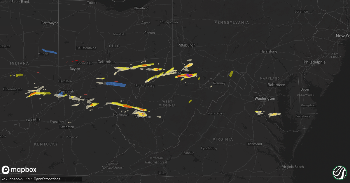
June 8 map
$229
one time, instant access
Download today. No call, no setup
Keep the $229
Bought the map and want the full workflow? Apply the entire $229 to a subscription within 7 days. None of it is wasted.
Every map, not just this one
This buys you this map. Subscription and you get every map we run, in the markets you choose from a few cities to whole states to nationwide. Plus real-time alerts the moment a storm fires.
Contact data
Name, contact info, occupancy, even credit band for addresses in the footprint. You go from where it hit to who to call.
Become the source they trust
Unlimited branding weather history reports on demand. You already have the documented answer ready for the property owner, and you are the one who showed up with it.
Property data and RoofTrace estimates
Pull up any address you have got, its value and the exact code rules for that jurisdiction, straight from One Click Code. Then RoofTrace estimates the squares, pitch, and roof value, priced the way you price.
Storm reports in West Virginia
West Virginia
| Date | Description |
|---|---|
| 06/08/20226:55 PM CDT | Multiple trunks of trees were broken along middle fork road. Time estimated from radar. |
| 06/08/20226:55 PM CDT | Between edens fork rd and sissonville dr. Time estimated by radar. |
| 06/08/20226:53 PM CDT | Trees and power lines blown down near the 6700 block along mcclane pike. |
| 06/08/20226:40 PM CDT | 911 dispatcher drove through some hail along turkey run road near route 7. |
| 06/08/20226:37 PM CDT | Quarter size hail reported. Possible car damage. |
| 06/08/20226:37 PM CDT | Barn blown completely down from strong wind... Near the vicinity of confidence elementary school. |
| 06/08/20226:30 PM CDT | Quarter size hail. Estimated wind gusts between 40-50 mph. |
| 06/08/20226:29 PM CDT | Multiple areas of trees down and power line outages. |
| 06/08/20226:25 PM CDT | A local report indicates 1.00 inch wind near PADEN CITY |
| 06/08/20226:25 PM CDT | A few trees down in paden city along route 2 |
| 06/08/20226:23 PM CDT | Multiple trees blown down near buffalo. |
| 06/08/20226:20 PM CDT | Multiple trees were blown down in the apple grove area. There were several power outages and also had some damage to homes with shingles blown off a few roofs and the s |
| 06/08/20226:20 PM CDT | A local report indicates 1.00 inch wind near BEVERLY |
| 06/08/20226:15 PM CDT | Wind damage along turkey run road was consistent with 75-80 mph wind. Time was adjusted based on confirmational evidence from local residents as to which of three storm |
| 06/08/20225:55 PM CDT | Em reports trees down in glenwood area. |
| 06/08/20225:54 PM CDT | Numerous trees down. Em employee observed from straight line winds. |
| 06/08/20225:54 PM CDT | Several trees and power line down across the road. |
| 06/08/20225:32 PM CDT | Tree damage was reported near springfield... Including a tree that blew down along wv-28 cumberland road near the train station. |
| 06/08/20225:32 PM CDT | A tree was down along cumberland road near the train station. |
| 06/08/20225:29 PM CDT | A tree blew down in the 4900 block of cr-5 jersey mountain road. |
| 06/08/20225:29 PM CDT | Tree damage was reported near three churches... Including a tree that blew down in the 4900 block of cr-5 jersey mountain road. |
| 06/08/20225:29 PM CDT | Tree down in the 4900 block of jersey mountain rd. |
| 06/08/20225:19 PM CDT | Tree down at the intersection of mckenzie rd. And shirley ln. |
| 06/08/20225:19 PM CDT | Tree damage was reported near russelldale... Including a tree that blew down at the intersection of mckenzie road and cr-50/4 shirley lane. |
| 06/08/20224:23 PM CDT | Quarter size hail was reported near intersection of pearre road and woodmont road. |
| 06/08/20224:18 PM CDT | National park service reported quarter sized hail near intersection of pearre road and woodmont road. |
| 06/08/20224:18 PM CDT | Nearly a dozen treez down in the 8000 block of cacapon rd. |
| 06/08/20224:15 PM CDT | Nearly a dozen trees blew down in the 8000 block of wv-9 cacapon road. |
| 06/08/20226:11 AM CDT | At 1111 PM EDT, severe thunderstorms were located along a line extending from near Kingwood to 6 miles southeast of Rowlesburg to 7 miles west of Parsons, moving east at 60 mph. HAZARD...60 mph wind gusts. SOURCE...Radar indicated. IMPACT...Damaging winds will cause some trees and large branches to fall. This could injure those outdoors, as well as damage homes and vehicles. Roadways may become blocked by downed trees. Localized power outages are possible. Unsecured light objects may become projectiles. Locations impacted include... Keyser, Moorefield, Mountain Lake Park, Oakland, Westernport, Bayard, Lonaconing, Piedmont, Loch Lynn Heights, Deer Park, Elk Garden, Kitzmiller, Barton, Franklin, Luke, Redhouse, Hutton, Gorman, Deep Creek Lake State Park and Crellin. |
| 06/08/20225:50 AM CDT | At 1050 PM EDT, a severe thunderstorm was located near Grafton, moving east at 50 mph. HAZARD...60 mph wind gusts. SOURCE...Radar indicated. IMPACT...Expect damage to roofs, siding, and trees. Locations impacted include... Grafton, Philippi, Flemington, Moatsville, Tygart Lake State Park, Thornton, Knottsville, Galloway and Nestorville. |
| 06/08/20225:30 AM CDT | At 1030 PM EDT, severe thunderstorms were located along a line extending from near East Palestine to 6 miles east of New Cumberland, moving east at 35 mph. HAZARD...60 mph wind gusts. SOURCE...Radar indicated. IMPACT...Expect damage to trees and power lines, resulting in some power outages. Locations impacted include... Cranberry, Moon Township, New Castle, Franklin Park, East Liverpool, Aliquippa, Beaver Falls, Monaca, East Palestine, Economy, Ellwood City, and Ambridge. |
| 06/08/20225:00 AM CDT | At 1000 PM EDT, severe thunderstorms were located along a line extending from near Leetonia to 9 miles west of Wellsville, moving east at 25 mph. HAZARD...60 mph wind gusts. SOURCE...Radar indicated. IMPACT...Expect damage to trees and power lines, resulting in some power outages. Locations impacted include... East Liverpool, Columbiana, East Palestine, Wellsville, Calcutta, Ohioville, Lisbon, Midland, Chester, Leetonia, Industry, and New Waterford. |
| 06/08/20224:10 AM CDT | At 910 PM EDT, a severe thunderstorm was located near Winfield, or near Westover, moving east at 30 mph. HAZARD...60 mph wind gusts and quarter size hail. SOURCE...Radar indicated. IMPACT...Minor hail damage to vehicles is possible. Expect wind damage to trees and power lines, resulting in some power outages. Locations impacted include... Morgantown, Fairmont, Westover, Kingwood, Star City, Winfield, Barrackville, Granville, Brookhaven, Rivesville, Grant Town, and Reedsville. |
| 06/08/20224:06 AM CDT | At 906 PM EDT, a severe thunderstorm was located near Woodsfield, moving east at 30 mph. HAZARD...60 mph wind gusts and quarter size hail. SOURCE...Radar indicated. IMPACT...Minor hail damage to vehicles is possible. Expect wind damage to trees and power lines, resulting in some power outages. Locations impacted include... Moundsville, New Martinsville, Woodsfield, Powhatan Point, Clarington, Cameron, Lynn Camp, Grove Oak, Proctor, Woodlands, Hannibal, and Laings. |
| 06/08/20223:58 AM CDT | At 858 PM EDT, a severe thunderstorm was located near Terra Alta, moving northeast at 40 mph. HAZARD...60 mph wind gusts and half dollar size hail. SOURCE...Radar indicated. IMPACT...Damaging winds will cause some trees and large branches to fall. This could injure those outdoors, as well as damage homes and vehicles. Roadways may become blocked by downed trees. Localized power outages are possible. Unsecured light objects may become projectiles. Locations impacted include... Oakland, Friendsville, Accident, Swallow Falls State Park, McHenry, Selbysport, Keysers Ridge, McComas Beach, Mineral Spring and Deep Creek Lake State Park. |
| 06/08/20223:44 AM CDT | At 844 PM EDT, a severe thunderstorm was located near Brookhaven, or 8 miles south of Westover, moving east at 30 mph. HAZARD...60 mph wind gusts and quarter size hail. SOURCE...Radar indicated. IMPACT...Minor hail damage to vehicles is possible. Expect wind damage to trees and power lines, resulting in some power outages. Locations impacted include... Morgantown, Kingwood, Brookhaven, Reedsville, Masontown, Albright, Valley Point, Booth, Laurel Run, Gladesville, Browns Chapel, and Cheat Lake. |
| 06/08/20223:43 AM CDT | At 843 PM EDT, a severe thunderstorm was located over Mannington, moving east at 30 mph. HAZARD...60 mph wind gusts and quarter size hail. SOURCE...Radar indicated. IMPACT...Minor hail damage to vehicles is possible. Expect wind damage to trees and power lines, resulting in some power outages. Locations impacted include... Morgantown, Fairmont, Westover, Mannington, Star City, Pleasant Valley, Winfield, Barrackville, Monongah, Granville, Fairview, and Cassville. |
| 06/08/20223:18 AM CDT | At 817 PM EDT, severe thunderstorms were located along a line extending from near Jackson to near South Webster, moving east at 55 mph. HAZARD...60 mph wind gusts. SOURCE...Radar indicated. IMPACT...Expect damage to roofs, siding, and trees. Locations impacted include... Jackson, Wellston, Point Pleasant, Gallipolis, Pomeroy, Oak Hill, Rio Grande, Rutland, New Haven, Mason, Gallia, Vernon, Waterloo, Middleport, Hamden, Syracuse, Hartford City, Coalton, Henderson and Vinton. |
| 06/08/20223:15 AM CDT | At 814 PM EDT, a severe thunderstorm was located over Poca, or near Nitro, moving east at 35 mph. HAZARD...60 mph wind gusts and quarter size hail. SOURCE...Radar indicated. IMPACT...Hail damage to vehicles is expected. Expect wind damage to roofs, siding, and trees. Locations impacted include... Charleston, Nitro, Winfield, Dunbar, Sissonville, Clendenin, Poca, Cross Lanes, Pinch, Elkview, Amma, Teays Valley, Bancroft and Procious.This includes the following highways... Interstate 79 between mile markers 1 and 27, and near mile marker32. Interstate 77 in West Virginia between mile markers 103 and 116. Interstate 64 in West Virginia between mile markers 43 and 49. |
| 06/08/20223:09 AM CDT | At 808 PM EDT, a severe thunderstorm was located near Hundred, or 15 miles north of Mannington, moving northeast at 30 mph. HAZARD...60 mph wind gusts and half dollar size hail. SOURCE...Radar indicated. IMPACT...Minor hail damage to vehicles is possible. Expect wind damage to trees and power lines, resulting in some power outages. Locations impacted include... Hundred, Rogersville, Aleppo, Nineveh, Spraggs, New Freeport, Brave, and Littleton. |
| 06/08/20222:37 AM CDT | At 736 PM EDT, a severe thunderstorm was located near Winfield, moving east at 30 mph. HAZARD...60 mph wind gusts and quarter size hail. SOURCE...Radar indicated. IMPACT...Hail damage to vehicles is expected. Expect wind damage to roofs, siding, and trees. Locations impacted include... Winfield, Sissonville, Kenna, Elkview, Bancroft, Kentuck, Liberty and Walton.This includes the following highways... Interstate 79 between mile markers 8 and 17. Interstate 77 in West Virginia between mile markers 111 and 125. |
| 06/08/20221:18 AM CDT | At 617 PM EDT, a severe thunderstorm was located 11 miles south of Rio Grande, moving east at 30 mph. HAZARD...Golf ball size hail and 70 mph wind gusts. SOURCE...Radar indicated. IMPACT...People and animals outdoors will be injured. Expect hail damage to roofs, siding, windows, and vehicles. Expect considerable tree damage. Wind damage is also likely to mobile homes, roofs, and outbuildings. Locations impacted include... Point Pleasant, Gallipolis, Henderson, Gage, Gallopolis Ferry and Ashton. |
| 06/08/20221:07 AM CDT | At 606 PM EDT, a severe thunderstorm was located near Pratt, or 15 miles east of Charleston, moving northeast at 35 mph. HAZARD...60 mph wind gusts and quarter size hail. SOURCE...Radar indicated. IMPACT...Hail damage to vehicles is expected. Expect wind damage to roofs, siding, and trees. Locations impacted include... Clay, Pratt, Wallback, Glen, Bickmore, Ivydale, Procious, Indore and Pond Gap.This includes Interstate 79 near mile marker 37. |
| 06/08/202212:32 AM CDT | At 532 PM EDT, a severe thunderstorm was located 7 miles north of Van, or 7 miles east of Madison, moving northeast at 25 mph. HAZARD...60 mph wind gusts and quarter size hail. SOURCE...Radar indicated. IMPACT...Hail damage to vehicles is expected. Expect wind damage to roofs, siding, and trees. Locations impacted include... Charleston, Chesapeake, Marmet, Belle, Cedar Grove, East Bank, Glasgow, Pratt, Coal Fork, Handley, Seth, Dawes, Prenter, Sharon and Racine.This includes the following highways... Interstate 77 in West Virginia near mile marker 96. West Virginia Turnpike between mile markers 78 and 95. |
| 06/08/202212:05 AM CDT | At 504 PM EDT, a severe thunderstorm was located over Upper Tract, or 10 miles north of Franklin, moving northeast at 25 mph. HAZARD...60 mph wind gusts and quarter size hail. SOURCE...Radar indicated. IMPACT...Damaging winds will cause some trees and large branches to fall. This could injure those outdoors, as well as damage homes and vehicles. Roadways may become blocked by downed trees. Localized power outages are possible. Unsecured light objects may become projectiles. Locations impacted include... Petersburg, Rough Run, Upper Tract, Welton, Landes, Arthur, Brushy Run, Deer Run, Seymourville, Rig, Masonville, Milam, Cabins, Dorcas, Fisher, Brake and Lahmansville. |
| 06/07/202210:30 PM CDT | 3 trees down blocking road. |
| 06/07/202210:30 PM CDT | Trees down; time estimate from radar |
| 06/07/202210:21 PM CDT | A few trees down. |
| 06/07/202210:17 PM CDT | A large tree was blown down along duck creek road. Many other reports of downed trees throughout harrison county. |
| 06/07/202210:15 PM CDT | Trees down; time estimate from radar |
| 06/07/202210:10 PM CDT | Trees down; time estimate from radar |
| 06/07/202210:08 PM CDT | Trees down near route 50 and south mountaineer hwy |
| 06/07/202210:02 PM CDT | Trees down; time estimate from radar |
| 06/07/20229:50 PM CDT | Several trees and a few powerlines reported down. Time estimated from radar. |
| 06/07/20229:50 PM CDT | Trees and powerlines reported down along lucwick rd. Time estimated from radar. |
| 06/07/20229:43 PM CDT | Tree down on river road. |
| 06/07/20229:43 PM CDT | Multiple trees and power lines were blown down along pike street and route 19 near clarksburg. |
| 06/07/20229:42 PM CDT | Several trees and power lines down. Time estimated from radar. |
| 06/07/20229:38 PM CDT | Tree down through roof of structure; time estimate from radar |
| 06/07/20229:35 PM CDT | Several trees reported down in the city. Time estimated from radar. |
| 06/07/20229:35 PM CDT | Several trees and large limbs down on conifer drive with gutters ripped off one house by falling tree. |
| 06/07/20229:32 PM CDT | Several trees and a few powerlines reported down in and around the town. Time estimated from radar. |
| 06/07/20229:32 PM CDT | A few trees and powerlines reported down. Time estimated from radar. |
| 06/07/20229:32 PM CDT | Several trees reported down. Time estimated from radar. |
| 06/07/20229:29 PM CDT | Several trees and powerlines reported down in and around the city. Time estimated from radar. |
| 06/07/20229:07 PM CDT | A few trees reported down. Time estimated from radar. |
| 06/07/20228:37 PM CDT | A local report indicates 1.50 inch wind near 1 N MASONTOWN |
| 06/07/20228:27 PM CDT | Tree down on pleasant hill road |
| 06/07/20228:27 PM CDT | Tree down on summers school road. |
| 06/07/20228:27 PM CDT | A local report indicates 1.00 inch wind near 2 SE BROOKHAVEN |
| 06/07/20228:26 PM CDT | A local report indicates 1.50 inch wind near 1 S DELLSLOW |
| 06/07/20228:25 PM CDT | A local report indicates 1.50 inch wind near 1 NE HOG EYE |
| 06/07/20228:22 PM CDT | Trees down. Time estimate based from radar |
| 06/07/20228:22 PM CDT | Widespread tree damage near turkey run |
| 06/07/20228:22 PM CDT | Tree down on aarons creek road |
| 06/07/20228:18 PM CDT | A local report indicates 1.50 inch wind near 1 WSW ROCK FORGE |
| 06/07/20228:15 PM CDT | Trees down in moundsville... And across marshall county |
| 06/07/20228:13 PM CDT | A local report indicates 1.00 inch wind near 1 ESE FLAGGY MEADOW |
| 06/07/20228:11 PM CDT | Trees down... Time estimate from radar |
| 06/07/20227:55 PM CDT | Trees down in grant town |
| 06/07/20227:55 PM CDT | A local report indicates 2.00 inch wind near MASONTOWN |
| 06/07/20227:55 PM CDT | A local report indicates 1.00 inch wind near REEDSVILLE |
| 06/07/20227:53 PM CDT | A local report indicates 2.00 inch wind near 2 NE GUM SPRING |
| 06/07/20227:48 PM CDT | A local report indicates 1.25 inch wind near 6 W REEDSVILLE |
| 06/07/20227:47 PM CDT | Several trees down in the city... Along with a snapped power pole. Numerous power outages reported. Time estimated from radar. |
| 06/07/20227:45 PM CDT | A local report indicates 1.75 inch wind near 4 NE CHARLESTON |
| 06/07/20227:37 PM CDT | A local report indicates 1.00 inch wind near 2 NNE SISSONVILLE |
| 06/07/20227:35 PM CDT | Tree down. |
| 06/07/20227:35 PM CDT | Time estimated from radar. |
| 06/07/20227:35 PM CDT | Time estimated from radar. |
All States Impacted by Hail Map on June 8, 2022
Cities Impacted by Hail Map on June 8, 2022
- Chouteau, OK
- Elizabethtown, IN
- Seymour, IN
- Butlerville, IN
- Versailles, IN
- Osgood, IN
- Scipio, IN
- Jonesville, IN
- Holton, IN
- Brownstown, IN
- Westport, IN
- Columbus, IN
- Greensburg, IN
- North Vernon, IN
- Madison, IN
- Sarahsville, OH
- Woodsfield, OH
- Beallsville, OH
- Summerfield, OH
- Caldwell, OH
- Lewisville, OH
- Clarington, OH
- Graysville, OH
- Carmichaels, PA
- Jefferson, PA
- Portsmouth, OH
- White Cottage, OH
- Zanesville, OH
- Roseville, OH
- Mooresville, IN
- Oxford, NC
- Proctor, WV
- Waynesburg, PA
- Patriot, OH
- Seagrove, NC
- Holdenville, OK
- Sweetwater, OK
- Lesage, WV
- Maysville, OK
- Pauls Valley, OK
- Lindsay, OK
- Lexington, OK
- Ridgeville, SC
- Summerville, SC
- Searcy, AR
- Augusta, AR
- Coweta, OK
- Porter, OK
- Locust Grove, OK
- Dix, IL
- Mount Vernon, IL
- Red House, WV
- Charleston, WV
- Poca, WV
- Liberty, WV
- Spruce Pine, AL
- Hodges, AL
- Phil Campbell, AL
- Russellville, AL
- Vina, AL
- Red Bay, AL
- Groom, TX
- Poyen, AR
- Malvern, AR
- Beaverton, AL
- Blanchard, OK
- Tuttle, OK
- Norman, OK
- Newcastle, OK
- Amber, OK
- Truth Or Consequences, NM
- Stonewall, OK
- Fitzhugh, OK
- Macomb, OK
- Dierks, AR
- Masontown, PA
- Uniontown, PA
- McClellandtown, PA
- Smithfield, PA
- Greensboro, PA
- Welling, OK
- Sulligent, AL
- Sterrett, AL
- Harpersville, AL
- Clarksburg, OH
- Alamogordo, NM
- Cloudcroft, NM
- Foster, KY
- Brooksville, KY
- Dunnellon, FL
- Pinson, AL
- Birmingham, AL
- Trussville, AL
- Tremont, MS
- Smithville, MS
- Hamilton, AL
- Fulton, MS
- Detroit, AL
- Greenwood Springs, MS
- Fort Stockton, TX
- El Dorado, AR
- Ripley, OH
- Winchester, OH
- Russellville, OH
- Manchester, OH
- West Union, OH
- Peebles, OH
- Sentinel, OK
- Dill City, OK
- Port Republic, MD
- Newburg, MD
- Charlotte Hall, MD
- Prince Frederick, MD
- Lusby, MD
- Saint Leonard, MD
- Mechanicsville, MD
- Hollywood, MD
- Broomes Island, MD
- Asher, OK
- Konawa, OK
- Purcell, OK
- Beverly Hills, FL
- Hernando, FL
- Charleston, AR
- Point Marion, PA
- Martin, PA
- Bobtown, PA
- Nemacolin, PA
- Morgantown, WV
- Dilliner, PA
- Maidsville, WV
- Adah, PA
- New Salem, PA
- Ronco, PA
- Garards Fort, PA
- Mount Morris, PA
- Uledi, PA
- Lamar, OK
- Mcalester, OK
- Burlington, WV
- New Creek, WV
- Batesville, IN
- Currituck, NC
- Moyock, NC
- Quinton, OK
- Stigler, OK
- Brownsville, PA
- Allison, PA
- Denbo, PA
- Hiller, PA
- East Millsboro, PA
- Merrittstown, PA
- Vanderbilt, PA
- Grindstone, PA
- Smock, PA
- Maud, OK
- Balmorhea, TX
- Erick, OK
- Van Horn, TX
- Park Hill, OK
- Tahlequah, OK
- Dyer, AR
- Van Buren, AR
- Lavaca, AR
- Fort Smith, AR
- Alma, AR
- Greenwood, AR
- Fairview, WV
- Rivesville, WV
- Farmington, WV
- Fairmont, WV
- Lexington, KY
- Sparkman, AR
- Pampa, TX
- Cambridge, OH
- Bretz, WV
- Masontown, WV
- Independence, WV
- Montana Mines, WV
- Mannington, WV
- Kingwood, WV
- Bruceton Mills, WV
- Reedsville, WV
- Albright, WV
- Rachel, WV
- Baxter, WV
- Sayre, OK
- Rocky, OK
- Hobart, OK
- Amberg, WI
- Pembine, WI
- Littleton, WV
- New Martinsville, WV
- Rayville, LA
- Oviedo, FL
- Wynnewood, OK
- Palatka, FL
- Green Cove Springs, FL
- Georgetown, OH
- Bethel, OH
- Hamersville, OH
- Branch, AR
- Winter Park, FL
- Winter Springs, FL
- Casselberry, FL
- Maitland, FL
- Sanford, FL
- Stafford, VA
- Quantico, VA
- Nanjemoy, MD
- Indian Head, MD
- Tularosa, NM
- Carnegie, OK
- Anadarko, OK
- Binger, OK
- Gracemont, OK
- Corn, OK
- Lookeba, OK
- Bessie, OK
- Clinton, OK
- Pocasset, OK
- Arapaho, OK
- Weatherford, OK
- Hydro, OK
- Cordell, OK
- Fort Cobb, OK
- Minco, OK
- Chickasha, OK
- Colony, OK
- Foss, OK
- Dumas, MS
- New Albany, MS
- Ripley, MS
- Blue Mountain, MS
- Somerset, OH
- Junction City, OH
- Cement, OK
- Bixby, OK
- Broken Arrow, OK
- Marlow, OK
- Elgin, OK
- Rush Springs, OK
- Ninnekah, OK
- Bradley, OK
- Fletcher, OK
- Inola, OK
- Tulsa, OK
- Sand Springs, OK
- Cullman, AL
- Hanceville, AL
- Hopkins, SC
- Columbia, SC
- Eastover, SC
- Abbeville, SC
- Haskell, OK
- Dupont, IN
- Mcconnelsville, OH
- Cumberland, OH
- Gallipolis, OH
- Vinson, OK
- Hollis, OK
- Eufaula, OK
- Woodlawn, IL
- Bunch, OK
- Dardanelle, AR
- London, AR
- Delaware, AR
- Russellville, AR
- Danville, AR
- Atkins, AR
- Pottsville, AR
- Byesville, OH
- Kipling, OH
- Senecaville, OH
- Lynx, OH
- Vanceburg, KY
- Stout, OH
- Aberdeen, OH
- Maysville, KY
- Proctorville, OH
- Nichols, SC
- New Matamoras, OH
- Reno, OH
- Williamstown, WV
- Whipple, OH
- Marietta, OH
- Newport, OH
- Verden, OK
- Geary, OK
- Hinton, OK
- Cleveland, OK
- Hominy, OK
- Prue, OK
- Osage, OK
- Inverness, FL
- Lancaster, OH
- Fort Sill, OK
- Bamberg, SC
- Healdton, OK
- Logan, AL
- Crane Hill, AL
- Tollesboro, KY
- Amanda, OH
- Quaker City, OH
- Pleasant City, OH
- Chandlersville, OH
- Pleasantville, OH
- Rushville, OH
- Philo, OH
- Carroll, OH
- Baltimore, OH
- New Lexington, OH
- Bremen, OH
- Crooksville, OH
- Blue Rock, OH
- Barnesville, OH
- Wellington, TX
- La Plata, MD
- Perryville, AR
- Paron, AR
- Plainview, AR
- Casa, AR
- Ola, AR
- Saint Cloud, FL
- Blountsville, AL
- Elkview, WV
- Clendenin, WV
- Augusta, KY
- Falmouth, KY
- Ratcliff, AR
- Nauvoo, AL
- Carbon Hill, AL
- White Sands Missile Range, NM
- Eastaboga, AL
- El Paso, TX
- Townley, AL
- Orrum, NC
- Latonia, KY
- Aurora, IN
- Florence, KY
- Rising Sun, IN
- Petersburg, KY
- Newport, KY
- Ft Mitchell, KY
- Union, KY
- Independence, KY
- Walton, KY
- Burlington, KY
- Cameron, WV
- Vienna, WV
- Pine Grove, WV
- Hundred, WV
- Paden City, WV
- Burton, WV
- Reader, WV
- New Freeport, PA
- Metz, WV
- Friendly, WV
- Middlebourne, WV
- Porters Falls, WV
- Wana, WV
- Aleppo, PA
- Sardis, OH
- Sistersville, WV
- Kenna, WV
- Buffalo, WV
- Paris, KY
- San Ysidro, NM
- Jemez Pueblo, NM
- Mayesville, SC
- Bishopville, SC
- Little Rock, AR
- Weleetka, OK
- Okemah, OK
- Sierra Blanca, TX
- Evergreen, NC
- Fort Davis, TX
- Benton, AR
- Alexander, AR
- Bryant, AR
- Davis, OK
- Sulphur, OK
- Vernon, AL
- Frankfort, OH
- Chillicothe, OH
- Greenfield, OH
- South Salem, OH
- Wewoka, OK
- Welcome, MD
- Mount Pleasant, TN
- Columbia, TN
- Belleville, AR
- Claude, TX
- Baileyton, AL
- Eva, AL
- Owasso, OK
- Catoosa, OK
- Dunbar, WV
- Hurricane, WV
- Scott Depot, WV
- Saint Albans, WV
- Winfield, WV
- Nitro, WV
- Hope, IN
- New Concord, OH
- Washington Court House, OH
- Galax, VA
- Fair Bluff, NC
- Houston, AL
- Addison, AL
- Walters, OK
- Faxon, OK
- Salt Flat, TX
- Dell City, TX
- Vincent, AL
- Mclean, TX
- Peggs, OK
- Rose, OK
- Salina, OK
- Pryor, OK
- Hartsville, IN
- Havana, AR
- Roxboro, NC
- Wheelersburg, OH
- Port Tobacco, MD
- Melbourne, KY
- California, KY
- Moscow, OH
- Butler, KY
- Alexandria, KY
- New Richmond, OH
- Felicity, OH
- Noble, OK
- Fraziers Bottom, WV
- Waterloo, OH
- South Shore, KY
- Willow Wood, OH
- Franklin Furnace, OH
- Glenwood, WV
- Pedro, OH
- Leon, WV
- South Portsmouth, KY
- Apple Grove, WV
- Crown City, OH
- Scottown, OH
- Ashton, WV
- South Webster, OH
- Kitts Hill, OH
- Chesapeake, OH
- Grafton, WV
- Bethesda, OH
- Belmont, OH
- Bickmore, WV
- Swiss, WV
- Clay, WV
- Summersville, WV
- Monrovia, IN
- Martinsville, IN
- Calhoun, GA
- Ona, WV
- South Charleston, WV
- Eleanor, WV
- Chaparral, NM
- Benoit, MS
- Hayden, AL
- Camden, SC
- Nobleton, FL
- Bushnell, FL
- Brooksville, FL
- Okeechobee, FL
- Eldridge, AL
- Nettleton, MS
- Okolona, MS
- Fort Hancock, TX
- Advent, WV
- De Queen, AR
- Nashoba, OK
- Waurika, OK
- Pioneer, LA
- Oak Grove, LA
- Mer Rouge, LA
- Lake Providence, LA
- Fairbank, PA
- Rices Landing, PA
- Crucible, PA
- New Geneva, PA
- Bear Creek, AL
- Woodstock, AL
- Vance, AL
- Hackleburg, AL
- Paoli, OK
- Arthurdale, WV
- Jerusalem, OH
- Floral City, FL
- Mullins, SC
- Blue Creek, OH
- Erlanger, KY
- Gallipolis Ferry, WV
- Southside, WV
- Williamsport, OH
- Wingett Run, OH
- Cameron, OH
- Woodlawn, VA
- Hancock, MD
- Berkeley Springs, WV
- Great Cacapon, WV
- Beverly, WV
- Glady, WV
- Terra Alta, WV
- Laguna, NM
- Cimarron, NM
- Mountain View, OK
- Willow, OK
- Mangum, OK
- Chattanooga, OK
- Lone Wolf, OK
- Burkburnett, TX
- Snyder, OK
- Oklaunion, TX
- Butler, OK
- Frederick, OK
- Iowa Park, TX
- Headrick, OK
- Electra, TX
- Cache, OK
- Gotebo, OK
- Canute, OK
- Harrold, TX
- Devol, OK
- Geronimo, OK
- Blair, OK
- Davidson, OK
- Holliday, TX
- Hollister, OK
- Roosevelt, OK
- Seymour, TX
- Loveland, OK
- Indiahoma, OK
- Mountain Park, OK
- Tipton, OK
- Elk City, OK
- Randlett, OK
- Grandfield, OK
- Vernon, TX
- Wichita Falls, TX
- Granite, OK
- Sheppard Afb, TX
- Carter, OK
- Lawton, OK
- Wagoner, OK
- Hulbert, OK
- Cookson, OK
- Muldrow, OK
- Fort Gibson, OK
- Stilwell, OK
- Uniontown, AR
- Calvin, OK
- Wetumka, OK
- Stuart, OK
- Allen, OK
- Atwood, OK
- Roland, AR
- Bigelow, AR
- Hollandale, MS
- Cleveland, MS
- Itta Bena, MS
- Isola, MS
- Greenville, MS
- Dermott, AR
- Grady, AR
- Wilmar, AR
- Moorhead, MS
- Star City, AR
- Shaw, MS
- Belzoni, MS
- Indianola, MS
- Boyle, MS
- Monticello, AR
- Arkansas City, AR
- Leland, MS
- Warren, AR
- Inverness, MS
- Rison, AR
- Dumas, AR
- Beulah, MS
- Tillar, AR
- McGehee, AR
- Rohwer, AR
- Vardaman, MS
- Grenada, MS
- Woodland, MS
- Gore Springs, MS
- Houston, MS
- Calhoun City, MS
- Duck Hill, MS
- Mantee, MS
- Rushville, IN
- Arlington, IN
- Arcanum, OH
- Troy, OH
- Tipp City, OH
- West Milton, OH
- Casstown, OH
- Springfield, OH
- Sardinia, OH
- South Bloomingville, OH
- Union City, IN
- Albany, IN
- Winchester, IN
- Farmland, IN
- Eaton, IN
- Parker City, IN
- Ridgeville, IN
- Muncie, IN
- Saratoga, IN
- Gaston, IN
- Milan, IN
- Dillsboro, IN
- Stilesville, IN
- Camby, IN
- Bargersville, IN
- Brooklyn, IN
- Greenwood, IN
- Ada, OK
- Stratford, OK
- Zaleski, OH
- Ray, OH
- Albany, OH
- New Plymouth, OH
- Athens, OH
- Creola, OH
- New Marshfield, OH
- McArthur, OH
- Londonderry, OH
- Hebron, KY
- Sharpsburg, GA
- Newnan, GA
- Carrollton, GA
- Franklin, GA
- Turkey, TX
- Flomot, TX
- Gould, OK
- Roaring Springs, TX
- Tulia, TX
- Quanah, TX
- Kress, TX
- Lockney, TX
- Wayside, TX
- Amarillo, TX
- Crosbyton, TX
- Plainview, TX
- Memphis, TX
- Ralls, TX
- Quitaque, TX
- Shamrock, TX
- Floydada, TX
- Happy, TX
- Clarendon, TX
- Dickens, TX
- Spur, TX
- Dodson, TX
- Paducah, TX
- Childress, TX
- Matador, TX
- Hedley, TX
- Mcadoo, TX
- Silverton, TX
- Lakeview, TX
- Lelia Lake, TX
- Afton, TX
- Wheeler, TX
- Canyon, TX
- Quail, TX


