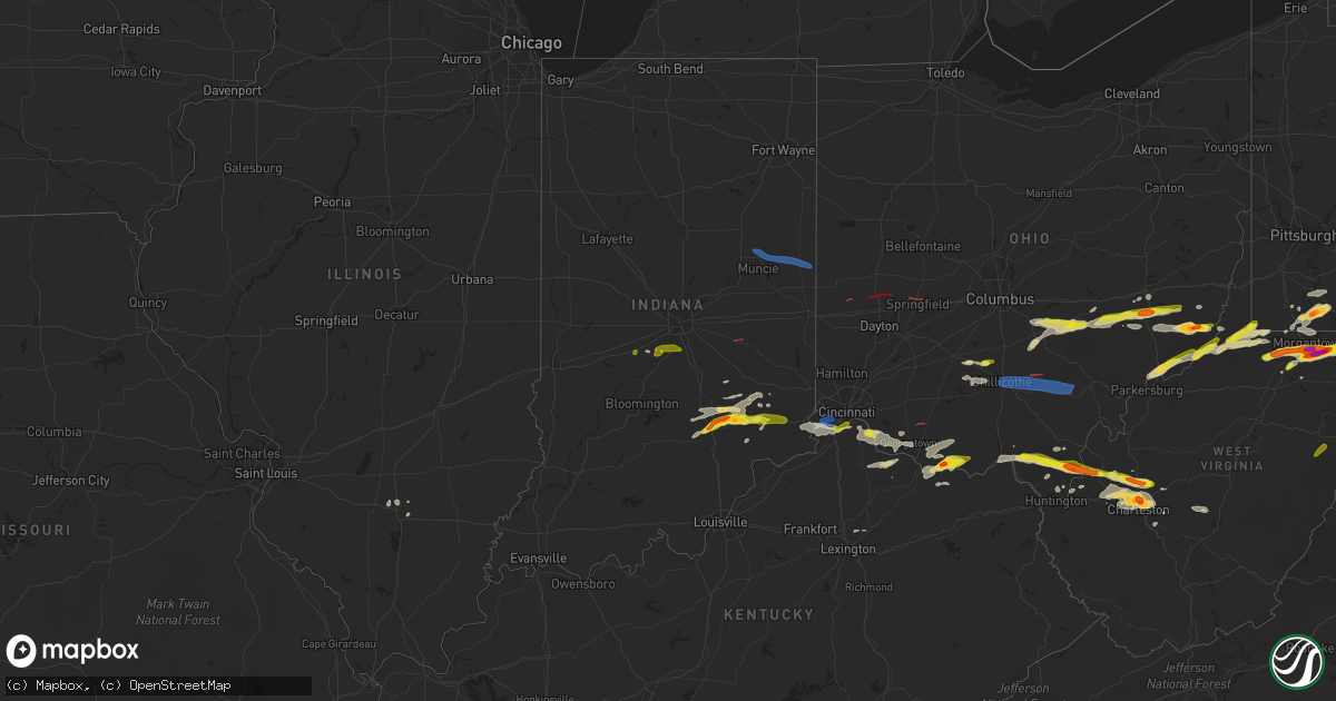
Hail Map on June 8, 2022
Get this storm
June 8 map
$229
one time, instant access
Download today. No call, no setup
Keep the $229
Bought the map and want the full workflow? Apply the entire $229 to a subscription within 7 days. None of it is wasted.
Every map, not just this one
This buys you this map. Subscription and you get every map we run, in the markets you choose from a few cities to whole states to nationwide. Plus real-time alerts the moment a storm fires.
Contact data
Name, contact info, occupancy, even credit band for addresses in the footprint. You go from where it hit to who to call.
Become the source they trust
Unlimited branding weather history reports on demand. You already have the documented answer ready for the property owner, and you are the one who showed up with it.
Property data and RoofTrace estimates
Pull up any address you have got, its value and the exact code rules for that jurisdiction, straight from One Click Code. Then RoofTrace estimates the squares, pitch, and roof value, priced the way you price.
States Impacted by Hail Map on June 8, 2022
Storm reports
Arkansas
| Date | Description |
|---|---|
| 06/08/20223:47 PM CDT | Wind gusts were estimated at 65 mph. Large tree limbs were blown down onto powerlines on natchez street. |
| 06/08/20223:25 PM CDT | Large oak tree was uprooted... Knocking down a second tree. A power pole was also blown over. |
| 06/08/20223:15 PM CDT | A tree was blown down across hwy 425. |
| 06/08/20227:42 AM CDT | At 1241 PM CDT, a severe thunderstorm was located near Ola, or 14 miles east of Danville, moving east at 40 mph. HAZARD...60 mph wind gusts and quarter size hail. SOURCE...Radar indicated. IMPACT...Hail damage to vehicles is expected. Expect wind damage to roofs, siding, and trees. Locations impacted include... Perryville... Ola... Perry... Adona... Houston... Little Italy... Wye Mountain... Williams Junction... Toad Suck... Bigelow... Casa... Aplin... Fourche... Birta... Avilla... Antioch in Perry County... Nimrod... Oak Grove in Perry County... Thornburg... Pleasant Valley in Perry County... |
| 06/08/20227:20 AM CDT | Power poles were snapped in dardanelle. |
| 06/08/20225:14 AM CDT | At 1014 AM CDT, severe thunderstorms were located along a line extending from 3 miles southwest of Maryetta to 5 miles east of Bunch to 3 miles west of Marble City, moving southeast at 40 mph. HAZARD...60 mph wind gusts. SOURCE...Radar indicated. IMPACT...Expect damage to roofs, siding, and trees. Locations in or near the path include... Van Buren... Stilwell... Cedarville... Natural Dam... Roland... Marble City... Rudy... Brushy... Figure Five... Lee Creek... Short... Uniontown... Dora... Furry...This includes the following highways, Interstate 40 in Arkansas between mile markers 0 and 6. Interstate 40 in Oklahoma between mile markers 324 and 328. |
| 06/08/20223:43 AM CDT | At 842 AM CDT, a severe thunderstorm was located over New Salem, or 8 miles east of Brinkley, moving southeast at 35 mph. HAZARD...60 mph wind gusts. SOURCE...Radar indicated. IMPACT...Expect damage to roofs, siding, and trees. Locations impacted include... Forrest City, Marianna, Hughes, Madison, Palestine, St Francis National Park, Helena-West Helena, Tunica, Caldwell, Colt, Wheatley, Horseshoe Lake, Lexa, Widener, Moro, Rondo, Aubrey, Haynes, Dubbs and Brickeys. |
| 06/08/20222:42 AM CDT | At 742 AM CDT, severe thunderstorms were located along a line extending from near Atkins to Petit Jean State Park to 7 miles east of Ola to near Plainview in Yell County, moving east at 45 mph. HAZARD...60 mph wind gusts and quarter size hail. SOURCE...Radar indicated. IMPACT...Hail damage to vehicles is expected. Expect wind damage to roofs, siding, and trees. Locations impacted include... Little Rock... North Little Rock... Conway... West Little Rock... Maumelle... Hot Springs Village... Morrilton... Perryville... Vilonia... Atkins... Mayflower... Ola... Oppelo... Menifee... Perry... Adona... Houston... Sequoya Park... Little Italy... Olmstead...This includes Interstate 40 between mile markers 102 and 147. |
| 06/08/20221:57 AM CDT | At 657 AM CDT, a severe thunderstorm was located near Knoxville, or 11 miles northwest of Russellville, moving southeast at 30 mph. HAZARD...60 mph wind gusts and nickel size hail. SOURCE...Radar indicated. IMPACT...Expect damage to roofs, siding, and trees. Locations impacted include... Russellville... Dardanelle... Atkins... Pottsville... Dover... London... Knoxville... Adona... Lake Dardanelle State Park... Carden Bottoms... Happy Bend... Mt Nebo State Park... Hattieville... Petit Jean State Park... Lake Dardanelle... Galla Creek WMA... Mosley... Taral... Ada... Holla Bend...This includes Interstate 40 between mile markers 65 and 102. |
| 06/07/202211:09 PM CDT | At 409 PM CDT, severe thunderstorms were located along a line extending from near Cleveland to near Holly Ridge to 6 miles west of Eudora, moving east at 60 mph. HAZARD...60 mph wind gusts and penny size hail. SOURCE...Radar indicated. IMPACT...Expect damage to roofs, siding, and trees. Severe thunderstorms will be near... Cleveland, Boyle, Holly Ridge and Tribbett around 415 PM CDT. Indianola and Ruleville around 420 PM CDT. Moorhead, Inverness and Blaine around 425 PM CDT. Glen Allan around 430 PM CDT. Itta Bena and Swiftown around 435 PM CDT. Nitta Yuma, Money, Panther Burn, Delta City and Quito around 440 PM CDT. Greenwood, Anguilla and Sidon around 445 PM CDT.Other locations impacted by these severe thunderstorms include SilverCity, Arcola, Louise, Doddsville, Schlater and Morgan City. |
| 06/07/202210:46 PM CDT | At 346 PM CDT, a severe thunderstorm was located near Rosedale, moving east at 65 mph. HAZARD...60 mph wind gusts. SOURCE...Radar indicated. IMPACT...Expect damage to roofs, siding, and trees. This severe thunderstorm will remain over mainly rural areas of central Desha County. |
| 06/07/202210:33 PM CDT | At 333 PM CDT, a severe thunderstorm was located over McGehee, or 9 miles southwest of Rohwer, moving east at 60 mph. HAZARD...60 mph wind gusts and penny size hail. SOURCE...Radar indicated. IMPACT...Expect damage to roofs, siding, and trees. This severe thunderstorm will be near... Scott and Lamont around 350 PM CDT. Benoit around 355 PM CDT. Shaw around 405 PM CDT. Cleveland and Boyle around 410 PM CDT.Other locations impacted by this severe thunderstorm include Beulah,Pace and Halley. |
| 06/07/202210:27 PM CDT | At 327 PM CDT, a severe thunderstorm was located 9 miles east of Monticello, moving east at 65 mph. HAZARD...60 mph wind gusts. SOURCE...Radar indicated. IMPACT...Expect damage to roofs, siding, and trees. Locations impacted include... Arkansas City... McGehee... Jersey Point... Masonville... McArthur... Enon... Halley... Selma... |
| 06/07/20228:09 PM CDT | At 108 PM CDT, a severe thunderstorm was located over Williams Junction, or 7 miles south of Perryville, moving east at 40 mph. HAZARD...60 mph wind gusts and penny size hail. SOURCE...Radar indicated. IMPACT...Expect damage to roofs, siding, and trees. Locations impacted include... Little Rock... North Little Rock... Conway... Sherwood... West Little Rock... Maumelle... Downtown Little Rock... Perryville... North Little Rock Airport... Southwest Little Rock... Vilonia... Mayflower... Wrightsville... Argenta... Perry... Houston... Little Italy... Ironton... Olmstead... Roland in Pulaski County...This includes the following highways... Interstate 30 between mile markers 129 and 142. Interstate 40 between mile markers 129 and 157. Interstate 430 between mile markers 1 and 12. Interstate 530 between mile markers 1 and 6. Interstate 630 between mile markers 1 and 7. Interstate 440 between mile markers 1 and 4. US Highway 67 between mile markers 1 and 4. |
Texas
| Date | Description |
|---|---|
| 06/08/202210:12 AM CDT | West texas mesonet. Associated with a weak shower behind a strong gust front. Severe gusts occurred between 10:04 am and 10:12 am. |
| 06/08/20229:57 AM CDT | A local report indicates 68 MPH wind near 3 WSW WICHITA FALLS |
| 06/08/20229:40 AM CDT | West texas mesonet. Severe gust occurred well ahead of the thunderstorms. |
| 06/08/20229:39 AM CDT | A local report indicates 59 MPH wind near SHEPPARD AFB |
| 06/08/20229:20 AM CDT | A local report indicates 62 MPH wind near 1 W SPUR |
| 06/08/20229:18 AM CDT | A local report indicates 70 MPH wind near 10 WSW GUTHRIE |
| 06/08/20229:08 AM CDT | West texas mesonet. Wind gusts from 67 to 71 mph between 9:06 am and 9:08 am. |
| 06/08/20229:05 AM CDT | Visibility down to 2-1/2 mi due to bldu. |
| 06/08/20229:03 AM CDT | West texas mesonet. Severe gusts occurred between 9 and 9:03 am. |
| 06/08/20229:02 AM CDT | A local report indicates 58 MPH wind near 6 SSW ANTON |
| 06/08/20229:00 AM CDT | West texas mesonet. |
| 06/08/20228:58 AM CDT | 59 mph at 8:58 cdt and 8:59 cdt. |
| 06/08/20228:54 AM CDT | Mcadoo west texas mesonet. Severe gusts started at 8:50 am and were continuing through 8:55 am |
| 06/08/20228:50 AM CDT | Measured by the mcadoo west texas mesonet. |
| 06/08/20228:44 AM CDT | West texas mesonet. Wind gusts of 65 to 81 mph from 8:43 to 8:45 am. |
| 06/08/20228:40 AM CDT | West texas mesonet. Wind gusts of 58 to 62 mph occurred between 8:32 am and 8:40 am. |
| 06/08/20228:22 AM CDT | West texas mesonet. |
| 06/08/20228:18 AM CDT | West texas mesonet. |
| 06/08/20228:15 AM CDT | West texas mesonet. Wind gusts of 59 to 62 mph from 8:14 to 8:16 am. |
| 06/08/20228:12 AM CDT | Peak gust measured by the turkey west texas mesonet. Wind gusts of 58 to 82 mph occurred from 8:10 am to 8:16 am... With another severe gust at 8:20 am. |
| 06/08/20228:11 AM CDT | Childress municipal airport. |
| 06/08/20228:10 AM CDT | West texas mesonet. |
| 06/08/20228:10 AM CDT | West texas mesonet. |
| 06/08/20228:07 AM CDT | West texas mesonet site wellington 6se. A 58 mph gust recurred at 755 am cdt. |
| 06/08/20228:05 AM CDT | Measured by the west texas mesonet. |
| 06/08/20228:01 AM CDT | West texas mesonet. Wind gusts of 58 to 66 mph occurred between 7:59 am and 8:02 am. |
| 06/08/20227:58 AM CDT | Lesley west texas mesonet report. |
| 06/08/20227:57 AM CDT | At 1256 AM CDT, a severe thunderstorm was located over Canadian, moving southeast at 25 mph. HAZARD...Ping pong ball size hail and 60 mph wind gusts. SOURCE...Radar indicated. IMPACT...Minor damage to roofs, siding, and trees is possible. People and animals outdoors will be injured. Expect hail damage to roofs, siding, windows, and vehicles. Locations impacted include... Canadian, Allison and Lake Marvin. |
| 06/08/20227:41 AM CDT | West texas mesonet station palo duro 4e |
| 06/08/20227:31 AM CDT | West texas mesonet. A gust to 60 mph also occurred at 7:33 am. |
| 06/08/20227:20 AM CDT | West texas mesonet station goodnight. A 58 mph gust recurred at 737 am cdt. |
| 06/08/20227:16 AM CDT | West texas mesonet station lake mcclellan 2nw. Gusts to 58 mph or greater occurred from 713 to 716 am cdt. |
| 06/08/20227:14 AM CDT | West texas mesonet station claude 12sw. Gust to 58 mph or greater occurred from 714 to 716 am cdt. |
| 06/08/20227:06 AM CDT | West texas mesonet site pantex 1 ese. Site gusted to 58 mph or greater from 646 to 714 am cdt. Other pantex maintained sites gusted to 65 to 75 mph during this period. |
| 06/08/20225:40 AM CDT | At 1040 AM CDT, severe thunderstorms were located along a line extending from near Ravia to 6 miles northwest of Lebanon to near Rubottom, moving southeast at 30 mph. HAZARD...60 mph wind gusts and penny size hail. SOURCE...Radar indicated. IMPACT...Expect damage to roofs, siding, and trees. Locations impacted include... Durant, Madill, Tishomingo, Marietta, Kingston, Dickson, Colbert, Mannsville, Ravia, Achille, Thackerville, Silo, Kemp, Mead, Armstrong, Leon, Hendrix, Cartwright, Utica and Burneyville. |
| 06/08/20225:35 AM CDT | At 1034 AM CDT, strong thunderstorm outflow winds were located along a line extending from 9 miles west of Graham to near Fort Griffin to near Trent, moving southeast at 50 mph. HAZARD...60 mph wind gusts. SOURCE...Radar indicated. IMPACT...Expect damage to roofs, siding, and trees. Severe thunderstorms will be near... Merkel around 1045 AM CDT. Ibex around 1050 AM CDT. Coronados Camp around 1100 AM CDT.Other locations impacted by these severe thunderstorms includeFunston, Admiral, Jud, Big Country Baptist Assembly, Impact, LakeAbilene, Mccarty Lake, Camp Tonkawa, Hitson and Lusk.This includes Interstate 20 between Mile Markers 264 and 323. |
| 06/08/20224:58 AM CDT | At 958 AM CDT, severe thunderstorms were located along a line extending from 4 miles west of Roff to near Sugden, moving east at 45 mph. HAZARD...60 mph wind gusts and quarter size hail. SOURCE...Radar indicated. IMPACT...Hail damage to vehicles is expected. Expect wind damage to roofs, siding, and trees. Locations impacted include... Ardmore, Ada, Pauls Valley, Sulphur, Madill, Tishomingo, Davis, Marietta, Waurika, Lone Grove, Healdton, Wynnewood, Wilson, Comanche, Stratford, Dickson, Ringling, Mannsville, Ryan and Roff. |
| 06/08/20224:28 AM CDT | At 927 AM CDT, severe thunderstorms were located along a line extending from 7 miles south of Ralls to 13 miles west of Benjamin, moving south at 55 mph. HAZARD...70 mph wind gusts. SOURCE...Radar indicated. IMPACT...Expect considerable tree damage. Damage is likely to mobile homes, roofs, and outbuildings. Locations impacted include... Crosbyton, Spur, Dickens, Guthrie, White River Lake, Ralls, Kalgary, Caprock, Finney, Afton and Mcadoo. |
| 06/08/20224:18 AM CDT | At 918 AM CDT, severe thunderstorms were located along a line extending from 14 miles northwest of O'brien to 7 miles east of Caprock, moving south at 50 mph. HAZARD...70 mph wind gusts. SOURCE...Radar indicated. IMPACT...Expect considerable tree damage. Damage is likely to mobile homes, roofs, and outbuildings. Locations impacted include... Post, Aspermont, Jayton, Lake Alan Henry, Girard, Peacock, Justiceburg, Old Glory, Swenson, Clairemont and Us- 380 Near The Haskell-Stonewall County Line. |
| 06/08/20224:09 AM CDT | At 908 AM CDT, severe thunderstorms were located along a line extending from 9 miles south of Sterling to 6 miles southwest of Grandfield to near Margaret, moving south at 35 mph. HAZARD...60 mph wind gusts and penny size hail. SOURCE...There have been several measured wind gusts of 60 mph or higher along and behind this line of thunderstorms. IMPACT...Expect damage to roofs, siding, and trees. Locations impacted include... Wichita Falls, Lawton, Vernon, Burkburnett, Henrietta, Seymour, Walters, Waurika, Archer City, Munday, Knox City, Crowell, Benjamin, Iowa Park, Electra, Holliday, Comanche, Geronimo, Grandfield and Temple. |
| 06/08/20223:42 AM CDT | At 842 AM CDT, severe thunderstorms were located along a line extending from 5 miles northeast of Cone to 5 miles south of Swearingen, moving south at 65 mph. HAZARD...60 mph wind gusts. SOURCE...Radar indicated. IMPACT...Expect damage to roofs, siding, and trees. Locations impacted include... Floydada, Crosbyton, Spur, Paducah, Matador, Dickens, Guthrie, White River Lake, Ralls, Kalgary, Cone, Dougherty, Afton, Grow, Dumont, Finney, Delwin, Chalk, Mcadoo and Hackberry. |
| 06/08/20223:39 AM CDT | At 838 AM CDT, severe thunderstorms were located along a line extending from near Lake Ellsworth to 4 miles southeast of Goodlett, moving southeast at 50 mph. HAZARD...60 mph wind gusts. SOURCE...There have been several wind gusts of 60 mph or higher. IMPACT...Expect damage to roofs, siding, and trees. Locations impacted include... Lawton, Altus, Vernon, Frederick, Quanah, Walters, Crowell, Cache, Elgin, Carnegie, Apache, Snyder, Geronimo, Fletcher, Cyril, Grandfield, Tipton, Blair, Sterling and Chillicothe. |
| 06/08/20223:15 AM CDT | At 814 AM CDT, severe thunderstorms were located along a line extending from 8 miles northeast of South Plains to 7 miles north of Northfield, moving southeast at 70 mph. HAZARD...70 mph wind gusts. SOURCE...Radar indicated. IMPACT...Expect considerable tree damage. Damage is likely to mobile homes, roofs, and outbuildings. Locations impacted include... Silverton, Turkey, Caprock Canyon State Park, Quitaque, Valley Schools, Mackenzie Reservoir, Brice, Lakeview and Plaska Community. |
| 06/08/20223:08 AM CDT | At 808 AM CDT, severe thunderstorms were located along a line extending from near Gotebo to near Hollis, moving south at 30 mph. HAZARD...60 mph wind gusts and penny size hail. SOURCE...Radar indicated. IMPACT...Expect damage to roofs, siding, and trees. Locations impacted include... Altus, Hobart, Mangum, Cordell, Hollis, Granite, Snyder, Sentinel, Tipton, Blair, Mountain View, Olustee, Dill City, Eldorado, Lone Wolf, Mountain Park, Indiahoma, Carter, Roosevelt and Gotebo. |
| 06/08/20222:58 AM CDT | At 757 AM CDT, severe thunderstorms were located along a line extending from near Caprock Canyon State Park to 10 miles north of Earth, moving southeast at 60 mph. HAZARD...60 mph wind gusts. SOURCE...Radar indicated. IMPACT...Expect damage to roofs, siding, and trees. Locations impacted include... Plainview, Littlefield, Floydada, Abernathy, Hale Center, Olton, Earth, Matador, Lockney, Petersburg, Amherst, Cotton Center, Fieldton, Spade, South Plains, Dougherty, Aiken, Flomot, Halfway and Northfield. |
| 06/08/20222:21 AM CDT | At 720 AM CDT, severe thunderstorms were located along a line extending from 8 miles southeast of Buffalo Lake to 8 miles east of Memphis, moving southeast at 55 mph. HAZARD...70 mph wind gusts. SOURCE...Radar indicated. IMPACT...Expect considerable tree damage. Damage is likely to mobile homes, roofs, and outbuildings. Locations impacted include... Tulia, Hart, Silverton, Turkey, Caprock Canyon State Park, Kress, Happy, Quitaque, Vigo Park, Claytonville, Mackenzie Reservoir, Brice, Valley Schools, Nazareth, Lakeview and Plaska Community. |
| 06/08/202212:22 AM CDT | At 521 PM MDT, a severe thunderstorm was located over Northeast El Paso, and is nearly stationary. HAZARD...60 mph wind gusts and quarter size hail. SOURCE...Radar indicated. IMPACT...Hail damage to vehicles is expected. Expect wind damage to roofs, siding, and trees. Locations impacted include... Northeast El Paso and Franklin Mountains State Park. |
| 06/07/202211:28 PM CDT | At 427 AM CDT, severe thunderstorms were located along a line extending from 3 miles east of Elmwood to 5 miles southeast of Guymon to 9 miles south of Keyes, moving southeast at 55 mph. HAZARD...70 mph wind gusts and half dollar size hail. SOURCE...Radar indicated. IMPACT...Expect some tree damage. Damage is likely to mobile homes, roofs, and outbuildings. Hail damage to vehicles is expected. Locations impacted include... Guymon, Perryton, Spearman, Lipscomb, Stratford, Beaver, Boise City, Booker, Goodwell, Gruver, Optima, Darrouzett, Hardesty, Wolf Creek Park, Griggs, Balko, Elmwood, Adams, Farnsworth and Boyd. |
| 06/07/202210:49 PM CDT | At 349 PM CDT, a severe thunderstorm was located 17 miles south of Balmorhea Lake, or 19 miles northeast of Fort Davis, moving south at 10 mph. HAZARD...60 mph wind gusts and half dollar size hail. SOURCE...Radar indicated. IMPACT...Hail damage to vehicles is expected. Expect wind damage to roofs, siding, and trees. This severe thunderstorm will remain over mainly rural areas of west central Pecos, northwestern Brewster and southeastern Jeff Davis Counties. |
| 06/07/202210:21 PM CDT | At 320 PM CDT, a severe thunderstorm was located 9 miles west of Kent, moving west at 30 mph. HAZARD...60 mph wind gusts and half dollar size hail. SOURCE...Radar indicated. IMPACT...Hail damage to vehicles is expected. Expect wind damage to roofs, siding, and trees. Locations impacted include... Kent and Plateau. This includes Interstate 10 between mile markers 149 and 177. |
| 06/07/20229:52 PM CDT | At 252 PM MDT, a severe thunderstorm was located 8 miles south of Cornudas, moving northwest at 5 mph. HAZARD...60 mph wind gusts and quarter size hail. SOURCE...Radar indicated. IMPACT...Hail damage to vehicles is expected. Expect wind damage to roofs, siding, and trees. Locations impacted include... Cornudas and US Highway 62/180 |
New Mexico
| Date | Description |
|---|---|
| 06/08/20226:30 PM CDT | Report from mping: 1-inch tree limbs broken; shingles blown off. |
| 06/08/20225:28 PM CDT | From speedway gas station employee. |
| 06/08/20223:14 AM CDT | At 814 PM MDT, a severe thunderstorm was located 7 miles southeast of White Sands National Monument, moving southeast at 10 mph. HAZARD...60 mph wind gusts and quarter size hail. SOURCE...Radar indicated. IMPACT...Hail damage to vehicles is expected. Expect wind damage to roofs, siding, and trees. Locations impacted include... White Sands National Monument and Boles Acres. This includes the following highways... Highway 70 in New Mexico between mile markers 185 and 205. Highway 54 in New Mexico between mile markers 40 and 60. |
| 06/08/20222:37 AM CDT | At 736 PM MDT, a severe thunderstorm was located near White Sands National Monument, moving east at 10 mph. HAZARD...60 mph wind gusts and quarter size hail. SOURCE...Radar indicated. IMPACT...Hail damage to vehicles is expected. Expect wind damage to roofs, siding, and trees. Locations impacted include... White Sands National Monument, Alamogordo and Holloman Air Force Base.This includes Highway 70 in New Mexico between mile markers 185 and 210. |
| 06/08/20221:31 AM CDT | At 631 PM MDT, a severe thunderstorm was located over Ute Park, or 27 miles east of Taos, moving northeast at 15 mph. HAZARD...60 mph wind gusts and half dollar size hail. SOURCE...Public. IMPACT...Hail damage to vehicles is expected. Expect wind damage to roofs, siding, and trees. Locations impacted include... Cimarron, Eagle Nest, Cimarron Canyon State Park, Eagle Nest Lake State Park, Ute Park and Philmont Scout Ranch.This includes Highway 64 between Mile Markers 282 and 284, andbetween Mile Markers 286 and 317. |
| 06/07/202211:28 PM CDT | At 427 PM MDT, a severe thunderstorm was located 20 miles southwest of Bosque Del Apache Refuge, or 23 miles northeast of Monticello, and is nearly stationary. HAZARD...60 mph wind gusts and half dollar size hail. SOURCE...Radar indicated. IMPACT...Hail damage to vehicles is expected. Expect wind damage to roofs, siding, and trees. This severe thunderstorm will remain over mainly rural areas of south central Socorro County.This includes Interstate 25 between Mile Markers 104 and 125. |
| 06/07/202211:09 PM CDT | At 408 PM MDT, a severe thunderstorm was located 12 miles southwest of San Ysidro, or 19 miles northwest of Rio Rancho, moving northeast at 35 mph. HAZARD...60 mph wind gusts and half dollar size hail. SOURCE...Radar indicated. IMPACT...Hail damage to vehicles is expected. Expect wind damage to roofs, siding, and trees. Locations impacted include... Santo Domingo Pueblo, San Ysidro, Zia Pueblo, Kewa Pueblo, Jemez Pueblo, Ponderosa and San Felipe Pueblo.This includes Highway 550 between Mile Markers 10 and 32. |
| 06/07/20229:57 PM CDT | At 257 PM MDT, a severe thunderstorm was located 15 miles south of Acoma Pueblo, or 25 miles south of Laguna Pueblo, and is nearly stationary. HAZARD...60 mph wind gusts and quarter size hail. SOURCE...Radar indicated. IMPACT...Hail damage to vehicles is expected. Expect wind damage to roofs, siding, and trees. This severe thunderstorm will remain over mainly rural areas of southeastern Cibola County. |
| 06/07/20227:30 PM CDT | Abci station. Reported by wsmr. |
| 06/07/20227:30 PM CDT | A local report indicates 1.00 inch wind near 1 ESE WHITE SANDS |
| 06/07/20227:30 PM CDT | A local report indicates 1.00 inch wind near WHITE SANDS |
| 06/07/20227:29 PM CDT | Along highway 64 near palisades sill historical marker. |
| 06/07/20227:26 PM CDT | Wind gust at ktcs airport. |
Florida
| Date | Description |
|---|---|
| 06/08/20225:00 PM CDT | Brevard em reported a tree fell on a home at 478 carmel dr. In suntree florida. Radar estiamted time was 6 pm. |
| 06/07/20228:22 PM CDT | At 122 PM EDT, a severe thunderstorm was located 9 miles northeast of North Brooksville, or 9 miles northeast of Brooksville, and is nearly stationary. HAZARD...Quarter size hail. SOURCE...Radar indicated. IMPACT...Damage to vehicles is expected. Locations impacted include... Nobleton, Croom, Suburban Acres, Floral City and Istachatta. |
Indiana
| Date | Description |
|---|---|
| 06/08/20226:00 PM CDT | Multiple trees and tree limbs down in the town. Time estimated by radar. |
| 06/08/20225:51 PM CDT | Multiple trees and tree limbs down in the town. Time estimated by radar. |
| 06/08/20225:13 PM CDT | Survey confirmed tornado on the ground for 0.57mi in summitville... In. |
| 06/08/20224:25 PM CDT | A few trees downed in peru. Time estimated from radar. |
| 06/08/20223:20 PM CDT | Law enforcement reports damage to a residence. Tornado possible. |
| 06/08/20223:15 PM CDT | Corrects previous tstm wnd dmg report from 2 w arlington. Law enforcement reports damage to a residence. Tornado possible. |
| 06/08/20223:15 PM CDT | Damage at posey twp volunteer fire dept reported by first responders. Tornado possible. |
| 06/08/20223:15 PM CDT | Wind damage to trees at 9100 block. Tornado possible. |
| 06/08/20223:10 PM CDT | Late report of 2 trees downed by thunderstorm winds. One tree downed at each end of garrity road. Time estimated from radar. |
| 06/08/20223:08 PM CDT | Survey confirmed tornado from 5ese morristown to 3n rushville. |
| 06/08/20223:05 PM CDT | Late report of 3 trees downed by thunderstorm winds on indiana route 135. |
| 06/08/20221:28 PM CDT | Delayed report. Large tree limb blocking east bound 800s west of sr 67. Time estimated from radar. |
| 06/08/20221:25 PM CDT | Thunderstorm produced golf ball sized hail. Time estimated from radar. |
| 06/08/20221:15 PM CDT | Thunderstorm produced golf ball sized hail in hayden. Time estimated from radar. |
| 06/08/20222:02 AM CDT | At 701 PM EDT, a severe thunderstorm was located near Union City, moving east at 60 mph. HAZARD...60 mph wind gusts. SOURCE...Radar indicated. IMPACT...Expect damage to trees and power lines. Locations impacted include... Troy, Sidney, Piqua, Greenville, Minster, Versailles, Covington, St. Henry, Newport, Bradford, Union City, Anna, Fort Loramie, Fort Recovery, Ansonia, Hardin, Webster, Russia, Gettysburg and Fletcher.This includes I-75 in Ohio between mile markers 76 and 100. |
| 06/08/20221:42 AM CDT | At 641 PM EDT, a severe thunderstorm was located over Redkey, or near Dunkirk, moving east at 45 mph. HAZARD...60 mph wind gusts. SOURCE...Radar indicated. IMPACT...Expect damage to roofs, siding, and trees. Locations impacted include... Dunkirk, Redkey, Bluff Point, Powers, Boundary City and New Mount Pleasant. |
| 06/08/20221:30 AM CDT | At 630 PM EDT, severe thunderstorms were located along a line extending from near Hartford City to 6 miles south of Matthews, moving east at 40 mph. HAZARD...70 mph wind gusts. SOURCE...Radar indicated. IMPACT...Expect considerable tree damage. Damage is likely to mobile homes, roofs, and outbuildings. Severe thunderstorms will be near... Albany around 650 PM EDT. |
| 06/08/20221:03 AM CDT | At 603 PM EDT, a severe thunderstorm was located near Dillsboro, moving east at 40 mph. HAZARD...60 mph wind gusts and quarter size hail. SOURCE...Radar indicated. IMPACT...Minor hail damage to vehicles is possible. Expect wind damage to trees and power lines. Locations impacted include... Covington, Florence, Independence, Erlanger, Edgewood, Elsmere, Fort Mitchell, Villa Hills, Taylor Mill, Fort Wright, Lawrenceburg, Crescent Springs, Aurora, Walton, Crestview Hills, Park Hills, Lakeside Park, Rising Sun, Oakbrook and Burlington.This includes the following Interstates... I-71 in Kentucky between mile markers 74 and 77. I-75 in Kentucky between mile markers 169 and 189. |
| 06/07/202211:54 PM CDT | At 453 PM EDT, a severe thunderstorm was located near North Vernon, or 18 miles southeast of Columbus, moving east at 40 mph. HAZARD...60 mph wind gusts and quarter size hail. SOURCE...Radar indicated. IMPACT...Hail damage to vehicles is expected. Expect wind damage to roofs, siding, and trees. This severe thunderstorm will be near... Nebraska around 505 PM EDT. |
| 06/07/202211:30 PM CDT | At 430 PM EDT, a severe thunderstorm was located 10 miles northwest of Seymour, moving east at 40 mph. HAZARD...60 mph wind gusts and quarter size hail. SOURCE...Radar indicated. IMPACT...Hail damage to vehicles is expected. Expect wind damage to roofs, siding, and trees. This severe thunderstorm will be near... Jonesville around 440 PM EDT. Azalia around 445 PM EDT. Elizabethtown around 450 PM EDT.Other locations in the path of this severe thunderstorm includeGrammer.This includes Interstate 65 between mile markers 54 and 62. |
| 06/07/202211:02 PM CDT | At 401 PM EDT, a severe thunderstorm was located near Nashville, or 15 miles west of Columbus, moving east at 35 mph. HAZARD...60 mph wind gusts. SOURCE...Radar indicated. IMPACT...Expect damage to roofs, siding, and trees. Locations impacted include... Columbus.This includes Interstate 65 between mile markers 58 and 71. |
| 06/07/202210:06 PM CDT | At 305 PM EDT, a severe thunderstorm was located 7 miles west of Versailles, moving east at 25 mph. HAZARD...60 mph wind gusts and quarter size hail. SOURCE...Radar indicated. IMPACT...Minor hail damage to vehicles is possible. Expect wind damage to trees and power lines. Locations impacted include... Versailles, Milan, Osgood, Sunman, Holton, Friendship, Versailles Lake, Rexville, Otter Village, Benham, Olean and New Marion. |
| 06/07/20229:29 PM CDT | At 229 PM EDT, a severe thunderstorm was located near Mooresville, or 18 miles southwest of Indianapolis, moving east at 30 mph. HAZARD...Quarter size hail. SOURCE...Radar indicated. IMPACT...Damage to vehicles is expected. This severe thunderstorm will be near... Waverly around 240 PM EDT.Other locations in the path of this severe thunderstorm includeBargersville, Greenwood and Whiteland. |
| 06/07/20229:25 PM CDT | At 225 PM EDT, a severe thunderstorm was located near North Vernon, or 13 miles northeast of Seymour, moving east at 35 mph. HAZARD...Golf ball size hail and 60 mph wind gusts. SOURCE...Radar indicated. IMPACT...People and animals outdoors will be injured. Expect hail damage to roofs, siding, windows, and vehicles. Expect wind damage to roofs, siding, and trees. This severe thunderstorm will be near... Butlerville around 240 PM EDT. Nebraska around 245 PM EDT. |
| 06/07/20229:06 PM CDT | At 206 PM EDT, a severe thunderstorm was located 11 miles west of Mooresville, or 26 miles southwest of Indianapolis, moving northeast at 35 mph. HAZARD...Quarter size hail. SOURCE...Radar indicated. IMPACT...Damage to vehicles is expected. This severe thunderstorm will be near... Monrovia and Lake Hart around 215 PM EDT. Clayton around 220 PM EDT. Mooresville around 225 PM EDT.Other locations in the path of this severe thunderstorm includePlainfield.This includes Interstate 70 between mile markers 50 and 66. |
| 06/07/20228:59 PM CDT | At 158 PM EDT, a severe thunderstorm was located over Seymour, moving northeast at 30 mph. HAZARD...60 mph wind gusts and quarter size hail. SOURCE...Radar indicated. IMPACT...Hail damage to vehicles is expected. Expect wind damage to roofs, siding, and trees. This severe thunderstorm will be near... Hayden around 210 PM EDT.Other locations in the path of this severe thunderstorm include NorthVernon and Country Squire Lakes.This includes Interstate 65 between mile markers 49 and 54. |
Missouri
| Date | Description |
|---|---|
| 06/08/20227:49 AM CDT | At 1249 AM CDT, severe thunderstorms were located along a line extending from near New Hampton to near Pattonsburg to near Osborn, moving east at 45 mph. HAZARD...60 mph wind gusts. SOURCE...Radar indicated. IMPACT...Expect damage to roofs, siding, and trees. Locations impacted include... Cameron, Trenton, Bethany, Hamilton, Gallatin, Jamesport, Osborn, Breckenridge, Gilman City, Pattonsburg, New Hampton, Spickard, Kidder, Winston, Altamont, Coffey, Jameson, Weatherby, Mcfall and Mooresville.This includes Interstate 35 in Missouri between mile markers 52 and92. |
| 06/08/20227:30 AM CDT | At 1230 AM CDT, severe thunderstorms were located along a line extending from near Lancaster to near Winchester to near Perry Lake, moving east at 45 mph. HAZARD...60 mph wind gusts and penny size hail. SOURCE...Radar indicated. IMPACT...Expect damage to roofs, siding, and trees. Locations impacted include... Shawnee, Lenexa, Leavenworth, Lansing, Atchison, Bonner Springs, De Soto, Tonganoxie, Platte City, Basehor, Edwardsville, Weston, Kansas City, Agency, Effingham, Dearborn, Camden Point, Linwood, Rushville and Lancaster.This includes the following highways... Interstate 70 in Kansas between mile markers 410 and 413. Interstate 29 between mile markers 13 and 42. Interstate 435 between mile markers 10 and 34. Kansas Turnpike between mile markers 210 and 226. |
| 06/08/202212:01 AM CDT | At 500 AM CDT, a severe thunderstorm was located 7 miles northwest of Sullivan, moving northeast at 40 mph. HAZARD...60 mph wind gusts and quarter size hail. SOURCE...Radar indicated. IMPACT...Hail damage to vehicles is expected. Expect wind damage to roofs, siding, and trees. This severe thunderstorm will be near... Beaufort around 510 AM CDT. St. Clair and Parkway around 520 AM CDT.Other locations in the path of this severe thunderstorm include Unionand Villa Ridge.This includes Interstate 44 in Missouri between exits 218 and 247. This also includes Meramec State Park. |
| 06/07/202210:58 PM CDT | At 358 AM CDT, severe thunderstorms were located along a line extending from 6 miles southwest of Auxvasse to near Holts Summit, moving east at 65 mph. HAZARD...60 mph wind gusts. SOURCE...Radar indicated. IMPACT...Expect damage to roofs, siding, and trees. Severe thunderstorms will be near... Auxvasse around 405 AM CDT. Chamois around 410 AM CDT. Shamrock around 415 AM CDT.Other locations in the path of these severe thunderstorms includeWellsville, Martinsburg, Montgomery City, Buell, Hermann, Bellflower,Big Spring and Jonesburg.This includes Interstate 70 in Missouri between exits 144 and 183. This also includes Deutschheim Historic Site and Graham Cave StatePark. |
| 06/07/202210:58 PM CDT | At 358 AM CDT, severe thunderstorms were located along a line extending from near Freeburg to 6 miles northeast of Iberia, moving east at 45 mph. HAZARD...60 mph wind gusts and quarter size hail. SOURCE...Radar indicated. IMPACT...Hail damage to vehicles is expected. Expect wind damage to roofs, siding, and trees. Locations impacted include... Belle... Vienna... Brinktown... Vichy... |
| 06/07/202210:47 PM CDT | At 347 AM CDT, severe thunderstorms were located along a line extending from Clark to near Murry, moving northeast at 60 mph. HAZARD...60 mph wind gusts. SOURCE...Radar indicated. IMPACT...Expect damage to roofs, siding, and trees. Severe thunderstorms will be near... Madison around 400 AM CDT.Other locations in the path of these severe thunderstorms includeMexico, Paris, Laddonia, Farber, Vandalia and Monroe City.This includes Interstate 70 in Missouri between exits 133 and 137. This also includes Union Covered Bridge Historic Site and Mark TwainLake Recreational Area. |
| 06/07/202210:22 PM CDT | At 322 AM CDT, a severe thunderstorm was located 8 miles southeast of Boonville, moving east at 55 mph. HAZARD...60 mph wind gusts. SOURCE...Radar indicated. IMPACT...Expect damage to roofs, siding, and trees. This severe thunderstorm will be near... Rocheport around 330 AM CDT. Midway around 335 AM CDT. Easley around 340 AM CDT.Other locations in the path of this severe thunderstorm includeColumbia Regional Airport and Fulton.This includes Interstate 70 in Missouri between exits 115 and 144. This also includes Rock Bridge State Park, Finger Lakes State Park,Jewell Cemetery Historic Site, and Jefferson Landing Historic Site. |
| 06/07/202210:19 PM CDT | At 319 AM CDT, severe thunderstorms were located along a line extending from near Bunceton to near Stover to near Hermitage, moving east at 40 mph. HAZARD...60 mph wind gusts and quarter size hail. SOURCE...Radar indicated. IMPACT...Hail damage to vehicles is expected. Expect wind damage to roofs, siding, and trees. Locations impacted include... Lake of The Ozarks... Ha Ha Tonka State Park... Lake of The Ozarks State Park... Eldon... Osage Beach... Camdenton... Versailles... Village of Four Seasons... Lake Ozark... Laurie... Sunrise Beach... Macks Creek... Linn Creek... Cross Timbers... Barnett... Gravois Mills... Olean... Climax Springs... Bagnell... Lakeside... |
| 06/07/202210:16 PM CDT | At 316 AM CDT, severe thunderstorms were located along a line extending from near Hickory Hill to 6 miles east of Lake Ozark, moving east at 35 mph. HAZARD...60 mph wind gusts and quarter size hail. SOURCE...Radar indicated. IMPACT...Hail damage to vehicles is expected. Expect wind damage to roofs, siding, and trees. Locations impacted include... Lake of The Ozarks State Park... Saint Elizabeth... St. Elizabeth... Tuscumbia... Eugene... Brinktown... Ulman... Marys Home... |
| 06/07/202210:04 PM CDT | At 304 AM CDT, a severe thunderstorm was located over Pilot Grove, or 10 miles southwest of Boonville, moving east at 55 mph. HAZARD...60 mph wind gusts. SOURCE...Radar indicated. IMPACT...Expect damage to roofs, siding, and trees. Locations impacted include... Boonville, New Franklin, Pilot Grove, Otterville, Bunceton, Prairie Home, Blackwater, Franklin, Wooldridge, Lamine and Clifton City.This includes Interstate 70 in Missouri between mile markers 86 and114. |
| 06/07/20229:46 PM CDT | At 246 AM CDT, severe thunderstorms were located along a line extending from 7 miles southeast of Houstonia to Sedalia to near Green Ridge, moving east at 60 mph. HAZARD...60 mph wind gusts. SOURCE...Radar indicated. IMPACT...Expect damage to roofs, siding, and trees. Locations impacted include... Sedalia, Smithton, Green Ridge, Otterville, Bunceton, Sedalia Memorial Arpt and Clifton City. |
| 06/07/20229:43 PM CDT | At 243 AM CDT, severe thunderstorms were located along a line extending from near La Monte to near Windsor to near Deepwater, moving southeast at 55 mph. HAZARD...60 mph wind gusts. SOURCE...Radar indicated. IMPACT...Expect damage to roofs, siding, and trees. Locations impacted include... Truman Lake... Truman State Park... Warsaw... Lincoln... Cole Camp... Stover... Syracuse... Ionia... Palo Pinto... Lakeview Heights... Florence... Brandon... Crockerville... Zora... Iconium... Racket... Edmonson... Mora... Whitakerville... |
| 06/07/20229:39 PM CDT | At 239 AM CDT, a severe thunderstorm was located 7 miles northeast of Midway, moving northeast at 40 mph. HAZARD...60 mph wind gusts and quarter size hail. SOURCE...Radar indicated. IMPACT...Hail damage to vehicles is expected. Expect wind damage to roofs, siding, and trees. This severe thunderstorm will be near... Hallsville around 250 AM CDT.Other locations in the path of this severe thunderstorm includeSturgeon and Centralia.This also includes Finger Lakes State Park. |
| 06/07/20229:27 PM CDT | At 227 AM CDT, a severe thunderstorm was located near Higbee, or 8 miles northeast of Fayette, moving northeast at 35 mph. HAZARD...60 mph wind gusts and half dollar size hail. SOURCE...Radar indicated. IMPACT...Hail damage to vehicles is expected. Expect wind damage to roofs, siding, and trees. Locations impacted include... Moberly, Higbee, Clark and Renick. |
| 06/07/20229:16 PM CDT | At 215 AM CDT, severe thunderstorms were located along a line extending from Higginsville to 7 miles southwest of Warrensburg to 7 miles east of Butler, moving southeast at 45 mph. HAZARD...60 mph wind gusts. SOURCE...Radar indicated. IMPACT...Expect damage to roofs, siding, and trees. Locations impacted include... Sedalia, Warrensburg, Clinton, Higginsville, Butler, Windsor, Knob Noster, Concordia, Holden, Adrian, Garden City, Sweet Springs, Whiteman Air Force Base, La Monte, Leeton, Urich, Green Ridge, Calhoun, Deepwater and Corder.This includes Interstate 70 in Missouri between mile markers 43 and71. |
| 06/07/20228:46 PM CDT | At 146 AM CDT, severe thunderstorms were located along a line extending from Crystal Lakes to near Greenwood to near Drexel, moving southeast at 45 mph. HAZARD...60 mph wind gusts. SOURCE...Radar indicated. IMPACT...Expect damage to roofs, siding, and trees. Locations impacted include... Independence, Blue Springs, Warrensburg, Grain Valley, Excelsior Springs, Harrisonville, Pleasant Hill, Oak Grove, Richmond, Odessa, Greenwood, Higginsville, Lexington, Peculiar, Buckner, Holden, Lake Lotawana, Garden City, Lake Winnebago and Lone Jack.This includes Interstate 70 in Missouri between mile markers 19 and53. |
Louisiana
| Date | Description |
|---|---|
| 06/07/202211:57 PM CDT | At 456 PM CDT, a severe thunderstorm was located near Darnell, or 19 miles west of Transylvania, moving east at 30 mph. HAZARD...60 mph wind gusts and quarter size hail. SOURCE...Radar indicated. IMPACT...Hail damage to vehicles is expected. Expect wind damage to roofs, siding, and trees. This severe thunderstorm will be near... Darnell around 505 PM CDT. Monticello around 515 PM CDT.Other locations impacted by this severe thunderstorm include Pioneerand Forest. |
North Carolina
| Date | Description |
|---|---|
| 06/08/20226:12 PM CDT | Trees were reported down on power lines along hammond road and chapanoke road. |
| 06/08/20226:05 PM CDT | Trees were report down on power lines along young road near old mill ford trail. |
| 06/08/20225:45 PM CDT | Multiple trees down in the area north of roxboro... Nc. |
| 06/08/20225:35 PM CDT | Tree down on lochwood ct. In chapel hill. |
| 06/08/20225:33 PM CDT | Trees were reported down on power lines near the intersection of nc highway 42 and rollins mill road. |
| 06/08/20225:29 PM CDT | Trees were reported down on power lines along homestead road near stratford drive. |
| 06/08/20225:10 PM CDT | Power outages caused by trees down near saxapahaw... Nc. |
| 06/08/20225:05 PM CDT | Tree down on nc 87. |
| 06/08/20224:01 PM CDT | 51 kt gust reported at khff. |
| 06/08/20222:29 PM CDT | Four county electric reports trees down on powerlines. Time estimated based on radar data. |
| 06/08/202211:30 AM CDT | Thunderstorm wind gust pushed a tree onto a truck along highway 18. Person in the truck was safely taken out of vehicle by fire department. |
| 06/08/20221:50 AM CDT | At 649 PM EDT, severe thunderstorms were located along a line extending from 12 miles west of Asheboro to near Seagrove, moving northeast at 20 mph. HAZARD...60 mph wind gusts and penny size hail. SOURCE...Radar indicated. IMPACT...Expect damage to roofs, siding, and trees. Locations impacted include... High Point, Asheboro, Randleman, North Carolina Zoo, Siler City, Seagrove, Liberty, Ramseur, Franklinville and Staley. |
| 06/08/20221:42 AM CDT | At 642 PM EDT, a severe thunderstorm was located over Fuquay-Varina, or 11 miles south of Cary, moving northeast at 55 mph. HAZARD...60 mph wind gusts. SOURCE...Radar indicated. IMPACT...Expect damage to roofs, siding, and trees. Locations impacted include... Raleigh, Cary, Smithfield, Lillington, Wake Forest, Garner, Fuquay-Varina, Clayton, Dunn and Zebulon. |
| 06/08/20221:35 AM CDT | At 635 PM EDT, a severe thunderstorm was located near Alton, or near Roxboro, moving east at 20 mph. HAZARD...60 mph wind gusts and penny size hail. SOURCE...Radar indicated. IMPACT...Expect damage to roofs, siding, and trees. Locations impacted include... Oxford, Roxboro, Stovall, Bethel Hill, Mayo Reservoir, Berea and John H Kerr Reservoir. |
| 06/08/20221:13 AM CDT | At 612 PM EDT, a severe thunderstorm was located near Carrboro, or 7 miles south of Chapel Hill, moving northeast at 40 mph. HAZARD...60 mph wind gusts. SOURCE...Radar indicated. IMPACT...Expect damage to roofs, siding, and trees. Locations impacted include... Raleigh, Durham, Cary, Chapel Hill, Hillsborough, Carrboro, Rougemont, RDU International, Morrisville and Lake Michie. |
| 06/08/202212:52 AM CDT | At 552 PM EDT, a severe thunderstorm was located 9 miles southeast of Sanford, moving northeast at 45 mph. HAZARD...60 mph wind gusts and penny size hail. SOURCE...Radar indicated. IMPACT...Expect damage to roofs, siding, and trees. Locations impacted include... Cary, Sanford, Pittsboro, Lillington, Garner, Fuquay-Varina, Angier, Goldston, Apex and Holly Springs. |
| 06/08/202212:46 AM CDT | At 545 PM EDT, a severe thunderstorm was located 12 miles east of Randleman, moving northeast at 15 mph. HAZARD...60 mph wind gusts. SOURCE...Radar indicated. IMPACT...Expect damage to roofs, siding, and trees. Locations impacted include... Burlington, Graham, Mebane, Elon, Gibsonville, Liberty, Haw River, Swepsonville, Alamance and Staley. |
| 06/07/202211:53 PM CDT | At 452 PM EDT, a severe thunderstorm was located over Westover Hills, or near Danville, moving northeast at 20 mph. HAZARD...60 mph wind gusts and quarter size hail. SOURCE...Radar indicated. IMPACT...Hail damage to vehicles is expected. Expect wind damage to roofs, siding, and trees. Locations impacted include... Danville... Chatham... Blairs... Dry Fork... Westover Hills... Ringgold... and Keeling.This includes The following Location Danville Airport. |
| 06/07/202210:29 PM CDT | At 328 PM EDT, a severe thunderstorm was located over Albert J Ellis Airport, or 9 miles west of Half Moon, moving east at 30 mph. HAZARD...60 mph wind gusts. SOURCE...Radar indicated. IMPACT...Expect damage to roofs, siding, and trees. Locations impacted include... Jacksonville, New River Station, Half Moon, Pumpkin Center, Piney Green, Camp Lejeune Center, Swansboro, Hubert, Richlands, Kellum, Cypress Creek, Midway Park, Verona, Catherine Lake, Albert J Ellis Airport, Richlands South, Deppe, Lyman and Haws Run. |
| 06/07/202210:07 PM CDT | At 306 PM EDT, a severe thunderstorm was located near Beulaville, or 15 miles northeast of Wallace, moving east at 30 mph. HAZARD...60 mph wind gusts. SOURCE...Radar indicated. IMPACT...Expect damage to roofs, siding, and trees. Locations impacted include... Jacksonville, Half Moon, Richlands, Beulaville, Cypress Creek, Catherine Lake, Chinquapin, Petersburg, Albert J Ellis Airport, Richlands South and Lyman. |
| 06/07/20229:25 PM CDT | At 225 PM EDT, a severe thunderstorm was located over Bennettsville, moving northeast at 20 mph. HAZARD...60 mph wind gusts and penny size hail. SOURCE...Radar indicated. IMPACT...Expect wind damage to trees and power lines. Locations impacted include... Bennettsville, Mccoll, Clio and Tatum. |
| 06/07/20228:54 PM CDT | At 154 PM EDT, a severe thunderstorm was located near Marion, moving northeast at 15 mph. HAZARD...60 mph wind gusts and quarter size hail. SOURCE...Radar indicated. IMPACT...Minor hail damage to vehicles is expected. Expect wind damage to trees and power lines. Locations impacted include... Marion, Spruce Pine, Lake James State Park, Table Rock, Linville Falls, Lake James, Nebo, Ingalls, Pleasant Gardens and Ashford. |
Kentucky
| Date | Description |
|---|---|
| 06/08/20226:06 PM CDT | Trees uprooted and large branches down. Time estimated from radar. |
| 06/08/20225:20 PM CDT | Barn collapsed. Time estimated by radar. |
| 06/08/20223:58 PM CDT | Observer watched trees snapped in 275/471 area. Winds pushed cars into other lanes... Causing accidents. |
| 06/08/20223:57 PM CDT | Photos of trees snapped posted on social media. Time estimated from radar. |
| 06/08/20223:46 PM CDT | Damage to a shed and several tree limbs downed. Time estimated by radar. |
| 06/08/20222:28 AM CDT | At 728 PM EDT, a severe thunderstorm was located over Peebles, moving east at 50 mph. HAZARD...60 mph wind gusts. SOURCE...Radar indicated. IMPACT...Expect damage to trees and power lines. Locations impacted include... Portsmouth, Wheelersburg, Waverly, New Boston, Piketon, Peebles, Seaman, South Webster, Rosemount, Clarktown, Kincaid Springs, Belfast, Lucasville, Sciotodale, Beaver, Rarden, Cherry Fork, Sinking Spring, Otway and Wakefield. |
| 06/08/20222:16 AM CDT | At 716 PM EDT, a severe thunderstorm was located over Claryville, moving east at 45 mph. HAZARD...60 mph wind gusts. SOURCE...Radar indicated. IMPACT...Expect damage to trees and power lines. Locations impacted include... Covington, Independence, Alexandria, Taylor Mill, Claryville, Amelia, Mount Orab, Wilder, Bethel, New Richmond, Augusta, Felicity, Cold Spring, Ryland Heights, Hamersville, Higginsport, Mentor, Moscow, Fairview and Neville. |
| 06/08/20221:54 AM CDT | At 654 PM EDT, a severe thunderstorm was located near Bethel, moving east at 50 mph. HAZARD...60 mph wind gusts and penny size hail. SOURCE...Radar indicated. IMPACT...Expect damage to trees and power lines. Locations impacted include... Georgetown, Mount Orab, West Union, Bethel, Williamsburg, Peebles, Ripley, Augusta, Winchester, Sardinia, Seaman, Felicity, Belfast, Emerald, Decatur, Russellville, Hamersville, Mowrystown, Higginsport and Cherry Fork. |
| 06/08/20221:37 AM CDT | At 637 PM EDT, a severe thunderstorm was located near Independence, moving east at 35 mph. HAZARD...60 mph wind gusts and quarter size hail. SOURCE...Radar indicated. IMPACT...Minor hail damage to vehicles is possible. Expect wind damage to trees and power lines. Locations impacted include... Covington, Independence, Fort Thomas, Alexandria, Highland Heights, Taylor Mill, Southgate, Claryville, Amelia, Wilder, Bethel, New Richmond, Williamsburg, Silver Grove, Felicity, Butler, Melbourne, Riverbend And Coney Island, Coldstream and Withamsville. |
| 06/08/20221:34 AM CDT | At 634 PM EDT, a severe thunderstorm was located over Milan, moving east at 35 mph. HAZARD...60 mph wind gusts. SOURCE...Radar indicated. IMPACT...Expect damage to trees and power lines. Locations impacted include... Lawrenceburg, Greendale, Aurora, Bright, Hidden Valley, Milan, Moores Hill, Guilford, Wilmington, Manchester, French, Sunman, Mount Sinai, Cold Springs, Weisburg, Petersburg and Belleview. |
| 06/08/20221:31 AM CDT | At 631 PM EDT, a severe thunderstorm was located near Paris, moving northeast at 35 mph. HAZARD...60 mph wind gusts and quarter size hail. SOURCE...Radar indicated. IMPACT...Hail damage to vehicles is expected. Expect wind damage to roofs, siding, and trees. This severe thunderstorm will be near... Paris around 640 PM EDT. |
| 06/07/202211:31 PM CDT | At 431 PM EDT, a severe thunderstorm was located over Elsmere, moving east at 35 mph. HAZARD...60 mph wind gusts and quarter size hail. SOURCE...Radar indicated. IMPACT...Minor hail damage to vehicles is possible. Expect wind damage to trees and power lines. Locations impacted include... Cincinnati, Covington, Florence, Independence, Erlanger, Fort Thomas, Newport, Edgewood, Alexandria, Elsmere, Fort Mitchell, Villa Hills, Highland Heights, Milford, Taylor Mill, Fort Wright, Southgate, Crescent Springs, Crestview Hills and Park Hills.This includes I-75 in Kentucky between mile markers 176 and 190. |
| 06/07/202211:02 PM CDT | At 401 PM EDT, a severe thunderstorm was located over Manchester, moving east at 25 mph. HAZARD...60 mph wind gusts and quarter size hail. SOURCE...Radar indicated. IMPACT...Minor hail damage to vehicles is possible. Expect wind damage to trees and power lines. Locations impacted include... West Union, Manchester, Rome, Blue Creek, Concord, Bentonville, Trinity, Carrs and Cedar Mills. |
| 06/07/202210:15 PM CDT | A member of the public reported one tree was downed along ky 191 outside of campton. The time of the event is radar estimated. |
| 06/07/20227:30 PM CDT | A public report via social media that included pictures indicated trees and limbs downed on grover flannery road. The event time is radar estimated. |
Virginia
| Date | Description |
|---|---|
| 06/08/20226:57 PM CDT | Large trees down and snapped on williams rd. |
| 06/08/20225:54 PM CDT | A tree was down at cotton mill drive and cardamom drive. |
| 06/08/20225:48 PM CDT | A tree was down along west lee street. |
| 06/08/20225:11 PM CDT | A local report indicates 59 MPH wind near QUANTICO MARINE CORP |
| 06/08/20225:10 PM CDT | Large tree down blocking nb us rte 1 near quantico corporate center |
| 06/08/20225:10 PM CDT | Tree damage was reported southwest of triangle... Including a large tree that blew down blocking northbound us-1 richmond highway near the quantico corporate center. |
| 06/08/20225:06 PM CDT | Tree damage was reported near bristersburg... Including a tree that blew down along va-616 bristersberg road at va-637 courtney school road. |
| 06/08/20225:06 PM CDT | A tree was down along bristersberg road at courtney school road. |
| 06/08/20225:03 PM CDT | A large limb was down along rixeyville road and hamilton lane. |
| 06/08/20225:02 PM CDT | Trees were down along rixeyville road and waterford road. |
| 06/08/20225:02 PM CDT | Trees blew down along va-229 rixeyville road and va-611 waterford road. A large tree limb blew down along va-229 rixeyville road near hamilton lane. |
| 06/08/20225:00 PM CDT | Trees were down on a power pole at sperryville pike and rudasill mill road. |
| 06/08/20224:59 PM CDT | A tree was down along the 2600 block of midland road. |
| 06/08/20224:59 PM CDT | A tree was dlwon along the 3100 block of midland road. |
| 06/08/20224:59 PM CDT | Trees blew down in the 2600 and 3100 blocks of va-610 midland road. |
| 06/08/20224:52 PM CDT | Two trees blew down in the 3700 block of us-1 jefferson davis highway... With one blocking the roadway. |
| 06/08/20224:45 PM CDT | Tree blown down near courtland circle. |
| 06/08/20224:42 PM CDT | A tree blew down blocking one lane at the intersection of va-719 mountain run lake road and j.b. Carpenter junior drive. |
| 06/08/20224:42 PM CDT | Tree damage was reported west of culpeper... Including a tree that blew down blocking one lane at the intersection of va-719 mountain run lake road and j.b. Carpenter j |
| 06/08/20224:42 PM CDT | A tree was down blocking one lane at the intersection of mountain run lake road and j.b. Carpenter junior drive. |
| 06/08/20224:40 PM CDT | Two trees down in the 3700 block of jefferson davis hwy. With one blocking the roadway. |
| 06/08/20224:39 PM CDT | Thunderstorm winds blew a tree down on the 500 block of creekview drive. Time estimated via radar. |
| 06/08/20224:35 PM CDT | Thunderstorm winds blew a tree down on sylvia road. Time estimated via radar. |
| 06/08/20224:35 PM CDT | Thunderstorm winds blew a tree down on the 300 block of revere road. Time estimated via radar. |
| 06/08/20224:25 PM CDT | Three trees blew down in the 3400 block of va-630 thoroughfare road. |
| 06/08/20224:25 PM CDT | Thunderstorm winds blew two trees down at the intersection of riverside drive and carsonville road. Time estimated via radar. (rn |
| 06/08/20224:25 PM CDT | Thunderstorm winds blew two trees down at the intersection of riverside drive and carsonville road. Time estimated via radar. |
| 06/08/20224:05 PM CDT | Trees... Limbs... And power lines down. Time estimated by radar. |
| 06/08/20222:38 PM CDT | A local report indicates 1.00 inch wind near 2 NE GALAX CITY |
| 06/08/20221:13 AM CDT | At 612 PM EDT, a severe thunderstorm was located over Quantico, moving east at 15 mph. HAZARD...60 mph wind gusts and quarter size hail. SOURCE...Radar indicated. IMPACT...Damaging winds will cause some trees and large branches to fall. This could injure those outdoors, as well as damage homes and vehicles. Roadways may become blocked by downed trees. Localized power outages are possible. Unsecured light objects may become projectiles. Locations impacted include... Quantico, Montclair, Triangle, Dumfries, Cherry Hill, Bryans Road, Pomfret, Marbury, Widewater, Ironsides, Ripley, Arkendale, Rison, Nanjemoy, Aquia, Pisgah and Welcome. |
| 06/08/202212:56 AM CDT | At 556 PM EDT, severe thunderstorms were located along a line extending from near Lewisburg to near Greenbrier State Forest to near Hollywood, moving east at 15 mph. HAZARD...60 mph wind gusts and quarter size hail. SOURCE...Radar indicated. IMPACT...Hail damage to vehicles is expected. Expect wind damage to roofs, siding, and trees. Locations impacted include... Alleghany... Lewisburg... White Sulphur Springs... Ronceverte... Renick... Asbury... and Pickaway.This includes The following Location The West Virginia StateFairgrounds. |
| 06/08/202212:41 AM CDT | At 541 PM EDT, a severe thunderstorm was located near Culpeper, moving northeast at 25 mph. HAZARD...60 mph wind gusts and quarter size hail. SOURCE...Radar indicated. IMPACT...Damaging winds will cause some trees and large branches to fall. This could injure those outdoors, as well as damage homes and vehicles. Roadways may become blocked by downed trees. Localized power outages are possible. Unsecured light objects may become projectiles. Locations impacted include... Culpeper, Warrenton, New Baltimore, Opal, Catalpa, Viewtown, Auburn, Amissville, Jeffersonton, Orlean, Turnbull, Airlie, Cardova, Rixeyville, Alanthus, Ada and Reva. |
| 06/08/202212:36 AM CDT | At 535 PM EDT, severe thunderstorms were located along a line extending from near Fries to Galax, moving northeast at 35 mph. HAZARD...60 mph wind gusts. SOURCE...Radar indicated. IMPACT...Expect damage to roofs, siding, and trees. Locations impacted include... Radford... Galax... Hillsville... Indian Valley... Patterson... Willis... and Allisonia. |
| 06/08/202212:30 AM CDT | Trees blew down on a power pole on us-522 sperryville pike and rudasill mill road. |
| 06/08/202212:09 AM CDT | At 509 PM EDT, a severe thunderstorm was located near Twin Oaks, or near Independence, moving northeast at 20 mph. HAZARD...60 mph wind gusts and quarter size hail. SOURCE...Radar indicated. IMPACT...Hail damage to vehicles is expected. Expect wind damage to roofs, siding, and trees. Locations impacted include... Galax... Sparta... Independence... Fries... Ennice... Bridle Creek... and Baywood. |
| 06/08/202212:04 AM CDT | Tree damage was reported near ingham... Including a tree that blew down in the 3600 block of va-640 grove hill river road. |
| 06/07/202211:58 PM CDT | A tree was down along route 340 north around collins avenue. |
| 06/07/202211:50 PM CDT | Tree damage was reported near compton... Including a tree that blew down onto northbound us-340 near ikes crossing lane. |
| 06/07/202211:50 PM CDT | Tree damage was reported near moscow... Including a tree that blew down in the 1500 block of va-607 mount solon road. |
| 06/07/202211:47 PM CDT | Tree damage was reported near fairview... Including a tree that blew down onto va-669 lake arrowhead road near dry run. |
| 06/07/202211:45 PM CDT | Tree damage was reported near luray. A tree blew down along northbound us-340 near va-731 collins avenue. A tree blew down in the 2800 block of va-654 old forge road. |
| 06/07/202211:37 PM CDT | Tree damage was reported near leaksville... Including a tree that blew down in the 800 block of ganders drive. |
| 06/07/202211:27 PM CDT | At 427 PM EDT, a severe thunderstorm was located over White Sulphur Springs, moving east at 10 mph. HAZARD...60 mph wind gusts and quarter size hail. SOURCE...Radar indicated. IMPACT...Hail damage to vehicles is expected. Expect wind damage to roofs, siding, and trees. Locations impacted include... Lewisburg... White Sulphur Springs... Neola... Alvon... Callaghan... and Greenbrier River Trail. |
| 06/07/202210:31 PM CDT | At 330 PM EDT, a severe thunderstorm was located near Woodlawn, or near Galax, moving east at 15 mph. HAZARD...60 mph wind gusts and quarter size hail. SOURCE...Radar indicated. IMPACT...Hail damage to vehicles is expected. Expect wind damage to roofs, siding, and trees. Locations impacted include... Galax... Hillsville... Fancy Gap... Cana... Dugspur... Byllesby... and Gladesboro. |
| 06/07/202210:00 PM CDT | At 300 PM EDT, a severe thunderstorm was located near Massanutten, or near Harrisonburg, moving east at 15 mph. HAZARD...60 mph wind gusts and quarter size hail. SOURCE...Radar indicated. IMPACT...Damaging winds will cause some trees and large branches to fall. This could injure those outdoors, as well as damage homes and vehicles. Roadways may become blocked by downed trees. Localized power outages are possible. Unsecured light objects may become projectiles. Locations impacted include... Shenandoah, Massanutten, Elkton, Newport, Rocky Bar, Penn Laird, Ingham, Keezletown, Lacey Spring, Jollett, Mcgaheysville and Montevideo. |
| 06/07/202210:00 PM CDT | At 300 PM EDT, a severe thunderstorm was located over Currituck, moving northeast at 25 mph. HAZARD...60 mph wind gusts and quarter size hail. SOURCE...Radar indicated. IMPACT...Minor damage to vehicles is possible. Expect wind damage to trees and powerlines. This severe thunderstorm will be near... Knotts Island around 315 PM EDT.Other locations impacted by this severe thunderstorm include Mapleand Sandbridge Beach. |
Maryland
| Date | Description |
|---|---|
| 06/08/20226:50 PM CDT | Numerous trees blew down in columbia. A tree blew down in the 6700 block of carlinda avenue. A 12-inch tree limb blew down onto cradlerock way. A tree blew down in the |
| 06/08/20226:45 PM CDT | Tree reported down near summer cloud way. |
| 06/08/20226:43 PM CDT | Tree down on ridge road near observation drive. R exit 22. |
| 06/08/20226:43 PM CDT | Tree down on ridge road near observation drive. |
| 06/08/20226:41 PM CDT | A tree was down along diamondback and reprise drive. |
| 06/08/20226:41 PM CDT | Tree damage was reported near gaithersburg. A tree blew down near the intersection of diamondback drive and reprise drive. A tree blew down near the intersection of war |
| 06/08/20226:31 PM CDT | Report of tree down near silvan lane and church road |
| 06/08/20226:27 PM CDT | Report of downed tree near ellcott mills dr and burgess mill way |
| 06/08/20226:27 PM CDT | Tree reported down on mt. Victoria road near mill run road. |
| 06/08/20226:17 PM CDT | Tree down on hawkins creamery and laytonsville road. |
| 06/08/20226:14 PM CDT | Tree damage was reported near ironsides... Including a tree that blew down on tayloes neck road near walters landing road. |
| 06/08/20226:14 PM CDT | A tree was down along tayloes neck road and walters landing road. |
| 06/08/20226:11 PM CDT | Report of tree down on 6200 block of star road |
| 06/08/20226:11 PM CDT | Report of 12 inch tree limb down on roadway on cradlerock way |
| 06/08/20225:48 PM CDT | A tree was down along keech road and charles street. |
| 06/08/20225:45 PM CDT | Tree damage was reported near historic ellicott city. A tree blew down near the intersection of ellicott mills drive and burgess mill way. A tree blew down near the int |
| 06/08/20225:45 PM CDT | Tree damage was reported near historic ellicott city... Including a tree that blew down near the intersection of ellicott mills drive and burgess mill way. |
| 06/08/20225:41 PM CDT | Tree down near ellicott mills dr and burgess mill way |
| 06/08/20225:36 PM CDT | A tree was down along the 2200 block of sandy point road. |
| 06/08/20225:36 PM CDT | Tree damage was reported near nanjemoy... Including a tree that blew down in the 2200 block of sandy point road. |
| 06/08/20225:28 PM CDT | Report of tree down on 6700 block of carlinda ave |
| 06/08/20226:06 AM CDT | At 1106 PM EDT, severe thunderstorms were located along a line extending from Seven Springs to near Ursina to near Friendsville, moving east at 45 mph. HAZARD...60 mph wind gusts. SOURCE...Radar indicated. IMPACT...Expect damage to roofs, siding, and trees. Locations impacted include... Somerset, Meyersdale, Berlin, Friedens, Central City, Acosta, Ursina, New Centerville, Mount Davis, Rockwood, Confluence and Salisbury.This includes The Pennsylvania Turnpike from mile markers 100 to 130. |
| 06/08/20224:45 AM CDT | At 944 PM EDT, a severe thunderstorm was located 8 miles north of Kingwood, moving east at 35 mph. HAZARD...Quarter size hail. SOURCE...Radar indicated. IMPACT...Minor damage to vehicles is possible. Locations impacted include... Reedsville, Masontown, Albright, Brandonville, Bruceton Mills, Valley Point, Laurel Run, Hazelton, and Cranesville. |
| 06/08/20224:41 AM CDT | At 940 PM EDT, a severe thunderstorm was located near Brookhaven, or 7 miles northwest of Kingwood, moving east at 35 mph. HAZARD...Two inch hail and 60 mph wind gusts. SOURCE...Radar indicated. IMPACT...Expect wind damage to trees and power lines. Hail is large enough to dent and damage vehicles. Some hail damage to roofs, siding, and windows is possible. Locations impacted include... Oakland, Bittinger, Deer Park, Accident, Deep Creek Lake State Park, Swallow Falls State Park, McHenry, Jennings and McComas Beach. |
| 06/08/20224:23 AM CDT | At 923 PM EDT, a severe thunderstorm was located over Baltimore, moving northeast at 15 mph. HAZARD...60 mph wind gusts and quarter size hail. SOURCE...Radar indicated. IMPACT...Damaging winds will cause some trees and large branches to fall. This could injure those outdoors, as well as damage homes and vehicles. Roadways may become blocked by downed trees. Localized power outages are possible. Unsecured light objects may become projectiles. Locations impacted include... Baltimore, Middle River, Dundalk, Towson, Bel Air South, Essex, Parkville, Bel Air North, Carney, Perry Hall, Rosedale, Rossville, White Marsh, Fallston, Bowleys Quarters, Hampton, Kingsville, Pleasant Hills, Edgewood and Joppatowne. |
| 06/08/20224:22 AM CDT | At 922 PM EDT, a severe thunderstorm was located over Calvert Cliffs, moving east at 25 mph. HAZARD...60 mph wind gusts and quarter size hail. SOURCE...Radar indicated. IMPACT...Minor damage to vehicles is possible. Expect wind damage to trees and powerlines. This severe thunderstorm will be near... Taylors Island around 940 PM EDT.Other locations impacted by this severe thunderstorm include Madison,Taylors Island, Honga, Church Creek, Woolford and Andrews. |
| 06/08/20224:17 AM CDT | At 917 PM EDT, a severe thunderstorm was located over Ursina, moving northeast at 50 mph. HAZARD...60 mph wind gusts and nickel size hail. SOURCE...Radar indicated. IMPACT...Expect damage to roofs, siding, and trees. Locations impacted include... Somerset, Friedens, Boswell, Davidsville, Jerome, Acosta, Ursina, New Centerville, Tire Hill, Mount Davis, Rockwood and Confluence.This includes The Pennsylvania Turnpike from mile markers 100 to 114. |
| 06/08/20224:07 AM CDT | At 907 PM EDT, a severe thunderstorm was located 7 miles north of Kingwood, moving east at 30 mph. HAZARD...60 mph wind gusts and quarter size hail. SOURCE...Radar indicated. IMPACT...Minor hail damage to vehicles is possible. Expect wind damage to trees and power lines, resulting in some power outages. Locations impacted include... Kingwood, Albright, Markleysburg, Brandonville, Bruceton Mills, Valley Point, Laurel Run, Hazelton, Cranesville, and Clifton Mills. |
| 06/08/20224:07 AM CDT | At 907 PM EDT, a severe thunderstorm was located near Saint Leonard Creek, moving east at 25 mph. HAZARD...Golf ball size hail and 60 mph wind gusts. SOURCE...Radar indicated. IMPACT...Expect wind damage to trees and power lines. Hail is large enough to dent and damage vehicles. Some hail damage to roofs, siding, and windows is possible. Locations impacted include... Chesapeake Ranch Estates, Greenwell State Park, Saint Leonard Creek, Cuckold Creek, Flag Harbor, Calvert Cliffs, Lusby, Saint Leonard, Drum Point, Long Beach, Calvert Beach, Port Republic, Dowell and Sotterley. |
| 06/08/20223:17 AM CDT | At 816 PM EDT, a severe thunderstorm was located 8 miles southwest of Golden Beach, or 9 miles east of Popes Creek, moving northeast at 20 mph. HAZARD...60 mph wind gusts and quarter size hail. SOURCE...Radar indicated. IMPACT...Damaging winds will cause some trees and large branches to fall. This could injure those outdoors, as well as damage homes and vehicles. Roadways may become blocked by downed trees. Localized power outages are possible. Unsecured light objects may become projectiles. Locations impacted include... Prince Frederick, Hallowing Point, Breezy Point, Sheridan Point, Flag Harbor, Golden Beach, Saint Leonard, Huntingtown, Long Beach, Mechanicsville, Charlotte Hall, Aquasco, Calvert Beach, Benedict, Barstow, Port Republic, Sandgates and Dares Beach. |
| 06/08/20222:09 AM CDT | At 709 PM EDT, a severe thunderstorm was located over Eldersburg, or 11 miles south of Westminster, moving northeast at 25 mph. HAZARD...60 mph wind gusts and quarter size hail. SOURCE...Radar indicated. IMPACT...Damaging winds will cause some trees and large branches to fall. This could injure those outdoors, as well as damage homes and vehicles. Roadways may become blocked by downed trees. Localized power outages are possible. Unsecured light objects may become projectiles. Locations impacted include... Owings Mills, Eldersburg, Reisterstown, Hampstead, Manchester, Sykesville, Oakland, Gamber, Finksburg, Carrollton, Upperco, Louisville, Gaither, Butler, Monkton, Glencoe, Glyndon, Sparks, Boring and Patapsco. |
| 06/08/20221:58 AM CDT | At 658 PM EDT, a severe thunderstorm was located over Colesville, or near Olney, moving northeast at 15 mph. HAZARD...60 mph wind gusts and quarter size hail. SOURCE...Radar indicated. IMPACT...Damaging winds will cause some trees and large branches to fall. This could injure those outdoors, as well as damage homes and vehicles. Roadways may become blocked by downed trees. Localized power outages are possible. Unsecured light objects may become projectiles. Locations impacted include... Columbia, Olney, Elkridge, Historic Ellicott City, Ellicott City, Aspen Hill, Fairland, Colesville, Rossmoor, Savage-guilford, Wheaton-Glenmont, Scaggsville, Ilchester, Calverton, Cloverly, Glenmont, Burtonsville, Savage, Fulton and Spencerville. |
| 06/08/20221:50 AM CDT | At 650 PM EDT, a severe thunderstorm was located 7 miles east of Quantico, moving east at 15 mph. HAZARD...60 mph wind gusts and quarter size hail. SOURCE...Radar indicated. IMPACT...Damaging winds will cause some trees and large branches to fall. This could injure those outdoors, as well as damage homes and vehicles. Roadways may become blocked by downed trees. Localized power outages are possible. Unsecured light objects may become projectiles. Locations impacted include... Waldorf, La Plata, Port Tobacco River, Saint Charles, Bryans Road, Pomfret, Port Tobacco Village, Marbury, Dentsville, Port Tobacco, White Plains, Ironsides, Ripley, Rison, Bel Alton, Nanjemoy, Pisgah, Welcome and Faulkner. |
| 06/08/20221:25 AM CDT | At 624 PM EDT, a severe thunderstorm was located over Laurel, or near Beltsville, moving northeast at 25 mph. HAZARD...60 mph wind gusts and quarter size hail. SOURCE...Radar indicated. IMPACT...Damaging winds will cause some trees and large branches to fall. This could injure those outdoors, as well as damage homes and vehicles. Roadways may become blocked by downed trees. Localized power outages are possible. Unsecured light objects may become projectiles. Locations impacted include... Columbia, Severn, Elkridge, Riviera Beach, Baltimore-Washington Airport, Glen Burnie, Ellicott City, Odenton, Laurel, Pasadena, Ferndale, Brooklyn Park, Fort Meade, Savage-guilford, South Gate, Pumphrey, Scaggsville, Ilchester, Linthicum and Lansdowne. |
| 06/08/20221:16 AM CDT | At 616 PM EDT, a severe thunderstorm was located over Romney, moving northeast at 25 mph. HAZARD...60 mph wind gusts and quarter size hail. SOURCE...Radar indicated. IMPACT...Damaging winds will cause some trees and large branches to fall. This could injure those outdoors, as well as damage homes and vehicles. Roadways may become blocked by downed trees. Localized power outages are possible. Unsecured light objects may become projectiles. Locations impacted include... Romney, Fort Ashby, Springfield, Green Spring, Burlington, Russelldale, Augusta, Shanks, Three Churches, Frenchburg, Headsville, Higginsville, Slanesville, Points, Levels, Junction and Wapocomo. |
| 06/08/202212:52 AM CDT | At 552 PM EDT, a severe thunderstorm was located 9 miles southeast of Bealeton, or 13 miles northwest of Stafford, moving northeast at 10 mph. HAZARD...60 mph wind gusts and quarter size hail. SOURCE...Radar indicated. IMPACT...Damaging winds will cause some trees and large branches to fall. This could injure those outdoors, as well as damage homes and vehicles. Roadways may become blocked by downed trees. Localized power outages are possible. Unsecured light objects may become projectiles. Locations impacted include... Dale City, Quantico, Lake Ridge, Linton Hall, Montclair, Bull Run, Triangle, Dumfries, Manassas, Sudley, Cherry Hill, Independent Hill, Nokesville, Catlett, Calverton, Roseville, Garrisonville, Ramoth, Heflin and Morrisville. |
| 06/08/202212:20 AM CDT | At 520 PM EDT, a severe thunderstorm was located near Berkeley Springs, or 9 miles northeast of Paw Paw, moving north at 25 mph. HAZARD...Quarter size hail. SOURCE...Radar indicated. IMPACT...Some hail damage to agriculture is expected. Locations impacted include... Hancock, Greenwood, Berkeley Springs, Great Cacapon, Johnsons Mill, Omps, Lineburg, Valley View, Fishers Bridge, Spohrs Crossroads, Oakland, Rock Gap, Stotlers Crossroads, Highland Ridge, Forest Park, Smith Crossroads, Berryville, New Hope and Shady Grove. |
| 06/07/202210:28 PM CDT | Tree damage was reported in oakland... Including a tree that blew down on east high street. |
| 06/07/20227:49 PM CDT | Tree down on wires at the intersecion of rt. 40 and tyson rd. |
| 06/07/20227:47 PM CDT | Dozens of trees blew down and a barn was leveled east of mechanicsville. Trees blew down in the 40000 block of md-6 new market turner road near morgan brothers road. Tr |
| 06/07/20227:46 PM CDT | Tree down in 4000 block of delabrooke road. |
| 06/07/20227:45 PM CDT | Two trees and large brances down along rt. 70 near marriotsville. |
| 06/07/20227:45 PM CDT | Tree and large branches down at route 29 near exit 22. |
| 06/07/20227:45 PM CDT | Tree and large branches down at route 29 neas and large limbs down on conifer drive with gutters ripped off one house by falling tree. |
| 06/07/20227:45 PM CDT | Tree down in the 40000 block of new market road. |
| 06/07/20227:43 PM CDT | Tree reported down on three notch road near point lookout road. |
| 06/07/20227:42 PM CDT | Tree reported down on new market turner road near morgan brothers road. |
| 06/07/20227:40 PM CDT | Tree damage was reported between elkridge and columbia... Including a tree that blew down off of summer cloud way. |
| 06/07/20227:40 PM CDT | Tree reported down on baptist church road near emmart lane. |
| 06/07/20227:38 PM CDT | Tree reported down on sandchain road near cobbler ct. |
| 06/07/20227:38 PM CDT | Dozens of trees blew down near mechanicsville. Trees blew down near the intersection of mechanicsville road and guy farm road. Trees blew down in the 16800 block of bap |
| 06/07/20227:36 PM CDT | Tree reported down on the 28700 block of lockes hill road. |
| 06/07/20227:32 PM CDT | Tree down on the 16800 block of baptist church road. Time determined by radar. |
| 06/07/20227:27 PM CDT | Trees down on mechanicsville road near guy farm road. |
| 06/07/20227:15 PM CDT | Two trees and large tree limbs blew down along i-70 near marriotsville. |
| 06/07/20227:08 PM CDT | Tree down near warfield and dorsey road. |
| 06/07/20227:01 PM CDT | Report of downed tree on a residence |
| 06/07/20227:01 PM CDT | Report of downed tree and multiple large trees limbs |
| 06/07/20227:00 PM CDT | Tree damage was reported between laytsonville and germantown. A tree blew down near the intersection of hawkins creamery road and md-108 laytonsville road. A tree blew |
New Jersey
| Date | Description |
|---|---|
| 06/08/20224:49 AM CDT | Trees downed on wires. Time estimated via radar. |
| 06/08/20224:44 AM CDT | Picture on social media of a rather large tree down into house. Time estimated via radar. |
| 06/08/20224:42 AM CDT | Utility company reports trees damaged/trees downed. Time estimated via radar. |
| 06/08/20224:24 AM CDT | Trees downed on wires causing over 100 power outages. Time estimated via radar. |
| 06/08/20224:00 AM CDT | Corrects previous tstm wnd dmg report from 2 w pine hill. Numerous trees down on cars and houses on deer park circle. Pictures provided through social media. Time estim |
| 06/08/20223:59 AM CDT | Nws storm survey concluded that a brief ef-1 tornado occurred near blackwood... Nj... Causing damage... Including tree damage and damage to outbuildings. Peak wind spee |
| 06/08/20223:50 AM CDT | Downed tree blocking ramp. Ramp is closed. Time estimated via radar. |
| 06/08/20223:47 AM CDT | Report sent in of a tree downed into a garage. Time estimated via radar. |
| 06/08/20223:45 AM CDT | Multiple trees down reported. Time estimated via radar. |
Oklahoma
| Date | Description |
|---|---|
| 06/08/202211:41 AM CDT | Report of power lines and trees down in locust grove. |
| 06/08/202211:40 AM CDT | Large trees down. |
| 06/08/202211:27 AM CDT | Emergency manager reported a couple of power poles downed by thunderstorm winds on oakwood road. |
| 06/08/202211:03 AM CDT | Tree down on car. |
| 06/08/202210:45 AM CDT | Large tree limbs down; time estimated by radar. |
| 06/08/202210:45 AM CDT | A local report indicates 60 MPH wind near 3 ESE HOLDENVILLE |
| 06/08/20229:35 AM CDT | A local report indicates 58 MPH wind near 4 NW WALTERS |
| 06/08/20229:32 AM CDT | Spotter measured 63 mph thunderstorm wind gust ese of hulbert. Multiple tree limbs... 1 to 2 inches in diameter damaged or broken. |
| 06/08/20229:19 AM CDT | Social media report of ping pong ball sized hail just northeast of sterling. |
| 06/08/20229:13 AM CDT | Report from mping: 1-inch tree limbs broken; shingles blown off. |
| 06/08/20228:59 AM CDT | Rfd winds in cold portion of storm after 12 degree of temperature change. |
| 06/08/20228:59 AM CDT | Report from mping: trees uprooted or snapped; roof blown off. |
| 06/08/20228:57 AM CDT | Report from mping: 3-inch tree limbs broken; power poles broken. |
| 06/08/20228:55 AM CDT | A local report indicates 62 MPH wind near 3 NW CHICKASHA |
| 06/08/20228:52 AM CDT | Off duty nws employee reports golf ball sized hail in nw norman. |
| 06/08/20228:50 AM CDT | A local report indicates 60 MPH wind near 4 S TIPTON |
| 06/08/20228:50 AM CDT | Meassured 58 mph wind gust. |
| 06/08/20228:48 AM CDT | Report from mping: half dollar |
| 06/08/20228:47 AM CDT | Report from mping: quarter |
| 06/08/20228:47 AM CDT | Report from mping: ping pong ball |
| 06/08/20228:30 AM CDT | A local report indicates 60 MPH wind near 3 S ALTUS |
| 06/08/20228:30 AM CDT | A local report indicates 2.50 inch wind near 1 W ACME |
| 06/08/20228:21 AM CDT | Social media report of golf ball sized hail just west of rush springs. |
| 06/08/20228:20 AM CDT | Golf ball sized hail reported just north of anadarko. |
| 06/08/20228:20 AM CDT | Social media report of 1 hail in rush springs. |
| 06/08/20228:15 AM CDT | A local report indicates 65 MPH wind near 3 W GOULD |
| 06/08/20228:00 AM CDT | A local report indicates 58 MPH wind near FORT COBB |
| 06/08/20228:00 AM CDT | A local report indicates 58 MPH wind near 4 NNW FORT COBB |
| 06/08/20227:59 AM CDT | Broadcast media relayed chaser report of measured thunderstorm wind gust of 59 mph and nickel hail between prue and osage. |
| 06/08/20227:50 AM CDT | Wind driven hail damage to house. This includes siding... Shingles and fence. |
| 06/08/20227:29 AM CDT | A local report indicates 1.00 inch wind near WEATHERFORD |
| 06/08/20227:29 AM CDT | Report from mping: quarter |
| 06/08/20227:15 AM CDT | A local report indicates 60 MPH wind near 4 WSW WEATHERFORD |
| 06/08/20227:10 AM CDT | A local report indicates 72 MPH wind near 4 WNW BESSIE |
| 06/08/20227:04 AM CDT | A local report indicates 1.75 inch wind near 3 SW CLINTON |
| 06/08/20227:04 AM CDT | A local report indicates 75 MPH wind near 3 SW CLINTON |
| 06/08/20226:48 AM CDT | At 1148 AM CDT, a severe thunderstorm was located over Rose, moving east at 40 mph. HAZARD...60 mph wind gusts and quarter size hail. SOURCE...Radar indicated. IMPACT...Hail damage to vehicles is expected. Expect wind damage to roofs, siding, and trees. Locations in or near the path include... Locust Grove... West Siloam Springs... Kansas... Oaks... Leach... Scraper... Twin Oaks... Rose... Natural Falls State Park... |
| 06/08/20225:59 AM CDT | At 1058 AM CDT, severe thunderstorms were located along a line extending from 6 miles south of Dustin to 6 miles southwest of Scipio, moving east at 45 mph. HAZARD...60 mph wind gusts and quarter size hail. SOURCE...Radar indicated. IMPACT...Hail damage to vehicles is expected. Expect wind damage to roofs, siding, and trees. Locations in or near the path include... Crowder... Canadian... Indianola... Hanna... Arrowhead State Park... Raiford... Scipio... Vivian... Vernon... |
| 06/08/20225:56 AM CDT | At 1055 AM CDT, a severe thunderstorm was located near Horntown, moving east at 25 mph. HAZARD...60 mph wind gusts. SOURCE...The Holdenville Mesonet measured a 60 mph wind gust. IMPACT...Expect damage to roofs, siding, and trees. Locations impacted include... Calvin, Lamar and Horntown. |
| 06/08/20225:06 AM CDT | At 1006 AM CDT, severe thunderstorms were located along a line extending from 3 miles northwest of Tecumseh to 6 miles northeast of Konawa to 4 miles west of Byng, moving east at 20 mph. HAZARD...60 mph wind gusts. SOURCE...Radar indicated. IMPACT...Expect damage to roofs, siding, and trees. Locations impacted include... Shawnee, Seminole, Tecumseh, Holdenville, Wewoka, Pink, Konawa, Byng, Maud, Allen, Earlsboro, Bowlegs, Asher, Tribbey, Wanette, Francis, Byars, St. Louis, Sasakwa and Atwood. |
| 06/08/20225:04 AM CDT | At 1003 AM CDT, severe thunderstorms were located along a line extending from 6 miles southwest of Ryan to 8 miles west of Westover, moving southeast at 35 mph. HAZARD...70 mph wind gusts. SOURCE...Trained weather spotters reported a 68 mph wind gust southwest of Wichita Falls. IMPACT...Expect considerable tree damage. Damage is likely to mobile homes, roofs, and outbuildings. Locations impacted include... Wichita Falls, Henrietta, Seymour, Archer City, Holliday, Petrolia, Scotland, Byers, Dean, Windthorst, Bellevue, Megargel, Jolly, Westover, Bluegrove, Bomarton, Mabelle, Mankins, Lake Arrowhead and Sheppard AFB. |
| 06/08/20224:43 AM CDT | At 943 AM CDT, severe thunderstorms were located along a line extending from 6 miles northwest of Tahlequah to 8 miles northwest of Cherokee Landing State Park to 2 miles north of Pumpkin Center, moving southeast at 40 mph. HAZARD...60 mph wind gusts and penny size hail. SOURCE...Radar indicated. IMPACT...Expect damage to roofs, siding, and trees. Locations in or near the path include... Tahlequah... Stilwell... Cookson... Eldon... Proctor... Cherokee Landing State Park... Bunch... Maryetta... |
| 06/08/20224:19 AM CDT | At 919 AM CDT, severe thunderstorms were located along a line extending from 4 miles southeast of Paoli to near Foster to 5 miles southeast of Bray, moving southeast at 25 mph. HAZARD...Ping pong ball size hail and 60 mph wind gusts. SOURCE...Radar indicated. IMPACT...People and animals outdoors will be injured. Expect hail damage to roofs, siding, windows, and vehicles. Expect wind damage to roofs, siding, and trees. Locations impacted include... Pauls Valley, Lindsay, Wynnewood, Maysville, Bray, Elmore City, Paoli, Katie, Foster, Antioch, Hennepin, Pernell, Cox City, Whitebead and Erin Springs. |
| 06/08/20224:15 AM CDT | At 915 AM CDT, severe thunderstorms were located along a line extending from 5 miles east of Inola to 10 miles south of Chouteau to near Wagoner to 2 miles south of Porter, moving east at 40 mph. HAZARD...60 mph wind gusts and penny size hail. SOURCE...Radar indicated. IMPACT...Expect damage to roofs, siding, and trees. Locations in or near the path include... Muskogee... Tahlequah... Wagoner... Fort Gibson... Okay... Hulbert... Porter... Tullahassee... Peggs... Sequoyah State Park... Redbird... Mazie... Lost City... Murphy... |
| 06/08/20224:02 AM CDT | At 902 AM CDT, a severe thunderstorm was located near Inola, moving southeast at 20 mph. HAZARD...70 mph wind gusts. SOURCE...Radar indicated. IMPACT...Expect considerable tree damage. Damage is likely to mobile homes, roofs, and outbuildings. Locations in or near the path include... Inola... Mazie... |
| 06/08/20223:58 AM CDT | At 858 AM CDT, severe thunderstorms were located along a line extending from 4 miles southwest of Agawam to 4 miles west of Goldsby, moving southeast at 30 mph. HAZARD...Golf ball size hail and 60 mph wind gusts. SOURCE...Radar indicated. IMPACT...People and animals outdoors will be injured. Expect hail damage to roofs, siding, windows, and vehicles. Expect wind damage to roofs, siding, and trees. Locations impacted include... Southern Oklahoma City, Norman, Moore, Duncan, Chickasha, Newcastle, Blanchard, Purcell, Marlow, Noble, Tuttle, Slaughterville, Lindsay, Lexington, Goldsby, Maysville, Rush Springs, Bray, Dibble and Wayne. |
| 06/08/20223:50 AM CDT | At 850 AM CDT, a severe thunderstorm was located 6 miles southwest of Bradley, moving northeast at 20 mph. HAZARD...Ping pong ball size hail and 60 mph wind gusts. SOURCE...Radar indicated. IMPACT...People and animals outdoors will be injured. Expect hail damage to roofs, siding, windows, and vehicles. Expect wind damage to roofs, siding, and trees. Locations impacted include... Lindsay, Dibble, Cole, Alex, Bradley, Criner, Cox City, Erin Springs and Payne. |
| 06/08/20223:44 AM CDT | At 844 AM CDT, severe thunderstorms were located along a line extending from 6 miles southwest of Hollis to 5 miles east of South Plains, moving southeast at 65 mph. HAZARD...70 mph wind gusts. SOURCE...Radar indicated. IMPACT...Expect considerable tree damage. Damage is likely to mobile homes, roofs, and outbuildings. Locations impacted include... Childress, Memphis, Turkey, Caprock Canyon State Park, Quitaque, Cee Vee, South Plains, Kirkland, Brice, Swearingen, Valley Schools, Flomot, Tell, Northfield, Estelline, Lakeview and Plaska Community. |
| 06/08/20223:31 AM CDT | At 830 AM CDT, a severe thunderstorm was located near Newcastle, moving northeast at 15 mph. HAZARD...60 mph wind gusts and quarter size hail. SOURCE...Radar indicated. IMPACT...Hail damage to vehicles is expected. Expect wind damage to roofs, siding, and trees. Locations impacted include... Southern Oklahoma City, Norman, Moore, Newcastle, Blanchard, Tuttle, Goldsby, Valley Brook, Bridge Creek, Stanley Draper Lake, Tinker Air Force Base and western Lake Thunderbird. |
| 06/08/20223:13 AM CDT | At 813 AM CDT, severe thunderstorms were located along a line extending from 6 miles north of Cogar to 4 miles east of Gracemont to 6 miles southwest of Fort Cobb, moving southeast at 35 mph. HAZARD...Ping pong ball size hail and 60 mph wind gusts. SOURCE...Radar indicated. IMPACT...People and animals outdoors will be injured. Expect hail damage to roofs, siding, windows, and vehicles. Expect wind damage to roofs, siding, and trees. Locations impacted include... Southwestern Oklahoma City, El Reno, Chickasha, Blanchard, Anadarko, Mustang, Tuttle, Carnegie, Union City, Minco, Cyril, Binger, Fort Cobb, Alex, Verden, Cement, Amber, Bridge Creek, Gracemont and Pocasset. |
| 06/08/20223:04 AM CDT | At 804 AM CDT, a severe thunderstorm was located 4 miles northeast of Sterling, moving east at 35 mph. HAZARD...Ping pong ball size hail and 60 mph wind gusts. SOURCE...Radar indicated. IMPACT...People and animals outdoors will be injured. Expect hail damage to roofs, siding, windows, and vehicles. Expect wind damage to roofs, siding, and trees. Locations impacted include... Chickasha, Rush Springs, Fletcher, Cyril, Sterling, Alex, Cement, Norge, Bradley, Agawam, Tabler, Ninnekah and Acme. |
| 06/08/20222:53 AM CDT | At 753 AM CDT, severe thunderstorms were located along a line extending from 7 miles southwest of Memphis to near Dodson, moving south at 80 mph. HAZARD...70 mph wind gusts. SOURCE...Radar indicated. IMPACT...Expect considerable tree damage. Damage is likely to mobile homes, roofs, and outbuildings. Locations impacted include... Childress, Memphis, Cee Vee, Tell, Kirkland, Swearingen and Estelline. |
| 06/08/20222:44 AM CDT | At 744 AM CDT, a severe thunderstorm was located over Osage, moving southeast at 25 mph. HAZARD...60 mph wind gusts and quarter size hail. SOURCE...Radar indicated. IMPACT...Hail damage to vehicles is expected. Expect wind damage to roofs, siding, and trees. Locations in or near the path include... Tulsa... Sand Springs... Cleveland... Mannford... Westport... Osage... Keystone State Park... Walnut Creek State Park... |
| 06/08/20222:42 AM CDT | At 742 AM CDT, severe thunderstorms were located along a line extending from 8 miles northwest of Vinson to 7 miles northeast of Lelia Lake to 11 miles west of Brice, moving east at 45 mph. HAZARD...70 mph wind gusts. SOURCE...Radar indicated. IMPACT...Expect some tree damage. Damage is likely to mobile homes, roofs, and outbuildings. Locations impacted include... Wellington, Clarendon, Shamrock, Mclean, Howardwick, Hedley, Dodson, Lutie, Lelia Lake, Lake Mcclellan, Lela, Samnorwood, Quail, Dozier, Alanreed and Greenbelt Lake. |
| 06/08/20222:41 AM CDT | At 740 AM CDT, severe thunderstorms were located along a line extending from near Hinton to near Eakly to 5 miles southeast of Cloud Chief, moving east at 30 mph. HAZARD...Golf ball size hail and 70 mph wind gusts. SOURCE...Radar indicated. IMPACT...People and animals outdoors will be injured. Expect hail damage to roofs, siding, windows, and vehicles. Expect considerable tree damage. Wind damage is also likely to mobile homes, roofs, and outbuildings. Locations impacted include... El Reno, Hinton, Carnegie, Union City, Minco, Mountain View, Binger, Fort Cobb, Eakly, Gracemont, Lookeba, Cogar, Alfalfa, Fort Cobb Reservoir, Albert, Lake Chickasha, Cedar Lake and Cowden. |
| 06/08/20222:27 AM CDT | At 727 AM CDT, severe thunderstorms were located along a line extending from near Dill City to 9 miles southwest of Erick, moving southeast at 40 mph. HAZARD...60 mph wind gusts and quarter size hail. SOURCE...Radar indicated. IMPACT...Hail damage to vehicles is expected. Expect wind damage to roofs, siding, and trees. Locations impacted include... Elk City, Sayre, Hobart, Mangum, Cordell, Hollis, Granite, Burns Flat, Erick, Sentinel, Dill City, Canute, Lone Wolf, Carter, Gotebo, Rocky, Foss, Willow, Texola and Retrop. |
| 06/08/20222:10 AM CDT | At 709 AM CDT, severe thunderstorms were located along a line extending from 4 miles north of Weatherford to 4 miles north of Corn to near Cordell, moving southeast at 25 mph. HAZARD...Golf ball size hail and 70 mph wind gusts. SOURCE...Trained weather spotters reported golf ball size hail and estimated 75 mph winds southwest of Clinton. IMPACT...People and animals outdoors will be injured. Expect hail damage to roofs, siding, windows, and vehicles. Expect considerable tree damage. Wind damage is also likely to mobile homes, roofs, and outbuildings. Locations impacted include... Weatherford, Cordell, Hinton, Burns Flat, Hydro, Corn, Eakly, Bessie, Lookeba, Colony, Bridgeport, Alfalfa, Cloud Chief, Fort Cobb Reservoir and Cowden. |
| 06/08/20221:59 AM CDT | At 659 AM CDT, severe thunderstorms were located along a line extending from 3 miles east of Allison to Pampa to 10 miles south of Fritch, moving east at 55 mph. HAZARD...70 mph wind gusts. SOURCE...Radar indicated. IMPACT...Expect some tree damage. Damage is likely to mobile homes, roofs, and outbuildings. Locations impacted include... Pampa, Borger, Miami, Fritch, Briscoe, White Deer, Skellytown, Sanford, New Mobeetie, Allison, Lora, Kingsmill, Codman and Mobeetie. |
| 06/08/20221:49 AM CDT | At 649 AM CDT, severe thunderstorms were located along a line extending from 5 miles east of Clinton to 3 miles northwest of Canute to 7 miles southwest of Hammon to 9 miles north of Sayre to 3 miles north of Sweetwater, moving southeast at 20 mph. HAZARD...Golf ball size hail and 60 mph wind gusts. SOURCE...Radar indicated. IMPACT...People and animals outdoors will be injured. Expect hail damage to roofs, siding, windows, and vehicles. Expect wind damage to roofs, siding, and trees. Locations impacted include... Elk City, Weatherford, Clinton, Sayre, Cordell, Burns Flat, Arapaho, Dill City, Canute, Corn, Custer City, Butler, Bessie, Foss, Colony, Sweetwater, Foss Reservoir, Berlin, Stafford and Dempsey. |
| 06/08/20221:36 AM CDT | At 636 AM CDT, severe thunderstorms were located along a line extending from 7 miles north of Sweetwater to 5 miles north of Lefors to 7 miles west of Panhandle to 8 miles northeast of Bushland, moving southeast at 55 mph. HAZARD...70 mph wind gusts and quarter size hail. SOURCE...Radar indicated. IMPACT...Expect some tree damage. Damage is likely to mobile homes, roofs, and outbuildings. Hail damage to vehicles is expected. Locations impacted include... Amarillo, Canyon, Panhandle, Wellington, Clarendon, Shamrock, Claude, Wheeler, White Deer, Lake Tanglewood, Mclean, Groom, Lefors, Howardwick, Hedley, Dodson, Bushland, Buffalo Lake, Lelia Lake and Lake Mcclellan. |
| 06/08/20221:26 AM CDT | At 626 AM CDT, severe thunderstorms were located along a line extending from 6 miles north of Lake Meredith to 4 miles north of Lora to 6 miles west of Durham, moving east at 40 mph. HAZARD...70 mph wind gusts and quarter size hail. SOURCE...Radar indicated. IMPACT...Expect some tree damage. Damage is likely to mobile homes, roofs, and outbuildings. Hail damage to vehicles is expected. Locations impacted include... Borger, Canadian, Miami, Fritch, Sunray, Stinnett, Sanford, Lora, Glazier, Lake Marvin, Lake Meredith and Pringle. |
| 06/08/20221:22 AM CDT | At 622 AM CDT, severe thunderstorms were located along a line extending from 4 miles southeast of Butler to 5 miles southwest of Hammon to near Strong City to 6 miles southeast of Reydon, moving southeast at 25 mph. HAZARD...Golf ball size hail and 70 mph wind gusts. SOURCE...Radar indicated. IMPACT...People and animals outdoors will be injured. Expect hail damage to roofs, siding, windows, and vehicles. Expect considerable tree damage. Wind damage is also likely to mobile homes, roofs, and outbuildings. Locations impacted include... Elk City, Clinton, Cheyenne, Arapaho, Hammon, Canute, Butler, Reydon, Foss, Strong City, Foss Reservoir, Roll, Berlin, Stafford and Dempsey. |
| 06/08/20221:12 AM CDT | At 612 AM CDT, a severe thunderstorm was located near Butler, moving east at 15 mph. HAZARD...60 mph wind gusts and half dollar size hail. SOURCE...Radar indicated. IMPACT...Hail damage to vehicles is expected. Expect wind damage to roofs, siding, and trees. Locations impacted include... Butler, Foss Reservoir and Stafford. |
| 06/08/20221:02 AM CDT | At 602 AM CDT, severe thunderstorms were located along a line extending from near Lake Marvin to 11 miles northeast of Borger to 6 miles west of Four Way, moving south at 30 mph. HAZARD...70 mph wind gusts and half dollar size hail. SOURCE...Radar indicated. IMPACT...Expect some tree damage. Damage is likely to mobile homes, roofs, and outbuildings. Hail damage to vehicles is expected. Locations impacted include... Amarillo, Pampa, Borger, Panhandle, Shamrock, Miami, Fritch, Briscoe, Wheeler, White Deer, Mclean, Groom, Lefors, Skellytown, Sanford, Lake Mcclellan, Twitty, Four Way, Kingsmill and Masterson. |
| 06/08/202212:59 AM CDT | At 558 AM CDT, a severe thunderstorm was located 5 miles southeast of Durham, moving southeast at 20 mph. HAZARD...70 mph wind gusts and half dollar size hail. SOURCE...Radar indicated. IMPACT...Hail damage to vehicles is expected. Expect considerable tree damage. Wind damage is also likely to mobile homes, roofs, and outbuildings. Locations impacted include... Cheyenne, Reydon, Strong City, Crawford, Roll and Durham. |
| 06/08/202212:49 AM CDT | At 549 AM CDT, severe thunderstorms were located along a line extending from near Hammon to 3 miles northeast of Roll, moving east at 15 mph. HAZARD...60 mph wind gusts and quarter size hail. SOURCE...Emergency management reported quarter size hail east of Crawford. IMPACT...Hail damage to vehicles is expected. Expect wind damage to roofs, siding, and trees. Locations impacted include... Hammon, Leedey, Butler, Strong City, Moorewood, Roll, Angora and Foss Reservoir. |
| 06/08/202212:37 AM CDT | At 537 AM CDT, a severe thunderstorm was located 5 miles west of Durham, moving east at 15 mph. HAZARD...Ping pong ball size hail and 60 mph wind gusts. SOURCE...Radar indicated. IMPACT...People and animals outdoors will be injured. Expect hail damage to roofs, siding, windows, and vehicles. Expect wind damage to roofs, siding, and trees. Locations impacted include... Crawford and Durham. |
| 06/08/202212:25 AM CDT | At 525 AM CDT, severe thunderstorms were located along a line extending from near Wolf Creek Park to Spearman to 13 miles northeast of Sunray to 8 miles east of Conlen, moving southeast at 25 mph. HAZARD...70 mph wind gusts and ping pong ball size hail. SOURCE...Radar indicated. IMPACT...Expect some tree damage. Damage is likely to mobile homes, roofs, and outbuildings. People and animals outdoors will be injured. Expect hail damage to roofs, siding, windows, and vehicles. Locations impacted include... Dumas, Borger, Perryton, Spearman, Lipscomb, Canadian, Stratford, Miami, Cactus, Fritch, Sunray, Stinnett, Booker, Gruver, Sanford, Wolf Creek Park, Lake Marvin, Pringle, Four Way and Masterson. |
| 06/08/202212:18 AM CDT | At 518 AM CDT, a severe thunderstorm was located near Clinton, moving east at 25 mph. HAZARD...Ping pong ball size hail and 60 mph wind gusts. SOURCE...Radar indicated. IMPACT...People and animals outdoors will be injured. Expect hail damage to roofs, siding, windows, and vehicles. Expect wind damage to roofs, siding, and trees. Locations impacted include... Weatherford, Clinton, Arapaho, Corn and Colony. |
| 06/08/202212:10 AM CDT | At 510 AM CDT, a severe thunderstorm was located near Crawford, moving east at 15 mph. HAZARD...60 mph wind gusts and quarter size hail. SOURCE...Radar indicated. IMPACT...Hail damage to vehicles is expected. Expect wind damage to roofs, siding, and trees. Locations impacted include... Crawford, Durham and Roll. |
| 06/07/202211:41 PM CDT | At 441 AM CDT, a severe thunderstorm was located near Foss Reservoir, moving southeast at 35 mph. HAZARD...60 mph wind gusts and quarter size hail. SOURCE...Radar indicated. IMPACT...Hail damage to vehicles is expected. Expect wind damage to roofs, siding, and trees. Locations impacted include... Clinton, Cordell, Arapaho, Custer City, Butler, Bessie, Foss, Foss Reservoir and Stafford. |
| 06/07/202210:21 PM CDT | At 320 AM CDT, a severe thunderstorm was located near Wilburton, moving southeast at 35 mph. HAZARD...Two inch hail and 70 mph wind gusts. SOURCE...Radar indicated. IMPACT...People and animals outdoors will be injured. Expect hail damage to roofs, siding, windows, and vehicles. Expect considerable tree damage. Wind damage is also likely to mobile homes, roofs, and outbuildings. This severe thunderstorm will be near... Wilburton around 325 AM CDT. Elkhart around 330 AM CDT. |
Mississippi
| Date | Description |
|---|---|
| 06/08/20225:10 PM CDT | Tree downed across ms hwy 17 south of lexington. |
| 06/08/20224:56 PM CDT | Two trees downed across howard rd. |
| 06/08/20224:37 PM CDT | Part of a tin roof blown off a building and into the lanes of us 49 in belzoni. |
| 06/08/20224:21 PM CDT | Trees and power lines downed along ms 448. |
| 06/08/20224:12 PM CDT | Corrects previous tstm wnd dmg report from shaw. A utility pole was downed and shingles were blown off the roof of an apartment building in shaw. |
| 06/08/20224:12 PM CDT | A utility pole was downed and the roof was blown off an apartment building in shaw. |
| 06/08/20224:07 PM CDT | Tree down across blaylock near broadway. |
| 06/08/20226:50 AM CDT | At 1149 AM CDT, a severe thunderstorm was located near Keownville, or 9 miles southeast of Ripley, moving east at 30 mph. HAZARD...60 mph wind gusts and quarter size hail. SOURCE...Radar indicated. IMPACT...Hail damage to vehicles is expected. Expect wind damage to roofs, siding, and trees. Locations impacted include... Booneville, Baldwyn, Jumpertown, Thrashers, Hinkle, Keownville, Wheeler, Dumas, Rienzi, Graham, Blackland, Gaston, Molino, Clarysville, Geeville, Locum, Hobo Station, Frankstown and Altitude. |
| 06/08/202212:57 AM CDT | At 557 PM CDT, severe thunderstorms were located along a line extending from near Derma to 7 miles northwest of Clarkson, moving east at 55 mph. HAZARD...60 mph wind gusts. SOURCE...Radar indicated. IMPACT...Expect damage to roofs, siding, and trees. Locations impacted include... Houston, Vardaman, Trebloc, Pyland, Woodland, Tabbville, Sparta, McCondy, Anchor, Atlanta, Egypt and Buena Vista. |
| 06/08/202212:39 AM CDT | At 539 PM CDT, severe thunderstorms were located along a line extending from near Gore Springs to near Sweatman, moving east at 45 mph. HAZARD...60 mph wind gusts. SOURCE...Radar indicated. IMPACT...Expect damage to roofs, siding, and trees. Locations impacted include... Calhoun City, Vardaman, Derma, Slate Springs, Sabougla, Big Creek, Retreat, Dentontown and Slate Spring. |
| 06/08/202212:37 AM CDT | At 537 PM CDT, severe thunderstorms were located along a line extending from Town Creek to near Russellville to 7 miles east of Red Bay, moving southeast at 15 mph. HAZARD...60 mph wind gusts and half dollar size hail. SOURCE...Radar indicated. IMPACT...Hail damage to vehicles is expected. Expect wind damage to roofs, siding, and trees. Locations impacted include... Russellville, Moulton, Red Bay, Phil Campbell, Town Creek, Littleville, Leighton, Courtland, Belgreen and Vina. |
| 06/07/202211:37 PM CDT | At 437 PM CDT, severe thunderstorms were located along a line extending from near Blaine to near Swiftown to near Midnight, moving east at 70 mph. HAZARD...60 mph wind gusts and penny size hail. SOURCE...Radar indicated. IMPACT...Expect damage to roofs, siding, and trees. Severe thunderstorms will be near... Tchula around 445 PM CDT. Greenwood and Thornton around 450 PM CDT. Black Hawk and Lexington around 455 PM CDT. Malmaison, Coxburg, Bowling Green, Emory and Tolarville around 500 PM CDT. Durant, North Carrollton, Ebenezer, Coila and Brozville around 505 PM CDT. Franklin around 510 PM CDT. Goodman, Pickens and Vaiden around 515 PM CDT.Other locations impacted by these severe thunderstorms include Eden,Carrollton, West and Cruger. |
| 06/07/202210:13 PM CDT | At 312 PM CDT, a severe thunderstorm was located near Plantersville, or 10 miles south of Star City, moving east at 45 mph. HAZARD...60 mph wind gusts. SOURCE...Radar indicated. IMPACT...Expect damage to roofs, siding, and trees. Locations impacted include... Dumas... Rohwer... Mitchellville... Tillar... Watson... Winchester... Omega... Plantersville... Lucca Landing... Kelso... Reed... Garrett Bridge... Gourd... Florence... Tyro... Rose Hill... Selma... Yukon... Montongo... Relfs Bluff... |
Ohio
| Date | Description |
|---|---|
| 06/08/20226:55 PM CDT | Fields flattened and tree limbs everywhere. |
| 06/08/20226:53 PM CDT | Trees down at morning street and harrison state. |
| 06/08/20226:52 PM CDT | Large branch from willow tree snapped. |
| 06/08/20226:48 PM CDT | Several trees down along state route 56. |
| 06/08/20226:47 PM CDT | A tree was blown down near the intersection of portland road and valley belle road. |
| 06/08/20226:46 PM CDT | Sheriff reported a tree down on county road 24. Time estimated from radar. |
| 06/08/20226:41 PM CDT | A local report indicates 1.00 inch wind near CAMBRIDGE |
| 06/08/20226:40 PM CDT | 8 inch healthy tree uprooted. Time estimated from radar. |
| 06/08/20226:30 PM CDT | Large tree limbs reported down. Time estimated from radar. |
| 06/08/20226:25 PM CDT | Large branch reported down from a healthy silver maple tree. Time estimated from radar. |
| 06/08/20226:25 PM CDT | Three 6 inch diameter tree limbs down near greenbrier and sr 247. Time estimated from radar. |
| 06/08/20226:23 PM CDT | Multiple trees were blown down in reading township. |
| 06/08/20226:18 PM CDT | Trees uprooted and snapped. A tree reported down on a camper. Near u.s. 68 and ripley-dayhill rd. Time estimated from radar. |
| 06/08/20226:17 PM CDT | Trees down along ripley-day hill road |
| 06/08/20226:15 PM CDT | Corrects time for previous tstm wnd dmg report from 7 ene marietta. Several areas of trees down. |
| 06/08/20226:11 PM CDT | Several large tree limbs downed near the intersection of katterman road and kratz road. |
| 06/08/20226:08 PM CDT | Large 6 to 8 inch branches reported down. Time estimated from radar. |
| 06/08/20226:08 PM CDT | Structures damaged around sardinia. Damage believed to be caused by a tornado based on radar depiction. Official confirmation to come after survey. |
| 06/08/20226:08 PM CDT | Large trees down. Medium sized limb down on a camper. Located near graham st and yankee rd. Time estimated from radar. |
| 06/08/20226:07 PM CDT | Ef0 tornado confirmed in sardinia ohio. Tree damage observed in and east of sardinia. |
| 06/08/20226:06 PM CDT | One large tree downed on tri-county highway west of sardinia. |
| 06/08/20226:06 PM CDT | Large trees uprooted along 13000 block of hamer rd. Possible tornado. Time estimated by radar. |
| 06/08/20226:06 PM CDT | Several large trees and tree limbs downed. A barn partially damaged as well. Time estimated by radar. |
| 06/08/20226:03 PM CDT | Multiple large limbs snapped and blown into field. |
| 06/08/20226:00 PM CDT | Wind damage to cabin. Multiple trees down. Localized flooding to secondary reservoir. |
| 06/08/20226:00 PM CDT | Wind damage to cabin. Multiple trees down. Localized flooding to secondary reservoir. |
| 06/08/20225:56 PM CDT | Small trees snapped at trunk. One tree uprooted in wet soil. |
| 06/08/20225:52 PM CDT | Large branches snapped off a large tree. |
| 06/08/20225:50 PM CDT | Trees reported down. Time estimated from radar. |
| 06/08/20225:50 PM CDT | Trees reported down. Damage noted west and east of the property as well. Possible tornado. Time estimated from radar. |
| 06/08/20225:50 PM CDT | Several large trees downed along n. Ludlow road near kennard kingscreek road. Possible tornado. Time estimated by radar. |
| 06/08/20225:50 PM CDT | Tree down into above ground pool. Time est. From radar. |
| 06/08/20225:50 PM CDT | Several large tree limbs downed and a barn damaged along carroll eastern rd northeast. Time estimated by radar. |
| 06/08/20225:50 PM CDT | A few small trees down. Time estimated from radar. |
| 06/08/20225:50 PM CDT | Numerous large trees reported down. Time estimated from radar. |
| 06/08/20225:45 PM CDT | Large tree limbs down.tornado possible. |
| 06/08/20225:45 PM CDT | Tree uprooted. Time estimated by radar. |
| 06/08/20225:43 PM CDT | Large tree reported down near west home rd and north fountain blvd. Possible tornado. Time estimated from radar. |
| 06/08/20225:42 PM CDT | Ef0 tornado confirmed in champaign county. Tree damage and some structural damage along path. |
| 06/08/20225:42 PM CDT | Numerous trees down... Fence damage. |
| 06/08/20225:42 PM CDT | Numerous trees down |
| 06/08/20225:36 PM CDT | 18 ft tree fell on house near delrey and troy roads. Time estimated from radar. |
| 06/08/20225:35 PM CDT | Report from mping: quarter |
| 06/08/20225:30 PM CDT | Several large trees damaged or uprooted in mercerville along with significant leaf shred... Vehicle damage and damage to house siding and windows due to large and wind |
| 06/08/20225:30 PM CDT | Emergency manager reports several trees down on houses in mercerville. |
| 06/08/20225:30 PM CDT | Emergency manager reports several trees down on houses in mercerville. |
| 06/08/20225:30 PM CDT | Large tree uprooted and minor damage to a shed near intersection of jefferson road and pickerington road. Time estimated by radar. |
| 06/08/20225:30 PM CDT | Picture sent via social media. |
| 06/08/20225:30 PM CDT | A local report indicates 1.75 inch wind near 5 N CROWN CITY |
| 06/08/20225:28 PM CDT | Several very large trees uprooted along spence road. Possible tornado. Time estimated by radar. |
| 06/08/20225:18 PM CDT | Tree uprooted. Possible tornado. Time estimated from radar. |
| 06/08/20225:15 PM CDT | Several areas of trees down. |
| 06/08/20225:07 PM CDT | Significant damage to a distribution center near interstate 75. Damage was caused by a tornado. Additional confirmation details to come after survey. |
| 06/08/20225:04 PM CDT | Compact car flipped. Tornado possible. Time estimated from radar |
| 06/08/20224:53 PM CDT | Nws survey confirms an ef2 tornado with a track length of 13.9 miles across miami county. Significant damage to several industrial buildings... A large number of trees. |
| 06/08/20224:42 PM CDT | Barn damaged on schnorf jones road. Possible tornado. |
| 06/08/20224:42 PM CDT | Nws survey confirms an ef1 tornado touched down and damaged barns and outbuildings... And heavily damaged a number of trees in southeast darke county. 2.5 mile track le |
| 06/08/20223:20 PM CDT | Reports of golf ball size hail. |
| 06/08/20226:14 AM CDT | A local report indicates 1.75 inch wind near 5 N CROWN CITY |
| 06/08/20226:08 AM CDT | Large 6 to 8 inch branches reported down. Time estimated from radar. |
| 06/08/20223:42 AM CDT | At 842 PM EDT, a severe thunderstorm was located 7 miles southeast of Brooksville, moving east at 45 mph. HAZARD...60 mph wind gusts. SOURCE...Radar indicated. IMPACT...Expect damage to trees and power lines. Locations impacted include... Maysville, Washington, Aberdeen, Lewisburg, Brooksville, Mount Olivet, Germantown, Sardis, Murphysville, Burika, Alhambra, Stonewall, Mays Lick, Mitchells Mill, Rectorville, Powersville, Peed, Helena, Hittville and US Route 62 at State Route 875. |
| 06/08/20223:38 AM CDT | At 838 PM EDT, a severe thunderstorm was located 9 miles southeast of Barnesville, moving east at 35 mph. HAZARD...60 mph wind gusts and quarter size hail. SOURCE...Radar indicated. IMPACT...Minor hail damage to vehicles is possible. Expect wind damage to trees and power lines, resulting in some power outages. Locations impacted include... Wheeling, Moundsville, Bellaire, Bethlehem, Triadelphia, Shadyside, McMechen, Powhatan Point, Glen Dale, Benwood, Beallsville, and Neffs. |
| 06/08/20223:12 AM CDT | At 812 PM EDT, a severe thunderstorm was located 11 miles southwest of Barnesville, moving east at 30 mph. HAZARD...60 mph wind gusts and quarter size hail. SOURCE...Radar indicated. IMPACT...Minor hail damage to vehicles is possible. Expect wind damage to trees and power lines, resulting in some power outages. Locations impacted include... Barnesville, Bethesda, Quaker City, Senecaville, Belmont, Beallsville, Summerfield, Jerusalem, Wilson, Somerton, Alledonia, and Batesville. |
| 06/08/20223:08 AM CDT | At 808 PM EDT, a severe thunderstorm was located 10 miles southwest of Hocking Hills State Park, or 11 miles northwest of Mcarthur, moving east at 55 mph. HAZARD...60 mph wind gusts. SOURCE...Radar indicated. IMPACT...Expect damage to roofs, siding, and trees. Locations impacted include... Athens, Mcarthur, Albany, Lake Hope State Park, Tuppers Plains, Chauncey, Zaleski, Amesville, Creola, Eagle Mills, Stroud Run State Park, Allensville and The Plains. |
| 06/08/20222:52 AM CDT | At 752 PM EDT, a severe thunderstorm was located near Sunbury, moving east at 40 mph. HAZARD...60 mph wind gusts. SOURCE...Radar indicated. IMPACT...Expect damage to trees and power lines. Locations impacted include... Newark, Johnstown, Sunbury, Utica, Hanover, Marne, Galena, Hartford, St. Louisville, Toboso, Fredonia, US Route 62 at State Route 661, Olive Green, Purity, Center Village and Fallsburg.This includes I-71 in Ohio between mile markers 127 and 128. |
| 06/08/20222:51 AM CDT | At 751 PM EDT, a severe thunderstorm was located 9 miles east of Byesville, or 10 miles west of Barnesville, moving east at 35 mph. HAZARD...60 mph wind gusts and quarter size hail. SOURCE...Radar indicated. IMPACT...Minor hail damage to vehicles is possible. Expect wind damage to trees and power lines, resulting in some power outages. Locations impacted include... Cambridge, Barnesville, Woodsfield, Caldwell, Freeport, Byesville, Bethesda, Antrim, Quaker City, Senecaville, Belmont, and Pleasant City. |
| 06/08/20222:48 AM CDT | At 748 PM EDT, severe thunderstorms were located along a line extending from near Mount Gilead to near Sparta to near Sunbury, moving east at 40 mph. HAZARD...60 mph wind gusts. SOURCE...Radar indicated. IMPACT...Expect damage to trees and power lines. Locations impacted include... Mount Vernon, Fredericktown, Gambier, Utica, Centerburg, Danville, Chesterville, Sparta, Waterford, Martinsburg, Gann, North Liberty and Bladensburg. |
| 06/08/20222:36 AM CDT | At 735 PM EDT, a severe thunderstorm was located 8 miles north of Bainbridge, moving east at 45 mph. HAZARD...60 mph wind gusts and quarter size hail. SOURCE...Radar indicated. IMPACT...Minor hail damage to vehicles is possible. Expect wind damage to trees and power lines. Locations impacted include... Chillicothe, Kingston, Bainbridge, North Folk Village, Frankfort, Londonderry, Laurelville, Adelphi, South Salem, Bourneville, Andersonville, Mooresville, Lattaville, Austin, South Bloomingville, Summithill, Knockemstiff, Richmond Dale, Massieville and Hallsville. |
| 06/08/20222:34 AM CDT | At 733 PM EDT, a severe thunderstorm was located near New Concord, or 7 miles southwest of Cambridge, moving east at 20 mph. HAZARD...60 mph wind gusts and quarter size hail. SOURCE...Radar indicated. IMPACT...Minor hail damage to vehicles is possible. Expect wind damage to trees and power lines, resulting in some power outages. Locations impacted include... Cambridge, New Concord, Byesville, Quaker City, Senecaville, Pleasant City, Cumberland, Lore City, Old Washington, Summerfield, Belle Valley, and Sarahsville. |
| 06/08/20222:27 AM CDT | At 727 PM EDT, a severe thunderstorm was located near Pine Grove, or near New Martinsville, moving northeast at 20 mph. HAZARD...60 mph wind gusts and quarter size hail. SOURCE...Radar indicated. IMPACT...Minor hail damage to vehicles is possible. Expect wind damage to trees and power lines, resulting in some power outages. Locations impacted include... New Martinsville, Pine Grove, Lynn Camp, Porters Falls, Wileyville, Big Run, Reader, Earnshaw, Knob Fork, and Littleton. |
| 06/08/20222:22 AM CDT | At 721 PM EDT, a severe thunderstorm was located near Delaware, moving east at 40 mph. HAZARD...60 mph wind gusts. SOURCE...Radar indicated. IMPACT...Expect damage to trees and power lines. Locations impacted include... Delaware, Sunbury, Ashley, Radnor, Delaware State Park, Olive Green, Stratford, Warrensburg, Leonardsburg and Kilbourne.This includes I-71 in Ohio between mile markers 130 and 138. |
| 06/08/20222:20 AM CDT | At 720 PM EDT, a severe thunderstorm was located 9 miles southwest of Hocking Hills State Park, or 14 miles northwest of Mcarthur, moving east at 50 mph. HAZARD...70 mph wind gusts and penny size hail. SOURCE...Radar indicated. IMPACT...Expect considerable tree damage. Damage is likely to mobile homes, roofs, and outbuildings. Locations impacted include... Nelsonville, Lake Hope State Park, Buchtel, Creola and Eagle Mills. |
| 06/08/20222:16 AM CDT | At 716 PM EDT, a severe thunderstorm was located over Prospect, or 9 miles south of Marion, moving east at 35 mph. HAZARD...60 mph wind gusts. SOURCE...Radar indicated. IMPACT...Expect damage to trees and power lines. Locations impacted include... Marion, Mount Gilead, Cardington, Ashley, Prospect, Waldo, Edison, Green Camp, Marengo, Fulton and State Route 229 at US Route 23. |
| 06/08/20222:12 AM CDT | At 712 PM EDT, a severe thunderstorm was located over Sistersville, or 7 miles northwest of Middlebourne, moving northeast at 25 mph. HAZARD...60 mph wind gusts and quarter size hail. SOURCE...Radar indicated. IMPACT...Minor hail damage to vehicles is possible. Expect wind damage to trees and power lines, resulting in some power outages. Locations impacted include... New Martinsville, Paden City, Sardis, Fly, Cameron, Antioch, Porters Falls, Hannibal, Rinard Mills, Laings, and Proctor. |
| 06/08/20222:11 AM CDT | At 710 PM EDT, a severe thunderstorm was located 7 miles southeast of South Zanesville, or 10 miles southeast of Zanesville, moving east at 20 mph. HAZARD...60 mph wind gusts and quarter size hail. SOURCE...Radar indicated. IMPACT...Minor hail damage to vehicles is possible. Expect wind damage to trees and power lines, resulting in some power outages. Locations impacted include... Zanesville, New Concord, South Zanesville, Philo, Pleasant Grove, Cumberland, Norwich, Cannelville, High Hill, Chandlersville, Ruraldale, and Bridgeville. |
| 06/08/20222:04 AM CDT | At 703 PM EDT, severe thunderstorms were located along a line extending from 6 miles southwest of Fort Recovery to near Winchester, moving east at 45 mph. HAZARD...70 mph wind gusts. SOURCE...Radar indicated. IMPACT...Expect considerable tree damage. Damage is likely to mobile homes, roofs, and outbuildings. These severe thunderstorms will remain over mainly rural areas of northeastern Randolph County. |
| 06/08/20222:00 AM CDT | At 700 PM EDT, a severe thunderstorm was located near Pleasantville, moving east at 30 mph. HAZARD...60 mph wind gusts and quarter size hail. SOURCE...Radar indicated. IMPACT...Minor hail damage to vehicles is possible. Expect wind damage to trees and power lines. Locations impacted include... Lancaster, Bremen, Pleasantville, Rushville, West Rushville and North Berne. |
| 06/08/20222:00 AM CDT | At 700 PM EDT, a severe thunderstorm was located near Pleasantville, or 8 miles west of Somerset, moving east at 30 mph. HAZARD...60 mph wind gusts and quarter size hail. SOURCE...Radar indicated. IMPACT...Hail damage to vehicles is expected. Expect wind damage to roofs, siding, and trees. Locations impacted include... New Lexington, Somerset, Perry State Forest, Crooksville and Junction City. |
| 06/08/20221:57 AM CDT | At 657 PM EDT, a severe thunderstorm was located over Marietta, moving east at 30 mph. HAZARD...60 mph wind gusts and quarter size hail. SOURCE...Radar indicated. IMPACT...Hail damage to vehicles is expected. Expect wind damage to roofs, siding, and trees. Locations impacted include... Marietta, St. Marys, Newport, Matamoras, Friendly, Arvilla, Point Lookout, New Matamoras and Devola.This includes Interstate 77 in Ohio between mile markers 1 and 6. |
| 06/08/20221:51 AM CDT | At 650 PM EDT, a severe thunderstorm was located 10 miles west of Buffalo, or 11 miles south of Gallipolis, moving east at 25 mph. HAZARD...Golf ball size hail and 70 mph wind gusts. SOURCE...Radar indicated. IMPACT...People and animals outdoors will be injured. Expect hail damage to roofs, siding, windows, and vehicles. Expect considerable tree damage. Wind damage is also likely to mobile homes, roofs, and outbuildings. Locations impacted include... Winfield, Eleanor, Buffalo, Bancroft, Grimms Landing, Southside, Fraziers Bottom and Ashton. |
| 06/08/20221:48 AM CDT | At 647 PM EDT, a severe thunderstorm was located near Gambier, or 7 miles east of Mount Vernon, moving north at 60 mph. HAZARD...60 mph wind gusts and quarter size hail. SOURCE...Radar indicated. IMPACT...Minor hail damage to vehicles is possible. Expect wind damage to trees and power lines, resulting in some power outages. Locations impacted include... Zanesville, South Zanesville, Philo, Pleasant Grove, Fultonham, Norwich, Cannelville, High Hill, Chandlersville, Ruraldale, Bridgeville, and Duncan Falls. |
| 06/08/20221:47 AM CDT | At 646 PM EDT, a severe thunderstorm was located over Perry State Forest, moving east at 30 mph. HAZARD...60 mph wind gusts and quarter size hail. SOURCE...Radar indicated. IMPACT...Hail damage to vehicles is expected. Expect wind damage to roofs, siding, and trees. Locations impacted include... New Lexington, Perry State Forest, Crooksville and Eagleport. |
| 06/08/20221:46 AM CDT | At 645 PM EDT, a severe thunderstorm was located over Perry State Forest, moving east at 30 mph. HAZARD...60 mph wind gusts and quarter size hail. SOURCE...Radar indicated. IMPACT...Hail damage to vehicles is expected. Expect wind damage to roofs, siding, and trees. Locations impacted include... New Lexington, Perry State Forest, Crooksville and Eagleport. |
| 06/08/20221:43 AM CDT | At 642 PM EDT, a severe thunderstorm was located near Baltimore, moving northeast at 35 mph. HAZARD...60 mph wind gusts and penny size hail. SOURCE...Radar indicated. IMPACT...Expect damage to trees and power lines. Locations impacted include... Newark, Lancaster, Pickerington, Heath, Canal Winchester, Baltimore, Buckeye Lake, Hebron, Millersport, Pleasantville, Fairfield Beach, Harbor Hills, Thornport, Thurston, Kirkersville, Carroll, Fairfield County Airport, State Route 158 at State Route 204, Interstate 70 at State Route 37 and Interstate 70 at State Route 13.This includes I-70 in Ohio between mile markers 122 and 139. |
| 06/08/202212:46 AM CDT | At 546 PM EDT, a severe thunderstorm was located near South Webster, or near Wheelersburg, moving east at 30 mph. HAZARD...60 mph wind gusts and quarter size hail. SOURCE...Radar indicated. IMPACT...Hail damage to vehicles is expected. Expect wind damage to roofs, siding, and trees. Locations impacted include... Gallia, Vernon, Waterloo and Gage. |
| 06/08/202212:19 AM CDT | At 519 PM EDT, a severe thunderstorm was located over Greenville, moving east at 35 mph. HAZARD...60 mph wind gusts and penny size hail. SOURCE...Radar indicated. IMPACT...Expect damage to trees and power lines. Locations impacted include... Troy, Sidney, Piqua, Greenville, Tipp City, West Milton, Versailles, Covington, Arcanum, Bradford, Pleasant Hill, Ansonia, Hardin, Webster, Wayne Lakes, Russia, Gettysburg, Laura, Fletcher and Pitsburg.This includes I-75 in Ohio between mile markers 69 and 93. |
| 06/08/202212:17 AM CDT | At 517 PM EDT, a severe thunderstorm was located near Liberty, moving east at 30 mph. HAZARD...60 mph wind gusts and penny size hail. SOURCE...Radar indicated. IMPACT...Expect damage to trees and power lines. Locations impacted include... Oxford, Eaton, Liberty, Camden, Gratis, Seven Mile, West College Corner, Darrtown, Salem, Brownsville, College Corner, Somerville, West Elkton, Dunlapsville, Whitewater State Park, Goodwins Corner, Collinsville, Cottage Grove, Morning Sun and Wheatville. |
| 06/07/20229:19 PM CDT | A few trees down. |
| 06/07/20229:06 PM CDT | Report of trees and power lines down on east washington street and other streets in lisbon... Oh. |
| 06/07/20228:50 PM CDT | Trees down; time estimate from radar |
| 06/07/20228:15 PM CDT | Trees down. Time estimate based on radar |
| 06/07/20227:59 PM CDT | A few trees down on state route 148 |
| 06/07/20227:58 PM CDT | Trees down. Time estimate based from radar |
| 06/07/20227:57 PM CDT | A local report indicates 1.75 inch wind near WOODSFIELD |
| 06/07/20227:56 PM CDT | Trees down. |
| 06/07/20227:54 PM CDT | Trees down |
| 06/07/20227:48 PM CDT | Large tree down on goosecreek road. |
| 06/07/20227:27 PM CDT | Several trees reported down along state route 144. Time estimated from radar. |
| 06/07/20227:20 PM CDT | Tops of several trees blown down on macedonia road closing the road. |
| 06/07/20227:13 PM CDT | Tree down on rosedale road |
| 06/07/20227:08 PM CDT | Several trees were blown down along narrows road. |
| 06/07/20227:03 PM CDT | Tree down on institute rd |
| 06/07/20227:02 PM CDT | Trees and powerline reported down. Time estimated from radar. |
| 06/07/20227:00 PM CDT | Several large limbs reported down. Time estimated from radar. |
West Virginia
| Date | Description |
|---|---|
| 06/08/20226:55 PM CDT | Multiple trunks of trees were broken along middle fork road. Time estimated from radar. |
| 06/08/20226:55 PM CDT | Between edens fork rd and sissonville dr. Time estimated by radar. |
| 06/08/20226:53 PM CDT | Trees and power lines blown down near the 6700 block along mcclane pike. |
| 06/08/20226:40 PM CDT | 911 dispatcher drove through some hail along turkey run road near route 7. |
| 06/08/20226:37 PM CDT | Barn blown completely down from strong wind... Near the vicinity of confidence elementary school. |
| 06/08/20226:37 PM CDT | Quarter size hail reported. Possible car damage. |
| 06/08/20226:30 PM CDT | Quarter size hail. Estimated wind gusts between 40-50 mph. |
| 06/08/20226:29 PM CDT | Multiple areas of trees down and power line outages. |
| 06/08/20226:25 PM CDT | A few trees down in paden city along route 2 |
| 06/08/20226:25 PM CDT | A local report indicates 1.00 inch wind near PADEN CITY |
| 06/08/20226:23 PM CDT | Multiple trees blown down near buffalo. |
| 06/08/20226:20 PM CDT | A local report indicates 1.00 inch wind near BEVERLY |
| 06/08/20226:20 PM CDT | Multiple trees were blown down in the apple grove area. There were several power outages and also had some damage to homes with shingles blown off a few roofs and the s |
| 06/08/20226:15 PM CDT | Wind damage along turkey run road was consistent with 75-80 mph wind. Time was adjusted based on confirmational evidence from local residents as to which of three storm |
| 06/08/20225:55 PM CDT | Em reports trees down in glenwood area. |
| 06/08/20225:54 PM CDT | Several trees and power line down across the road. |
| 06/08/20225:54 PM CDT | Numerous trees down. Em employee observed from straight line winds. |
| 06/08/20225:32 PM CDT | A tree was down along cumberland road near the train station. |
| 06/08/20225:32 PM CDT | Tree damage was reported near springfield... Including a tree that blew down along wv-28 cumberland road near the train station. |
| 06/08/20225:29 PM CDT | Tree damage was reported near three churches... Including a tree that blew down in the 4900 block of cr-5 jersey mountain road. |
| 06/08/20225:29 PM CDT | A tree blew down in the 4900 block of cr-5 jersey mountain road. |
| 06/08/20225:29 PM CDT | Tree down in the 4900 block of jersey mountain rd. |
| 06/08/20225:19 PM CDT | Tree damage was reported near russelldale... Including a tree that blew down at the intersection of mckenzie road and cr-50/4 shirley lane. |
| 06/08/20225:19 PM CDT | Tree down at the intersection of mckenzie rd. And shirley ln. |
| 06/08/20224:23 PM CDT | Quarter size hail was reported near intersection of pearre road and woodmont road. |
| 06/08/20224:18 PM CDT | National park service reported quarter sized hail near intersection of pearre road and woodmont road. |
| 06/08/20224:18 PM CDT | Nearly a dozen treez down in the 8000 block of cacapon rd. |
| 06/08/20224:15 PM CDT | Nearly a dozen trees blew down in the 8000 block of wv-9 cacapon road. |
| 06/08/20226:11 AM CDT | At 1111 PM EDT, severe thunderstorms were located along a line extending from near Kingwood to 6 miles southeast of Rowlesburg to 7 miles west of Parsons, moving east at 60 mph. HAZARD...60 mph wind gusts. SOURCE...Radar indicated. IMPACT...Damaging winds will cause some trees and large branches to fall. This could injure those outdoors, as well as damage homes and vehicles. Roadways may become blocked by downed trees. Localized power outages are possible. Unsecured light objects may become projectiles. Locations impacted include... Keyser, Moorefield, Mountain Lake Park, Oakland, Westernport, Bayard, Lonaconing, Piedmont, Loch Lynn Heights, Deer Park, Elk Garden, Kitzmiller, Barton, Franklin, Luke, Redhouse, Hutton, Gorman, Deep Creek Lake State Park and Crellin. |
| 06/08/20225:50 AM CDT | At 1050 PM EDT, a severe thunderstorm was located near Grafton, moving east at 50 mph. HAZARD...60 mph wind gusts. SOURCE...Radar indicated. IMPACT...Expect damage to roofs, siding, and trees. Locations impacted include... Grafton, Philippi, Flemington, Moatsville, Tygart Lake State Park, Thornton, Knottsville, Galloway and Nestorville. |
| 06/08/20225:30 AM CDT | At 1030 PM EDT, severe thunderstorms were located along a line extending from near East Palestine to 6 miles east of New Cumberland, moving east at 35 mph. HAZARD...60 mph wind gusts. SOURCE...Radar indicated. IMPACT...Expect damage to trees and power lines, resulting in some power outages. Locations impacted include... Cranberry, Moon Township, New Castle, Franklin Park, East Liverpool, Aliquippa, Beaver Falls, Monaca, East Palestine, Economy, Ellwood City, and Ambridge. |
| 06/08/20225:00 AM CDT | At 1000 PM EDT, severe thunderstorms were located along a line extending from near Leetonia to 9 miles west of Wellsville, moving east at 25 mph. HAZARD...60 mph wind gusts. SOURCE...Radar indicated. IMPACT...Expect damage to trees and power lines, resulting in some power outages. Locations impacted include... East Liverpool, Columbiana, East Palestine, Wellsville, Calcutta, Ohioville, Lisbon, Midland, Chester, Leetonia, Industry, and New Waterford. |
| 06/08/20224:10 AM CDT | At 910 PM EDT, a severe thunderstorm was located near Winfield, or near Westover, moving east at 30 mph. HAZARD...60 mph wind gusts and quarter size hail. SOURCE...Radar indicated. IMPACT...Minor hail damage to vehicles is possible. Expect wind damage to trees and power lines, resulting in some power outages. Locations impacted include... Morgantown, Fairmont, Westover, Kingwood, Star City, Winfield, Barrackville, Granville, Brookhaven, Rivesville, Grant Town, and Reedsville. |
| 06/08/20224:06 AM CDT | At 906 PM EDT, a severe thunderstorm was located near Woodsfield, moving east at 30 mph. HAZARD...60 mph wind gusts and quarter size hail. SOURCE...Radar indicated. IMPACT...Minor hail damage to vehicles is possible. Expect wind damage to trees and power lines, resulting in some power outages. Locations impacted include... Moundsville, New Martinsville, Woodsfield, Powhatan Point, Clarington, Cameron, Lynn Camp, Grove Oak, Proctor, Woodlands, Hannibal, and Laings. |
| 06/08/20223:58 AM CDT | At 858 PM EDT, a severe thunderstorm was located near Terra Alta, moving northeast at 40 mph. HAZARD...60 mph wind gusts and half dollar size hail. SOURCE...Radar indicated. IMPACT...Damaging winds will cause some trees and large branches to fall. This could injure those outdoors, as well as damage homes and vehicles. Roadways may become blocked by downed trees. Localized power outages are possible. Unsecured light objects may become projectiles. Locations impacted include... Oakland, Friendsville, Accident, Swallow Falls State Park, McHenry, Selbysport, Keysers Ridge, McComas Beach, Mineral Spring and Deep Creek Lake State Park. |
| 06/08/20223:44 AM CDT | At 844 PM EDT, a severe thunderstorm was located near Brookhaven, or 8 miles south of Westover, moving east at 30 mph. HAZARD...60 mph wind gusts and quarter size hail. SOURCE...Radar indicated. IMPACT...Minor hail damage to vehicles is possible. Expect wind damage to trees and power lines, resulting in some power outages. Locations impacted include... Morgantown, Kingwood, Brookhaven, Reedsville, Masontown, Albright, Valley Point, Booth, Laurel Run, Gladesville, Browns Chapel, and Cheat Lake. |
| 06/08/20223:43 AM CDT | At 843 PM EDT, a severe thunderstorm was located over Mannington, moving east at 30 mph. HAZARD...60 mph wind gusts and quarter size hail. SOURCE...Radar indicated. IMPACT...Minor hail damage to vehicles is possible. Expect wind damage to trees and power lines, resulting in some power outages. Locations impacted include... Morgantown, Fairmont, Westover, Mannington, Star City, Pleasant Valley, Winfield, Barrackville, Monongah, Granville, Fairview, and Cassville. |
| 06/08/20223:18 AM CDT | At 817 PM EDT, severe thunderstorms were located along a line extending from near Jackson to near South Webster, moving east at 55 mph. HAZARD...60 mph wind gusts. SOURCE...Radar indicated. IMPACT...Expect damage to roofs, siding, and trees. Locations impacted include... Jackson, Wellston, Point Pleasant, Gallipolis, Pomeroy, Oak Hill, Rio Grande, Rutland, New Haven, Mason, Gallia, Vernon, Waterloo, Middleport, Hamden, Syracuse, Hartford City, Coalton, Henderson and Vinton. |
| 06/08/20223:15 AM CDT | At 814 PM EDT, a severe thunderstorm was located over Poca, or near Nitro, moving east at 35 mph. HAZARD...60 mph wind gusts and quarter size hail. SOURCE...Radar indicated. IMPACT...Hail damage to vehicles is expected. Expect wind damage to roofs, siding, and trees. Locations impacted include... Charleston, Nitro, Winfield, Dunbar, Sissonville, Clendenin, Poca, Cross Lanes, Pinch, Elkview, Amma, Teays Valley, Bancroft and Procious.This includes the following highways... Interstate 79 between mile markers 1 and 27, and near mile marker32. Interstate 77 in West Virginia between mile markers 103 and 116. Interstate 64 in West Virginia between mile markers 43 and 49. |
| 06/08/20223:09 AM CDT | At 808 PM EDT, a severe thunderstorm was located near Hundred, or 15 miles north of Mannington, moving northeast at 30 mph. HAZARD...60 mph wind gusts and half dollar size hail. SOURCE...Radar indicated. IMPACT...Minor hail damage to vehicles is possible. Expect wind damage to trees and power lines, resulting in some power outages. Locations impacted include... Hundred, Rogersville, Aleppo, Nineveh, Spraggs, New Freeport, Brave, and Littleton. |
| 06/08/20222:37 AM CDT | At 736 PM EDT, a severe thunderstorm was located near Winfield, moving east at 30 mph. HAZARD...60 mph wind gusts and quarter size hail. SOURCE...Radar indicated. IMPACT...Hail damage to vehicles is expected. Expect wind damage to roofs, siding, and trees. Locations impacted include... Winfield, Sissonville, Kenna, Elkview, Bancroft, Kentuck, Liberty and Walton.This includes the following highways... Interstate 79 between mile markers 8 and 17. Interstate 77 in West Virginia between mile markers 111 and 125. |
| 06/08/20221:18 AM CDT | At 617 PM EDT, a severe thunderstorm was located 11 miles south of Rio Grande, moving east at 30 mph. HAZARD...Golf ball size hail and 70 mph wind gusts. SOURCE...Radar indicated. IMPACT...People and animals outdoors will be injured. Expect hail damage to roofs, siding, windows, and vehicles. Expect considerable tree damage. Wind damage is also likely to mobile homes, roofs, and outbuildings. Locations impacted include... Point Pleasant, Gallipolis, Henderson, Gage, Gallopolis Ferry and Ashton. |
| 06/08/20221:07 AM CDT | At 606 PM EDT, a severe thunderstorm was located near Pratt, or 15 miles east of Charleston, moving northeast at 35 mph. HAZARD...60 mph wind gusts and quarter size hail. SOURCE...Radar indicated. IMPACT...Hail damage to vehicles is expected. Expect wind damage to roofs, siding, and trees. Locations impacted include... Clay, Pratt, Wallback, Glen, Bickmore, Ivydale, Procious, Indore and Pond Gap.This includes Interstate 79 near mile marker 37. |
| 06/08/202212:32 AM CDT | At 532 PM EDT, a severe thunderstorm was located 7 miles north of Van, or 7 miles east of Madison, moving northeast at 25 mph. HAZARD...60 mph wind gusts and quarter size hail. SOURCE...Radar indicated. IMPACT...Hail damage to vehicles is expected. Expect wind damage to roofs, siding, and trees. Locations impacted include... Charleston, Chesapeake, Marmet, Belle, Cedar Grove, East Bank, Glasgow, Pratt, Coal Fork, Handley, Seth, Dawes, Prenter, Sharon and Racine.This includes the following highways... Interstate 77 in West Virginia near mile marker 96. West Virginia Turnpike between mile markers 78 and 95. |
| 06/08/202212:05 AM CDT | At 504 PM EDT, a severe thunderstorm was located over Upper Tract, or 10 miles north of Franklin, moving northeast at 25 mph. HAZARD...60 mph wind gusts and quarter size hail. SOURCE...Radar indicated. IMPACT...Damaging winds will cause some trees and large branches to fall. This could injure those outdoors, as well as damage homes and vehicles. Roadways may become blocked by downed trees. Localized power outages are possible. Unsecured light objects may become projectiles. Locations impacted include... Petersburg, Rough Run, Upper Tract, Welton, Landes, Arthur, Brushy Run, Deer Run, Seymourville, Rig, Masonville, Milam, Cabins, Dorcas, Fisher, Brake and Lahmansville. |
| 06/07/202210:30 PM CDT | 3 trees down blocking road. |
| 06/07/202210:30 PM CDT | Trees down; time estimate from radar |
| 06/07/202210:21 PM CDT | A few trees down. |
| 06/07/202210:17 PM CDT | A large tree was blown down along duck creek road. Many other reports of downed trees throughout harrison county. |
| 06/07/202210:15 PM CDT | Trees down; time estimate from radar |
| 06/07/202210:10 PM CDT | Trees down; time estimate from radar |
| 06/07/202210:08 PM CDT | Trees down near route 50 and south mountaineer hwy |
| 06/07/202210:02 PM CDT | Trees down; time estimate from radar |
| 06/07/20229:50 PM CDT | Several trees and a few powerlines reported down. Time estimated from radar. |
| 06/07/20229:50 PM CDT | Trees and powerlines reported down along lucwick rd. Time estimated from radar. |
| 06/07/20229:43 PM CDT | Multiple trees and power lines were blown down along pike street and route 19 near clarksburg. |
| 06/07/20229:43 PM CDT | Tree down on river road. |
| 06/07/20229:42 PM CDT | Several trees and power lines down. Time estimated from radar. |
| 06/07/20229:38 PM CDT | Tree down through roof of structure; time estimate from radar |
| 06/07/20229:35 PM CDT | Several trees and large limbs down on conifer drive with gutters ripped off one house by falling tree. |
| 06/07/20229:35 PM CDT | Several trees reported down in the city. Time estimated from radar. |
| 06/07/20229:32 PM CDT | A few trees and powerlines reported down. Time estimated from radar. |
| 06/07/20229:32 PM CDT | Several trees and a few powerlines reported down in and around the town. Time estimated from radar. |
| 06/07/20229:32 PM CDT | Several trees reported down. Time estimated from radar. |
| 06/07/20229:29 PM CDT | Several trees and powerlines reported down in and around the city. Time estimated from radar. |
| 06/07/20229:07 PM CDT | A few trees reported down. Time estimated from radar. |
| 06/07/20228:37 PM CDT | A local report indicates 1.50 inch wind near 1 N MASONTOWN |
| 06/07/20228:27 PM CDT | Tree down on pleasant hill road |
| 06/07/20228:27 PM CDT | A local report indicates 1.00 inch wind near 2 SE BROOKHAVEN |
| 06/07/20228:27 PM CDT | Tree down on summers school road. |
| 06/07/20228:26 PM CDT | A local report indicates 1.50 inch wind near 1 S DELLSLOW |
| 06/07/20228:25 PM CDT | A local report indicates 1.50 inch wind near 1 NE HOG EYE |
| 06/07/20228:22 PM CDT | Widespread tree damage near turkey run |
| 06/07/20228:22 PM CDT | Trees down. Time estimate based from radar |
| 06/07/20228:22 PM CDT | Tree down on aarons creek road |
| 06/07/20228:18 PM CDT | A local report indicates 1.50 inch wind near 1 WSW ROCK FORGE |
| 06/07/20228:15 PM CDT | Trees down in moundsville... And across marshall county |
| 06/07/20228:13 PM CDT | A local report indicates 1.00 inch wind near 1 ESE FLAGGY MEADOW |
| 06/07/20228:11 PM CDT | Trees down... Time estimate from radar |
| 06/07/20227:55 PM CDT | A local report indicates 2.00 inch wind near MASONTOWN |
| 06/07/20227:55 PM CDT | A local report indicates 1.00 inch wind near REEDSVILLE |
| 06/07/20227:55 PM CDT | Trees down in grant town |
| 06/07/20227:53 PM CDT | A local report indicates 2.00 inch wind near 2 NE GUM SPRING |
| 06/07/20227:48 PM CDT | A local report indicates 1.25 inch wind near 6 W REEDSVILLE |
| 06/07/20227:47 PM CDT | Several trees down in the city... Along with a snapped power pole. Numerous power outages reported. Time estimated from radar. |
| 06/07/20227:45 PM CDT | A local report indicates 1.75 inch wind near 4 NE CHARLESTON |
| 06/07/20227:37 PM CDT | A local report indicates 1.00 inch wind near 2 NNE SISSONVILLE |
| 06/07/20227:35 PM CDT | Time estimated from radar. |
| 06/07/20227:35 PM CDT | Time estimated from radar. |
| 06/07/20227:35 PM CDT | Tree down. |
South Carolina
| Date | Description |
|---|---|
| 06/08/20225:24 PM CDT | South carolina highway patrol reported a tree down on st. Mark bowman boulevard near the intersection with carn street. The tree was likely down due to the passage of t |
| 06/08/20222:44 PM CDT | Dorchester county dispatch reported a tree down on a camper in the 100 block of olin circle. |
| 06/08/20222:44 PM CDT | An nws employee reported a few trees down along luden drive near where the road crosses the sawmill branch trail. |
| 06/08/20222:44 PM CDT | An nws employee reported an oak tree snapped along king charlest circle near the intersection with axtell drive. |
| 06/08/20222:41 PM CDT | An nws employee reported a couple of small trees down near the intersection of navaho boulevard and hw-17a. |
| 06/08/20222:25 PM CDT | South carolina highway patrol reported a tree down in the roadway on i-26 at mile marker 193 westbound. |
| 06/08/20222:18 PM CDT | South carolina highway patrol reported a tree down on summerset lane near heavens way. |
| 06/08/20222:12 PM CDT | South carolina highway patrol reported a tree down on short cut road before hw-78. The tree was likely down due to the passage of thunderstorm outflow. |
| 06/08/202212:12 PM CDT | South carolina highway patrol reported a tree down on forest avenue near rock street. The tree was likely down due to the passage of thunderstorm outflow. |
| 06/08/202211:43 AM CDT | One tree reported down on highway 201 as the storm moved through the area. |
| 06/08/20227:39 AM CDT | At 1239 PM EDT, a severe thunderstorm was located 8 miles west of Abbeville, or 5 miles southeast of Lake Secession, moving east at 25 mph. HAZARD...60 mph wind gusts and quarter size hail. SOURCE...Radar indicated. IMPACT...Minor hail damage to vehicles is expected. Expect wind damage to trees and power lines. Locations impacted include... Greenwood, Abbeville, Ware Shoals, Due West, Lake Secession, Donalds, Cokesbury, Hodges, Shoals Junction and Antreville. |
| 06/08/202212:10 AM CDT | At 509 PM EDT, a severe thunderstorm was located over Furman, moving east at 30 mph. HAZARD...60 mph wind gusts. SOURCE...Radar indicated. IMPACT...Expect damage to trees and powerlines. Locations impacted include: Yemassee, Furman, Scotia, Coosawhatchie, Gardens Corner, Grays, Hendersonville, Garnett, Dale, Pineland, Sheldon, Early Branch, Cummings, Gillisonville and Robertville.This warning includes I-95 in South Carolina between mile markers 27and 51. |
| 06/07/202210:24 PM CDT | At 324 PM EDT, a severe thunderstorm was located over Jedburg, moving east at 20 mph. HAZARD...60 mph wind gusts and penny size hail. SOURCE...Radar indicated. IMPACT...Expect damage to trees and powerlines. Locations impacted include: North Charleston, Summerville, Goose Creek, Hanahan, Moncks Corner, Ladson, Ridgeville, Sangaree, Crowfield Plantation, Jedburg, Knightsville and College Park.This warning includes I-26 between mile markers 189 and 206. |
Alabama
| Date | Description |
|---|---|
| 06/08/20226:19 PM CDT | Tree down at wall triana and nick davis. |
| 06/08/20226:18 PM CDT | Large tree down on a home and vehicle. |
| 06/08/20226:05 PM CDT | Trees down throughout the phil campbell community... Including three trees down on houses. Time estimated by radar. |
| 06/08/20226:05 PM CDT | Tree down at this location. |
| 06/08/20226:00 PM CDT | Trees were blown down on highway 172 near hackleburg. |
| 06/08/20225:40 PM CDT | Multiple trees reported down in russellville. |
| 06/08/20225:36 PM CDT | Trees were blown down near shottsville. |
| 06/08/20227:49 AM CDT | At 1248 PM CDT, a severe thunderstorm was located near Beaverton, or 9 miles south of Hamilton, moving northeast at 20 mph. HAZARD...60 mph wind gusts and quarter size hail. SOURCE...Radar indicated. IMPACT...Hail damage to vehicles is expected. Expect wind damage to roofs, siding, and trees. Locations impacted include... Hamilton, Guin, Brilliant, Beaverton, Gu- Win, Twin, Henson Springs, Marion County Public Lake, Pearces Mill, Rankin Fite Airport and Pikeville. |
| 06/08/20227:00 AM CDT | Trees reported down blocking the roadway at the 3000 block of county rd 42 west of jemison. |
| 06/08/20221:28 AM CDT | At 627 PM CDT, a severe thunderstorm was located 7 miles east of Phil Campbell, or 9 miles north of Haleyville, moving east at 50 mph. HAZARD...60 mph wind gusts. SOURCE...Radar indicated. IMPACT...Expect damage to roofs, siding, and trees. Locations impacted include... Moulton, Phil Campbell, Mt Hope, Chalybeate Springs, Speake, Bankhead National Forest, Caddo, Wren and Landersville. |
| 06/08/20221:21 AM CDT | At 620 PM CDT, severe thunderstorms were located along a line extending from near Priceville to near Hartselle to near Falkville, moving east at 35 mph. HAZARD...60 mph wind gusts. SOURCE...Radar indicated. IMPACT...Expect damage to roofs, siding, and trees. Locations impacted include... Decatur, Hartselle, Arab, Priceville, Falkville, Morgan City, Vinemont, Somerville, Baileyton and Eva. |
| 06/08/20221:18 AM CDT | At 618 PM CDT, severe thunderstorms were located along a line extending from near Haleyville to near Moreland to Sardis, moving southeast at 35 mph. HAZARD...60 mph wind gusts and quarter size hail. SOURCE...Radar indicated. IMPACT...Hail damage to vehicles is expected. Expect wind damage to roofs, siding, and trees. Locations impacted include... Haleyville, Arley, Double Springs, Addison, Houston Recreational Area, Nesmith, Smith Lake, Brushy Lake, Helicon, Inmanfield, Ashridge, Sardis, Corinth Rec Area, Falls City, Needmore, Moreland, Winston Free State Barn, Houston, Posey Field Airport and Mill Branch. |
| 06/08/202212:55 AM CDT | At 554 PM CDT, a severe thunderstorm was located near Hackleburg, or 10 miles northeast of Hamilton, moving east at 40 mph. HAZARD...60 mph wind gusts. SOURCE...Radar indicated. IMPACT...Expect damage to roofs, siding, and trees. Locations impacted include... Haleyville, Hackleburg, Bear Creek, Pigeye, Tessner and Upper Bear Creek Reservoir. |
| 06/08/202212:32 AM CDT | At 531 PM CDT, a severe thunderstorm was located near Weston, or 8 miles west of Hamilton, moving east at 40 mph. HAZARD...60 mph wind gusts and quarter size hail. SOURCE...Radar indicated. IMPACT...Hail damage to vehicles is expected. Expect wind damage to roofs, siding, and trees. Locations impacted include... Hamilton, Haleyville, Weston, Lake Buttahatchee, Brinn, Bexar, Pearces Mill, Rankin Fite Airport and Piney Grove. |
| 06/08/202212:14 AM CDT | At 513 PM CDT, a severe thunderstorm was located near Belgreen, or near Russellville, moving southeast at 30 mph. HAZARD...60 mph wind gusts and quarter size hail. SOURCE...Radar indicated. IMPACT...Hail damage to vehicles is expected. Expect wind damage to roofs, siding, and trees. Locations impacted include... Russellville, Littleville, Belgreen, Mt Hope, La Grange, Tharptown, Ne Smith, Rockwood, Landersville and Newburg. |
| 06/08/202212:13 AM CDT | At 513 AM CDT, a severe thunderstorm was located near Ashby, or 9 miles west of Jemison, moving east at 20 mph. HAZARD...60 mph wind gusts and quarter size hail. SOURCE...Radar indicated. IMPACT...Hail damage to vehicles is expected. Expect wind damage to roofs, siding, and trees. Locations impacted include... Jemison, Thorsby, Brierfield Ironworks Park, Ashby, Chilton County Motor Sports Park and Randolph. |
| 06/07/202211:51 PM CDT | At 451 PM CDT, a severe thunderstorm was located near Belgreen, or 11 miles west of Russellville, moving east at 35 mph. HAZARD...60 mph wind gusts and quarter size hail. SOURCE...Radar indicated. IMPACT...Hail damage to vehicles is expected. Expect wind damage to roofs, siding, and trees. Locations impacted include... Russellville, Phil Campbell, Littleville, Belgreen, Cedar Creek Reservoir, Srygley Church, New Bethel, La Grange, Tharptown and Rockwood. |
| 06/07/202211:10 PM CDT | At 409 AM CDT, a severe thunderstorm was located over Eoline, or near Brent, moving southeast at 15 mph. HAZARD...60 mph wind gusts and half dollar size hail. SOURCE...Radar indicated. IMPACT...Hail damage to vehicles is expected. Expect wind damage to roofs, siding, and trees. Locations impacted include... Brent, Centreville, Eoline, West Centreville, Trio, Pearson, Harmon, Six Mile and Bibb County Airport. |
| 06/07/202211:10 PM CDT | At 409 PM CDT, a severe thunderstorm was located over West End-Cobb Town, moving northeast at 30 mph. HAZARD...60 mph wind gusts. SOURCE...Radar indicated. IMPACT...Expect damage to roofs, siding, and trees. Locations impacted include... Anniston, Oxford, Jacksonville, Fort McClellan, Saks, Cobb Town, West End-Cobb Town, Weaver, Hobson City, Anniston Regional Airport, Oxford Lake, Blue Mountain, Bynum, Alexandria, Choccolocco and Dearmanville. |
| 06/07/202210:51 PM CDT | At 350 AM CDT, a severe thunderstorm was located near Eoline, or 10 miles northwest of Brent, moving southeast at 15 mph. HAZARD...60 mph wind gusts and quarter size hail. SOURCE...Radar indicated. IMPACT...Hail damage to vehicles is expected. Expect wind damage to roofs, siding, and trees. Locations impacted include... Brent, Centreville, Vance, Eoline, Low Gap, West Centreville, Pearson, Harmon and Hagler. |
| 06/07/20229:32 PM CDT | At 232 PM CDT, severe thunderstorms were located along a line extending from Meadowbrook to Highland Lakes to Chelsea, moving northeast at 20 mph. HAZARD...60 mph wind gusts. SOURCE...Radar indicated. IMPACT...Expect damage to roofs, siding, and trees. Locations impacted include... Hoover, Leeds, Chelsea, Indian Springs Village, Vincent, Harpersville, Westover, Inverness, Highland Lakes, Fowler Lake, Vandiver, Lake Purdy, Brook Highland, Greystone, Meadowbrook, Mount Laurel, Oak Mountain State Park, Sterrett, Hoover Veterans Park and Shoal Creek. |
| 06/07/20228:15 PM CDT | Several trees were blown down around ohatchee. |
| 06/07/20228:00 PM CDT | Trees down at the corner of cr 50 and cr 44. Tim estimated from radar. |
| 06/07/20227:30 PM CDT | A few trees were blown down around graysville. One was blocking highway 78 and one down on cherry ave. |
| 06/07/20227:15 PM CDT | Several trees were blown down along us 231 around cleveland. |
Kansas
| Date | Description |
|---|---|
| 06/08/20227:20 AM CDT | At 1220 AM CDT, severe thunderstorms were located along a line extending from 3 miles southwest of Meriden to 3 miles southeast of Dover to 6 miles north of Allen, moving southeast at 55 mph. HAZARD...60 mph wind gusts. SOURCE...Radar indicated. IMPACT...Expect damage to roofs, siding, and trees. Locations impacted include... Topeka, Lawrence, Baldwin City, Carbondale, Eskridge, Tecumseh, Richland, Dover, Auburn, Overbrook, Burlingame, Perry, Scranton, Lecompton, Clinton, Lone Star, Harveyville, Pleasant Grove, Globe and Pauline.This includes the following highways... Interstate 70 between mile markers 352 and 355. Kansas Turnpike between mile markers 155 and 205. |
| 06/08/20227:11 AM CDT | At 1209 AM CDT, severe thunderstorms were located along a line extending from near Ravenwood to 9 miles southwest of Stanberry to Savannah, moving east at 45 mph. Another severe storm was in Gentry County near Ford City. This storm is moving east at 20 mph. HAZARD...60 mph wind gusts and penny size hail. SOURCE...Radar indicated. IMPACT...Expect damage to roofs, siding, and trees. Locations impacted include... Cameron, Savannah, Albany, Stanberry, Maysville, King City, Ravenwood, Union Star, Pattonsburg, Amazonia, New Hampton, Clarksdale, Conception Junction, Parnell, Rosendale, Cosby, Darlington, Weatherby, Mcfall and Guilford.This includes the following highways... Interstate 35 in Missouri between mile markers 62 and 67, andbetween mile markers 72 and 79. Interstate 29 between mile markers 56 and 61. |
| 06/07/202210:09 PM CDT | At 309 AM CDT, a severe thunderstorm was located 10 miles north of Elkhart, moving south at 35 mph. HAZARD...Two inch hail and 70 mph wind gusts. SOURCE...Radar indicated. IMPACT...Expect some tree damage. Damage is likely to mobile homes, roofs, and outbuildings. People and animals outdoors will be injured. Expect hail damage to roofs, siding, windows, and vehicles. Locations impacted include... Guymon, Hooker, Goodwell, Texhoma, Optima, Hardesty, Eva, Hough and Adams. |
| 06/07/202210:01 PM CDT | At 300 AM CDT, a severe thunderstorm was located 11 miles west of Richfield, moving southeast at 20 mph. HAZARD...Two inch hail and 70 mph wind gusts. SOURCE...Radar indicated. IMPACT...People and animals outdoors will be injured. Expect hail damage to roofs, siding, windows, and vehicles. Expect considerable tree damage. Wind damage is also likely to mobile homes, roofs, and outbuildings. This severe thunderstorm will remain over mainly rural areas of southwestern Morton County. |
| 06/07/20229:36 PM CDT | At 235 AM CDT, a severe thunderstorm was located near The Saunders Elevator, moving southeast at 25 mph. HAZARD...Tennis ball size hail and 70 mph wind gusts. SOURCE...Radar indicated. IMPACT...People and animals outdoors will be injured. Expect hail damage to roofs, siding, windows, and vehicles. Expect considerable tree damage. Wind damage is also likely to mobile homes, roofs, and outbuildings. This severe thunderstorm will be near... The Saunders Elevator around 240 AM CDT. |
| 06/07/20229:20 PM CDT | At 219 AM CDT, a severe thunderstorm was located near Beverly, moving east at 30 mph. HAZARD...60 mph wind gusts and half dollar size hail. SOURCE...Radar indicated. IMPACT...Hail damage to vehicles is expected. Expect wind damage to roofs, siding, and trees. Locations impacted include... Tescott and Culver. |
| 06/07/20229:10 PM CDT | At 210 AM CDT, a severe thunderstorm was located near Beverly, or 6 miles east of Lincoln, moving east at 30 mph. HAZARD...Quarter size hail. SOURCE...Radar indicated. IMPACT...Damage to vehicles is expected. Locations impacted include... Beverly. |
| 06/07/20228:08 PM CDT | At 107 AM CDT, severe thunderstorms were located along a line extending from Tracy to near Kansas City to near De Soto, moving east at 50 mph. HAZARD...60 mph wind gusts. SOURCE...Radar indicated. IMPACT...Expect damage to roofs, siding, and trees. Locations impacted include... Kansas City, Overland Park, Olathe, Independence, Lee's Summit, Shawnee, Blue Springs, Lenexa, Leawood, Raytown, Liberty, Gladstone, Grandview, Belton, Prairie Village, Raymore, Grain Valley, Lansing, Excelsior Springs and Merriam.This includes the following highways... Interstate 70 in Missouri between mile markers 0 and 24. Interstate 70 in Kansas between mile markers 410 and 423. Interstate 35 in Missouri between mile markers 0 and 26. Interstate 35 in Kansas between mile markers 216 and 235. Interstate 29 between mile markers 0 and 26. Interstate 635 between mile markers 0 and 12. Interstate 470 between mile markers 0 and 16. Interstate 435 between mile markers 0 and 83. Kansas Turnpike between mile markers 224 and 226. |
Georgia
| Date | Description |
|---|---|
| 06/08/20225:57 AM CDT | At 1057 PM EDT, a severe thunderstorm was located over Sharpsburg, or 9 miles east of Newnan, moving east at 35 mph. HAZARD...60 mph wind gusts. SOURCE...Radar indicated. IMPACT...Expect damage to roofs, siding, and trees. Locations impacted include... Newnan, Fayetteville, Peachtree City, Tyrone, Senoia, Brooks, Sharpsburg, Turin, Woolsey, Starrs Mill, Birdie, Vaughn, Inman, Digbey, Jw Smith Reservoir, Lake Horton, Zetella, Thomas Crossroads and Irondale. |
| 06/07/202211:00 PM CDT | Damage sustained to a home on north cherokee rd due to large limbs torn from nearby tree |
| 06/07/202210:55 PM CDT | Several trees downed around monroe |
| 06/07/202210:10 PM CDT | Power line down across road at intersection of i-85 and dolly nixon rd. |
| 06/07/202210:04 PM CDT | Multiple trees down in the lakewood area. |
| 06/07/202210:03 PM CDT | *** 5 inj *** local media reports large tree downed onto a home on the 2700 block of grand avenue. |
| 06/07/202210:00 PM CDT | Transformer fire and power line down at intersection of mcdonald rd and tope rd. |
| 06/07/20229:47 PM CDT | 4500+ customers without power across eastern newnan and eastern coweta county per local utility webpage. |
| 06/07/20229:47 PM CDT | Power line down across road on bill hart rd. |
| 06/07/20229:40 PM CDT | Multiple trees down near intersection of woolsey rd and parks rd. |
| 06/07/20229:40 PM CDT | Tree down across road at intersection of belltree cir and hunterian pl. |
| 06/07/20229:40 PM CDT | Tree down in road near intersection of newnan lakes blvd and lower fayetteville rd. |
| 06/07/20229:40 PM CDT | Tree down at home2 suites in newnan. |
| 06/07/20229:35 PM CDT | Transformer fire and power line down on pete davis rd. |
Colorado
| Date | Description |
|---|---|
| 06/08/20227:42 AM CDT | At 1242 AM MDT, severe thunderstorms were located along a line extending from 16 miles northwest of Manter to 8 miles northwest of Two Buttes Reservoir, moving southeast at 40 mph. HAZARD...70 mph wind gusts and half dollar size hail. SOURCE...Radar indicated. IMPACT...Hail damage to vehicles is expected. Expect considerable tree damage. Wind damage is also likely to mobile homes, roofs, and outbuildings. These severe thunderstorms will remain over mainly rural areas of southern Prowers and northeastern Baca Counties. |
| 06/08/20227:38 AM CDT | At 1237 AM MDT, a severe thunderstorm was located near Sugar City, or 23 miles north of La Junta, moving southeast at 45 mph. HAZARD...Ping pong ball size hail and 60 mph wind gusts. SOURCE...Radar indicated. IMPACT...People and animals outdoors will be injured. Expect hail damage to roofs, siding, windows, and vehicles. Expect wind damage to roofs, siding, and trees. This severe thunderstorm will remain over mainly rural areas of northeastern Otero, southwestern Kiowa, southeastern Crowley and northwestern Bent Counties. |
| 06/07/202210:46 PM CDT | At 346 AM CDT, severe thunderstorms were located along a line extending from near Campo to 8 miles west of Elkhart, moving southwest at 45 mph. HAZARD...70 mph wind gusts and quarter size hail. SOURCE...Radar indicated. IMPACT...Expect some tree damage. Damage is likely to mobile homes, roofs, and outbuildings. Hail damage to vehicles is expected. Locations impacted include... Boise City, Keyes, Kenton, Wheeless, Black Mesa Park, Felt, Griggs and Sturgis. |
| 06/07/20228:27 PM CDT | At 126 AM MDT, a severe thunderstorm was located near The Saunders Elevator, moving southeast at 40 mph. HAZARD...Tennis ball size hail and 70 mph wind gusts. SOURCE...Radar indicated. IMPACT...People and animals outdoors will be injured. Expect hail damage to roofs, siding, windows, and vehicles. Expect considerable tree damage. Wind damage is also likely to mobile homes, roofs, and outbuildings. Locations impacted include... Walsh and Stonington. |
Pennsylvania
| Date | Description |
|---|---|
| 06/08/20226:26 AM CDT | At 1126 PM EDT, a severe thunderstorm was located over Cessna, moving northeast at 50 mph. HAZARD...60 mph wind gusts. SOURCE...Radar indicated. IMPACT...Expect damage to roofs, siding, and trees. Locations impacted include... Bedford, New Enterprise, Osterburg, St. Clairsville, Cessna, Saxton, Manns Choice, Woodbury, Defiance and Hopewell.This includes the following Interstates... The Pennsylvania Turnpike from mile markers 140 to 150. Interstate 99 from mile markers 0 to 10. |
| 06/08/20225:46 AM CDT | At 1046 PM EDT, a severe thunderstorm was located over Berlin, moving northeast at 35 mph. HAZARD...60 mph wind gusts. SOURCE...Radar indicated. IMPACT...Expect damage to roofs, siding, and trees. Locations impacted include... Berlin, Buffalo Mills, Indian Lake, Schellsburg, Manns Choice, New Paris and New Baltimore.This includes The Pennsylvania Turnpike from mile markers 120 to 142. |
| 06/08/20225:16 AM CDT | At 1016 PM EDT, a severe thunderstorm was located 7 miles north of Fairview, or 12 miles north of Mannington, moving east at 35 mph. HAZARD...60 mph wind gusts. SOURCE...Radar indicated. IMPACT...Expect damage to trees and power lines, resulting in some power outages. Locations impacted include... Morgantown, Westover, Star City, Point Marion, Granville, Fairview, Cassville, Brookhaven, Bobtown, Greensboro, Blacksville, and Spraggs. |
| 06/08/20222:48 AM CDT | At 748 PM EDT, a severe thunderstorm was located 8 miles south of Cameron, or 12 miles east of New Martinsville, moving northeast at 25 mph. HAZARD...60 mph wind gusts and half dollar size hail. SOURCE...Radar indicated. IMPACT...Minor hail damage to vehicles is possible. Expect wind damage to trees and power lines, resulting in some power outages. Locations impacted include... Cameron, Hundred, Aleppo, New Freeport, Rocklick, Lynn Camp, Lone Oak, Glen Easton, Knob Fork, Beelers Station, and Littleton. |
| 06/07/202210:40 PM CDT | Tree down at 1879 berlin plank rd between somerset and berlin. |
| 06/07/202210:35 PM CDT | Ema/nws coordinated damage assessment determined non-tornadic... Straight-line wind damage |
| 06/07/202210:30 PM CDT | Multiple trees down on berry rd. Near pa653 between rockwood and new centerville. |
| 06/07/20229:50 PM CDT | Tree down 9651 glades pike. |
| 06/07/20229:46 PM CDT | Power lines down near pleasant drive and main street |
| 06/07/20229:43 PM CDT | Vehicle struck a tree blocking the road on south eighty road near donham road. |
| 06/07/20229:18 PM CDT | Multiple trees down near 294 toms run road. |
| 06/07/20229:17 PM CDT | Trustin run road impassable due to downed tree. |
| 06/07/20228:40 PM CDT | Trees and wires down along covered bridge road in middlecreek township. |
| 06/07/20228:30 PM CDT | Sporadic reports of trees down across addison... Upper turkeyfoot... And lower turkeyfoot townships. |
| 06/07/20228:18 PM CDT | Several trees down... Time estimated by radar |
| 06/07/20227:59 PM CDT | Several trees down... Time estimated by radar |
| 06/07/20227:59 PM CDT | Several trees down... Time estimated by radar |
| 06/07/20227:55 PM CDT | A local report indicates 2.00 inch wind near MASONTOWN |
| 06/07/20227:50 PM CDT | Trees down. Time estimate from radar |
| 06/07/20227:30 PM CDT | Nws storm survey discovered scattered tree damage along a half mile stretch of sr 3013 just southwest of oak grove. Large limbs and branches up to 6 inches in diameter |
| 06/07/20227:20 PM CDT | Multiple trees down in wayne twp... Gilmore twp along tustin rd and toms run rd. Time estimate based from radar |
| 06/07/20227:10 PM CDT | Trees down. Time estimate based from radar |
Cities Impacted by Hail Map on June 8, 2022
- Chouteau, OK
- Elizabethtown, IN
- Seymour, IN
- Butlerville, IN
- Versailles, IN
- Osgood, IN
- Scipio, IN
- Jonesville, IN
- Holton, IN
- Brownstown, IN
- Westport, IN
- Columbus, IN
- Greensburg, IN
- North Vernon, IN
- Madison, IN
- Sarahsville, OH
- Woodsfield, OH
- Beallsville, OH
- Summerfield, OH
- Caldwell, OH
- Lewisville, OH
- Clarington, OH
- Graysville, OH
- Carmichaels, PA
- Jefferson, PA
- Portsmouth, OH
- White Cottage, OH
- Zanesville, OH
- Roseville, OH
- Mooresville, IN
- Oxford, NC
- Proctor, WV
- Waynesburg, PA
- Patriot, OH
- Seagrove, NC
- Holdenville, OK
- Sweetwater, OK
- Lesage, WV
- Maysville, OK
- Pauls Valley, OK
- Lindsay, OK
- Lexington, OK
- Ridgeville, SC
- Summerville, SC
- Searcy, AR
- Augusta, AR
- Coweta, OK
- Porter, OK
- Locust Grove, OK
- Dix, IL
- Mount Vernon, IL
- Red House, WV
- Charleston, WV
- Poca, WV
- Liberty, WV
- Spruce Pine, AL
- Hodges, AL
- Phil Campbell, AL
- Russellville, AL
- Vina, AL
- Red Bay, AL
- Groom, TX
- Poyen, AR
- Malvern, AR
- Beaverton, AL
- Blanchard, OK
- Tuttle, OK
- Norman, OK
- Newcastle, OK
- Amber, OK
- Truth Or Consequences, NM
- Stonewall, OK
- Fitzhugh, OK
- Macomb, OK
- Dierks, AR
- Masontown, PA
- Uniontown, PA
- McClellandtown, PA
- Smithfield, PA
- Greensboro, PA
- Welling, OK
- Sulligent, AL
- Sterrett, AL
- Harpersville, AL
- Clarksburg, OH
- Alamogordo, NM
- Cloudcroft, NM
- Foster, KY
- Brooksville, KY
- Dunnellon, FL
- Pinson, AL
- Birmingham, AL
- Trussville, AL
- Tremont, MS
- Smithville, MS
- Hamilton, AL
- Fulton, MS
- Detroit, AL
- Greenwood Springs, MS
- Fort Stockton, TX
- El Dorado, AR
- Ripley, OH
- Winchester, OH
- Russellville, OH
- Manchester, OH
- West Union, OH
- Peebles, OH
- Sentinel, OK
- Dill City, OK
- Port Republic, MD
- Newburg, MD
- Charlotte Hall, MD
- Prince Frederick, MD
- Lusby, MD
- Saint Leonard, MD
- Mechanicsville, MD
- Hollywood, MD
- Broomes Island, MD
- Asher, OK
- Konawa, OK
- Purcell, OK
- Beverly Hills, FL
- Hernando, FL
- Charleston, AR
- Point Marion, PA
- Martin, PA
- Bobtown, PA
- Nemacolin, PA
- Morgantown, WV
- Dilliner, PA
- Maidsville, WV
- Adah, PA
- New Salem, PA
- Ronco, PA
- Garards Fort, PA
- Mount Morris, PA
- Uledi, PA
- Lamar, OK
- Mcalester, OK
- Burlington, WV
- New Creek, WV
- Batesville, IN
- Currituck, NC
- Moyock, NC
- Quinton, OK
- Stigler, OK
- Brownsville, PA
- Allison, PA
- Denbo, PA
- Hiller, PA
- East Millsboro, PA
- Merrittstown, PA
- Vanderbilt, PA
- Grindstone, PA
- Smock, PA
- Maud, OK
- Balmorhea, TX
- Erick, OK
- Van Horn, TX
- Park Hill, OK
- Tahlequah, OK
- Dyer, AR
- Van Buren, AR
- Lavaca, AR
- Fort Smith, AR
- Alma, AR
- Greenwood, AR
- Fairview, WV
- Rivesville, WV
- Farmington, WV
- Fairmont, WV
- Lexington, KY
- Sparkman, AR
- Pampa, TX
- Cambridge, OH
- Bretz, WV
- Masontown, WV
- Independence, WV
- Montana Mines, WV
- Mannington, WV
- Kingwood, WV
- Bruceton Mills, WV
- Reedsville, WV
- Albright, WV
- Rachel, WV
- Baxter, WV
- Sayre, OK
- Rocky, OK
- Hobart, OK
- Amberg, WI
- Pembine, WI
- Littleton, WV
- New Martinsville, WV
- Rayville, LA
- Oviedo, FL
- Wynnewood, OK
- Palatka, FL
- Green Cove Springs, FL
- Georgetown, OH
- Bethel, OH
- Hamersville, OH
- Branch, AR
- Winter Park, FL
- Winter Springs, FL
- Casselberry, FL
- Maitland, FL
- Sanford, FL
- Stafford, VA
- Quantico, VA
- Nanjemoy, MD
- Indian Head, MD
- Tularosa, NM
- Carnegie, OK
- Anadarko, OK
- Binger, OK
- Gracemont, OK
- Corn, OK
- Lookeba, OK
- Bessie, OK
- Clinton, OK
- Pocasset, OK
- Arapaho, OK
- Weatherford, OK
- Hydro, OK
- Cordell, OK
- Fort Cobb, OK
- Minco, OK
- Chickasha, OK
- Colony, OK
- Foss, OK
- Dumas, MS
- New Albany, MS
- Ripley, MS
- Blue Mountain, MS
- Somerset, OH
- Junction City, OH
- Cement, OK
- Bixby, OK
- Broken Arrow, OK
- Marlow, OK
- Elgin, OK
- Rush Springs, OK
- Ninnekah, OK
- Bradley, OK
- Fletcher, OK
- Inola, OK
- Tulsa, OK
- Sand Springs, OK
- Cullman, AL
- Hanceville, AL
- Hopkins, SC
- Columbia, SC
- Eastover, SC
- Abbeville, SC
- Haskell, OK
- Dupont, IN
- Mcconnelsville, OH
- Cumberland, OH
- Gallipolis, OH
- Vinson, OK
- Hollis, OK
- Eufaula, OK
- Woodlawn, IL
- Bunch, OK
- Dardanelle, AR
- London, AR
- Delaware, AR
- Russellville, AR
- Danville, AR
- Atkins, AR
- Pottsville, AR
- Byesville, OH
- Kipling, OH
- Senecaville, OH
- Lynx, OH
- Vanceburg, KY
- Stout, OH
- Aberdeen, OH
- Maysville, KY
- Proctorville, OH
- Nichols, SC
- New Matamoras, OH
- Reno, OH
- Williamstown, WV
- Whipple, OH
- Marietta, OH
- Newport, OH
- Verden, OK
- Geary, OK
- Hinton, OK
- Cleveland, OK
- Hominy, OK
- Prue, OK
- Osage, OK
- Inverness, FL
- Lancaster, OH
- Fort Sill, OK
- Bamberg, SC
- Healdton, OK
- Logan, AL
- Crane Hill, AL
- Tollesboro, KY
- Amanda, OH
- Quaker City, OH
- Pleasant City, OH
- Chandlersville, OH
- Pleasantville, OH
- Rushville, OH
- Philo, OH
- Carroll, OH
- Baltimore, OH
- New Lexington, OH
- Bremen, OH
- Crooksville, OH
- Blue Rock, OH
- Barnesville, OH
- Wellington, TX
- La Plata, MD
- Perryville, AR
- Paron, AR
- Plainview, AR
- Casa, AR
- Ola, AR
- Saint Cloud, FL
- Blountsville, AL
- Elkview, WV
- Clendenin, WV
- Augusta, KY
- Falmouth, KY
- Ratcliff, AR
- Nauvoo, AL
- Carbon Hill, AL
- White Sands Missile Range, NM
- Eastaboga, AL
- El Paso, TX
- Townley, AL
- Orrum, NC
- Latonia, KY
- Aurora, IN
- Florence, KY
- Rising Sun, IN
- Petersburg, KY
- Newport, KY
- Ft Mitchell, KY
- Union, KY
- Independence, KY
- Walton, KY
- Burlington, KY
- Cameron, WV
- Vienna, WV
- Pine Grove, WV
- Hundred, WV
- Paden City, WV
- Burton, WV
- Reader, WV
- New Freeport, PA
- Metz, WV
- Friendly, WV
- Middlebourne, WV
- Porters Falls, WV
- Wana, WV
- Aleppo, PA
- Sardis, OH
- Sistersville, WV
- Kenna, WV
- Buffalo, WV
- Paris, KY
- San Ysidro, NM
- Jemez Pueblo, NM
- Mayesville, SC
- Bishopville, SC
- Little Rock, AR
- Weleetka, OK
- Okemah, OK
- Sierra Blanca, TX
- Evergreen, NC
- Fort Davis, TX
- Benton, AR
- Alexander, AR
- Bryant, AR
- Davis, OK
- Sulphur, OK
- Vernon, AL
- Frankfort, OH
- Chillicothe, OH
- Greenfield, OH
- South Salem, OH
- Wewoka, OK
- Welcome, MD
- Mount Pleasant, TN
- Columbia, TN
- Belleville, AR
- Claude, TX
- Baileyton, AL
- Eva, AL
- Owasso, OK
- Catoosa, OK
- Dunbar, WV
- Hurricane, WV
- Scott Depot, WV
- Saint Albans, WV
- Winfield, WV
- Nitro, WV
- Hope, IN
- New Concord, OH
- Washington Court House, OH
- Galax, VA
- Fair Bluff, NC
- Houston, AL
- Addison, AL
- Walters, OK
- Faxon, OK
- Salt Flat, TX
- Dell City, TX
- Vincent, AL
- Mclean, TX
- Peggs, OK
- Rose, OK
- Salina, OK
- Pryor, OK
- Hartsville, IN
- Havana, AR
- Roxboro, NC
- Wheelersburg, OH
- Port Tobacco, MD
- Melbourne, KY
- California, KY
- Moscow, OH
- Butler, KY
- Alexandria, KY
- New Richmond, OH
- Felicity, OH
- Noble, OK
- Fraziers Bottom, WV
- Waterloo, OH
- South Shore, KY
- Willow Wood, OH
- Franklin Furnace, OH
- Glenwood, WV
- Pedro, OH
- Leon, WV
- South Portsmouth, KY
- Apple Grove, WV
- Crown City, OH
- Scottown, OH
- Ashton, WV
- South Webster, OH
- Kitts Hill, OH
- Chesapeake, OH
- Grafton, WV
- Bethesda, OH
- Belmont, OH
- Bickmore, WV
- Swiss, WV
- Clay, WV
- Summersville, WV
- Monrovia, IN
- Martinsville, IN
- Calhoun, GA
- Ona, WV
- South Charleston, WV
- Eleanor, WV
- Chaparral, NM
- Benoit, MS
- Hayden, AL
- Camden, SC
- Nobleton, FL
- Bushnell, FL
- Brooksville, FL
- Okeechobee, FL
- Eldridge, AL
- Nettleton, MS
- Okolona, MS
- Fort Hancock, TX
- Advent, WV
- De Queen, AR
- Nashoba, OK
- Waurika, OK
- Pioneer, LA
- Oak Grove, LA
- Mer Rouge, LA
- Lake Providence, LA
- Fairbank, PA
- Rices Landing, PA
- Crucible, PA
- New Geneva, PA
- Bear Creek, AL
- Woodstock, AL
- Vance, AL
- Hackleburg, AL
- Paoli, OK
- Arthurdale, WV
- Jerusalem, OH
- Floral City, FL
- Mullins, SC
- Blue Creek, OH
- Erlanger, KY
- Gallipolis Ferry, WV
- Southside, WV
- Williamsport, OH
- Wingett Run, OH
- Cameron, OH
- Woodlawn, VA
- Hancock, MD
- Berkeley Springs, WV
- Great Cacapon, WV
- Beverly, WV
- Glady, WV
- Terra Alta, WV
- Laguna, NM
- Cimarron, NM
- Mountain View, OK
- Willow, OK
- Mangum, OK
- Chattanooga, OK
- Lone Wolf, OK
- Burkburnett, TX
- Snyder, OK
- Oklaunion, TX
- Butler, OK
- Frederick, OK
- Iowa Park, TX
- Headrick, OK
- Electra, TX
- Cache, OK
- Gotebo, OK
- Canute, OK
- Harrold, TX
- Devol, OK
- Geronimo, OK
- Blair, OK
- Davidson, OK
- Holliday, TX
- Hollister, OK
- Roosevelt, OK
- Seymour, TX
- Loveland, OK
- Indiahoma, OK
- Mountain Park, OK
- Tipton, OK
- Elk City, OK
- Randlett, OK
- Grandfield, OK
- Vernon, TX
- Wichita Falls, TX
- Granite, OK
- Sheppard Afb, TX
- Carter, OK
- Lawton, OK
- Wagoner, OK
- Hulbert, OK
- Cookson, OK
- Muldrow, OK
- Fort Gibson, OK
- Stilwell, OK
- Uniontown, AR
- Calvin, OK
- Wetumka, OK
- Stuart, OK
- Allen, OK
- Atwood, OK
- Roland, AR
- Bigelow, AR
- Hollandale, MS
- Cleveland, MS
- Itta Bena, MS
- Isola, MS
- Greenville, MS
- Dermott, AR
- Grady, AR
- Wilmar, AR
- Moorhead, MS
- Star City, AR
- Shaw, MS
- Belzoni, MS
- Indianola, MS
- Boyle, MS
- Monticello, AR
- Arkansas City, AR
- Leland, MS
- Warren, AR
- Inverness, MS
- Rison, AR
- Dumas, AR
- Beulah, MS
- Tillar, AR
- McGehee, AR
- Rohwer, AR
- Vardaman, MS
- Grenada, MS
- Woodland, MS
- Gore Springs, MS
- Houston, MS
- Calhoun City, MS
- Duck Hill, MS
- Mantee, MS
- Rushville, IN
- Arlington, IN
- Arcanum, OH
- Troy, OH
- Tipp City, OH
- West Milton, OH
- Casstown, OH
- Springfield, OH
- Sardinia, OH
- South Bloomingville, OH
- Union City, IN
- Albany, IN
- Winchester, IN
- Farmland, IN
- Eaton, IN
- Parker City, IN
- Ridgeville, IN
- Muncie, IN
- Saratoga, IN
- Gaston, IN
- Milan, IN
- Dillsboro, IN
- Stilesville, IN
- Camby, IN
- Bargersville, IN
- Brooklyn, IN
- Greenwood, IN
- Ada, OK
- Stratford, OK
- Zaleski, OH
- Ray, OH
- Albany, OH
- New Plymouth, OH
- Athens, OH
- Creola, OH
- New Marshfield, OH
- McArthur, OH
- Londonderry, OH
- Hebron, KY
- Sharpsburg, GA
- Newnan, GA
- Carrollton, GA
- Franklin, GA
- Turkey, TX
- Flomot, TX
- Gould, OK
- Roaring Springs, TX
- Tulia, TX
- Quanah, TX
- Kress, TX
- Lockney, TX
- Wayside, TX
- Amarillo, TX
- Crosbyton, TX
- Plainview, TX
- Memphis, TX
- Ralls, TX
- Quitaque, TX
- Shamrock, TX
- Floydada, TX
- Happy, TX
- Clarendon, TX
- Dickens, TX
- Spur, TX
- Dodson, TX
- Paducah, TX
- Childress, TX
- Matador, TX
- Hedley, TX
- Mcadoo, TX
- Silverton, TX
- Lakeview, TX
- Lelia Lake, TX
- Afton, TX
- Wheeler, TX
- Canyon, TX
- Quail, TX