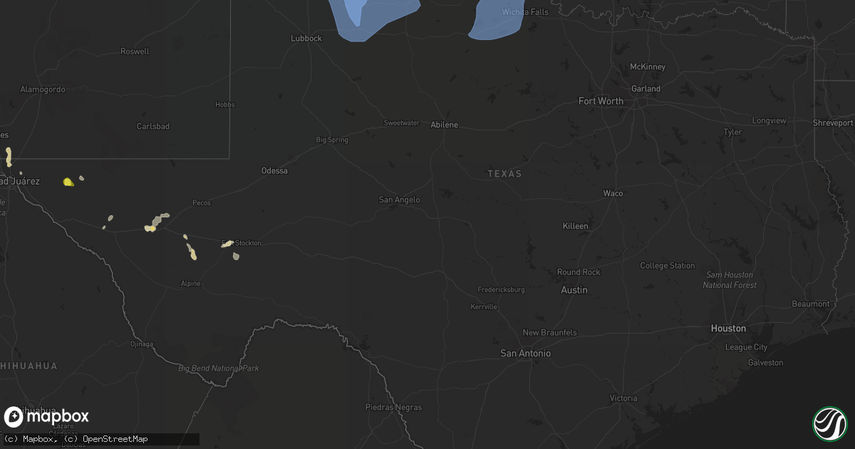
Hail Map in Texas on June 8, 2022
Get this storm
June 8 map
$229
one time, instant access
Download today. No call, no setup
Keep the $229
Bought the map and want the full workflow? Apply the entire $229 to a subscription within 7 days. None of it is wasted.
Every map, not just this one
This buys you this map. Subscription and you get every map we run, in the markets you choose from a few cities to whole states to nationwide. Plus real-time alerts the moment a storm fires.
Contact data
Name, contact info, occupancy, even credit band for addresses in the footprint. You go from where it hit to who to call.
Become the source they trust
Unlimited branding weather history reports on demand. You already have the documented answer ready for the property owner, and you are the one who showed up with it.
Property data and RoofTrace estimates
Pull up any address you have got, its value and the exact code rules for that jurisdiction, straight from One Click Code. Then RoofTrace estimates the squares, pitch, and roof value, priced the way you price.
Storm reports in Texas
Texas
| Date | Description |
|---|---|
| 06/08/202210:12 AM CDT | West texas mesonet. Associated with a weak shower behind a strong gust front. Severe gusts occurred between 10:04 am and 10:12 am. |
| 06/08/20229:57 AM CDT | A local report indicates 68 MPH wind near 3 WSW WICHITA FALLS |
| 06/08/20229:40 AM CDT | West texas mesonet. Severe gust occurred well ahead of the thunderstorms. |
| 06/08/20229:39 AM CDT | A local report indicates 59 MPH wind near SHEPPARD AFB |
| 06/08/20229:20 AM CDT | A local report indicates 62 MPH wind near 1 W SPUR |
| 06/08/20229:18 AM CDT | A local report indicates 70 MPH wind near 10 WSW GUTHRIE |
| 06/08/20229:08 AM CDT | West texas mesonet. Wind gusts from 67 to 71 mph between 9:06 am and 9:08 am. |
| 06/08/20229:05 AM CDT | Visibility down to 2-1/2 mi due to bldu. |
| 06/08/20229:03 AM CDT | West texas mesonet. Severe gusts occurred between 9 and 9:03 am. |
| 06/08/20229:02 AM CDT | A local report indicates 58 MPH wind near 6 SSW ANTON |
| 06/08/20229:00 AM CDT | West texas mesonet. |
| 06/08/20228:58 AM CDT | 59 mph at 8:58 cdt and 8:59 cdt. |
| 06/08/20228:54 AM CDT | Mcadoo west texas mesonet. Severe gusts started at 8:50 am and were continuing through 8:55 am |
| 06/08/20228:50 AM CDT | Measured by the mcadoo west texas mesonet. |
| 06/08/20228:44 AM CDT | West texas mesonet. Wind gusts of 65 to 81 mph from 8:43 to 8:45 am. |
| 06/08/20228:40 AM CDT | West texas mesonet. Wind gusts of 58 to 62 mph occurred between 8:32 am and 8:40 am. |
| 06/08/20228:22 AM CDT | West texas mesonet. |
| 06/08/20228:18 AM CDT | West texas mesonet. |
| 06/08/20228:15 AM CDT | West texas mesonet. Wind gusts of 59 to 62 mph from 8:14 to 8:16 am. |
| 06/08/20228:12 AM CDT | Peak gust measured by the turkey west texas mesonet. Wind gusts of 58 to 82 mph occurred from 8:10 am to 8:16 am... With another severe gust at 8:20 am. |
| 06/08/20228:11 AM CDT | Childress municipal airport. |
| 06/08/20228:10 AM CDT | West texas mesonet. |
| 06/08/20228:10 AM CDT | West texas mesonet. |
| 06/08/20228:07 AM CDT | West texas mesonet site wellington 6se. A 58 mph gust recurred at 755 am cdt. |
| 06/08/20228:05 AM CDT | Measured by the west texas mesonet. |
| 06/08/20228:01 AM CDT | West texas mesonet. Wind gusts of 58 to 66 mph occurred between 7:59 am and 8:02 am. |
| 06/08/20227:58 AM CDT | Lesley west texas mesonet report. |
| 06/08/20227:57 AM CDT | At 1256 AM CDT, a severe thunderstorm was located over Canadian, moving southeast at 25 mph. HAZARD...Ping pong ball size hail and 60 mph wind gusts. SOURCE...Radar indicated. IMPACT...Minor damage to roofs, siding, and trees is possible. People and animals outdoors will be injured. Expect hail damage to roofs, siding, windows, and vehicles. Locations impacted include... Canadian, Allison and Lake Marvin. |
| 06/08/20227:41 AM CDT | West texas mesonet station palo duro 4e |
| 06/08/20227:31 AM CDT | West texas mesonet. A gust to 60 mph also occurred at 7:33 am. |
| 06/08/20227:20 AM CDT | West texas mesonet station goodnight. A 58 mph gust recurred at 737 am cdt. |
| 06/08/20227:16 AM CDT | West texas mesonet station lake mcclellan 2nw. Gusts to 58 mph or greater occurred from 713 to 716 am cdt. |
| 06/08/20227:14 AM CDT | West texas mesonet station claude 12sw. Gust to 58 mph or greater occurred from 714 to 716 am cdt. |
| 06/08/20227:06 AM CDT | West texas mesonet site pantex 1 ese. Site gusted to 58 mph or greater from 646 to 714 am cdt. Other pantex maintained sites gusted to 65 to 75 mph during this period. |
| 06/08/20225:40 AM CDT | At 1040 AM CDT, severe thunderstorms were located along a line extending from near Ravia to 6 miles northwest of Lebanon to near Rubottom, moving southeast at 30 mph. HAZARD...60 mph wind gusts and penny size hail. SOURCE...Radar indicated. IMPACT...Expect damage to roofs, siding, and trees. Locations impacted include... Durant, Madill, Tishomingo, Marietta, Kingston, Dickson, Colbert, Mannsville, Ravia, Achille, Thackerville, Silo, Kemp, Mead, Armstrong, Leon, Hendrix, Cartwright, Utica and Burneyville. |
| 06/08/20225:35 AM CDT | At 1034 AM CDT, strong thunderstorm outflow winds were located along a line extending from 9 miles west of Graham to near Fort Griffin to near Trent, moving southeast at 50 mph. HAZARD...60 mph wind gusts. SOURCE...Radar indicated. IMPACT...Expect damage to roofs, siding, and trees. Severe thunderstorms will be near... Merkel around 1045 AM CDT. Ibex around 1050 AM CDT. Coronados Camp around 1100 AM CDT.Other locations impacted by these severe thunderstorms includeFunston, Admiral, Jud, Big Country Baptist Assembly, Impact, LakeAbilene, Mccarty Lake, Camp Tonkawa, Hitson and Lusk.This includes Interstate 20 between Mile Markers 264 and 323. |
| 06/08/20224:58 AM CDT | At 958 AM CDT, severe thunderstorms were located along a line extending from 4 miles west of Roff to near Sugden, moving east at 45 mph. HAZARD...60 mph wind gusts and quarter size hail. SOURCE...Radar indicated. IMPACT...Hail damage to vehicles is expected. Expect wind damage to roofs, siding, and trees. Locations impacted include... Ardmore, Ada, Pauls Valley, Sulphur, Madill, Tishomingo, Davis, Marietta, Waurika, Lone Grove, Healdton, Wynnewood, Wilson, Comanche, Stratford, Dickson, Ringling, Mannsville, Ryan and Roff. |
| 06/08/20224:28 AM CDT | At 927 AM CDT, severe thunderstorms were located along a line extending from 7 miles south of Ralls to 13 miles west of Benjamin, moving south at 55 mph. HAZARD...70 mph wind gusts. SOURCE...Radar indicated. IMPACT...Expect considerable tree damage. Damage is likely to mobile homes, roofs, and outbuildings. Locations impacted include... Crosbyton, Spur, Dickens, Guthrie, White River Lake, Ralls, Kalgary, Caprock, Finney, Afton and Mcadoo. |
| 06/08/20224:18 AM CDT | At 918 AM CDT, severe thunderstorms were located along a line extending from 14 miles northwest of O'brien to 7 miles east of Caprock, moving south at 50 mph. HAZARD...70 mph wind gusts. SOURCE...Radar indicated. IMPACT...Expect considerable tree damage. Damage is likely to mobile homes, roofs, and outbuildings. Locations impacted include... Post, Aspermont, Jayton, Lake Alan Henry, Girard, Peacock, Justiceburg, Old Glory, Swenson, Clairemont and Us- 380 Near The Haskell-Stonewall County Line. |
| 06/08/20224:09 AM CDT | At 908 AM CDT, severe thunderstorms were located along a line extending from 9 miles south of Sterling to 6 miles southwest of Grandfield to near Margaret, moving south at 35 mph. HAZARD...60 mph wind gusts and penny size hail. SOURCE...There have been several measured wind gusts of 60 mph or higher along and behind this line of thunderstorms. IMPACT...Expect damage to roofs, siding, and trees. Locations impacted include... Wichita Falls, Lawton, Vernon, Burkburnett, Henrietta, Seymour, Walters, Waurika, Archer City, Munday, Knox City, Crowell, Benjamin, Iowa Park, Electra, Holliday, Comanche, Geronimo, Grandfield and Temple. |
| 06/08/20223:42 AM CDT | At 842 AM CDT, severe thunderstorms were located along a line extending from 5 miles northeast of Cone to 5 miles south of Swearingen, moving south at 65 mph. HAZARD...60 mph wind gusts. SOURCE...Radar indicated. IMPACT...Expect damage to roofs, siding, and trees. Locations impacted include... Floydada, Crosbyton, Spur, Paducah, Matador, Dickens, Guthrie, White River Lake, Ralls, Kalgary, Cone, Dougherty, Afton, Grow, Dumont, Finney, Delwin, Chalk, Mcadoo and Hackberry. |
| 06/08/20223:39 AM CDT | At 838 AM CDT, severe thunderstorms were located along a line extending from near Lake Ellsworth to 4 miles southeast of Goodlett, moving southeast at 50 mph. HAZARD...60 mph wind gusts. SOURCE...There have been several wind gusts of 60 mph or higher. IMPACT...Expect damage to roofs, siding, and trees. Locations impacted include... Lawton, Altus, Vernon, Frederick, Quanah, Walters, Crowell, Cache, Elgin, Carnegie, Apache, Snyder, Geronimo, Fletcher, Cyril, Grandfield, Tipton, Blair, Sterling and Chillicothe. |
| 06/08/20223:15 AM CDT | At 814 AM CDT, severe thunderstorms were located along a line extending from 8 miles northeast of South Plains to 7 miles north of Northfield, moving southeast at 70 mph. HAZARD...70 mph wind gusts. SOURCE...Radar indicated. IMPACT...Expect considerable tree damage. Damage is likely to mobile homes, roofs, and outbuildings. Locations impacted include... Silverton, Turkey, Caprock Canyon State Park, Quitaque, Valley Schools, Mackenzie Reservoir, Brice, Lakeview and Plaska Community. |
| 06/08/20223:08 AM CDT | At 808 AM CDT, severe thunderstorms were located along a line extending from near Gotebo to near Hollis, moving south at 30 mph. HAZARD...60 mph wind gusts and penny size hail. SOURCE...Radar indicated. IMPACT...Expect damage to roofs, siding, and trees. Locations impacted include... Altus, Hobart, Mangum, Cordell, Hollis, Granite, Snyder, Sentinel, Tipton, Blair, Mountain View, Olustee, Dill City, Eldorado, Lone Wolf, Mountain Park, Indiahoma, Carter, Roosevelt and Gotebo. |
| 06/08/20222:58 AM CDT | At 757 AM CDT, severe thunderstorms were located along a line extending from near Caprock Canyon State Park to 10 miles north of Earth, moving southeast at 60 mph. HAZARD...60 mph wind gusts. SOURCE...Radar indicated. IMPACT...Expect damage to roofs, siding, and trees. Locations impacted include... Plainview, Littlefield, Floydada, Abernathy, Hale Center, Olton, Earth, Matador, Lockney, Petersburg, Amherst, Cotton Center, Fieldton, Spade, South Plains, Dougherty, Aiken, Flomot, Halfway and Northfield. |
| 06/08/20222:21 AM CDT | At 720 AM CDT, severe thunderstorms were located along a line extending from 8 miles southeast of Buffalo Lake to 8 miles east of Memphis, moving southeast at 55 mph. HAZARD...70 mph wind gusts. SOURCE...Radar indicated. IMPACT...Expect considerable tree damage. Damage is likely to mobile homes, roofs, and outbuildings. Locations impacted include... Tulia, Hart, Silverton, Turkey, Caprock Canyon State Park, Kress, Happy, Quitaque, Vigo Park, Claytonville, Mackenzie Reservoir, Brice, Valley Schools, Nazareth, Lakeview and Plaska Community. |
| 06/08/202212:22 AM CDT | At 521 PM MDT, a severe thunderstorm was located over Northeast El Paso, and is nearly stationary. HAZARD...60 mph wind gusts and quarter size hail. SOURCE...Radar indicated. IMPACT...Hail damage to vehicles is expected. Expect wind damage to roofs, siding, and trees. Locations impacted include... Northeast El Paso and Franklin Mountains State Park. |
| 06/07/202211:28 PM CDT | At 427 AM CDT, severe thunderstorms were located along a line extending from 3 miles east of Elmwood to 5 miles southeast of Guymon to 9 miles south of Keyes, moving southeast at 55 mph. HAZARD...70 mph wind gusts and half dollar size hail. SOURCE...Radar indicated. IMPACT...Expect some tree damage. Damage is likely to mobile homes, roofs, and outbuildings. Hail damage to vehicles is expected. Locations impacted include... Guymon, Perryton, Spearman, Lipscomb, Stratford, Beaver, Boise City, Booker, Goodwell, Gruver, Optima, Darrouzett, Hardesty, Wolf Creek Park, Griggs, Balko, Elmwood, Adams, Farnsworth and Boyd. |
| 06/07/202210:49 PM CDT | At 349 PM CDT, a severe thunderstorm was located 17 miles south of Balmorhea Lake, or 19 miles northeast of Fort Davis, moving south at 10 mph. HAZARD...60 mph wind gusts and half dollar size hail. SOURCE...Radar indicated. IMPACT...Hail damage to vehicles is expected. Expect wind damage to roofs, siding, and trees. This severe thunderstorm will remain over mainly rural areas of west central Pecos, northwestern Brewster and southeastern Jeff Davis Counties. |
| 06/07/202210:21 PM CDT | At 320 PM CDT, a severe thunderstorm was located 9 miles west of Kent, moving west at 30 mph. HAZARD...60 mph wind gusts and half dollar size hail. SOURCE...Radar indicated. IMPACT...Hail damage to vehicles is expected. Expect wind damage to roofs, siding, and trees. Locations impacted include... Kent and Plateau. This includes Interstate 10 between mile markers 149 and 177. |
| 06/07/20229:52 PM CDT | At 252 PM MDT, a severe thunderstorm was located 8 miles south of Cornudas, moving northwest at 5 mph. HAZARD...60 mph wind gusts and quarter size hail. SOURCE...Radar indicated. IMPACT...Hail damage to vehicles is expected. Expect wind damage to roofs, siding, and trees. Locations impacted include... Cornudas and US Highway 62/180 |
All States Impacted by Hail Map on June 8, 2022
Cities Impacted by Hail Map on June 8, 2022
- Chouteau, OK
- Elizabethtown, IN
- Seymour, IN
- Butlerville, IN
- Versailles, IN
- Osgood, IN
- Scipio, IN
- Jonesville, IN
- Holton, IN
- Brownstown, IN
- Westport, IN
- Columbus, IN
- Greensburg, IN
- North Vernon, IN
- Madison, IN
- Sarahsville, OH
- Woodsfield, OH
- Beallsville, OH
- Summerfield, OH
- Caldwell, OH
- Lewisville, OH
- Clarington, OH
- Graysville, OH
- Carmichaels, PA
- Jefferson, PA
- Portsmouth, OH
- White Cottage, OH
- Zanesville, OH
- Roseville, OH
- Mooresville, IN
- Oxford, NC
- Proctor, WV
- Waynesburg, PA
- Patriot, OH
- Seagrove, NC
- Holdenville, OK
- Sweetwater, OK
- Lesage, WV
- Maysville, OK
- Pauls Valley, OK
- Lindsay, OK
- Lexington, OK
- Ridgeville, SC
- Summerville, SC
- Searcy, AR
- Augusta, AR
- Coweta, OK
- Porter, OK
- Locust Grove, OK
- Dix, IL
- Mount Vernon, IL
- Red House, WV
- Charleston, WV
- Poca, WV
- Liberty, WV
- Spruce Pine, AL
- Hodges, AL
- Phil Campbell, AL
- Russellville, AL
- Vina, AL
- Red Bay, AL
- Groom, TX
- Poyen, AR
- Malvern, AR
- Beaverton, AL
- Blanchard, OK
- Tuttle, OK
- Norman, OK
- Newcastle, OK
- Amber, OK
- Truth Or Consequences, NM
- Stonewall, OK
- Fitzhugh, OK
- Macomb, OK
- Dierks, AR
- Masontown, PA
- Uniontown, PA
- McClellandtown, PA
- Smithfield, PA
- Greensboro, PA
- Welling, OK
- Sulligent, AL
- Sterrett, AL
- Harpersville, AL
- Clarksburg, OH
- Alamogordo, NM
- Cloudcroft, NM
- Foster, KY
- Brooksville, KY
- Dunnellon, FL
- Pinson, AL
- Birmingham, AL
- Trussville, AL
- Tremont, MS
- Smithville, MS
- Hamilton, AL
- Fulton, MS
- Detroit, AL
- Greenwood Springs, MS
- Fort Stockton, TX
- El Dorado, AR
- Ripley, OH
- Winchester, OH
- Russellville, OH
- Manchester, OH
- West Union, OH
- Peebles, OH
- Sentinel, OK
- Dill City, OK
- Port Republic, MD
- Newburg, MD
- Charlotte Hall, MD
- Prince Frederick, MD
- Lusby, MD
- Saint Leonard, MD
- Mechanicsville, MD
- Hollywood, MD
- Broomes Island, MD
- Asher, OK
- Konawa, OK
- Purcell, OK
- Beverly Hills, FL
- Hernando, FL
- Charleston, AR
- Point Marion, PA
- Martin, PA
- Bobtown, PA
- Nemacolin, PA
- Morgantown, WV
- Dilliner, PA
- Maidsville, WV
- Adah, PA
- New Salem, PA
- Ronco, PA
- Garards Fort, PA
- Mount Morris, PA
- Uledi, PA
- Lamar, OK
- Mcalester, OK
- Burlington, WV
- New Creek, WV
- Batesville, IN
- Currituck, NC
- Moyock, NC
- Quinton, OK
- Stigler, OK
- Brownsville, PA
- Allison, PA
- Denbo, PA
- Hiller, PA
- East Millsboro, PA
- Merrittstown, PA
- Vanderbilt, PA
- Grindstone, PA
- Smock, PA
- Maud, OK
- Balmorhea, TX
- Erick, OK
- Van Horn, TX
- Park Hill, OK
- Tahlequah, OK
- Dyer, AR
- Van Buren, AR
- Lavaca, AR
- Fort Smith, AR
- Alma, AR
- Greenwood, AR
- Fairview, WV
- Rivesville, WV
- Farmington, WV
- Fairmont, WV
- Lexington, KY
- Sparkman, AR
- Pampa, TX
- Cambridge, OH
- Bretz, WV
- Masontown, WV
- Independence, WV
- Montana Mines, WV
- Mannington, WV
- Kingwood, WV
- Bruceton Mills, WV
- Reedsville, WV
- Albright, WV
- Rachel, WV
- Baxter, WV
- Sayre, OK
- Rocky, OK
- Hobart, OK
- Amberg, WI
- Pembine, WI
- Littleton, WV
- New Martinsville, WV
- Rayville, LA
- Oviedo, FL
- Wynnewood, OK
- Palatka, FL
- Green Cove Springs, FL
- Georgetown, OH
- Bethel, OH
- Hamersville, OH
- Branch, AR
- Winter Park, FL
- Winter Springs, FL
- Casselberry, FL
- Maitland, FL
- Sanford, FL
- Stafford, VA
- Quantico, VA
- Nanjemoy, MD
- Indian Head, MD
- Tularosa, NM
- Carnegie, OK
- Anadarko, OK
- Binger, OK
- Gracemont, OK
- Corn, OK
- Lookeba, OK
- Bessie, OK
- Clinton, OK
- Pocasset, OK
- Arapaho, OK
- Weatherford, OK
- Hydro, OK
- Cordell, OK
- Fort Cobb, OK
- Minco, OK
- Chickasha, OK
- Colony, OK
- Foss, OK
- Dumas, MS
- New Albany, MS
- Ripley, MS
- Blue Mountain, MS
- Somerset, OH
- Junction City, OH
- Cement, OK
- Bixby, OK
- Broken Arrow, OK
- Marlow, OK
- Elgin, OK
- Rush Springs, OK
- Ninnekah, OK
- Bradley, OK
- Fletcher, OK
- Inola, OK
- Tulsa, OK
- Sand Springs, OK
- Cullman, AL
- Hanceville, AL
- Hopkins, SC
- Columbia, SC
- Eastover, SC
- Abbeville, SC
- Haskell, OK
- Dupont, IN
- Mcconnelsville, OH
- Cumberland, OH
- Gallipolis, OH
- Vinson, OK
- Hollis, OK
- Eufaula, OK
- Woodlawn, IL
- Bunch, OK
- Dardanelle, AR
- London, AR
- Delaware, AR
- Russellville, AR
- Danville, AR
- Atkins, AR
- Pottsville, AR
- Byesville, OH
- Kipling, OH
- Senecaville, OH
- Lynx, OH
- Vanceburg, KY
- Stout, OH
- Aberdeen, OH
- Maysville, KY
- Proctorville, OH
- Nichols, SC
- New Matamoras, OH
- Reno, OH
- Williamstown, WV
- Whipple, OH
- Marietta, OH
- Newport, OH
- Verden, OK
- Geary, OK
- Hinton, OK
- Cleveland, OK
- Hominy, OK
- Prue, OK
- Osage, OK
- Inverness, FL
- Lancaster, OH
- Fort Sill, OK
- Bamberg, SC
- Healdton, OK
- Logan, AL
- Crane Hill, AL
- Tollesboro, KY
- Amanda, OH
- Quaker City, OH
- Pleasant City, OH
- Chandlersville, OH
- Pleasantville, OH
- Rushville, OH
- Philo, OH
- Carroll, OH
- Baltimore, OH
- New Lexington, OH
- Bremen, OH
- Crooksville, OH
- Blue Rock, OH
- Barnesville, OH
- Wellington, TX
- La Plata, MD
- Perryville, AR
- Paron, AR
- Plainview, AR
- Casa, AR
- Ola, AR
- Saint Cloud, FL
- Blountsville, AL
- Elkview, WV
- Clendenin, WV
- Augusta, KY
- Falmouth, KY
- Ratcliff, AR
- Nauvoo, AL
- Carbon Hill, AL
- White Sands Missile Range, NM
- Eastaboga, AL
- El Paso, TX
- Townley, AL
- Orrum, NC
- Latonia, KY
- Aurora, IN
- Florence, KY
- Rising Sun, IN
- Petersburg, KY
- Newport, KY
- Ft Mitchell, KY
- Union, KY
- Independence, KY
- Walton, KY
- Burlington, KY
- Cameron, WV
- Vienna, WV
- Pine Grove, WV
- Hundred, WV
- Paden City, WV
- Burton, WV
- Reader, WV
- New Freeport, PA
- Metz, WV
- Friendly, WV
- Middlebourne, WV
- Porters Falls, WV
- Wana, WV
- Aleppo, PA
- Sardis, OH
- Sistersville, WV
- Kenna, WV
- Buffalo, WV
- Paris, KY
- San Ysidro, NM
- Jemez Pueblo, NM
- Mayesville, SC
- Bishopville, SC
- Little Rock, AR
- Weleetka, OK
- Okemah, OK
- Sierra Blanca, TX
- Evergreen, NC
- Fort Davis, TX
- Benton, AR
- Alexander, AR
- Bryant, AR
- Davis, OK
- Sulphur, OK
- Vernon, AL
- Frankfort, OH
- Chillicothe, OH
- Greenfield, OH
- South Salem, OH
- Wewoka, OK
- Welcome, MD
- Mount Pleasant, TN
- Columbia, TN
- Belleville, AR
- Claude, TX
- Baileyton, AL
- Eva, AL
- Owasso, OK
- Catoosa, OK
- Dunbar, WV
- Hurricane, WV
- Scott Depot, WV
- Saint Albans, WV
- Winfield, WV
- Nitro, WV
- Hope, IN
- New Concord, OH
- Washington Court House, OH
- Galax, VA
- Fair Bluff, NC
- Houston, AL
- Addison, AL
- Walters, OK
- Faxon, OK
- Salt Flat, TX
- Dell City, TX
- Vincent, AL
- Mclean, TX
- Peggs, OK
- Rose, OK
- Salina, OK
- Pryor, OK
- Hartsville, IN
- Havana, AR
- Roxboro, NC
- Wheelersburg, OH
- Port Tobacco, MD
- Melbourne, KY
- California, KY
- Moscow, OH
- Butler, KY
- Alexandria, KY
- New Richmond, OH
- Felicity, OH
- Noble, OK
- Fraziers Bottom, WV
- Waterloo, OH
- South Shore, KY
- Willow Wood, OH
- Franklin Furnace, OH
- Glenwood, WV
- Pedro, OH
- Leon, WV
- South Portsmouth, KY
- Apple Grove, WV
- Crown City, OH
- Scottown, OH
- Ashton, WV
- South Webster, OH
- Kitts Hill, OH
- Chesapeake, OH
- Grafton, WV
- Bethesda, OH
- Belmont, OH
- Bickmore, WV
- Swiss, WV
- Clay, WV
- Summersville, WV
- Monrovia, IN
- Martinsville, IN
- Calhoun, GA
- Ona, WV
- South Charleston, WV
- Eleanor, WV
- Chaparral, NM
- Benoit, MS
- Hayden, AL
- Camden, SC
- Nobleton, FL
- Bushnell, FL
- Brooksville, FL
- Okeechobee, FL
- Eldridge, AL
- Nettleton, MS
- Okolona, MS
- Fort Hancock, TX
- Advent, WV
- De Queen, AR
- Nashoba, OK
- Waurika, OK
- Pioneer, LA
- Oak Grove, LA
- Mer Rouge, LA
- Lake Providence, LA
- Fairbank, PA
- Rices Landing, PA
- Crucible, PA
- New Geneva, PA
- Bear Creek, AL
- Woodstock, AL
- Vance, AL
- Hackleburg, AL
- Paoli, OK
- Arthurdale, WV
- Jerusalem, OH
- Floral City, FL
- Mullins, SC
- Blue Creek, OH
- Erlanger, KY
- Gallipolis Ferry, WV
- Southside, WV
- Williamsport, OH
- Wingett Run, OH
- Cameron, OH
- Woodlawn, VA
- Hancock, MD
- Berkeley Springs, WV
- Great Cacapon, WV
- Beverly, WV
- Glady, WV
- Terra Alta, WV
- Laguna, NM
- Cimarron, NM
- Mountain View, OK
- Willow, OK
- Mangum, OK
- Chattanooga, OK
- Lone Wolf, OK
- Burkburnett, TX
- Snyder, OK
- Oklaunion, TX
- Butler, OK
- Frederick, OK
- Iowa Park, TX
- Headrick, OK
- Electra, TX
- Cache, OK
- Gotebo, OK
- Canute, OK
- Harrold, TX
- Devol, OK
- Geronimo, OK
- Blair, OK
- Davidson, OK
- Holliday, TX
- Hollister, OK
- Roosevelt, OK
- Seymour, TX
- Loveland, OK
- Indiahoma, OK
- Mountain Park, OK
- Tipton, OK
- Elk City, OK
- Randlett, OK
- Grandfield, OK
- Vernon, TX
- Wichita Falls, TX
- Granite, OK
- Sheppard Afb, TX
- Carter, OK
- Lawton, OK
- Wagoner, OK
- Hulbert, OK
- Cookson, OK
- Muldrow, OK
- Fort Gibson, OK
- Stilwell, OK
- Uniontown, AR
- Calvin, OK
- Wetumka, OK
- Stuart, OK
- Allen, OK
- Atwood, OK
- Roland, AR
- Bigelow, AR
- Hollandale, MS
- Cleveland, MS
- Itta Bena, MS
- Isola, MS
- Greenville, MS
- Dermott, AR
- Grady, AR
- Wilmar, AR
- Moorhead, MS
- Star City, AR
- Shaw, MS
- Belzoni, MS
- Indianola, MS
- Boyle, MS
- Monticello, AR
- Arkansas City, AR
- Leland, MS
- Warren, AR
- Inverness, MS
- Rison, AR
- Dumas, AR
- Beulah, MS
- Tillar, AR
- McGehee, AR
- Rohwer, AR
- Vardaman, MS
- Grenada, MS
- Woodland, MS
- Gore Springs, MS
- Houston, MS
- Calhoun City, MS
- Duck Hill, MS
- Mantee, MS
- Rushville, IN
- Arlington, IN
- Arcanum, OH
- Troy, OH
- Tipp City, OH
- West Milton, OH
- Casstown, OH
- Springfield, OH
- Sardinia, OH
- South Bloomingville, OH
- Union City, IN
- Albany, IN
- Winchester, IN
- Farmland, IN
- Eaton, IN
- Parker City, IN
- Ridgeville, IN
- Muncie, IN
- Saratoga, IN
- Gaston, IN
- Milan, IN
- Dillsboro, IN
- Stilesville, IN
- Camby, IN
- Bargersville, IN
- Brooklyn, IN
- Greenwood, IN
- Ada, OK
- Stratford, OK
- Zaleski, OH
- Ray, OH
- Albany, OH
- New Plymouth, OH
- Athens, OH
- Creola, OH
- New Marshfield, OH
- McArthur, OH
- Londonderry, OH
- Hebron, KY
- Sharpsburg, GA
- Newnan, GA
- Carrollton, GA
- Franklin, GA
- Turkey, TX
- Flomot, TX
- Gould, OK
- Roaring Springs, TX
- Tulia, TX
- Quanah, TX
- Kress, TX
- Lockney, TX
- Wayside, TX
- Amarillo, TX
- Crosbyton, TX
- Plainview, TX
- Memphis, TX
- Ralls, TX
- Quitaque, TX
- Shamrock, TX
- Floydada, TX
- Happy, TX
- Clarendon, TX
- Dickens, TX
- Spur, TX
- Dodson, TX
- Paducah, TX
- Childress, TX
- Matador, TX
- Hedley, TX
- Mcadoo, TX
- Silverton, TX
- Lakeview, TX
- Lelia Lake, TX
- Afton, TX
- Wheeler, TX
- Canyon, TX
- Quail, TX


