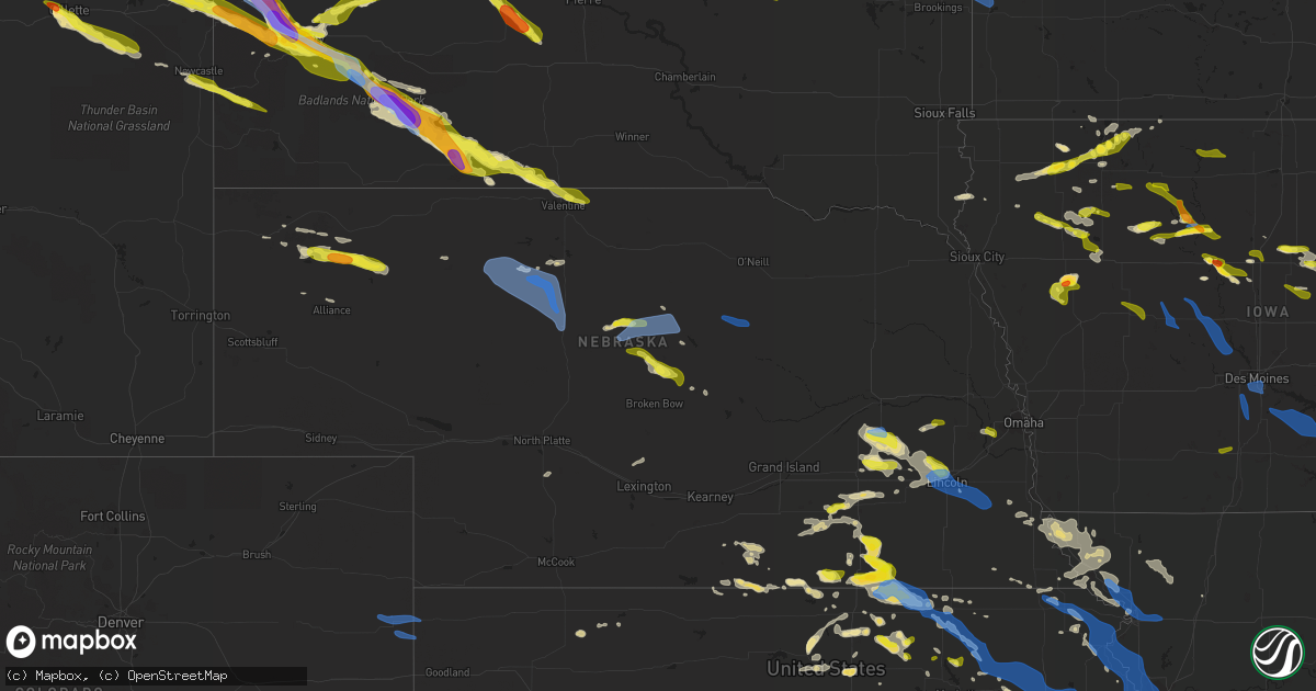
Hail Map in Nebraska on June 4, 2020
Get this storm
June 4 map
$229
one time, instant access
Download today. No call, no setup
Keep the $229
Bought the map and want the full workflow? Apply the entire $229 to a subscription within 7 days. None of it is wasted.
Every map, not just this one
This buys you this map. Subscription and you get every map we run, in the markets you choose from a few cities to whole states to nationwide. Plus real-time alerts the moment a storm fires.
Contact data
Name, contact info, occupancy, even credit band for addresses in the footprint. You go from where it hit to who to call.
Become the source they trust
Unlimited branding weather history reports on demand. You already have the documented answer ready for the property owner, and you are the one who showed up with it.
Property data and RoofTrace estimates
Pull up any address you have got, its value and the exact code rules for that jurisdiction, straight from One Click Code. Then RoofTrace estimates the squares, pitch, and roof value, priced the way you price.
Storm reports in Nebraska
Nebraska
| Date | Description |
|---|---|
| 06/04/20206:42 PM CDT | A local report indicates 60 MPH wind near 30 S VALENTINE |
| 06/04/20206:30 PM CDT | 4 to 6 inch diameter branches down also. |
| 06/04/20206:28 PM CDT | Emergency manager reported a semi rollover caused by wind. Semi was empty at time of rollover. |
| 06/04/20206:22 PM CDT | A local report indicates 60 MPH wind near 10 S NORTH PLATTE |
| 06/04/20206:18 PM CDT | A local report indicates 70 MPH wind near 3 ENE NORTH PLATTE |
| 06/04/20206:17 PM CDT | Widespread power outages in north platte via emergency manager. Time estimated from radar. |
| 06/04/20206:17 PM CDT | A local report indicates 60 MPH wind near NORTH PLATTE |
| 06/04/20206:13 PM CDT | Several large trees down. Time estimated from radar. |
| 06/04/20205:45 PM CDT | Dispatcher received a report of a possible landspout 10 miles west of benkelman. Landspout was in contact with the ground around 30 seconds. |
| 06/04/20205:05 PM CDT | 1/4 mile visibility and 70 mph winds |
| 06/04/20205:05 PM CDT | Estimated between 1 and 1.5 inch hail along with 30 to 35 mph winds. |
| 06/04/20207:25 AM CDT | At 1224 AM CDT, severe thunderstorms were located along a line extending from 3 miles north of Reserve to Onaga to 4 miles northeast of Talmage, moving east at 55 mph. HAZARD...60 mph wind gusts and nickel size hail. SOURCE...Radar indicated. IMPACT...Expect damage to roofs, siding, and trees. Locations impacted include... Northwestern Topeka, Manhattan, Junction City, Abilene, Wamego, Holton, Hiawatha, Sabetha, Seneca, Horton, Rossville, Alma, Westmoreland, Blaine, St. Marys, Ogden, Grandview Plaza, Dover, Silver Lake and Chapman.This includes Interstate 70 between mile markers 267 and 355. |
| 06/04/20206:38 AM CDT | At 1137 PM CDT, severe thunderstorms were located along a line extending from near Prague to near Valparaiso, moving east at 35 mph. HAZARD...60 mph wind gusts and quarter size hail. SOURCE...Radar indicated. IMPACT...Hail damage to vehicles is expected. Expect wind damage to roofs, siding, and trees. Locations impacted include... Wahoo, Ashland, Yutan, Valparaiso, Mead, Weston, Prague, Ceresco, Ithaca, Malmo, Memphis, Colon, Two Rivers State Recreation Area and Memphis State Recreation Area. |
| 06/04/20206:27 AM CDT | At 1127 PM CDT, a severe thunderstorm was located near Valentine, moving southeast at 40 mph. HAZARD...60 mph wind gusts and quarter size hail. SOURCE...Radar indicated. IMPACT...Hail damage to vehicles is expected. Expect wind damage to roofs, siding, and trees. Locations impacted include... Norden, Sparks and Smith Falls State Park. This includes Highway 12 between mile markers 2 and 30. |
| 06/04/20206:13 AM CDT | At 1112 PM CDT, severe thunderstorms were located along a line extending from Dwight to near Seward, moving southeast at 45 mph. HAZARD...65 mph wind gusts and quarter size hail. SOURCE...Radar indicated. This storm has a history of producing up to 60 mph winds. IMPACT...Hail damage to vehicles is expected. Expect wind damage to roofs, siding, and trees. Severe thunderstorms will be near... Valparaiso and Pleasant Dale around 1125 PM CDT. Lincoln around 1145 PM CDT. Waverly around 1150 PM CDT. Hickman around 1155 PM CDT. Bennet and Panama around 1200 AM CDT.Other locations impacted by these severe thunderstorms include Davey,Branched Oak State Recreation Area, Sprague, Malcolm, Raymond, PawneeState Recreation Area, Stagecoach State Recreation Area, Denton,Wagon Train State Recreation Area and Ceresco.This includes Interstate 80 in Nebraska between mile markers 385 and414. |
| 06/04/20206:06 AM CDT | At 1105 PM CDT, a severe thunderstorm was located over Utica, or 13 miles east of York, moving southeast at 40 mph. A separate severe thunderstorm was also impacting northern Seward county. HAZARD...60 mph wind gusts and quarter size hail. SOURCE...Radar indicated. IMPACT...Hail damage to vehicles is expected. Expect wind damage to roofs, siding, and trees. This severe thunderstorm will be near... Beaver Crossing around 1115 PM CDT. Seward around 1120 PM CDT. Milford around 1130 PM CDT. Pleasant Dale around 1140 PM CDT.Other locations impacted by this severe thunderstorm include Goehner,Cordova, Tamora and Blue River State Recreation Area.This includes Interstate 80 in Nebraska between mile markers 366 and388. |
| 06/04/20205:59 AM CDT | At 1058 PM CDT, a severe thunderstorm was located near Gresham, or 9 miles northeast of York, moving southeast at 40 mph. HAZARD...60 mph wind gusts and quarter size hail. SOURCE...Radar indicated. IMPACT...Hail damage to vehicles is expected. Expect wind damage to roofs, siding, and trees. Locations impacted include... York, Waco, Gresham and Thayer. This includes Interstate 80 between mile markers 354 and 365. |
| 06/04/20205:48 AM CDT | At 1048 PM CDT, a severe thunderstorm was located near Saint Francis, or 19 miles southwest of Mission, moving southeast at 45 mph. HAZARD...Ping pong ball size hail and 60 mph wind gusts. SOURCE...Radar indicated. IMPACT...People and animals outdoors will be injured. Expect hail damage to roofs, siding, windows, and vehicles. Expect wind damage to roofs, siding, and trees. Locations impacted include... Valentine, Crookston, Highway 97 crossing the Niobrara River and Schlagel Creek State Wildlife Management Area.This includes the following highways... Highway 20 between mile markers 180 and 206. Highway 97 between mile markers 131 and 141. Highway 83 between mile markers 200 and 221. Highway 12 between mile markers 1 and 17. |
| 06/04/20205:45 AM CDT | At 1044 PM CDT, a severe thunderstorm was located near Shelby, or 20 miles south of Columbus, moving southeast at 40 mph. HAZARD...60 mph wind gusts and nickel size hail. SOURCE...Trained weather spotters reported 50 to 60 mph wind gusts near Shelby with this storm. IMPACT...Expect damage to roofs, siding, and trees. Locations impacted include... Seward, Rising City, Staplehurst, Garland, Dwight, Bee, Ulysses, Garrison and Surprise. |
| 06/04/20205:13 AM CDT | At 1013 PM CDT, a severe thunderstorm was located near Grafton, or 23 miles south of York, moving east at 45 mph. HAZARD...60 mph wind gusts and quarter size hail. SOURCE...Radar indicated. IMPACT...Hail damage to vehicles is expected. Expect wind damage to roofs, siding, and trees. Locations impacted include... Geneva, Sutton, Exeter, Fairmont, Edgar, Shickley, Milligan, Grafton, Ohiowa, Ong and Strang. |
| 06/04/20204:32 AM CDT | At 931 PM CDT, a severe thunderstorm was located 6 miles northeast of Spalding, or 36 miles east of Ord, moving southeast at 45 mph. HAZARD...60 mph wind gusts and penny size hail. SOURCE...Radar indicated. IMPACT...Expect damage to roofs, siding, and trees. This severe thunderstorm will be near... Albion around 950 PM CDT. St. Edward around 1005 PM CDT.Other locations impacted by this severe thunderstorm include Lorettoand The Highway 14 And 56 Junction. |
| 06/04/20204:13 AM CDT | At 913 PM CDT, a severe thunderstorm was located near Campbell, or 22 miles southwest of Hastings, moving east at 35 mph. HAZARD...60 mph wind gusts and quarter size hail. SOURCE...Radar indicated. IMPACT...Hail damage to vehicles is expected. Expect wind damage to roofs, siding, and trees. Locations impacted include... Blue Hill, Campbell, Bladen, Roseland, Holstein, Ayr and Rosemont. |
| 06/04/20203:52 AM CDT | At 851 PM CDT, severe thunderstorms were located along a line extending from near Ericson to near Ord to near Mason City, moving east at 35 mph. HAZARD...60 mph wind gusts and quarter size hail. SOURCE...Radar indicated. IMPACT...Hail damage to vehicles is expected. Expect wind damage to roofs, siding, and trees. Locations impacted include... Ord, Greeley, Loup City, Spalding, Scotia, Arcadia, North Loup, Litchfield, Elba, Ashton, Farwell, Rockville, Hazard, Elyria, Cotesfield and Sherman Reservoir Dam. |
| 06/04/20203:33 AM CDT | At 832 PM CDT, a severe thunderstorm was located near Sargent, or 11 miles south of Taylor, moving southeast at 35 mph. HAZARD...60 mph wind gusts and quarter size hail. SOURCE...Radar indicated. IMPACT...Hail damage to vehicles is expected. Expect wind damage to roofs, siding, and trees. Locations impacted include... Ord, Arcadia, Elyria and Fort Hartsuff State Park. |
| 06/04/20203:28 AM CDT | At 828 PM CDT, severe thunderstorms were located along a line extending from 11 miles west of Amelia to 11 miles northeast of Calamus Reservoir State Recreation Area to Burwell, moving east at 40 mph. HAZARD...60 mph wind gusts and quarter size hail. SOURCE...Radar indicated. IMPACT...Hail damage to vehicles is expected. Expect wind damage to roofs, siding, and trees. Locations impacted include... Burwell, Chambers, Bartlett, Ericson, Amelia, Calamus Reservoir State Recreation Area, Virginia Smith Dam, Hannamon Bayou Campground, Buffalo Flats, Carson Lake, Sunfish Lake, Homestead Knolls Campground, Cumminsville, Four Corners, Pibel Lake State Recreation Area, Nunda Shoal Campground, Goose Lake State Wildlife Management Area, Deverre, Valley View Flat Campground and Gables.This includes Highway 281 between mile markers 132 and 178. |
| 06/04/20203:16 AM CDT | At 815 PM CDT, a severe thunderstorm was located 10 miles west of Sargent, or 10 miles southwest of Taylor, moving southeast at 40 mph. HAZARD...60 mph wind gusts and quarter size hail. SOURCE...Radar indicated. IMPACT...Hail damage to vehicles is expected. Expect wind damage to roofs, siding, and trees. Locations impacted include... Taylor, Sargent, Comstock, Weissert, Westerville, Lillian, Round Valley, Walworth, Arcadia Diversion Dam State Wildlife Management Area, Wescott, Kent Diversion Dam State Wildlife Management Area, Big Oak Canyon, Almeria, Divide Hill and Gates.This includes the following highways... Highway 183 between mile markers 97 and 126. Highway 92 between mile markers 307 and 308. |
| 06/04/20203:10 AM CDT | At 809 PM CDT, severe thunderstorms were located along a line extending from 3 miles northwest of Lebanon to near Norcatur to near Clayton to 8 miles southeast of Jennings, moving east at 40 mph. HAZARD...60 mph wind gusts. SOURCE...Trained weather spotters reported blowing dust and tree limb damage. IMPACT...Expect damage to roofs, siding, and trees. Locations impacted include... Norton, Oberlin, Almena, Lenora, Norcatur, Danbury and Jennings. |
| 06/04/20202:47 AM CDT | At 747 PM CDT, a severe thunderstorm was located 12 miles south of Rose, or 13 miles east of Brewster, moving east at 45 mph. HAZARD...60 mph wind gusts and quarter size hail. SOURCE...Radar indicated. IMPACT...Hail damage to vehicles is expected. Expect wind damage to roofs, siding, and trees. Locations impacted include... Burwell, Calamus Reservoir State Recreation Area, Fox Bayou, Almeria Meadow State Wildlife Management Area, Virginia Smith Dam, Hannamon Bayou Campground, Carson Lake, Homestead Knolls Campground, Horseshoe Bend Lake, Nunda Shoal Campground, Deverre, Valley View Flat Campground and Almeria.This includes Highway 183 between mile markers 127 and 152. |
| 06/04/20202:19 AM CDT | At 718 PM CDT, a severe thunderstorm was located near Dunning, or 12 miles west of Brewster, moving east at 30 mph. HAZARD...60 mph wind gusts and quarter size hail. SOURCE...Radar indicated. IMPACT...Hail damage to vehicles is expected. Expect wind damage to roofs, siding, and trees. Locations impacted include... Brewster, Dunning, Milburn Diversion Dam State Wildlife Management Area, Almeria Meadow State Wildlife Management Area and Hawley Flats.This includes Highway 2 between mile markers 229 and 245. |
| 06/04/20202:12 AM CDT | At 711 PM CDT, a severe thunderstorm was located 7 miles northwest of Elsmere, or 20 miles northeast of Thedford, moving east at 35 mph. HAZARD...60 mph wind gusts and penny size hail. SOURCE...Radar indicated. IMPACT...Expect damage to roofs, siding, and trees. Locations impacted include... Elsmere, Purdum, Hofeld Lake, Raven, Koshopah, Jones Lake, Moon Lake, Willow Lake State Wildlife Management Area, Long Lake State Wildlife Management Area and Johnsons Corner.This includes Highway 83 between mile markers 153 and 159. |
| 06/04/20201:42 AM CDT | At 641 PM CDT, severe thunderstorms were located along a line extending from Brady to 9 miles north of Moorefield to near Curtis, moving east at 35 mph. HAZARD...70 mph wind gusts and blowing dust. SOURCE...Radar indicated. IMPACT...Expect considerable tree damage. Damage is likely to mobile homes, roofs, and outbuildings. Locations impacted include... Lexington, Cozad, Gothenburg, Bertrand, Elwood, Overton, Sumner, Eddyville, Smithfield, Willow Island, Johnson Lake and Farnam.This includes Interstate 80 between mile markers 209 and 254. |
| 06/04/20201:39 AM CDT | At 638 PM CDT, severe thunderstorms were located along a line extending from 10 miles northeast of Maxwell to 8 miles northwest of Moorefield, moving east at 45 mph. HAZARD...70 mph wind gusts and penny size hail. SOURCE...Trained weather spotters. IMPACT...Expect considerable tree damage. Damage is likely to mobile homes, roofs, and outbuildings. Locations impacted include... Brady, Oconto, Jeffrey Canyon State Wildlife Management Area, Etna and Vroman.This includes Interstate 80 in Nebraska between mile markers 192 and208. |
| 06/04/20201:23 AM CDT | At 623 PM CDT, severe thunderstorms were located along a line extending from Wellfleet to near Palisade, moving east at 35 mph. HAZARD...70 mph wind gusts and a blinding cloud of dust. SOURCE...Radar indicated. IMPACT...Expect considerable tree damage. Damage is likely to mobile homes, roofs, and outbuildings. Locations impacted include... Curtis, Hayes Center, Eustis, Wellfleet, Moorefield, Stockville, Medicine Creek Reservoir State Recreation Area, Maywood, Quick, Hansen Memorial Reserve State Wildlife Management Area, Willow View Campground, Freedom, Hayes Center State Wildlife Management Area, Marengo, Orafino, Bluegill Haven Campground, Red Willow Reservoir State Recreation Area and Dancing Leaf Earth Lodge.This includes Highway 83 between mile markers 27 and 58. |
| 06/04/20201:15 AM CDT | At 615 PM CDT/515 PM MDT/, a severe thunderstorm was located 19 miles southwest of Merritt Reservoir, or 24 miles north of Mullen, moving east at 45 mph. HAZARD...60 mph wind gusts and quarter size hail. SOURCE...Radar indicated. IMPACT...Hail damage to vehicles is expected. Expect wind damage to roofs, siding, and trees. Locations impacted include... Brownlee, Valentine National Wildlife Refuge, Highway 97 crossing the North Loup River, Marsh Flat, Giant Hill, Highway 97 crossing Big Creek, Highway 83 crossing Goose Creek and Highway 83 crossing the North Loup River.This includes the following highways... Highway 97 between mile markers 77 and 106. Highway 83 between mile markers 161 and 188. |
| 06/04/20201:06 AM CDT | At 605 PM CDT, a severe thunderstorm was located 9 miles northeast of Dickens, or 14 miles southwest of North Platte, moving east at 45 mph. HAZARD...60 mph wind gusts and a large cloud of blinding dust. SOURCE...Radar indicated. IMPACT...Expect damage to roofs, siding, and trees. Locations impacted include... North Platte, Brady, Maxwell, Dickens, Lake Maloney State Recreation Area, North Platte Airport, Keith, Cottonwood Canyon State Wildlife Management Area, Jeffrey Canyon State Wildlife Management Area and Somerset.This includes the following highways... Interstate 80 in Nebraska between mile markers 175 and 201. Highway 83 between mile markers 59 and 82. |
| 06/04/202012:39 AM CDT | A local report indicates 1.00 inch wind near GRETNA |
| 06/04/202012:11 AM CDT | Damage to ag buildings. |
| 06/04/202012:05 AM CDT | Tree limbs blown down. |
| 06/03/202011:57 PM CDT | At 457 PM MDT/557 PM CDT/, severe thunderstorms were located along a line extending from 11 miles north of Haigler to 5 miles west of St. Francis to 9 miles southeast of Bonny Reservoir to near Burlington, moving east at 45 mph. HAZARD...60 mph wind gusts. SOURCE...Radar indicated. IMPACT...Expect damage to roofs, siding, and trees. Locations impacted include... Goodland, Burlington, St. Francis, Atwood, Benkelman, Stratton and Trenton.This includes the following highways... Interstate 70 in Kansas between mile markers 0 and 48. Interstate 70 in Colorado between mile markers 411 and 450. Highway 385 between mile markers 183 and 218. |
| 06/03/202011:52 PM CDT | A local report indicates 1.00 inch wind near MALMO |
| 06/03/202011:43 PM CDT | Report from mping: 1-inch tree limbs broken; shingles blown off. |
| 06/03/202011:40 PM CDT | Report from mping: 3-inch tree limbs broken; power poles broken. |
| 06/03/202011:36 PM CDT | Personal weather station. |
| 06/03/202011:34 PM CDT | Personal weather station. |
| 06/03/202011:33 PM CDT | A local report indicates 69 MPH wind near LINCOLN |
| 06/03/202011:31 PM CDT | Personal weather station. |
| 06/03/202011:20 PM CDT | Pea size hail as well. |
| 06/03/202011:07 PM CDT | Davis weatherlink station. |
| 06/03/202010:43 PM CDT | At 342 PM MDT, a severe thunderstorm was located 13 miles east of Box Butte Dam, or 13 miles southwest of Hay Springs, moving east at 35 mph. HAZARD...70 mph wind gusts and quarter size hail. SOURCE...Radar indicated. IMPACT...Hail damage to vehicles is expected. Expect considerable tree damage. Wind damage is also likely to mobile homes, roofs, and outbuildings. Locations impacted include... Watson Lake, Diamond Lake, Billys Lake, Wolf Hill, Smith Lake State Wildlife Management Area, Highway 250 crossing the Niobrara River, Intersection of Highway 87 and Antelope Road, Walgren Lake State Recreation Area and Argo Hill.This includes Highway 250 between mile markers 14 and 43. |
| 06/03/202010:40 PM CDT | Estimated winds of 50 to 60 mph. |
| 06/03/202010:29 PM CDT | At 329 PM MDT, a severe thunderstorm was located near Box Butte Dam, or 21 miles southwest of Hay Springs, moving east at 45 mph. HAZARD...60 mph wind gusts and half dollar size hail. SOURCE...Radar indicated. IMPACT...Hail damage to vehicles is expected. Expect wind damage to roofs, siding, and trees. Locations impacted include... Box Butte Campground and Box Butte Dam. |
| 06/03/202010:11 PM CDT | A local report indicates 1.00 inch wind near SUTTON |
| 06/03/202010:11 PM CDT | Relayed by em. |
| 06/03/20208:45 PM CDT | A local report indicates 61 MPH wind near ORD AIRPORT |
| 06/03/20208:43 PM CDT | Corrects previous tstm wnd gst report from ord airport. |
| 06/03/20208:30 PM CDT | A local report indicates 60 MPH wind near BURWELL |
| 06/03/20208:21 PM CDT | Dime size hail and 60 mph thunderstorm wind gusts. |
| 06/03/20207:18 PM CDT | 2 foot in diameter tree branch down. Time estimated from radar. |
All States Impacted by Hail Map on June 4, 2020
Cities Impacted by Hail Map on June 4, 2020
- Lincoln, NE
- Smith Center, KS
- Lebanon, KS
- Red Cloud, NE
- Riverton, NE
- Burr Oak, KS
- Inavale, NE
- Laverne, OK
- Claude, TX
- Duncan, OK
- Milford, IA
- Spearfish, SD
- Utica, NE
- Waco, NE
- Benedict, NE
- York, NE
- Gresham, NE
- Steamboat Rock, IA
- Silverton, TX
- Harrisonville, PA
- Gail, TX
- Fluvanna, TX
- Bladen, NE
- Ulysses, KS
- Ida Grove, IA
- Memphis, TN
- Germantown, TN
- Maryneal, TX
- Mechanicsville, IA
- Tipton, IA
- Hart, TX
- Hale Center, TX
- Olton, TX
- Plainview, TX
- Saint Onge, SD
- Whitewood, SD
- Belle Fourche, SD
- Beulah, WY
- Aladdin, WY
- Saint George, KS
- Danville, WV
- Seth, WV
- Madison, WV
- Peytona, WV
- Turtle Creek, WV
- Foster, WV
- Lubbock, TX
- Decatur, TX
- Hebron, NE
- Needmore, PA
- McConnellsburg, PA
- Fort Loudon, PA
- Mercersburg, PA
- Humboldt, IA
- Milesville, SD
- Midland, SD
- Gillette, WY
- Hendricks, MN
- Waverly, IA
- Sumner, IA
- Tripoli, IA
- Vesuvius, VA
- Raphine, VA
- Robert Lee, TX
- Stratford, IA
- Rozet, WY
- Pleasant Dale, NE
- Milford, NE
- Terril, IA
- La Porte City, IA
- Bremen, KS
- Marysville, KS
- Clifton, KS
- Palmer, KS
- Linn, KS
- Clay Center, KS
- Cordova, TN
- Liberal, KS
- Hugoton, KS
- Martin, SD
- Allen, SD
- Tuthill, SD
- Wellfleet, NE
- Warsaw, OH
- Blissfield, OH
- Walhonding, OH
- Canadian, TX
- Ruthton, MN
- Salem, NE
- Morrill, KS
- Hiawatha, KS
- Sabetha, KS
- Clarendon, TX
- Mobeetie, TX
- Miami, TX
- Hill City, SD
- Deadwood, SD
- Rapid City, SD
- Lead, SD
- Masonville, IA
- Lamont, IA
- Winthrop, IA
- Ellsworth Afb, SD
- Devils Tower, WY
- Scenic, SD
- Sturgis, SD
- Nemo, SD
- New Underwood, SD
- Piedmont, SD
- Sundance, WY
- Hermosa, SD
- Moorcroft, WY
- Wasta, SD
- Caputa, SD
- Box Elder, SD
- Black Hawk, SD
- Wanblee, SD
- Kyle, SD
- Gilmore City, IA
- Tulia, TX
- Cimarron, KS
- Dupree, SD
- Faith, SD
- Comstock, NE
- Haddam, KS
- Morrowville, KS
- Grantville, PA
- Palmyra, PA
- Annville, PA
- Harrisburg, PA
- Ratliff City, OK
- Graham, OK
- Lakefield, MN
- Windom, MN
- Bethel, PA
- Myerstown, PA
- Hulett, WY
- Lorenzo, TX
- Floydada, TX
- Ralls, TX
- Post, TX
- Reva, SD
- Prairie City, SD
- Grundy Center, IA
- Buckingham, IA
- Reinbeck, IA
- Traer, IA
- Lincoln, IA
- Morrison, IA
- Gladbrook, IA
- Wichita Falls, TX
- Alzada, MT
- Broadus, MT
- Fulda, MN
- Worthington, MN
- Brewster, MN
- Limestone, TN
- Chuckey, TN
- West Jefferson, OH
- London, OH
- Mount Sterling, OH
- Orient, OH
- Erick, OK
- Millersburg, PA
- Millerstown, PA
- Liverpool, PA
- Newport, PA
- Halifax, PA
- Duncannon, PA
- Dauphin, PA
- Seward, NE
- Clearville, PA
- Everett, PA
- Olsburg, KS
- Amanda, OH
- Lancaster, OH
- Circleville, OH
- Ashville, OH
- Stoutsville, OH
- York, PA
- Seven Valleys, PA
- Spring Grove, PA
- York New Salem, PA
- Dallastown, PA
- Luray, KS
- Fargo, OK
- Gage, OK
- Shattuck, OK
- Pocahontas, IA
- Cuba, KS
- Agenda, KS
- Saint Francis, SD
- Perryton, TX
- Kress, TX
- Heron Lake, MN
- Battle Creek, IA
- Philipsburg, PA
- Del Rio, TN
- Everest, KS
- Sargent, NE
- Broken Bow, NE
- Anselmo, NE
- Dike, IA
- Parkersburg, IA
- Valentine, NE
- Hardesty, OK
- Iowa Falls, IA
- Alden, IA
- Glasgow, VA
- Buena Vista, VA
- Natural Bridge, VA
- Natural Bridge Station, VA
- Buchanan, VA
- Montvale, VA
- Russell, MN
- Balaton, MN
- Tyler, MN
- Sayre, OK
- Temple, OK
- Waurika, OK
- Walters, OK
- Hastings, OK
- Alva, WY
- Quitaque, TX
- Lehigh, IA
- Webster City, IA
- Stanhope, IA
- Duncombe, IA
- Milford Center, OH
- Marysville, OH
- Edgemont, SD
- Wadena, IA
- Arlington, IA
- Elkader, IA
- Fayette, IA
- Strawberry Point, IA
- Volga, IA
- Loveland, OK
- Balko, OK
- Big Spring, TX
- Coahoma, TX
- Tahoka, TX
- Odonnell, TX
- Guide Rock, NE
- Superior, NE
- Hudson, IA
- Waterloo, IA
- Hartley, IA
- Melvin, IA
- Cherry Creek, SD
- Jetmore, KS
- Ingalls, KS
- Frankfort, KS
- Matador, TX
- Garvin, MN
- Jewell, KS
- Beloit, KS
- Randall, KS
- Follett, TX
- Booker, TX
- Deshler, NE
- Big Prairie, OH
- Glenmont, OH
- Killbuck, OH
- Norton, KS
- Nelson, NE
- Ruskin, NE
- Hardy, NE
- Moscow, KS
- Wheeler, TX
- Briscoe, TX
- Concordia, KS
- Scandia, KS
- Belleville, KS
- Manhattan, KS
- May, OK
- Tarkio, MO
- Letart, WV
- Aurelia, IA
- Exeter, NE
- Fairmont, NE
- McCool Junction, NE
- Mission, SD
- Hawkeye, IA
- Lebanon, MO
- Fonda, IA
- Henrietta, TX
- Atalissa, IA
- West Liberty, IA
- Waterloo, NE
- Ashland, NE
- Elkhorn, NE
- Gretna, NE
- Nocona, TX
- Osco, IL
- Cambridge, IL
- Crystal Spring, PA
- Chambersburg, PA
- Breezewood, PA
- Saint Thomas, PA
- Warfordsburg, PA
- Sugar Grove, OH
- Logan, OH
- Bremen, OH
- Guymon, OK
- Lockney, TX
- Justiceburg, TX
- Petersburg, TX
- Dimmitt, TX
- Happy, TX
- Wheatland, IA
- Blue Ridge, VA
- Vinton, VA
- Lexington, VA
- Roanoke, VA
- Belvidere, NE
- Fairbury, NE
- Reynolds, NE
- Bruning, NE
- Gilead, NE
- Strang, NE
- Chester, NE
- Ohiowa, NE
- Alexandria, NE
- Hubbell, NE
- Paw Paw, WV
- Wamego, KS
- Alma, KS
- Paxico, KS
- Webber, KS
- Mankato, KS
- Courtland, KS
- Holly Springs, MS
- Buffalo, SD
- Bison, SD
- Arnett, OK
- Sharon, OK
- Mena, AR
- Clearmont, WY
- Buffalo, WY
- Shallowater, TX
- New Deal, TX
- Nazareth, TX
- Abernathy, TX
- Jackson, MN
- Crown Point, IN
- Campbell, NE
- Upland, NE
- Blackwater, MO
- Liscomb, IA
- Marshalltown, IA
- Fort Dodge, IA
- Arthur, IA
- Crawford, OK
- Morganville, KS
- Clyde, KS
- Walker, IA
- Coggon, IA
- Glasco, KS
- Aurora, KS
- Delphos, KS
- Saint Marys, KS
- Slayton, MN
- Ord, NE
- Shelbyville, MO
- West Branch, IA
- Garden City, KS
- Sublette, KS
- Satanta, KS
- Interior, SD
- Canton, OH
- Tussy, OK
- Healdton, OK
- Flomot, TX
- Rushville, NE
- Hay Springs, NE
- Hemingford, NE
- Mahaska, KS
- Evansdale, IA
- Raymond, IA
- Du Bois, NE
- Pierceville, KS
- Potts Camp, MS
- Rulo, NE
- Craig, MO
- Raymond, NE
- Chadron, NE
- Marsland, NE
- Pine Grove, PA
- Spearman, TX
- Loraine, TX
- Okeene, OK
- Newcastle, WY
- Custer, SD
- Watson, OK
- Cove, AR
- Edgar, NE
- Hammon, OK
- Reydon, OK
- Durham, OK
- Belvue, KS
- Thedford, NE
- Ryan, OK
- Millersburg, OH
- Danville, OH
- Willow, OK
- Granite, OK
- Alex, OK
- Malcolm, NE
- Garland, NE
- Parmelee, SD
- Cement, OK
- Cyril, OK
- Fletcher, OK
- Eskridge, KS
- Maple Hill, KS
- Orrtanna, PA
- Hopewell, PA
- Bedford, PA
- Fayetteville, PA
- Home, KS
- Beattie, KS
- Mound City, MO
- Maitland, MO
- Oregon, MO
- Fillmore, MO
- Sutton, NE
- Ivanhoe, MN
- Arco, MN
- Blairsburg, IA
- Ira, TX
- Spirit Lake, IA
- Greenville, IA
- Gillett Grove, IA
- Marcus, IA
- Meriden, IA
- Cleghorn, IA
- Cherokee, IA
- Randlett, OK
- New Providence, IA
- Fort Pierre, SD
- Meadow, SD
- Hayes, SD
- Okaton, SD
- Westbrook, TX
- Colorado City, TX
- Spencer, IA
- Geneva, NE
- Panhandle, TX
- Purdum, NE
- Brownville, NE
- Falls City, NE
- Westboro, MO
- Peru, NE
- Watson, MO
- Skidmore, MO
- Fairfax, MO
- Nemaha, NE
- Rock Port, MO
- Fort Supply, OK
- Remsen, IA
- Thomson, IL
- Calamus, IA
- Eads, TN
- Palmer, IA
- Simpson, KS
- Clarence, IA
- Solon, IA
- Iowa City, IA
- Lisbon, IA
- Julian, NE
- Brock, NE
- Nebraska City, NE
- Oberlin, KS
- Jennings, KS
- Dresden, KS
- Annandale, VA
- Fairfax, VA
- Springfield, VA
- Leonardville, KS
- Riley, KS
- Smithville, OK
- Ulysses, NE
- Surprise, NE
- Stromsburg, NE
- Shelby, NE
- Osceola, NE
- Staplehurst, NE
- Rising City, NE
- Holland, MN
- Woodstock, MN
- Burwell, NE
- Thor, IA
- Alvord, TX
- Whitney, NE
- Delaware, OH
- Afton, TN
- Bellevue, TX
- Bowie, TX
- Hollenberg, KS
- Washington, KS
- Narka, KS
- Dayton, IA
- Plain City, OH
- Rosston, OK
- Gate, OK
- Westbrook, MN
- Randolph, KS
- Chattanooga, OK
- Bradgate, IA
- Rutland, IA
- Okabena, MN
- Hanover, KS
- Fairfield, NE
- Shickley, NE
- Grafton, NE
- Saronville, NE
- Henderson, NE
- Friend, NE
- Munden, KS
- Clay Center, NE
- Cordova, NE
- Osceola, AR
- Etowah, AR
- Keiser, AR
- Wilson, OK
- Ringling, OK
- Forestburg, TX
- Dows, IA
- Alliance, NE
- Hermleigh, TX
- Thomasville, PA
- Red Lion, PA
- Dawson, NE
- Nokesville, VA
- Gainesville, VA
- Bristow, VA
- Cheyenne, OK
- Coldwater, MS
- Byhalia, MS
- Hernando, MS
- Buffalo, OK
- Osceola Mills, PA
- Crawford, NE
- Saint Jo, TX
- Troy, KS
- Forest City, MO
- Wathena, KS
- Long Island, VA
- Boones Mill, VA
- Williamsburg, IA
- Brewster, NE
- Westmoreland, KS
- Sanborn, IA
- Archer, IA
- Sheldon, IA
- Primghar, IA
- Moscow, IA
- Carleton, NE
- Geary, OK
- Lindsay, OK
- Springer, OK
- Bassett, NE
- Myrtle, MS
- Hickory Flat, MS
- Roaring Springs, TX
- Alcester, SD
- Hawarden, IA
- Dolliver, IA
- Wellsburg, IA
- Topeka, KS
- Ferrum, VA
- East Moline, IL
- Bettendorf, IA
- Brainard, NE
- Hazleton, IA
- Aurora, IA
- Stanley, IA
- Independence, IA
- Amarillo, TX
- Crowell, TX
- Upton, WY
- Woodstock, OH
- North Lewisburg, OH
- Urbana, OH
- Mechanicsburg, OH
- Cable, OH
- Irwin, OH
- Dixon, IA
- Donahue, IA
- Canyon, TX
- Wilton, IA
- Muscatine, IA
- Stanberry, MO
- King City, MO
- Guilford, MO
- Rossville, TN
- Everly, IA
- Hospers, IA
- Fostoria, IA
- Orange City, IA
- Alton, IA
- Estherville, IA
- Fredericksburg, IA
- Shamrock, TX
- Berkeley Springs, WV
- Bloomery, WV
- Great Cacapon, WV
- Oketo, KS
- Camdenton, MO
- Watonga, OK
- Lexington, OK
- Dunbar, NE
- Syracuse, NE
- Southaven, MS
- Nesbit, MS
- Olive Branch, MS
- Horn Lake, MS
- Greeneville, TN
- Krum, TX
- Ponder, TX
- Zanesfield, OH
- West Liberty, OH
- Rockbridge Baths, VA
- Weinert, TX
- O'Brien, TX
- Munday, TX
- Conception Junction, MO
- Butler, OK
- Union, IA
- Norway, KS
- Jamestown, KS
- Mahaffey, PA
- Punxsutawney, PA
- Glen Campbell, PA
- Raymond, OH
- Abbottstown, PA
- Winston, MO
- West Union, IA
- Marengo, IA
- Robinson, KS
- Muenster, TX
- Currie, MN
- Alpha, MN
- Saint Joseph, MO
- Cole Camp, MO
- Hardy, VA
- Fairfield, VA
- Roberts, MT
- Absarokee, MT
- Fishtail, MT
- Manchester, MD
- Westminster, MD
- Lebanon, PA
- Ono, PA
- Richland, PA
- Womelsdorf, PA
- Fredericksburg, PA
- Jonestown, PA
- Willow Hill, PA
- Fannettsburg, PA
- Woodward, OK
- Bainbridge, OH
- Parrottsville, TN
- Hereford, TX
- Edwards, MO
- Lincoln, MO
- Warsaw, MO
- Canal Fulton, OH
- North Lawrence, OH
- Marshallville, OH
- Lake Wilson, MN
- Kenna, WV
- Ripley, WV
- Given, WV
- Jeromesville, OH
- Loudonville, OH
- Jonesborough, TN
- Beaver Crossing, NE
- Rose, OK
- Salina, OK
- Powell, OH
- Dublin, OH
- Williamstown, WV
- Vienna, WV
- Catlett, VA
- Clare, IA
- Wooster, OH
- Shreve, OH
- Chester, OK
- Rush Springs, OK
- Beaver, OK
- Dysart, IA
- Callaway, VA
- Wayside, TX
- Royal, IA
- Manson, IA
- Stoutland, MO
- Brinkhaven, OH
- Readlyn, IA
- Denver, IA
- Grand Mound, IA
- Lowden, IA
- New Liberty, IA
- Bennett, IA
- Clarence, MO
- Leonard, MO
- Merrillville, IN
- Waynesboro, PA
- Vermillion, KS
- Axtell, KS
- Lakeview, TX
- Aberdeen, SD
- Rembrandt, IA
- Alta, IA
- Storm Lake, IA
- Burnside, IA
- Wakarusa, KS
- Carbondale, KS
- Higgins, TX
- Bloomington, NE
- Kensington, KS
- Ackley, IA
- Zanesville, OH
- Byron, NE
- Leavenworth, KS
- Mount Judea, AR
- Pelsor, AR
- Groom, TX
- Merriman, NE
- Comanche, OK
- Centreville, VA
- Manassas, VA
- Blue Rapids, KS
- Waterville, KS
- Barnes, KS
- Thomas, OK
- Cozad, NE
- Tribune, KS
- Collierville, TN
- Burke, VA
- Lorton, VA
- Fairfax Station, VA
- Geneseo, IL
- Orion, IL
- Colona, IL
- Coal Valley, IL
- Horton, KS
- Indiahoma, OK
- Idalou, TX
- Springlake, TX
- Fort Belvoir, VA
- Linn Grove, IA
- Toledo, IA
- Schleswig, IA
- Danbury, IA
- Mapleton, IA
- Charter Oak, IA
- Saint Paris, OH
- Wells Tannery, PA
- Weston, NE
- Lipscomb, TX
- Big Cove Tannery, PA
- Turkey, TX
- Robinsonville, MS
- Tracy, MN
- Chandlersville, OH
- Norwich, OH
- Newport, TN
- Republic, KS
- Valparaiso, NE
- Dwight, NE
- David City, NE
- Bee, NE
- Humboldt, NE
- Atchison, KS
- Easton, KS
- Crookston, NE
- Talmage, NE
- Ireton, IA
- Sedalia, MO
- Peterson, IA
- Round Lake, MN
- Murdo, SD
- Mud Butte, SD
- Chandler, MN
- Hanover, PA
- East Berlin, PA
- Okoboji, IA
- Jewell, IA
- Mount Auburn, IA
- Albert City, IA
- Hampstead, MD
- Leedey, OK
- Astoria, SD
- Quasqueton, IA
- Rowley, IA
- Sutherland, IA
- Bradley, OK
- Lakeville, OH
- Russell, KS
- Milledgeville, GA
- Haddock, GA
- Long Lane, MO
- Byers, TX
- Faxon, OK
- Red Banks, MS
- Haskell, TX
- Ostrander, OH
- Wilmont, MN
- Leoti, KS
- Westgate, IA
- Banner, WY
- Silvis, IL
- Clifton, VA
- Woodbridge, VA
- Mosheim, TN
- Butler, OH
- Howard, OH
- Mount Vernon, OH
- Slaton, TX
- Rocky Mount, VA
- Wirtz, VA
- Lakin, KS
- Syracuse, KS
- Prague, NE
- Bruno, NE
- Mifflin, PA
- Port Royal, PA
- Avoca, TX
- Cummings, KS
- Lancaster, KS
- Effingham, KS
- Hennepin, OK
- Elmore City, OK
- Foster, OK
- Columbus, OH
- Hilliard, OH
- Aplington, IA
- Harveyville, KS
- Rossville, KS
- Custer City, OK
- Lake Park, IA
- Morning Sun, IA
- Pawnee City, NE
- Sanger, TX
- Houtzdale, PA
- Early, IA
- Nemaha, IA
- Schaller, IA
- Ninnekah, OK
- Lamesa, TX
- Wilson, TX
- San Angelo, TX
- Carlsbad, TX
- Braddock, PA
- Pittsburgh, PA
- Homestead, PA
- Hollister, OK
- Blair, OK
- Tipton, OK
- Altus, OK
- Mangum, OK
- Devol, OK
- Grandfield, OK
- Headrick, OK
- Frederick, OK
- Altus Afb, OK
- Roosevelt, OK
- Snyder, OK
- Mountain Park, OK
- Lone Wolf, OK
- Devon, PA
- Berwyn, PA
- Villanova, PA
- Wayne, PA
- Bryn Mawr, PA
- Paoli, PA
- Gladwyne, PA
- Malvern, PA
- Fort Meade, SD
- Norris, SD
- Howes, SD
- Enning, SD
- Wall, SD
- Bath, SD
- Groton, SD
- Ferney, SD
- Andover, SD
- Conde, SD
- Bristol, SD
- Redfield, SD
- Tulare, SD
- Saint Lawrence, SD
- Wessington, SD
- Wolsey, SD
- North Canton, OH
- Cody, NE
- Taylor, NE
- Bartlett, NE
- Chambers, NE
- Walton, NE
- Burr, NE
- Eagle, NE
- Douglas, NE
- Roca, NE
- Palmyra, NE
- Unadilla, NE
- Denton, NE
- Bennet, NE
- East Sparta, OH
- Bolivar, OH
- Mechanicstown, OH
- Carrollton, OH
- Salineville, OH
- Paris, OH
- Minerva, OH
- Waynesburg, OH
- East Canton, OH
- Robertsville, OH
- Navarre, OH
- East Liverpool, OH
- Irondale, OH
- New Cumberland, WV
- Chester, WV
- Wellsville, OH
- Hammondsville, OH
- Newell, WV
- Bergholz, OH
- New Albany, MS
- Blue Springs, MS
- Dunning, NE
- Malmo, NE
- Omaha, NE
- Darrouzett, TX
- Greenville, VA
- Elk City, OK
- Canute, OK
- Clinton, OK
- Foss, OK
- Dill City, OK
- Calumet, OK
- El Reno, OK
- Yukon, OK
- Weatherford, OK
- Binger, OK
- Hinton, OK
- Hydro, OK
- Minco, OK
- Florence, SD
- Webster, SD
- Stratford, SD
- Ortley, SD
- Summit, SD
- Bradley, SD
- Waubay, SD
- Marvin, SD
- Wallace, SD
- Castlewood, SD
- Clear Lake, SD
- Watertown, SD
- Hazel, SD
- Elkton, SD
- Brandt, SD
- Estelline, SD
- Toronto, SD
- White, SD
- Lake Benton, MN
- Avoca, MN
- Dovray, MN
- Wray, CO
- Eckley, CO
- Yuma, CO
- Vernon, CO
- Idalia, CO
- Saint Francis, KS
- Kirk, CO
- Burlington, CO
- Moline, IL
- Dakota City, IA
- Long Grove, IA
- Davenport, IA
- Walcott, IA
- Eldridge, IA
- Scranton, IA
- Jefferson, IA
- Churdan, IA
- Dana, IA
- Bouton, IA
- Paton, IA
- Granger, IA
- Grand Junction, IA
- Beaver, IA
- Perry, IA
- Minburn, IA
- Woodward, IA
- Ogden, IA
- Norwalk, IA
- Carlisle, IA
- Des Moines, IA
- Saint Charles, IA
- Martensdale, IA
- Prole, IA
- Indianola, IA
- Lacona, IA
- Tracy, IA
- Ackworth, IA
- Knoxville, IA
- Bussey, IA
- Columbia, IA
- Melcher Dallas, IA
- Hamilton, IA
- Pleasantville, IA
- Lovilia, IA
- Milo, IA
- Silver Lake, KS
- Grantville, KS
- Endicott, NE
- Berryton, KS
- Hoyt, KS
- Oskaloosa, KS
- Meriden, KS
- Tecumseh, KS
- Perry, KS
- Emmett, KS
- Ozawkie, KS
- Lecompton, KS
- Havensville, KS
- Delia, KS
- Lawrence, KS
- Mayetta, KS
- Onaga, KS
- Soldier, KS
- Independence, MO
- Bendena, KS
- Denton, KS
- Riverside, MO
- Dearborn, MO
- Camden Point, MO
- Leawood, KS
- Weston, MO
- Lees Summit, MO
- Holden, MO
- Greenwood, MO
- Mission, KS
- Basehor, KS
- Kansas City, MO
- Platte City, MO
- Fort Leavenworth, KS
- Rushville, MO
- Pleasant Hill, MO
- Kansas City, KS
- Overland Park, KS
- Highland, KS
- Strasburg, MO
- Lansing, KS
- Farley, MO
- Kingsville, MO
- Prairie Village, KS
- De Kalb, MO
- Waldron, MO
- Blue Springs, MO
- Stewartsville, MO
- Cosby, MO
- Easton, MO
- Clarksdale, MO
- Savannah, MO
- Amazonia, MO
- Windsor, MO
- Knob Noster, MO
- Warrensburg, MO
- Centerview, MO
- Green Ridge, MO
- Deepwater, MO
- Clinton, MO
- Calhoun, MO
- Osceola, MO
- Pomeroy, IA
- Kamrar, IA
- Williams, IA
- Hubbard, IA
- Clemons, IA
- Bancroft, IA
- Burt, IA
- Woden, IA
- Titonka, IA
- Sioux Rapids, IA
- Ayrshire, IA
- Ruthven, IA
- Dickens, IA
- Webb, IA
- Eagle Grove, IA
- West Bend, IA
- Ottosen, IA
- Mallard, IA
- Emmetsburg, IA
- Vincent, IA
- Bode, IA
- Rolfe, IA
- Cylinder, IA
- Carroll, IA
- Breda, IA
- Lidderdale, IA
- Glidden, IA
- Osceola, IA
- Murray, IA
- Vincentown, NJ
- Berlin, NJ
- Grenloch, NJ
- Voorhees, NJ
- Glassboro, NJ
- Medford, NJ
- Mullica Hill, NJ
- Williamstown, NJ
- Warwick, MD
- Stratford, NJ
- Odessa, DE
- Gibbsboro, NJ
- Townsend, DE
- Atco, NJ
- Sewell, NJ
- West Berlin, NJ
- Monroeville, NJ
- Alloway, NJ
- Blackwood, NJ
- Marlton, NJ
- Salem, NJ
- Pitman, NJ
- Bridgeton, NJ
- Woodstown, NJ
- Sicklerville, NJ
- Middletown, DE
- Clayton, NJ
- Elmer, NJ
- Clementon, NJ
- Woodbury, NJ
- Franklinville, NJ
- Chatsworth, NJ
- Egg Harbor City, NJ
- Hammonton, NJ


