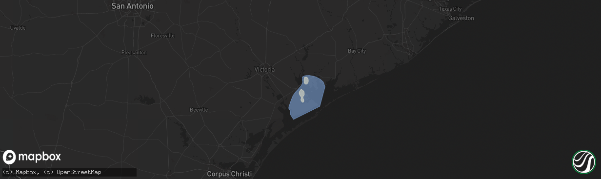
Hail Map in Port Lavaca, TX on June 1, 2024
The weather event in Port Lavaca, TX on June 1, 2024 includes Hail and Wind maps. 12 states and 558 cities were impacted and suffered possible damage. The total estimated number of properties impacted is 0.
Hail
Wind
0
Estimated number of impacted properties by a 1.00" hail or larger0
Estimated number of impacted properties by a 1.75" hail or larger0
Estimated number of impacted properties by a 2.50" hail or largerStorm reports in Port Lavaca, TX
Port Lavaca, TX
| Date | Description |
|---|---|
| 06/01/202410:09 AM CDT | Two boats were capsized just offshore. An rv and shed were completely destroyed along state highway 316. A home along brighton ave lost a few shingles and farther south |
| 06/01/20249:55 AM CDT | Tempest weather station in southwest port lavaca measured a wind gust of 62 mph at 9:55 am cdt. |
All States Impacted by Hail Map on June 1, 2024
All Cities Impacted by Hail Map on June 1, 2024
- Hemingford, NE
- Alliance, NE
- Arthur, NE
- North Platte, NE
- Stapleton, NE
- Maxwell, NE
- Ashby, NE
- Oelrichs, SD
- Arnold, NE
- Hyannis, NE
- Goliad, TX
- Callaway, NE
- Whitman, NE
- Lexington, NE
- Victoria, TX
- Cozad, NE
- Brady, NE
- Edna, TX
- Port Lavaca, TX
- Bloomington, TX
- Oconto, NE
- Palacios, TX
- Lolita, TX
- Eddyville, NE
- Bay City, TX
- Elwood, NE
- Freeport, TX
- Wilmer, AL
- Bertrand, NE
- Smithfield, NE
- Seadrift, TX
- Port O'Connor, TX
- El Campo, TX
- Louise, TX
- Leakesville, MS
- Lucedale, MS
- Clute, TX
- Boyd, TX
- Paradise, TX
- Azle, TX
- Newark, TX
- Rhome, TX
- Springtown, TX
- Gulfport, MS
- Biloxi, MS
- Argyle, TX
- Rosenberg, TX
- Justin, TX
- Fort Worth, TX
- Haslet, TX
- Roanoke, TX
- Keller, TX
- Southlake, TX
- Richmond, TX
- Grapevine, TX
- Colleyville, TX
- Flower Mound, TX
- North Richland Hills, TX
- Irving, TX
- Dallas, TX
- Coppell, TX
- Carrollton, TX
- Euless, TX
- Lewisville, TX
- Lake Charles, LA
- Devers, TX
- Beaumont, TX
- Orange, TX
- Iowa, LA
- Vidor, TX
- Long Beach, MS
- Hurst, TX
- Dayton, TX
- Bridge City, TX
- Rockwall, TX
- Rowlett, TX
- Mesquite, TX
- Buna, TX
- Bedford, TX
- Garland, TX
- Liberty, TX
- Forney, TX
- Sunnyvale, TX
- Violet, LA
- Deweyville, TX
- Plaquemine, LA
- Grand Prairie, TX
- Canton, TX
- Vinton, LA
- Hull, TX
- Duncanville, TX
- Desoto, TX
- Starks, LA
- Calhan, CO
- Saint Gabriel, LA
- Merryville, LA
- Belle Chasse, LA
- New Orleans, LA
- Saint Bernard, LA
- Plantersville, TX
- Magnolia, TX
- Lancaster, TX
- Hutchins, TX
- Wilmer, TX
- Ramah, CO
- Singer, LA
- Braithwaite, LA
- Batson, TX
- Montgomery, TX
- Cedar Hill, TX
- Terrell, TX
- Kaufman, TX
- Pinehurst, TX
- Kountze, TX
- Saratoga, TX
- Red Oak, TX
- Ferris, TX
- Wills Point, TX
- Dequincy, LA
- Simla, CO
- Welsh, LA
- Ennis, TX
- Seagoville, TX
- Scurry, TX
- Donaldsonville, LA
- Gonzales, LA
- Darrow, LA
- Sorrento, LA
- Palmer, TX
- Kemp, TX
- Cimarron, NM
- Fred, TX
- Longville, LA
- Saint James, LA
- Rosser, TX
- Ragley, LA
- Silsbee, TX
- Spurger, TX
- Belle Rose, LA
- Rapid City, SD
- Eunice, LA
- Basile, LA
- Pritchett, CO
- Deridder, LA
- Addis, LA
- Baton Rouge, LA
- Okeene, OK
- Kirbyville, TX
- Chatfield, TX
- Bell City, LA
- Raton, NM
- Mabank, TX
- Eustace, TX
- Trinidad, TX
- Quinter, KS
- Bucklin, KS
- Fairburn, SD
- Utica, KS
- Trenton, NE
- Minneola, KS
- Culbertson, NE
- Rushville, NE
- Keystone, NE
- Ogallala, NE
- Ness City, KS
- Bingham, NE
- Beeler, KS
- Wauneta, NE
- Atwood, KS
- Ford, KS
- Pine Ridge, SD
- Grainfield, KS
- Protection, KS
- Hayes Center, NE
- Palisade, NE
- Ellsworth, NE
- Herndon, KS
- Elsie, NE
- Hoxie, KS
- Jetmore, KS
- Caputa, SD
- Selden, KS
- Paxton, NE
- Hermosa, SD
- Spearville, KS
- Dry Creek, LA
- Kinder, LA
- Las Animas, CO
- Woodville, TX
- Malakoff, TX
- Limon, CO
- Jasper, TX
- Bushnell, NE
- Arnaudville, LA
- Pearl River, LA
- Prairieville, LA
- Ville Platte, LA
- Mittie, LA
- Newton, TX
- Pitkin, LA
- Athens, TX
- Denham Springs, LA
- Genoa, CO
- Oakdale, LA
- Balmorhea, TX
- Walker, LA
- Greenwell Springs, LA
- Mandeville, LA
- Breaux Bridge, LA
- Livingston, LA
- Montalba, TX
- Holden, LA
- Lindon, CO
- Granada, CO
- Holly, CO
- Tennessee Colony, TX
- Ponchatoula, LA
- Port Barre, LA
- Branson, CO
- Port Allen, LA
- Troup, TX
- Cheyenne, WY
- Las Vegas, NM
- Sapello, NM
- Saint Landry, LA
- Salt Flat, TX
- Sidney, NE
- Fort Davis, TX
- Palestine, TX
- Fort Stockton, TX
- Madisonville, LA
- Melville, LA
- Palmetto, LA
- Krotz Springs, LA
- Encino, NM
- Albany, LA
- Independence, LA
- Blessing, TX
- Glenmora, LA
- Burns, WY
- Warren, TX
- Bunkie, LA
- Tickfaw, LA
- Amite, LA
- Covington, LA
- Lecompte, LA
- Meriden, WY
- Forest Hill, LA
- Mount Enterprise, TX
- Garrison, TX
- Henderson, TX
- Jacksonville, TX
- Woodworth, LA
- Evergreen, LA
- Syracuse, KS
- Kendall, KS
- Deerfield, KS
- Lakin, KS
- Van Horn, TX
- Rusk, TX
- Reklaw, TX
- Laneville, TX
- Saint Martinville, LA
- Cottonport, LA
- Plaucheville, LA
- Lagrange, WY
- Center, TX
- Bush, LA
- Tatum, TX
- Holcomb, KS
- Cushing, TX
- Garden City, KS
- Sterling, CO
- Otis, CO
- Akron, CO
- Kentwood, LA
- Greensburg, LA
- Alexandria, LA
- Batchelor, LA
- Simmesport, LA
- Dell City, TX
- Iliff, CO
- Franklinton, LA
- Springfield, CO
- Wilson, LA
- Loranger, LA
- Valentine, TX
- Pecos, TX
- Alpine, TX
- Lettsworth, LA
- Padroni, CO
- De Berry, TX
- Overton, TX
- Kilgore, TX
- Moreauville, LA
- Clinton, LA
- Folsom, LA
- Cloutierville, LA
- Lena, LA
- Saint Francisville, LA
- Jena, LA
- Nacogdoches, TX
- Bogalusa, LA
- Leoti, KS
- Keithville, LA
- Monterey, LA
- Mount Hermon, LA
- Watrous, NM
- Alto, TX
- Valmora, NM
- Jonesville, LA
- Marksville, LA
- Wells, TX
- Acme, LA
- Liberty, MS
- Gering, NE
- Lyman, NE
- Brusly, LA
- Marienthal, KS
- Mansfield, LA
- Fleming, CO
- Vidalia, LA
- Osyka, MS
- Scott City, KS
- Atwood, CO
- Pollock, LA
- Saint Amant, LA
- Torrington, WY
- Trementina, NM
- Manter, KS
- Cimarron, KS
- Healy, KS
- Marathon, TX
- Sedgwick, CO
- Trout, LA
- Haxtun, CO
- Morrill, NE
- Coushatta, LA
- Julesburg, CO
- Ferriday, LA
- Sicily Island, LA
- Crook, CO
- Harrison, NE
- Georgetown, LA
- Tullos, LA
- Burlington, OK
- Pollok, TX
- Pelican, LA
- Dighton, KS
- Olla, LA
- Campti, LA
- Amorita, OK
- Campo, CO
- Saline, LA
- Broadwater, NE
- Rolla, KS
- Bridgeport, NE
- Goodwell, OK
- Meadville, MS
- McCall Creek, MS
- Goldonna, LA
- Bronson, TX
- Pineland, TX
- Hay Springs, NE
- Chadron, NE
- Guymon, OK
- Dodson, LA
- Manchester, OK
- Oshkosh, NE
- Bay Springs, MS
- Union Church, MS
- Arnold, KS
- Plains, KS
- Anthony, KS
- Copeland, KS
- Montezuma, KS
- Ransom, KS
- Marsland, NE
- Mentone, TX
- Hooker, OK
- Provencal, LA
- Wakeeney, KS
- Brownell, KS
- Ellis, KS
- Dryden, TX
- Gordon, NE
- Hays, KS
- Champion, NE
- Meade, KS
- Calhoun, LA
- Raleigh, MS
- Batesland, SD
- Gruver, TX
- Hardesty, OK
- Spearman, TX
- Victoria, KS
- Martin, SD
- Gate, OK
- Wounded Knee, SD
- Gorham, KS
- Walker, KS
- Allen, SD
- Stockville, NE
- Curtis, NE
- Russell, KS
- Valentine, NE
- Maywood, NE
- Perryton, TX
- Oglala, SD
- Buffalo, OK
- Kyle, SD
- Comstock, TX
- Manderson, SD
- Purdum, NE
- Imperial, TX
- Ulysses, KS
- Moorefield, NE
- Brewster, NE
- Eustis, NE
- Johnson, KS
- Moscow, KS
- Arapahoe, NE
- Hugoton, KS
- Sugartown, LA
- Mooreland, OK
- Beaver City, NE
- Edison, NE
- Oberlin, LA
- Ainsworth, NE
- Newcastle, WY
- Elton, LA
- Ewing, NE
- Bristow, NE
- Liberal, KS
- Hubbell, NE
- Menard, TX
- Tyrone, OK
- Hebron, NE
- Leakey, TX
- Duson, LA
- Rayne, LA
- Carleton, NE
- Hunt, TX
- Clifton, KS
- Reynolds, NE
- Geneva, NE
- Silver Creek, NE
- Turpin, OK
- Linn, KS
- Morrowville, KS
- Maurice, LA
- Lafayette, LA
- Mountain Home, TX
- Patterson, LA
- Palmer, KS
- Clarks, NE
- Osceola, NE
- Gilead, NE
- Youngsville, LA
- Washburn, ND
- Seneca, SD
- Fairbury, NE
- Belvidere, NE
- Bruning, NE
- Enterprise, KS
- Abilene, KS
- Abbeville, LA
- Delcambre, LA
- Erath, LA
- New Iberia, LA
- Chapman, KS
- Mahaska, KS
- Green, KS
- Porcupine, SD
- Clearwater, NE
- Strang, NE
- Greenleaf, KS
- Broussard, LA
- Harrisburg, NE
- Ohiowa, NE
- Forgan, OK
- Endicott, NE
- Faulkton, SD
- Woodbine, KS
- Randolph, KS
- Tilden, NE
- Jeanerette, LA
- Franklin, LA
- Hollenberg, KS
- Marion, KS
- Clay Center, KS
- Junction City, KS
- Ipswich, SD
- White City, KS
- Morganville, KS
- Haddam, KS
- Washington, KS
- Wanblee, SD
- Elgin, NE
- Oakdale, NE
- Mansfield, SD
- Lost Springs, KS
- Herington, KS
- Lincolnville, KS
- Leonardville, KS
- Barnes, KS
- Grinnell, KS
- Voca, TX
- Brady, TX
- Gove, KS
- Dwight, KS
- Meadow Grove, NE
- Miami, TX
- Albion, NE
- Ashley, ND
- Olsburg, KS
- Frankfort, KS
- Westmoreland, KS
- Rochelle, TX
- Dodge City, KS
- Pampa, TX
- Monroe, NE
- Newman Grove, NE
- Forbes, ND
- Alta Vista, KS
- Petersburg, NE
- Ellendale, ND
- Fort Riley, KS
- Platte Center, NE
- Humphrey, NE
- Hope, KS
- Lindsay, NE
- Brownwood, TX
- Brookesmith, TX
- Council Grove, KS
- Wilsey, KS
- Columbus, NE
- Madison, NE
- Leigh, NE
- Schuyler, NE
- Creston, NE
- Linwood, NE
- Clarkson, NE
- Morse Bluff, NE
- Rosston, OK
- North Bend, NE
- Shamrock, TX
- Dodge, NE
- Rogers, NE
- Abie, NE
- David City, NE
- Bruno, NE
- Prague, NE
- McCook, NE
- Fordoche, LA
- Morganza, LA
- Shickley, NE
- Milligan, NE


