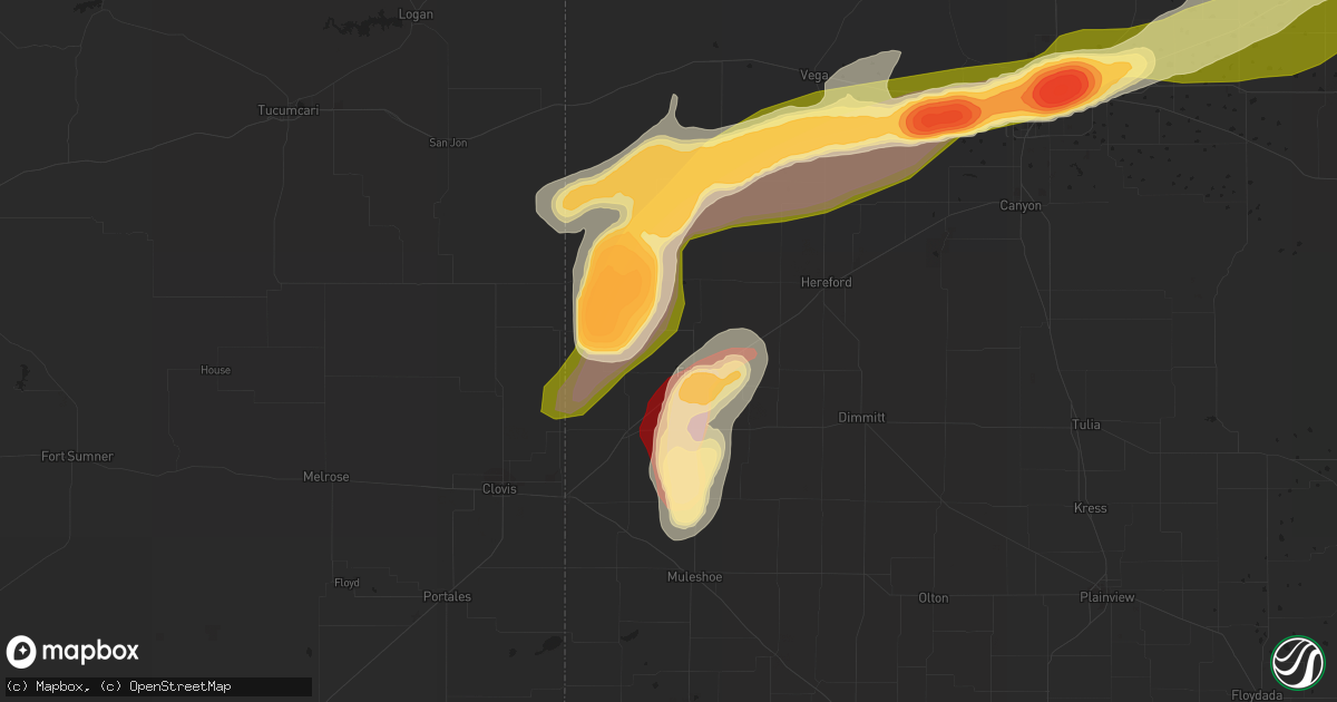
Hail Map in Friona, TX on May 28, 2013
Get this storm
May 28 map
$229
one time, instant access
Download today. No call, no setup
Keep the $229
Bought the map and want the full workflow? Apply the entire $229 to a subscription within 7 days. None of it is wasted.
Every map, not just this one
This buys you this map. Subscription and you get every map we run, in the markets you choose from a few cities to whole states to nationwide. Plus real-time alerts the moment a storm fires.
Contact data
Name, contact info, occupancy, even credit band for addresses in the footprint. You go from where it hit to who to call.
Become the source they trust
Unlimited branding weather history reports on demand. You already have the documented answer ready for the property owner, and you are the one who showed up with it.
Property data and RoofTrace estimates
Pull up any address you have got, its value and the exact code rules for that jurisdiction, straight from One Click Code. Then RoofTrace estimates the squares, pitch, and roof value, priced the way you price.
Storm reports in Friona, TX
Friona, TX
| Date | Description |
|---|---|
| 05/28/20136:55 PM CDT | A local report indicates 1.75 inch wind near 6 W BOOTLEG |
| 05/28/20136:45 PM CDT | Rope tornado reported west of his location. |
| 05/28/20136:42 PM CDT | A local report indicates 2.50 inch wind near 5 W BOOTLEG |
| 05/28/20136:21 PM CDT | Relayed report of golfball size hail and bigger |
| 05/28/20136:13 PM CDT | A local report indicates 1.75 inch wind near RHEA |
| 05/28/20135:57 PM CDT | A local report indicates 2.50 inch wind near 4 NNW RHEA |
| 05/28/20135:26 PM CDT | A local report indicates 1.75 inch wind near FRIONA |
| 05/28/20135:18 PM CDT | A local report indicates 1.75 inch wind near FRIONA |
| 05/28/20135:14 PM CDT | Relayed via media |
| 05/28/20135:10 PM CDT | Relayed from wfo amarillo |
| 05/28/20135:09 PM CDT | A local report indicates 1.00 inch wind near FRIONA |
| 05/28/20134:44 PM CDT | A local report indicates 1.00 inch wind near FRIONA |
| 05/28/20134:40 PM CDT | Per west texas mesonet |
| 05/28/20134:30 PM CDT | Per west texas mesonet |
| 05/28/20134:19 PM CDT | A local report indicates 1.25 inch wind near 12 S FRIONA |
| 05/28/20133:37 PM CDT | Short lived hail via coop observer |
All States Impacted by Hail Map on May 28, 2013
All Cities Impacted by Hail Map on May 28, 2013
- Lewellen, NE
- Arthur, NE
- Kinsman, OH
- Jamestown, PA
- Williamsfield, OH
- Greenville, PA
- Atlantic, PA
- Adamsville, PA
- Hartstown, PA
- Andover, OH
- Hadley, PA
- Torrington, WY
- Amarillo, TX
- Wildorado, TX
- Tescott, KS
- Bennington, KS
- Minneapolis, KS
- Iliff, CO
- Crook, CO
- Plains, KS
- Forgan, OK
- Meade, KS
- Lingle, WY
- Ovid, CO
- Brownville, NE
- Rock Port, MO
- Tarkio, MO
- Westboro, MO
- Nemaha, NE
- Barnard, KS
- Friona, TX
- Seneca, KS
- Baileyville, KS
- Goff, KS
- Oneida, KS
- Sabetha, KS
- Corning, KS
- Centralia, KS
- Wetmore, KS
- Allerton, IA
- Corydon, IA
- Humeston, IA
- Sublette, KS
- Satanta, KS
- Julesburg, CO
- Victoria, KS
- Walker, KS
- Hereford, TX
- Vega, TX
- Ashland, KS
- Rosston, OK
- Buffalo, OK
- Protection, KS
- Auburn, NE
- Watson, MO
- Beloit, KS
- Lincoln, KS
- Solomon, KS
- Lucas, KS
- Tipton, KS
- Hunter, KS
- Beverly, KS
- Osborne, KS
- Lenox, IA
- Creston, IA
- Hiawatha, KS
- Highland, KS
- Robinson, KS
- Venango, NE
- Gurley, NE
- Sidney, NE
- Sedgwick, CO
- Chappell, NE
- Muleshoe, TX
- Farwell, TX
- Fleming, CO
- Newcastle, WY
- Vermillion, KS
- Axtell, KS
- Havensville, KS
- Frankfort, KS
- Home, KS
- Powhattan, KS
- Onaga, KS
- Beattie, KS
- Fairview, KS
- Hays, KS
- Schoenchen, KS
- Sterling, CO
- Chariton, IA
- Oshkosh, NE
- Tryon, NE
- Columbus Junction, IA
- Crawfordsville, IA
- Mount Pleasant, IA
- Wapello, IA
- Wayland, IA
- Winfield, IA
- Coldwater, KS
- Lodgepole, NE
- Panhandle, TX
- Adrian, TX
- Potter, NE
- Dalton, NE
- Harrison, NE
- Morrill, NE
- Circleville, KS
- Blue Rapids, KS
- Summerfield, KS
- Netawaka, KS
- Soldier, KS
- Marysville, KS
- Haxtun, CO
- Hershey, NE
- Sutherland, NE
- White Cloud, KS
- Clearfield, IA
- Diagonal, IA
- Brighton, IA
- Bovina, TX
- Pampa, TX
- San Jon, NM
- White Deer, TX
- Groom, TX
- Gate, OK
- Englewood, KS
- Albia, IA
- Eddyville, IA
- Ottumwa, IA
- Pattonsburg, MO
- Maysville, MO
- Weatherby, MO
- Afton, IA
- Parkston, SD
- Dimock, SD
- Lancaster, KS
- Wathena, KS
- Bendena, KS
- Denton, KS
- Oregon, MO
- Troy, KS
- Atchison, KS
- Everest, KS
- Pickering, MO
- Blockton, IA
- Sheridan, MO
- Hatfield, MO
- Redding, IA
- Grant City, MO
- Parnell, MO
- Maryville, MO
- Mount Ayr, IA
- Ravenwood, MO
- Hopkins, MO
- Paxton, NE
- Richland, IA
- Fairfield, IA
- Packwood, IA
- Hallam, NE
- Pickrell, NE
- Clatonia, NE
- Fairbury, NE
- Martell, NE
- Plymouth, NE
- Jansen, NE
- Cortland, NE
- De Witt, NE
- Diller, NE
- Beatrice, NE
- Endicott, NE
- Fort Laramie, WY
- Jay Em, WY
- Yoder, WY
- Wilmore, KS
- Ulysses, KS
- Grant, NE
- Kilgore, NE
- Dix, NE
- Padroni, CO
- Lemoyne, NE
- Peetz, CO
- Lisco, NE
- Lake City, KS
- Saint Joseph, MO
- Savannah, MO
- McFall, MO
- Rea, MO
- Amazonia, MO
- King City, MO
- Union Star, MO
- Cosby, MO
- Amity, MO
- Helena, MO
- Otis, CO
- Big Springs, NE
- Madrid, NE
- Ogallala, NE
- Holyoke, CO
- Kellerton, IA
- Eagleville, MO
- Lamoni, IA
- Mukwonago, WI
- Tripp, SD
- Delmont, SD
- Burlington Junction, MO
- Elmo, MO
- Skidmore, MO
- Clearmont, MO
- Chillicothe, MO
- Wheeling, MO
- Linneus, MO
- Purdin, MO
- Laverne, OK
- Alva, OK
- Freedom, OK
- Deer Trail, CO
- Agate, CO
- Keystone, NE
- Bristolville, OH
- Southington, OH
- Warren, OH
- Farmdale, OH
- Cortland, OH
- West Farmington, OH
- Cochranton, PA
- Orwell, OH
- Rome, OH
- Jefferson, OH
- West Springfield, PA
- Albion, PA
- Conneaut, OH
- Accokeek, MD
- Clinton, MD
- Brandywine, MD
- Upper Marlboro, MD
- Texico, NM
- Skellytown, TX
- Gruver, TX
- Spearman, TX
- Stratford, TX
- Fowler, KS
- Horton, KS
- McCracken, KS
- Agenda, KS
- Haddam, KS
- Clifton, KS
- Mahaska, KS
- Concordia, KS
- Washington, KS
- Morrowville, KS
- Clyde, KS
- Wilber, NE
- Downs, KS
- Glen Elder, KS
- Hemingford, NE
- Alliance, NE
- McCamey, TX
- Crane, TX
- Eagle, WI
- Lovilia, IA
- Cedar, IA
- Oskaloosa, IA
- Hedrick, IA
- Fremont, IA
- Sigourney, IA
- Bedford, IA
- Osceola, IA
- Weldon, IA
- Woodburn, IA
- Grand River, IA
- Blakesburg, IA
- Promise City, IA
- Russell, IA
- Lockridge, IA
- Keithsburg, IL
- Oakville, IA
- Mediapolis, IA
- Seaton, IL
- Washington, IA


