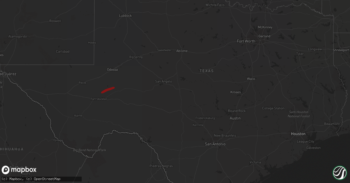
Hail Map in Texas on May 28, 2013
Get this storm
May 28 map
$229
one time, instant access
Download today. No call, no setup
Keep the $229
Bought the map and want the full workflow? Apply the entire $229 to a subscription within 7 days. None of it is wasted.
Every map, not just this one
This buys you this map. Subscription and you get every map we run, in the markets you choose from a few cities to whole states to nationwide. Plus real-time alerts the moment a storm fires.
Contact data
Name, contact info, occupancy, even credit band for addresses in the footprint. You go from where it hit to who to call.
Become the source they trust
Unlimited branding weather history reports on demand. You already have the documented answer ready for the property owner, and you are the one who showed up with it.
Property data and RoofTrace estimates
Pull up any address you have got, its value and the exact code rules for that jurisdiction, straight from One Click Code. Then RoofTrace estimates the squares, pitch, and roof value, priced the way you price.
Storm reports in Texas
Texas
| Date | Description |
|---|---|
| 05/28/20136:55 PM CDT | A local report indicates 1.75 inch wind near 6 W BOOTLEG |
| 05/28/20136:45 PM CDT | Rope tornado reported west of his location. |
| 05/28/20136:42 PM CDT | A local report indicates 2.50 inch wind near 5 W BOOTLEG |
| 05/28/20136:21 PM CDT | Relayed report of golfball size hail and bigger |
| 05/28/20136:13 PM CDT | A local report indicates 1.75 inch wind near RHEA |
| 05/28/20136:13 PM CDT | A local report indicates 66 MPH wind near 7 ENE AMARILLO |
| 05/28/20136:11 PM CDT | A local report indicates 60 MPH wind near 5 W AMARILLO |
| 05/28/20136:09 PM CDT | A local report indicates 61 MPH wind near 5 NNW AMARILLO |
| 05/28/20136:06 PM CDT | A local report indicates 58 MPH wind near 7 SW PANTEX |
| 05/28/20136:05 PM CDT | A local report indicates 64 MPH wind near 2 W AMARILLO |
| 05/28/20136:05 PM CDT | A local report indicates 66 MPH wind near 7 ENE AMARILLO |
| 05/28/20136:02 PM CDT | A local report indicates 60 MPH wind near 7 ENE AMARILLO |
| 05/28/20135:57 PM CDT | A local report indicates 66 MPH wind near 5 SSW AMARILLO |
| 05/28/20135:57 PM CDT | A local report indicates 2.50 inch wind near 4 NNW RHEA |
| 05/28/20135:57 PM CDT | Roof blown off a metal building at 6th and osage |
| 05/28/20135:57 PM CDT | Power lines down in the fairgrounds area. |
| 05/28/20135:56 PM CDT | A local report indicates 60 MPH wind near 2 E PERRYTON |
| 05/28/20135:44 PM CDT | A local report indicates 61 MPH wind near 3 NW AMARILLO |
| 05/28/20135:44 PM CDT | A local report indicates 58 MPH wind near 6 ENE AMARILLO |
| 05/28/20135:42 PM CDT | Spotter found melted hail and is expected to have been as large as golf ball. |
| 05/28/20135:36 PM CDT | A local report indicates 58 MPH wind near 6 ENE AMARILLO |
| 05/28/20135:28 PM CDT | A local report indicates 58 MPH wind near 2 WSW AMARILLO |
| 05/28/20135:27 PM CDT | A local report indicates 1.00 inch wind near 2 N GRUVER |
| 05/28/20135:26 PM CDT | A local report indicates 1.75 inch wind near FRIONA |
| 05/28/20135:20 PM CDT | Tractor trailer rig blown over on u.s. Highway 287 about five miles east of the interstate 40 and u.s. Highway 287 split |
| 05/28/20135:18 PM CDT | Power poles down west of canyon on highway 60. Winds estimated at 50 to 60 mph. |
| 05/28/20135:18 PM CDT | A local report indicates 1.75 inch wind near FRIONA |
| 05/28/20135:16 PM CDT | Two power poles snapped at washington street and farmers |
| 05/28/20135:14 PM CDT | Relayed via media |
| 05/28/20135:10 PM CDT | Relayed from wfo amarillo |
| 05/28/20135:09 PM CDT | A local report indicates 1.00 inch wind near FRIONA |
| 05/28/20135:00 PM CDT | Tree limbs blown off - most around three to four inches in diameter with some five to seven inch diameter limbs |
| 05/28/20135:00 PM CDT | A local report indicates 62 MPH wind near 7 ENE AMARILLO |
| 05/28/20134:59 PM CDT | A local report indicates 58 MPH wind near 6 W AMARILLO |
| 05/28/20134:57 PM CDT | A local report indicates 69 MPH wind near 5 WNW TIMBERCREEK CANYO |
| 05/28/20134:52 PM CDT | A local report indicates 60 MPH wind near 3 E BUSHLAND |
| 05/28/20134:46 PM CDT | A local report indicates 58 MPH wind near 6 ENE AMARILLO |
| 05/28/20134:44 PM CDT | A local report indicates 1.00 inch wind near FRIONA |
| 05/28/20134:40 PM CDT | Per west texas mesonet |
| 05/28/20134:34 PM CDT | Measured 2.21 inch hail with digital caliper |
| 05/28/20134:33 PM CDT | A local report indicates 61 MPH wind near 5 SSW AMARILLO |
| 05/28/20134:30 PM CDT | Per west texas mesonet |
| 05/28/20134:25 PM CDT | Pea to quarter size |
| 05/28/20134:19 PM CDT | A local report indicates 1.25 inch wind near 12 S FRIONA |
| 05/28/20133:45 PM CDT | A local report indicates 1.00 inch wind near 8 W LAZBUDDIE |
| 05/28/20133:37 PM CDT | Short lived hail via coop observer |
| 05/28/201312:53 AM CDT | Quarter size hail and 50-60 mph winds |
| 05/28/201312:39 AM CDT | Delayed report...del rio asos measured wind gust of 63 mph from thunderstorm outflow |
| 05/28/201312:39 AM CDT | Corrected wind speed...wind gust of 63 mph from thunderstorm outflow damaged buildings at weather service office...delayed report |
| 05/28/201312:30 AM CDT | Peas to half dollar size hail |
| 05/28/201312:15 AM CDT | Hail covering roadway. |
| 05/28/201312:14 AM CDT | Hail nearly the ground. |
| 05/28/201312:05 AM CDT | Pea to quarter size hail fell at the nws office. Hail was nearly covering the ground. |
| 05/28/201312:00 AM CDT | A local report indicates 1.75 inch wind near 4 NNW AMARILLO |
| 05/27/201311:52 PM CDT | 1.5 inches of hail covering ground. |
| 05/27/201311:50 PM CDT | A local report indicates 1.50 inch wind near 2 SW AMARILLO |
| 05/27/201311:47 PM CDT | A local report indicates 1.75 inch wind near 6 WSW AMARILLO |
| 05/27/201311:47 PM CDT | A local report indicates 1.00 inch wind near AMARILLO |
| 05/27/201311:41 PM CDT | A local report indicates 1.25 inch wind near AMARILLO |
| 05/27/201311:41 PM CDT | Large 2 to 3 foot diameter tree was split with the split part peeling down and southward facing windows and skylights were broken at an apartment complex. |
| 05/27/201311:40 PM CDT | Hail broke windows at a restaurant at 34th and soncy. |
| 05/27/201311:39 PM CDT | Golfball size hail at the loop and western |
| 05/27/201311:38 PM CDT | A local report indicates 1.25 inch wind near 7 WSW AMARILLO |
| 05/27/201311:38 PM CDT | Golfball size hail at i-40 and coulter |
| 05/27/201311:35 PM CDT | A local report indicates 1.75 inch wind near 4 WSW AMARILLO |
| 05/27/201311:11 PM CDT | Power flashes also reported at this location |
| 05/27/201311:09 PM CDT | Storm is also reporting a lot of pea to marble size hail. |
| 05/27/201311:03 PM CDT | A local report indicates 1.75 inch wind near WILDORADO |
| 05/27/201310:36 PM CDT | A local report indicates 1.75 inch wind near 6 S VEGA |
| 05/27/20139:07 PM CDT | A local report indicates a tornado near 9 W SIMMS |
| 05/27/20139:06 PM CDT | A local report indicates a tornado near 9 W SIMMS |
| 05/27/20138:47 PM CDT | Hail collecting on roadway and nearby fields flooded. |
| 05/27/20138:32 PM CDT | A local report indicates 1.50 inch wind near 15 S ADRIAN |
| 05/27/20138:18 PM CDT | Hail covering the road 2 inches deep. |
| 05/27/20138:00 PM CDT | A local report indicates 2.00 inch wind near 10 N BOOTLEG |
All States Impacted by Hail Map on May 28, 2013
Cities Impacted by Hail Map on May 28, 2013
- Lewellen, NE
- Arthur, NE
- Kinsman, OH
- Jamestown, PA
- Williamsfield, OH
- Greenville, PA
- Atlantic, PA
- Adamsville, PA
- Hartstown, PA
- Andover, OH
- Hadley, PA
- Torrington, WY
- Amarillo, TX
- Wildorado, TX
- Tescott, KS
- Bennington, KS
- Minneapolis, KS
- Iliff, CO
- Crook, CO
- Plains, KS
- Forgan, OK
- Meade, KS
- Lingle, WY
- Ovid, CO
- Brownville, NE
- Rock Port, MO
- Tarkio, MO
- Westboro, MO
- Nemaha, NE
- Barnard, KS
- Friona, TX
- Seneca, KS
- Baileyville, KS
- Goff, KS
- Oneida, KS
- Sabetha, KS
- Corning, KS
- Centralia, KS
- Wetmore, KS
- Allerton, IA
- Corydon, IA
- Humeston, IA
- Sublette, KS
- Satanta, KS
- Julesburg, CO
- Victoria, KS
- Walker, KS
- Hereford, TX
- Vega, TX
- Ashland, KS
- Rosston, OK
- Buffalo, OK
- Protection, KS
- Auburn, NE
- Watson, MO
- Beloit, KS
- Lincoln, KS
- Solomon, KS
- Lucas, KS
- Tipton, KS
- Hunter, KS
- Beverly, KS
- Osborne, KS
- Lenox, IA
- Creston, IA
- Hiawatha, KS
- Highland, KS
- Robinson, KS
- Venango, NE
- Gurley, NE
- Sidney, NE
- Sedgwick, CO
- Chappell, NE
- Muleshoe, TX
- Farwell, TX
- Fleming, CO
- Newcastle, WY
- Vermillion, KS
- Axtell, KS
- Havensville, KS
- Frankfort, KS
- Home, KS
- Powhattan, KS
- Onaga, KS
- Beattie, KS
- Fairview, KS
- Hays, KS
- Schoenchen, KS
- Sterling, CO
- Chariton, IA
- Oshkosh, NE
- Tryon, NE
- Columbus Junction, IA
- Crawfordsville, IA
- Mount Pleasant, IA
- Wapello, IA
- Wayland, IA
- Winfield, IA
- Coldwater, KS
- Lodgepole, NE
- Panhandle, TX
- Adrian, TX
- Potter, NE
- Dalton, NE
- Harrison, NE
- Morrill, NE
- Circleville, KS
- Blue Rapids, KS
- Summerfield, KS
- Netawaka, KS
- Soldier, KS
- Marysville, KS
- Haxtun, CO
- Hershey, NE
- Sutherland, NE
- White Cloud, KS
- Clearfield, IA
- Diagonal, IA
- Brighton, IA
- Bovina, TX
- Pampa, TX
- San Jon, NM
- White Deer, TX
- Groom, TX
- Gate, OK
- Englewood, KS
- Albia, IA
- Eddyville, IA
- Ottumwa, IA
- Pattonsburg, MO
- Maysville, MO
- Weatherby, MO
- Afton, IA
- Parkston, SD
- Dimock, SD
- Lancaster, KS
- Wathena, KS
- Bendena, KS
- Denton, KS
- Oregon, MO
- Troy, KS
- Atchison, KS
- Everest, KS
- Pickering, MO
- Blockton, IA
- Sheridan, MO
- Hatfield, MO
- Redding, IA
- Grant City, MO
- Parnell, MO
- Maryville, MO
- Mount Ayr, IA
- Ravenwood, MO
- Hopkins, MO
- Paxton, NE
- Richland, IA
- Fairfield, IA
- Packwood, IA
- Hallam, NE
- Pickrell, NE
- Clatonia, NE
- Fairbury, NE
- Martell, NE
- Plymouth, NE
- Jansen, NE
- Cortland, NE
- De Witt, NE
- Diller, NE
- Beatrice, NE
- Endicott, NE
- Fort Laramie, WY
- Jay Em, WY
- Yoder, WY
- Wilmore, KS
- Ulysses, KS
- Grant, NE
- Kilgore, NE
- Dix, NE
- Padroni, CO
- Lemoyne, NE
- Peetz, CO
- Lisco, NE
- Lake City, KS
- Saint Joseph, MO
- Savannah, MO
- McFall, MO
- Rea, MO
- Amazonia, MO
- King City, MO
- Union Star, MO
- Cosby, MO
- Amity, MO
- Helena, MO
- Otis, CO
- Big Springs, NE
- Madrid, NE
- Ogallala, NE
- Holyoke, CO
- Kellerton, IA
- Eagleville, MO
- Lamoni, IA
- Mukwonago, WI
- Tripp, SD
- Delmont, SD
- Burlington Junction, MO
- Elmo, MO
- Skidmore, MO
- Clearmont, MO
- Chillicothe, MO
- Wheeling, MO
- Linneus, MO
- Purdin, MO
- Laverne, OK
- Alva, OK
- Freedom, OK
- Deer Trail, CO
- Agate, CO
- Keystone, NE
- Bristolville, OH
- Southington, OH
- Warren, OH
- Farmdale, OH
- Cortland, OH
- West Farmington, OH
- Cochranton, PA
- Orwell, OH
- Rome, OH
- Jefferson, OH
- West Springfield, PA
- Albion, PA
- Conneaut, OH
- Accokeek, MD
- Clinton, MD
- Brandywine, MD
- Upper Marlboro, MD
- Texico, NM
- Skellytown, TX
- Gruver, TX
- Spearman, TX
- Stratford, TX
- Fowler, KS
- Horton, KS
- McCracken, KS
- Agenda, KS
- Haddam, KS
- Clifton, KS
- Mahaska, KS
- Concordia, KS
- Washington, KS
- Morrowville, KS
- Clyde, KS
- Wilber, NE
- Downs, KS
- Glen Elder, KS
- Hemingford, NE
- Alliance, NE
- McCamey, TX
- Crane, TX
- Eagle, WI
- Lovilia, IA
- Cedar, IA
- Oskaloosa, IA
- Hedrick, IA
- Fremont, IA
- Sigourney, IA
- Bedford, IA
- Osceola, IA
- Weldon, IA
- Woodburn, IA
- Grand River, IA
- Blakesburg, IA
- Promise City, IA
- Russell, IA
- Lockridge, IA
- Keithsburg, IL
- Oakville, IA
- Mediapolis, IA
- Seaton, IL
- Washington, IA


